

Miros Strengthens Real-Time Ocean Insights Portfolio with Full Acquisition of Miros Mocean
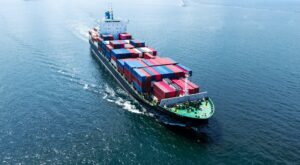
Miros AS is pleased to announce a significant milestone in its strategic growth by acquiring full ownership of Miros Mocean AS.
The acquisition enhances Miros’ ability to provide cutting-edge real-time ocean insights, benefiting all relevant market segments, including commercial shipping.
As of September 2024, Miros acquired all remaining shares in Miros Mocean from its joint venture partners, BW Group and Copenhagen Commercial Platform (CCP).
Miros Mocean will continue to operate as a wholly owned subsidiary of Miros, under the leadership of CEO Marius Five Aarset.
“The full integration of Miros Mocea
n into Miros allows us to further consolidate and optimize our portfolio of vessel performance services,” said Mr Aarset. “Our strengthened offering will provide even greater value to customers and partners across the maritime industry.”
Miros focuses on enhancing the real-time understanding of how weather affects vessel performance, enabling operators to make safe and informed decisions. By digitizing local ocean conditions, Miros uses reliably measured – not derived – data, for an accurate overview of vessel performance and efficiency in real-time, throughout the lifetime of a vessel.
Mr Aarset added: “The alignment between Miros and Miros Mocean reinforces our commitment to delivering industry-leading ocean insights that enhance vessel performance and fuel efficiency while increasing maritime safety and sustainability. We focus on our client’s evolving needs by providing innovative solutions, including wave and current measurements from the industry-recognized product Wavex, vessel performance indicators with VTI, and safety monitoring with Anti-Roll assistant.”
Miros would like to extend its gratitude to BW Group and CCP for their invaluable cooperation in growing Miros Mocean and its portfolio of services to its current stage.

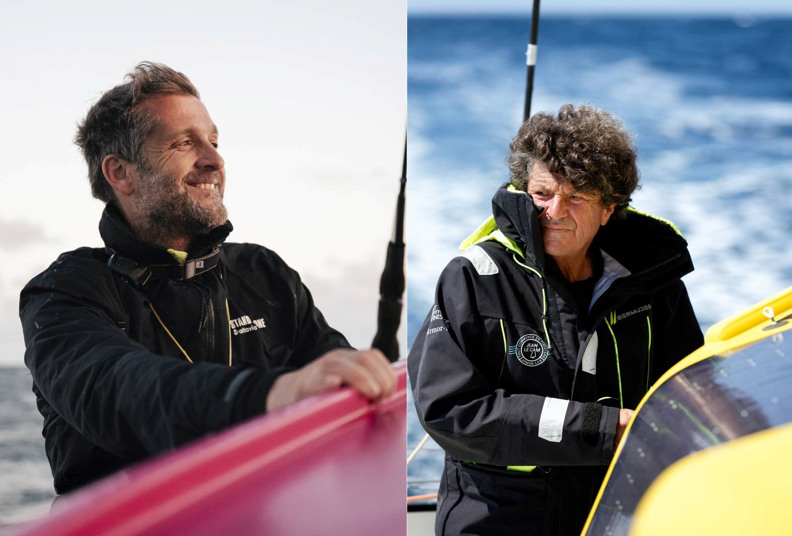
Exail to equip French skippers Eric Bellion and Jean Le Cam with Hydrins navigation system for the Vendée Globe
 Exail, a global leader in inertial navigation technology, has been selected to equip the boats of French skippers Eric Bellion and Jean Le Cam with Hydrins Inertial Navigation System (INS) for the upcoming Vendée Globe. By delivering highly accurate and reliable navigation data, Hydrins will play a crucial role in enhancing both the performance and safety of the skippers during this offshore race, which is one of the most challenging and prestigious in the world.
Hydrins features advanced sensors and data processing algorithms, providing a heading accuracy of 0.01 0 and a maximum data output frequency of 200Hz with minimal latency. This enables optimal integration with the boat's autopilot system, facilitating precise course adjustments and speed control. Such capabilities are critical for responding effectively to the rapidly changing conditions encountered during the race. At sea, this will allow the skippers to make quick, informed strategic decisions, essential for improving their overall race performance. The system's robust design and ability to operate autonomously, even in the event of GNSS signal loss, will ensure safe and efficient navigation throughout the race, especially during its most challenging moments.
Commenting on the partnership, Eric Bellion said: "Having Hydrins onboard gives me an extra level of confidence in my navigation. It allows me to focus more on my race strategy, knowing I have reliable data at all times."
Jean Le Cam added: "In a race like the Vendée Globe, precision is everything. Exail technology provides us with the reliability we need to navigate safely and efficiently. We have full trust in Hydrins, not just for its exceptional performance, which is wellknown in the world of competitive sailing, but also for the high level of support provided by Exail's team throughout the installation and setup process, ensuring we are wellprepared for the race."
Quentin Chiche, Regional Sales Manager at Exail, stated: "We are proud to collaborate with such distinguished sailors as Eric Bellion and Jean Le Cam. Their experience and dedication to solo offshore racing align with our commitment to delivering innovation and performance. Hydrins will be central to ensuring the precision and reliability required for optimal navigation during the race. '
The Vendée Globe is widely regarded as one of the most grueling endurance tests in professional sailing, pushing both sailors and their technology to the limit. Exail's involvement in this race further solidifies its position as a leading provider of highperformance inertial navigation systems, with more than 80% of racing boats worldwide equipped with its technology.
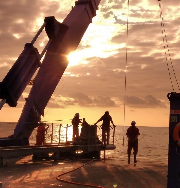
TDI-Brooks completes geotechnical program offshore filyos, turkey – black sea
TDI-Brooks has successfully completed its fifth geotechnical investigation for DenAr Ocean Engineering S.A. The RV NAUTILUS was dispatched to the Black Sea from the US East Coast to facilitate this operation. The geotechnical aspect of the investigation
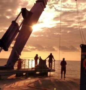
included 49 gCPTs, 50 JPCs, 48 CPTs, and 41 BCs. Additionally, an environmental component was incorporated, which comprised 27 Environmental BCs, 28 CTDs, 19 water samples, and 180 kilometers of marine fauna transects. TDI-Brooks provides a comprehensive range of marine geotechnical survey services, covering offshore, nearshore, and inland regions. Our team utilizes a diverse set of advanced instruments to ensure accurate soil sampling and measurement.
TDI-Brooks owns and operates five (5) oceanographic research vessels on the spot market. RV BROOKS McCALL and RV MISS EMMA McCALL are both U.S. registered Jones Act-compliant, and services the U.S. East and West Coasts, Gulf of Mexico and Mexico. RV GYRE, RV PROTEUS and RV NAUTILUS (DP2) are all Vanuatu registered, fully SOLAS compliant, and serve clients globally. These multi-use vessels suited for a wide variety of oceanographic research duties for the offshore renewables and energy sectors.
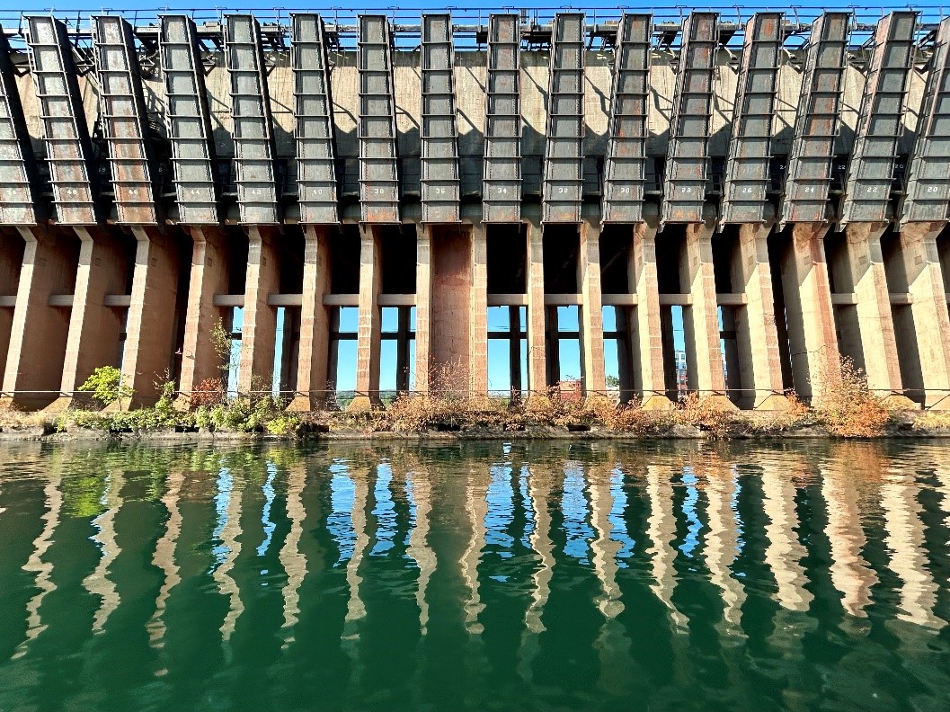
Kongsberg Discovery puts ‘eyes under the water’ for historic infrastructure challenge on Lake Superior
Kongsberg Discovery demonstrated the ability of advanced to illuminate the world beneath the waves with a detailed, efficient, and comprehensive inspection of the historic Lower Harbor Ore Dock at Marquette on Lake Superior.
The iconic structure, a pivotal point for the transportation of iron ore from Michigan mines right across the Great Lakes region, dates back to the late 19th century. Kongsberg Discovery’s 21st century multibeam sonar and imaging technology showed just how well it had withstood the test of time, harsh weather, and a busy history of vessel operations.
Structural insights
Situated a stone’s throw from Marquette town center, the imposing concrete and steel structure is now a popular tourist attraction and local landmark. Kongsberg Discovery, which specializes in innovative underwater robotics and sensor technology, gathered a group of leading organizations and companies to showcase how the latest hydroacoustics could
deliver rapid, powerful, and high-resolution imaging of structural integrity. Qualities which are essential for reliable inspection and monitoring of key shore and ocean infrastructure.
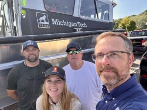
Attendees at the day-long survey included U.S. Army Corps Detroit District, U.S. Border Patrol, Krech Ojard Engineering, Schnabel Engineering, Lundin Mining, Carmeuse Mining, AMI Engineers, and U.S. Geologic Survey.
From challenge to opportunity
Jessica Daignault, Professional Civil Engineer with Kongsberg Discovery comments: “Long-term exposure to the forces of water and weather take their toll. Add in decades of large vessel operations and you have a recipe for undermining structural integrity. The iconic Lower Harbor Ore Dock retains its strength and beauty above the waterline, but we also wanted to make sure it was equally as robust below the water surface.
“It’s the kind of infrastructure inspection that can be challenging when using traditional methods, such as dive teams, but can be conducted efficiently and safely with modern hydroacoustic solutions. Our technology gave a powerful demonstration of that ability, revealing the dock as it’s never been seen before.”
Crystal clear
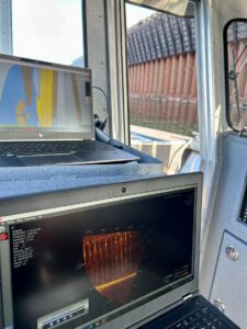
Kongsberg Discovery used two of its sonars, the M3 Sonar HF multibeam sonar and the 1171 Hi-Res Scanning singlebeam sonar, to scan the vertical wall structure. SoundTiles, an IQUA Robotics software, was used to process the multibeam data for rapid mosaicking. The high resolution 1171 single-beam sonar was then deployed to create a powerful real time visualization of the walls, diving into detail across the timber pole piles and concrete foundations for “incredible imaging”.
“The entire group of stakeholders we invited were able to enjoy a beautiful day on the water while learning about new technology,” notes Jessica. “The images were distortion free and of excellent resolution, giving a crystal-clear view of the structure and allowing everyone to appreciate the durable quality of this unique engineering project.
“This was a ‘fun’ assignment, but with a very serious message. In busy, operationally challenging environments conducting efficient, safe, and high-quality infrastructure inspection and monitoring is essential. Hydroacoustic technology truly opens the possibility to do just that, simplifying and fast-tracking the entire process, while providing outstanding results. The day at Marquette provided tangible proof of that fact. It was great to get eyes under the water and see the dock above and below the waterline.”
Norwegian headquartered Kongsberg Discovery boasts over 1000 expert employees and a network of locations spanning the globe. With products ranging from advanced Unmanned Autonomous Vehicles (UAVs) to naval support solutions and state-of-the-art communication, positioning and mapping technology, the company is positioned to help clients address a broad range of ocean challenges and opportunities.


To discover more please see: https://www.kongsberg.com/discovery/
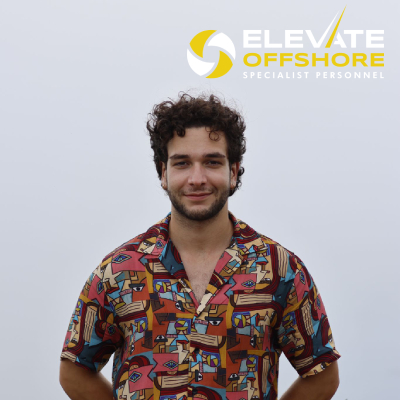
Elevate Offshore Announces Scholarship Recipient for MSc in Hydrography at the University of Plymouth
Elevate Offshore, a leading provider of survey, ROV, geotechnical, and inspection personnel for the offshore energy sector—including renewable energy, telecoms, and power—has proudly announced that Hans Elyar Ebrahim Schaeper has been awarded the Elevate Offshore Scholarship for the MSc in Hydrography program at the University of Plymouth. This newly launched scholarship fully covers tuition fees and provides invaluable mentorship from experienced industry professionals.
Scholarship Impact and Mentorship
The scholarship aims to support individuals pursuing careers in hydrography, addressing the growing demand for skilled personnel in this field. Andrew Blears, Managing Director of Elevate Offshore, expressed enthusiasm for Hans's selection, stating, “This is just the first of many scholarship opportunities that Elevate Offshore plans to offer as part of our ongoing commitment to attracting and nurturing new talent in the industry. We are excited to support Hans in his educational journey and to provide a springboard for his career in the offshore sector.”
About Hans Elyar Ebrahim Schaeper
Hans, 23, recently graduated with Honours in Marine Biology and Oceanography from the University of Plymouth in July 2024. He is a qualified HSE Professional SCUBA diver and gained valuable research experience through a competitive internship at the Alfred-Wegener Institute. During his internship, he participated in a diving team that focused on deploying and maintaining underwater sensors, leading a project aimed at reducing marine biofouling on in-situ technology. His academic journey culminated in a dissertation titled "A Novel Method to Reduce Biofouling on In-Situ Marine Sensors."
In his final year, Hans showcased his commitment to environmental issues by earning second place in the Just Picture It: Our Changing World photography competition, highlighting the impact of human activities on seabirds with a photograph of Gannets in their breeding nests littered with fishing nets and plastics.
Pursuing Hydrography
When asked about his motivation for pursuing hydrography, Hans stated, “I have a great interest in exploring the ocean, along with the drive to continue seeking new prospects and broadening my horizons. During my time at university, I had the chance to speak with lecturers and working professionals, and I was fortunate enough to be accepted into a competitive research institute, which further fuelled my curiosity about the ocean and its potential. By the time I graduated, I knew I wanted to pursue a career in hydrography to gain greater insight into the offshore world across all its sectors.”
He chose the University of Plymouth for his MSc in Hydrography due to its excellent teaching methods and limited number of universities offering this specialised programme. “Having sp
oken to previous graduates, I found that the University of Plymouth was the best choice for me to receive the education necessary to reach my goals,” he explained. The course leader, Tim Scott, also highlighted the exceptional opportunity that the Elevate Offshore Scholarship presents.
Personal Significance
Receiving this scholarship holds special significance for Hans, who has navigated his educational journey with dyslexia. He remarked, “Having received guidance from the university throughout my undergraduate degree due to my dyslexia, I believe that the mentorship provided by this scholarship - from those with first-hand experience in the industry - will be invaluable in aiding my studies over the coming year’.
Hans is particularly excited about the breadth of opportunities available in the offshore energy sector, stating, “The unique lifestyle of those in the offshore energy sector is something I hope to experience fully, allowing me the chance to explore the world while working on something I love.”
Future Aspirations
Once he completes his MSc, Hans aims to work within the offshore sector, leveraging the opportunities provided by Elevate Offshore and the University to build connections within the industry. He aspires to join a company that values the importance of the ocean and is committed to creating sustainable solutions for the future.
Hans envisions that the mentorship from Elevate Offshore staff surveyors will significantly shape his learning experience and career development. He stated, “Throughout university, I have benefited from working with industry experts in marine and sustainability sectors, which has allowed me to grow professionally. I hope to provide similar support to the next generation of surveyors and students in my career.”
By offering initiatives like this scholarship, Elevate Offshore aims to contribute to developing skilled professionals and promoting sustainable practices within the offshore energy industry.
The University of Plymouth website has more information on the Elevate Offshore scholarship and the MSc in Hydrography programme.

CMS GeoScience Expands Operations with Acquisition of New Site in Falmouth, Cornwall
 CMS GeoScience Ltd (CMSG) is pleased to announce the recent purchase of a new site in Falmouth, Cornwall, marking a significant milestone in the company's ongoing growth and development. This strategic move underscores their commitment to enhancing their operational capabilities and strengthening their presence in the region whilst also enabling them to support the development of renewable energy and floating offshore wind in the southwest and Irish sea.
The Gables will support their operations and enhance research and development of new equipment. The site is being updated to ensure it can support the companies ambitious growth plan and exciting strategy. CMSG already working on building new laboratories and storage facilities for their equipment, ensuring that they can continue to deliver the high standards of service and innovation that their clients have come to expect. The new facility will serve as the headquarters for management, administrative and survey teams supporting the company’s future growth.
CMSG will continue to maintain their long-standing presence in Lowestoft, with its large warehouse and dedicated berth remaining a fundamental part of their operations. The 24m multipurpose survey vessel, MV Flatholm will continue to operate from this location, moving between the east coast and south west providing the unique ability to operate efficiently along all sides of the UK and Europe.
CMSG are proud and excited to take this significant step forward which demonstrates their dedication to both the development of CMS GeoScience, their people and the services they provide as well as their long-term commitment to the area. This substantial investment in infrastructure will enable CMS GeoScience to better serve their clients, support their team, and contribute to the continued success of the company.
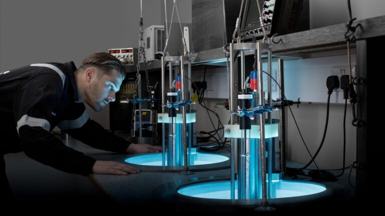
Ashtead Technology to acquire Seatronics and J2 Subsea
Ashtead Technology, a leading provider of subsea technology and services, announces it has signed an agreement to acquire Seascan Limited and its subsidiaries (known as Seatronics), and its sister company J2 Subsea Limited, international subsea electronics and ROV tooling rental and services businesses for £63m from Acteon Group. The transaction remains subject to customary closing conditions including approval of the Competition and Markets Authority.
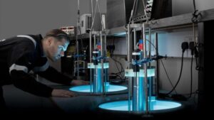 This latest acquisition, the ninth in seven years, will further expand Ashtead Technology’s capabilities in the global survey & robotics rental market. Seatronics and J2 have operations in Singapore, UAE, UK and US, providing subsea electronics and tooling products and services to the global offshore energy market. Together they support the installation, inspection, maintenance & repair, and decommissioning of subsea oil & gas and renewable energy infrastructure
The highly complementary acquisition will increase the breadth and depth of Ashtead Technology’s survey & robotics rental fleet and services, bringing a highly skilled employee base of 110 people with significant domain knowledge and technical expertise, adding more than 7,000 proprietary assets increasing Ashtead Technology’s rental portfolio by 30%.
Allan Pirie, Chief Executive Officer of Ashtead Technology, said:
“Seatronics and J2 are businesses we have known for a long time. With our most recent acquisitions focussing on expanding our mechanical services capability, this latest acquisition strengthens our international footprint and capability within our Survey & Robotics market. We look forward to welcoming new colleagues to Ashtead Technology and increasing the wealth of in-house expertise as a larger Group, creating a world leading subsea survey and robotics team”.
Brice Bouffard, Chief Executive Officer of Acteon, added:
“Upon closing, this transaction will be the next important step in focusing our service portfolio to achieve Acteon’s long-term strategic goals. Seatronics and J2 have been an integral part of our business for many years and I’m very pleased to see both teams moving together to such a dynamic new home at Ashtead Technology. Acteon is committed to optimising our portfolio to better serve our customers and stakeholders as we support the evolving offshore energy market”.
This significant investment is part of Ashtead Technology’s commitment to delivering high-quality subsea technology and services, supporting customers across the offshore energy sector.
Forcys and DRASS to revolutionise underwater operations
 Forcys brings together leading technologies, offering a comprehensive naval and subsea capability to the world defence market.
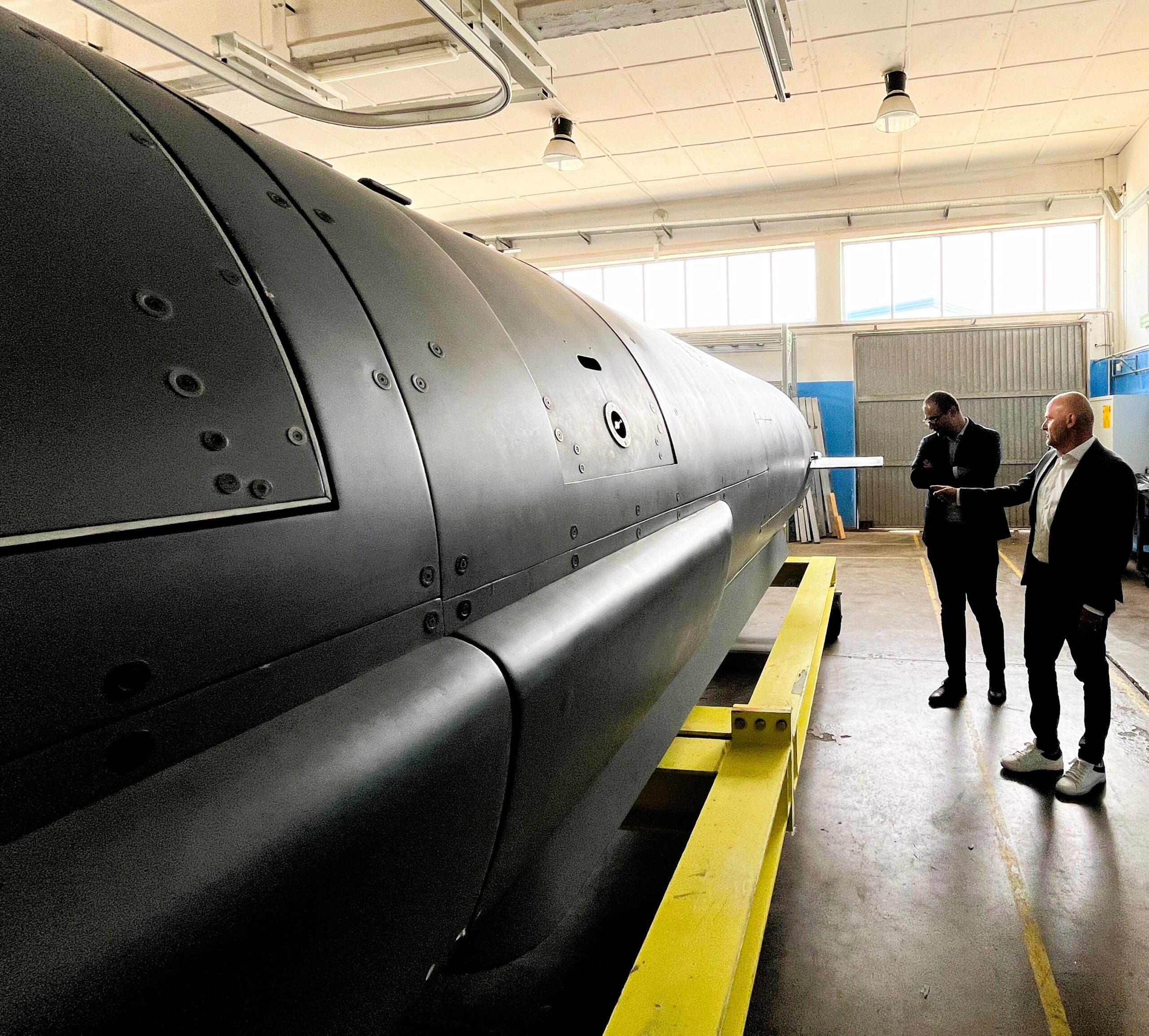
Forcys, a global leader in underwater defence technology, and DRASS, a renowned name in the manufacturing of diving systems and underwater vehicles, have signed a Memorandum of Understanding (MoU) aimed at revolutionising underwater operations.
Forcys integrates and brings to the defence market world-changing solutions from leading technology partners Chelsea Technologies, EIVA, Sonardyne, Voyis, and Wavefront Systems. These companies are renowned for their innovative offerings in underwater and maritime operations, making them ideal partners for DRASS.
Luca Biasci, SDV & LUUV Program Manager at DRASS, emphasizes the significance of this collaboration: "DRASS has consistently been at the forefront of technological innovation in the underwater domain. With this partnership, Forcys' robust portfolio of advanced payload technologies will be integrated with our Large Unmanned Underwater Vehicles (LUUVs), RONDA, expanding our suite of solutions to meet the evolving demands of the underwater sector."
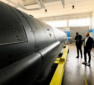 Under this agreement, Forcys' advanced underwater vehicle systems and sensor payloads will complement DRASS’ capability to meet the evolving needs of navies.
Antonio J. Belfiore, who leads sales in the Europe, Middle East, India, and Africa (EMEIA) region for Forcys, recently visited DRASS headquarters in Livorno, where the final details of the agreement were ironed out.
“We are thrilled to partner with DRASS, a company that shares our commitment to innovation and excellence,” said Antonio J. Belfiore. “This partnership allows us to combine our expertise and provides customers with state-of-the-art systems that enhance operational capabilities and ensure safety and efficiency in underwater missions.”
Both companies are committed to pushing the boundaries of what is possible in the underwater domain, leveraging their combined expertise to deliver state-of-the-art solutions to defence markets worldwide.
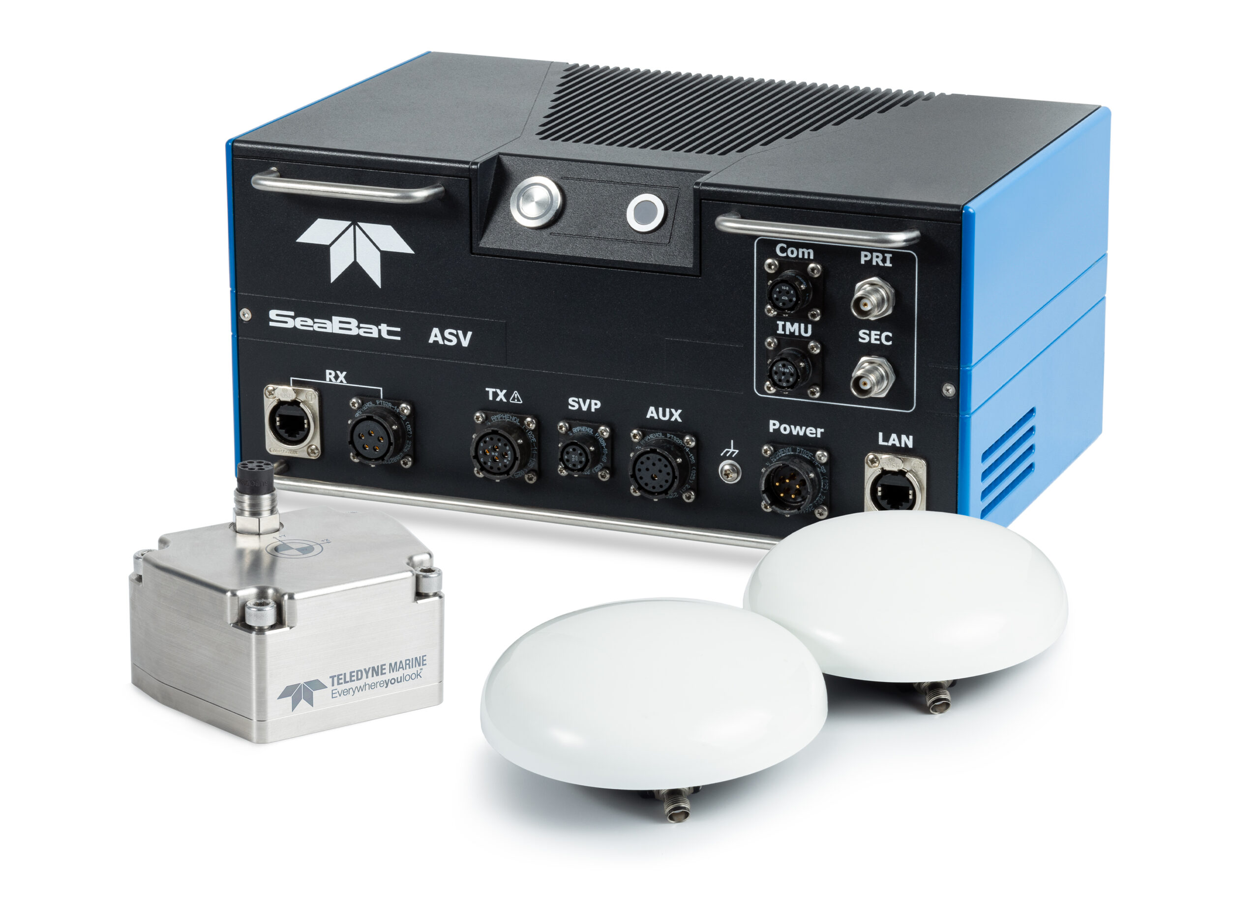
Teledyne Marine Launches Intrepid – A GNSS/Inertial Navigation System
 Teledyne Marine is excited to unveil the Intrepid, a GNSS/Inertial Navigation System. The system is integrated with the SeaBat T20-ASV processor and comprises a compact inertial measurement unit (IMU) and two GNSS antennas, delivering reliable and precise positioning.
With the Intrepid on board, no manual interfacing between sensors is required, as the system automatically streams data to third-party software. This eliminates the need for manual sensor interfacing and reduces downtime.
Teledyne Marine’s unified approach combines hardware and software into one single, intuitive interface for monitoring and controlling the mapping system. Moreover, the centralized system streamlines firmware and software updates, providing users with effortless access to the latest features and enhancements. The new Intrepid GNSS/Inertial Navigation System combines immediate feedback with the consistent and precise results of the SeaBat T20-ASV, delivering a seamless mapping experience.
The Intrepid GNSS/INS benefits all users in marine surveying applications by providing the precise navigation necessary for operational efficiency. Due to its intuitive design, it is easy to configure and monitor, allowing even entry-level operators to quickly set up the system and receive immediate feedback on navigational status - essential for dynamic marine operations.
“Teledyne Marine’s Intrepid GNSS/INS is the next step in our line of INS products with a combined GNSS/INS system. What we have done is to integrate the SeaBat Sonar software and the Intrepid software into one software program, making it simple and easy to use for the operators,” says Pim Kuus, Senior Hydrographer and Product Manager Instruments & Imaging at Teledyne Marine.
Greensea IQ Awarded $1.9 Million NAVSEA Contract for Coupled ROV and Manipulator Control
 Richmond, VT – October 1, 2024 – Greensea IQ announces the awarding of a Phase II contract from the Naval Sea Systems Command (NAVSEA) as part of SBIR Topic #N211-066. The contract, including options, is valued at $1.9 million and spans up to three years if all options are exercised.
The objective of this contract is to significantly enhance the capabilities of the MESR Mk20 Expeditionary ROV platform by integrating manipulators and providing intuitive, one-operator control of the ROV and manipulator system. This integration will allow ROVs to perform increasingly complex tasks in marine environments, using a single control system for both the ROV and manipulator. This innovation aims to optimize performance, reduce operator workload, and simplify control station complexity.
Commenting on the award, Ben Kinnaman, CEO of Greensea IQ, stated, “I founded Greensea with the singular vision of using autonomy and advanced technologies to improve the relationship between operator and robot in the ocean industry. We have always specialized in the pragmatic application of bleeding-edge autonomy, AI, navigation, and Human Machine Interface developments. This project with the U.S. Navy is the epitome of Greensea’s motivation. It will allow defense operators to use robots as meaningful and viable tools offshore, creating scale and safety in their mission to combat threats.”
The challenges of working with manipulators on small ROV platforms is not unique to Expeditionary Forces. As ROV platforms have gotten smaller and more capable and electric manipulators have become more viable for serious underwater tasks, their combined potential is significant for the offshore industry as well as defense. These systems are challenging to operate however because they have significantly less mass than traditional Work-Class ROVs and are deployed with a reduced operating footprint, often consisting of a single operator. This technology, combined with Greensea’s mature autonomy, positioning, and perception technologies, will pave the way for widespread adoption of miniature ROVs with advanced manipulator packages in all aspects of the ocean industry.