
Hydromea Unveils D-FIN™: A Cutting-Edge ESC Motor Controller for Robotic Vehicles
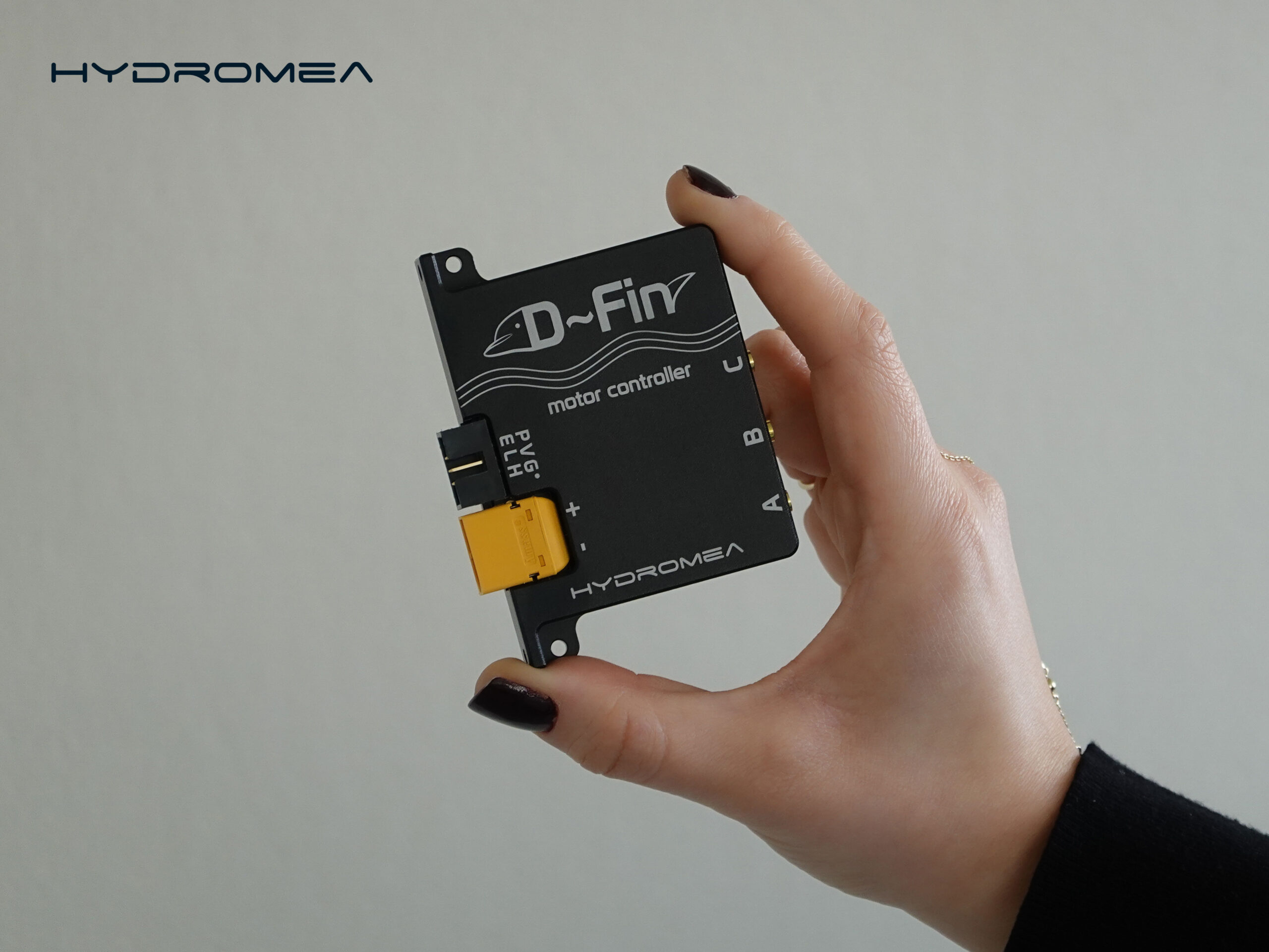
 Hydromea, a pioneer in underwater robotics and wireless communication, is proud to announce the launch of its newest product, the D-FIN™ Electronic Speed Controller (ESC) Motor Controller. This state-of-the-art device is engineered to deliver unparalleled efficiency, compactness, and precision for brushless permanent magnet DC (BLDC) motors and thrusters.
The D-FIN™ controller is engineered in Switzerland to offer unmatched compact power and precision for Hydromea’s unique DISKDRIVE™ thrusters and many other brushless permanent magnet DC (BLDC) motors in the robotics and equipment space. This advanced controller brings smooth, silent, and efficient performance to your motors. To fit into the smallest robotic vehicles, it can be stacked on a proprietary backplane to optimize space constraints and reduce cabling. Multiple digital interfaces provide flexibility to integrate D-FIN™ into your system with ease. D-FIN™ can be controlled and monitored via RS485 serial bus, CAN bus, USB-C, or PWM.
Key Features of D-FIN™:
• Compact Design: Measuring just 83 x 62 x 12 mm and weighing 80 grams, D-FIN™ is engineered for applications where space and weight are critical.
• Wide Input Voltage Range: Supports input voltages from 10 to 36 V, offering versatility across various power systems.
• High Current Handling: Capable of managing up to 25 A of current, ensuring robust performance for demanding applications.
• Flexible Communication Interfaces: Offers RS485, CAN bus (configurable), USB-C (virtual serial port), and PWM interfaces for seamless integration with diverse systems.
• Advanced Control Modes: Supports multiple communication modes, including hall-sensor trapezoidal, hall-sensor Field-Oriented Control (FOC), sensorless trapezoidal, and sensorless FOC, along with a self-calibration mode.
Felix Schill, Co-Founder and CTO of Hydromea, commented on the launch: "As many robotics developers, we’ve been frustrated with the unavailability of a compact, efficient, and precise ESC motor controller in the market. So we developed one for our own thrusters. The D-FIN™ ESC Motor Controller represents a significant advancement in marine motor control technology. Its compact size, high efficiency, and versatile integration capabilities make it an ideal solution for enhancing the performance of robotic systems and many other equipment that requires precise control of BLDC motors."
Hydromea continues to lead in marine innovation, as evidenced by recent developments such as the EXRAY™ underwater inspection ROV equipped with proprietary LUMA™ wireless communication technology. The introduction of D-FIN™ further solidifies Hydromea's commitment to providing cutting-edge solutions for marine exploration and inspection.
Meet Hydromea at Ocean Business 2025!
Hydromea will be exhibiting at Ocean Business 2025 at Stand R3, showcasing its latest innovations, including the D-FIN™ ESC Motor Controller, LUMA™ optical communication technology, and EXRAY™ wireless underwater. Join us to see these groundbreaking solutions in action, meet our experts, and explore how Hydromea is shaping the future of underwater technology.

Marine AI unveils hat trick of mous to revolutionise maritime operations

Marine AI has recently announced the launch of a hat trick of commercial contracts in waiting, with Memoranda of Understanding (MOUs) issued that showcase the remarkable versatility of its cutting-edge software and underscore its transformative impact on maritime operations.
Seabot Maritime, a pioneer in workforce development solutions, will partner with Marine AI to develop an immersive training programme for USV operators and the creation of new specialized courses for advanced navigation with complex systems. Hefring, a frontrunner in AI-driven optimisation, will contribute its state-of-the-art tool designed to revolutionise maritime course planning by harnessing localised weather data. Meanwhile, the Royal Navy, globally recognised for its maritime defence expertise, is set to advance next-generation training pathways for uncrewed systems, thereby setting new standards in operational excellence.
Marine AI’s cutting-edge software leverages machine learning and real-time analytics to tackle key challenges in navigation, safety, and operational efficiency. It has recently played a pivotal in the Royal Navy’s CETUS, first Extra Large Underwater Autonomous Vehicle (XLUAV) technology demonstrator, Zero USV’s, that is building the world’s first fleet of autonomous charter boats for hire and the Royal Navy’s Patrick Blackett trials ship.
Tom Rooney, general manager at Marine AI, said: "We’re delighted to partner with such forward-thinking, leading organisations in international maritime. Seeing our software being applied in such a wide array of applications is truly exciting. We're at the forefront of a digital revolution in maritime operations, pioneering solutions that not only revolutionise navigation, safety and performance but also set new benchmarks for efficiency at sea."
Gordon Meadow, CEO of SeaBot Maritime, said: “By partnering with Marine AI, we're combining our training expertise with their world-beating navigation and situational awareness systems to deliver programs that prepare operators for the complexities of modern maritime autonomy."
Captain Keith Stephenson, head of NavyX, said: “AI and autonomous systems will be pivotal in ensuring the Royal Navy’s readiness for future challenges, and this trial is an important step in understanding how these cutting-edge tools can enhance decision-making, operational efficiency, and the safety of our personnel. This collaboration represents a significant leap forward in naval innovation, positioning the Royal Navy and the UK maritime industry at the cutting edge of this journey.”
OSIL Ocean Business 2025 Product Highlight
Ocean Scientific International Ltd
Stand C1
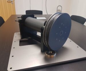
Join OSIL at Ocean Business 2025 (Stand C1) to explore the forefront of marine engineering and scientific innovation. Our advanced USV profiling winch systems are engineered to deliver precision, reliability, and integration for demanding oceanographic applications:
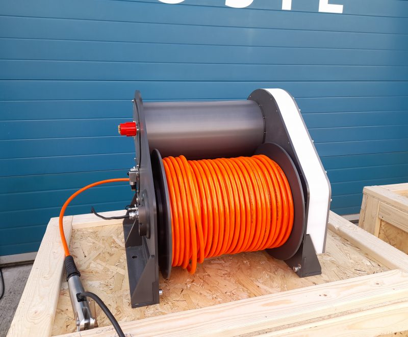
• Micro Profiling Winch: This ultra-compact, fully autonomous winch offers a rapid deployment solution for high-resolution profiling. Engineered for streamlined installation and precision data collection, it is capable of operating at depths up to 500m, making it an ideal tool for detailed environmental analysis.
• Profiling Winch: Designed for rigorous performance, this automated winch system supports both robotic and manual control modes. With the ability to handle loads up to 1 tonne, operate at depths reaching 1.5km, or support advanced equipment with a 12-core slipring configuration, this design facilitates seamless integration with larger USV systems and surface platforms, serving critical applications in military research, aquaculture monitoring, and oceanographic exploration.
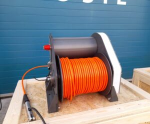
Discover how OSIL's cutting-edge technology can enhance your marine data acquisition capabilities and support sophisticated research initiatives.
For further technical details, please contact us at +44 (0)2392 488240 or via email at [email protected].
Visit www.osil.com for more information.
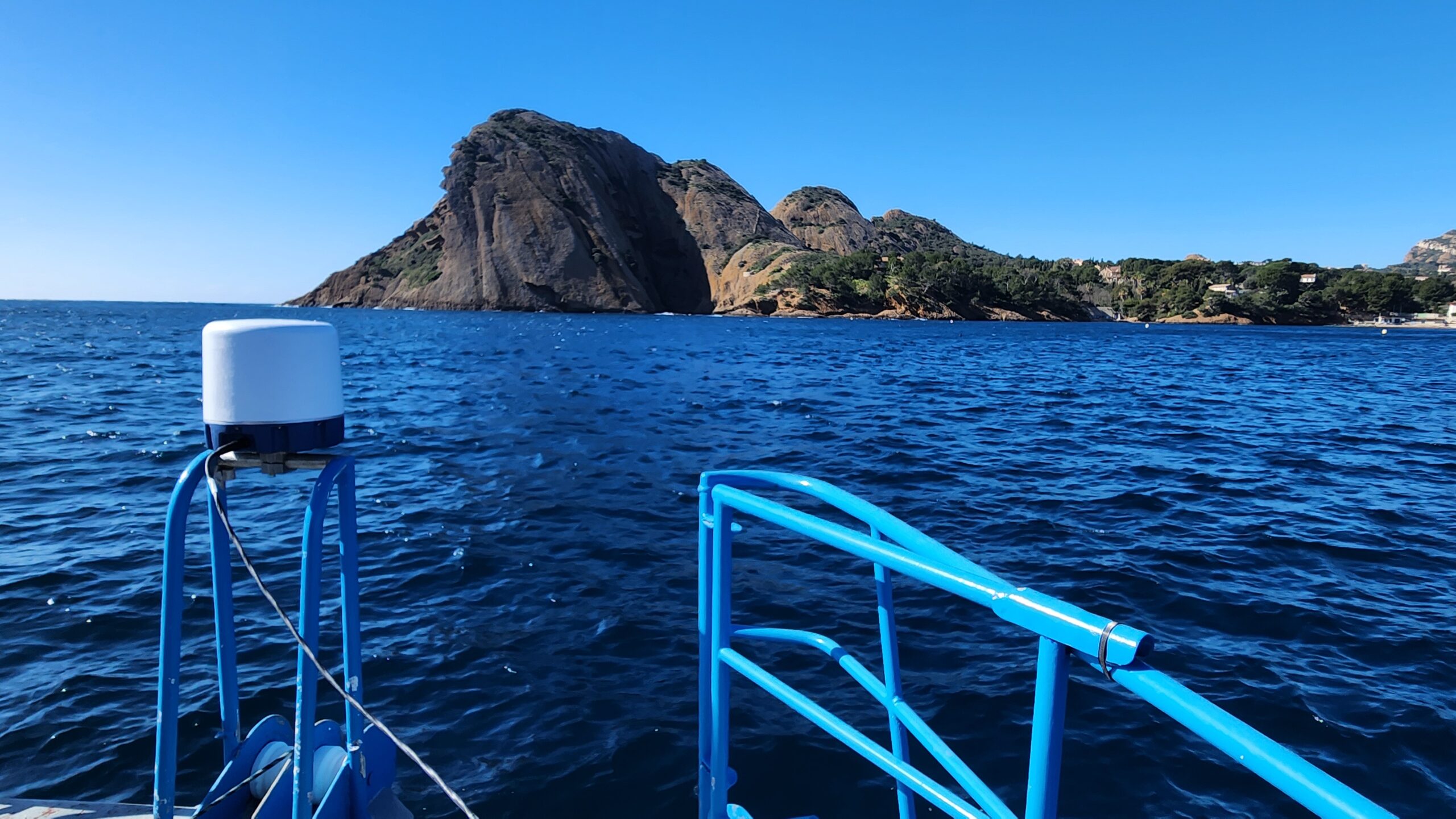
Navtech radar launches the world’s first 77ghz fmcw maritime radar set to transform ocean safety
 The world’s first 77GHz FMCW marine radar, a groundbreaking, ultra-high-definition W-band system for all-weather navigation and safer manoeuvring in crowded waterways, has recently launched.
Navtech Radar’s MAS10, developed in collaboration with leading marine companies, has true all-weather capability provides unparalleled reliability in all-weather environments. Unlike optical and infrared sensors, its W-band radar technology cuts through fog, heavy rain, and snow, providing clear and consistent detection. It excels in low visibility conditions, functioning seamlessly in darkness, bright sunlight, and shadowed areas where cameras and LIDAR often fail.
Built with a ruggedised design specifically for mission critical marine applications, the MAS10 withstands sea spray and mist, ensuring accurate performance even when moisture would typically degrade other sensors. And its resistance to wind and turbulence guarantees uninterrupted tracking, even in rough conditions, making it essential for safe and efficient navigation.
The MAS10 radar is designed with developers in mind, offering seamless integration into existing and emerging autonomous systems. With open architecture, standardised APIs, and comprehensive SDK support, it enables effortless connectivity with navigation software, sensor fusion platforms, and AI-driven vessel control systems. Its plug-and-play capability ensures minimal setup time, while robust data output formats allow for easy customisation and real-time processing.
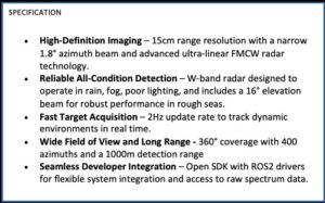
The MAS10 launches as maritime traffic reaches unprecedented levels and autonomous vessels take centre stage, making precision more critical than ever. Unlike traditional longer-range radars, which struggle to detect small objects up close, the MAS10 offers centimetre-level resolution, allowing vessels to identify and classify even the smallest hazards in congested waterways.
Rachael O’Connor, marine business development manager at Navtech Radar, said: “Uncrewed vessels are set to revolutionise maritime operations across numerous applications and markets, from energy to border control. However they face a critical gap in sensor technology for situational awareness in congested waterways. Conventional radars excel at long-range detection, but new challenges demand more advanced solutions. The MAS10 radar is purpose-built for marine automation, combining 1km range with centimetre-level precision and all-weather reliability.
“The MAS10’s high-resolution imaging enables machine-learning-powered classification, setting a new standard for safe and intelligent navigation. With 25 years of Navtech expertise, the MAS10 is designed to enable safer and smarter navigation for the future of maritime operations.”
Matthew Ratsey, founder and managing director of Zero USV, has worked closely with other leading innovators in the marine industry to help drive the development of the MAS10. He said:
“High-definition short range (up to 1km) radar are vital in completing ‘the picture’. When you are totally reliant on your sensor pack for your autonomous navigation, ensuring you have the complete picture is vital.
“Navtech’s MAS10 is such a unit, the definition and quality to pick up even the smallest of targets in cluttered environments is vital for the autonomous industry to continue seeking the goal of ‘jetty to jetty’ navigation where busy harbours still represent a significant challenge.”
With over 6,000 radar deployments in mission-critical environments worldwide, Navtech continues to lead the way in radar innovation. The MAS10 represents the next evolution in marine situational awareness, empowering the future of autonomous navigation with unmatched precision, reliability, and intelligence.
Sonardyne revolutionises small marine robotics navigation with launch of SPRINT-Nav U
World's smallest hybrid acoustic-inertial navigator packs powerful performance into ultra-compact form factor
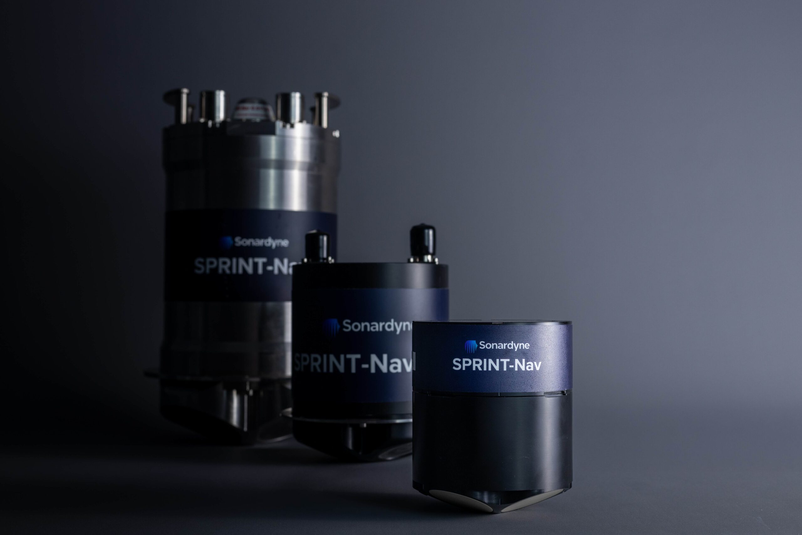
Sonardyne International Ltd is proud to announce the launch of SPRINT-Nav U, the world's smallest hybrid acoustic-inertial navigator designed specifically for compact marine robotic platforms.
This groundbreaking technology delivers the proven performance of Sonardyne's industry-leading SPRINT-Nav family in a package measuring just 135 mm tall by 114 mm in diameter and weighing only 600 grams in water.
SPRINT-Nav U represents a significant advancement for operators of small ROVs, AUVs, towfish, and USVs, who can now access survey-grade navigation capabilities previously available only to larger platforms. The system combines four critical instruments—AHRS, DVL, INS, and pressure sensor—into a single unit with one connector and one cable, dramatically simplifying integration while optimising size, weight, and power consumption.
"SPRINT-Nav U transforms what's possible for small robotic platforms. Operators can now conduct complex inspections and surveys around offshore structures, ports, and harbours with exceptional accuracy and reliability, without the need for large-scale vessel deployments." Aidan Thorn, Business Development Manager – Marine Robotics, Sonardyne.
Key features and benefits
• Ultra-compact design: Measuring 135 mm x114 mm and weighing only 0.6 kg in water (1.98 kg in air), SPRINT-Nav U fits into spaces traditionally occupied by just a DVL
• True north seeking: Maintains accurate heading even in ferrous environments where MEMS-based navigation systems struggle
• Survey-grade performance: Delivers 0.1% error for distance travelled during typical surveys, with heading accuracy of 0.15°
• Extended altitude range: 500 kHz DVL maintains bottom lock at up to 100 m altitude
• Rapid deployment: Aligns in just 5 minutes with DVL bottom lock
• Easy operation: Familiar web user interface shared with SPRINT-Nav Mini, with outputs compatible with third-party software
Game-changing capabilities for offshore energy
SPRINT-Nav U is particularly valuable for offshore wind operations, where its compact FOG-based IMU provides continuous, high-accuracy position, orientation, and velocity data even when operating in and around steel structures. This capability enables operators to conduct thorough inspections of wind turbine foundations, cables, and other subsea infrastructure without the interference issues common to magnetic-based systems.
"The ability to maintain accurate navigation in and around ferrous structures is a game-changer for operations such as offshore wind farm monitoring and maintenance. SPRINT-Nav U ensures operators can collect consistent, high-quality data near steel components where other systems would fail." John Houlder, Senior Product Manager, Sonardyne.
SBG Systems unveils the world's First MEMS-based Gyrocompassing IMU at Ocean Business 2025
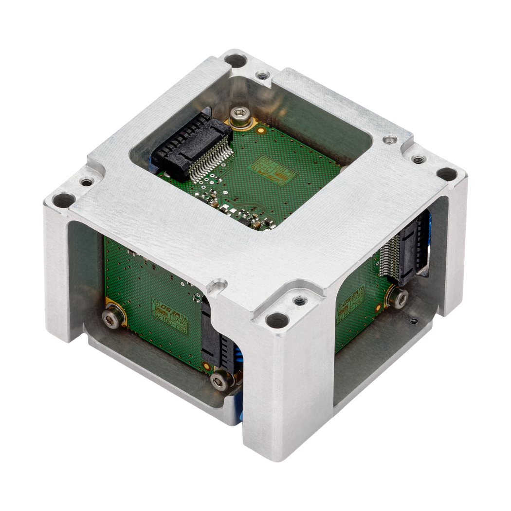
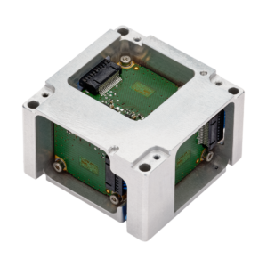 SBG Systems and Inertial Navigation Systems (INS), is proud to introduce the world’s first MEMS-based North seeking IMU, capable of operating without GNSS aiding—a breakthrough in MEMS technology. This leap forward paves the way for future products, including AHRS and INS solutions, to further expand the possibilities of MEMS-based navigation.
This innovation marks a major milestone in inertial navigation by bringing the benefits of MEMS sensors to the world of high-performance navigation and orientation.
Unprecedented Performance & Innovation
This MEMS-based IMU provides unparalleled precision, achieving a heading accuracy better than 1° secant latitude without GNSS aiding, and an INS heading accuracy better than 0.01° when combined with SBG Systems’ state-of-the-art navigation and orientation algorithms.
Furthermore, this is a true MEMS-based gyrocompass with no moving parts, that doesn’t rely on carouseling or May-tagging, ensuring durability and reliability in all environments.
Key benefits of SBG Systems’ MEMS-based Gyrocompassing IMU include:
• Unmatched SWaP (Size, Weight, and Power) optimization: miniature form factor (52 x 52 x 36 mm, <150g) with low power consumption (2W), making it the most compact and efficient solution in its category.
• Volume ready: designed for high-volume production, enabling broad adoption across industries and competitive pricing.
• Robustness: no moving parts, ensuring long-term reliability even in the most demanding conditions.
• ITAR-Free – For unrestricted global deployment.
Revolutionary Gyrocompass Alignment Algorithms
SBG Systems has developed cutting-edge and patent pending algorithms to provide ultra-fast gyrocompass and INS alignment in all conditions:
• Pure north-finding algorithm: capable of rapid initialization in both static and dynamic conditions down to one minute.
• Advanced GNSS/INS algorithm: takes full advantage of gyroscope performance, to provide exceptional single-antenna heading accuracy even in non-dynamic scenarios.
“With this breakthrough, we are pushing the boundaries of MEMS technology. This IMU lays the foundation for a new generation of compact, cost-effective, and high-accuracy navigation solutions for marine, autonomous systems, and georeferencing applications.” said Thibault Bonnevie, CEO of SBG Systems.
Target Markets
• Subsea applications: ideal for ROVs (Remotely Operated Vehicles) and AUVs (Autonomous Underwater Vehicles) that require precise navigation in extreme environments.
• Geospatial & marine surveying: enables high-performance single-antenna marine surveys with unparalleled accuracy, making it the perfect choice for hydrographic, dredging, and offshore operations.
Exail secures first sale of Gaps M3 USBL system to major Asian offshore construction group
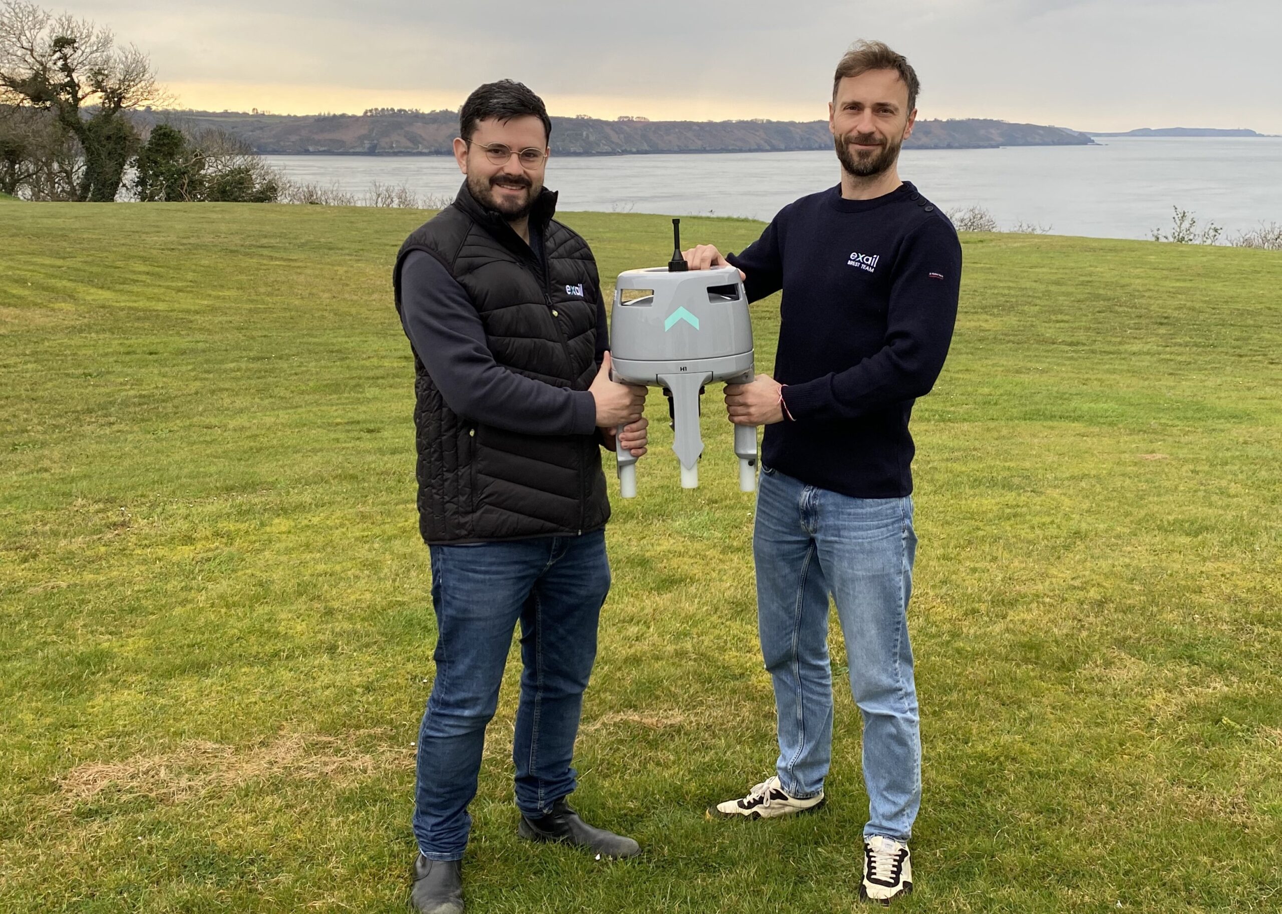
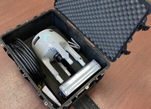
 Exail has secured its first sale of the Gaps M3 compact USBL (Ultra-Short Baseline) positioning system to a major offshore construction group in Asia. The system will be deployed for a subsea cable laying project, providing precise underwater positioning in a dynamic coastal environment.
The Gaps M3 was specifically selected for its ability to deliver high-precision subsea tracking while remaining cost-effective. Integrated with a vessel’s existing attitude and heading reference system, the Gaps M3 will provide the same accuracy as Exail’s high-end Gaps USBL models, offering an ideal solution for operations that require reliable subsea navigation at a lower cost.
“This first sale of the Gaps M3 reflects the growing demand for compact and affordable subsea positioning systems that maintain high performance,” said Lucy Xi, Regional Sales Manager at Exail. “With its versatility, ease of deployment, and cost-effectiveness, the Gaps M3 is a valuable tool for offshore operators seeking efficient and accurate tracking capabilities.”
Designed for both permanent and opportunistic installations, the Gaps M3 excels in coastal and nearshore projects, where space, budget, and operational flexibility are crucial. Its ability to track targets at high elevations makes it particularly well-suited for dynamic offshore environments, such as subsea cable laying, pipeline installation, and marine construction.
With this milestone, Exail continues to expand its portfolio of inertial and acoustic positioning solutions, reaffirming its commitment to delivering accessible, high-performance navigation technology to the offshore and subsea industries.
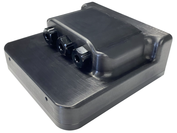
Cerulean Sonar Unveils the Omniscan 450 Compact: Expanding the Omniscan Family with Convenient Form Factor and Enhanced Connectivity
 Cerulean Sonar recently announced the launch of the Omniscan 450 Compact, the latest addition to its Omniscan family. The "Compact" introduces a new form factor and advanced connectivity and diagnostic features that simplify deployment on modern small ROVs.
The Omniscan 450 Compact features three external ports and an internal Ethernet switch, allowing users to daisy chain up to two additional Ethernet devices while utilizing only a single vehicle Ethernet port. This configuration offers streamlined integration with other onboard systems, reducing cabling complexity and enhancing deployment efficiency. One of the additional ports can also accommodate a variety of pressure and temperature sensors, further broadening the Compact’s versatility.
The new form factor matches common FLS devices supported by most small ROVs, thus easing integration efforts. Finally, a new externally visible LED provides clear power indication and additional diagnostic feedback, ensuring quick and effective troubleshooting during operation.
The entire Omniscan family, including the FS, SS, and Compact models, employs a fixed, single, narrow, tall “fan beam.” Scanning with Omniscan is under the direct control of the ROV operator so they can focus on specific areas of interest. As the ROV or surface vessel moves, SonarView “paints” a clear, detailed image of the scanned area, providing exceptional situational awareness even in the murkiest underwater conditions. Omniscan has superior image quality and longer range than multibeam FLS sonars costing 10 times more.
For underwater vehicles lacking positioning information, Omniscan's patent-pending Doppler Motion Tracking technology offers translational data in the direction of the beam. When paired with two Omniscan 450FS units—one facing forward and one oriented 90 degrees to the side—users can achieve full 2D motion tracking. Additionally, the system supports position-hold functionality when integrated with compatible ROV systems.
For more information about the Omniscan 450 Compact and the full range of Cerulean Sonar products, visit www.ceruleansonar.com

Sidus Solutions llc announces strategic partnership with industrial device investments, llc
 SIDUS is an integrated systems provider of security and video surveillance systems for the energy, nuclear, scientific research, military, and petrochemical industries. SIDUS designs, services, and manufactures complete, integrated security and surveillance solutions for any marine, defense, and subsea application.
IDI is a family investment office specializing exclusively in industrial product companies. With a focus on fostering innovation, IDI supports companies leveraging emerging technologies, operating from a proven playbook, to enhance industrial processes and drive growth.
The investment by Industrial Device Investments in SIDUS Solutions was crafted to meet the unique needs of SIDUS’ seller, Leonard Pool, who will be staying on as the company’s president while IDI seeks to build infrastructure and continue the company’s strong growth. IDI's Managing Director Charles Aiken led the closing of the deal.
John Dalton, Managing Partner of IDI, said, “We are delighted to have invested with Leonard and the SIDUS team. SIDUS is an excellent company with a clear plan, operating in a defined niche, and is a great fit for IDI. We worked to achieve Leonard’s goals and create a strong platform for growth for IDI, and now we are very proud that IDI is six companies strong.”
Leonard Pool, seller, shared, “We are thrilled to have successfully completed this transaction. While the process was challenging, our collaboration with IDI has been outstanding. They took the time to understand my goals as a seller and crafted a deal that aligned with both of our objectives. Their strategic approach and deep understanding of our business were key in making this partnership a success. I'm excited about the future and look forward to a long and productive relationship.”
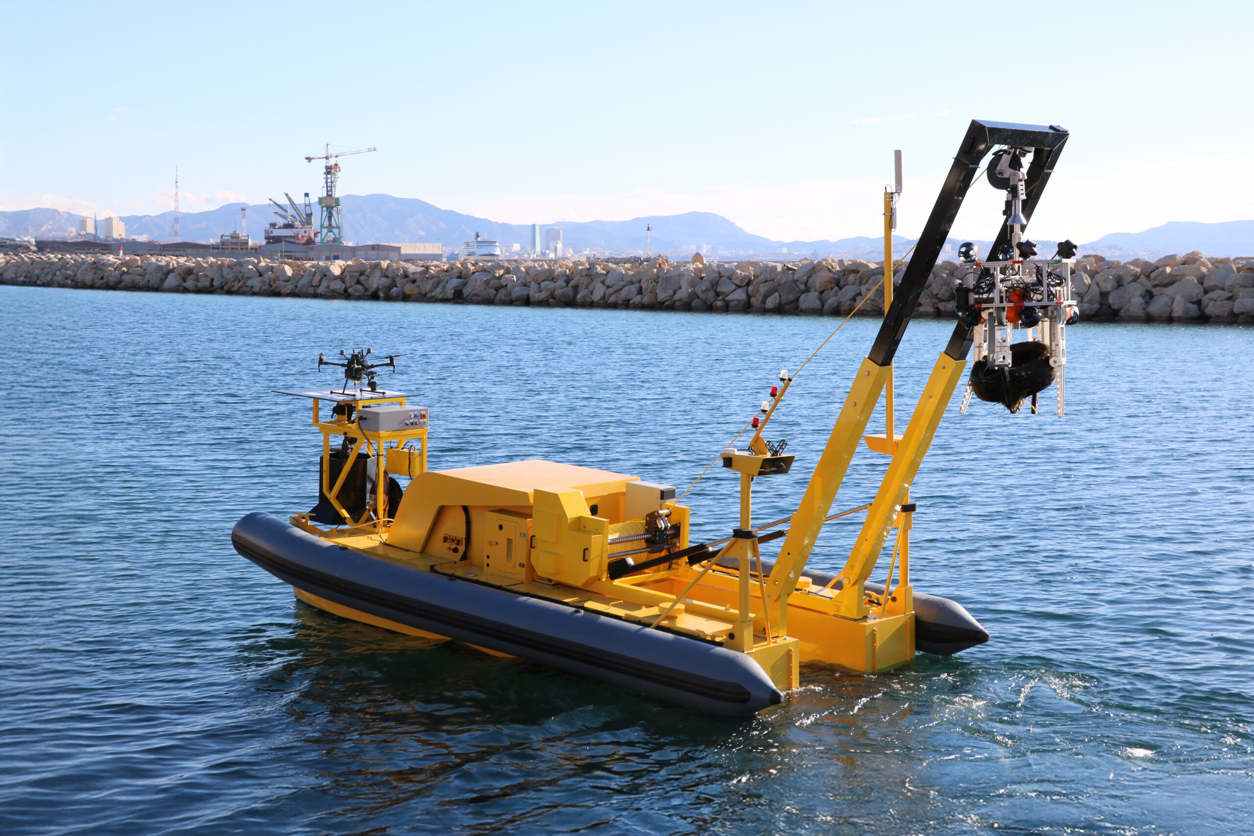
SeaClear 2.0: Cleaning Our Oceans bottom with Uncrewed Autonomous Systems
 With approximately 25 million tons of plastic waste polluting our oceans and over 90% of marine litter resting on the seafloor, tackling this issue has never been more urgent. The SeaClear 2.0 project is at the forefront of innovation, combining robotics, AI, and sustainability to develop ground-breaking solutions for cleaning our oceans.
The Mission to Restore Our Oceans
SeaClear 2.0 addresses one of the Mediterranean Sea's most pressing issues: plastic pollution. Every year, an estimated 600,000 tons of macroplastics and microplastics enter European seas, with the Mediterranean being the hardest hit due to its semi-enclosed geography and intense coastal activity.
As part of the European Mission to restore, protect, and preserve the health of our oceans, seas, and waters by 2030, SeaClear 2.0 is pioneering a comprehensive approach to reduce marine litter. The project aims to:
• Decrease pollution in the Mediterranean and beyond.
• Advance innovative, cost-effective solutions for ocean clean up.
• Demonstrate collaboration between the original SeaClear and its enhanced successor, SeaClear 2.0.
• Engage stakeholders, empower citizens, and provide actionable policy recommendations.
Subsea Tech's Contribution to SeaClear 2.0
As a key partner in the project, Subsea Tech brings its expertise in autonomous and robotic systems to support SeaClear 2.0’s mission. The company provides two advanced robotic solutions:
SeaCAT USV
The SeaCAT is an autonomous and remote-controlled Uncrewed Surface Vehicle (USV) that serves as the central hub for SeaClear 2.0. It coordinates and deploys multiple robotic assets to detect, classify, and collect marine litter.
• Dimensions: L 6.83 m x W 3.1 m x H 2.15 m
• Weight: 1,200 kg (without payload and fuel)
• Fuel capacity: 400 l
• Payload capacity: 500 kg
• Max. speed: 6 knots
• Endurance: Up to 10 days
• Sea state tolerance: Up to sea state 3 (operation), 5 (transit)
• Deployed systems:
o Mini TORTUGA ROV for underwater mapping and environmental monitoring
o Autonomous UAV for aerial mapping and detection
o Motorised Grapple system for handling marine waste up to 250 kg
o Collecting net for floating debris
Mini TORTUGA ROV
The Mini TORTUGA is a compact and highly manoeuvrable Remotely Operated Vehicle (ROV) deployed by the SeaCAT to map the seafloor and identify debris before collection operations.
• Max. depth: 300 m
• Dimensions: L 672 mm x W 310 mm x H 381 mm
• Weight: 19 kg (ROV only)
• Max. speed: 4 knots
• Mission: Underwater mapping, debris detection, and environmental monitoring
• Sensors: Full HD video, high-resolution imaging sonar, side-scan sonar, magnetometer
By integrating these cutting-edge robotic solutions, SeaClear 2.0 can autonomously detect, classify, and collect marine litter, even in challenging underwater environments. The system is capable of operating at depths of up to 300 meters and lifting objects weighing up to 250 kilograms.
Revolutionising Ocean Cleanup
SeaClear 2.0 is a direct evolution of the Horizon 2020-funded SeaClear project. With its fleet of autonomous surface and underwater robots, it represents a technological breakthrough in ocean clean-up efforts. By leveraging AI and robotics, the project supports the EU’s Zero Pollution Action Plan, aiming to reduce plastic litter by 50% and microplastics by 30% by 2030.
Furthermore, the project aligns with the Marine Strategy Framework Directive, ensuring that marine litter no longer poses a threat to marine ecosystems and human activities.
Looking Ahead
As SeaClear 2.0 enters its second phase, the project is preparing for its first system pilot in Hamburg, Germany, in May 2025. Following this, the technology will be demonstrated across five Mediterranean locations, Marseille, Venice, Dubrovnik, Ashdod and Tarragona, where it will prove its versatility in diverse underwater environments. These pilots will also highlight the SeaCAT’s potential for future applications, including geotechnical surveys, seabed mapping, and marine environmental monitoring.
About Subsea Tech
Subsea Tech is a leader in innovative underwater technologies, specializing in tailored solutions for infrastructure inspection and environmental restoration. Known for its agility and rapid response, the company is a trusted partner in advancing sustainable marine operations worldwide. With its SeaCAT USV and Mini TORTUGA ROV, Subsea Tech is contributing to the future of autonomous marine clean-up solutions, helping industries and governments meet their environmental objectives.
For more information, visit https://www.seaclear2.eu/ or contact us at [email protected]