
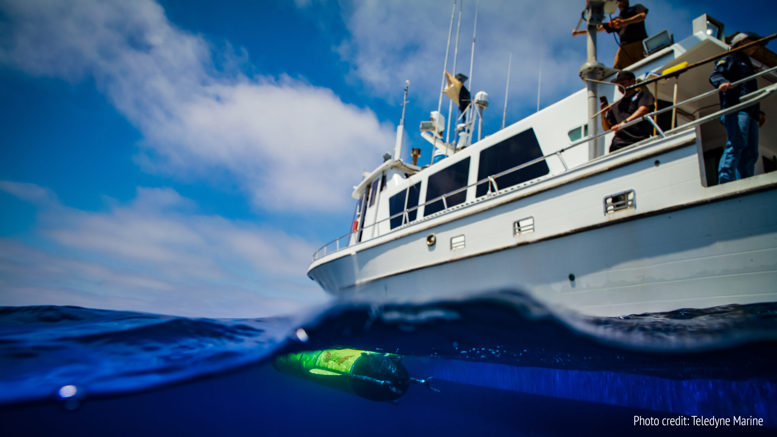
World-first: Underwater Autonomous Glider to circumnavigate the globe
 In a world-first for marine science and technology, Teledyne Marine in collaboration with Rutgers University-New Brunswick, will conduct a pioneering mission to circumnavigate the globe with an autonomous underwater glider.
Using Teledyne’s ‘Redwing’, the most advanced commercial subsea glider ever developed, the near five-year Sentinel Mission departs on 10 October 2025 following a ceremony at Woods Hole Oceanographic Institution (WHOI), which operates the second largest glider fleet in the world.
Launched from the edge of the continental shelf south of Martha’s Vineyard, Massachusetts, the next generation Slocum Sentinel Glider will gather unparalleled levels of data on ocean currents, sea temperature and their impact on weather systems and the planet. This data will help refine weather models and improve hurricane intensity forecasting. The data will also help to inform ocean policy and conservation efforts.
“This is a truly historic mission,” says Brian Maguire, COO at Teledyne Marine. “It will pave the way for a future where a global fleet of autonomous underwater gliders will be able to continuously sample our oceans. These gliders will deliver early warnings of extreme weather and will track the impact of shifting ocean currents so that we can refine long-term weather projections in a way that scientists have dreamed of for decades.
“It will also prove that long-range, next-generation, low energy autonomous underwater vehicles (AUVs) are capable of carrying more complex, heavier, and increasingly energy hungry sensors on missions that we could only have imagined previously.”
A legacy realised
The culmination of a vision first imagined by glider inventor Doug Webb — who pioneered autonomous ocean vehicles at Teledyne Webb Research — the Sentinel Mission serves as both a tribute to Webb, who passed away in 2024 at the age of 94, and a response to the urgent need for global ocean monitoring.
Specially built for the mission ‘Redwing’ – an acronym for Research & Education Doug Webb Inter-National Glider – will surf global ocean currents on its epic mission gathering critical ocean data from under-sampled, remote regions of the globe.
A global flight path
Redwing’s first leg will see it ride the Gulf Stream south of Martha’s Vineyard toward Europe, before sweeping south to stop at Gran Canaria off the coast of North West Africa. Its next leg will take it to Cape town in South Africa, before crossing the Indian Ocean to stop at Perth in Western Australia, then on to Wellington, New Zealand. It will then navigate the Antarctic Circumpolar Current — the most powerful current on Earth — taking it on its longest leg to the Falkland Islands. From here there will be possible stops in Brazil and the Caribbean before heading back to Cape Cod in the U.S.
Providing vital data
Transmitting information via satellite when it surfaces every 8-12 hours, Redwing will share vital data on ocean temperature, salinity, currents, and ocean health via the National Oceanic and Atmospheric Administration’s (NOAA) global monitoring system. This will ensure that scientists, oceanographers, meteorologists, universities, and even schools worldwide will be able to access real-time results internationally, building interest in the mission.
Inside the Sentinel Redwing
Built for endurance
The Sentinel Redwing is a new class of sea glider, purpose-designed for ultra-long missions across some of the harshest seas on Earth. Specially engineered with extended battery capacity and additional sensor capability, it can travel up to 15,000 kilometres on a single leg.
Depth and performance
Redwing will dive to depths of 1,000 metres before returning to the surface to transmit data every 8-12 hours. Using only gravity and buoyancy for propulsion, it flies in a sawtooth pattern through the water, conserving energy for years-long deployments.
Smart design
Redwing’s carbon fibre hull flexes under pressure, compressing slightly during descent, while its buoyancy is adjusted via an oil pump and pitch battery system. This ingenious design allows Redwing to “surf” rather than fight ocean currents, travelling at an average speed of 0.75-1 knots as it efficiently propels its way forward, enabling it to travel vast distances, staying deployed for longer.
Payload and sensors
At 2.57m long and 0.33m in diameter, Redwing carries a payload of up to 3.5kg, including:
- CTD sensor (conductivity, temperature, depth/density)
- Altimeter to avoid the seafloor
- Attitude and compass sensors for navigation
- And a fish monitor from Dalhousie University, tracking tagged marine life such as sharks and whales
Shea Quinn, Sentinel Mission Project Lead and Slocum Glider Product Line Manager, explains: “As we travel through the layers of the ocean, which move over and under each other in different directions, we’ll gather data on water temperature and density, and we’ll pick up pings from tagged marine life. “We’ll be able to see what’s happening at the surface and deeper underwater where huge patches of cold water and warm water move. This data will help us to show, for example, where a hurricane is going to go next and how intense it’s going to be. We’ll also build a better knowledge about the impact of ocean currents on our weather patterns, informing global ocean models of the future, and our understanding of long-term climate change.”
Supported by partners from Spain, Gran Canaria, South Africa, Australia, New Zealand, Brazil, the UK, and the U.S, the mission is a truly international undertaking.
 Collaborating with academia
Teledyne Marine engineers will work closely with more than 50 Rutgers University students at the Center for Ocean Observing Leadership (COOL), who have helped programme the navigation software that will guide Redwing across the oceans. Together, they will track Redwing from their shared mission control bases and will keep it on its flight path, making necessary adjustments each time it surfaces throughout the 73,000km journey.
“This is a pivotal moment for ocean science,” said Scott Glenn, Distinguished Professor in the Department of Marine and Coastal Sciences at Rutgers. “We’re deploying an autonomous glider that will travel the world’s oceans, gathering data. And we’re doing it with students, educators and international collaborators every step of the way.”
Oscar Schofield, Distinguished Professor in the Department of Marine and Coastal Sciences at Rutgers, added: “There’s no doubt in my mind that this mission will not only shape our understanding of the oceans and their impact on the climate in a new way, but it will also change the future of autonomous ocean exploration.
“Fittingly, it will also realise a piece of science-fiction written by Henry Strommel of Woods Hole Oceanographic Institution that appeared in Oceanography Magazine in 1989. This foresaw an international race between three Slocumb Sentinel gliders to circumnavigate the globe first, and a time when there would be a fleet of underwater gliders taking part in missions around the world.”
The Sentinel Mission’s progress will be updated on www.teledynemarine.com/sentinelmission and can be followed on Instagram: https://www.instagram.com/teledynemarinevehicles/

Robosys Automation Secures Landmark Offshore Wind Vessel Retrofit Contract
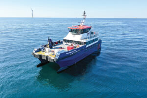
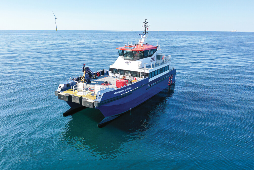
Robosys Automation, a global leader in maritime autonomy, vessel control systems, and smart shipping solutions, has announced that it has secured a new contract to retrofit a 26-metre Damen 2610 Fast Crew Supplier (FCS) Twin Axe High Speed Support Vessel (HSSV), with its flagship VOYAGER AI advanced maritime autonomy software.
The vessel, built in 2015 to Lloyd's Register classification standards, is powered by twin Caterpillar C32 engines with direct drives and is equipped with an Alphatron autopilot, Böning control system, Bosch Rexroth ship controls, and a Hydrosta bow thruster system.
This integration will be the second such type using of Robosys’ VOYAGER AI into a CTV (Crew Transfer Vessel) having first retrofitted a similar Damen 26m CTV with the VOYAGER AI Autonomous Navigation System (ANS) in 2019.
These onboard systems will be seamlessly integrated with Robosys' VOYAGER AI, enabling Remote Control as well as enhanced safe Autonomous Navigation and safe and smart decision-making capabilities using integrated Electronic Navigation Charts (ENCs) ie. ECDIS for route/path planning and re-planning validation plus COLREGS based Collision Avoidance.
The contract, awarded by an undisclosed European client, involves a comprehensive retrofit to ensure optimal performance of the VOYAGER AI platform in real-world offshore support operations, including crew transfers, logistics, and dynamic positioning tasks.
Nigel Lee, Chief Strategy Officer at Robosys Automation, commented: “This project represents a significant leap forward not only for Robosys but for the offshore renewables industry. The integration of VOYAGER AI into this Damen FCS 2610 vessel highlights the confidence in remote and autonomous smart vessel technologies to enhance safety, operational efficiency, and sustainability, within offshore wind operations.”
VOYAGER AI offers scalable levels of autonomy, ranging from decision-support to fully autonomous operations, and is built to integrate with existing vessel control systems with minimal disruption.
Lee continues: “The integration of Robosys’ VOYAGER AI into the Damen 2610 marks a major step forward in enhancing the safety, efficiency, and sustainability of our customer’s offshore operations. As the offshore wind industry continues to evolve, embracing advanced autonomy is a natural progression to meet future demands, for safer and cleaner seas.”
This adaptability was key in securing the retrofit contract, with VOYAGER AI complementing the vessel’s legacy systems while opening the door to remote and autonomous operations.
With global demand for offshore wind accelerating, this deployment demonstrates how intelligent autonomy solutions can play a critical role in future-proofing vessel operations and supporting net-zero ambitions.
Robosys Automation s a provider of advanced maritime autonomy, vessel control systems, and smart shipping solutions. Its VOYAGER AI software suite supports a wide range of surface and sub-surface vessel operations, from ports and naval defence to offshore energy and commercial shipping. Find out more at www.robosysautomation.com.
Elevate Offshore strengthens global footprint with new presence in Australia
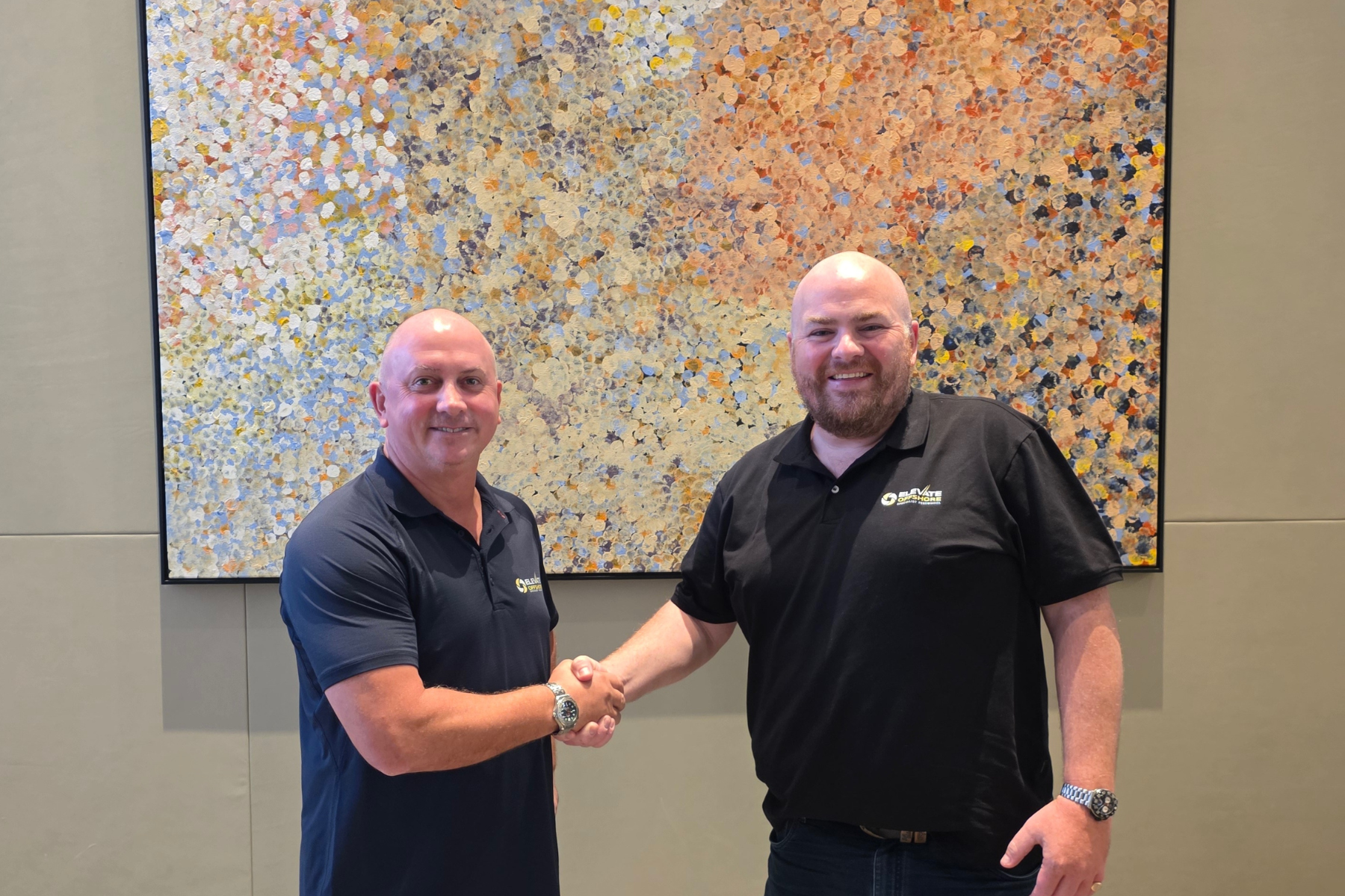
 Elevate Offshore has launched operations in Australia, marking a strategic expansion for the company. The new base will be led by Gwilym (Gwil) Conran, who has been appointed General Manager for the region.
Australia is a significant market for the offshore energy sector, with major infrastructure, resources, and subsea projects shaping regional demand.
Elevate Offshore supplies specialist personnel to the global offshore industry, working as a trusted partner within project teams. Its open and accountable culture has earned a reputation for responsiveness, quality, and reliable expertise.
Andrew Blears, Managing Director of Elevate Offshore, commented, "Australia has always been an important market for us, and to fully support our growing client base, we need a local presence. Establishing a base here allows us to be closer to clients, ensure compliance with local regulations, and create opportunities for Australian personnel. This step is about building strong, lasting partnerships on the ground."
He added, "I'm delighted to welcome Gwil to the leadership team. His deep industry knowledge, leadership experience in Australia, and overall character make him the ideal person to grow our operations here."
Gwil will be based in Perth, supported by Elevate Offshore's Singapore office, with plans to expand a dedicated team around him as operations develop. Services in Australia will include project management, engineering, ROV teams, offshore inspection, and offshore survey.
With over 20 years of experience spanning the geospatial, surveying, and utilities sectors, Gwil has held senior commercial and operational leadership roles with leading Australian companies. His career spans major infrastructure, resources, and offshore energy projects, alongside responsibility for group operations across multiple geospatial businesses.
Gwil said, "Since its inception, Elevate Offshore has stood out in the offshore energy sector for its quality and differentiation. Leading the company's presence in Australia is both an honour and a responsibility. Being locally based gives us the knowledge and perspective to understand the market more acutely, break into new sectors, and strengthen our commercial insight - all while building on our international strengths."
He added, "My initial focus will be on our clients - delivering safe, efficient outcomes on existing projects and building strong foundations for the future. Developing a local team and culture is also a priority, always aligned with our global standards. Collaboration and trust are at the heart of how I lead, and my door is always open to our clients, colleagues, and partners."
Elevate Offshore's flexible model, supported by its existing teams, enables the company to grow in step with client demand. The Australian base enhances the company's ability to deliver safe, efficient, and high-quality offshore operations both locally and worldwide.
ASL and Sofar Ocean Engage in Strategic Marketing and Distribution Partnership
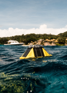 ASL Environmental Sciences Inc. is proud to announce a new strategic marketing and distribution partnership with Sofar Ocean, bringing innovative oceanographic solutions to Canada and Alaska. This collaboration strengthens ASL’s position as a trusted supplier of advanced ocean monitoring technologies while enhancing Sofar’s reach in northern markets.
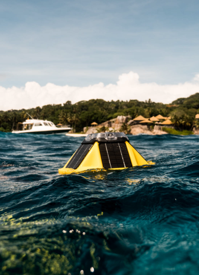
At the center of this partnership is the Sofar Spotter Platform a compact, solar-powered metocean buoy that delivers real-time data on waves, winds, sea surface temperature, barometric pressure, and more. Rugged yet portable, the Spotter Buoy connects researchers and operators to their data 24/7 via satellite or cellular networks, with intuitive access through the Spotter dashboard and API. ASL currently offers several Spotter Buoys in its lease pool and provides customized mooring solutions to integrate these buoys into site-specific coastal and offshore studies.
In addition, ASL is also featuring its Acoustic Zooplankton Fish Profiler-nano (AZFP-nano) as a new integration option to the Spotter Platform. As part of the Sofar's Smart Mooring system, the lightweight and portable AZFP-nano delivers subsurface acoustic backscatter data that provides critical insights into zooplankton and fish populations. Through Sofar’s Bristlemouth hardware interface, AZFP-nano data can now be transmitted in near real-time, giving researchers unprecedented access to subsurface biological data alongside Spotter’s metocean measurements.
This partnership highlights ASL’s commitment to providing cutting-edge ocean observing technologies and flexible mooring designs tailored to client needs. By combining Sofar ’s proven Spotter Platform with ASL’s innovative acoustic tools, researchers can now unlock new opportunities for integrated, real-time ocean monitoring.
Marine Measurement Forum Announces Exciting New Venue: Winchester Science Centre & Planetarium
The Ocean Business team are delighted to be hosting the 70th edition of the Marine Measurement Forum, fondly known as the MMF, taking place on the 28th January 2026.
The conference will bring together professionals from across the marine sector under the spectacular dome of one of the UK’s leading science engagement venues - the Winchester Science Centre & Planetarium. Powerfully connecting two largely unexplored realms, particularly as the need for satellite and space technology for navigation and remote data collection is ever increasing.
January's event will highlight how knowledge-sharing between ocean and space science is essential to providing answers, and to help us better understand our planet.
The call for speakers will be issued shortly, contributors from all corners of the marine and space sectors are encouraged to apply.
For event updates make sure you sign-up here.
We look forward to seeing you there!
Your Ocean Business Team
Fugro and NOAA partner to advance remote deep-ocean mapping
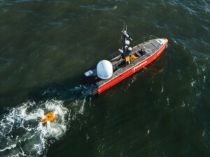
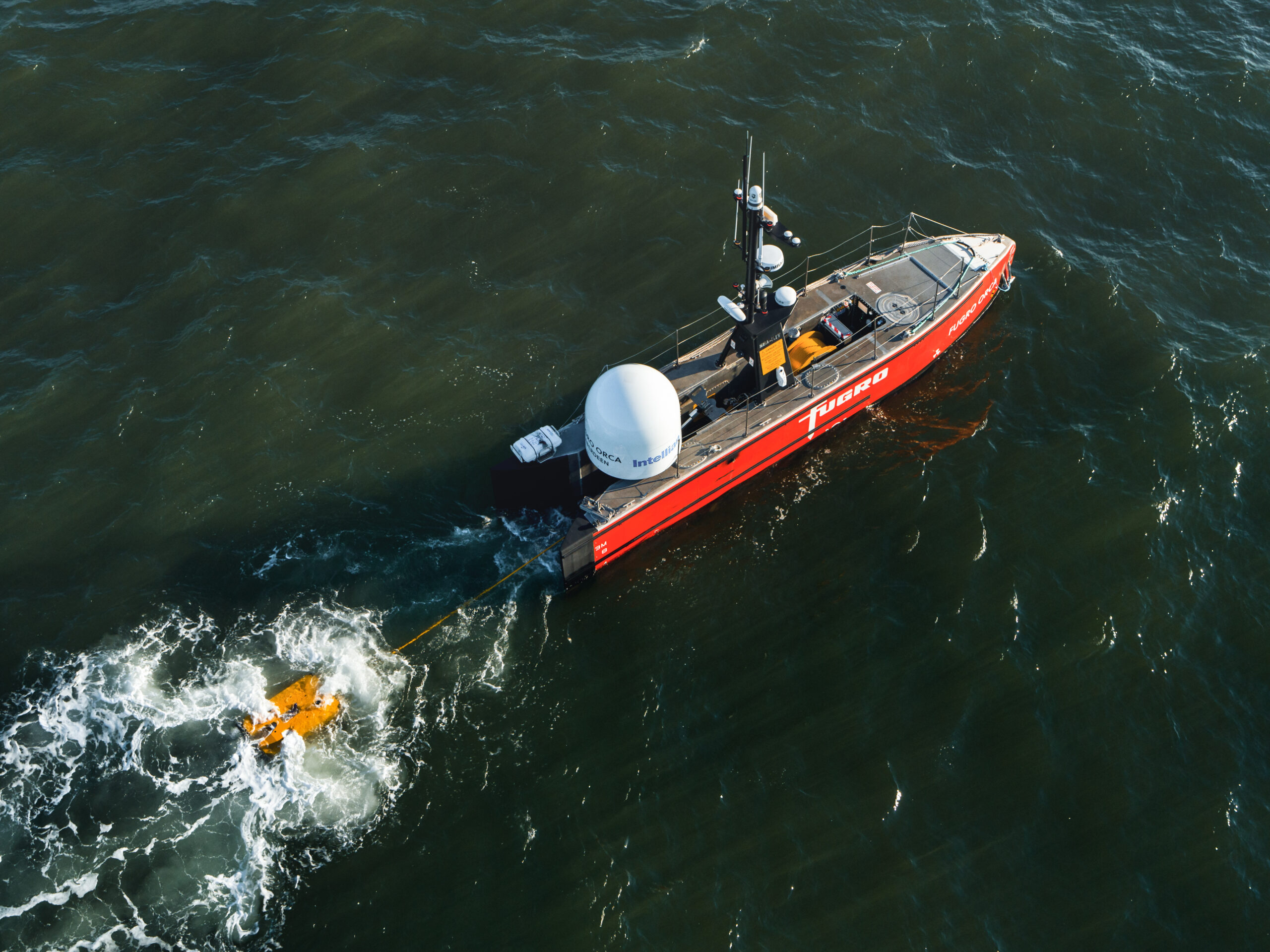
Fugro and NOAA Ocean Exploration have entered into a five-year Cooperative Research and Development Agreement (CRADA) to design and deploy remote and uncrewed technologies that will accelerate deep-ocean mapping and characterisation. This public–private partnership aims to close critical data gaps in one of the least understood parts of our planet, enabling informed decisions about offshore energy, marine resource management and national security.
The collaboration combines NOAA’s scientific and operational expertise with Fugro’s leadership in remote and uncrewed systems. Fugro will contribute its experience designing and operating uncrewed surface vessels (USVs), electric remotely operated vehicles (eROVs) and cloud-based data workflows that link offshore surface platforms and underwater systems with onshore teams in real time. These capabilities will help NOAA explore the deep ocean more efficiently and expand access to scientific data in support of its strategic priorities.
“NOAA Ocean Exploration is on a mission to accelerate the scope, pace and precision of ocean mapping and characterisation, and this strategic partnership will help us do exactly that,” said NOAA Corps Capt. William Mowitt, acting director of NOAA Ocean Exploration. “By enabling remote operations and enhancing the use of innovative technologies, we can reduce costs and expand our reach, unlocking the ocean’s potential at a scale and speed needed to keep pace with America’s growing demands for ocean resources and information.”
“We’re entering an exciting new era of deep ocean mapping, one where data can be collected and delivered without a single person at sea,” said Céline Gerson, Fugro’s Group Director for the Americas and President of Fugro USA. “Our more than 25-year collaboration with NOAA has paved the way for this progress. From introducing remote survey operations on crewed vessels to advancing fully remote, cloud-connected systems, we’re proud to help NOAA shape the future of ocean science through innovation and shared purpose.”
In the coming months, Fugro and NOAA will host joint workshops and demonstrations to launch collaborative projects. These may include new sensor technologies, digital workflows and data integration tools to support habitat mapping and marine environmental assessment. The partnership also supports NOAA’s goals in workforce development, digital infrastructure and public engagement, while helping Fugro refine its remote technologies for broader scientific use.
Saab to lead NATO's new underwater battlespace project
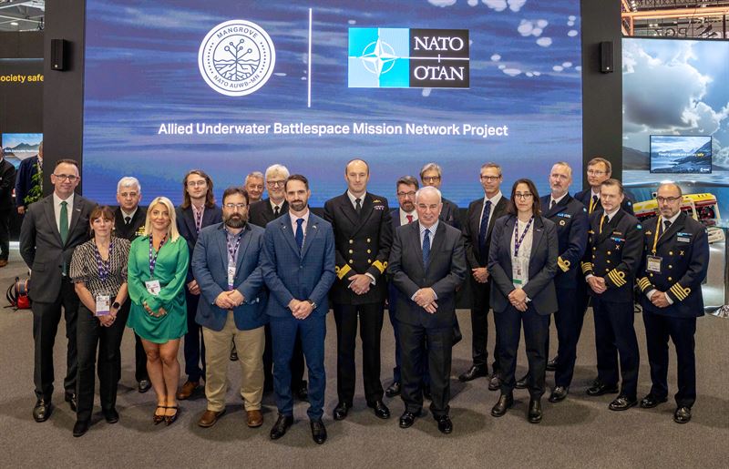
 The Saab-led MANGROVE consortium has been selected by NATO to lead the Allied Underwater Battlespace Mission Network project (AUWB-MN). The project formally commenced 1 September 2025 and will deliver interoperability for Maritime Uncrewed Systems and conventional platforms across allied nations.
The project is designing a Reference Architecture and a Test and Reference Environment for a mission network that leverages both crewed and uncrewed systems, above, on and below the water.
The mission network will facilitate rapid and secure information exchange, and integration across domains, supporting combined operations between all branches of the military. The outcome is expected to become a new standard for NATO.
“Saab is delighted to lead this pivotal project for NATO. All of the MANGROVE consortium's expertise and collaborative focus for the next 12 months will be on the successful development of a mission network for NATO’s operations in the underwater battlespace. As all aspects of the underwater domain grow in their strategic significance, this will be a critical contribution to our collective maritime security and defence,” said Mats Wicksell, head of Saab’s business area Kockums.
“The AUWB-MN project is a significant step forward in the modernisation of our warfighting capabilities and the ability for NATO allies to operate effectively together in the underwater domain of the future. We are confident that Saab and the Mangrove consortium will deliver a robust and effective mission network that strengthens NATO's maritime defence,” said David Burton, Project Director, NATO Antisubmarine Warfare Barrier Smart Defence Initiative.
The consortium was selected on 16 July, 2025 and the project is part of NATO's Digital Ocean and Antisubmarine Warfare Barrier Smart Defence Initiative. It is sponsored by twelve different nations led by the UK, together with Sweden, the US, Australia, Spain, Germany, Italy, Portugal, Canada, the Netherlands, Denmark, and Norway. Together they have committed to adopting the standard developed through this project.
Saab’s business area Kockums is leading the multinational consortium, MANGROVE, comprising CETENA and IDS part of Fincantieri Group, FlySight, GraalTech, Miraya, Saab UK and BlueBear, S2IX and the University of Plymouth.

FET launches new ROV control system
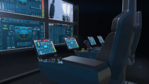 Forum Energy Technologies has unveiled its next generation remotely operated vehicle (ROV) control system – ICE Unity.
In what is a significant leap forward for ROV control technology, the introduction of ICE Unity meets the increasing sector demand for data and control access from outside the core control system.
Key features of ICE Unity include:
- A modern user interface with physical and touchscreen controls;
- One common user interface across different ROVs, minimising operator training;
- And network connectively which allows for remote operations as well as live streaming of survey data, and system monitoring.
Network connectively also enables machine learning, predictive maintenance, and remote support and updates.
Kevin Taylor, FET’s Vice President Operations – Subsea, said: “ICE Unity brings together innovation with seamless collaboration. This a step change in ROV controlling, bringing immense time and cost-saving benefits by enabling remote operations from outside the core control system.
“One major benefit is the ability to monitor performance remotely and reduce downtime by allowing the replacement of components when needed rather than using fixed maintenance intervals.”
The system can be rolled out across FET’s range of ROVs, including observation class, work class and trenching vehicles, both electric and hydraulic. Continuous development will ensure compatibility with the latest sensors and tooling.
FET ROVs are used globally to support underwater industry applications, including in defence, traditional and sustainable energy, telecommunications, mining, aquaculture and academia.
Aker Solutions and Kongsberg Discovery join forces in protecting critical infrastructure
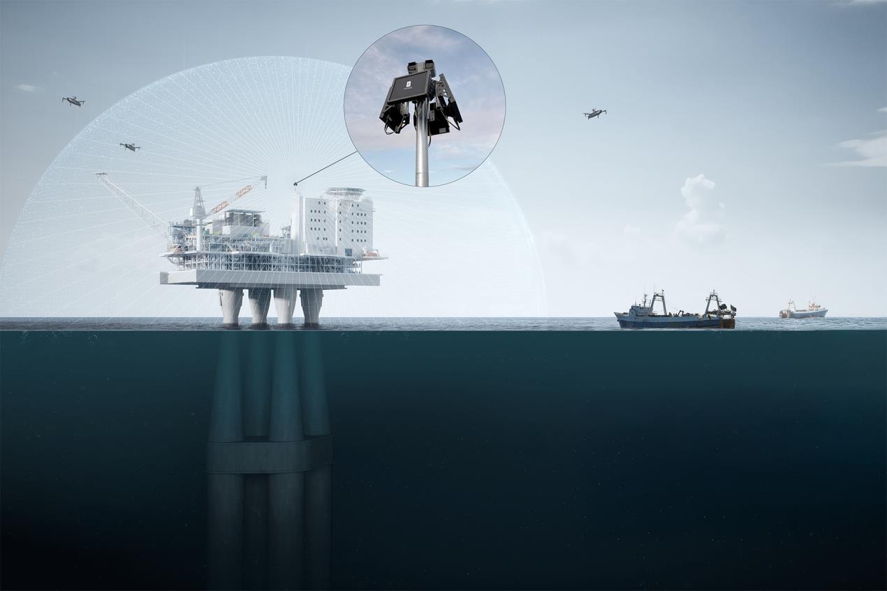
 Kongsberg Discovery and Aker Solutions are joining forces to showcase a drone (UAV) detection system in Stavanger, using Kongsberg’s Drone Detection Radar. This marks the beginning of a broader rollout of infrastructure products in the North Sea to enhance situational awareness around offshore assets and transit lanes.
Kongsberg Discovery develops subsurface, acoustic, navigation, and marine robotics systems, including AUVs and USVs. The company’s technologies are used in navigation and infrastructure protection, offering products such as Drone Detection Radar, Mobile Broadband Radio, integrated camera systems, and acoustic solutions for subsea monitoring and surveillance.
Aker Solutions brings integrated energy solutions, enabling low-carbon oil & gas and advancing renewables like offshore wind, CCS, and hydrogen.
Kongsberg Discovery and Aker Solutions plan to implement the drone detection system in phases, starting with a demonstrator at Aker Solutions at the Stavanger site to showcase to potential customers. The system will then be deployed offshore and gradually expanded with camera clusters and underwater sensors to enhance situational awareness.
According to Joachim Hovland, Head of Drones and Robotics in Aker Solutions, this cooperation sets a new standard:“This collaboration marks the beginning of a scalable solution to enhance situational awareness at critical infrastructure, offshore and onshore. By combining Kongsberg Discovery’s technology expertise with Aker Solutions’ integration and domain knowledge, we are setting a new standard for safety and security at sea.”
Later phases include installation on supply vessels, integration with onshore control centres, broader rollout across rigs and vessels, and eventual expansion to other countries. Aker Solutions will act as system integrator, with Kongsberg Discovery as sub-supplier, and the demonstrator will be available for joint customer presentations.
According to Cato Giil Eliassen, VP Infrastructure in Kongsberg Discovery, recent incidents again show the need for establishing a drone detection system in connection with critical infrastructure:
“There have been many observations of drones close to critical infrastructure in the last couple of years. Few are properly documented. This cooperation between Aker Solutions and Kongsberg Discovery will provide the end customer with proper tools to monitor, record and document illegal, as well as legal, UAV activity around installations.”
For further information please see https://www.kongsberg.com/discovery
Sulmara expands to Bristol with new CIO and AI/ML Innovation Hub
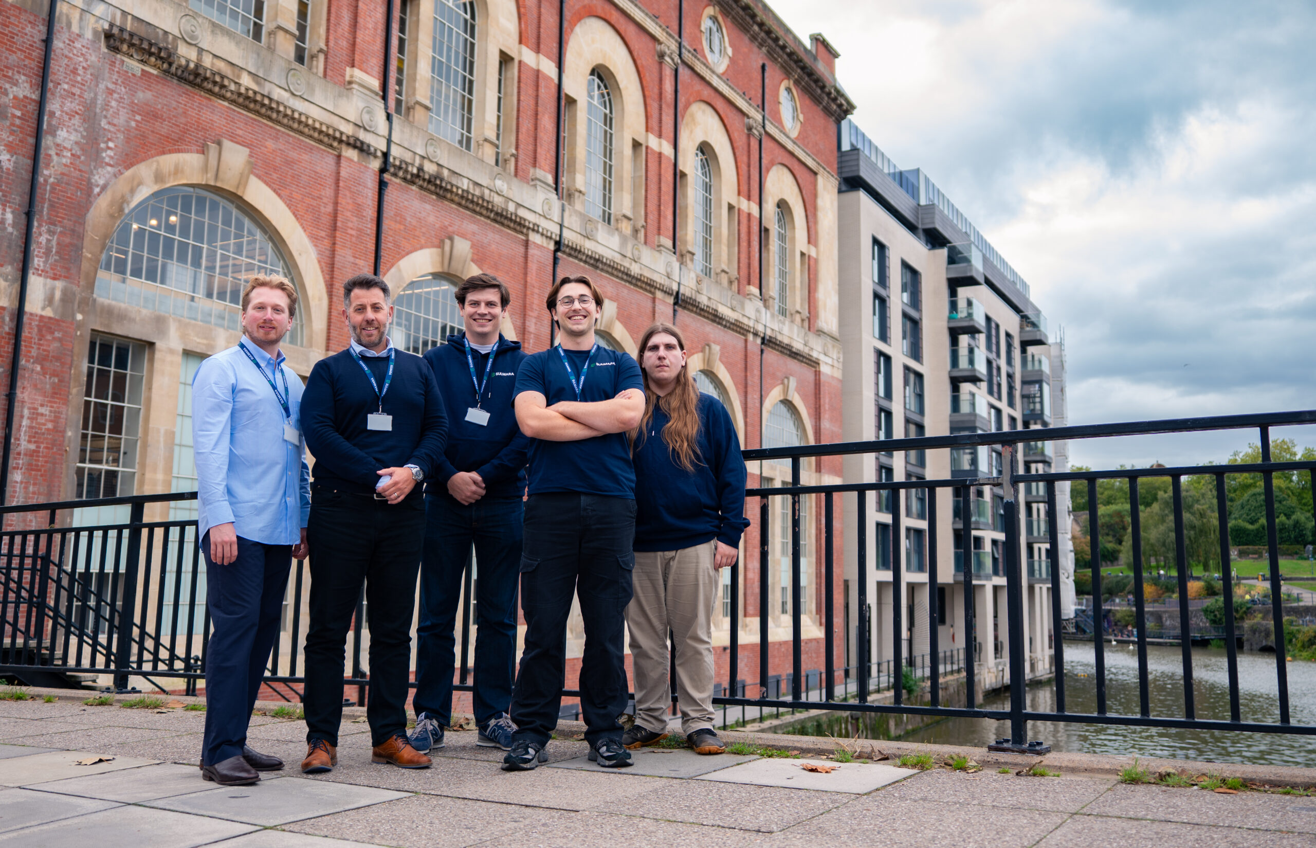
 International subsea survey and inspection company Sulmara has opened a new office in Bristol, strengthening its technical leadership and accelerating innovation in subsea data solutions.
The new office is now home to a specialist team, focusing on enterprise data infrastructure, software development and data analytics driven by artificial intelligence and machine learning (AI/ML). They will help transform how offshore survey data is collected, processed, and delivered, and their work will reduce the number of people working offshore, improve survey accuracy, and shorten project timelines.
At the heart of this move is the appointment of Richard Goodwin as Chief Information Officer (CIO). Based in Bristol, Richard will lead Sulmara’s global technical development & operations, driving the integration of AI/ML, cloud, and automation into subsea survey workflows.
Richard brings more than 25 years of experience, including two decades at Capgemini where he held global senior leadership roles across AI/ML, infrastructure, security, and solution architecture. His background spans multiple sectors – including marine and subsea – giving him the expertise to tackle some of the industry’s toughest data and technology challenges.
“This is more than just a new office – it’s a highly experienced team ready to deliver from day one,” said Richard. “With AI and machine learning, we see a huge opportunity to transform underwater exploration – making it safer, faster, and more precise than ever before.”
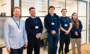 Kevin McBarron, CEO at Sulmara, added: “We’re really pleased to welcome Richard and the wider team to Sulmara as they settle into our new Bristol office. They bring a high level of technical skill, professionalism, and a collaborative spirit that aligns with how we work as a company.
“Having this team in place adds further depth to the expertise we offer our clients, and we’re genuinely looking forward to working together.”
The Bristol hub will focus on developing tools for tasks such as UXO identification, seafloor target picking, and boulder detection, all critical to reducing project risk and enabling greater adoption of remote technologies.
This expansion reflects Sulmara’s commitment to data-driven innovation and to providing clients with faster, safer, and more efficient subsea services.
To find out more about Sulmara, please visit www.sulmara.com.