
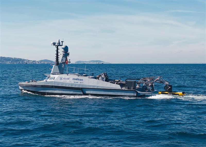
Kraken Robotics Demonstrates KATFISH Autonomous Launch and Recovery from SEFINE USV
Kraken Robotics Inc. (“Kraken” or the “Company”) (TSX-V: PNG, OTCQB: KRKNF) announces the successful integration and demonstration of it's KATFISH towed synthetic aperture sonar and autonomous launch and recovery system (LARS) from SEFINE’s RD-22 unmanned surface vessel (USV) in coordination with SEFINE SISAM (Strategic Unmanned Systems Research Center). The demonstration took place in Q1 2026 off the coast of İstanbul, Türkiye.
“Recent developments underscore the importance of safeguarding critical maritime transit routes and underwater infrastructure, and autonomous mine countermeasure capabilities like KATFISH can play an important role in helping navies efficiently detect and classify mine-like objects,” said Bernard Mills, Executive Vice President, Defence at Kraken Robotics. “By combining SEFINE’s multi-role USV with Kraken’s cutting-edge KATFISH and USV LARS, navies can deploy advanced technologies faster and more efficiently, strengthening defence and maritime security in increasingly complex environments.”
The demonstration focused on rapid detection and classification of mine-like objects and critical underwater infrastructure and was attended by several navies and government organizations. KATFISH delivered 3 cm x 3 cm resolution data at a range of 200 meters per side which was live streamed to a command center onshore, enabling real-time classification of contacts by operators with SEFINE SISAM’s mission planning software. The same KATFISH and USV LARS were demonstrated from a UK Royal Navy in-service 11-meter ARCIMS USV in November 2025. These joint integrations mark a major step forward in delivering agile, modular, and cost-effective mine countermeasure capabilities for modern naval operations. A video of the demonstration can be viewed at https://youtu.be/JIXapiCCeSA.

General Oceans Enters Purchase Agreement with MRV Systems, LLC
 General Oceans has announced that it has entered into a purchase agreement with MRV Systems, LLC.
The addition of MRV to General Oceans expands the Company’s capabilities in long-duration, autonomous data collection and strengthens its position as a global leader in underwater technology. MRV Systems has around 22 employees and has offices in San Diego, Wood Dale (HQ) and Seattle, increasing General Oceans’ US footprint. The Transaction will further enhance General Oceans’ growth strategy and enable collaboration between MRV and its existing brands, realising the benefits of the Group’s global capabilities. It marks yet another acquisition in accordance with General Oceans’ growth strategy and expands the recent track record of successful acquisitions.
About the MRV acquisition, Atle Lohrmann, President of General Oceans, said:
“MRV is a great fit for General Oceans, and we’re excited to have them join our growing Group. General Oceans has a proud tradition as a provider of advanced instrumentation and sensors to the scientific community making MRV a natural fit. With access to the Group’s extensive sales network and engineering experience, we believe we can develop MRV’s global presence quickly and explore new revenue opportunities as we move forward.”
Founded in 2010 as a spin-off from the Scripps Institution of Oceanography, MRV has become a trusted supplier of advanced profiling vehicles for ocean research, climate monitoring, and maritime domain awareness. It currently contributes meaningfully to the U.S. commitment of profiling floats to the Argo program. MRV is well established with strong US presence and serves customers such as NOAA, NASA, the U.S. Naval Oceanographic Office.
About joining General Oceans, Shawn Vasquez, President & CEO of MRV said:
“I am excited for the future of MRV as part of General Oceans. Collaborating across the Group will allow MRV to accelerate delivery of innovative solutions to meet our customers’ ocean technology needs. MRV is delighted to join a Group with a shared passion for continuously growing our knowledge of the ocean through ongoing research, development and innovation in the ocean technology space.”
Regarding the MRV sale, Fred Maas, outgoing Executive Chairman of MRV, stated:
"We are thrilled to participate in the announcement of General Ocean's acquisition of MRV Systems. From a tiny lab in San Diego with only the Scripps and Woods Hole Institutes of Oceanography as its customers, MRV grew to 3 offices in 3 states and over 30 customers. Most importantly, MRV has participated in a vast expanse of our knowledge of the world's oceans. We look forward to watching its continued success."
For more information on MRV, visit https://www.mrvsys.com/.
Mapping the Unmappable: Sulmara Discover and the Nunavik EAUFON-3 Project
 Set in the Arctics harsh and challenging environment and in waters too shallow for traditional vessels and systems, the Nunavik EAUFON-3 Project required a new approach. That was the challenge facing Seaforth Geosurveys while assessing the seabed for a planned fibre-optic cable installation in Ungava Bay, Canada.
Sulmara's answer was Sulmara Discover: a bespoke technology stack combining a high-resolution 3D Synthetic Aperture Sonar (SAS) sub-bottom system with inertial navigation and positioning sensors. This was mounted on a remotely operated Uncrewed Surface Vessel (USV) to acquire data, with in-house software packages for processing, interpretation and delivery. It's the only system of its kind.
"Seaforth selected as our unique solution to deliver the performance they needed in a remote location with incredibly challenging seabed conditions," said Darius Rivera, Sulmara Project Manager.
A Platform Built for the Challenge
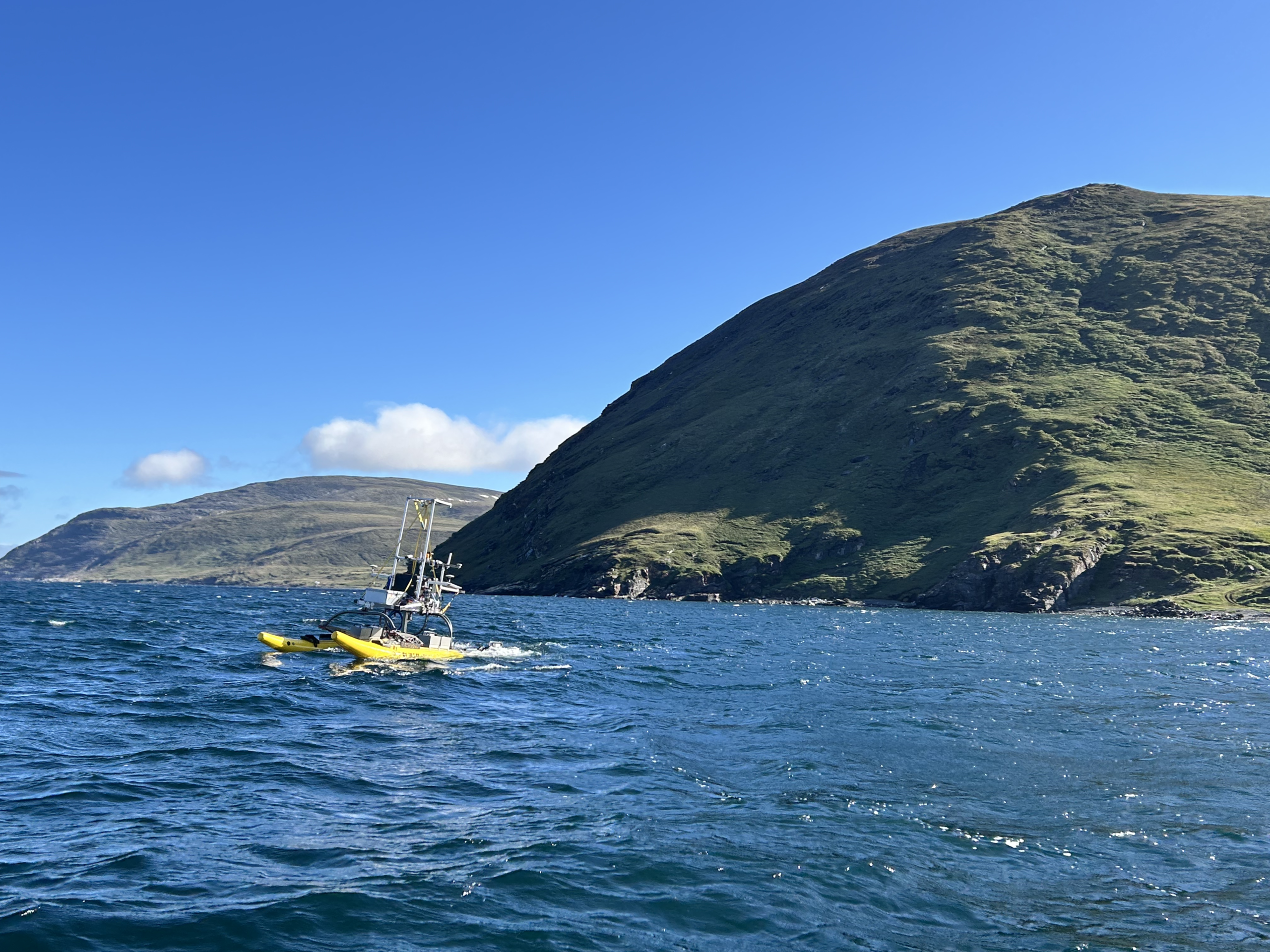
Sulmara used the WAM-V 16 USV, working closely with Seaforth to launch by crane from the Coriolis II mothership. The stability provided by the WAM-V 16’s independently mobile pontoons, along with the shallow draft, provides the perfect platform. The system was operated both locally and over-the-horizon from Sulmara’s Remote Operations Centre in Glasgow, UK.
As part of the Sulmara Discover package, the WAM-V 16 was equipped with the EdgeTech Buried Object Scanning Sonar (eBOSS), providing high-resolution, three-dimensional sub-bottom data in an area with some of the world's largest tidal ranges along a cable route littered with boulders above and below the seabed. This full-volume sub-bottom data set at 5cm resolution is collected across a 120° swathe, enabling rapid coverage over large areas.
Surface and buried boulders were mapped in size, depth and density to allow the end client to assess cable burial or protection measures at several landfall locations.
“This survey represents a significant advancement in the ability to map both surface and subsea boulders. Conducting nearshore operations with the WAM-V 16 reduces costs while extending high-quality ground model coverage closer to shoreline landings. In contrast, a traditional survey approach, relying on sub-bottom profiling and side scan sonar, would require substantially more time and yield lower-quality information. The data provided by Sulmara Discover is invaluable for detecting and avoiding buried hazards, enabling better-informed decision-making for cable routing and burial operations,” said Kevin Rychert, Sulmara’s Principal Acoustic Scientist.
This was a team effort with Seaforth, with the companies working closely together through planning, execution and delivery phases of the project. The Discover deliverables were developed and adjusted according to feedback from Seaforth before being combined with data collected by Seaforth to deliver a comprehensive dataset of the seafloor and subsurface.
Ben Wentzell, Senior Geologist at Seaforth said, “Sulmara’s commitment to quality was evident from initial mobilisation through to final reporting. Their field and office teams worked closely with all parties, while consistently innovating and adapting to meet project specifications and deliverables. The use of the Discover workflow provided a turnkey geophysical and subsurface hazard solution for an exceptionally challenging environment.”
Solving a New Kind of Problem
Previous projects using ROVs or ROTV systems operate at a fixed, controlled distance from the seabed. This survey was different. Water depths shifted dramatically from less than one metre to 20 metres in a few metres, requiring continuous sensor adjustment and an entirely new approach to eBOSS data processing. This was made possible with Sulmara's in-house software, developed specifically for eBOSS datasets. “Historically, they would be running on an ROV at a precise height above the seafloor,” highlights Dennis Wilson, Principal Development Scientist at Sulmara. “As we move to surface-mounted systems, the challenge is interpreting datasets acquired at a dynamic range in a single pass.”
Ultimately, the collaboration between Sulmara and Seaforth Geosurveys delivered a unique, high-quality dataset that gives the end client confidence to move forward to cable installation, safely, efficiently and with certainty.
IQUA Robotics validates the use of AUVs for autonomous ship hull inspection
The ESCABVENTS project, developed by the company IQUA Robotics in collaboration with the Zamakona Yards shipyard, has successfully concluded its proof of concept tests, demonstrating the viability of using Autonomous Underwater Vehicles (AUVs) for naval inspection tasks. This initiative, integrated into the Sail2future project, seeks to improve efficiency and safety in the preventive maintenance of vessels. The project has been funded by the European Union – NextGenerationEU through the PERTE NAVAL aid managed by the Spanish Ministry of Industry, Trade and Tourism, within the Recovery, Transformation and Resilience Plan.
Advances in autonomy and data capture
The research has focused on overcoming the limitations of current methods, which usually rely on divers or tethered robots (ROVs). The use of an autonomous vehicle like the Sparus II AUV allows for systematic hull scanning without direct intervention from an operator in piloting.
Throughout the project, several key technical capabilities have been validated:
- Adaptive tracking: The vehicle uses a multibeam sonar to detect the hull profile in real-time, adjusting its navigation to maintain a constant distance.
- Systematic navigation: The system executes adaptive “lawnmower” type trajectories that ensure complete and uniform coverage of the inspected area to collect hull images.
- Operational safety: Protocols have been implemented that allow the vehicle to perform automatic escape maneuvers towards free zones in case of experiencing a failure and ensure that the vehicle does not get trapped under the hull
Results and practical applications
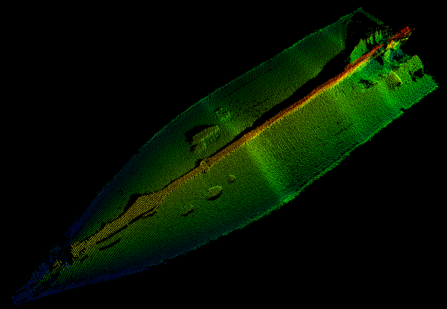
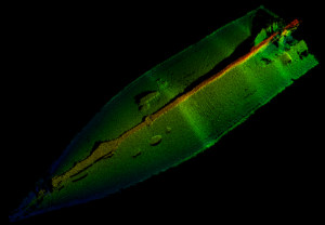
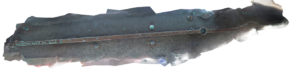
Experimental tests, carried out in collaboration with the Zamakona Yards shipyard and the staff of Reparaciones Navales Canarias, have been fundamental to validate the system in real port environments. These campaigns allowed the collection of multiple datasets on four vessels of different types, including fishing, research, and defense ships. The results show that it is possible to obtain 3D reconstructions with centimetric resolution, facilitating the identification of corrosion, marine fouling (biofouling), or paint damage.
Next steps toward specialization
Although the system has proven effective in the uniform sections of the hull, research has identified challenges in areas of complex geometry, such as the stern (propellers and rudders), where acoustic reflections complicate automatic tracking. Likewise, difficulties have been detected in taking images of the sides of the vessel, as the high light contrast of the surface causes underexposure in these areas. Therefore, future technical steps include:
- The design of new payloads with multi-camera systems and artificial lighting to improve visual quality.
- The exploration of 3D sonars to anticipate abrupt changes in the vessel’s profile and improve the vehicle’s control response.
In addition to industrial maintenance, this technology is expected to be applicable in port security for the inspection of critical infrastructure or the detection of threats and contraband adhered below the waterline.
Njord Survey selects Sonardyne navigation for ecoSUB AUVs
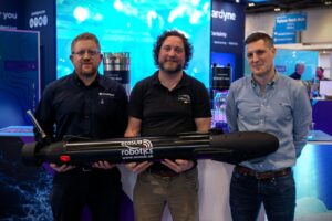
Swedish innovator Njord Survey has chosen Sonardyne navigation technology for its ecoSUB Robotics autonomous underwater vehicles (AUVs) to transform subsea survey operations.
Using Sonardyne’s smallest navigator, SPRINT-Nav U, on ecoSUB’s low-logistics AUVs, Njord Survey is targeting at-scale survey operations, starting with UXO surveys.
Underpinned by accurate navigation, deployment at scale will enable parallel operations, reducing vessel dependency, logistics, cost and time for these types of survey.
Combining detection and verification and allowing re-tasking, with the same easily transportable platforms, also means surveys can be delivered faster and more flexibly, without compromising data quality, says Gothenburg, Sweden, based Njord Survey.
Anders Wikmar, Survey and Technical Director, at the company, which provides high‑quality, low‑carbon hydrographic and geophysical surveys, says, “Our goal is bringing smart and cost-effective solutions to the market by pushing the boundaries working with partners like ecoSUB and Sonardyne.
“Using ecoSUB’s small AUVs at scale lets us move beyond one-platform, one-vessel operations and deploy multiple platforms in parallel, dramatically improving survey efficiency.
“By reducing vessel dependency and combining detection with visual verification on the same platform, we cut false targets, save further vessel time and can re-task vehicles quickly – delivering faster, more flexible surveys without compromising data quality.
“This can only work if each vehicle can collect data that is spatially reliable enough for detection, correlation and verification. SPRINT-Nav U provides the level of navigation performance we need, making these operational gains possible and that’s not something logistically possible or cost effective before.”
Iain Vincent, Director & General Manager, at ecoSUB Robotics, says, “With SPRINT-Nav U providing reliable, survey-grade navigation into our one person-portable AUVs, we’ve been able to move from standard, off-the-shelf designs to a more engineered, project-focused approach.
“This means creating vehicles that can carry high-quality payloads, operate independently and adapt to evolving customer needs. Together with Njord survey, we’re transforming small AUVs into scalable, primary survey platforms.”
Njord Survey plans to put its ecoSUB straight into operation on client projects to demonstrate benefits from day one as it proves and evolves its survey offering.
Aidan Thorn, Marine Robotics Business Development Manager, at Sonardyne, adds, “In the past, small-scale AUV navigation has been the limiting factor, because position accuracy hasn’t matched survey requirements.
“SPRINT-Nav U removed these limits. It is unlocking collaborations like this that show how by working together we can bring new, smart and cost-effective safe, secure and environmentally sound solutions into the market.”
Greensea IQ Demonstrates Autonomous UXO Detection with Bayonet 350 in Live Deployment
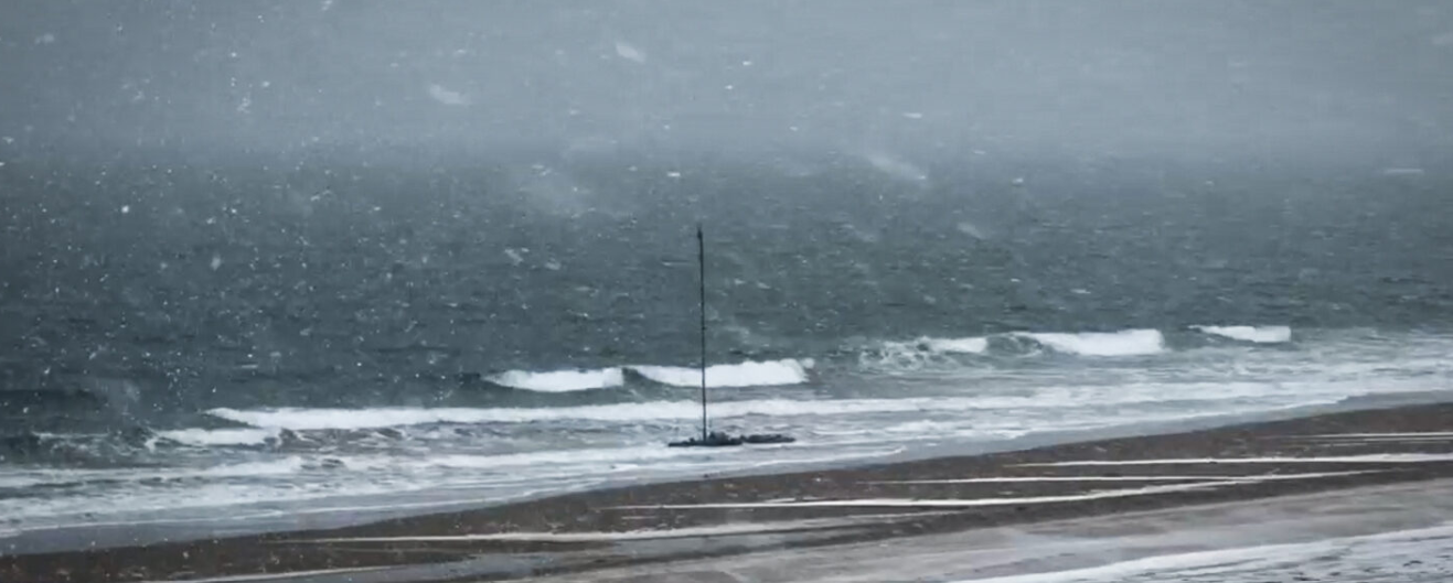
 Greensea IQ successfully supported a live autonomous Unexploded Ordnance (UXO) detection and classification demonstration at the former Maine Bombing Area. Showcasing the Bayonet 350 Autonomous Underwater Ground Vehicle (AUGV) operating in surf, shallow water, and nearshore environments while towing a UXO detection sensor sled. The deployment demonstrated reliable, high-accuracy data collection, as well as autonomous operations in complex coastal conditions.
Greensea IQ’s Bayonet 350, outfitted with an RTK-GPS system, supported the deployment and operation of White River Technologies’ APEX three-dimensional electromagnetic (3D EM) system. Greensea IQ and White River Technologies have partnered to create a viable and commercially available solution for maritime UXO detection, classification, and mapping.
Unexploded Ordnance (UXO) refers to the munitions that were deployed but failed to detonate and remain in the environment. These materials are commonly found in former military training and testing areas, including coastal regions, beaches, and nearshore waters. The former Maine Bombing Area is a Formerly Used Defense Site (FUDS) located in Reid State Park and the site of a World War II bombing range. This demonstration, funded through the Department of War’s Strategic Environmental Research and Development Program (SERDP) and the Environmental Security Technology Certification Program (ESTCP), aimed to validate emerging UXO detection capabilities in real-world operational conditions.
UXO presents a significant risk to both public safety and the environment. These hazards can remain active for decades, posing danger to civilians, marine operations, and coastal development. In many cases, large areas of seabed and shoreline remain restricted due to the presence or suspected presence of UXO.
Historically, identifying and classifying UXO in nearshore environments has been a complex and resource-intensive process. Traditional methods typically require manual surveying in hazardous areas and can struggle to distinguish between actual threats and benign metallic debris. As a result, many impacted areas remain unaddressed due to the difficulty, cost, and risk associated with large-scale detection and classification. Greensea IQ CEO Ben Kinnaman explains:
“Unexploded ordnance is a major issue in the ocean, especially on beaches, sounds, and marshes. UXO presents both a public safety risk and an environmental hazard. Historically, these areas have been difficult to address because there has not been a reliable way to efficiently search large areas and accurately distinguish UXO from typical seabed trash. The Bayonet AUGV, paired with the APEX system from White River Technologies, enables autonomous surveying of large seabed areas while producing accurate maps of classified threats. This allows for more efficient and precise mitigation. This technology provides a cost-effective way to address a significant public safety challenge and reopen impacted areas for recreation and public use.”
Over five days of field operations, including through a New England blizzard, the Bayonet 350 conducted autonomous surveys over approximately eight acres of surf zone, swash zone, and shoreline with no downtime due to system failures or issues.
Data collected during demonstration was processed by White River Technologies using advanced geophysical classification (AGC) methods to generate maps and identify Targets of Interest for follow-on investigation by the U.S. Army Corps of Engineers.
The operation demonstrated the Bayonet 350’s ability to:
- Autonomously survey hazardous nearshore environments in harsh weather conditions
- Collect high-resolution geophysical data with precise positioning
- Reduce risk by eliminating the need for personnel in dangerous surf and swash zones
- Support scalable, data-driven UXO response operations
Fugro to conduct geotechnical campaign for South America’s first licensed offshore wind project
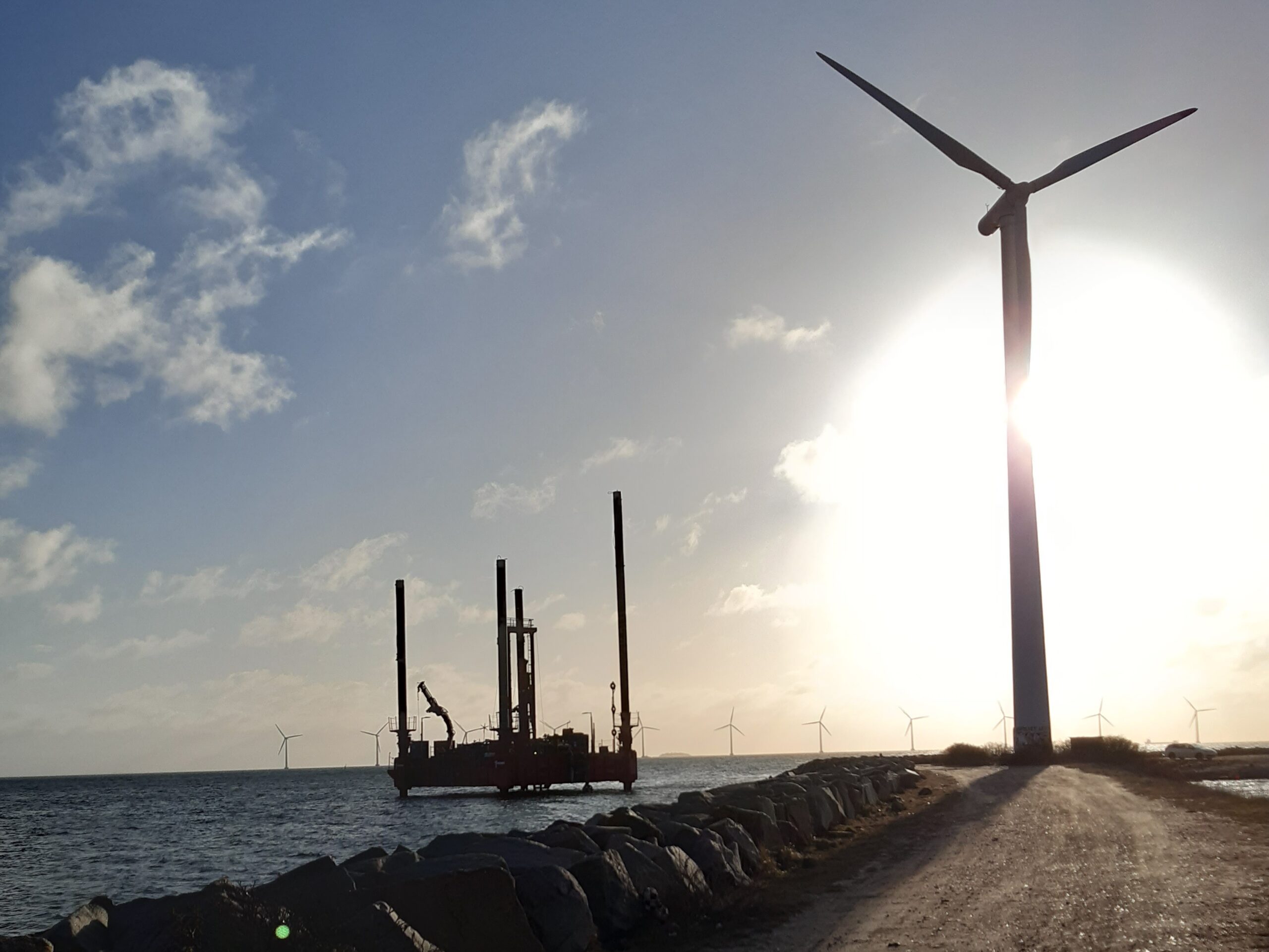
Petrobras has selected Fugro to deliver a geotechnical site investigation for the Rio de Janeiro Offshore Wind Pilot Project, the first offshore wind development in South America to advance under a formal environmental licensing process. The 18 MW pilot marks an essential step in energy diversification as countries in the region begin to establish regulated pathways for the responsible development of offshore wind.
Working within a nearshore study area off São João da Barra, Fugro will acquire the Geo‑data needed to inform safe and efficient design. Activities include soil sampling, in situ testing and laboratory analysis across four coastal and shallow‑water locations, along with onshore investigations to support cable landfall and routing. Field operations and analysis will begin in April and continue through Q3 2026, with final reporting scheduled for 2027.
The project stands to benefit from Fugro’s work on early‑stage offshore wind developments in emerging markets worldwide, ranging from initial pilot studies to full site characterisation. For this effort, Fugro’s Brazil‑based teams will lead delivery, pairing nearshore operations from the Rio das Ostras hub with laboratory analysis at the Pinhais facility. This combination of local insight and global experience will help ensure consistent, decision‑ready data for Petrobras.
“As South America moves forward with its offshore wind ambitions, early Geo‑data is one of the most important tools for reducing uncertainty and setting projects up for long-term success,” said Céline Gerson, President and Group Director for Fugro in the Americas. “By partnering with Petrobras at this early stage, we’re helping establish the technical foundation needed to progress offshore wind responsibly and expand future energy options in Brazil and across the wider region.”
SBG Systems unveils Stellar-40, its most resilient INS
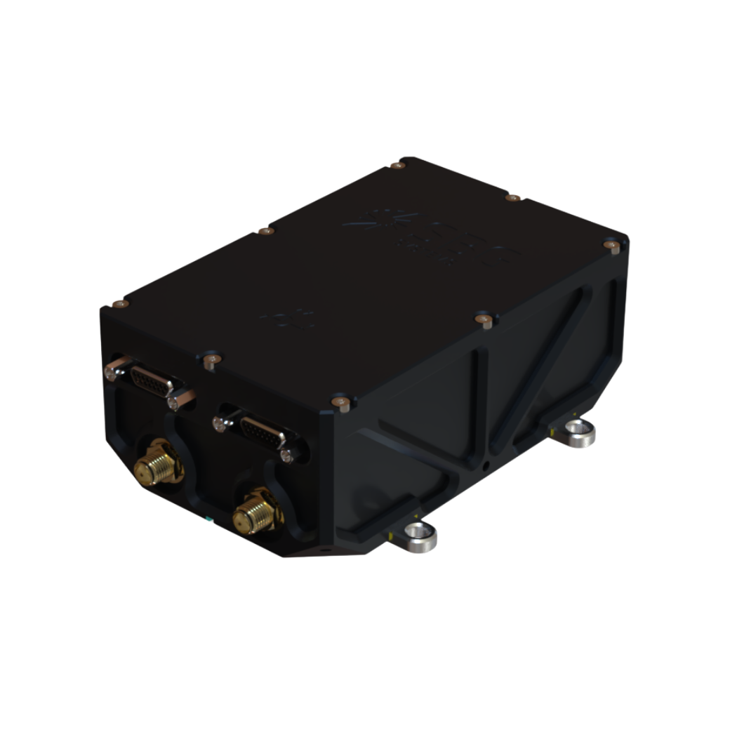
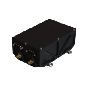 SBG Systems expands its product portfolio with the unveiling of Stellar-40, a modular and scalable inertial navigation system (INS) developed for demanding environments and mission-critical applications.
Designed for land, air, and marine platforms, Stellar-40 integrates a tactical-grade IMU, a GNSS receiver, and advanced sensor fusion algorithms within a compact and rugged enclosure. The system is developed to provide reliable navigation performance in high-vibration, high-dynamics, and electronically challenging environments.
The development of Stellar-40 focused on two main objectives, increasing resilience in harsh operational conditions and improving production scalability. To overcome the vibration sensitivity commonly encountered in defense and industrial applications, SBG Systems implemented an innovative three-level mitigation approach:
- Sensor-level isolation: dampers integrated directly at the IMU sensor level reduce vibrations at the source.
- Resonance-free enclosure: a specialized housing engineered to drastically minimize resonance and internally induced vibrations.
- Structural isolation: custom external dampers designed to isolate the unit from harsh vehicle dynamics.
This architecture supports stable system behavior in dynamic environments.
Beyond mechanical robustness, Stellar-40 addresses modern electronic warfare challenges. The system incorporates a high-performance GNSS receiver designed to actively mitigate advanced jamming and spoofing threats. When GNSS signals are degraded or unavailable, the system relies on multi-sensor fusion and dead-reckoning capabilities to maintain navigation continuity.
Positioned as the heavy-duty counterpart to Ekinox Micro, Stellar-40 introduces a revised mechanical and electronic design intended to simplify integration and manufacturing processes. The system is suited for defense programs, robotics platforms, UAVs, and autonomous systems requiring compact, scalable navigation solutions.
Kaoutar, Product Manager at SBG Systems, comments:
“Stellar-40 was developed with scalability and integration flexibility as key priorities. The design aims to support a broad range of platforms while keeping large-scale production in mind. This product brings high-end resilience against vibrations, jamming, and spoofing into a box that teams can completely trust in real-world operations."
With the introduction of Stellar-40, SBG Systems continues to expand its range of inertial navigation solutions for professional and industrial applications.
For more information about Stellar-40, visit www.sbg-systems.com/ins/stellar-40/
Applications Across Industries
Stellar-40 is designed for a wide range of applications across defense and autonomous systems. It supports platforms such as UAVs, robotics, and other autonomous vehicles that require compact and scalable navigation solutions. Its revised mechanical and electronic design simplifies integration and manufacturing, making it well suited for both large-scale production programs and demanding operational environments.
Availability
Stellar-40 will be commercially available worldwide in June this year.
North Sea Hydrographic Commission joins Seabed 2030 as partner
The Nippon Foundation-GEBCO Seabed 2030 Project is pleased to announce a new partnership with the North Sea Hydrographic Commission (NSHC), bringing together a regional network of hydrographic offices to support seabed mapping efforts across the North Sea and surrounding waters.
Established in 1962 in The Hague, the NSHC comprises Belgium, Denmark, France, Germany, Iceland, Ireland, the Netherlands, Norway, Sweden and the UK. The Commission provides a longstanding framework for cooperation on hydrographic surveying, charting, and the exchange of maritime information, including coordination of survey activity beyond national waters.
Seabed 2030 is a collaborative project between The Nippon Foundation and the General Bathymetric Chart of the Oceans (GEBCO), which seeks to inspire the complete mapping of the world’s ocean by 2030, and to compile all the data into the freely available GEBCO Ocean Map. The Project is formally endorsed as a Decade Action of the UN Ocean Decade. GEBCO is a joint programme of the International Hydrographic Organization (IHO) and the Intergovernmental Oceanographic Commission (IOC), and is the only organisation with a mandate to map the entire ocean floor.
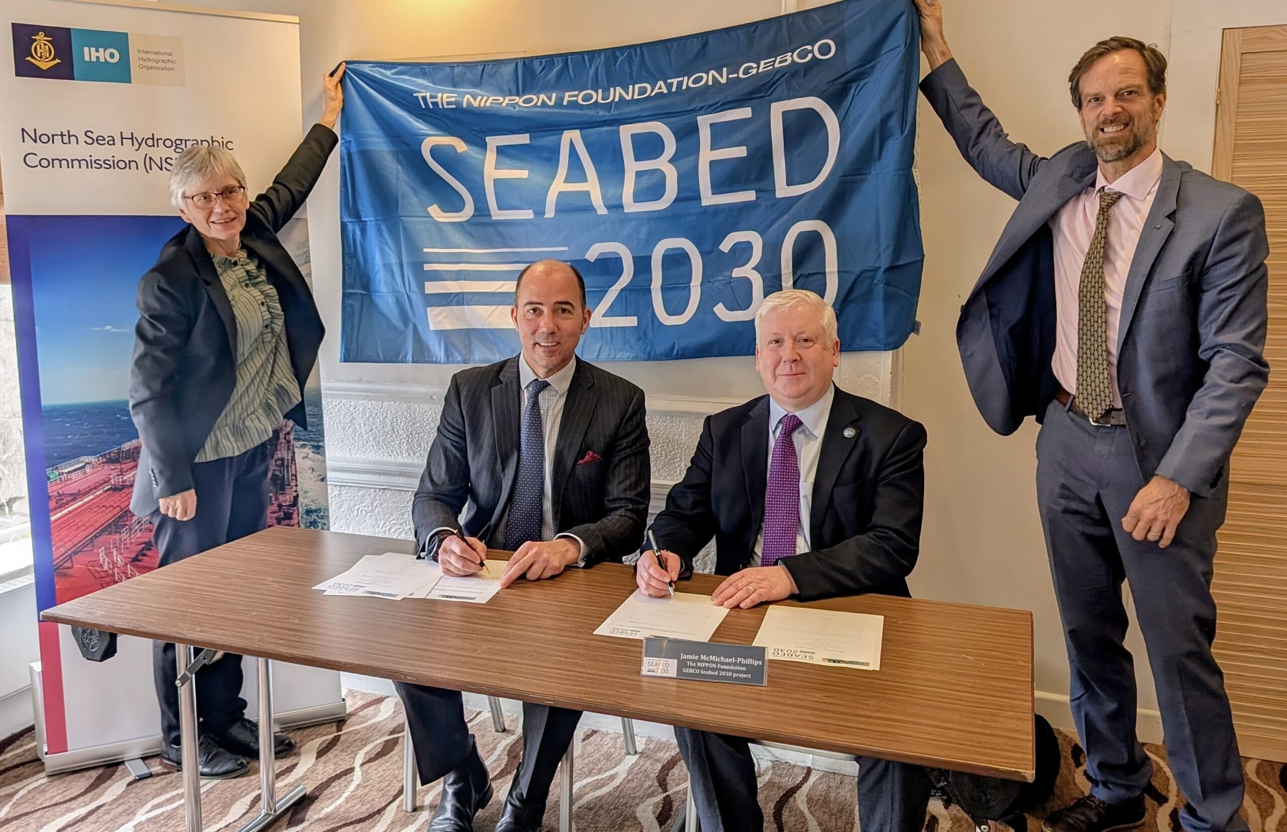
The new partnership was formalised with a Memorandum of Understanding signed at the 39th Meeting of the North Sea Hydrographic Commission in Aberdeen, Scotland, by Rear Admiral Angus Essenhigh OBE, UK National Hydrographer and Director of Data Acquisition and Defence at the UK Hydrographic Office, on behalf of the NSHC and Seabed 2030 Director Jamie McMichael-Phillips.
By bringing together multiple national hydrographic offices under a single framework, the partnership strengthens regional coordination, supporting data sharing and reinforcing the collective commitment of North Sea nations to advancing seabed mapping.
Commenting on the announcement, Jamie McMichael-Phillips said: “The North Sea region has a long history of hydrographic excellence and cooperation, and we are delighted to formalise our partnership with the Commission in support of Seabed 2030’s global mission.
“Partnerships of this nature help ensure that data collected at national and regional levels can be brought together effectively, strengthening the global bathymetric dataset and supporting progress towards a complete map of the ocean floor.”
Rear Admiral Angus Essenhigh OBE said: “The NSHC has a long-standing commitment to cooperation in support of safe navigation and improved understanding of our waters. This partnership with Seabed 2030 builds on that legacy, enabling Member States to further coordinate survey activity and contribute bathymetric data.”
GEBCO Chair, Evert Flier, added: “The NSHC represents a strong and well-established model of regional collaboration. Its partnership with Seabed 2030 highlights the importance of coordinated hydrographic efforts in ensuring that high-quality bathymetric data is shared, integrated and made available for the widest possible use. This includes providing high quality bathymetric data to the GEBCO grid via EMODNet and Seabed 2030.”
All data collected and shared with the Seabed 2030 project is included in the free and publicly available GEBCO global grid.

IMarEST sets new standard for Marine Technology

The Institute of Marine Engineering, Science and Technology (IMarEST) has strengthened its commitment to supporting professionals working in marine technology and innovation with the launch of a reimagined, and future‑ready, professional registration standard. Its new Technology Register will help candidates demonstrate that they meet the evolving needs of the global marine sector and the expectations of international regulators.
As the only professional body in the world offering dedicated professional registration for the marine technology and innovation community, the IMarEST continues to champion professionals whose work extends beyond traditional engineering and science.
Backed by its prestigious Royal Charter, the Institute offers members the opportunity to achieve the professional titles of Marine Technician (MarTech), Registered Marine Technologist (RMarTech) and Chartered Marine Technologist (CMarTech). These accolades recognise excellence and promote the highest standards across the global marine industry.
The updated standard supporting these titles now provides clearer and more robust guidelines, enables smoother career progression, and reflects modern workplace practices such as digital literacy, data‑driven decision‑making and sustainability. Requirements for Continued Professional Development (CPD) have also been significantly strengthened, with reflection, planning and professional growth now feeding directly into how candidates are assessed.
Naomi Taylor, membership and professional services director at the IMarEST said: “As part of our work to help create a united, safe and sustainable future for the marine industry, we are laser focused on driving professional standards. I am continually inspired by the work our members do in areas such as ocean technologies and sustainable marine solutions, and I’m proud that this new standard reflects the calibre of their contribution to our sector.
“If you’re working in any aspect of marine technology and innovation, I strongly encourage you to get in touch and explore your options.”
The types of roles that fall under marine technology are diverse and include (but are not limited to): fleet managers, hydrographers, marine superintendents (deck), meteorologists, pilots, marine logisticians, deck officers and ratings, marine surveyors, shipping professionals, harbour masters, college lecturers, navigators, radar/sonar maintenance experts, warfare officers and ratings, and naval officers and ratings.
www.imarest.org/professional-registration