
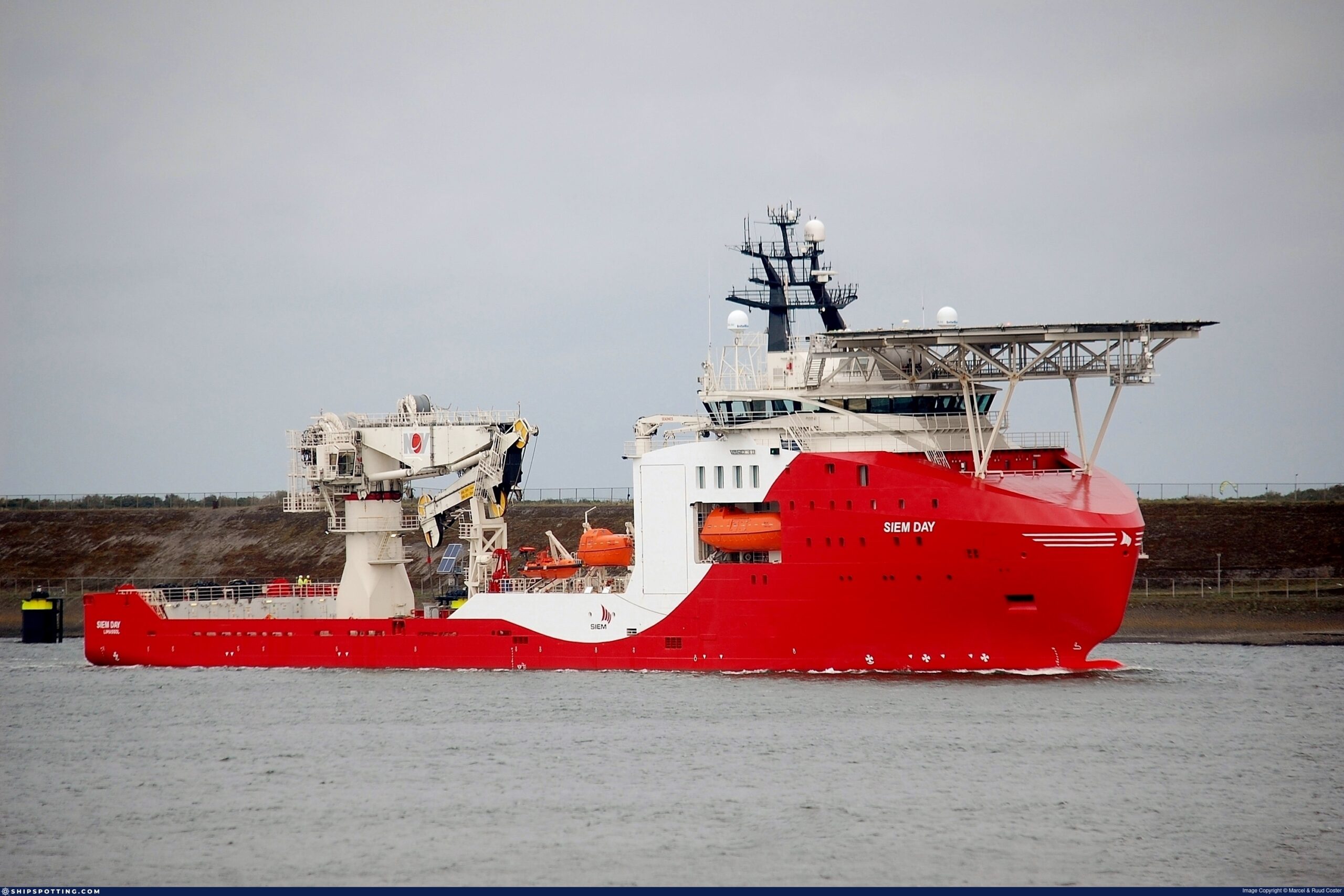
Next Geosolutions has partnered with Intesa Sanpaolo and Cassa Depositi e Prestiti (CDP) to finance the acquisition of a new offshore support vessel, the “NG Supporter"
The company’s total investment amounts to USD 112 million. The two financial institutions supported the transaction with financing equal to 70% of the total investment
Next Geosolutions, one of the leading international groups in marine geosciences and offshore construction support services, primarily in the energy sector, announces the execution of a financing agreement to support the acquisition of the new offshore vessel “Siem Day” from the Norwegian company Siem Day II AS, subsequently renamed “NG Supporter”, for a total value of approximately USD 112 million. The expansion of the Company’s fleet had already been announced on January 15, 2026 (see press release), concurrently with the signing of the Letter of Intent (LOI) with Saipem.
Intesa Sanpaolo and Cassa Depositi e Prestiti supported the transaction with financing covering 70% of the total investment, with a repayment term of 10 years. In particular, Intesa Sanpaolo, acting as lead bank, underwrote 60% of the financed amount, while CDP contributed the remaining 40%, further consolidating its role as a strategic partner in the development of high-tech and industrial projects. This initiative falls within the broader framework of CDP and Intesa’s efforts to support the growth of Italian companies with a strong international focus.
Giuseppe Maffia, CFO of NextGeo, stated: “We are very pleased to have completed this important financial transaction, which enables us to strengthen our partnership with Intesa Sanpaolo, which has historically supported NextGeo’s development plan, and to further reinforce our collaboration with CDP, which is playing an increasingly key role in our growth and in strengthening NextGeo’s presence in international markets”.
This transaction not only allows NextGeo to expand its fleet with a highly specialized asset, but also represents a concrete example of collaboration between the banking system and institutions to enhance the country’s competitiveness on a global scale, supporting investments in strategic sectors such as offshore energy.
Attilio Ievoli, Chairman of NextGeo, commented: “In this transaction, the support of institutions such as Intesa Sanpaolo and CDP has been fundamental to the acquisition of an asset like NG Supporter, a vessel that represents a true added value for the diversification of our activities across our reference markets. Its technical features and onboard systems make NG Supporter a strategic asset in the subsea sector, enhancing the Group’s capabilities in delivering offshore construction support services. In this context, its addition to our fleet marks a concrete step forward in our industrial growth path and in strengthening the Group’s positioning in international markets”.
Giuseppe Nargi, Regional Director for Campania, Calabria and Sicily at Intesa Sanpaolo, stated: “Through this transaction, Intesa Sanpaolo reaffirms its mission to support world-class excellence emerging from Southern Italy. Thanks to ongoing investments and the strategic vision of many companies, we are progressively witnessing a narrowing of the gap with Northern Italy. The transaction with Next Geosolutions – a company we have supported over time also through extraordinary finance – demonstrates how our bank is able to deploy a unique advisory model, leveraging a network of cross-functional expertise to assist companies undertaking competitive growth paths. Following the recent success of the IPO, carried out together with IMI Corporate & Investment Banking, Next Geosolutions continues to demonstrate a consistent growth trajectory and stands as clear evidence of our ongoing support for the local industrial system”.
Manuel Palmiero, Head of Business Relations for South-West Enterprises at CDP, commented: “This financing, carried out in partnership with Intesa Sanpaolo, represents an important transaction to support the development of companies in Southern Italy that innovate, compete, and aim to expand decisively into international markets. The acquisition of the new offshore vessel is a concrete step in this direction, as it enhances NextGeo’s operational capacity, and we are proud to support such virtuous companies along their growth path”.

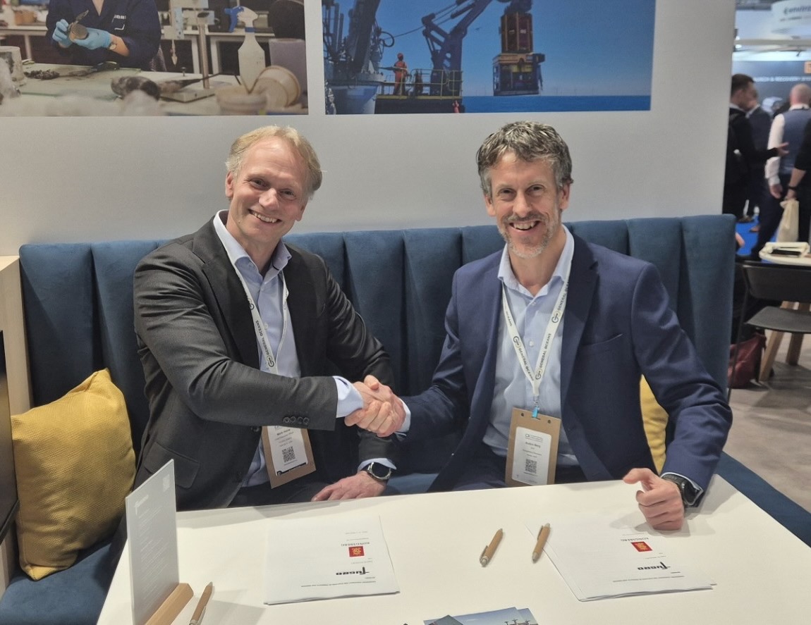
Kongsberg Discovery and Fugro consolidate partnership with Main Supplier agreement
Kongsberg Discovery and Fugro have signed a new framework agreement that strengthens a decades-long technology partnership between the two companies. The contract, confirmed at Oceanology International in London, positions Kongsberg Discovery as a key supplier of advanced hydroacoustic and positioning technologies across Fugro’s global fleet, including the company’s expanding portfolio of uncrewed surface vessels (USVs).
Integrated approach
Fugro is widely recognised as the world’s leading Geo-data specialist, delivering insights that support energy production, the energy transition, large-scale infrastructure development and climate resilience. Its operations span offshore and onshore environments worldwide, with increasing emphasis on sustainable survey solutions and remote operations.
The new agreement reinforces Kongsberg Discovery’s position as a preferred technology partner for Fugro, providing continued access to the company’s high-end solutions – such as the EM2042 multibeam echosounder and Seapath motion and GNSS positioning systems, which have been selected for integration across Fugro’s new generation of autonomous survey platforms. Working together, the assets and technology will deliver high-quality, precise hydrospatial data and optimally efficient, safe and sustainable remote operations.
Shared commitment
Auden Berg, EVP, Kongsberg Discovery, says the agreement reflects a shared commitment to advancing subsea technology while maintaining the highest standards of data quality.
“Fugro has been a valued partner for many decades and together we have helped shape the evolution of modern hydrospatial surveying,” Berg comments. “This new framework agreement takes that collaboration to the next level. By combining Fugro’s operational expertise with Kongsberg Discovery’s advanced sensor and positioning technologies, we can continue delivering the reliable, high-quality data that Fugro’s customers depend on for informed decision making and understanding of complex marine environments.”
Empowering autonomy
Although the agreement is wide-ranging in reach, Fugro’s decision to expand its USV fleet, as announced at Oceanology International, is a natural focal point. The Dutch multinational, which employs approximately 10,000 people in 52 countries, has built an advanced network of Remote Operations Centres (ROCs) to enable USV tasks, helping dramatically reduce emissions (by up 95%), with enhanced safety and 24/7 operational efficiency. Kongsberg Discovery technologies are central to these developments, supporting the precise navigation, seabed mapping and underwater positioning required for autonomous success.
In addition to multibeam echosounders and Seapath INS, Fugro will continue to utilise a broader portfolio of Kongsberg Discovery systems including HiPAP underwater acoustic positioning and communication technology. Together, these solutions provide the high-accuracy situational awareness needed for complex offshore survey projects.
Unlocking value
Mark Heine, Fugro CEO, says the strengthened partnership reflects the company’s confidence in Kongsberg Discovery’s technology and expertise.
Heine comments: “Our focus is on delivering high‑quality Geo‑data and clear insights that help customers reduce risk and make well‑informed decisions throughout the life of their projects. Kongsberg Discovery’s systems play a key role in supporting our global survey operations, enabling us to operate efficiently while maintaining consistent and reliable outcomes in increasingly complex marine environments. This framework agreement supports our shared ambition to advance more efficient and sustainable survey operations. We are pleased to continue working closely with Kongsberg Discovery as we build on this long‑standing collaboration for the benefit of our customers worldwide.”
To discover more please see https://www.kongsberg.com/discovery/
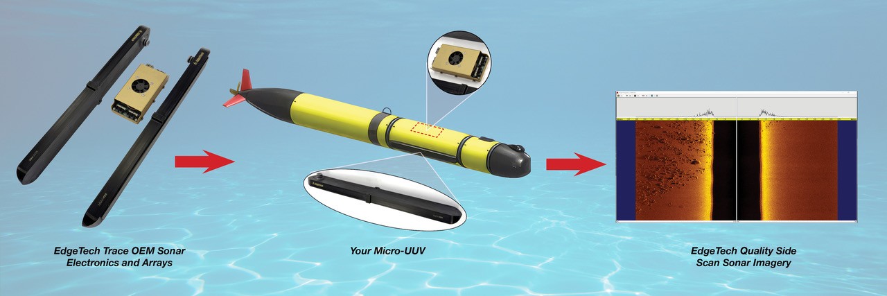
EdgeTech Introduces the Trace Micro-UUV, ROV and USV Based Side Scan Sonar System
 EdgeTech, the leader in high resolution sonar imaging systems, and acoustic release solutions has recently expanded their OEM side scan sonar product offering to meet the needs of small and micro sized autonomous vehicles.
EdgeTech designed the new Trace OEM side scan sonar specifically with micro-UUV, small ROV and shallow water USV in mind. The Trace system is a small form factor (13cm x 7cm), low power, high quality EdgeTech OEM side scan sonar solution for small and micro vehicles.
The dual frequency Trace system can be configured to operate at a range of frequency pairs including: 540/1600 kHz or 540/850 kHz or 850/1600kHz with standard cabled arrays or customized vehicle-specific arrays. The system is ideal for shallow water survey applications, providing an excellent combination for range and resolution. With an average power draw of only 7-10W the 12-24 v DC system has been optimized for size, power and weight. Integrators can choose RS232 communications for navigation devices and other sensors. External triggering is also available. The Trace system has an ethernet interface to connect to the host platform and comes with a common EdgeTech command and control interface. EdgeTech’s high quality sonar data is streamed from the Trace system for storage on the host platform.
2026 marks 60 years of EdgeTech leading the way in high resolution sonar imaging systems, sub-bottom profilers, on-demand (ropeless) fishing systems and acoustic release solutions. The Trace system being the latest in a long line of industry leading products.
For more information please visit: https://www.edgetech.com/product/trace-mico-uuv-rov-and-usv-based-side-scan-sonar-system/
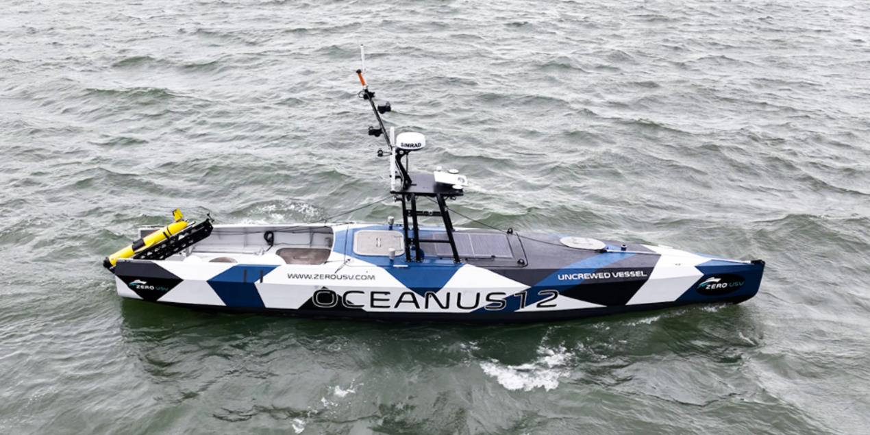
Teledyne and M Subs Announce Strategic Collaboration
 Teledyne Marine, a global leader in maritime unmanned underwater vehicles and marine technologies, and M Subs, a UK-based innovator in marine unmanned systems and associated autonomy, are pleased to announce the signing of a Memorandum of Understanding (MOU) to establish a strategic collaboration.
This partnership aims to leverage the complementary expertise of both organizations to develop and execute business opportunities related to the UK Royal Navy and other international naval programs. The collaboration will focus on integrating advanced technologies, including vehicle platforms, autonomy systems, sonars, acoustic communications, cameras, lighting, and subsea connectors, to deliver cutting-edge solutions for maritime operations.
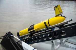
Efforts are already underway on cooperation with Teledyne SeaBat multibeam sonars successfully integrated and demonstrated on Zero USV platforms at REPMUS 2025. In addition, work has commenced on the deployment of Slocum gliders and Osprey class AUVs from Zero USV systems with demonstrations in the UK and Iceland planned in Q1 and Q2 of 2026.
Key highlights of the partnership include:
- Support for Royal Navy Programs: The collaboration will focus on advancing projects with the UK Royal Navy including possible joint cooperation for Atlantic Bastion and MHC Block 2 while leveraging M Subs and Teledyne’s significant UK presence and capability.
- Joint Business Development: Teledyne and M Subs will work together to identify and pursue mutually beneficial opportunities globally.
- Shared Expertise: Both parties will combine their technological capabilities to enhance unmanned systems and autonomy solutions for maritime applications.
 Brian Maguire, Teledyne Marine Chief Operating Officer and Vehicles General Manager, stated, “This collaboration represents a significant step forward in advancing maritime technologies. By combining our expertise, we aim to deliver innovative solutions that meet the evolving needs of the UK and international markets.”
Brett Phaneuf, Director of M Subs, added, “It has been a pleasure to work with Teledyne to integrate the myriad sensors and devices they bring to bear on the marine and defense space; they have proved nimble and forward leaning in our work together, necessary qualities from flagship companies partnered with small SMEs for us to be successful in the future when serving the nation…it’s also been a great deal of fun!”
The partnership between Teledyne and M Subs is set to drive innovation and deliver impactful and operationally relevant solutions with high technology readiness levels for defense and commercial applications.
Proven Performance: Teledyne Marine is a leading provider of unmanned underwater vehicles (UUVs) with two main production facilities located in North Falmouth, MA and Kopavogur, Iceland along with a network of international service centers. As of January 2026, Teledyne has delivered over 12,000 APEX floats, approximately 1,275 Slocum gliders (with over 600 to NATO naval users), and Gavia AUV systems have been purchased by 18 navies. Teledyne unmanned systems are operational with numerous NATO and AUKUS navies including the Royal Navy.
UK Presence: Teledyne currently has over 2,700 employees in the UK at 18 main sites and is committed to supporting current and future UK defense priorities with proven technology and local expertise.
HydroSurv delivers REAV-25 to strengthen Skanska Norway’s uncrewed survey operations
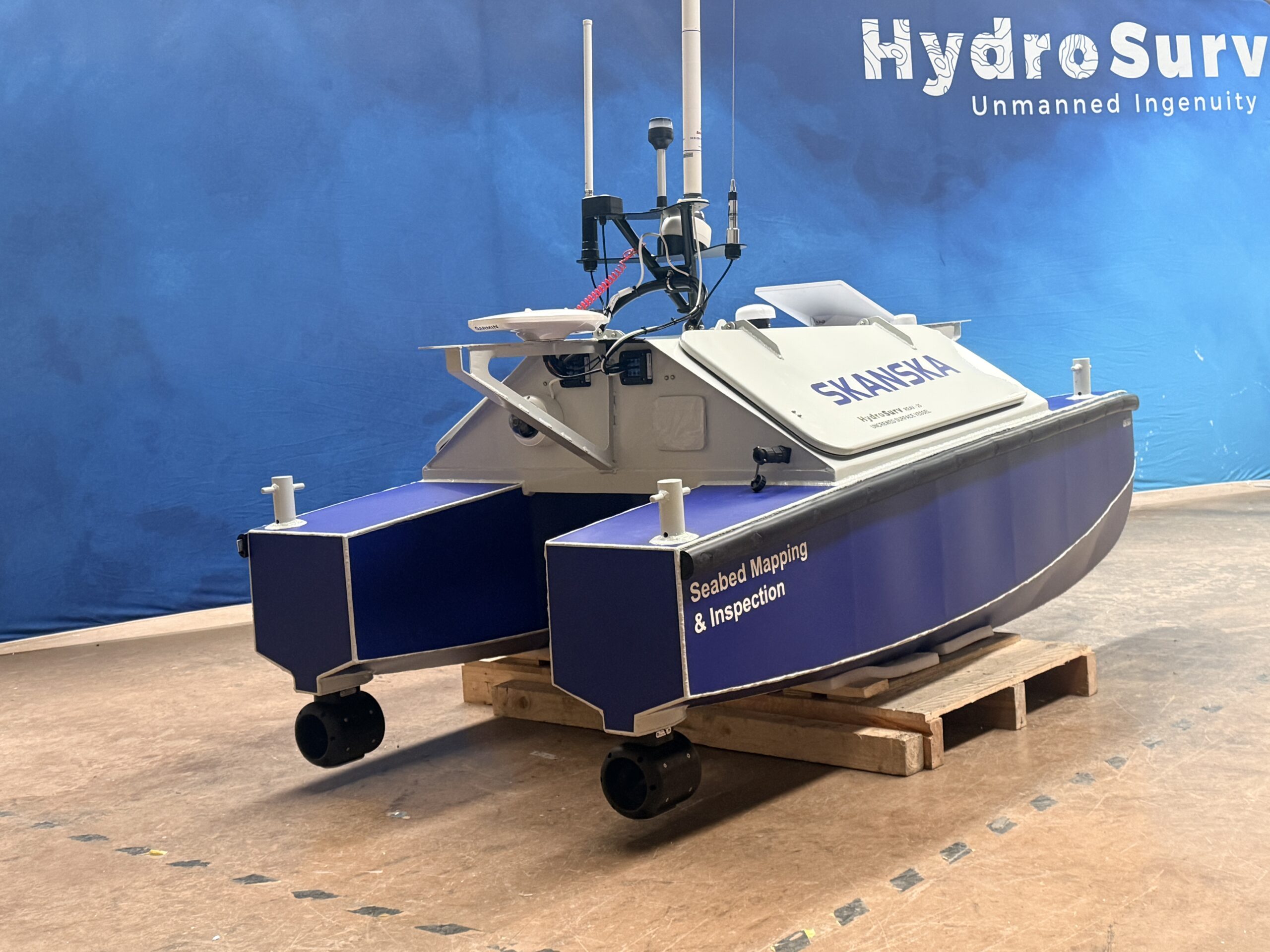
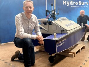 HydroSurv has announced the sale and delivery of its latest REAV-25 Uncrewed Surface Vessel (USV) to Skanska Norway AS, marking a significant milestone in Skanska’s expansion of uncrewed survey capability for infrastructure projects across the country.
Skanska is a leading civil engineering and construction company with a substantial portfolio of works spanning inland waterways, ports and harbours, and coastal environments. Supporting the successful delivery of these projects is Skanska’s in-house survey and inspection unit, where the REAV-25 will play a key role in strengthening inland hydrographic survey operations.
The USV will be primarily deployed to deliver high-resolution bathymetric surveys using a Norbit iWBMS multibeam echo sounder, supporting the design, construction and long-term maintenance of infrastructure located over, under and alongside the water. The acquisition reflects Skanska’s growing adoption of uncrewed technologies to improve data availability, operational efficiency and safety, while reducing the environmental footprint of survey activities.
Designed for zero-emission day operations, the REAV-25 is a sheltered-water, multipurpose USV capable of supporting a wide range of hydrographic and environmental data collection campaigns. The vessel is equipped with twin 2.5 kW rim-driven thrusters, minimising the risk of entanglement or damage during shallow-water operations, and is powered by a 6-kWh lithium battery system enabling full-day endurance. As a commercial-grade platform, the REAV-25 features HydroSurv’s Virtual Watchkeeper Vessel Control System (VCS) alongside the Dynautics Spectre autopilot.
David Hull, Founder and CEO of HydroSurv, said:
“We’re extremely proud to have been selected by Skanska to support the delivery of this new REAV-25 USV for survey operations in Norway. The portability and flexibility of the platform allows rapid mobilisation and the repeatable collection of high-quality survey data, aligning well with Skanska’s operational and project delivery requirements.
Stuart Duncan, Team Lead (Seabed Mapping & Inspection) at Skanska Survey Norway AS, said:
“We contacted several companies and looked at various USV solutions in this now crowded workspace, but HydroSurv really shone as a company that Skanska felt it could do business with. We have been impressed throughout this process and look very much forward to receiving and working with our REAV-25. The compact vehicle is ideal for our current area of growth, and moving personnel from the field to the office will make us far more competitive to our clients.”
The USV, named Saga, will complete trials in the UK in March 2026 and is expected to enter operational service with Skanska in Norway in early spring.
Greensea IQ Introduces Post-Mission Analysis Toolset
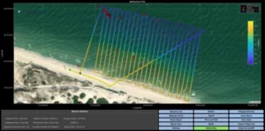 Greensea IQ today announced the release of a new post-processing software toolset called Bayonet Insight for its maritime robotics software products deployed to defense forces. Bayonet Insight supports all software deployed on Bayonet Autonomous Underwater Ground Vehicles (AUGVs), EOD Edge and EOD Workspace deployed on Mission Specialist Defender ROVs by VideoRay (an AeroVironment company), RNAV diver navigation systems by STIDD Systems, Bayonet Underwater Control (BUC) systems, and Greensea’s EverClean ship maintenance and inspection robots. The tool was developed in response to a clear and persistent need from operators: faster access to mission insight while it still matters.
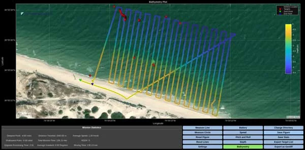
Bayonet Insight enables operators to process raw mission data immediately, during a mission or after recovery, and produce valuable intelligence products that can easily be distributed or uploaded into battlespace management platforms such as TAK. The post-mission analysis toolset allows the generation of numerous products, including bathymetry maps, geo-referenced mission summaries, contact reports, sonar and video exports, and plots of any telemetry channel within the system. This type of intelligence traditionally takes hours of processing after a mission using a variety of tools, delaying reporting, decision-making, and follow-on tasking.
“This tool was built in response to clear market demand from operators,” said Luis Mejia, Senior Solutions Manager at Greensea IQ. “Immediate data distributed to all stakeholders is critical to operational efficiency.”
Developed as a standalone application and distributed with all Greensea software, Bayonet Insight allows users to load mission data files and automatically organize critical telemetry, mission events, sensor data, sonar data, and video into a structured workspace. From there, operators can quickly generate plots and data products as well as 2D and 3D bathymetric visualizations. Interactive tools allow users to inspect specific points along a mission track, capture synchronized sonar and video snapshots, and extract precise measurements and coordinates.
One of the most significant benefits is the ability to export georeferenced bathymetric images and mission data directly as GeoTIFFs, enabling seamless integration with mission planning, reporting, and GIS systems in a single workflow.
Bayonet Insight has already been demonstrated in live operational settings, where it successfully enabled rapid data product generation and on-time intelligence for mission stakeholders and decision makers. Its development reflects Greensea IQ’s continued focus on pairing advanced autonomy and robotics with practical, operator-driven software solutions. This software will be available to customers with current EVERGREEN subscriptions.
“This isn’t software built in isolation,” Lu Mejia added. “It’s a direct result of listening to the people doing the work and understanding how critical speed and clarity are once a mission ends.”
New TrustLink™ Data introduces high‑speed clarity at depth with assured 10Gbit/s to 6,000 metres
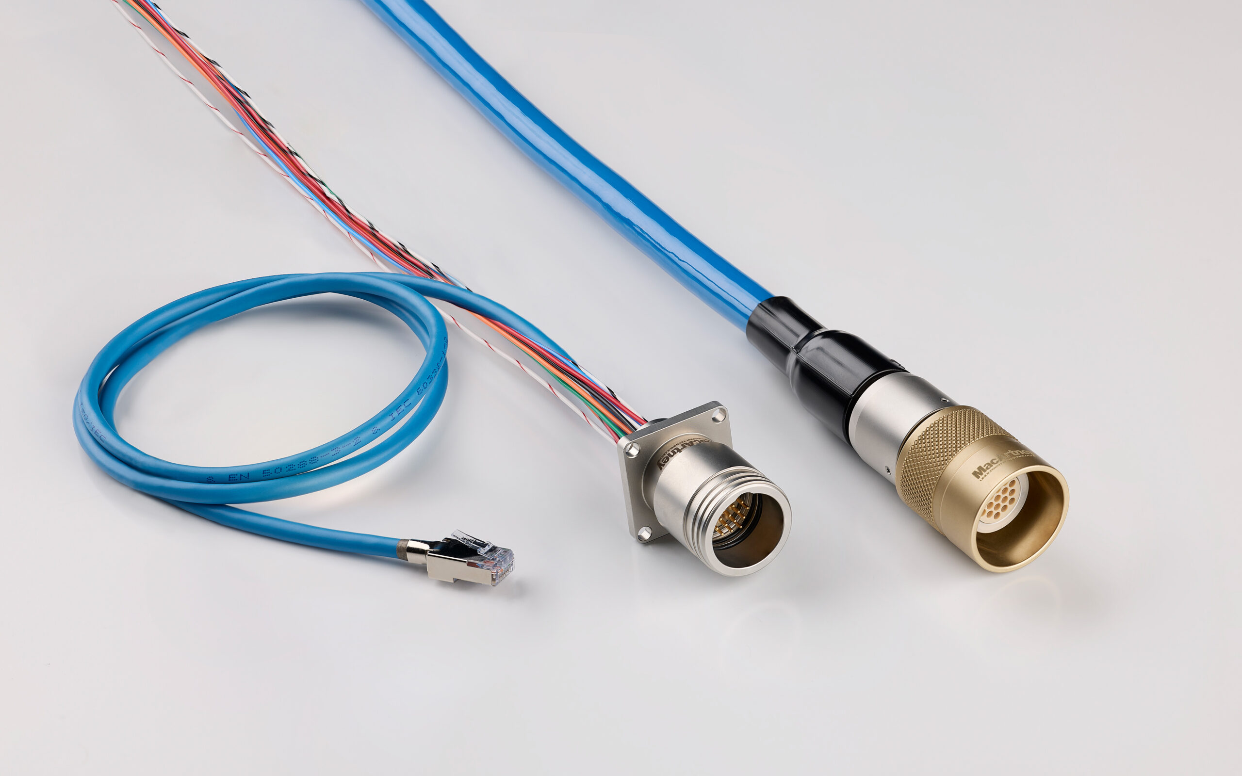
TrustLink™ Data is a complete harness solution that delivers assured 10Gbit/s data transmission across cable assemblies up to 10 metres, tested and qualified to operate at 600 bar. Designed for modern sensors, sonar platforms and real-time underwater operations, it preserves signal integrity throughout the connection for advanced systems in marine and offshore, ocean science and naval applications.
Sensors, real‑time telemetry and high‑resolution imaging now generate far more data than earlier generations, placing greater demands on the subsea link that carries information into the wider setup. As applications grow in complexity, system manufacturers and users developing and integrating advanced subsea technologies require connectivity that preserves speed, consistency and signal quality even in environments where pressure, movement and electrical interference are present.
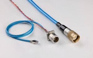
A complete high-performance harness solution built around TrustLink TrustLink Data addresses this with a complete harness solution designed for reliable high-data-rate transmission. It combines a 19-contact connector, a specifically designed MacArtney data cable and controlled termination to perform as a single integrated unit. Within this configuration, the core transmission section functions as a cable harness composed of CCP–Cable–CCP, while the complete TrustLink Data assembly includes FCR/BCR terminations at each end.
Paul Anthony, Global Business Development Manager: “Underwater applications require clean, uninterrupted data to perform reliably. When you picture real-time sonar tracking the seabed with clarity, the quality of the connection delivering that information becomes essential. TrustLink Data provides this through a complete harness solution that carries both power and data with confidence and speed. It integrates easily with new or existing platforms, providing a robust, practical solution that reduces uncertainty and supports critical decision-making.”
Enhanced performance below the surface The development of TrustLink Data reflects two years of focused engineering, built on extensive research, stepwise prototyping and repeated testing across multiple cable configurations. MacArtney’s in‑house pressure‑testing capabilities enabled validation under realistic subsea conditions and guided precise refinements to the cable, connector and termination assembly.
Every termination is handled by MacArtney technicians who have undergone dedicated technical training and internal certification, ensuring the required precision. The result is a harness solution shaped by thoroughness and verified through rigorous testing for reliable high-data-rate transmission and stable signal handling down to 6,000 metres.
Designed for integration across high-bandwidth applications Tested to the RFC 2544 and ITU-T Y.1564 standards, it supports demanding subsea applications, including sonar systems, imaging platforms, advanced sensors, ROVs, AUVs, and long-term monitoring solutions. Its stable, predictable performance provides a dependable foundation for mission-critical equipment across the underwater domain.
Added value for a data-driven underwater world As subsea systems push toward higher bandwidth and greater autonomy, traditional copper-based interfaces are reaching their limits because their electrical and physical characteristics do not meet the data volumes demanded by today’s modern subsea infrastructures.
TrustLink™ Data strengthens the data acquisition chain, where clarity and signal integrity have a decisive influence on overall operational performance. Available through MacArtney’s global operations from April, it offers a robust connection for the next generation of underwater technologies.

GeoAcoustics and Ocean Floor Geophysics Collaborate on Single Towfish Side Scan Sonar and Magnetometer Solution

GeoAcoustics Ltd and Ocean Floor Geophysics (OFG) have joined forces to develop a combined side scan sonar and magnetometer system as a single towfish. The new configuration integrates the GeoAcoustics GeoScan side scan sonar with OFG’s Self-Compensating Magnetometer (SCM), bringing acoustic imaging and magnetic detection together in a single streamlined platform for the first time.
The collaboration builds on the high-resolution imaging capability of the simultaenous dual-frequency GeoScan system and the SCM’s unique real-time compensation to address a long-standing operational challenge in marine survey. Traditionally, magnetometers must be towed at a significant distance behind side scan sonars to avoid interference from magnetic components on the towbody. This requires the deployment of two separate towfish, either towed inline one following the other, or on separate cables. These conventional configurations of marine magnetometers increases deck handling complexity, layback management and operational risk, particularly from smaller vessels and USVs
The new configuration integrates the SCM directly onto the tail of the GeoScan side scan sonar via a dedicated stinger assembly. The SCM’s self-compensation capability enables it to operate effectively in close proximity to metallic survey hardware, making true single-towfish deployment possible.
The development also reflects the growing use of uncrewed surface vessels (USV) in hydrographic and geophysical operations. Launching multiple towed systems from a USV presents significant practical challenges and increased operational risks. A single GeoScan towfish integrating the SCM is a simpler configuration lowering risk to remote and autonomous survey operations.
By reducing two towed bodies to one, the system simplifies launch and recovery, improves survey efficiency and enhances operational safety. The solution is particularly relevant for unexploded ordnance (UXO) surveys, where high-resolution seabed imagery and magnetic anomaly detection are routinely required together to identify and classify targets.
“Bringing side scan sonar and a self-compensating magnetometer together in a single towfish represents a significant step forward in survey integration,” said Richard Dowdeswell, Chief Commercial Officer at GeoAcoustics. “We believe the configuration, made possible by OFG’s innovative self-compensation technology demonstrates what can be achieved when two specialist companies collaborate to solve real operational challenges.”
“The SCM was engineered to actively compensate for nearby magnetic influences, which fundamentally changes how magnetometers can be deployed in marine survey,” said Matthew Kowalczyk, General Manager at Ocean Floor Geophysics. “By integrating with the GeoScan platform, we are enabling a compact, single-towfish configuration that is better suited to modern, remote and uncrewed survey operations.”
Beyond UXO detection, the combined system can support cable route investigations, marine construction projects, archaeological surveys and subsea infrastructure inspection, where acoustic and magnetic datasets provide complementary insight.
GeoAcoustics and Ocean Floor Geophysics are currently progressing development of the single-towfish configuration, with availability anticipated in Q3 2026.
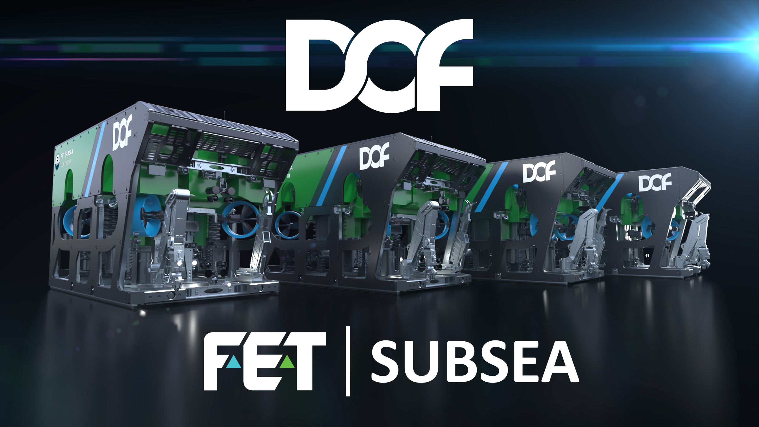
FET to deliver series of cutting edge ROVs to DOF
 Forum Energy Technologies’ (FET) Subsea product line has secured a contract to provide four of its new generation work class remotely operated vehicles (ROV), the XLX EVO III, to long-term client DOF.
The contract, signed in late August 2025, schedules the delivery of the four ROVs for April, June, July and August 2026 respectively. The first two vehicles will be mobilised in Singapore.
Since 2008, DOF has purchased over 60 ROVs from FET, with this latest sale indicating the continuation of a longstanding partnership of high strategic importance between the two companies.
The XLX EVO III will demonstrate the most cutting-edge Ultra-Heavy-Duty subsea vehicle technology available on the market. Designed to undertake a broad spectrum of underwater tasks, the 3000m ROVs will be equipped with 420mm diameter thrusters for increased through water performance and an improved buoyancy package, facilitating over 500kg of unladen payload.
The XLX EVO III comes with updated pilot chairs and console as well as FET’s next-gen control software, ICE Unity, providing unparalleled response for remote operations and comprehensive data access.
Kevin Taylor, FET’s Vice President Operations – Subsea, said: “This contract reaffirms the strong partnership between DOF and FET, and an order of this scale reflects the confidence DOF places in our subsea technologies. We are excited to see our next generation work class ROV in action next year and look forward to supporting DOF through our customer services team.”
The ROVs will be manufactured at FET’s UK facility at Kirkbymoorside, North Yorkshire, UK and marks the latest in a string of significant contracts for FET this year, signifying strong growth across the subsea industry.
FET’s ROVs are used globally to support underwater industry applications, including in defence, traditional and sustainable energy, telecommunications, mining, aquaculture and academia.
Issued on behalf of FET by BIG Partnership. For more information, please contact Rory Riddoch on [email protected] or +44 7710 305352.

Kongsberg Maritime, Seadrill, and Hanwha Drilling Forge Alliance to Pioneer Remote Dynamic Positioning (DP) Technology

Collaboration to Establish New Standards for Offshore Drilling Safety, Efficiency, and Centralized Operations
Seadrill Limited (“Seadrill”) NYSE: SDRL, a premier offshore drilling contractor, Kongsberg Maritime AS (“KM”), a global technology leader, and Hanwha Drilling a leading provider of offshore drilling services, announced a strategic alliance to develop the next generation of remote Dynamic Positioning (DP) technology in offshore drilling.
This collaboration represents a shared commitment to defining a global operating model for the future of DP operations for the industry. The initiative will develop the technical and regulatory foundations required for the safe adoption of remote DP and establish a new industry standard. By combining Kongsberg Maritime’s automation and communications technologies with the operational expertise of Seadrill and Hanwha Drilling, the partnership will create centralized, repeatable processes that ultimately reduce cognitive load on rig crews, improve decision making, and deliver higher levels of safety, efficiency, and performance at sea.
Johnathan Dady, Director of Rig Innovation and Technology at Seadrill, commented: “Seadrill is committed to leading the industry in adopting technologies that deliver safer and more efficient operations. Implementing remote DP capabilities fundamentally changes how our crews manage dynamic positioning. It will enable our rig teams to focus on what they do best, maintaining a safe, high-performance operation delivering tangible results for our clients. This is the first step on the path to a shift in industry operations, and a change of this scale requires us all to work together to define what it will look like and how it can work for us all. We are excited to be taking the opportunity to be leaders in this space.”
Eivind Alling, SVP, Americas Region and Head of Kongsberg Maritime Inc., added: “This alliance represents a significant step in using advanced technologies to transform the industry. Remote DP isn’t just about moving control; it’s about creating an intelligent operational architecture that uses automation to enhance safety, reduce risk, and sharpen vessel performance. By combining Kongsberg Maritime technology and the operational expertise of two forward-thinking drilling leaders, we aim to set a new benchmark for safety and efficiency in offshore drilling.”
Scott McKaig, CTO / Vice President Technical at Hanwha Drilling commented “Our vision extends beyond today’s fleet. We are investing in the future of offshore operations. Partnering on Remote DP enables Hanwha Drilling to help define the next generation of smart, automated DP systems that will move the industry forward. This collaboration supports the development of resilient, centralized DP operations that enhance safety and efficiency while reducing costs of deepwater operations worldwide.”