
Kraken Robotics appoints Chief Operating Officer and hires Marketing Director
 Kraken Robotics Inc. (“Kraken” or the “Company”) (TSX-V: PNG, OTCQB: KRKNF) announces that effective July 9, Nathaniel Spencer has been appointed Chief Operating Officer of Kraken. Mr. Spencer joined Kraken in August 2021 with the acquisition of PanGeo Subsea, where he was the Vice President of Service Delivery. For the last 18 months, Nat has been the Managing Director of Kraken’s subsea power business. Nat has over 12 years in the marine sector, including founding a subsea inspection business that was sold to Oceaneering in 2016.
Greg Reid, Kraken’s President and CEO noted, “I am pleased to promote Nat to the COO role after 3 years at Kraken. Nat’s strength is in driving operational performance, by building strong teams, setting goals, and effectively monitoring and communicating both up and down an organization. He is very process driven and brings a sense of urgency and solid business sense to matters at Kraken. Combined with the rest of our Executive Management team that includes Joe MacKay (CFO), Dave Shea (CTO), and Lynne Adu (CCO) our organization is now well structured to handle strong organic growth and to integrate selective acquisitions that add additional technology, customers, and profitability to our business.
Kraken is also pleased to announce that Erica Kierstead has joined as Director of Global Marketing. Based in Boston, Erica spent 2 years at MITRE in marketing and communications most recently focused on the AI and Bluetech sectors, and prior to that spent 9 years at Hydroid and then HII in marketing. With over 10 years of experience in ocean technology and the defense industries, Erica is a welcome addition to lead Kraken’s marketing efforts.

The Convex Seascape Survey
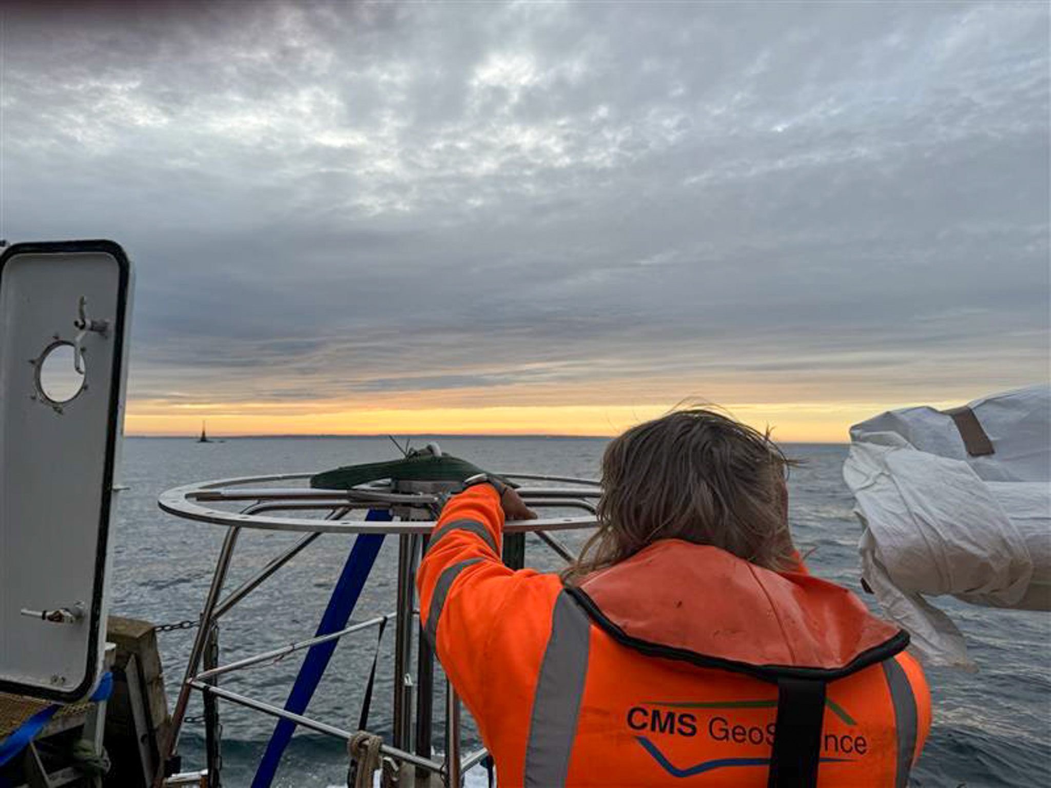
 CMs GeoScience Ltd recently partnered with the Blue Marine Foundation, the University of Exeter and Jersey Marine Resources on an exciting project, The Convex Seascape Survey. This initiative is a pioneering collaboration of world-leading scientists working to quantify and understand blue carbon stored in the coastal ocean floor, and the effects of marine life upon it. It will deliver new, reliable open-source data which will educate, inspire and enable informed decisions on ocean use, to harness the power of the sea in the fight against climate change. The role of CMS’s specialised geotechnical team was to collect 55 vibrocores and 8 multicores across various locations in the waters around Jersey.
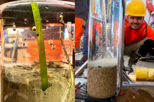
They collected undisturbed samples of sediment and supernatant water using a multi corer at 8 locations on the south and east of the island. One core from each location was transferred back to shore where the research team could perform eDNA testing. Dr Richard Tennant established a field molecular laboratory that allowed the team to both extrude and subsample the cores, as well as purify and sequence the DNA in Jersey. This data was then taken back to Exeter where they will investigate which flora and fauna are contributing to carbon stocks and determine how they have formed over the past two centuries. As the survey team were able to conduct on-site analysis, the data they generated can be validated once the other cores have been received in Exeter, to better understand the impacts of storage and/or transportation.
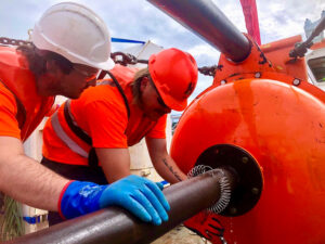 The project also looked at how protection from trawling and dredging activities might affect the capacity of the seabed to accumulate and store organic carbon. Researchers had a particular interest in how this protection affects the biodiversity of seabed habitats, as it is likely that the animals that live around jersey may play an important role in the flux of carbon through these environments.
The CMS team collected cores both inside and outside of the Jersey Marine Protected Area where mobile fishing gear is prohibited. This will allow academics to compare the differences in seabed organic carbon content and biodiversity according to different levels of seabed disturbance. The samples they cored will be analysed alongside short sediment cores of 30-60cm that they survey team gathered by hand using SCUBA.
Researcher, Dr Ben Harris, utilised a range of techniques to measure differences in biodiversity. Baited Remote Underwater Video Systems (BRUVS) were deployed to collect information on the abundance and body size of different fish and highly mobile invertebrate species such as crabs or lobsters. ROV and photo-quadrants were used to quantify the density and species diversity of less mobile animals living on-top of the seabed, these include sponges, ascidians and hydrozoans. The third approach was collecting sediment grabs for counting the biodiversity of animals, like worms and bivalves, living within the sediment itself.
CMS GeoScience worked with Anna Smith and the Convex team to design this survey. Jersey is a challenging place to operate, having the third-largest tidal range in the world with a range of >10m and 5-6 knots. Looking at sediment types as well as potential obstructions and limitations, CMS advised on sample locations to ensure that the needs of the project were met. With more interest in the top layers of sediment, it was decided that the HPC corer would be deployed in 3m mode, with a smaller corer aiming to help mitigate some of the tidal restrictions. After consultation, the project scope was defined as 55 vibrocores, predominantly around the south and east of the island.
Jersey is a busy tourist destination, attracting many small craft, sailing and leisure boat users. This is always a challenge when working close to shore, but particularly trying in such a picturesque location. The team consulted with Jersey Harbour Authorities and local agents to establish a plan that avoided any major maritime events, as well as using moorings and quay space around the island to limit steaming time.
Hayley Santer, the Senior Surveyor on the project, highlighted the need to remain fluid in approach to a project such as this. Each location was assessed and categorised depending on whether they were exposed to weather or tidally restrained. Weather forecasts were changeable and so it was vital that the team acquired the more weather sensitive sites, with contingency plans in place for operations to go ahead depending on the observed sea conditions at the time.
Hayley spoke about the level of preparation needed: ‘To maintain efficiency, and with several tidal locations spread in various bays around Jersey, it was crucial that we worked to minimise time spent waiting on the tide when trying to access more shallow locations.
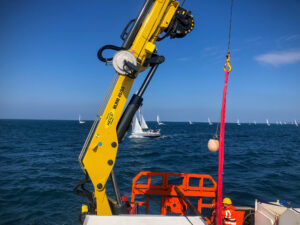 In addition to significant tidal ranges and rocky coastline, many of the reefs were poorly charted. With the team finding that there were large discrepancies in the data, it was important for us to take the additional time to capitalise on rising tides as well as note and mark a safe route into shoal areas, paying particular attention to locations that, while technically deep enough, were enclosed behind prominent, sometimes awash, rock. Using these proven routes, and ensuring we received regularly updated tidal information, enabled real-time assessment of the observed depths both on approach and when were deployed at each location. This also allowed us to establish what depths we could expect on completion of the sampling.
Communication went beyond those involved and extended to local power companies who had seabed assets within our remit. Consultation was key in carving out exclusion zones, with these companies requiring our assurance that any instance of seabed touch-down, be that from a sampler or sound velocity profiler, was logged outside of the reduced cable zones.
We were often operating within busy shipping routes, and St Helier VTW and the Jersey Coastguard were instrumental in reminding other vessels of the requirements of space and safe passing. To add to the intricacies of this project, our team were working over a number of weekends which meant that the increase in recreational club activities added to the difficulties of working in an area where marine traffic was already saturated. Our choice of a smaller, more compact vessel enabled us to work alongside these clubs and societies and we were able to complete the campaign safely with minimal disruption to us and the public’.
The geology around Jersey also presented a specific challenge to the team, with rocky outcrops being exposed by the high tidal range. Extensive planning using tidal and weather forecasts, as well as water depths, enabled the team to maximise working windows.
Owing to the unique tidal movements around the island, Rory Bardner, CMS Marine Geologist, found it interesting to discover such variation in the geology sampled throughout the campaign:
‘Cores recovered deposits ranging from silty sands to coarse gravels, often in proximity, and igneous bedrock was samples in many cases. Using the multi corer to recover undisturbed samples of the shallow seabed gave a real insight into the sediments, marine life and seagrass below us.
Due to the testing required, the cores had to remain at a constant temperature of between 4-5 degrees, which was made more difficult as many of the locations were >4-hour steam away from harbour. By working with the client and the vessel, a solution was found which allowed for onboard chilling facilities, as well as a space to safely operate the vibrocoring system, the multi corer and other equipment. Through creative thinking, the CMS team were able to meet this requirement to guarantee the quality of the samples and the subsequent data.
Mechanical Design Engineer, Jack Foll, reported on the difficulty in operating the geotechnical systems and the performance of the team overall:
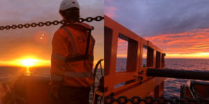
‘There was a great deal of preparation in anticipation for this campaign as we knew we would be working within a demanding environment. The waters in which the team were deployed experiences a tidal height of up to 12m, and this meant that our HPC corer had to operate in 3m to compensate for the strength of the tide. As well as this, we experienced unseasonably inclement weather throughout our time on the island which meant the team had to work within tight windows of opportunity, adding even more to the complexity of the project. We worked to ensure that our systems were tested, checked and serviced prior to commencing the project, and everyone onboard carried out their duties safely and effectively. The extensive planning from all involved meant that the contract was completed without any system breakdowns, and the team operated the equipment well, without incident, despite the many difficulties they faced.’
CMS GeoScience is proud to have played its part in helping researchers to highlight the need to preserve the ecologically, economically, and culturally important marine habitats of the Island, especially when Jersey relies so heavily on the ocean as a resource.
Scottish expansion underway for UK’s world-leading offshore industry data resource
Work is now underway to integrate Scottish survey findings into the Marine Data Exchange (MDE), the UK’s world-leading resource for offshore industry survey data, research and evidence.
This follows an agreement between The Crown Estate and Crown Estate Scotland to extend the MDE to cover Scottish waters, allowing all developers working in UK waters to benefit from a streamlined and comprehensive dataset to inform offshore developments, supporting the faster, more sustainable roll-out of offshore technologies critical to the UK’s energy transition, while protecting and restoring the biodiversity of our seas and the marine environment.
Marine consultancy and survey company ABPmer has been appointed by Crown Estate Scotland to support data handling tasks critical to the effective management of the Scottish marine survey data and associated documents uploaded to the MDE. This includes primary data, observations, metadata, and reports gathered and stored by or on behalf of tenants in relation to geotechnical, geophysical, bathymetric, oceanographic, meteorological, acoustic, biological, sea user, sedimentological, cultural and heritage investigations, and modelling and monitoring.
The MDE was created by The Crown Estate in 2013 to store, manage and disseminate offshore survey data collected by offshore renewables developers during the planning, building and operation of offshore renewable energy projects and outputs from Regional Environmental Characterisation Surveys (RECS) under the Marine Aggregate Levey Sustainability Fund (MALSF).
The MDE provides an evidence base to help developers and stakeholders understand impacts, providing valuable lessons learnt and efficiencies for new projects and understanding cumulative impacts on the seabed. It enables The Crown Estate to draw insights using data across various projects and regions, so a holistic and proportionate approach to the development of the seabed can be made.
The data submitted to the MDE must comply with a set of consistent standards and requirements to ensure it is maintained to a high standard and is easily discoverable in line with the Q-FAIR principles (Quality, Findable, Accessible, Interoperable and Reusable). ABPmer’s support will ensure the data holding continues to align with Q-FAIR so the database maintains an excellent level of customer service, and to assist Crown Estate Scotland in ensuring the data holding continues to be utilised in projects which benefit the environment, the offshore industry, and the nation.
Damon O’Brien, ABPmer Managing Director said:
"We are proud to work with Crown Estate Scotland to ensure a high standard of quality for Scottish MDE survey data. Our specialists bring over a decade of experience to the project, having supported The Crown Estate with essential quality assurance and data handling for the MDE since inception.
Having provided input to many of Scotland’s key offshore wind developments, including Ayre, Bowdun, Salamander, MarramWind, Beatrice, Moray East and Moray West, we are delighted to further our support for the next generation of Scottish renewable energy, helping accelerate Scotland’s progress towards net zero.”
ABPmer’s data and GIS specialists are experienced marine data handlers, developing bespoke GIS mapping and data management tools for governing bodies, the public sector and marine and coastal operators. A recognised Development Service Provider, they support clients throughout the renewable project life cycle, and are regularly asked to advise government when developing and shaping policy.
Exail, RTsys and ABYSSA join forces for ocean floor mapping with AUVs
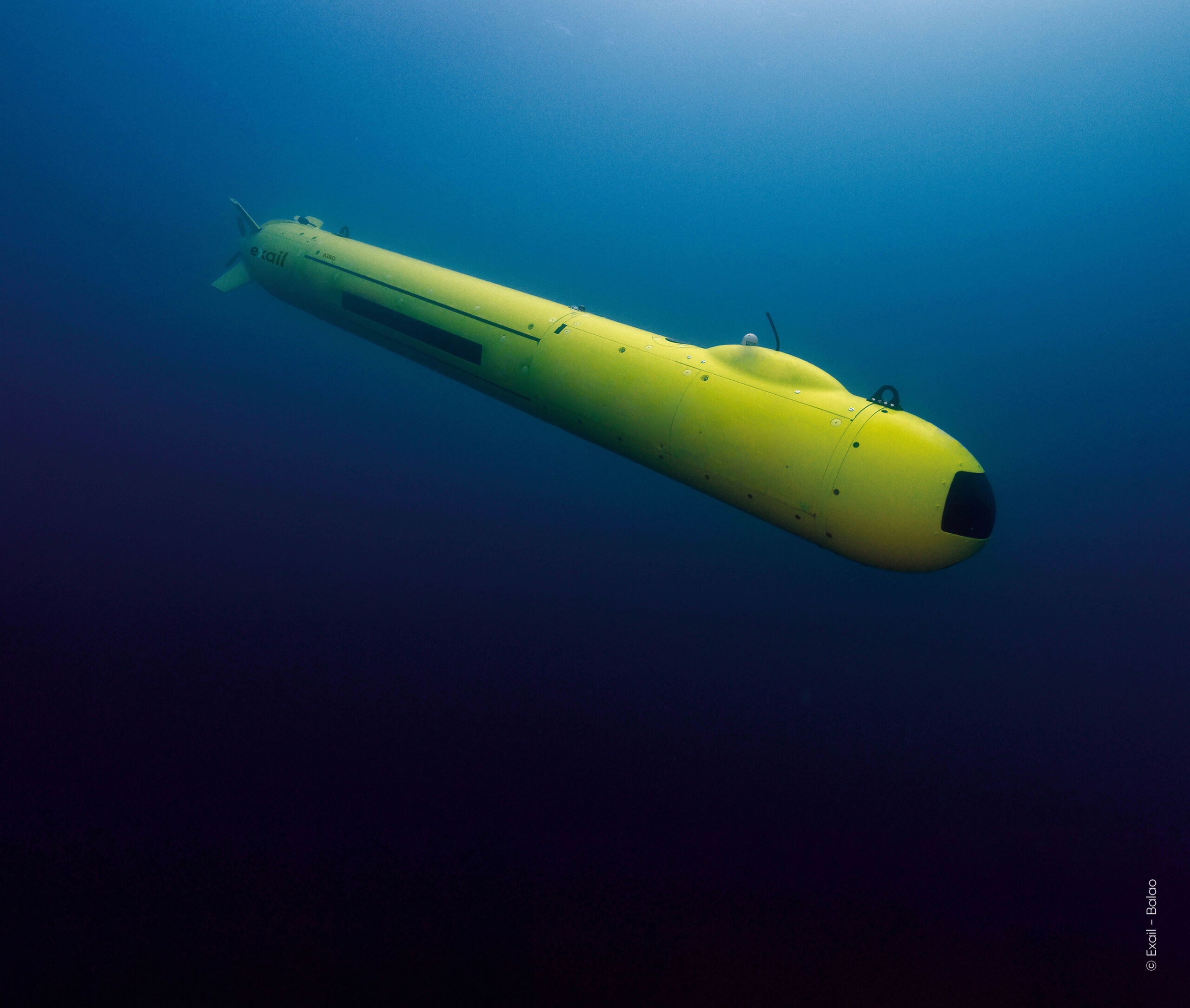
 Exail, RTsys, and ABYSSA, announce their strategic partnership in the CARMA (Mineral resources mapping by AUVs swarms) project. Co-funded by Bpifrance under the #France2030 initiative and designed to advance knowledge of great depths, the CARMA project focuses on developing swarms of Autonomous Underwater Vehicles (AUVs) for efficient ocean floor mapping.
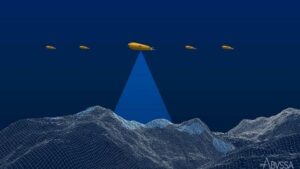
This project aims to develop an innovative solution for precise seabed surveying at great depths. The ongoing development involves creating a solution in which a multi-sensor underwater drone capable of diving to 3,000 meters will coordinate multiple AUVs to increase the surface of the exploration area. The research program also includes the development of advanced collaborative navigation, acoustic communications, positioning, and innovative mapping capabilities. CARMA supports the French authorities' strategy to develop extensive deep-sea exploration capacities.
As part of this strategy, Exail will improve the capabilities of its deep-water AUV A18-D to serve as the leading AUV to guide the swarm. Improvements will enable navigation down to 3,000 meters, at close altitude from the seabed over sloped terrains, and to accurately geolocate swarm’s acquired data. RTsys will extend the capabilities of its newly developed AUV COMET-3000 to dive up to 3,000 meters. Multiple units will be provided to act as followers, along with the development of an innovative launch and recovery system for the AUV swarm. ABYSSA will focus on developing exploration strategies for deep-water swarms of AUVS. Additionally, ABYSSA will process the magnetic data collected to map the magnetic anomalies on the seabed.
This project will result in the deployment of an operational demonstrator at sea in 2026, paving the way for future commercial phases. Concurrently, the project will carry out a preliminary study on extending exploration capacity to 6,000 meters depth.
"We are pleased to announce our collaboration with ABYSSA and RTsys in the innovative CARMA project, where we combine our technological expertise” said Catherine Pikovsky, project manager at Exail. “As we push the boundaries of autonomous underwater exploration, we enhance the capabilities of our deep-water AUV A18-D to navigate close to the seabed. Leveraging pack piloting techniques and advanced navigation algorithms, we lead the way towards a precise seabed surveying down to 3,000 meters, reflecting our dedication to innovation and advancing deep-sea exploration.”
“Thanks to this project we have the opportunity to work on the development of an AUV swarm operating at 3,000 meters depth. This allows us to enrich our expertise, innovate in the deep-sea field and demonstrate our swarm capability. The studies conducted thanks to the AUV swarm will provide scientific knowledge and contribute to the inventory of underwater heritage.” said Marine Postec, project manager at RTsys.
“We are defending the principle of the AUVs swarm, winner of the 2015 Global Innovation Competition, because it enables oceanographers to carry out extensive and accurate non-intrusive mapping in deep, little-known areas” said Michel Colinet, Deputy CEO at ABYSSA.
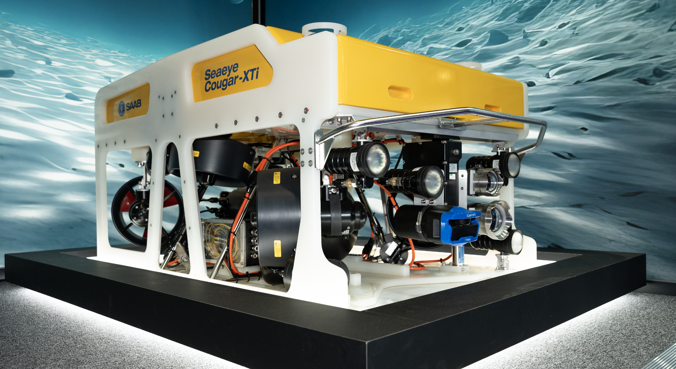
HBC Group, a leading provider of offshore inspection services, has recently purchased Saab’s Seaeye Cougar-XTi, a state-of-the-art remotely operated vehicle (ROV) known for its advanced capabilities
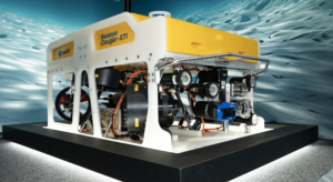 Saab’s Seaeye Cougar-XTi stood out due to its remarkable carrying capacity, a crucial factor for HBC Group's operations. The Cougar-XTi is a highly flexible and extremely powerful electric ROV, depth rated to 2000m. The ROV is fitted with six 500 Volt, DC thrusters that provide exceptional thrust for stable vehicle operations in high current environments.
These features allow the transport of survey equipment that was previously too large for HBC Group’s existing ROVs, catering to the specific needs of clients, particularly those in offshore wind farms.
The versatility of the Cougar-XTi extends to carrying specialised tools for hydrographics and geophysical services. HBC Group utilises PMAC Group’s system for cathodic protection measurements, and the manipulator arms play a crucial role in non-destructive testing.
Christian Eilersen, CEO at HBC Group Said:
“We are thrilled to elevate our offshore inspection capabilities with the Seaeye Cougar-XTi. This advanced ROV enables us to meet the unique needs of our clients in offshore wind farms, and its addition to our fleet reflects our ongoing commitment to excellence and innovation in the field of offshore inspections.”
Looking ahead, HBC Group plans to deploy the Cougar-XTi for daily inspections, allowing them to bid on tenders that were previously inaccessible due to payload constraints. The order/capability is expected to open new avenues for the company in the offshore wind sector.
Jon Roberston, Managing Director at Saab Seaeye said:
“We're thrilled to empower HBC Group with the advanced Seaeye Cougar-XTi. This sale underscores our commitment to delivering top-tier equipment, redefining standards for efficiency and reliability in offshore operations.”
In addition to the Cougar-XTi, HBC Group highlighted the success of its previous ROV purchase with Saab, the Seaeye Tiger. The company noted its reliability and higher uptime compared to previous ROVs. The Tiger has played a crucial role in recent inspections on offshore wind farms in Denmark, the UK, and Germany, particularly in waveform inspections.
The addition of the Cougar-XTi to HBC Group's fleet signifies the company's commitment to staying at the forefront of technology in the offshore inspection services sector.
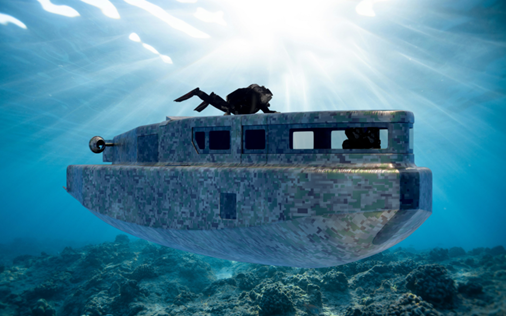
Robosys unveils first-in-class subsea AI-supported navigation and vessel control solution, following a significant contract win for a fleet of Advanced Swimmer Delivery Vehicles
The UK maritime innovator, Robosys Automation, has unveiled its new subsea advanced navigation and vessel control solution following its announcement that the business has
secured a significant contract with an undisclosed international customer for a fleet of Swimmer Delivery Vehicles.
The first-in-class Advanced Swimmer Delivery Vehicles (ASDVs) will feature Robosys’ Voyager AI-supported advanced navigation and vessel control systems, enabling critical navigational and enhanced decision-aided support to the crew.
The ASDVs will safely and comfortably enable dive units to be transported to and from remote and challenging locations. Operating in three modes, surface, semi-submerged and submerged, initially the ASDVs will be crewed, with decision-aided navigational support.
Following completion of their initial project, the ASDVs will be upgraded in a phased roll-out to feature an autonomous mode allowing autonomous self-navigation, a return to base and loiter facility whether operating on the surface or subsea.
Once the ASDVs are upgraded they will be able to be remotely operated and monitored from a mothership, Ground Control Centre (GCC), or from a Remote Operation Centre (ROC).
Voyager AI is a world-leading maritime artificial intelligence (AI) software both developed and supplied by Robosys Automation. Operators benefit from decision-aided autonomous operations with collision and obstacle avoidance as well as anti-grounding enabling safe passage, combined with AI reasoning, being crucial when operating in challenging subsea and surface waterborne environments.
Aditya Nawab, CEO of Robosys Automation, which is headquartered at the National Oceanography Centre in Southampton, UK comments, “We are delighted to unveil Robosys’ new
subsea autonomous navigation and vessel control solution. Robosys is already regarded as a leader in its advanced maritime autonomy provision to surface vessels of all types and sizes, therefore it was only natural to provide subsea solutions when further developing Voyager AI. It is an exciting time, whilst also reassuring to know that we are helping to support safer and smarter (and cleaner) seas.”
The new first-in-class fleet of Advanced Swimmer Delivery Vehicles will be launched in Spring
2025.
Discover more at www.robosysautomation.com
GEOxyz expands fleet with 3 new vessels
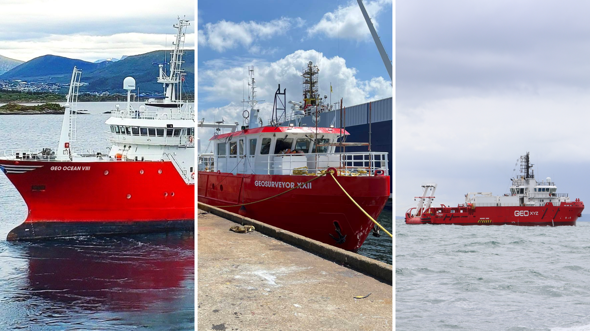
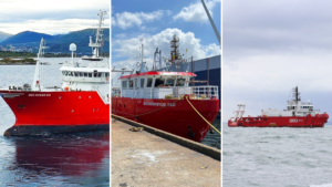 GEOxyz is excited to unveil the addition of three new vessels into its fleet, bringing the total fleet count to 30. This strategic expansion comes in response to the increasing demand for specialized survey services across the near- and offshore industries.
The new vessels, each equipped with the newest technology and advanced sensors, will enhance GEOxyz' capability to deliver survey solutions tailored to the unique needs of its customers.
- GEO Ocean VIII – This offshore vessel, set to join the fleet in late summer after undergoing a significant drydock transformation and will be fully equipped to undertake a wide range of surveys, including geophysical and geotechnical work.
Scheduled for its maiden project in September 2024.
- GEO Ocean IX – A sister vessel to our GEO Ocean V and GEO Ocean VI, the GEO Ocean IX will serve as the go-to vessel for environmental surveys and light geotechnical surveys.
Following an extensive drydock, she embarked on her first survey project in the North Sea in June.
- GEOSurveyor XXII – Designed for nearshore 24-hour operations, the GEOSurveyor XXII is currently undergoing final checks and preparations in drydock.
Ready for sea in a couple of weeks, this vessel will provide efficient solutions for nearshore survey requirements.
"We are happy to welcome these three new vessels to our fleet," said Patrick Reyntjens, CEO at GEOxyz. "In a very in-demand market like today, the expansion of our vessel portfolio is a very welcome decision. It offers more flexibility towards planning and expands the services we can offer to our customers. With these new vessels, we are very well-equipped to meet the evolving needs of our customers and deliver exceptional survey services across diverse projects. Furthermore, the expansion with two new GEO Ocean vessels supports our company's ongoing geographical growth beyond Europe, of which, we are very excited about."
Acteon awarded structural monitoring and digital twin O&M work for Kincardine Offshore Wind Farm floating turbines
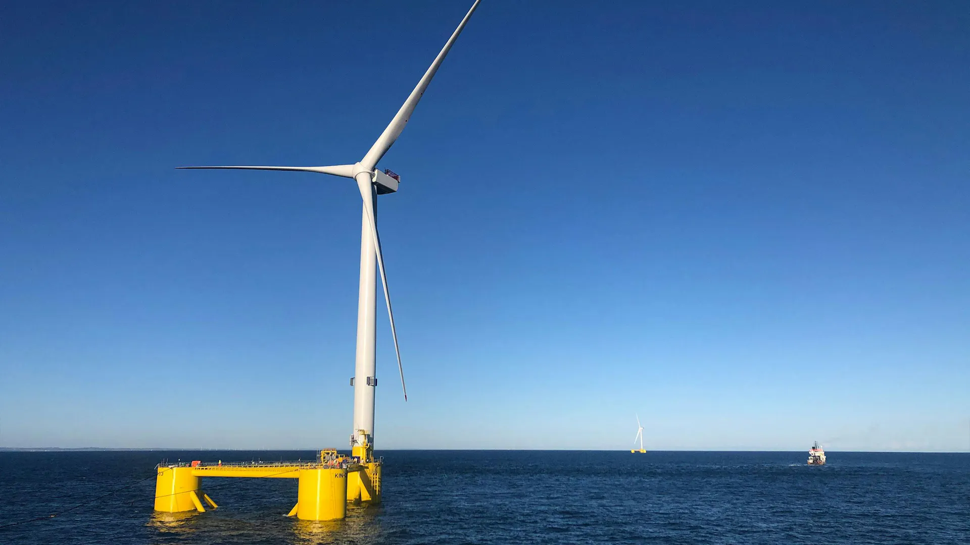
Acteon, a global leader in offshore engineering and technology services, has been awarded operations and maintenance (O&M) work comprising integrated structural health and motion monitoring, and a structural response digital twin for the Kincardine Offshore Wind Farm.
The scope of work covers the wind farm’s floating turbines, located 15 km off the coast of Aberdeen, Scotland. The work started in spring 2024 for Grupo Cobra, which operates the 50-MW wind farm for Kincardine Offshore Windfarm Limited (KOWL), whose majority shareholder is DRAGADOS S.A.
Pulse, Acteon’s established brand specialising in structural monitoring, is spearheading the design, supply, and installation of cutting-edge structural health and motion monitoring systems for the floating wind turbines. The systems will include six-degree-of-freedom motion monitoring and position and heading sensors on the platforms, additional load strain gauges and data-connectivity infrastructure.
In parallel, 2H, Acteon’s renowned advanced systems engineering brand, is developing and implementing a structural response digital twin based on machine-learning techniques. As a solution that is seamlessly integrated with the monitoring systems, this digital twin will provide unparalleled insight into the asset response during operations, give an early indication of possible anomalies, and help optimise future inspection and survey activities. The operational data will also be an invaluable tool to enable asset life extension.
Over the course of the 18-month work, Acteon will collaborate closely with Grupo Cobra to advance digital twin technology and the project is part-funded by Red.es (Grant ID: 2021/C005/00149745), through the Spanish Recovery and Resilience Plan, funded by the European Union (Next Generation EU).
Kincardine Offshore Wind Farm, featuring five V164-9.5 MW turbines mounted on Principle Power WindFloat platforms, is one of the world’s largest operating floating wind farms. Positioned in water depths ranging from 60–80 metres, these turbines have been successfully generating clean energy since October 2021.
“With eighty per cent of the world’s offshore wind resources in deep waters, floating turbines open new opportunities to harness clean energy,” says Juan Antonio López, Grupo Cobra O&M Manager. “Scotland is at the leading edge of floating wind developments. Kincardine demonstrates the readiness of floating wind, and Acteon’s work in helping us to understand how the assets respond to real life operating conditions will be invaluable for managing this wind farm and providing the insight we need to improve future floating wind projects.”
“Providing an integrated monitoring and digital twin solution is vital,” says Tim Eyles, Vice President, Acteon. “Our technologies are specifically selected for dynamic floating wind assets. Our extensive long-term experience of structural monitoring and design of dynamic offshore assets will inform the digital twin response modelling and assessment of the floating turbines.”
MacArtney and Elettra Collaborate to Enhance INGV's Subsea Monitoring Capabilities
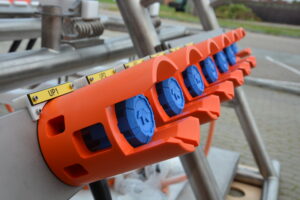
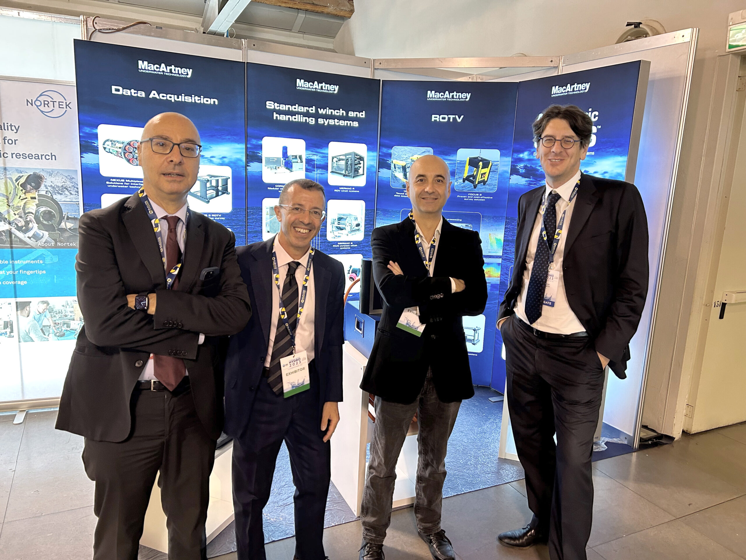
MacArtney is proud to announce a partnership with Elettra Tlc to deliver critical subsea infrastructure for the Italian National Institute of Geophysics and Volcanology (INGV), enhancing its capacity for environmental monitoring and research.
The scope of this collaboration involves installing and connecting a new subsea power, communication and data transmission network located 2,200 metres deep and 35 kilometres offshore from Catania, Italy, where INGV will strongly enforce its existing marine site as part of the ITINERIS project (Italian Integrated Environmental Research Infrastructures System).
Elettra and MacArtney have joined forces to supply essential and dependable subsea infrastructure, ensuring high-quality performance and data efficiency for INGV's operations.
"We are thrilled to collaborate with MacArtney on this significant project for INGV," said Elio Rubino, Managing Director of Elettra Tlc. "Our combined effort ensures a robust and reliable system, providing INGV with the tools necessary for critical environmental monitoring."
Comprehensive technical scope
In this partnership, Elettra and MacArtney will handle different but complementary responsibilities. Elettra will supply the main electro-optical submarine cable (MEOC). Their scope also includes ensuring robust connections and managing the installation and testing of the complete system at the operating site.
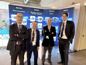
MacArtney will provide the cable termination assembly (CTA) and a customised cable termination frame (CTF) as integral components of an advanced subsea sensor platform. The CTF serves as both a distribution hub and connection point for the sensor platform, allowing for seamless integration of scientific instruments into the power network and efficient data transfer to and from the ground station, utilising hybrid ODI penetrators and ROV-mateable connectors. At the heart of this platform is the medium voltage conversion system (MVC) and PBOF transformer canister, which are essential for its smooth operation.
The scope also includes a power supply and control system, a remote management system for INGV's operational oversight and maintenance, and factory and site acceptance testing to check and verify compliance with the preapproved specifications.
Significance and impact through joint efforts
"Our collaboration with Elettra marks a significant milestone in advancing INGV's subsea monitoring capabilities," said Vincenzo Mauro, General Manager at MacArtney Italy. "By combining our strengths, we ensure that INGV can rely on a powerful and efficient infrastructure for their research. Additionally, this project highlights MacArtney's growth in delivering innovative underwater solutions."
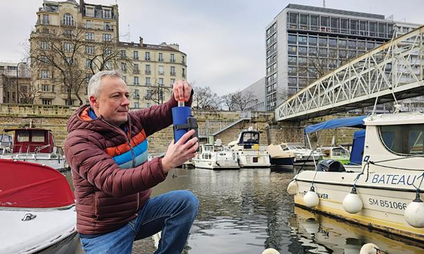
Fluidion® launches live 2024 Olympics Seine Water Quality Data as part of Open Data initiative
One month prior to the 2024 Olympic opening ceremony, our partners Fluidion is proud to announce the launch of the live water quality data broadcast for the Seine River. This initiative is part of Fluidion’s Open Data Initiative, accessible on the Fluidion Open Data Initiative Website.
With the 2024 Olympics set to host several water-based events in the Seine River, addressing water quality concerns has become crucial. As a leader in rapid microbiology instrumentation and a deep-tech company founded on scientific expertise, Fluidion is deploying the state-of-the-art ALERT technology to provide up-to-date water quality insights for the Olympic venue. Fluidion has maintained an intensive monitoring program in the Seine River since 2016.
As athletes and spectators from around the world gather in Paris for the 2024 Olympic Games, Fluidion is committed to transparently informing the public about water safety using accurate and scientifically validated data.
Key Highlights:
- Live Data Access: The Open Data Initiative offers live updates on water quality at the 2024 Olympic site, ensuring transparency and safety for all water-based activities during the Olympics.
- Advanced Automated Monitoring Technologies: Fluidion’s ALERT technology provides rapid, accurate, near real-time measurements of fecal indicator bacteria such as E. coli, enabling timely and automated results delivered directly in the Cloud.
- Laboratory Validation: We display side-by-side results obtained using standard laboratory methods.
- Managing Uncertainty: In addition to daily measurements, we provide confidence intervals to highlight measurement uncertainty, crucial for managing risks in microbiology.
- Getting the Science Right: We provide a wealth of additional information beyond traditional measurements. Fluidion ALERT instrumentation offers both planktonic and comprehensive E. coli counts, providing a deeper understanding of waterborne health risks not captured by standard laboratory methods. We also collect DNA-based measurements of human tracers.
- Accounting for Environmental Factors: We also provide environmental data such as rainfall and river discharge to correlate their effects with water quality.
- Data History: We offer high-resolution time series of E. coli levels in the Seine starting in early April, showcasing improvements in water quality.
- Global Impact: With technologies deployed worldwide, Fluidion helps communities, utilities, and municipalities manage water quality effectively and sustainably.
“We are excited to support the 2024 Olympics by transparently providing live water quality data for the Seine River.” said Dr. Dan Angelescu, CEO of Fluidion. “Our mission is to develop scientifically-validated automated monitoring solutions that promote a healthier environment and reduce the public health impacts of pollution. ”
Fluidion invites the public, athletes, and environmental enthusiasts to visit the Open Data Initiative website to monitor the Seine’s water quality in the run-up to and during the Olympics. This transparency not only enhances safety but also promotes environmental awareness and responsibility.