

GeoAcoustics Ltd expanded their dealer network for Canada and North America
GeoAcoustics Ltd, the UK based manufacturer of side-scan, bathymetry and sub-bottom profiling systems have recently expanded their dealer network for Canada and North America through the appointment of Canadian based Dasco Equipment Inc and US based Telestra Technologies.

Dasco Equipment Inc based in Charlottetown, Canada have a 30 year track record in the supply of hydrographic instrumentation and will be able to represent GeoAcoustics’ product from their bases in both East and West Canada.
Telestra Technologies based in Katy, Texas are an established marine solutions provider with 4 locations across the US.
For more information visit: www.geoacoustics.com

IIC Technologies and XOCEAN Deliver Ground-breaking Survey of Lake Superior Seabed for the Canadian Hydrographic Service
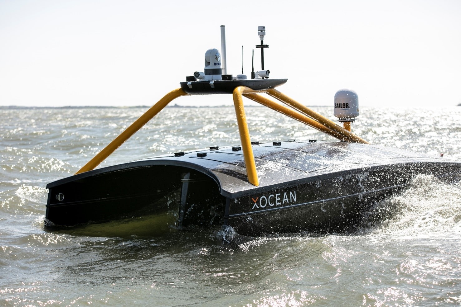
In a substantial move forward for the Canadian marine industry, two XOCEAN Uncrewed Surface Vessels (USVs), remotely controlled via satellite, took to Lake Superior this winter to undertake pioneering survey work for the Canadian Hydrographic Service (CHS) in partnership with IIC Technologies.
The project marks the first time that USV technology was used to gather bathymetry data in inland waters in Canada.
CHS contracted IIC Technologies to acquire a high-resolution seabed survey in water depths up to 200m, of over 800km2 off Thunder Bay, Ontario, using USV technology. IIC partnered with XOCEAN, who provided and remotely operated their XO-450 USVs from XOCEAN’s Control Centres in the UK and Ireland, while IIC provided the Party Chief, shore-based data processing, and logistical support.
The uncrewed vessels are around the size of an average car (4.5 metres) and half the weight (750kg) and are remotely monitored and controlled 24/7 via a satellite connection by a team that can be located anywhere in the world. XOCEAN’s USVs offer significant benefits including increased safety with operators remaining onshore, survey efficiency due to multiple-day mission 24/7 operations, drastically reduced local resourcing requirements, and carbon-neutral operations which together lead to significant economic savings.
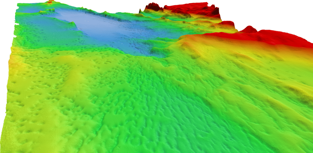
Throughout the mission, a team combining IIC Technologies Hydrographers and Data Processors and XOCEAN USV Pilots and Surveyors remotely monitored the USVs to ensure safe operation of the vessels and quality of data acquisition. The success of this project demonstrates the highly flexible and collaborative nature of this new technology, enabling industry experts to have direct access to real time data, from any location. Given ongoing COVID-19 restrictions, XOCEAN continues to prove the resiliency of its operations by partnering with experts, such as IIC Technologies, who also performed an active support role on site with the USVs while in Thunder Bay.
Dave Bazowsky, Engineering Project Supervisor, said: “CHS wanted to evaluate the operational readiness of a commercial off-the-shelf autonomous technology in a real working environment. The area chosen in northern Lake Superior lies within a Secondary Low Impact Shipping Corridor and the world’s largest freshwater National Marine Conservation Area. It was also selected to simulate an analogous working environment one may expect in the Canadian Arctic. The IHO S-44 Order 1A data collected in this area will be used to update navigational publications used to facilitate safe and efficient navigation and will also contribute to the Blue Economy in general.”
John Conyon, Director of Hydrographic Operations, said: “The cooperation and flexibility shown by XOCEAN and CHS were key to successfully performing this project in very challenging late fall conditions in northern Lake Superior. The XOCEAN ASV’s performed well through storms and sea ice, providing a stable platform that enabled the acquisition of high-quality bathymetric data that meets CHS stringent requirements”
Commenting on the project, James Ives, CEO of XOCEAN said: “Our USV platform has demonstrated itself to be a safe, reliable and carbon neutral solution for the collection of ocean data. We are delighted to be working with IIC Technologies on this ground-breaking project delivering data for the Canadian Hydrographic Service.”
For more information visit: www.xocean.com
Greensea Receives US NAVY Award to Advance Standoff Command and Control
Greensea's open architecture technology on Remotely Operated Vehicles furthered by Small Business Innovation Research Phase II grant
Greensea Systems, Inc. creator of OPENSEA®, the open architecture robotics platform for the marine industry, is pleased to announce the award of a Phase II Small Business Innovation Research (SBIR) ASAP grant totaling $1,100,000, with option for additional funding, for the continued development of Standoff Command and Control of Remotely Operated Vehicles (ROVs). This project has been funded in whole or in part with Federal funds from the Naval Air Warfare Center Aircraft Division, under Contract No. N6833521C0113.
The Phase II award will further the development of Greensea's long range standoff command and control system for ROVs towards providing the US Navy a capability of conducting water-borne Explosive Ordnance Disposal operations with marine robotics from a safe standoff distance. The standoff system is hardware, transmission, and vehicle agnostic and provides high levels of autonomy for the ROV as well as the coordination of launch and recovery, vehicle tether, and host USV platform. Greensea's long range standoff system leverages almost 15 years of developing supervised autonomy systems for ROVs and by virtue of being built on OPENSEA, is entirely open architecture. Commercial applications of this technology include operating highly integrated ROVs and robotic systems from Unmanned Surface Vessels by operators located anywhere in the world.
Ben Kinnaman, CEO of Greensea, is the Principal Investigator of this Phase II SBIR award. “The long range standoff command and control of ROVs is the single best solution to keep the warfighter safe by getting them as far as possible from a subsea threat,” notes Kinnaman. Peter Kerson, Program Manager for EOD Technologies at Greensea, adds “standoff command and control will dramatically increase flexibility and maneuverability of maritime expeditionary EOD forces, and that same flexibility will be invaluable to industry users who want to centralize ROV operations, reduce personnel who have to go to sea, and migrate to fully unmanned offshore services.”
While the technology is being developed for the military, Greensea is working with leading marine industry companies on commercialized variants of the technology. Greensea's technology will directly address the shortage of offshore personnel for ROV operations including near-term shortages associated with the COVID pandemic.
For more information visit www.greensea.com

Teledyne Marine Announces New Upgraded Universal Topside System
Teledyne Benthos is pleased to announce the availability of its new UTS-9500 Universal Topside System used to communicate with and command their full line of acoustic modems and releases. The UTS-9500 offers customers a CE marked, enhanced replacement to the UTS-9400 unit. The updated portable topside delivers a highly intuitive and flexible Graphical User Interface (GUI) that removes the need for an additional laptop, something particularly useful for deployments from RHIBs or smaller vessels. The redesigned UTS-9500 is also lighter than its predecessor, adding to the system portability, and features new rechargeable lithium ion battery technology that will lessen required maintenance cycles. Other new features include enhanced corrosion resistance, improved system safety, and an enhanced communication port.
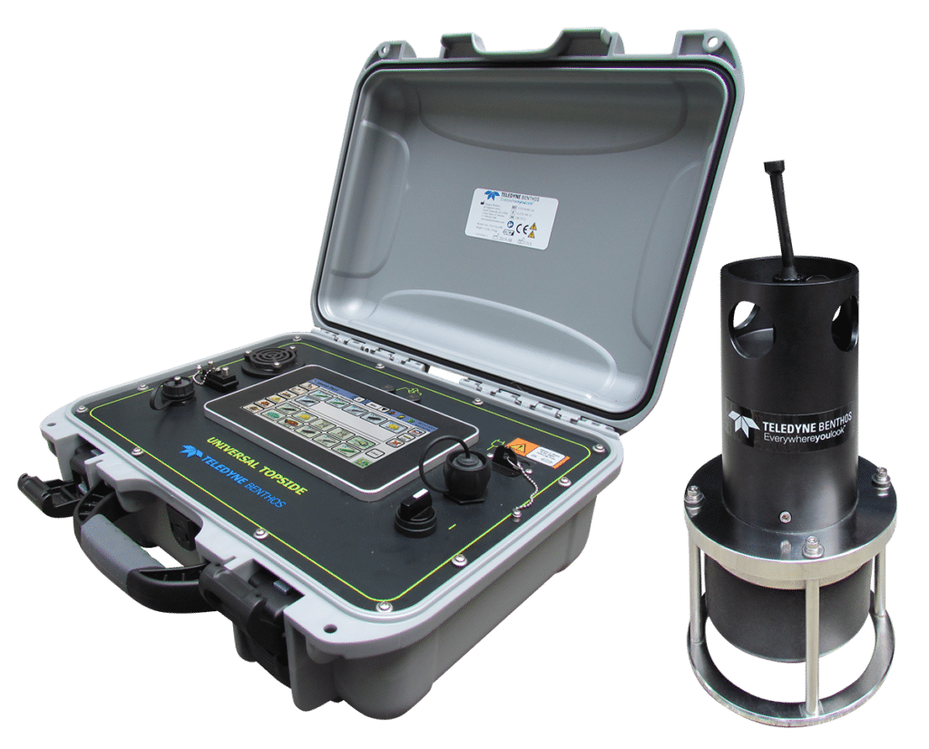
As with the UTS-9400, the UTS-9500 also offers optional GNSS functionality, allowing users to survey in their mooring without the need for an external PC. This saves valuable time and money by allowing the user to precisely calculate and record where their acoustic release and/or modem is deployed for fast and easy detection and recovery using a minimal set of hardware. For more information on the UTS-9500, visit: www.teledynemarine.com/UTS-9500
Aleron Group Announce Strategic Organisation Restructure to enhance Client Offerings
Aleron Group have announced a high-level organisation restructure to align with their strategic growth plans to consolidate product and service offerings to their global clients. The Aleron Group consisting of individual entities, Aleron Subsea and ROVQUIP, will now formally be recognised as the single entity of Aleron Limited.
The division of Aleron Subsea was originally established in 2009 and founded on decades of experience in Remote Operated Vehicles. Aleron Subsea design and manufacture flexible ROV systems including AUXROV, TRACKROV and most recently MultiROV. Joining the group in 2014, ROVQUIP, provided the complimentary service of custom and standard subsea tooling for either purchase or rental globally, as well as expert knowledge in concept design.
Gary McConnell, Commercial Director, Aleron, said “Combining the decades of experience housed with these brands will strengthen the Aleron packaged solutions, as well as bringing increased efficiencies to our clients by being able to contract with one entity, Aleron Limited”.
The Aleron restructure follows their recent expansion to an enhanced new facility in Aberdeenshire. Dedicated to their company mission, Aleron will continue to challenge conventional thinking, offering their clients responsive, efficient and bespoke specialised ROV solutions globally.
For further information on Aleron Limited’s products and services, visit www.aleron-group.com or email [email protected].
Using innovative acoustic technology to prepare for the America’s Cup
INEOS TEAM UK needed accurate measurements of speed through water while training for the America’s Cup in waters with complex current flows. How did Nortek’s acoustic Doppler instrumentation meet their stringent demands for high performance?
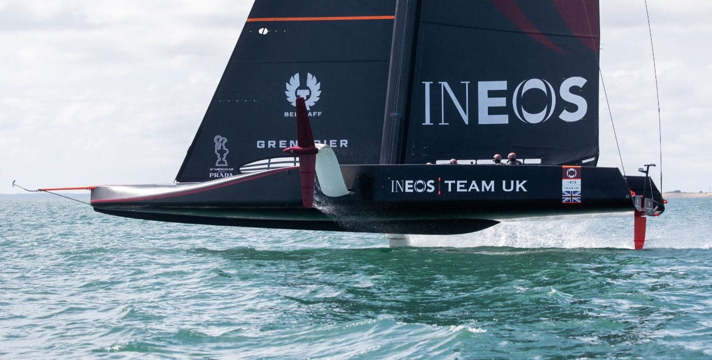
INEOS TEAM UK was formed to challenge for the 36th America’s Cup, to be held in New Zealand in 2021. They will compete in their new AC75 yacht named Britannia, a foiling monohull that flies over water on T-foils at speeds up to or exceeding 50 knots.
The team represent the Royal Yacht Squadron, one of the most prestigious yacht clubs in the world, and are based out of Portsmouth on the south coast of Britain, using the Solent as their training waters.
“The Solent’s reputation as a venue for sailboat racing is well-known. Its strong tides and complex geography and wind patterns make it an interesting and fun place to race,” says INEOS TEAM UK’s Technology Coordinator, Mark Chisnell.
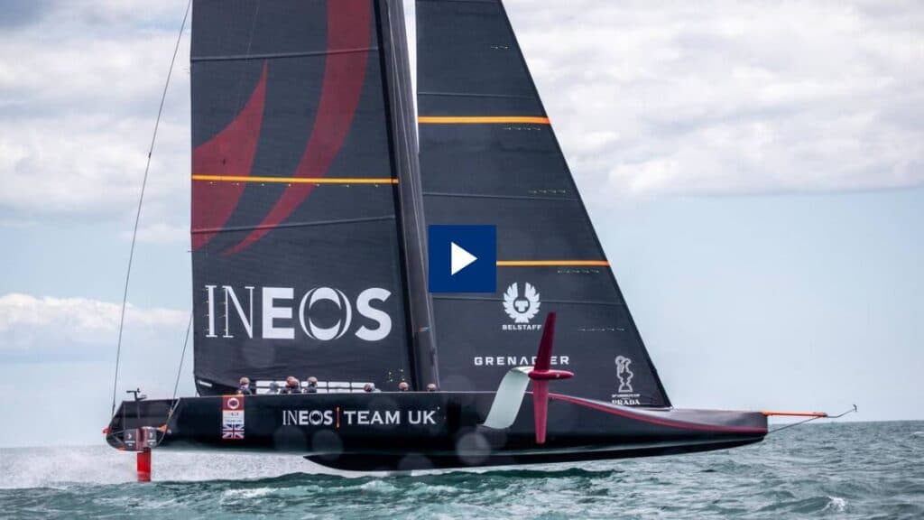
Watch video: Using innovative ocean technology to prepare for the America’s Cup
“Unfortunately, these conditions can make it a tricky venue for testing America’s Cup yachts, as satnav cannot be relied on for accurate performance information because it only measures motion relative to the seabed. The complex and ever-changing tidal current flows of the Solent add an unknown vector into the data that makes it difficult to accurately measure the yacht’s true speed.”
Measuring speed through water
The tide can flow at speeds in excess of four knots in some areas of the Solent, and if not measured correctly could potentially introduce a significant error in the test data.
“We try to sail in areas with weaker tidal flow to mitigate the error from satnav speed measurements,” adds Chisnell. “And we have tidal charts to help us work out the current rate in the test areas, but measuring the boat’s speed through water will give us much less potential error in the data.”
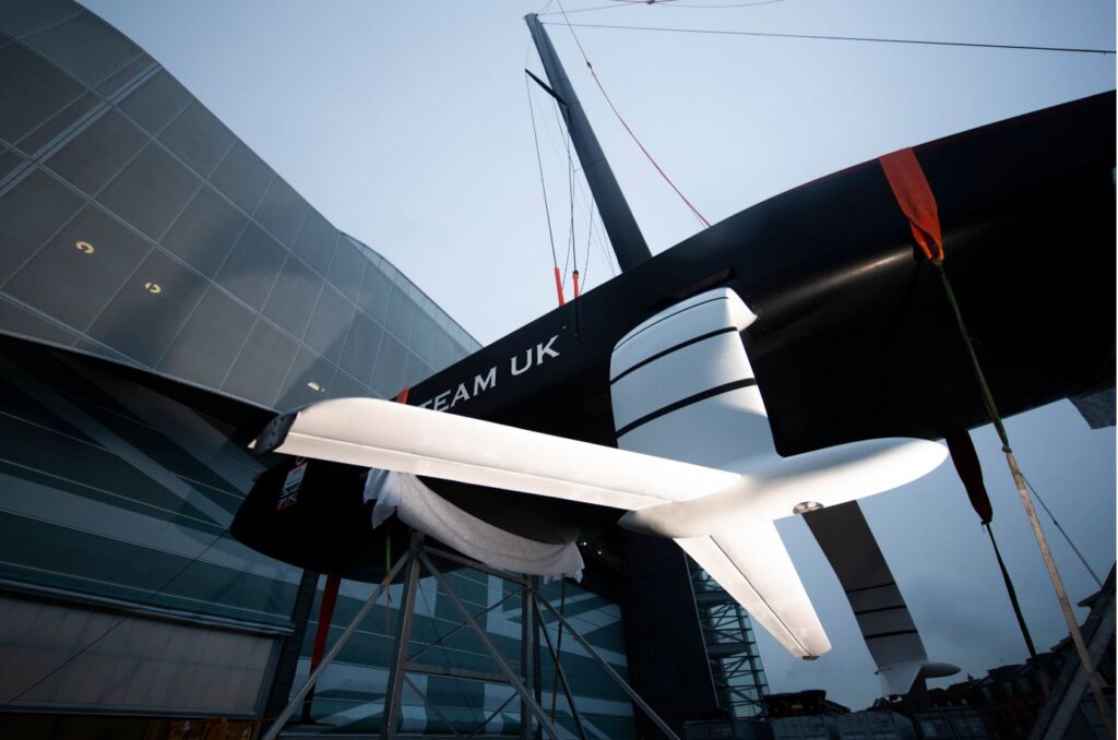
Finding the solution
The team needed to measure velocity through water very accurately. The team’s review of the market led them to oceanographic instrumentation specialist Nortek, who have had great success with their technologically advanced and accurate Doppler Velocity Logs (DVLs) for subsea navigation. These sensors use an acoustic Doppler measurement to estimate velocity relative to the water column.
“We knew that the Nortek DVL had been used successfully in ocean racing, involving high-performance monohulls that could reach 30 knots. So while the DVL was intended for the slow speed and high accuracy demands of subsea navigation, there was evidence that the sensor might cope with the speeds of the AC75,” says Chisnell.
Integrating a cutting-edge acoustic speed log
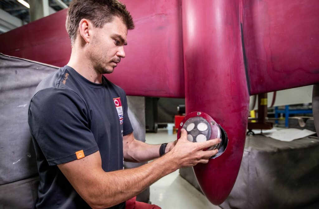
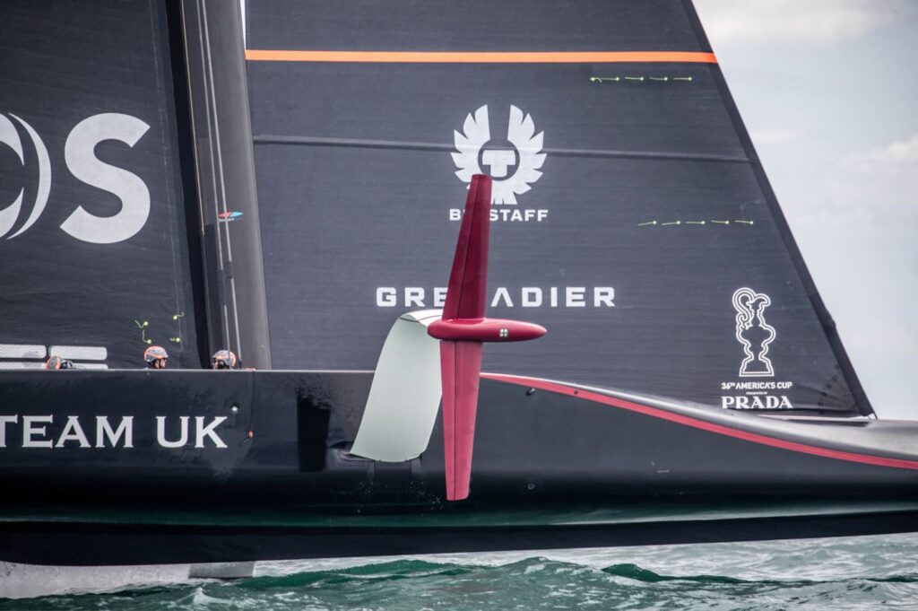
The solution was to mount a tailor-made Doppler speed log from Nortek inside the bulbs of each of Britannia’s T-shaped foils, with a flooded chamber sealing the space and forming a smooth interface with the external face of the bulb. This provides very accurate speed through water measurements without affecting performance.
“We recessed the speed log into the bulb, which was flooded. It was then covered with a piece of acoustically neutral plastic, a polycarbonate plate. This achieved the two goals of an unbroken (or measurable) acoustic path from the transducer into the water column, while maintaining a very smooth and efficient underside to the bulb,” explains Chisnell.
“We’re very happy to have had Nortek as a partner in this project. Nortek’s Doppler speed log is an impressive technical achievement. Having accurate knowledge of the inflow vector to the lifting foils has given the team new insights into the boat’s dynamic behavior and performance,” says Nick Holroyd, Chief Designer, INEOS TEAM UK.
Building on a tradition of marine problem-solving
Nortek has a long tradition of solving technically challenging problems in the marine environment.
“INEOS TEAM UK approached Nortek knowing that we had been down a similar path before. However, the challenge presented was to measure speed through water accurately from a foiling sailing machine – something that has not been done before now,” says Torstein Pedersen, Development Engineer at Nortek.
The success of this solution was very much cooperative: Nortek provided the modified electronics and operational advice, while the INEOS TEAM UK technical team ensured an optimized installation in the foil.
“We are familiar with an iterative process for these custom solutions, but in this instance I think we were all surprised how well it worked right out of the gate. When we now watch Britannia tearing across the ocean surface, balanced merely on its foils, it is hard to believe that there is a little speed log just below the surface pinging away and answering questions,” Pedersen adds.
Contacts for further information: www.ineosteamuk.com

KVH Partners with GreenSteam for KVH WatchMaritime IoT Solution
KVH Industries, Inc., (Nasdaq: KVHI), announced today that GreenSteam, developers of vessel performance optimization solutions for a sustainable shipping industry, has joined the KVH Watch® Solution Partner program and will offer the KVH Watch service as part of its enhanced performance platform for improved data mobility. KVH Watch’s dedicated connectivity will support GreenSteam’s core services, facilitating the movement of data from vessels to shore-based analysts more frequently and reliably in real-time. This will enable customers to better understand the factors leading to fuel wastage and develop more effective sustainability optimization strategies, ultimately reducing costs.
“The lifeblood of GreenSteam is data volume, however, without the ability to move this data off a ship in a timely manner to enable rapid assessments and responses, its impact is lessened,” says Daniel Slater, head of business development at GreenSteam. “As vessels are becoming increasingly sophisticated data generators, this partnership with KVH Watch will enable us to benefit from significant advances in satellite communications by improving the flow of information. This in turn will support shipowners and charterers to make better operational decisions, saving time and money, while reducing emissions.”
“This is an excellent opportunity for the maritime sector to capitalize on the exceptional gains made in satellite communications and performance optimization technology in recent years,” says Sven Brooks, senior director of IoT business development for KVH. “The combination of our Watch HTS connectivity with GreenSteam’s machine learning solutions can result in operational efficiencies, cost savings, and increased sustainability for fleets. This represents one more way that shipping is benefitting from digitalization.”
Digitalization is proving to be a transformative tool for the maritime industry, but with the sector now evolving beyond the data collection stage, attention is turning to the management, storage, and transfer of the data generated. Without real-time data flow from the vessel, machine-learning solutions must rely on incremental data transfers, therefore limiting the accuracy and confidence of the IoT analysis and prediction. With dedicated satellite connectivity, shipowners can capitalize on real-time data analysis to support vessel optimization throughout the course of a sea voyage.
KVH Watch is an IoT Connectivity as a Service solution that provides Flow, secure 24/7/365 machine-to-cloud satellite connectivity for remote monitoring of onboard equipment plus the ability to perform on-demand Remote Expert Interventions using video, voice, or text via KVH’s global HTS network. KVH Watch is designed for maritime system optimization providers such as GreenSteam, maritime equipment manufacturers, multicard service providers, and shipyards seeking affordable monthly subscription-based connectivity that L-band and cellular services cannot deliver at deep sea.
KVH is a mobile tech innovator that provides connectivity solutions for commercial maritime, leisure marine, and land mobile applications on vessels and vehicles, including the award-winning TracPhone® and TracVision® product lines, the global mini-VSAT Broadbandsm network, KVH Watch maritime IoT solutions, and AgilePlans® Connectivity as a Service (CaaS). The company’s KVH Media Group provides news, sports, and entertainment content with such brands as NEWSlink™ and SPORTSlink™.
For more information, please visit kvh.com/watch
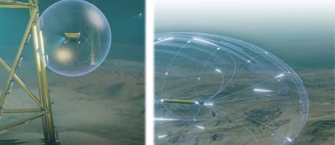
ELWAVE breakthrough “electric sense” perception technology for underwater vehicles
ELWAVE secures 2 million euros funding to commercialize its breakthrough “electric sense” perception technology for underwater vehicles, drones and robotics.
With its patented “electric sense” technology, manufacturers and operators of underwater and industrial robots can access a unique real-time 360° detection sensor to improve safety and productivity of their operations.
ELWAVE, an industrial designer and manufacturer of innovative electromagnetics sensors for the underwater and industrial robotics, announced today that it has completed its first capital raise. The funds will support the company’s global growth ambition, industrialization and commercialization of its first products for underwater robotics.
The funding round was led by SOFIMAC Innovation with co-investors Litto Invest Fund and Atlantique Vendée Innovation Fund. Bpifrance and banks have completed this capital raise with other financial supports. This equity financing comes as ELWAVE scales to meet strong demand in the underwater robotics, especially for wind offshore market and underwater autonomous vehicles (AUVs).
ELWAVE was founded in 2018 to valorize more than 10 years of top-level academic research on the « electric sense » technology from the Biorobotic Laboratory of Institut Mines Telecom Atlantique. Electric sense (or active electrolocation) is an electromagnetic perception mode used by tropical fishes living in muddy and cluttered waters in which vision and acoustic perception are inefficient.
Based on this biomimetics approach, ELWAVE solution is the only one to provide a real-time 360° perception for underwater and industrial robots, either remotely piloted and autonomous ones. ELWAVE technology can detect, locate and characterize (shape, size, metallic or non-metallic) any type of objects in simple and complex environments. ELWAVE will develop dedicated and market focus solutions. ELWAVE is especially completing a solution for the tracking of buried objects in underwater sediments such as cables, pipelines or mines.
Providing unmatched performances by other classic acoustic and magnetic technologies, ELWAVE currently works with leading underwater robotics companies such as TOTAL, SAIPEM, SUBSEA7, IXBLUE, NAVAL GROUP and others for the development of its solutions and their implementation on client's vehicles.
The financing will enable ELWAVE to industrialize and commercialize its first products and to pursue its developments in electronics and artificial intelligence. Shallow water applications, such as wind offshore cables inspection, UxO detection (unexploded mines from World War I and II) and ROV/AUV navigation
are first targeted.
“We are thrilled by the support of ambitious, successful investors who see the disruptive potential of electric sense technology to increase safety and productivity of operations in high-growth markets such as offshore wind” says Pierre Tuffigo, CEO and founder of ELWAVE.
For more information, please visit www.elwave.com
WHOI Appoints Douglas C. Webb as Oceanographer Emeritus
Teledyne Marine is delighted to announce the appointment of Douglas C. Webb, founder of Teledyne Webb Research, as Oceanographer Emeritus at the Woods Hole Oceanographic Institution effective January 1, 2021. This peer appointed honorary position has been bestowed upon Doug Webb in recognition of his contributions to WHOI and to oceanographic science and engineering world-over.
When asked about the appointment, Dr. Richard Murray, Deputy Director and Vice President for Research at Woods Hole Oceanographic Institution commented, “Throughout his career, Doug Webb elegantly crossed and merged the boundaries of science and technology, all the while setting a terrific example of how to be farsighted to the future while also getting whatever is before him simply “done”. It is a true honor for Woods Hole Oceanographic Institution to grant him this honorary and esteemed appointment.”
 Although always quick to acknowledge the contributions of others, Doug is a gifted engineer and inventor whose pioneering work can be credited for fundamentally changing the way in which scientists are now able to observe the interior of the oceans. From his graduate work at Manchester University, where he demonstrated the first prototype transistorized computer, Doug brought individual transistor technology with him to WHOI where he developed accurate timing for acoustically tracking langrangian floats (integrated circuits were not yet available). Throughout his career, Doug has been an early adopter of enabling technologies (i.e. silicon chips, ceramic transducers, satellite communications, GPS, etc.), and continually brought those technologies to bear to solve a set of problems that helped resolve ocean dynamics.
Doug recognized early on that one of the key hurdles facing the oceanographic community and data collection was the ocean’s grand scale and the limited size of the research fleet. He set out to develop and create a toolbox of long-endurance remote sensing platforms that would provide scientists with a better look into the world’s vastly under-sampled oceans. His innovative work includes low-frequency acoustic sound sources used for water mass tracking, long range navigation, and tomography (SOFAR, RAFOS, Tonpilz), Vertical Current Meters (VCMs) to measure water chimney convection, profiling floats (ALACE and APEX) that evolved into the ARGO program, and the genesis of ocean gliders (Slocum). The sound sources are still in use today for a variety of applications. The VCMs morphed into the floats with the added capability of electromagnetic probes (EM-APEX) for water velocity measurements that are now air deployed from C-130 planes. Over the last 20 years of the Argo program, the floats have made over 2 million ocean profiles, or four times as many profiles as all other ocean observing tools combined! The Slocum gliders, capable of crossing ocean basins with well over a year of endurance, are routinely being used to measure and monitor many facets of the ocean including biogeochemical properties, whale and penguin movements, and facilitating hurricane intensity predictions.
“I continue to have the good fortune of working alongside Doug through many shared adventures. Doug’s spark of inquisitiveness and creativity is contagious, and we strive to follow the advice that he gave to Rutgers students after the first Slocum glider Atlantic Ocean crossing – “Work hard, have fun, and change the world”” Clayton Jones, Senior Director of Technology, Teledyne Marine
For more information visit: www.teledynemarine.com
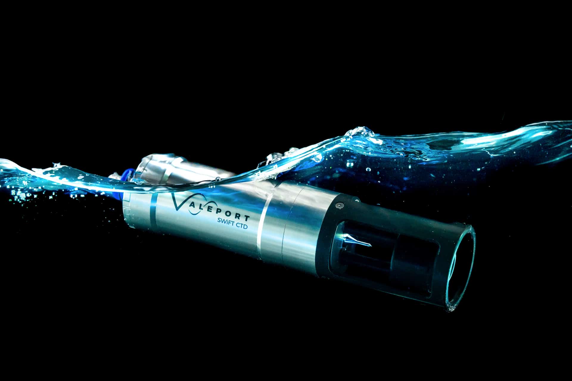
Valeport introduces new SWiFT CTD profiler
Designed with the intention of a seamless workflow, the new SWiFT CTD is the next generation of Valeport’s popular SWiFT profiler range and delivers enhanced accuracy and versatility for those requiring CTD measurements.
The SWiFT CTD profiler from Valeport, a leading oceanographic and hydrographic instrumentation manufacturer, provides survey-grade sensor technology coupled with the convenience of Bluetooth connectivity, rechargeable battery and an integral GPS module to geo-locate each profile.
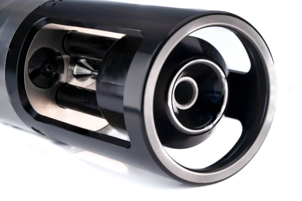
Using Valeport’s world-leading high accuracy sensor technology to combine sensors for multiple profiles in a single drop, the SWiFT CTD features a new fast response temperature probe and operates down to 500m as standard, delivering directly measured Conductivity, Temperature and Depth.
In addition to the directly measured CTD, computed Salinity, Density and Sound Velocity is calculated using the UNESCO international standard algorithm and the Chen and Millero equation. Data can be quickly and easily downloaded wirelessly, and uses Valeport’s new Ocean software for iOS, Android and PC platforms. Data can be instantly shared in industry standard data formats.
Ease of use is at the heart of the SWiFT range and the new SWiFT CTD not only makes any problematic battery changes a thing of the past and delivers fully automated data transfer with no user input required, it also features Valeport’s signature SWiFT magnetic switch ring. The switch ring is easy to operate even with cold hands, it simply turns through 90 degrees and reassuringly clicks into position. The end cap features user-friendly LED status indications for GPS, battery and communications.
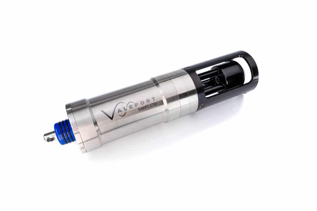
With an operational battery life of up to five days and the convenience of charge via USB, the SWiFT CTD is intended for offshore, coastal, harbour and inland environmental and hydrographic survey use.
“Developed for those who need precise CTD data for scientific applications, this is the first time that measured CTD has been available with all the benefits of our SWiFT profiler; ease of use, Bluetooth connectivity, rechargeable battery and GPS. The new SWiFT CTD delivers the highest quality CTD profiles in a compact, robust and portable package.” commented Guy Frankland, Valeport head of marketing.
Constructed from titanium to provide unmatched durability, the CTD sensors are housed in a strong acetal sensor guard. An optional deployment cage is also available to bolt onto the instrument to help get the SWiFT CTD to depth in fast flowing currents.
The new SWiFT CTD is now available to order.
For more information contact: [email protected] or visit www.valeport.co.uk