

Next Geosolutions expands offshore services with trenching work on the Bouri Gas Utilisation Project
Next Geosolutions, one of the leading international players in marine geoscience and offshore construction support services for the energy sector and listed on Euronext Growth Milan market, announces the completion of post-lay trenching work as part of the Bouri Gas Utilisation Project (BGUP).
This initiative marks a further step forward in the Group’s development, expanding the range of solutions offered to customers through the integration of trenching services, in line with the growth strategy outlined in recent market announcements.
Within BGUP, operational activities are carried out in support of the installation operations led by Saipem, thanks to the contribution of Rana Subsea and the collaboration, for trenching activities, with Pharos Offshore Group, the supplier of the specialist technologies used. The initiative reflects NextGeo’s approach, based on the integration of expertise and strategic industrial partnerships to enhance the value offered across the offshore services chain.
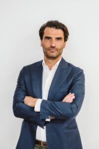
Alessandro Buffa, CEO of Rana Subsea, commented: “With this initiative, we are reaffirming our ability to meet the highest industry standards in trenching as well – a new service now included in the range of solutions NextGeo offers its clients, including through collaboration with strategic partners. At RANA Subsea, we are particularly proud to contribute, through our engineering and operational expertise, to strengthening the Group’s position in highly complex projects.”

Multi-robot demo showcases new Plymouth subsea test range
A new underwater trials site designed to accelerate UK marine autonomy and ocean sensing has completed its first major test thanks to a live, multi-marine surface and subsea robotic platform demonstration.
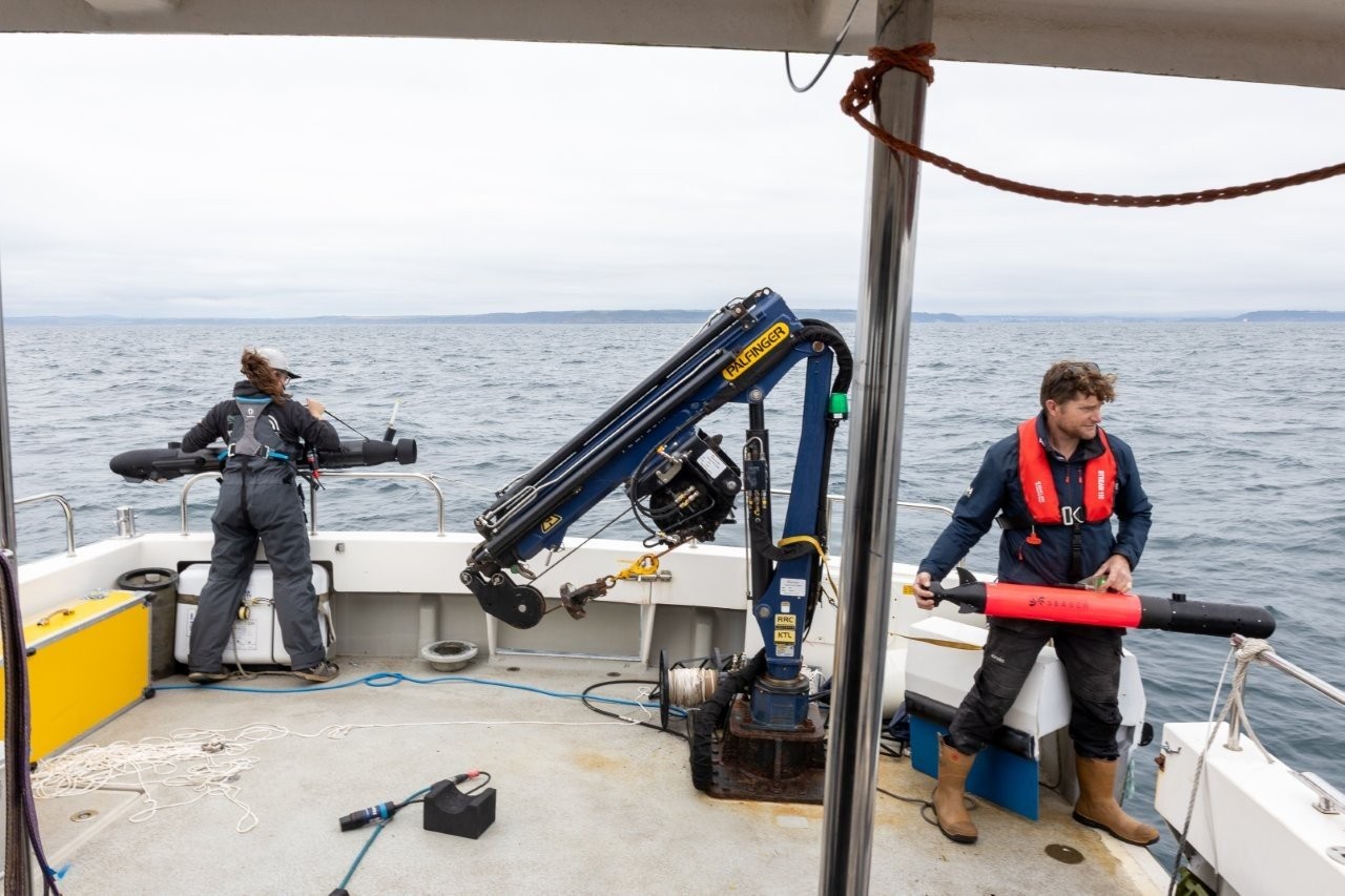
The Smart Sound Connect Subsurface (SSCS) project, part of Smart Sound Plymouth, led by the University of Plymouth, with Plymouth Marine Laboratory (PML), saw platforms from ACUA Ocean, ecoSUB Robotics, Seaber and Sonardyne working together above and below the surface.
The all-day collaborative demonstration enabled visitors from business, science, defence and national bodies to view the potential of the three-year, £1.2 million SSCS project.
Delivered by Sonardyne, the SSCS’ infrastructure extends Smart Sound Plymouth — already the UK’s premier marine autonomy testbed — and the Western Channel Observatory, through a seabed node array for absolute positioning and communications, alongside other intelligent sensors within a highly characterised environment.
Professor James Fishwick, Head of Innovation for Smart Sound Plymouth (at PML), said: “Smart Sound Plymouth is going from strength to strength. The addition of the subsurface network enables even greater integration between platforms and supports our state-of-the-art testing capabilities for autonomous vehicles and advanced technologies. It complements the high-speed military-encrypted network above the surface and helps provide a fully connected environment. This successful technology demonstration further reflects Plymouth’s place as a world-leading hub for marine autonomy.”
Dr Lilian Lieber, Senior Research Fellow at the University of Plymouth, said: “SSCS provides a unique opportunity to test new ocean observing technologies. For me, its value lies in turning prototypes and field-tested technologies into trusted data streams, accelerating ocean observing towards autonomous sensing and near-real-time insight. This helps turn ocean data into actionable intelligence for climate resilience, early warning and preparedness, while the infrastructure itself enables technology innovation and stronger industry collaboration.”
A key element of SSCS is the seabed node array, which provides absolute positioning and communications using passive Ultra-Short BaseLine (USBL) technology for testing underwater systems in a real-world highly characterised testing environment.
During the demonstration, both the University of Plymouth’s Seaber autonomous underwater vehicle (AUV) and an ecoSUB AUV navigated simultaneously using only the seabed node array.
At the surface, a PIONEER uncrewed surface vessel (USV) from Plymouth-based ACUA Ocean tracked and controlled an AUV from Southampton-based ecoSUB using a Sonardyne Ranger 2 Gyro USBL positioning system on the USV.
The USV also wirelessly harvested data from a permanently deployed Sonardyne Origin 600 acoustic Doppler current profiler (ADCP) in the SSCS, which also transmits real-time data to shore – and a live internet feed as part of the Western Channel Observatory – via the long-running L4 oceanographic monitoring station.
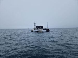
In addition, marine software engineering firm Marine AI showed the ability to continue navigating, even when GNSS drops out, using Sonardyne’s SPRINT-Nav, based on trials in the SSCS earlier this year.
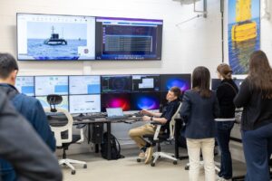
The demonstrations were viewed live by guests from the UK and overseas from within PML’s onshore remote operations centre at its campus in Plymouth.
Geraint West, Business Development Advisor at Sonardyne, said, “This ability to test and accelerate marine autonomous system innovation in a known environment with the type of infrastructure we now have in the SSCS is a real boost not just for Plymouth.
“The demonstration had interest from around the UK and internationally, with visitors from North America and Asia and from a wide range of stakeholders, military, commercial, science and industry. It just shows the reputation Plymouth now has and continues to build for marine autonomy, thanks to the environment, ecosystem and collaboration we have in the city and in Plymouth Sound.”
ACUA Ocean’s John Hunnibell, Chief Product Officer, said, “This demonstration provided an excellent opportunity to demonstrate the persistent mission utility and seagoing characteristics of our USV PIONEER as a 'mothership' for nested robotics, data harvesting and data transfer at sea.
“Specifically, we used this event to demonstrate that the USV PIONEER can deliver subsea monitoring and security for critical underwater infrastructure by teaming with multi-static seabed sensor nodes. It was also a great way to develop our relationships with capable, credible technical partners: Sonardyne, ecoSUB, PML and the University of Plymouth in Smart Sound Plymouth.”
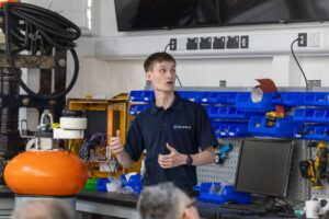
Iain Vincent, Director & General Manager at ecoSUB Robotics said, “Smart Sound and the SSCS environment has already been an extremely useful resource for ecoSUB Robotics. Most recently we have collaborated with Sonardyne on the development of a subsea AUV launch and navigation solution.
“Smart Sound provided the perfect place to test this technology, with easy access to open water, vessels and subsea nodes, and an outgoing and helpful community who support activity.”
The Smart Sound Connect Subsurface team is currently seeking additional research and development partners to collaborate in further trials of the SSCS testing environment.
It encourages anyone interested in testing new subsea vehicle operations, underwater data telemetry or any other use of the new infrastructure to contact Aaron Barrett, Lecturer in Autonomy at the University of Plymouth to learn how they can get involved.
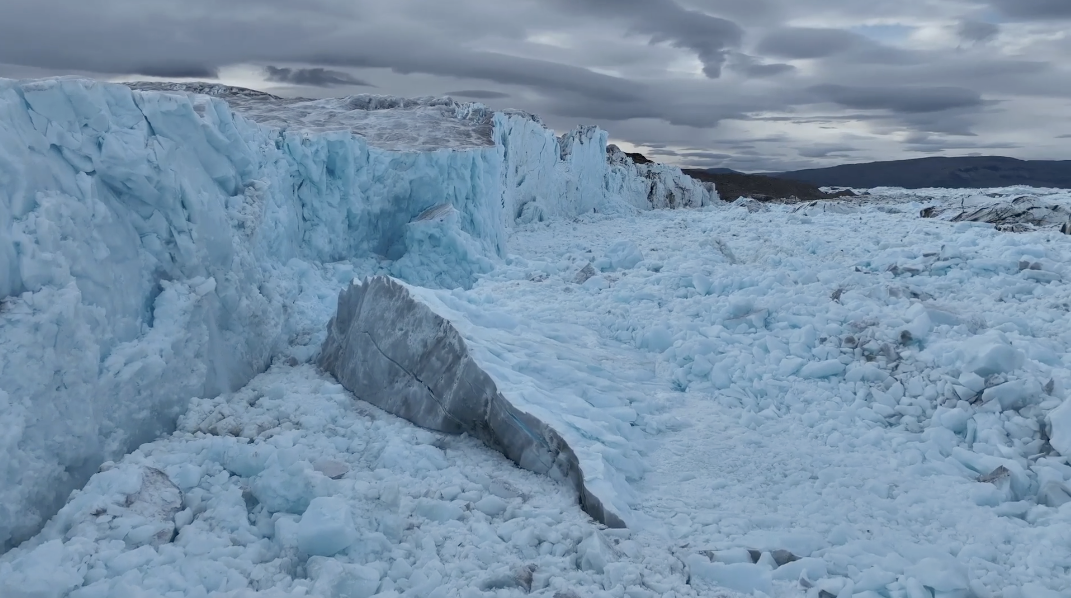
Historic expedition reveals hidden seafloor influence on Greenland glacier
The Swedish icebreaker Oden – one of the world's most powerful icebreakers – became the first vessel ever to reach and collect scientific data in the remote Victoria Fjord of North Greenland during the GEOEO North of Greenland 2024 Expedition.
Now, researchers have published the first scientific findings from the landmark expedition – revealing how previously unmapped seafloor features may explain in part why the ice tongue of C.H. Ostenfeld Gletsjer disappeared while neighbouring glaciers retained theirs.
The study focuses on C.H. Ostenfeld Gletsjer, one of three major outlet glaciers draining northern Greenland. While nearby Ryder and Petermann glaciers still retain floating ice tongues, C.H. Ostenfeld Gletsjer lost its ice tongue in the early 2000s – but the reasons for this difference have long remained unclear.
In 2024, an international team of researchers aboard Oden collected new bathymetric and oceanographic data from the previously unsurveyed fjord. The study found that warm Atlantic water is able to reach the margin of C.H. Ostenfeld Gletsjer through Victoria Fjord. Unlike neighbouring fjords, Victoria Fjord lacks a shallow protective sill that helps limit the inflow of warmer water towards the glacier front. The findings offer new insight into why the glacier evolved differently from its neighbours.
Martin Jakobsson, Professor of Marine Geology and Geophysics at Stockholm University, co-Head of Seabed 2030's Arctic and North Pacific Ocean Regional Center, and one of the chief scientists aboard Oden, said: "For years, we have sought to better understand why C.H. Ostenfeld Gletsjer evolved so differently from neighbouring glaciers. Reaching Victoria Fjord and collecting the first scientific data from this remote area gave us a unique opportunity to investigate that question.
"What makes these findings particularly exciting is that they show how features hidden beneath the ocean surface can influence what happens at the glacier front. It's a powerful reminder of how much there is still to learn about the ocean and why mapping the seafloor matters."
The expedition also produced the first detailed bathymetric measurements from Victoria Fjord. These newly acquired data have since been incorporated into updates of the International Bathymetric Chart of the Arctic Ocean (IBCAO), helping improve understanding of a previously unmapped part of the Arctic seafloor.
For Seabed 2030, the findings provide a powerful example of the value of ocean mapping. The shape of the seafloor influences how water moves through the ocean, including how warmer waters interact with glacier margins. By improving knowledge of the ocean floor, scientists can better understand processes that would otherwise remain hidden beneath the surface.
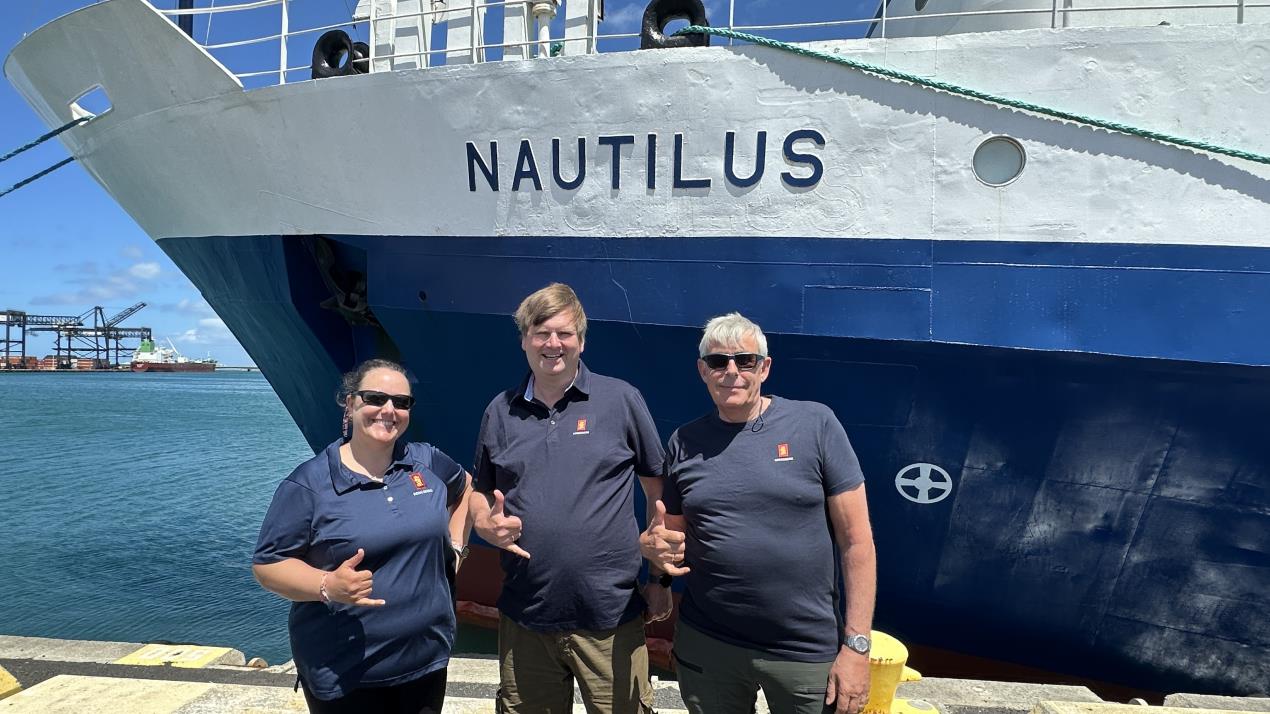
KONGSBERG accelerates seabed mapping developments with Ocean Exploration Trust expedition aboard Exploration Vessel Nautilus
KONGSBERG and the Ocean Exploration Trust (OET) are set to dive deeper than ever before in a new expedition to map vast areas of previously unexplored seafloor in the Central Pacific.
The Pacific Mapping (NA178) expedition, running 10–24 June, sees OET Exploration Vessel Nautilus deploying KONGSBERG's EM 304 MKII multibeam echo sounder for the first time. Three KONGSBERG engineers will be embedded aboard Nautilus for the full 14 days, using the mission as a critical real-world testing platform for advancing multibeam technology and helping to raise standards across the global mapping community.
Mapping the mystery
Despite covering more than 70% of the planet, huge swathes of the ocean remain uncharted at high resolution. The challenge is particularly acute in deep ocean environments, where access, cost and technical limitations typically constrain survey efforts.
The EM 304 MKII is designed to tackle these pain points head-on. Capable of operating at full ocean depth, it combines wide swath coverage with consistently high resolution, enabling survey teams to map larger areas more efficiently without compromising data quality.
For OET, this translates into a significant step forward in capability, as explained by Derek Sowers, Mapping Manager, Ocean Exploration Trust: “The EM 304 MKII is optimised for features of interest we tend to explore, like complex canyons, seamounts, ridges, trenches, seafloor spreading centres, and subsea volcanoes. It allows us to map and reveal these amazing features in greater detail and sets us up for success for further exploration using our ROVs and other assets.”
The system is expected to transform mapping efficiency for OET, effectively doubling the area that can be surveyed compared to previous equipment, while reducing both time and operational costs in remote environments.
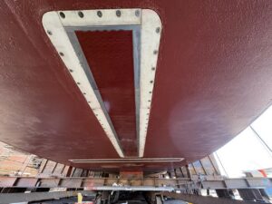
Real-world testbed
While the scientific expedition is critically important, it also provides KONGSBERG with a unique opportunity to test and refine the EM304 MKII in demanding, real-world conditions.
Operating onboard Nautilus, the system will generate live datasets across a range of seabed environments, allowing engineers to optimise both hardware performance and software functionality. These learnings will feed directly into ongoing improvements, benefiting future deployments worldwide.
Colleen Peters, Product Manager Mapping Software, KONGSBERG, explains: “We can simulate many configurations in the lab and on our test vessels, but not the realities of deep-water surveying. That is why it is essential to test in the same conditions our customers work in, so we can confirm new features perform as intended.
“Nautilus is an ideal platform for system testing because the team is committed to pushing new technology forward. It also runs an integrated mapping internship on every cruise, giving us a rare chance to see how first-time users interact with the software.”
The power of partnership
The deployment reflects a strong collaborative approach between industry, research organisations and funding bodies, with the system installed as part of a wider upgrade supported by the U.S. Navy’s Office of Naval Research.
For KONGSBERG, partnerships such as this are central to driving innovation. Working alongside organisations like OET enables the company to accelerate development cycles, validate performance in operational settings and contribute to broader scientific and technological progress.
Colleen Peters, Product Manager Mapping Software, KONGSBERG, concludes: “As ocean industries continue to expand, the need for reliable seabed data keeps growing. Seafloor mapping supports everything from research and environmental monitoring to subsea infrastructure and better-informed policies. The EM304 MKII helps meet that need with full-ocean-depth capability, broad coverage and high-quality data. We’re looking forward to showing what it can do onboard Nautilus with OET on its first mapping expedition since the upgrade.”
You can follow the Nautilus livestream here: https://nautiluslive.org/
UK Centre for Seabed Mapping (CSM) Bursary Scheme
The Hydrographic Society UK & Ireland (THS:UKI) is pleased to announce the UK Centre for Seabed Mapping (CSM) Bursary Scheme, an initiative led by the CSM Education and Research Working Group (ERWG) to address the growing shortage of skilled hydrographic surveyors in the UK. Designed to support the next generation of professionals entering the sector, the scheme will provide financial assistance to students pursuing careers in hydrography and seabed mapping, helping to strengthen the future capability and resilience of the maritime industry.
The Hydrographic Society UK & Ireland (THS UKI) will be the administrative body for this scheme. UK CSM is administered by the UK Hydrographic Office.
THS:UKI is inviting industry organisations to support the scheme through a tiered sponsorship model, offering a unique opportunity to invest in the sector’s talent pipeline, demonstrate corporate leadership, and support the sustainability of world-class training institutions. By contributing, sponsors will help ensure a steady supply of highly trained graduates while reducing future recruitment and training pressures.
Organisations interested in supporting this important initiative are encouraged to contact [email protected].
Your support is a strategic investment in the educational infrastructure that supplies talent to the maritime industry.
1. Securing Your Future Talent Pipeline
The hydrographic survey sector is facing a skills gap. Your support will support the talent who will eventually work on your vessels, process your data and lead your projects. Industry will see highly trained students exiting education, reducing your training costs and onboarding timeline.
2. Leadership and Corporate Social Responsibility (CSR)
Supporting the Bursary Scheme demonstrates industry leadership to students, early-career professionals and the wider sector. It will position your company as a champion of maritime excellence and demonstrate a commitment to future-proofing our industry. Sponsors will benefit from the exposure provided by this scheme.
3. Sector stability
Universities and training institutions underpin the maritime economy. Your support will strengthen these institutions and aims to halt the decline in world-leading expertise in seabed mapping education.
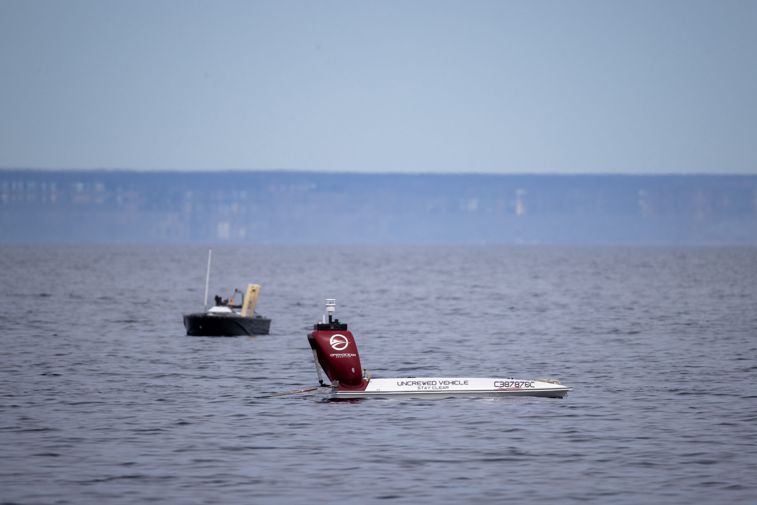
DRDC-Led Maritime Autonomy Trials advance collaborative innovation in Canada
 COVE and The Launch support national field trials focused on autonomous maritime surveillance and integrated defence technologies
COVE is proud to support the Canadian Autonomy Trials Series–Maritime (CATS-M) in Holyrood, NL. The inaugural trial brought together remotely piloted and autonomous maritime platforms, acoustic sensors, and information systems to provide a realistic, system-integration-level environment for detecting and tracking underwater targets.
With a focus on underwater domain awareness, the CATS-M trial series is part of an ongoing collaboration between COVE and Defence Research and Development Canada (DRDC) to support maritime testing and validation of innovative technologies with industry partners. This CATS-M trial integrated solutions from several COVE ecosystem partners, including Open Ocean Robotics, JASCO Applied Sciences, and General Dynamics Mission Systems-Canada.
The CATS-M trial series is a critical step in advancing Canadian capabilities in autonomous maritime surveillance.
“CATS-M highlights the value of collaborative experimentation in advancing autonomous maritime capability,” said Melanie Nadeau, CEO of COVE. “Working together in a realistic operational setting allows partners to better develop, test, and scale integrated surveillance and autonomous systems.”
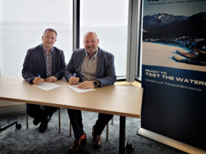
The trial was held at The Launch, a remote test centre in Holyrood, NL, operated by Marine Institute. COVE and The Launch recently signed a Memorandum of Understanding to enhance collaboration on testing, applied research, and commercialization of Canadian-developed technologies.
“The Launch was created to support the development and demonstration of marine technologies in real-world environments,” said Kelly Santos, Executive Director of The Launch. “Working with COVE will expand opportunities for innovators, researchers, and SMEs to access the expertise, infrastructure, and partnerships needed to help bring Canadian-developed technologies to market.”
A stakeholder event at The Launch on May 12 provided invited guests with an opportunity to observe elements of the experimentation activity and engage with trial partners.
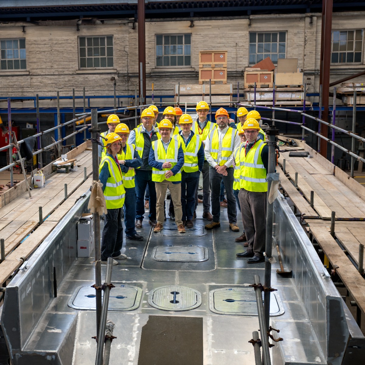
ZeroUSV demonstrates UK sovereign maritime capability during VIP tour
ZeroUSV welcomed recently representatives from the Royal Navy, MOD and NSO (National Shipbuilding Office) to Manor Marine’s headquarters in Portland for a VIP tour showcasing the company’s expanding autonomous maritime capabilities.
The visit follows ZeroUSV’s recent strategic investment in Manor Marine, strengthening the partnership and boosting sovereign UK production capacity for the company’s Oceanus class uncrewed surface vessels (USVs).
During the tour, guests were shown around Manor Marine’s facilities and given an update on the ongoing build of ZeroUSV’s next-generation Oceanus17 platform, which remains on track to be launched in July this year.
The tour demonstrated ZeroUSV’s ability to rapidly scale production of advanced British-built autonomous vessels, while highlighting the strength of UK sovereign shipbuilding and innovation within the maritime defence sector.
Designed for long-range, over-the-horizon operations, Oceanus17 represents a significant step forward in modular, multi-role autonomous maritime capability.
The 17-metre platform features a 4-tonne payload capacity and a 20ft ISO-compatible mission deck, enabling rapid reconfiguration for a wide range of defence, security and commercial maritime missions.
Matthew Ratsey, Managing Director of ZeroUSV, said: “It was a pleasure to welcome representatives from the Royal Navy and MOD, and showcase the progress being made across our Oceanus programme.
“The visit highlighted not only the pace at which we are developing advanced autonomous capabilities, but also the strength of British engineering and sovereign shipbuilding. Through our partnership with Manor Marine, we are building the foundations needed to deliver scalable, mission-ready USV capability for both defence and commercial applications.”
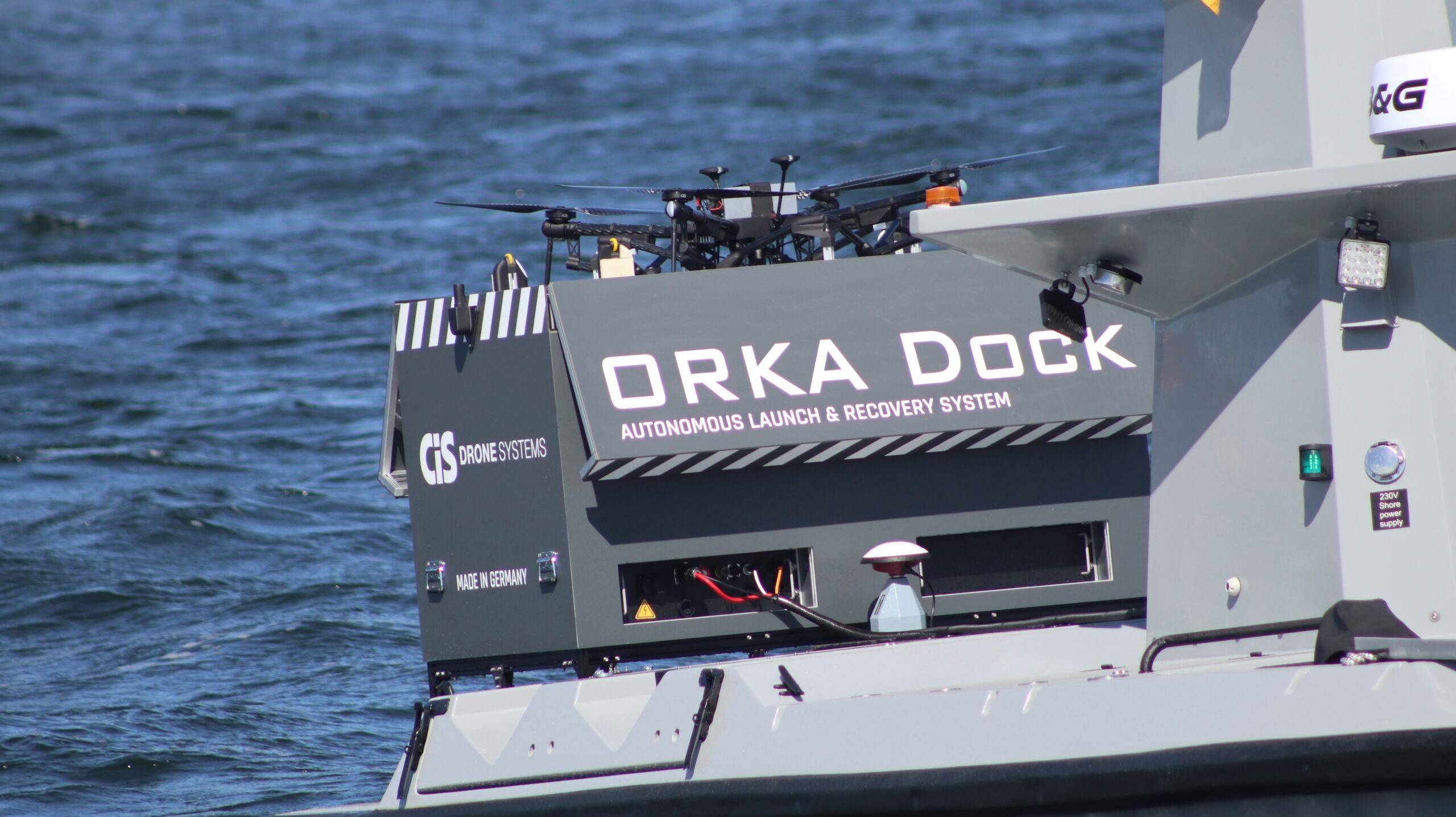
CiS Unveils ORKA Dock: World’s first autonomous UAS launch and recovery system for moving maritime and mobile platforms
 CiS, a leading European developer of autonomous aerial systems, today announced the introduction of ORKA Dock - a fully automatic launch and recovery hangar for its ORKA Uncrewed Aerial System (UAS). The announcement was made on the opening day of the Combined Naval Event, a maritime conference and exhibition taking place in Farnborough, UK.
ORKA is CiS’s long-range tactical drone, developed for aerial surveillance, reconnaissance, and inspection missions over land and water. Delivering 75 minutes of endurance with a 5.0 kg mission payload capacity, ORKA provides operators with persistent awareness across a broad spectrum of operational scenarios.
Automated launch and landing from a moving platform has been a core capability of ORKA since its introduction. The new ORKA Dock now extends and refines that capability into a fully self-contained, fully-enclosed, go-anywhere deployment solution.
Designed and built in Germany using sovereign components, the system enables the ORKA to launch, return-to-home, and recharge entirely without any operator intervention - from ships, uncrewed surface vessels, land vehicles, and expeditionary sites. Its compact design integrates fast recharging, optional tether capability, and battery-backup operation, ensuring continuous mission readiness with the capability to open and launch in under 30 seconds.
Prior to today’s announcement, CiS conducted a live demonstration of the ORKA Dock at SeaSEC 2026, the international naval security exercise held in April 2026 in Rostock, Germany. The demonstration marked the first operational deployment of the ORKA Dock aboard a moving USV in an operational environment. The system was integrated aboard the back deck of Q-RECON 24, a high-speed, long-range USV developed by FLANQ, CiS’ strategic partner in the maritime domain.
Operating daily over the course of two weeks, in missions ranging from offshore energy asset protection to harbour security, the ORKA Dock successfully demonstrated automatic launch and recovery of ORKA while the Q-RECON 24 was underway, validating the system’s proprietary Precision Landing System (PLS), which enables autonomous recovery onto a moving and pitching surface.
The exercise confirmed the dock’s performance at platform speeds of up to 15 knots, meeting the demands of naval customers seeking persistent, multi-domain intelligence, surveillance, and reconnaissance (ISR) capability.
Speaking at CNE , Tom Kaufman, Founder and CEO of CiS said: “SeaSEC was a landmark moment for CiS and for autonomous naval aviation more broadly. Achieving fully autonomous launch and recovery from a moving USV in a live exercise environment - without any operator intervention - is something that has never been done before. We believe it to be a world first.
The ORKA and ORKA Dock, working collaboratively with FLANQ USVs, give navies, coast guards, and maritime security operators the persistent aerial capability they need, deployable from virtually any surface asset. We’re excited to debut this technology at the Combined Naval Event and look forward to moving into full-scale production.”
New oceanographic array to aid AMOC observations
 Marine scientists in Scotland have helped to develop the most comprehensive view yet of how large-scale north Atlantic currents that dictate our climate may be changing.
The scientists at the Scottish Association for Marine Science (SAMS) in Oban, a partner of UHI, have combined data from a range of sources to measure the mass formation of Atlantic currents, known as the Atlantic Meridional Overturning Circulation (AMOC).
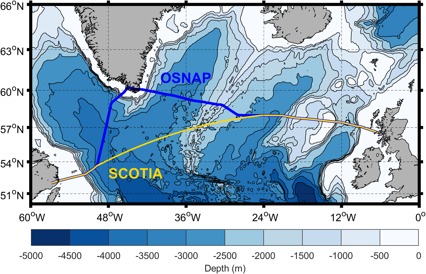
Their Scotland-Canada Overturning Array (SCOTIA) of observations incorporates data from scientific moorings on the existing sub-polar OSNAP array and the 50-year Extended Ellett Line time series, as well as Argo floats drifting in the Atlantic. Data from the new array, which stretches from Scotland to Canada, also pre-dates OSNAP (established in 2014) by 10 years, giving observations from 2004 – 2024. The findings have been published in a new paper in the journal Ocean Science.
Oceanographers across the world have long hypothesised that the AMOC could be weakening because of climate change, a view partly supported by a sub-tropical array of moorings known as RAPID, which has been in place since 2004. Because AMOC transports heat northwards from the tropics, a weakening, or complete collapse, of this ocean system could potentially plunge western Europe into freezing temperatures more commonly associated with higher latitudes such as Greenland and Siberia.
Project lead Dr Neil Fraser of SAMS said SCOTIA had shown no clear signal that the AMOC was weakening at sub-polar latitude, but added this did not necessarily mean there was no overall weakening over a longer period of time.
Dr Fraser said: “The creation of the SCOTIA array and the methods we used to gather this data mean we are a step closer to answering one of the biggest questions in ocean science: is the AMOC weakening? It will allow us to effectively keep our finger on the pulse of the AMOC to give us the best chance of detecting a weakening or collapse.
“By extending the record backwards by 10 years, we have brought the subpolar observations in line with the sub-tropical observations and can therefore better understand AMOC behaviour across the Atlantic.
“Crucially, we have observations from the Labrador Sea, east of Canada where the dense waters that sustain the AMOC engine flow southward.
“What we have developed is a cost-effective, sustainable approach to observing the AMOC that will help to future-proof research in this topic.”
The new SCOTIA array builds on the OSNAP array but adopts a different observational configuration, omitting measurements around Greenland. Instead, SCOTIA directly connects Ellett Line data on the eastern side of the Atlantic with mooring data from the western boundary that extend back to the 1990s. Argo float data are used to fill gaps across the central Atlantic.
The reduced mooring array design and use of Argo float data means that getting a near-real-time AMOC estimate from SCOTIA is now a realistic ambition. This would give society the earliest possible warning if, or when the AMOC does start to slow down, or indeed collapse.
BeyonC and HydroSurv target NOK 5 billion subsea survey market with integrated USV-ROV solution
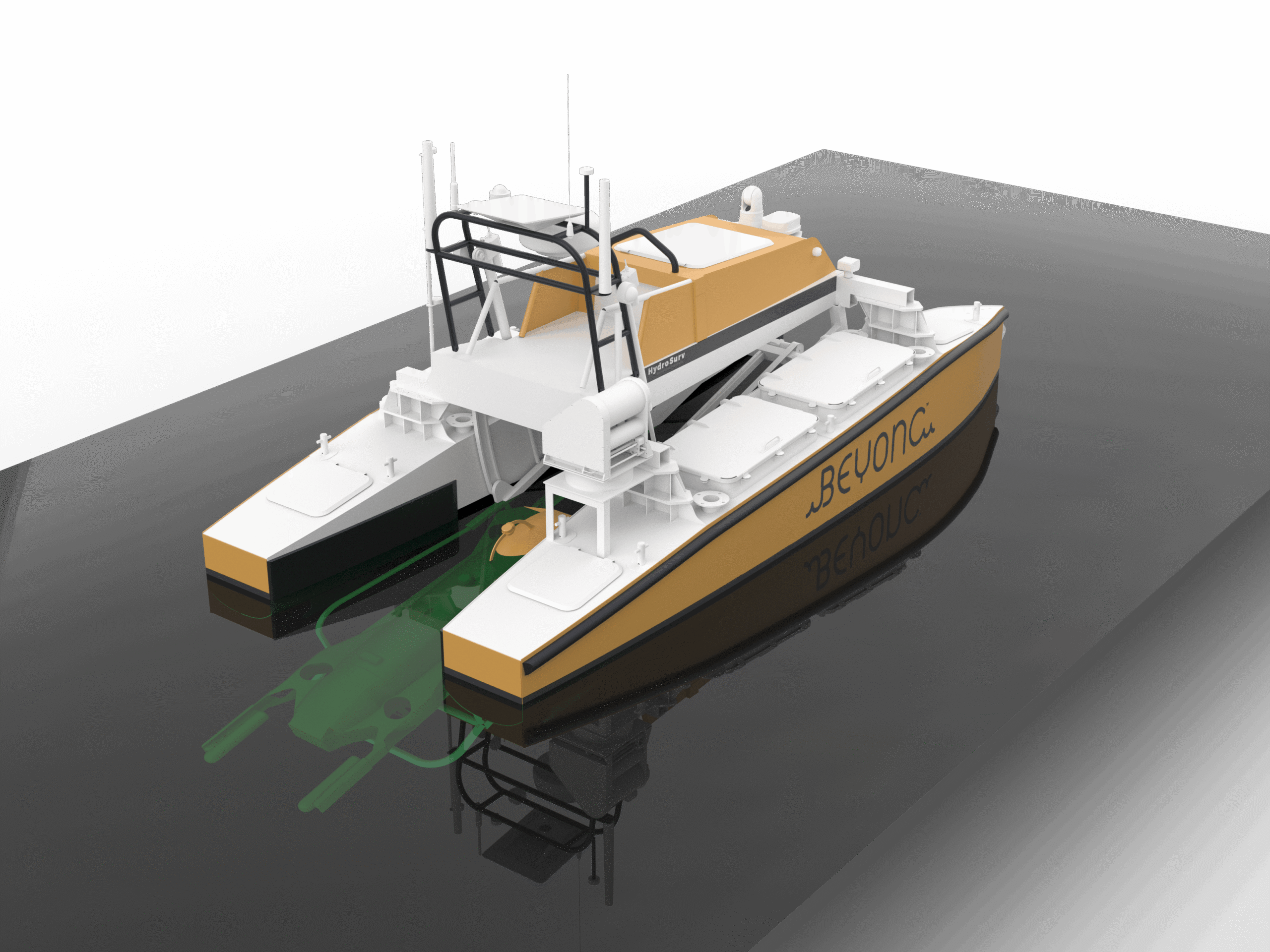
HydroSurv and BeyonC have finalised an agreement to deliver a REAV-60 Uncrewed Surface Vessel (USV) configured for the deployment and operation of BeyonC’s advanced Syncro pipeline survey ROV. The collaboration marks a significant step towards a scalable, low-emission operating model for shallow-water subsea survey.
The integrated USV-ROV system is designed to address one of the industry’s growing challenges: how to survey expanding subsea cable and pipeline infrastructure more frequently, more efficiently and with less reliance on conventional crewed vessels. By combining HydroSurv’s commercial-duty uncrewed surface platform with BeyonC’s purpose-built Syncro ROV, the companies aim to deliver high-quality subsea data while reducing cost, emissions and offshore personnel exposure.
BeyonC AS, a Norwegian subsea technology and ROV specialist, has developed Syncro specifically for safe, repeatable and high-efficiency survey operations in shallow-water environments. Together, the companies have developed a bespoke Launch & Recovery System (LARS) to integrate Syncro into the REAV-60 surface platform. The agreement was finalised during Oceanology International 2026 in London, following completion of the initial design engineering.
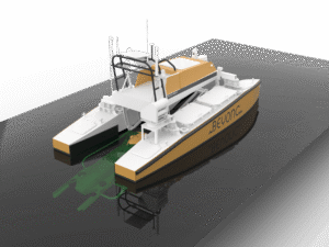
Configured as a dedicated uncrewed host platform, HydroSurv has integrated a tether management winch and a system architecture that enables coordinated positioning between the USV and the ROV. The 2026 updates to the REAV-60 are designed to support precision station-keeping, automated ROV following and real-time connectivity between Syncro and the remote operating team, enabling controlled, repeatable and high-resolution pipeline and subsea cable surveys.
For BeyonC, the collaboration forms part of a clear commercial strategy to industrialise shallow-water subsea survey. The company estimates that the addressable market for recurring pipeline and subsea cable survey represents a NOK 5 billion opportunity, with an estimated need for approximately 70 operational Syncro systems to provide sufficient survey capacity across existing and expanding infrastructure.
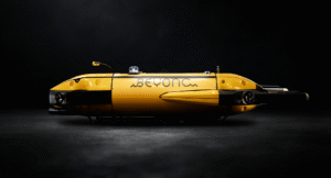
By removing the need for conventional crewed support vessels in many shallow-water scenarios, the integrated robotic survey solution has the potential to reduce vessel day rates, cut emissions and make repeat survey of critical infrastructure commercially viable at scale. This is particularly relevant as subsea cable networks and pipeline infrastructure continue to expand, while operators face increasing pressure to document asset integrity, reduce operational risk and lower the carbon intensity of offshore operations.
David Hull, Founder and CEO of HydroSurv, said:
“Working in partnership with BeyonC, this project demonstrates what can now be achieved with mid-size USVs in support of inspection-class ROV operations. Syncro has been developed with a clear focus on specific shallow-water inspection requirements, and that clarity translates well into an integrated system. By combining this ROV with a commercial-duty surface platform, we’re able to deliver the stability, control and repeatability needed for reliable deployment without reliance on conventional vessels. It’s a practical example of how uncrewed systems are starting to take on defined operational roles within subsea inspection.”
Morten Hegdal, CEO of BeyonC AS commented:
“Subsea survey is entering a new phase. Capacity, cost and emissions now matter just as much as technical capability. We believe the market needs a more scalable way to survey shallow-water cables and pipelines, and Syncro has been developed for exactly that purpose. Integrating Syncro with HydroSurv’s REAV-60 gives us a platform that can move ROV-based survey beyond conventional vessel operations and towards a repeatable, lower-risk and commercially scalable model. For BeyonC, this is an important step in building the survey capacity we believe the industry will need in the years ahead.”
Building upon BeyonC’s early trials positioning the ROV with a small USV, the introduction of launch and recovery capability takes Syncro from remote positioning towards a complete uncrewed survey concept. The preliminary design phase began in December 2025, and construction of the REAV-60 has commenced, with the hulls expected to be completed in May 2026.
The collaboration reflects a shared ambition to accelerate the transition towards safer, more efficient and more sustainable subsea survey operations. As demand for repeat survey of cables and pipelines increases, HydroSurv and BeyonC aim to demonstrate how integrated surface and subsea robotic systems can deliver commercial survey services at scale.