
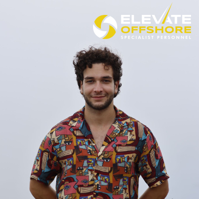
Elevate Offshore Announces Scholarship Recipient for MSc in Hydrography at the University of Plymouth
Elevate Offshore, a leading provider of survey, ROV, geotechnical, and inspection personnel for the offshore energy sector—including renewable energy, telecoms, and power—has proudly announced that Hans Elyar Ebrahim Schaeper has been awarded the Elevate Offshore Scholarship for the MSc in Hydrography program at the University of Plymouth. This newly launched scholarship fully covers tuition fees and provides invaluable mentorship from experienced industry professionals.
Scholarship Impact and Mentorship
The scholarship aims to support individuals pursuing careers in hydrography, addressing the growing demand for skilled personnel in this field. Andrew Blears, Managing Director of Elevate Offshore, expressed enthusiasm for Hans's selection, stating, “This is just the first of many scholarship opportunities that Elevate Offshore plans to offer as part of our ongoing commitment to attracting and nurturing new talent in the industry. We are excited to support Hans in his educational journey and to provide a springboard for his career in the offshore sector.”
About Hans Elyar Ebrahim Schaeper
Hans, 23, recently graduated with Honours in Marine Biology and Oceanography from the University of Plymouth in July 2024. He is a qualified HSE Professional SCUBA diver and gained valuable research experience through a competitive internship at the Alfred-Wegener Institute. During his internship, he participated in a diving team that focused on deploying and maintaining underwater sensors, leading a project aimed at reducing marine biofouling on in-situ technology. His academic journey culminated in a dissertation titled "A Novel Method to Reduce Biofouling on In-Situ Marine Sensors."
In his final year, Hans showcased his commitment to environmental issues by earning second place in the Just Picture It: Our Changing World photography competition, highlighting the impact of human activities on seabirds with a photograph of Gannets in their breeding nests littered with fishing nets and plastics.
Pursuing Hydrography
When asked about his motivation for pursuing hydrography, Hans stated, “I have a great interest in exploring the ocean, along with the drive to continue seeking new prospects and broadening my horizons. During my time at university, I had the chance to speak with lecturers and working professionals, and I was fortunate enough to be accepted into a competitive research institute, which further fuelled my curiosity about the ocean and its potential. By the time I graduated, I knew I wanted to pursue a career in hydrography to gain greater insight into the offshore world across all its sectors.”
He chose the University of Plymouth for his MSc in Hydrography due to its excellent teaching methods and limited number of universities offering this specialised programme. “Having sp
oken to previous graduates, I found that the University of Plymouth was the best choice for me to receive the education necessary to reach my goals,” he explained. The course leader, Tim Scott, also highlighted the exceptional opportunity that the Elevate Offshore Scholarship presents.
Personal Significance
Receiving this scholarship holds special significance for Hans, who has navigated his educational journey with dyslexia. He remarked, “Having received guidance from the university throughout my undergraduate degree due to my dyslexia, I believe that the mentorship provided by this scholarship - from those with first-hand experience in the industry - will be invaluable in aiding my studies over the coming year’.
Hans is particularly excited about the breadth of opportunities available in the offshore energy sector, stating, “The unique lifestyle of those in the offshore energy sector is something I hope to experience fully, allowing me the chance to explore the world while working on something I love.”
Future Aspirations
Once he completes his MSc, Hans aims to work within the offshore sector, leveraging the opportunities provided by Elevate Offshore and the University to build connections within the industry. He aspires to join a company that values the importance of the ocean and is committed to creating sustainable solutions for the future.
Hans envisions that the mentorship from Elevate Offshore staff surveyors will significantly shape his learning experience and career development. He stated, “Throughout university, I have benefited from working with industry experts in marine and sustainability sectors, which has allowed me to grow professionally. I hope to provide similar support to the next generation of surveyors and students in my career.”
By offering initiatives like this scholarship, Elevate Offshore aims to contribute to developing skilled professionals and promoting sustainable practices within the offshore energy industry.
The University of Plymouth website has more information on the Elevate Offshore scholarship and the MSc in Hydrography programme.


CMS GeoScience Expands Operations with Acquisition of New Site in Falmouth, Cornwall
 CMS GeoScience Ltd (CMSG) is pleased to announce the recent purchase of a new site in Falmouth, Cornwall, marking a significant milestone in the company's ongoing growth and development. This strategic move underscores their commitment to enhancing their operational capabilities and strengthening their presence in the region whilst also enabling them to support the development of renewable energy and floating offshore wind in the southwest and Irish sea.
The Gables will support their operations and enhance research and development of new equipment. The site is being updated to ensure it can support the companies ambitious growth plan and exciting strategy. CMSG already working on building new laboratories and storage facilities for their equipment, ensuring that they can continue to deliver the high standards of service and innovation that their clients have come to expect. The new facility will serve as the headquarters for management, administrative and survey teams supporting the company’s future growth.
CMSG will continue to maintain their long-standing presence in Lowestoft, with its large warehouse and dedicated berth remaining a fundamental part of their operations. The 24m multipurpose survey vessel, MV Flatholm will continue to operate from this location, moving between the east coast and south west providing the unique ability to operate efficiently along all sides of the UK and Europe.
CMSG are proud and excited to take this significant step forward which demonstrates their dedication to both the development of CMS GeoScience, their people and the services they provide as well as their long-term commitment to the area. This substantial investment in infrastructure will enable CMS GeoScience to better serve their clients, support their team, and contribute to the continued success of the company.
Ashtead Technology to acquire Seatronics and J2 Subsea
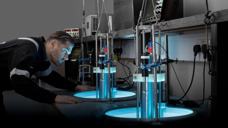
Ashtead Technology, a leading provider of subsea technology and services, announces it has signed an agreement to acquire Seascan Limited and its subsidiaries (known as Seatronics), and its sister company J2 Subsea Limited, international subsea electronics and ROV tooling rental and services businesses for £63m from Acteon Group. The transaction remains subject to customary closing conditions including approval of the Competition and Markets Authority.
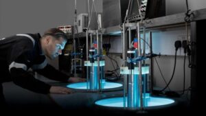 This latest acquisition, the ninth in seven years, will further expand Ashtead Technology’s capabilities in the global survey & robotics rental market. Seatronics and J2 have operations in Singapore, UAE, UK and US, providing subsea electronics and tooling products and services to the global offshore energy market. Together they support the installation, inspection, maintenance & repair, and decommissioning of subsea oil & gas and renewable energy infrastructure
The highly complementary acquisition will increase the breadth and depth of Ashtead Technology’s survey & robotics rental fleet and services, bringing a highly skilled employee base of 110 people with significant domain knowledge and technical expertise, adding more than 7,000 proprietary assets increasing Ashtead Technology’s rental portfolio by 30%.
Allan Pirie, Chief Executive Officer of Ashtead Technology, said:
“Seatronics and J2 are businesses we have known for a long time. With our most recent acquisitions focussing on expanding our mechanical services capability, this latest acquisition strengthens our international footprint and capability within our Survey & Robotics market. We look forward to welcoming new colleagues to Ashtead Technology and increasing the wealth of in-house expertise as a larger Group, creating a world leading subsea survey and robotics team”.
Brice Bouffard, Chief Executive Officer of Acteon, added:
“Upon closing, this transaction will be the next important step in focusing our service portfolio to achieve Acteon’s long-term strategic goals. Seatronics and J2 have been an integral part of our business for many years and I’m very pleased to see both teams moving together to such a dynamic new home at Ashtead Technology. Acteon is committed to optimising our portfolio to better serve our customers and stakeholders as we support the evolving offshore energy market”.
This significant investment is part of Ashtead Technology’s commitment to delivering high-quality subsea technology and services, supporting customers across the offshore energy sector.
Forcys and DRASS to revolutionise underwater operations
 Forcys brings together leading technologies, offering a comprehensive naval and subsea capability to the world defence market.
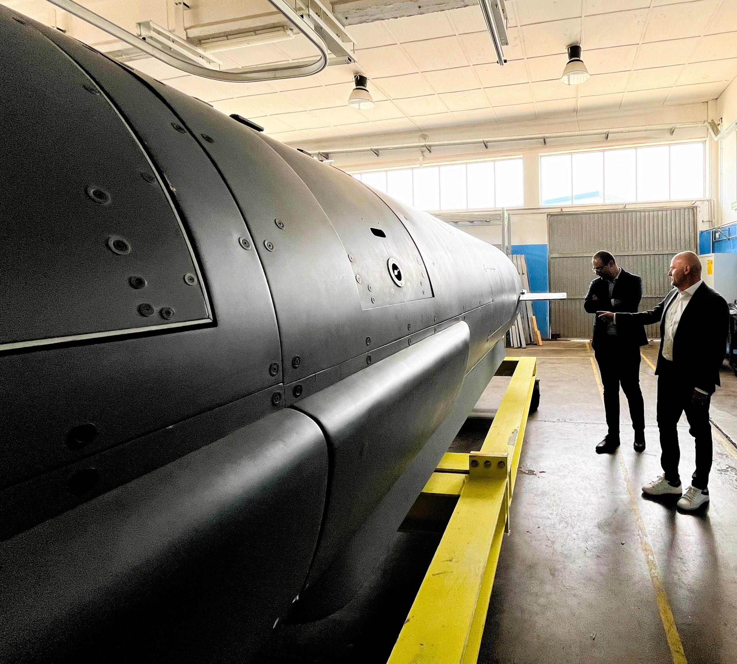
Forcys, a global leader in underwater defence technology, and DRASS, a renowned name in the manufacturing of diving systems and underwater vehicles, have signed a Memorandum of Understanding (MoU) aimed at revolutionising underwater operations.
Forcys integrates and brings to the defence market world-changing solutions from leading technology partners Chelsea Technologies, EIVA, Sonardyne, Voyis, and Wavefront Systems. These companies are renowned for their innovative offerings in underwater and maritime operations, making them ideal partners for DRASS.
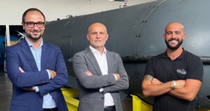
Luca Biasci, SDV & LUUV Program Manager at DRASS, emphasizes the significance of this collaboration: "DRASS has consistently been at the forefront of technological innovation in the underwater domain. With this partnership, Forcys' robust portfolio of advanced payload technologies will be integrated with our Large Unmanned Underwater Vehicles (LUUVs), RONDA, expanding our suite of solutions to meet the evolving demands of the underwater sector."
 Under this agreement, Forcys' advanced underwater vehicle systems and sensor payloads will complement DRASS’ capability to meet the evolving needs of navies.
Antonio J. Belfiore, who leads sales in the Europe, Middle East, India, and Africa (EMEIA) region for Forcys, recently visited DRASS headquarters in Livorno, where the final details of the agreement were ironed out.
“We are thrilled to partner with DRASS, a company that shares our commitment to innovation and excellence,” said Antonio J. Belfiore. “This partnership allows us to combine our expertise and provides customers with state-of-the-art systems that enhance operational capabilities and ensure safety and efficiency in underwater missions.”
Both companies are committed to pushing the boundaries of what is possible in the underwater domain, leveraging their combined expertise to deliver state-of-the-art solutions to defence markets worldwide.
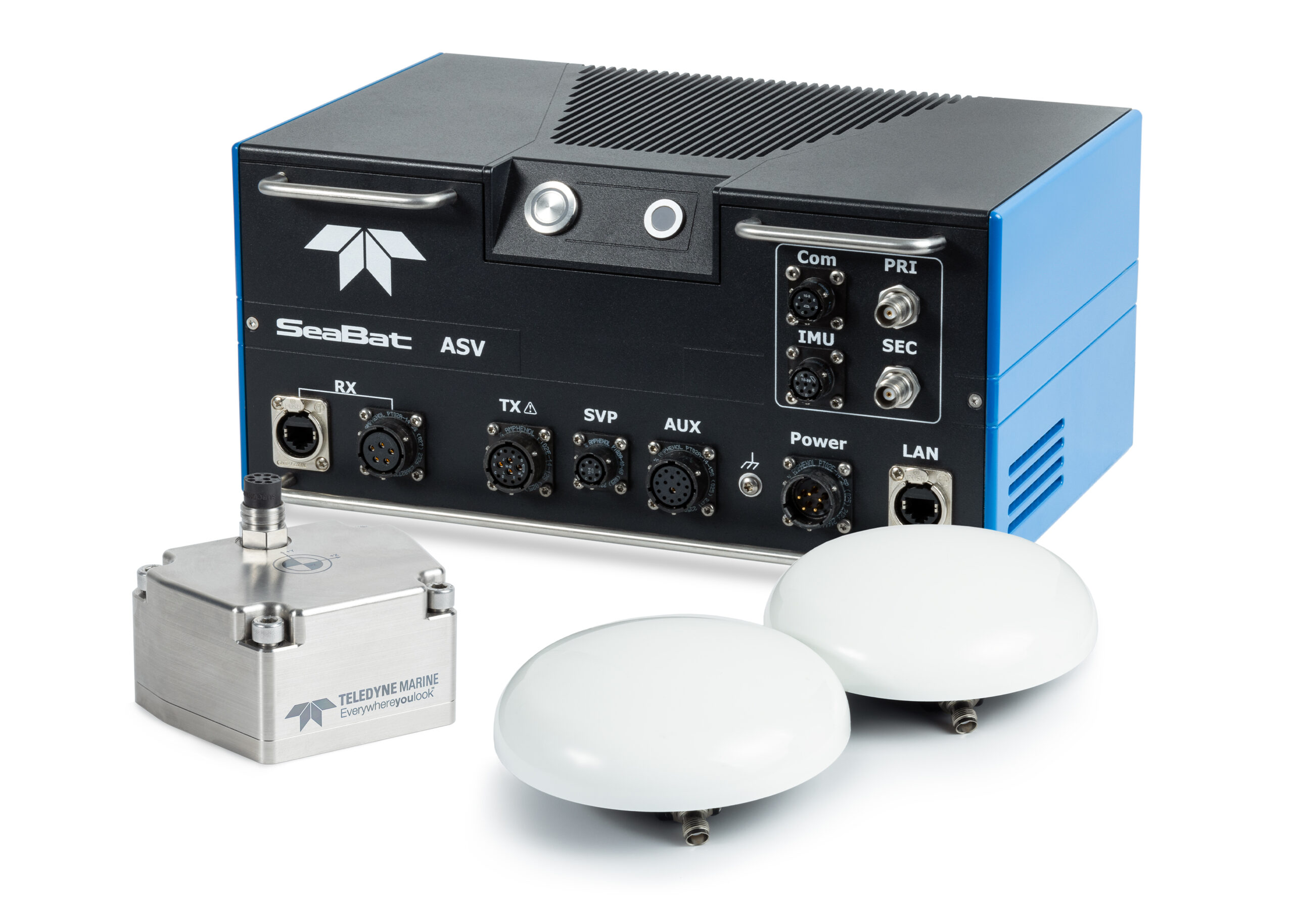
Teledyne Marine Launches Intrepid – A GNSS/Inertial Navigation System
 Teledyne Marine is excited to unveil the Intrepid, a GNSS/Inertial Navigation System. The system is integrated with the SeaBat T20-ASV processor and comprises a compact inertial measurement unit (IMU) and two GNSS antennas, delivering reliable and precise positioning.
With the Intrepid on board, no manual interfacing between sensors is required, as the system automatically streams data to third-party software. This eliminates the need for manual sensor interfacing and reduces downtime.
Teledyne Marine’s unified approach combines hardware and software into one single, intuitive interface for monitoring and controlling the mapping system. Moreover, the centralized system streamlines firmware and software updates, providing users with effortless access to the latest features and enhancements. The new Intrepid GNSS/Inertial Navigation System combines immediate feedback with the consistent and precise results of the SeaBat T20-ASV, delivering a seamless mapping experience.
The Intrepid GNSS/INS benefits all users in marine surveying applications by providing the precise navigation necessary for operational efficiency. Due to its intuitive design, it is easy to configure and monitor, allowing even entry-level operators to quickly set up the system and receive immediate feedback on navigational status - essential for dynamic marine operations.
“Teledyne Marine’s Intrepid GNSS/INS is the next step in our line of INS products with a combined GNSS/INS system. What we have done is to integrate the SeaBat Sonar software and the Intrepid software into one software program, making it simple and easy to use for the operators,” says Pim Kuus, Senior Hydrographer and Product Manager Instruments & Imaging at Teledyne Marine.
Greensea IQ Awarded $1.9 Million NAVSEA Contract for Coupled ROV and Manipulator Control
 Richmond, VT – October 1, 2024 – Greensea IQ announces the awarding of a Phase II contract from the Naval Sea Systems Command (NAVSEA) as part of SBIR Topic #N211-066. The contract, including options, is valued at $1.9 million and spans up to three years if all options are exercised.
The objective of this contract is to significantly enhance the capabilities of the MESR Mk20 Expeditionary ROV platform by integrating manipulators and providing intuitive, one-operator control of the ROV and manipulator system. This integration will allow ROVs to perform increasingly complex tasks in marine environments, using a single control system for both the ROV and manipulator. This innovation aims to optimize performance, reduce operator workload, and simplify control station complexity.
Commenting on the award, Ben Kinnaman, CEO of Greensea IQ, stated, “I founded Greensea with the singular vision of using autonomy and advanced technologies to improve the relationship between operator and robot in the ocean industry. We have always specialized in the pragmatic application of bleeding-edge autonomy, AI, navigation, and Human Machine Interface developments. This project with the U.S. Navy is the epitome of Greensea’s motivation. It will allow defense operators to use robots as meaningful and viable tools offshore, creating scale and safety in their mission to combat threats.”
The challenges of working with manipulators on small ROV platforms is not unique to Expeditionary Forces. As ROV platforms have gotten smaller and more capable and electric manipulators have become more viable for serious underwater tasks, their combined potential is significant for the offshore industry as well as defense. These systems are challenging to operate however because they have significantly less mass than traditional Work-Class ROVs and are deployed with a reduced operating footprint, often consisting of a single operator. This technology, combined with Greensea’s mature autonomy, positioning, and perception technologies, will pave the way for widespread adoption of miniature ROVs with advanced manipulator packages in all aspects of the ocean industry.
Uni of Strathclyde Collaboration in Subsea Neuromorphic Object Detection
 Robosys Automation and the UK’s University of Strathclyde have signed a Knowledge Exchange Agreement to support a new project which will explore underwater object detection using neuromorphic sensing.
Robosys is collaborating with the University of Strathclyde’s Department of Naval Architecture, Ocean and Marine Engineering (NAOME) and NSSP (Neuromorphic Sensor Signal Processing) lab from Department of Electrical and Electronics Engineering (EEE), and will also fund the testing of the sensing technology for underwater object detection using novel technologies. The aim of the project is to develop the encoding mechanisms for multimodal data collected through neuromorphic sensors for underwater object detection.
The challenges to underwater object detection include limited optical sensor visibility due to water turbidity and lack of light penetration, combined with interference due to environmental factors such as tides, temperatures and salinity, together with financial implications due to specialized equipment and increased maintenance frequency.
The University of Strathclyde’s Dr Chaitanya Patil, Lecturer in Naval Architecture, Ocean and Marine Engineering is leading the pioneering project, working closely with the EEE Department’s NSSP lab Research Director, Dr. Gaetano Di Caterina. Dr Patil is a specialist in marine system intelligence with a particular focus on modelling and simulation across cutting-edge technologies.
Dr Patil’s current research around intelligent marine systems utilizing advanced machine-learning methodologies lead him to develop the project focused on Neuromorphic sensor fusion for underwater object detection (SENSE) has been facilitated through EPSRC Grant reference EP/X525820/1.
Dr Patil approached Robosys due to the Company’s notable expertise and standing in the field of maritime navigation, autonomy and background in vision systems and associated algorithm development, in order to initiate a collaboration to help propel the research into neuromorphic systems.
The emergence of neuromorphic systems has delivered new methodology to how traditional computation is performed in robotics. Neuromorphic supported intelligence features brain-inspired efficiency, enabling robotics to swiftly and robustly learn and adapt to new scenarios and operations.
Aditya Nawab, Founder, CEO & CTO of Robosys Automation, comments, “We are delighted that Robosys Automation is collaborating with the University of Strathclyde in this exciting and ground-breaking project. As maritime industry innovators, the Robosys’ technical team continually explores novel methods of pushing the envelope. This project with the University demonstrates this, with change detection sensing working hand-in-hand with cooperative and competitive computation for perception and control, which will enable ever-increased learning and problem solving, being essential in the future of a safer, smarter and greener maritime.”
Following the culmination of the initial underwater object detection project, and as a reflection of the significance of the positive impact this technology will bring to the maritime and ocean technologies sectors, it is planned that this project will be further developed by the University’s PhD Students and Researchers in subsequent years.
NOR Offshore Rental Expands UK Operations with Major Sonardyne Technology Investment for Construction Survey
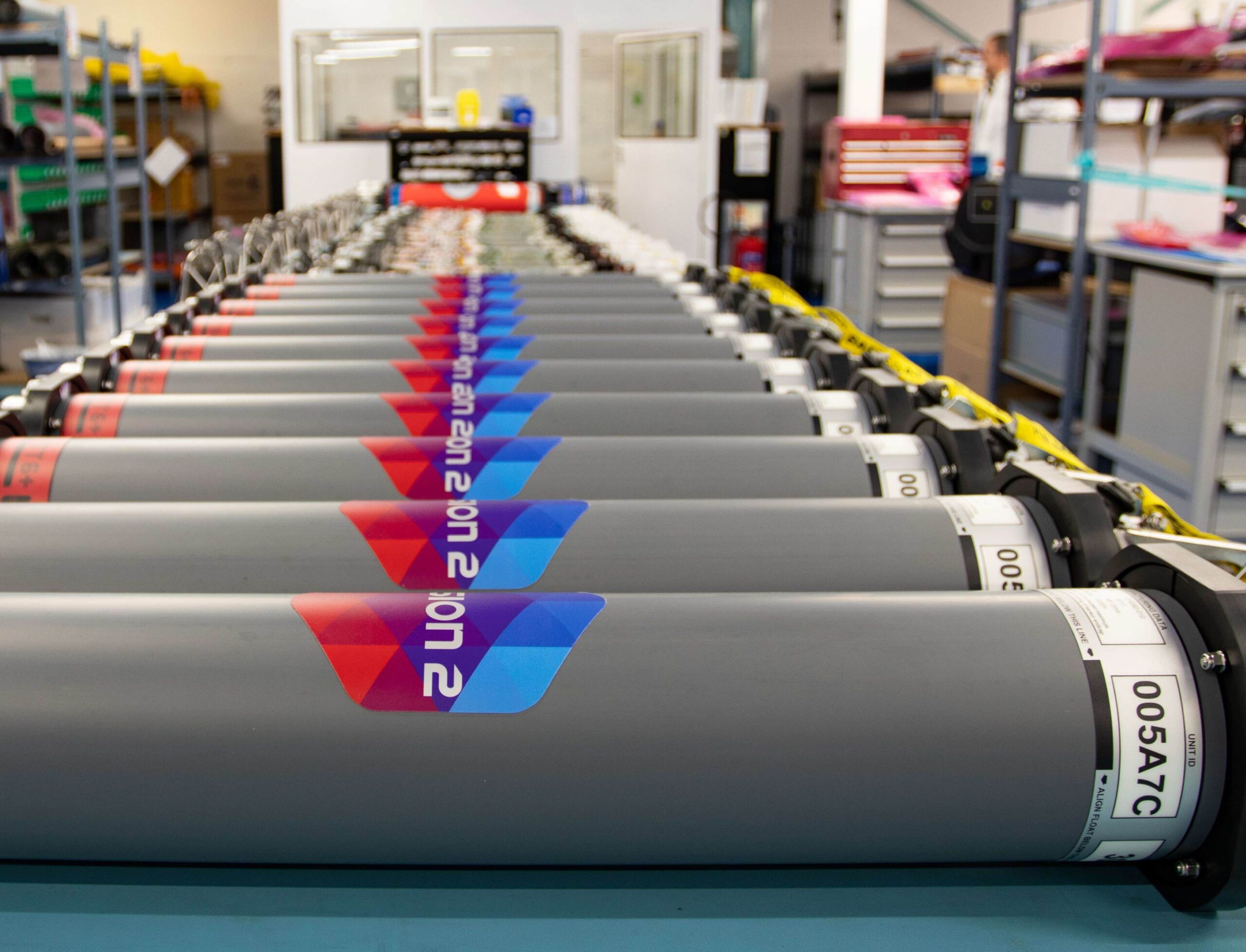
NOR Offshore Rental (NOR) has made a further, multi-million-pound, investment in Sonardyne products for their rental pool as part of their expansion at NOR Ltd, their UK subsidiary office in Aberdeen.
This investment comes as result of increased demand for NOR’s services and equipment globally. NOR has ambitions to outfit their Aberdeen office with the same services as their headquarters in Norway.
The investment includes stocking their rental pool with additional tooling and survey equipment including SPRINT-Nav, Compatt 6+ and Fusion 2 systems to support the offshore construction industry.
Welcoming the investment, Sonardyne’s Aberdeen Sales Manager. Colin Sutherland commented; “It’s great to see NOR’s confidence in our technology confirmed by this further investment in products for their rental pool. The NOR Ltd. expansion is beneficial for all involved; NOR, their customers, Aberdeen and of course us. We look forward to working with them as they continue to serve the North Sea marine industry.”
With duplicate services in Aberdeen, NOR can increase speed and efficiency when it comes to mobilising their services and equipment from both sides of the North Sea. To accommodate the expansion, NOR LTD will be moving to a new facility which is triple the size of their current location.
Jostein Jansen, CCO, NOR Offshore Rental, says;” The investment in Sonardyne equipment is a part of our global growth strategy, to meet our customer needs globally. It is a very exciting time for NOR, and we are looking forward to seeing our UK subsidiary in Aberdeen grow to its full potential with the support of valued suppliers such as Sonardyne.”
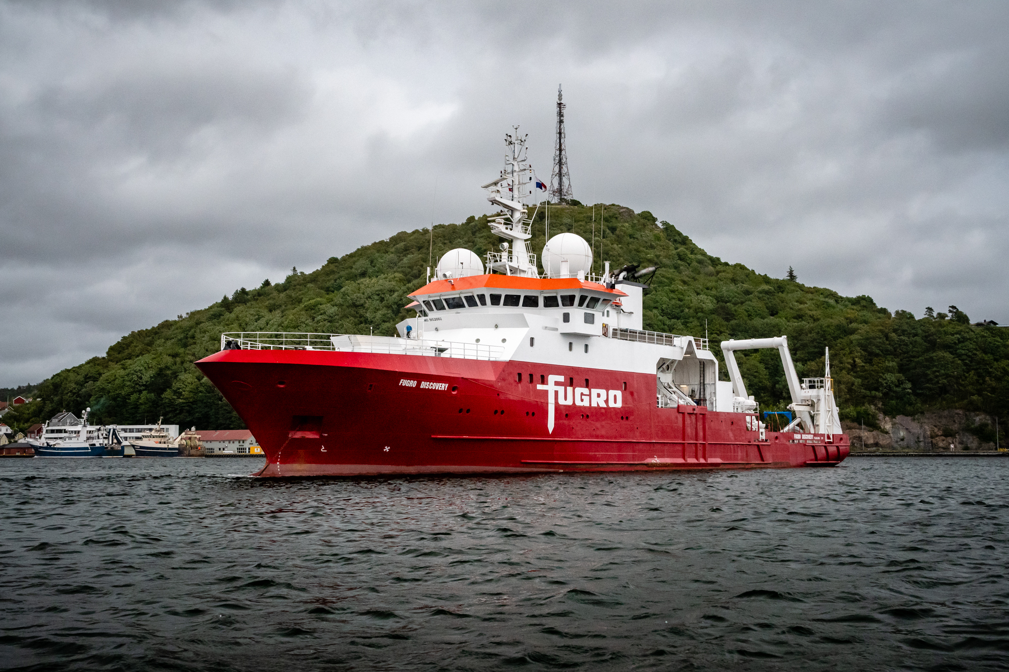
Fugro extends role in Norway’s 2024 MAREANO programme for seabed mapping with eDNA service
 Fugro has completed the survey work for the 2024 MAREANO seabed mapping programme, including an innovative environmental DNA (eDNA) service, as part of a hydrographic survey contract awarded by the Norwegian Hydrographic Service (NHS). Supported by the Central Government of Norway, MAREANO is a multidisciplinary initiative aimed at mapping the seabed to generate scientific information for the responsible management and preservation of Norway’s marine resources.
This year’s survey covered an extensive 2,823 km² region in the North Sea, with water depths ranging from 146 to 337 metres. Using the Fugro Discovery, equipped with high-resolution multibeam echo sounders and sub-bottom data acquisition systems, the primary goal is to gather seamless datasets, integrating bathymetry, water column, and acoustic backscatter data.
Fugro employed cutting-edge sensors and advanced calibration techniques tailored to these challenging conditions. The survey was completed in September and work is now progressing on the final reports and data that will be available via VirGeo®, Fugro's web-based Geo-data platform.
In a first for the programme, Fugro included environmental DNA (eDNA) sampling as part of the survey datasets. This cutting-edge approach provides valuable insights into biodiversity and community composition, which are essential for projects aiming for net biodiversity gain and for monitoring endangered and invasive species. eDNA enhances existing environmental sampling programmes to gain deeper ecological insights, complementing other survey activities such as metocean, geophysical, and geotechnical surveys.
Furthermore, Fugro collected transit data for NHS to share with the European Marine Observation and Data Network (EMODnet). This data will contribute to The Nippon Foundation-GEBCO Seabed 2030 Project, which aims to map the world's entire ocean floor by 2030.
"The last few years, the MAREANO programme has placed emphasis on the North Sea. There is a need for marine knowledge in areas considered as particularly valuable and vulnerable. This marine knowledge is also relevant for the new marine industries – such as offshore wind and offshore aquaculture.” says Nicolien Haasbroek, project engineer for MAREANO in the Norwegian Mapping Authority.
Marc Kebbel, Fugro’s Service Line Director Hydrography for Europe and Africa said, "MAREANO is the largest multidisciplinary mapping programme of its kind in Norway and we are excited to continue our support for the project. Our knowledge of the marine environment and innovative techniques allow us to collect high-quality Geo-Data that deepens our understanding of the seafloor and supports scientific discoveries; to keep our oceans healthy and help manage them sustainably.”
Fugro has a track record of conducting successful surveys for the programme since 2006. To date Fugro has acquired over 140,000 km2 of data under the programme, which has helped Norway improve its understanding of its marine environment and resources.
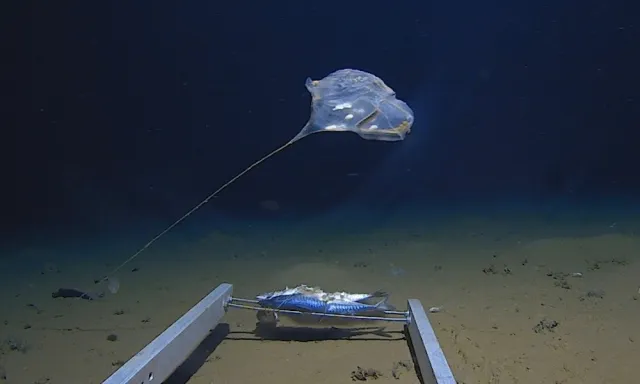
New use cases highlight critical role of seabed mapping in driving ocean sustainability and innovation
The Nippon Foundation-GEBCO Seabed 2030 Project, in partnership with NLA International (NLAI), has published a series of seabed mapping use cases. This comprehensive compendium showcases the indispensable role of seabed mapping in addressing some of the world’s most pressing marine and maritime challenges.
The use cases – compiled as part of the ‘Wind in the Sails (WITS)’ project – aim to address pressing global issues such as climate change mitigation, marine biodiversity protection, and Blue Economy development. They also ensure that seabed mapping efforts are targeted to support ocean sustainability, policy development, and economic growth.
The WITS project is a key initiative supporting Seabed 2030 by providing critical empirical data to inform the development of a prioritised, targeted seabed mapping strategy. It seeks to bring together the global hydrographic community and stakeholders in the marine and maritime sectors, establishing a unified global seabed mapping priority list.
The use cases were first unveiled by Seabed 2030 Project Director Jamie McMichael-Phillips at the Risorsa Mare Forum, held in Palermo, Sicily – an international gathering focused on fostering collaboration and innovation within the marine and maritime sectors.
The twelve use cases, accessible in this compendium, cover key areas such as climate change, marine biodiversity, disaster management, and marine spatial planning. They also address the evolving needs of both the Global North and South, including Small Island Developing States (SIDS), as well as the Blue Economy sectors:
1. Seabed Mapping Innovation
2. EEZ Seabed Mapping in the Absence of a National Hydrographic Organization
3. Subsea Cable Planning and Design
4. Tsunami Propagation and Storm Surge Modeling
5. Renewable Energy - Offshore Wind Energy
6. Climate Change Ocean Models
7. Small Island Developing States (SIDS) Sea Level Rise and Coastal Inundation
8. Marine Biodiversity
9. SIDS Marine and Coastal Development and Seabed Mapping for Marine Spatial Planning
10. Government Policy
11. Ocean Discovery and Ocean Exploration
12. Seabed 2030 Driving Hydrographic Industry Expansion and Human Capital Benefits
"The Seabed Mapping Use Cases represent a critical step forward in realising our vision of a fully mapped ocean,” commented McMichael-Phillips. “Leveraging evidence-based priorities helps us ensure that seabed mapping efforts directly contribute to sustainability, innovation and economic development across multiple sectors – from climate resilience to the growth of the Blue Economy.”
"The WITS project provides a clear, data-driven pathway for aligning seabed mapping efforts with the real world needs of the marine sector,” observed Gary Hesling, NLAI Associate Director and WITS project lead.
“This robust, evidence-based framework will help Seabed 2030’s diverse set of supporters focus even more effectively on areas where seabed data is most needed. This will catalyse yet more activity around the world in support not only scientific and environmental goals, but also tangible economic and social development.”
Seabed 2030 is a collaborative project between The Nippon Foundation and the General Bathymetric Chart of the Oceans (GEBCO), which seeks to inspire the complete mapping of the world’s ocean by 2030, and to compile all the data into the freely available GEBCO Ocean Map. The Project is formally endorsed as a Decade Action of the UN Ocean Decade. GEBCO is a joint programme of the International Hydrographic Organization (IHO) and the Intergovernmental Oceanographic Commission (IOC), and is the only organisation with a mandate to map the entire ocean floor.
All data collected and shared with the Seabed 2030 project is included in the free and publicly available GEBCO global grid.