
TCarta Provides Satellite-Based Solution to Ship Groundings in Coastal Waters
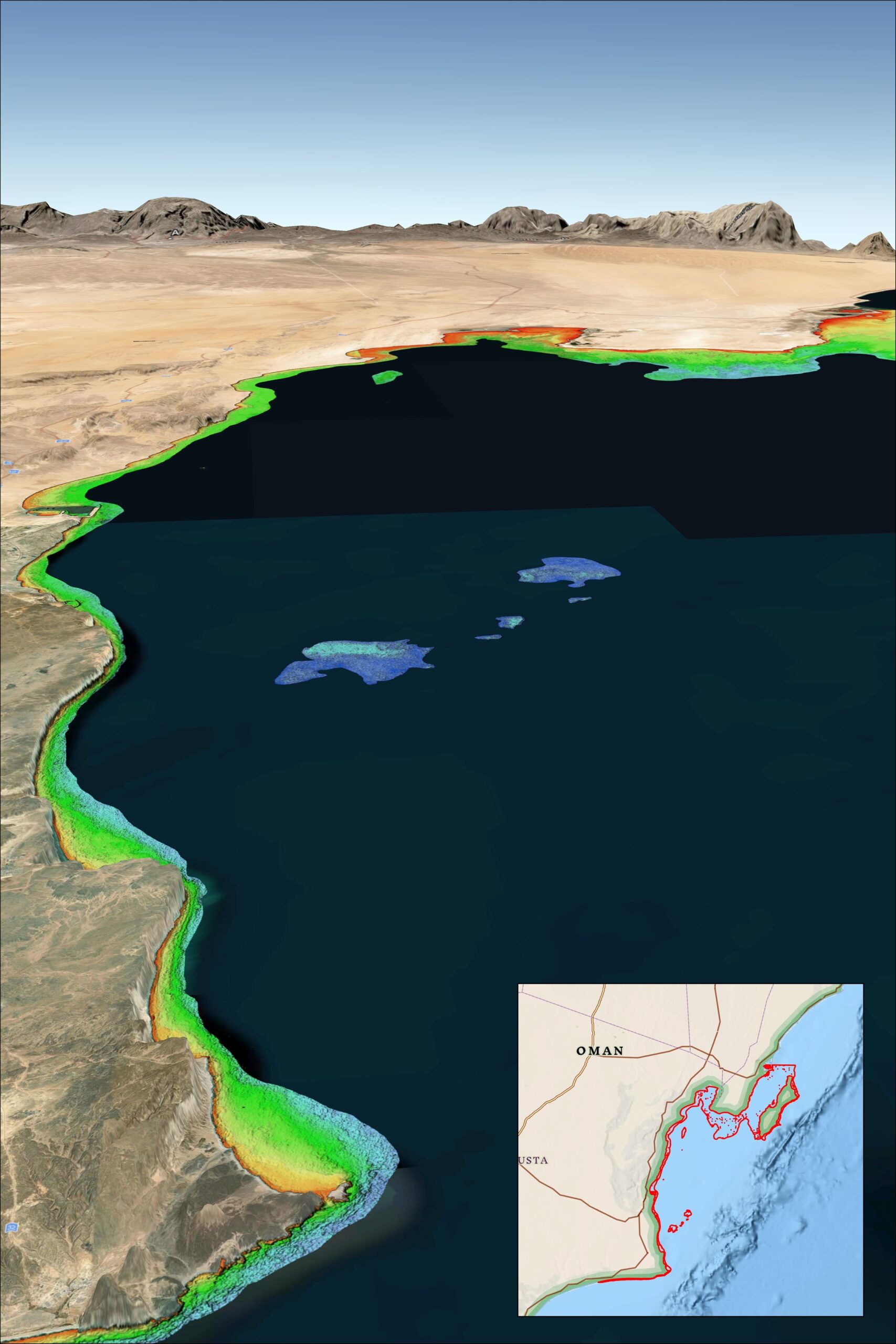
 Multiple recent incidents in which naval and commercial vessels ran aground have highlighted the dangers of maritime operations in shallow or poorly charted coastal waters. TCarta Marine of Denver offers a cost-effective, environmentally safe solution using Earth observation satellites to derive accurate water depth measurements in near-shore areas.
“While the exact causes of recent ship groundings off the coasts of Oman, Greenland, and Fiji are under investigation and often complex, the risk of such accidents can be significantly reduced with up-to-date bathymetric data produced from satellite imagery,” said TCarta President Kyle Goodrich. “Often in coastal areas, the regions outside commercial shipping lanes are poorly charted or not surveyed.”
Unfortunately, the collection of high-quality water depth measurements in shallow coastal areas – where they are needed the most – has traditionally been expensive and dangerous to acquire with ships or aircraft, especially in remote or contested regions, Goodrich said. And the risk of groundings is only growing as military vessels and eco-tourism charters increasingly operate in unfamiliar and inadequately mapped coastal zones.
For over 10 years, TCarta has been supplying marine charting organizations with water depth data using a technique called Satellite Derived Bathymetry (SDB). SDB applies physics-based computer algorithms to optical imagery captured by commercial remote sensing satellites. This analysis detects and measures light reflecting off the seafloor to calculate water depth. Depending on water clarity, SDB is routinely accurate to depths of 20 to 30 meters.
“In addition to posing no danger to personnel, equipment, or coastal environments, satellites are more cost effective than ship-borne sonar or airborne laser scanning because they acquire image data over large regions in seconds,” said Goodrich. “And because satellites orbit without geographic restrictions, data can be collected for areas otherwise off limits to vessels or aircraft.”
TCarta has mapped nearly one third of the world’s coastlines with SDB and offers products in custom and off-the-shelf versions. Custom SDB data sets are typically generated using high-resolution satellite imagery capable of resolving seafloor objects, such as shoals and reefs, with one-meter resolution.
The off-the-shelf bathymetry product Global Satellite Derived Bathymetry (G-SDB) offers 10-meter detail and is ideal for identifying coastal shoals in remote areas that don’t appear on nautical charts. Large-area contiguous G-SDB products are immediately available for more than a dozen critical locations, including:
- South China Sea
- Arabian/Persian Gulf
- Gulf of Oman
- Red Sea
- Black Sea
- Eastern Mediterranean
Government and commercial organizations may order bathymetry products directly from TCarta or through the GSA Schedule.

Coast Capital provides foundational support to COAST to launch Blue Pathways, a blue economy training hub
 With foundational support from Coast Capital, COAST Centre for Ocean Applied Sustainable Technologies, is pleased to launch Blue Pathways, a training hub that connects individuals and companies with curated courses and other learning opportunities to drive innovation in the burgeoning blue economy.
As of 2019, Canada’s marine economy generated $39 billion in GDP and encompassed sectors as diverse as marine transportation, data and artificial intelligence, ocean energy, fisheries and aquaculture, recreation and tourism.
The blue economy is projected to soon outpace broader economic growth in Canada by 20 percent. Canada’s Ocean Supercluster is galvanizing ocean innovators to achieve a $220 billion ocean economy by 2035.
“The sustainable blue economy’s growth is magnifying the gap between demand and supply when it comes to qualified personnel, enhanced skills, and complementary competencies,” says COAST Executive Director Jason Goldsworthy. “That’s why we developed the Blue Pathways
hub.”
Goldsworthy sees Blue Pathways as a training nexus that brings together traditional and non-traditional training providers, job seekers and employers. ”There’s a shift toward augmenting traditional learning with rapid upskilling, reskilling and co-skilling,” says Goldsworthy. “Blue Pathways will connect workers and businesses to the training they need for a rapidly transforming, technologically-driven industry.”
COAST’s Director of Blue Pathways, Dr. Tom Roemer, has worked to establish an offering that meets employer needs while catering to learner goals—all in service of developing well-rounded, skilled learners ready to accelerate the ocean workforce in BC.
“In our fast-paced world, new disciplines constantly emerge at the interface of existing industry sectors and the blue economy is a prime example. Today, training for applied careers has to be competency-based and modular; credits need to be transferable and stackable towards larger credentials; and delivery must be flexible. The Blue Pathways initiative assembles an increasing portfolio of courses and activities that fulfil these expectations.”
Coast Capital is a Founding Partner of Blue Pathways and has been involved since the ideation and creation of the initiative. “Driven by our purpose to Build Better Futures Together by unlocking financial opportunities, Coast Capital is thrilled to support COAST as a Founding Partner of the Blue Pathways Training Hub,” said Tanya Smith, Senior Manager Social Purpose Ecosystems at Coast Capital. “We’re dedicated to supporting programs that equip individuals and businesses in Canada with the knowledge, skills, and experience needed to enhance their earning potential and grow their incomes. We also acknowledge the undeniable impacts of climate change and are committed to being part of the solution. That’s why Coast Capital is proud to support the Blue Pathways Training Hub, which not only fosters economic growth but also promotes the health of our ocean ecosystems.”.
To learn more about Blue Pathways visit canadacoast.ca/blue-pathways.
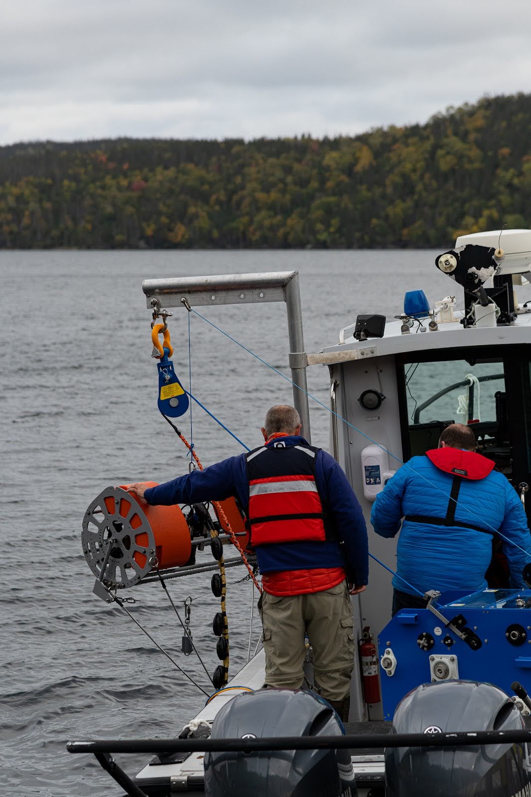
SubC Imaging Upgrades Tow Camera System
SubC Imaging, a leader in subsea imaging technology, is excited to announce the release of its updated Tow Camera System, offering significant upgrades in both hardware and software to meet the growing demands of underwater surveys and research. This new version builds on the proven success of the original system, incorporating cutting-edge features designed to improve operational efficiency, data quality, and user experience.
Enhanced Hardware for Precision and Ease of Use
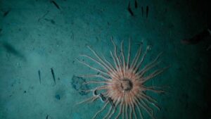
 The updated Tow Camera System boasts several hardware improvements to achieve more precise and detailed underwater footage. New adjustable LEDs, lasers, and camera settings provide customizable illumination, measurement, and capture options, allowing users to fine-tune the system to their specific needs. These features ensure superior footage quality and accuracy, essential for seafloor mapping, marine observations, and infrastructure inspection.
Safety has been enhanced, making the system even more reliable in demanding subsea environments. User-friendly improvements have been introduced to simplify adjustments in the field, ensuring that the Tow Camera System is easy to deploy and operate.
Software Upgrades for Real-Time Insights 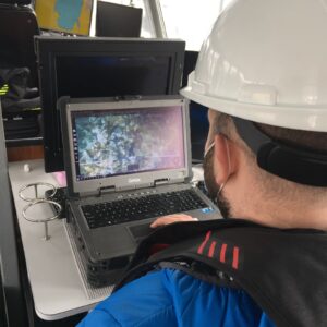
The Tow Camera System is now powered by Rayfin Single Channel Inspection Software, offering real-time media and data transfer. Users can instantly access and record data topside, without post-mission downloading, drastically reducing post-processing time. Automated organization and embedded metadata streamline the retrieval and analysis of images, videos, and sensor data. At the same time, new capabilities such as Rapid Digital Imaging (RDI) allow for high-resolution stills capture and LED strobing at speeds of up to 2Hz.
 Pushing Boundaries in Underwater Technology
The upgraded Tow Camera System can operate at depths up to 380 meters. Built for the most challenging underwater conditions, the system’s rugged stainless steel and epoxy-coated aluminum frame ensures durability, while its neutral buoyancy design provides optimal stability during tow operations.
“The latest version of our Tow Camera System sets a new standard in underwater imaging,” says Chad Collett, CEO of SubC Imaging. “We’ve incorporated feedback from our customers and pushed the boundaries of what’s possible in data acquisition, usability, and imaging quality. This system will empower research and inspection professionals to capture the highest-quality visual data in real-time, drastically improving the efficiency of their operations.”
For more information about the Tow Camera System or to schedule a demo, please visit our website or contact us at [email protected].
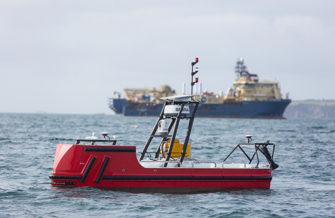
Unmanned Survey Solutions Commissions New USV featuring Robosys’ VOYAGER AI maritime autonomy
 Unmanned Survey Solutions (USS) has unveiled and commissioned its latest Accession class Unmanned Surface Vessel (USV) featuring Robosys Automation’s ground-breaking VOYAGER AI Survey advanced maritime autonomy suite.
The USS Accession class vessel is pioneering, eco-friendly, repeatable and reliable for offshore Beyond Line of Sight (BLoS) operations.
Meticulously designed for high performance, endurance, versatility and low emissions, the Accession excels due to its modular payload system, exceptional stability, and advanced hybrid battery systems, with diverse capabilities as a sensor agnostic platform for the integration of a vast array of mission-specific instruments.
USS’s growing fleet of game-changing hybrid USVs are built with ambition and capacity for tomorrow yet are proven and commercially viable as the optimal solution for rapid deployment today.
Working with leading global clients in the maritime sector, USS is successfully mobilising, deploying and remotely operating its advanced vessels in offshore, coastal and inland waters for maritime data acquisition projects including offshore renewable energy industries, oil & gas, dredging and construction, ports and harbours, and defence & security, as well as for scientific and environmental purposes.
Robosys' groundbreaking VOYAGER AI SURVEY delivers Remote Control and Autonomous Navigation with Autonomous Collision Avoidance, Obstacle Avoidance, combined with Anti-Grounding features enabled by integration of S-57 ENC charts. Specifically designed for the marine survey sector, it also boasts a software Autopilot with Widget control, Heading & Track Control, and Route(s) & Waypoint(s) Planning & Following, with Approach, Harbour and Tidal modes. The integration also sees over 200 PLC channels integrated in to the single, integrated, VOYAGER AI User Interface.
James Williams, USS CEO comments,” Choosing Robosys as a strategic partner for the main control and autopilot system onboard the Accession class USVs has resulted in a step change in our operational capabilities.
He continues, “Robosys’ support and attention to detail has been exemplary. We look forward to working with them on new vessels builds over the coming years as the adoption of USVs becomes standard in the maritime industry”.
Discover more at www.robosysautomation.com.

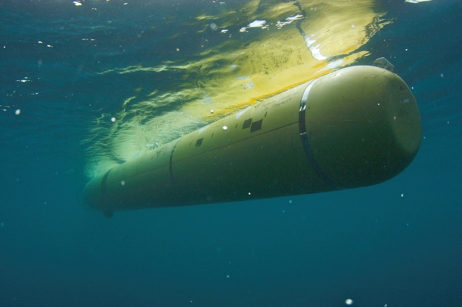
MBARI upgrades deepwater AUV fleet with Exail Phins Compact C7 Inertial Navigation System
 The Monterey Bay Aquarium Research Institute (MBARI), a leading institution in oceanographic research, has selected the Exail Phins Compact C7 Inertial Navigation System (INS) to upgrade its deepwater Autonomous Underwater Vehicle (AUV) fleet.
Built on advanced Fiber-Optic Gyroscope (FOG) technology, the Phins Compact C7 INS was chosen for its ability to deliver survey-grade navigation at depths of down to 6,000 meters. Its compact OEM design allows for seamless integration with MBARI’s existing AUVs, while its compatibility with additional navigation tools enhances overall accuracy, meeting MBARI’s operational needs.
“MBARI’s advanced underwater vehicles gather important data about our changing ocean. Our seafloor mapping operations required a navigation system that could provide state-of-the-art precision and reliability in extreme conditions,” said Erik Trauschke, Autonomous Systems Operations Manager at MBARI. “Its ability to integrate with a Teledyne RDI Doppler Velocity Log (DVL) offers us added flexibility, allowing for a customized INS-DVL configuration.”
“We are delighted that MBARI has chosen our Phins Compact C7 INS for their deepwater AUV fleet,” said Shayan Haque, Business Development Manager at Exail. “It has been a true collaborative effort with everyone involved at MBARI. We are excited to see our systems contributing to their ongoing exploration and research efforts.”
The acquisition of Exail's systems came after a significant period of collaboration between MBARI and the Exail support team, who worked closely to develop a customized solution tailored to MBARI's AUVs and the specific requirements of their deep-sea missions.
"The technical exchange with Erik Trauschke and his team was extremely thorough, and we were aligned from day one. We provided a loaner unit for MBARI to assess the system's performance and assisted in designing their customized mounting bracket. This close collaboration highlights our commitment and ability to support our clients in developing bespoke solutions for their specific needs," said Patrick Lieffering, Support Operations Manager for the Americas at Exail.
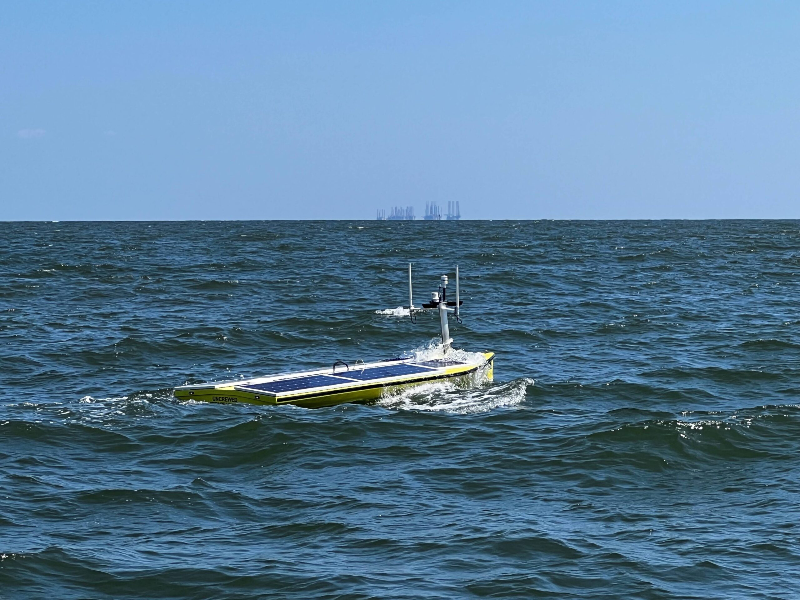
Important oceanographic data from Atlantic Ocean currents in the U.S. Gulf of Mexico has been gathered fully remotely, thanks to Sonardyne technology and an uncrewed surface vehicle (USV) supplied by SeaTrac Systems
A number of Sonardyne Origin 65 Acoustic Doppler Current Profilers (ADCPs) and Current Pressure Inverted Echo Sounders (CPIES) are positioned on the seabed in the Gulf of Mexico gathering long term data on the Loop Current System (LCS).
Understanding the LCS is important for oceanographers as it has a wide-reaching impact on many areas including the disruption of subsea operations, hurricane intensity and changes to nutrient and food cycles important to marine life. However, sending manned vessels offshore to gather this LCS data incurs risk to crews and high operational costs, as well as generating greenhouse gas emissions.
SeaTrac recently launched its SP-48 USV from the Louisiana Universities Marine Consortium (LUMCON) in Cocodrie, LA and remotely piloted it 580 nautical miles with an HPT 7000L transceiver onboard to acoustically gather the data from the ADCPs and CPIES.
The use of the solar and battery powered USV reduced the environmental impact and cost of sending a crewed vessel for the mission whilst allowing for 24hr operations with no manual intervention or personnel onboard.
Aidan Thorn, Business Development Manager for Marine Robotics at Sonardyne, commented: “The use of a fully solar powered USV for a data gathering operation of this scale is a key moment in marine robotics. The Gulf of Mexico presents some of the most challenging ocean currents for any vessel, not-least an uncrewed one. One of the key reasons SeaTrac was chosen to partner with us on this project was their willingness to rise to the challenge and we are delighted with the results. USV’s are a great platforms for collecting data from our seabed nodes and profilers through the integration of our acoustic communication technologies. We look forward to continued work with SeaTrac on this project and hopefully many others.”
Three further sets of data will be gathered over the next 18 months using the same uncrewed methods before the project completes.
Hobie Boeschenstein, Director of Operations and Business Development, at SeaTrac said: “We’re delighted to be working with Sonardyne on this project. Our SP-48 USV provides a complete system for maritime observation, data collection and reconnaissance. Powered by the sun with high-reserve batteries, it can operate in both near-shore and offshore environments through varying weather and sea conditions, as this mission has demonstrated. It can undertake missions lasting from several hours to several months and is designed to support a wide range of customer payloads. Sonardyne’s technology and company ethos is a great fit for ours and we look forward to supporting them in many future missions.”
Further details of the project and the data collected will be announced in due course as more information is gathered.
Greensea IQ Awarded $1.9 Million NAVSEA Contract for Coupled ROV and Manipulator Control
 Greensea IQ, a leader in ocean robotics technology, has announced a strategic partnership with Woods Hole Oceanographic Institution (WHOI) to provide greater diversity of access and accelerate scientific innovation and discovery in the ocean. This operational collaboration with WHOI’s Deep Submergence Laboratory (DSL) and the National Deep Submergence Facility (NDSF), hosted at WHOI, combines Greensea IQ's class-leading expertise in navigation, robotics, remote operations, and user interface systems with WHOI's outstanding reputation as a world leader in deep-sea exploration capabilities and expertise in the design and construction of underwater systems for scientific research. The partnership will create scalable systems to support a wide range of oceanographic research, increasing access to the deep ocean. In addition, technologies and systems developed under this partnership will focus on improving operational efficiency, increasing compatibility with existing systems, and creating and supporting the tele-operation of ROVs.
The primary objective of the partnership between Greensea IQ and NDSF is to create an environment of open collaboration that will facilitate the integration of existing as well as new subsea platforms, that will benefit all of science and discovery in the ocean. Greensea IQ’s open architecture platform will provide the backbone for these developments. The adoption of common standards, tools, and technologies that are shared throughout the community via NDSF will modernize and strengthen the deep submergence capability within the US.
“Two technology leaders, WHOI and Greensea IQ, are collaborating to break down barriers that often hinder innovation, leveraging their combined strengths to advance ocean research,” says Ben Kinnaman, Greensea IQ CEO. “Greensea IQ has a rich history within the scientific community with the adoption of OPENSEA by several research institutions such as MBARI and Schmidt Ocean Institute. By extending OPENSEA, our open architecture platform, further into the science community via NDSF, Greensea IQ will make a higher impact that will support a more diverse community of scientists and researchers.”
Andy Bowen, Director of the NDSF and a Principal Engineer at WHOI adds: “Our experience at the forefront of ocean science and exploration pairs well with Greensea IQ’s mission to expand a common set of foundational tools that enable broader and more flexible access”. Bowen goes on to add, “For more than half a century, WHOI has pioneered deep submergence technology. Forging this collaboration with Greensea IQ is a natural continuation of that legacy, one that will power greater reach and impact for the tools that form the basis of our current and future understanding of the ocean that serves as our planet’s life-support system.”
Kinnaman adds, “Systems and technologies that come out of this alliance will be ready to take on the challenges that face us as we turn to the ocean to solve our generation's most complex problems. We are humbled to be chosen to work alongside such a revered institution.”
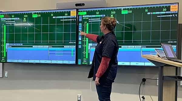
Greensea IQ and Woods Hole Oceanographic Institution establish a partnership to develop future vehicles and technologies supporting scientific research
Greensea IQ, a leader in ocean robotics technology, has announced a strategic partnership with Woods Hole Oceanographic Institution (WHOI) to provide greater diversity of access and accelerate scientific innovation and discovery in the ocean. This operational collaboration with WHOI’s Deep Submergence Laboratory (DSL) and the National Deep Submergence Facility (NDSF), hosted at WHOI, combines Greensea IQ's class-leading expertise in navigation, robotics, remote operations, and user interface systems with WHOI's outstanding reputation as a world leader in deep-sea exploration capabilities and expertise in the design and construction of underwater systems for scientific research. The partnership will create scalable systems to support a wide range of oceanographic research, increasing access to the deep ocean. In addition, technologies and systems developed under this partnership will focus on improving operational efficiency, increasing compatibility with existing systems, and creating and supporting the tele-operation of ROVs.
The primary objective of the partnership between Greensea IQ and NDSF is to create an environment of open collaboration that will facilitate the integration of existing as well as new subsea platforms, that will benefit all of science and discovery in the ocean. Greensea IQ’s open architecture platform will provide the backbone for these developments. The adoption of common standards, tools, and technologies that are shared throughout the community via NDSF will modernize and strengthen the deep submergence capability within the US.
“Two technology leaders, WHOI and Greensea IQ, are collaborating to break down barriers that often hinder innovation, leveraging their combined strengths to advance ocean research,” says Ben Kinnaman, Greensea IQ CEO. “Greensea IQ has a rich history within the scientific community with the adoption of OPENSEA by several research institutions such as MBARI and Schmidt Ocean Institute. By extending OPENSEA, our open architecture platform, further into the science community via NDSF, Greensea IQ will make a higher impact that will support a more diverse community of scientists and researchers.”
Andy Bowen, Director of the NDSF and a Principal Engineer at WHOI adds: “Our experience at the forefront of ocean science and exploration pairs well with Greensea IQ’s mission to expand a common set of foundational tools that enable broader and more flexible access”. Bowen goes on to add, “For more than half a century, WHOI has pioneered deep submergence technology. Forging this collaboration with Greensea IQ is a natural continuation of that legacy, one that will power greater reach and impact for the tools that form the basis of our current and future understanding of the ocean that serves as our planet’s life-support system.”
Kinnaman adds, “Systems and technologies that come out of this alliance will be ready to take on the challenges that face us as we turn to the ocean to solve our generation's most complex problems. We are humbled to be chosen to work alongside such a revered institution.”
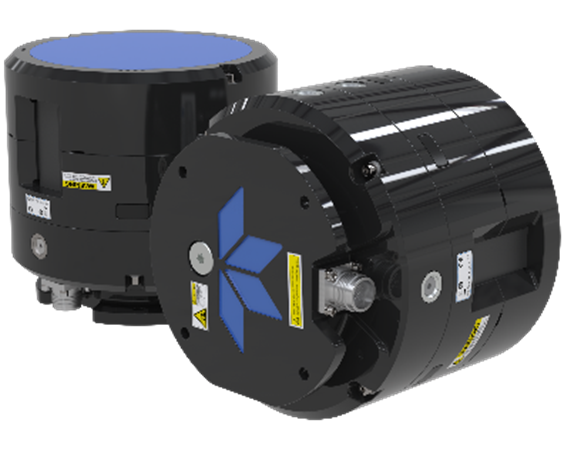
MacArtney Asia Appointed as Regional Reseller for Teledyne RD Instruments ADCP and DVL Products
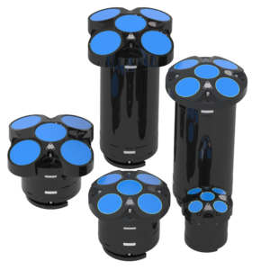 MacArtney Asia, a leading provider of underwater technology solutions based in Singapore, is proud to announce its appointment as the regional reseller for Teledyne RD Instruments’ Acoustic Doppler Current Profilers (ADCP) and Doppler Velocity Log (DVL) products. This strategic partnership will enhance the availability and support of Teledyne RDI’s advanced ADCP and DVL technology across the region.
The MacArtney Group is a global supplier of underwater technology products and systems, specializing in the design, manufacture, sales, and service of a wide range of systems to oil & gas offshore operators, ROV, diving, and survey contractors, the renewable energy sector, ocean science institutes, and navies around the world. The company offers a variety of advanced and reliable products and system solutions, spanning from subsea cables and connectors to state-of-the-art integrated packages, including fibre optic telemetry, underwater cameras and lights, oceanographic instruments, marine winch systems, and remotely operated, towed vehicles. All products supplied are designed and tested to provide high quality, efficiency, and reliable performance in the challenging underwater environment.
“We are thrilled to be appointed as the regional reseller for Teledyne RDI ADCP and DVL products,” said Anthony Gleeson, Managing Director at MacArtney Asia. “This partnership aligns with our commitment to providing our customers with the most advanced and reliable underwater technology solutions. Teledyne RDI’s ADCP and DVL products are renowned for their precision and durability, and we are excited to bring these exceptional products to our clients in the region.”
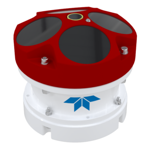 Teledyne RDI is a world leader in the design and manufacture of ADCPs and DVLs, which are used for measuring water current velocities over a depth range, and velocity of underwater vehicles using the Doppler effect. Their products are widely used in oceanographic research, environmental monitoring, defense, and various industrial applications.
Grant Jennings, Product Line Director of Teledyne RDI, is also excited about the new partnership. “Teledyne RDI is pleased to have an organisation with such a great reputation and technical capability representing our products in the region, said Grant. “RDI has 40 years of sales into South East Asia, and we feel Anthony and his team are the best partner to look after our existing customers and help grow our market share. With a range of new products being released in 2024 and 2025, the timing is perfect to bring MacArtney onboard.”

RBR Collaborates with Alcatel Submarine Networks to support SMART cable innovation
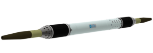 RBR is pleased to announce an exciting collaboration with global subsea communication experts Alcatel Submarine Networks (ASN) and seismic instrumentation leaders Nanometrics for the development of advanced innovative solutions as part of ASN’s Climate Change solution. This collaboration sets a new benchmark for subsea cable technology, combining cutting-edge innovations and unparalleled expertise for the Scientific Monitoring and Reliable Telecommunications (SMART) cable market.
ASN, with an existing installed base of over 800,000 km of optical submarine cables worldwide, selected RBR as a leader in precision environmental sensors with a proven track record of over 50 years. A specialised team at RBR worked closely with ASN engineers to develop and refine the simplicity of the system provided, which is based on our well-proven BPR|zero technology.
The custom variant of the existing BPR|zero, intended for submarine cable usage, has been miniaturised and also ruggedised in order to handle the extreme environment experienced during normal cable-laying ship deployments. The system is intended to be housed adjacent to a normal repeater housing and used with a simplified interface with a minimal command set.
All components are tested to far greater than normal operating cycles, given the intended harsh deployment conditions and 25-year undersea life requirement, but still provide the same A-zero-A drift correction as the elder sibling whose output has a resolution of 10ppb (1Hz sampling period) and is therefore suitable for tsunami monitoring and subsidence detection.
Greg Johnson, President of RBR, stated “This is another example where the proven technology and in-house expertise of the team at RBR, leads to innovative and comprehensive solutions for our end clients. Working closely with the team at ASN during development has been key in the successful outcome of the first phase of the project, and we look forward to this collaboration developing further in delivering additional SMART solutions.”
ASN is contracted to design, manufacture, and deploy two pioneering SMART cable projects with deployment scheduled for 2026. These SMART cable systems will not only enhance underwater data connectivity but also provide critical real-time monitoring of seismic, tsunami, and environmental events.
For more details on the project visit ASN or please reach out to the team at [email protected]