
Sonardyne awarded contract for seabed monitoring landers and associated services for NEP project
Sonardyne are delighted to have been selected through a competitive bidding process to deliver baseline environmental monitoring services for the UK’s first offshore carbon capture and storage (CCS) site.
Sonardyne has been contracted by the Northern Endurance Partnership (NEP), the developer of the onshore and offshore infrastructure needed to transport carbon dioxide (CO2) from carbon capture projects across Teesside and the Humber – collectively known as the East Coast Cluster - to secure storage under the North Sea. The infrastructure is crucial to achieving net zero in the UK’s most carbon intensive industrial regions.
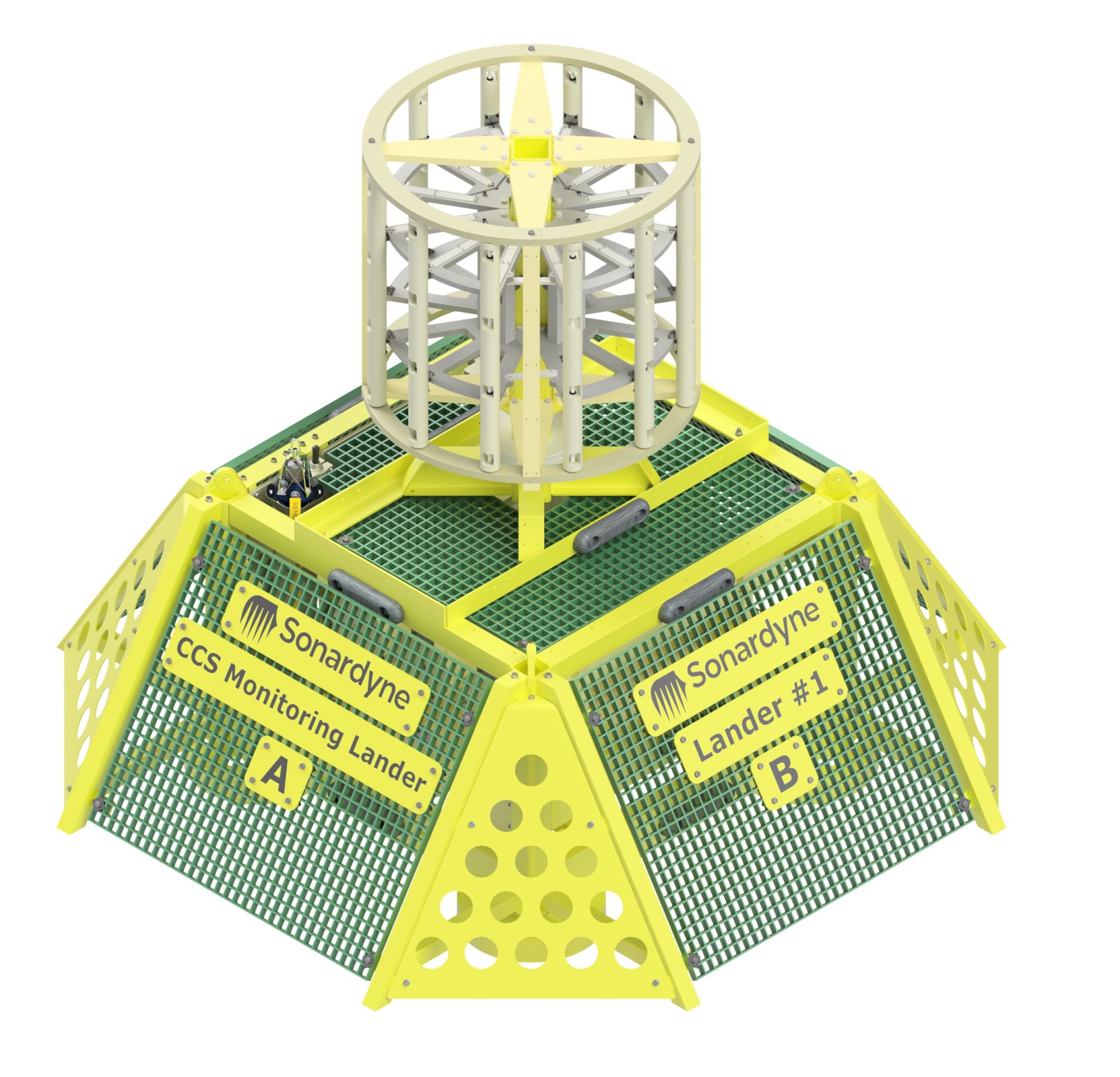
Sonardyne will provide environmental monitoring, in the form of seabed landers, at key locations above and around the subsurface Endurance site - the saline aquifer located 145km off the coast of Teesside where captured CO2 will be stored.
Monitoring of the site will begin in the summer of 2026 to provide baseline data for a duration of two years before the transportation and storage of captured CO2 commences. The seabed landers will be equipped with Sonardyne’s Edge data processing application, power management and acoustic through-water communications to enable long-term, remote battery-operated deployment. Each lander will also contain a suite of hardware including Sonardyne’s Origin 600 ADCP, Wavefront’s passive sonar array and multiple third-party sensors. Together, this technology can detect small changes in water chemistry across a wide area, while the data can be harvested, without retrieving the lander, using wireless subsea acoustic communication techniques.
Monitoring is a key activity for offshore CCS developments to verify safe containment of CO2 within the reservoir, provide reassurance to stakeholders and foster public confidence in this greenhouse gas abatement process.
Stephen Auld, Business Development Manager for Custom Projects at Sonardyne, welcomed the appointment: “Being selected to deliver subsea environmental monitoring for this landmark project is a real honour and a testament to Sonardyne’s significant experience and expertise in this field. As a company who are already carbon neutral in our UK operations, we are passionate about combatting climate change and the drive for carbon neutrality. We are delighted to be working with NEP in delivering cutting edge marine technology to ensure their safe and successful offshore carbon storage operations.”
Sarah Buchanan, bp Subsurface Manager: "NEP is at the forefront of driving the UK’s journey to net zero in securing a permit for carbon capture and storage at the Endurance site. Our collaboration with Sonardyne to monitor the storage site plays a critical role in ensuring carbon is stored safely and securely.”

The Ocean Census Embarks on First Deep-sea Expedition in Japan, Partnering with JAMSTEC
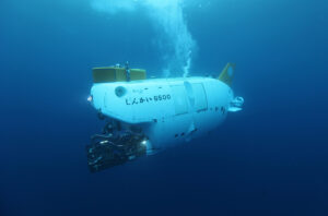
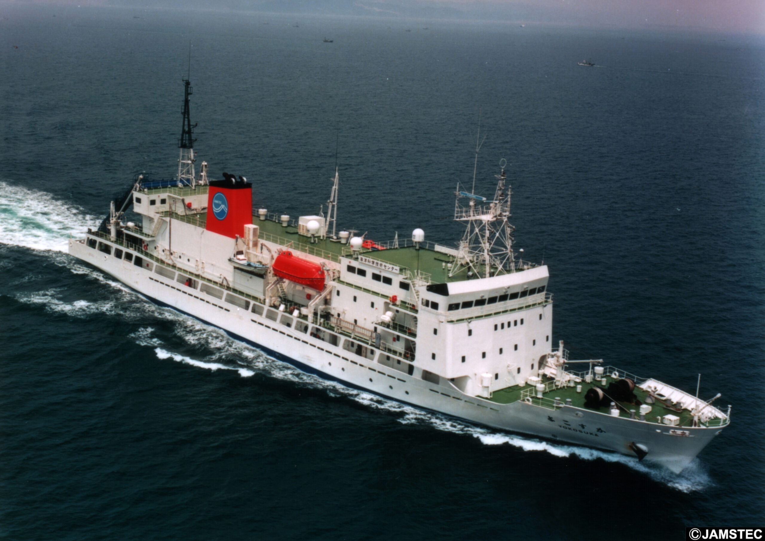
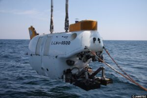
Japan is taking centre stage in a groundbreaking international expedition to explore and document new life in the deep ocean. In June 2025, the Japan Agency for Marine-Earth Science and Technology (JAMSTEC) will collaborate with The Nippon Foundation–Nekton Ocean Census, deploying the renowned submersible Shinkai 6500 on a 20-day scientific voyage into some of Japan’s most mysterious deep-sea ecosystems.
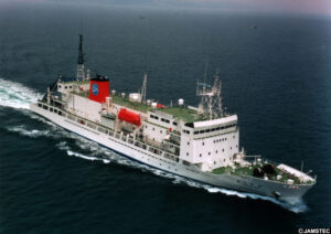
The expedition, aboard the research vessel Yokosuka, will target biologically rich deep-sea regions within Japan's Exclusive Economic Zone, including the Nankai Trough and Shichiyo Seamounts, aiming to discover marine species never before seen by science.
"This expedition represents more than a journey into the unknown; it signifies a convergence of knowledge, expertise, and a shared vision dedicated to advancing the discovery of marine biodiversity. With JAMSTEC's Shinkai 6500 at its core, this mission shows the transformative power of international collaboration in deep-sea research. Together, we aim to deepen our understanding of life in the ocean’s most remote regions and to contribute meaningfully to the preservation of our planet’s biodiversity." Dr. Takeshi Kawano, Executive Director of JAMSTEC.
Launched in 2023 by The Nippon Foundation and UK-based charity Nekton, the Ocean Census is the world’s largest programme to accelerate marine species discovery. JAMSTEC’s expedition marks Japan’s flagship contribution to this global initiative, which is endorsed by the United Nations Ocean Decade.
Japanese Technology Meets Global Science
The expedition celebrates Japan’s leadership in ocean technology and science, exemplified by the Shinkai 6500 – one of the world's deepest-diving human-occupied research submersibles capable of diving to 6500 m deep. Since 1990, it has completed over 1,800 dives and remains a symbol of Japan’s deep-sea expertise.
“We’re proud to deploy the Shinkai 6500 on home ground in service of global science,” said Dr Akinori Yabuki, Principal Investigator of the expedition at JAMSTEC. “Japan’s waters hold extraordinary biological diversity, and many areas remain virtually unexplored.”
The expedition’s international scientific team includes experts from JAMSTEC, the Ocean Census, Nagoya University, Hokkaido University, and the Australian National University. Together, they will aim to undertake up to 11 dives, collecting and documenting deep-sea species across a range of remarkable ecosystems; from volcanic seamounts to methane seep communities.
"This is about more than discovery. It’s about creating a new knowledge base for ocean stewardship, led by Japan and shared with the world," said Dr Michelle Taylor, co-lead of the expedition and Head of Science at the Ocean Census. "Thanks to JAMSTEC’s incredible legacy and infrastructure, and with the support of The Nippon Foundation, we expect to find species new to science."
Open Discovery for All
In line with the Ocean Census’ commitment to open science, all discoveries from the cruise will be made freely available through the Ocean Census Biodiversity Data Platform. A post-expedition Species Discovery Workshop will be held at JAMSTEC headquarters in late 2025, where Japanese and international scientists will catalogue the findings together.The expedition will feature a public engagement campaign in Japan, including social media updates, educational collaborations, and captivating footage from the submersible itself. The public is invited to follow the expedition’s progress through dedicated social media channels, including @oceancensus on X, Instagram for global updates, and @oceancensus_jp for updates from Japan.
As the R/V Yokosuka departs and Shinkai 6500 dives into uncharted depths, this mission offers a rare glimpse into Earth’s final frontier—and an inspiring example of global collaboration, scientific curiosity, and the power of discovery.
Demand for Sulmara’s innovative survey services increases as developers accelerate offshore wind projects
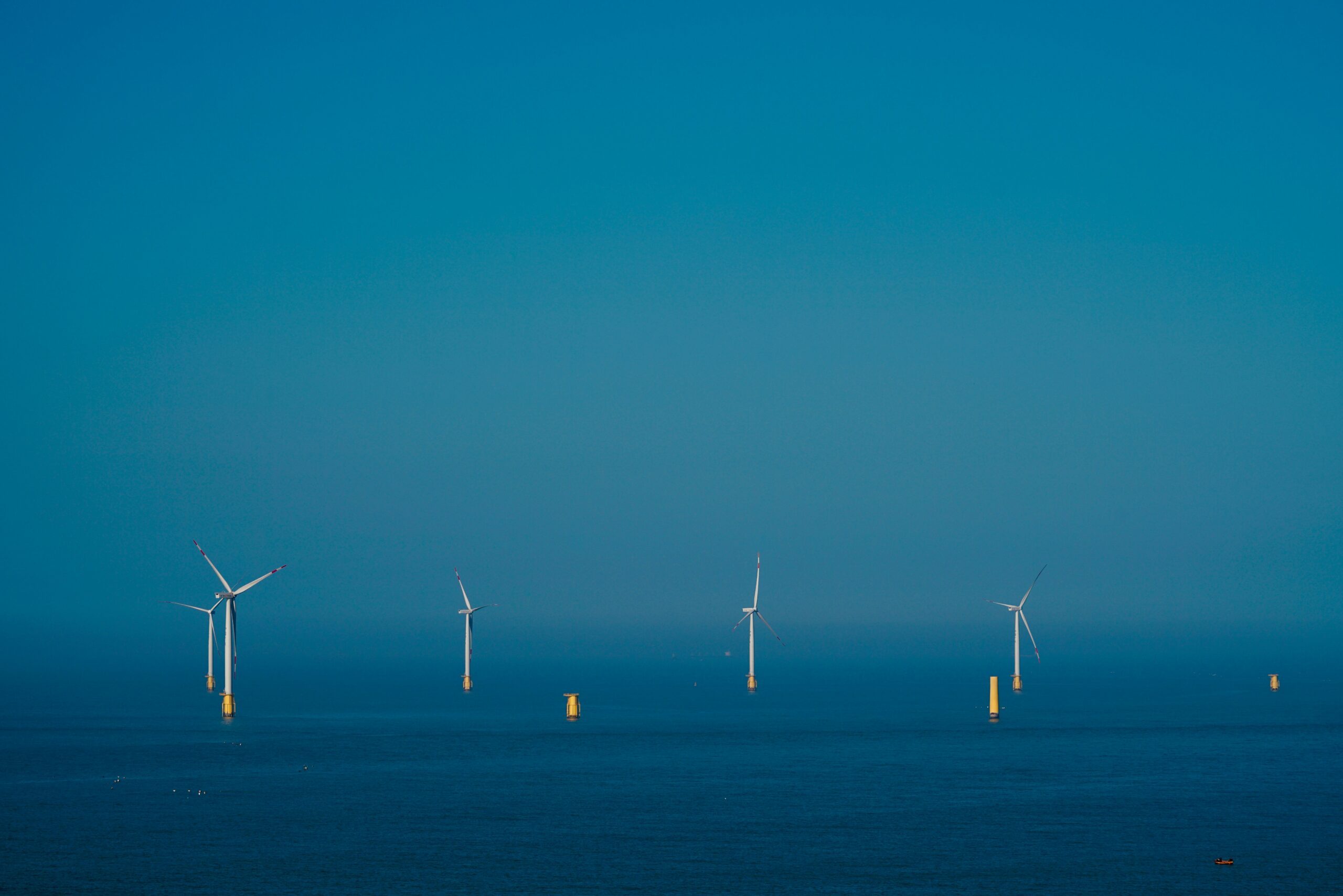
 International subsea specialist Sulmara is seeing a rise in demand for its uncrewed surface vessel (USV) operations and seabed mapping services, driven by the ongoing expansion of Taiwan’s offshore wind market. This surge also reflects a clear trend among developers - a shift toward earlier engagement in site investigation and survey planning to support more efficient, long-term project delivery.
The shift is driving interest in long-term survey and seabed data solutions. James Hope, Regional Director Eastern Hemisphere at Sulmara, comments: “As the offshore wind sector in Taiwan gains momentum and certainty, we are seeing a clear shift toward long-term planning and early engagement, particularly around innovative services like USV operations and seabed mapping. This presents a real opportunity for Sulmara to support clients through every phase of project development.
“Clients are also increasingly looking to secure multi-year agreements to guarantee access to high-quality data outputs at key stages of development.”
Since setting up the local office in Taiwan in 2021, Sulmara has built momentum year-on-year by undertaking numerous repeat contracts with major wind farm developers and installation contractors in-country to provide a range of innovative and bespoke services.
Sulmara has a growing presence in Taiwan’s offshore wind sector. One long-term partnership of note is with Seaway7, for whom Sulmara has successfully completed its second consecutive year under contract - supporting the renowned global leader in fixed offshore wind farm construction on the Zhong Neng Project.
Hope continues, “Our work with Seaway7 at Zhong Neng reflects not only the trust placed in Sulmara, but also the capability and commitment of our team in Taiwan as we enter our fifth year of operations in the region.”
Reflecting on Sulmara’s role in the project, Antonina Timofeeva of Seaway7 said, “Sulmara’s performance on the Zhong Neng project was reliable, and the in-country team successfully supported delivery of survey equipment to the project and provided operational assistance to overcome any challenges.”
Following the success of the Zhong Neng contract, Sulmara is currently supporting Ørsted on the Greater Changhua 2b and 4 offshore wind farms, delivering geoscience construction monitoring (GCM) services and seabed mapping to support offshore construction which began in February 2025.
Sulmara continues to invest in the upskilling of local staff, with Taiwanese surveyors and project team members gaining hands-on experience across a number of high-profile projects. One notable example is Yu-Fan Tao, a former intern who returned to join the Zhong Neng project team and is now playing a key role in Sulmara’s delivery for the Greater Changhua wind farms.
Hope expands, “A key area of focus for Sulmara is on developing local talent by combining international experience with in-country knowledge. Empowering our Taiwanese staff to take on increasingly complex roles is central to how we grow the business and contribute to the sector’s long-term success.”
Beyond Taiwan, Sulmara is also expanding its presence in the Asia-Pacific region, having recently signed a Memorandum of Understanding (MoU) with South Korean company Allforland to jointly deliver mapping solutions to help support the country’s offshore wind ambitions.
Ocean robots exploring role of ‘marine snow’ in carbon storage
A cutting-edge fleet of ocean robots and instruments has been deployed to explore the depths of the Labrador Sea as part of a ground-breaking year-long experiment led by scientists from the UK’s National Oceanography Centre (NOC).
The ReBELS project (Resolving Biological Carbon Export in the Labrador Sea) is investigating the biological carbon pump, a key ocean process that helps remove carbon dioxide from the atmosphere and store it in the deep sea and without which atmospheric CO₂ would be 50% higher.
Using a combination of moored sensors, drifting profiling floats and autonomous underwater vehicles, the project seeks to understand how carbon-rich particles sink through the water column and how physical ocean processes, such as deep convection currents, might enhance carbon storage in this remote and understudied region.
A key innovation in the project is the FluxCAM, a novel marine snow camera system designed to measure the sinking speeds of different-sized particles to reduce uncertainties in how much carbon the ocean absorbs from the atmosphere.
Two FluxCAMs were installed on a deep-sea mooring in the Labrador Sea, between Newfoundland and Greenland, last year, along with a specially programmed drifting profiling float.
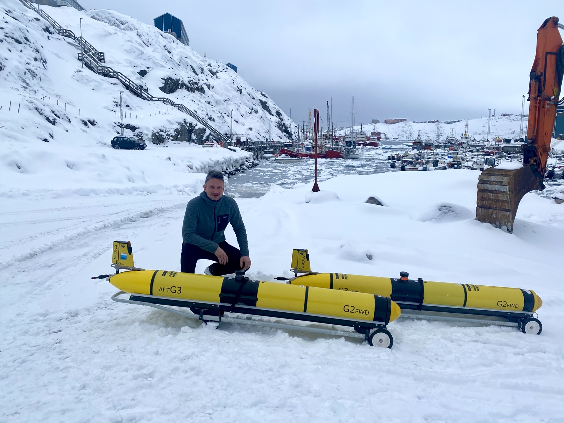
Now, they have been joined by autonomous underwater gliders, which will measure ocean properties and carbon flux for five to six months.
“The biological carbon pump plays a crucial role in regulating Earth’s climate,” says project lead Dr Filipa Carvalho at NOC. “Microscopic marine plants, known as phytoplankton, absorb carbon dioxide from the atmosphere and convert it into organic material.
“This material is then consumed by marine organisms, with remnants eventually sinking as ‘marine snow’—tiny carbon-rich particles that settle in the deep ocean, where the carbon can be stored for centuries.
“However, the rate at which these particles sink and how much carbon is ultimately locked away remain uncertain. The ReBELS project is using cutting-edge technology to answer these questions. This combination of fixed and mobile instruments will allow us to track how carbon is transported and transformed in the Labrador Sea over time.”
The cameras were fixed at 100 and 300 m deep on a 3,300 m-long mooring in the sea between Newfoundland and Greenland.
The ReBELS float has been programmed to carry out more frequent and varied depth profiles than standard floats and is also equipped with advanced sensors, including an optical sediment trap to help us to understand the amount of sinking particles when the float is drifting at the same depth.
One of the gliders will stay near the mooring, while another one will follow a drifting profiling float, capturing detailed, high-resolution data on particle movement, ocean circulation and biological activity.
“This combination of moored sensors, drifting instruments and mobile gliders is designed to overcome the challenges of studying carbon flux in the ocean,” adds Dr Louis Clement, co-investigator and also at NOC.
“While moored instruments provide long-term, fixed-location data, they do not capture the movement of water masses. The drifting float follows ocean currents, providing a dynamic perspective on sinking particles, while the gliders add another layer of insight, especially into small scale turbulence effects on the biological carbon pump.
“By integrating data from these platforms, we hope to build the most accurate picture yet of carbon transport and storage in the Labrador Sea.”
ReBELS is a four-year program funded by the Natural Environment Research Council (NERC) and builds on decades of research into ocean carbon storage. By deploying state-of-the-art robotic technology, the project is expected to provide new insights into one of the ocean’s most important climate-regulating mechanisms, improving our ability to predict and respond to global climate change.
Subsea Supplies expands digital technology offering with Anekonnect partnership
Subsea Supplies, a trusted supplier of market leading offshore and underwater technology equipment, has announced a strategic new partnership with Anekonnect Incorporated, further diversifying its offering to the global market.
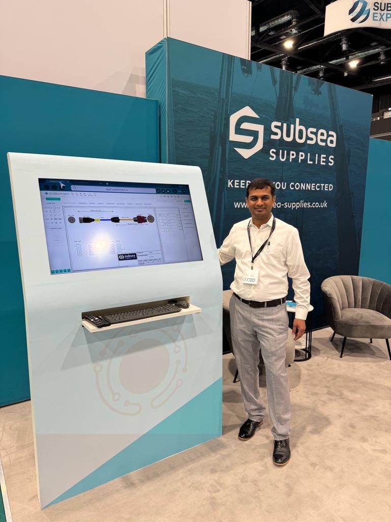
The subsea equipment provider will deploy the company’s digital diagramming tool, tailored for creating cable assemblies and electrical circuit schemas for subsea and marine purposes, from its production base in Aberdeen.
Anekonnect is an innovative solution that accelerates the design, procurement and moulding of subsea cables. Developed with direct input from survey engineers, ROV builders and operators, cable moulders, equipment rental companies, and connector manufacturers, the company’s tools are specifically engineered to address the unique challenges of the subsea industry, delivering increased efficiency, reliability, and precision at each stage of the cable lifecycle.
Shaun Stirling, Head of Sales at Subsea Supplies, said: “The evolution of the subsea market has seen the advancement and adoption of technology become key to its future. Our team is working across the industry to secure the most advanced products to supply to our customers and this announcement is a testament to this.
“Anekonnect’s technology is revolutionary for our clients that need to digitise the diagramming of their subsea systems. This software can be easily combined with our existing product offering, such as our connector range, enabling the design and delivery of fully integrated solutions. Having worked with the team for more than 8 years, we are proud to be strategically partnering with them and look forward to seeing the benefits that this will unlock for our clients.
“These partnerships ensure that Subsea Supplies remains at the forefront of innovation and service within the industry and is ready to meet the evolving needs of its global clients.”
Bhavin Shah, co-founder at Anekonnect Incorporated, commented: “We are thrilled to unveil our official representative partnership with Subsea Supplies, a reputable brand with over 25 years of experience in the field, known for representing esteemed names in the subsea sector.
“The fusion of Anekonnect's comprehensive cable design solution with Subsea Supplies extensive networks and industry acumen signifies a significant leap towards offering cutting-edge solutions to the global offshore and marine engineering communities. This collaboration anticipates a promising future of innovation and enhanced support for the industry.”
This announcement comes as Subsea Supplies celebrates its 25th anniversary year and marks another pivotal moment in the company’s continued growth. With plans for further business expansion, an enhanced presence in Aberdeen and globally - with the upgrading of its facilities and expanding production capabilities - and growing its dedicated team, already underway.
NOC awarded £2.6 m to investigate expanding ocean deserts
Scientists at the UK’s National Oceanography Centre (NOC) are to lead a new, five-year funded project to investigate the alarming expansion of ocean deserts—vast regions of the ocean with little life or nutrients.
The research, supported by a £2.6 million European Research Council (ERC) Consolidator Grant, will explore whether microscopic organisms called diazotrophs could slow or even reverse this trend thanks to their nitrogen fixing capabilities.
Subtropical gyres, often referred to as “ocean deserts”, cover more than 60% of the ocean's surface. These regions are expanding at an unprecedented rate of five million square kilometres per decade—an area equivalent to the Amazon Rainforest or the entire European Union.
As global temperatures rise, scientists are concerned about the long-term impact of this expansion on marine ecosystems and the Earth's climate, which would reduce the health of the ocean, affecting marine food webs and the ocean’s role as a carbon sink.
The new project, called EXPAND, will focus on the Indian Ocean subtropical gyre, the least understood of these ocean deserts, with partners from France, USA, Canada and South Africa.
Project lead and NOC senior scientist Dr Mar Benavides highlights the urgency of understanding what drives the expansion of ocean deserts—and whether nitrogen fixing diazotrophs, which can benefit from ocean desert conditions, could help counteract its effects.
"This research will reveal how marine microorganisms support ocean health and global biogeochemical cycles," says Dr Benavides. "We aim to determine whether diazotrophs—microorganisms that convert atmospheric nitrogen into nutrients—can sustain marine productivity in these expanding deserts.
"By uncovering the links between nitrogen fixation and marine productivity, we will be able to refine climate change models and improve predictions of how marine ecosystems respond to environmental changes. Ultimately, this project could offer new insights into mitigating climate change’s impact on our oceans."
As part of the project, researchers will conduct two expeditions aboard the R/V Marion Dufresne. These expeditions will bring together experts in biogeochemistry, microbiology, physical oceanography and ocean engineering to collect critical data from the Indian Ocean.
TDI-BROOKS completes a geological assessment in the Gulf of Mexico for Enbridge
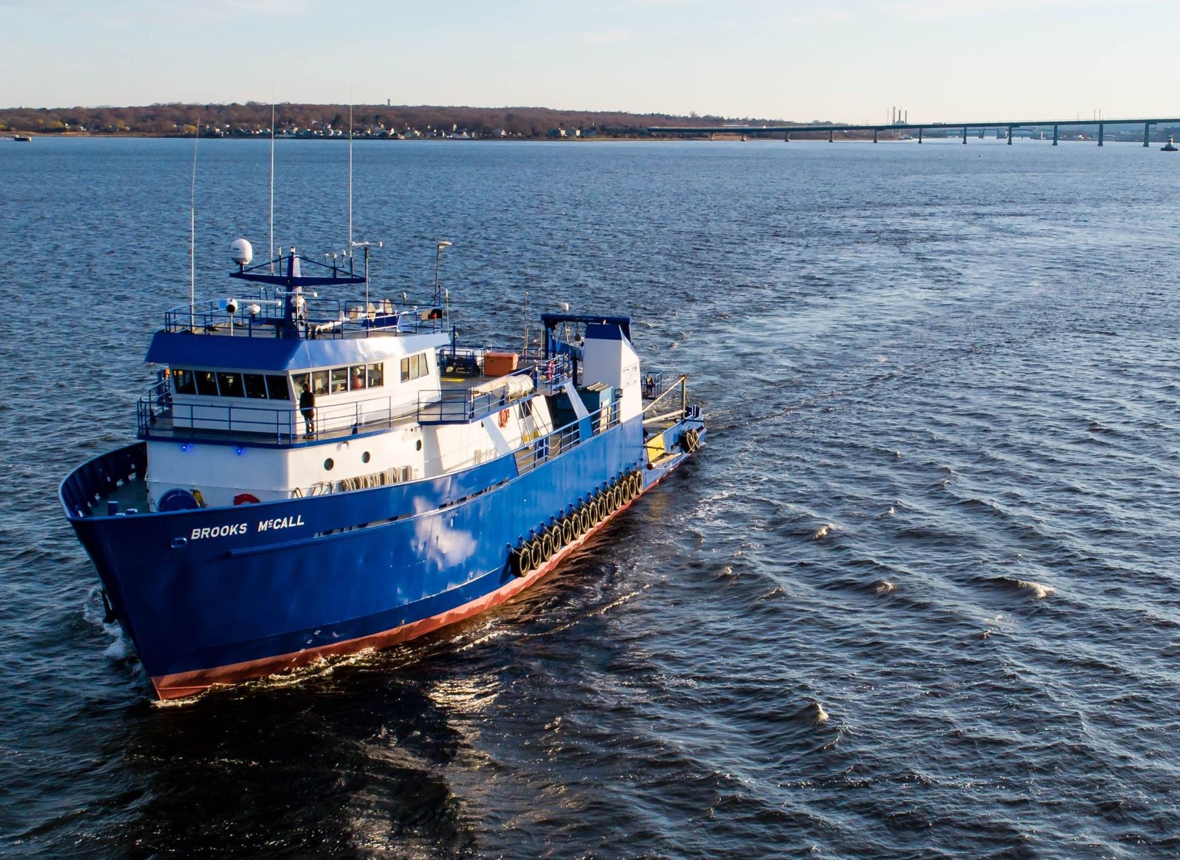
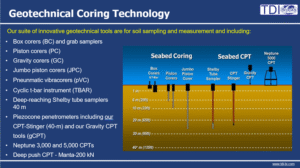 TDI-Brooks has recently finalized a geological evaluation in the Gulf of Mexico on behalf of Enbridge. For this project, TDI-Brooks utilized the R/V BROOKS MCCALL, executing 38 piston cores (PC), 7 gravity cone penetration tests (gCPTs), and 82 box cores (BC). TDI-Brooks geotechnical tool set onboard the BMCC consisting of piston, 20-m jumbo piston and box cores, 40-m CPT-Stingers and 40-m Stinger-Sampler.
TDI-Brooks has conducted previous geotechnical projects for Enbridge in the Gulf of Mexico. All samples gathered will be examined at TDI-Brooks' Geotechnical Laboratory located in College Station, Texas. TDI-Brooks has engaged GEMS/Geosyntec to deliver the Field Reporting.
About TDI-Brooks International, Inc.
TDI-Brooks is a 29-year-old research and service company specializing in geotechnical and offshore survey projects; multi-disciplinary oceanographic and environmental projects; surface geochemical exploration; and high-end environmental chemistry for IOC and offshore wind clients in addition to federal and state agencies.
TDI-Brooks has multi-use vessels suited for a wide variety of oceanographic research duties for the offshore renewables and energy sectors. These include operations and management of five (5) research vessels, Brooks McCall, Miss Emma McCall, Gyre, Proteus and the Nautilus. The Brooks McCall and Miss Emma McCall are both U.S. registered Jones-Act compliant vessel while the Gyre, Proteus and Nautilus are Vanuatu registered, fully SOLAS compliant, and serve clients globally.
Greensea IQ announces Neotek as exclusive representative for France and Belgium
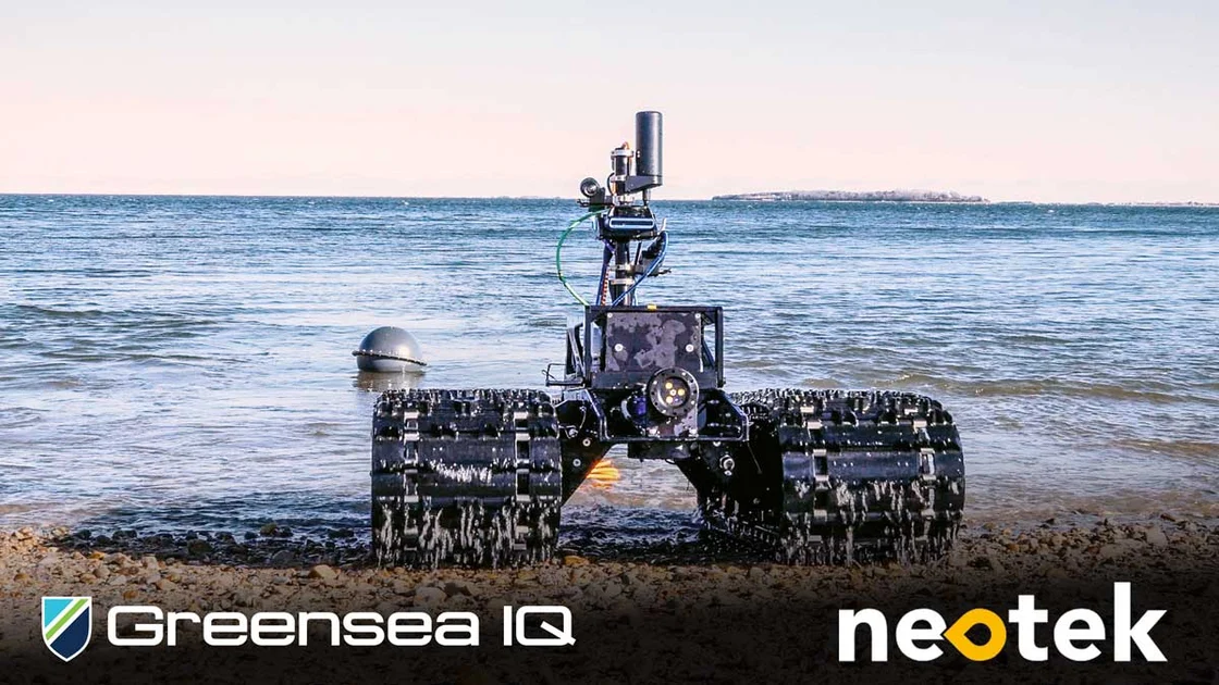
 Greensea IQGreensea IQ, a leader in autonomous robotic systems for the maritime and defense industries, is pleased to announce a new exclusive representation agreement with Neotek, a well-established provider of marine technologies headquartered in Lorient, France. Under this agreement, Neotek will represent Greensea IQ’s Bayonet line of surf-zone autonomous vehicles and IQNS navigation and situational awareness systems in France and Belgium.
This partnership marks a strategic expansion of Greensea IQ’s international sales network, bringing two of its core product lines to new markets through a highly respected regional expert in marine systems integration and distribution.
“Neotek brings deep technical expertise and strong customer relationships in the maritime and defense sectors across France and Belgium,” said Rob Howard, Chief Growth Officer of Greensea IQ. “We’re excited to partner with a company that understands the operational challenges of the surf zone and the value of precise navigation and autonomy. Together, we’ll support customers seeking new capabilities for littoral and seabed defense operations.”
The Bayonet family of Autonomous Underwater Ground Vehicles (AUGVs) provides robust, adaptable solutions for operations in the surf zone and shallow water—delivering applications including mine countermeasures (MCM), UXO detection, beach surveys, and payload delivery. IQNS, Greensea IQ’s Integrated Navigation System, enables accurate and reliable positioning, communication, and control across complex subsea missions.
“We are proud to become the exclusive representative for Greensea IQ in France and Belgium,” said Antoine HANOY, Defense Sales Manager at Neotek. “The Bayonet and IQNS systems fit perfectly within our portfolio and address growing demand in the region for advanced autonomous technologies. We look forward to supporting Greensea IQ’s growth and bringing these powerful capabilities to our customers.”
This agreement strengthens Greensea IQ’s ability to serve regional defense, scientific, and commercial users with integrated robotic solutions designed for mission-critical success.
About Neotek
Neotek is a wholly owned French company by Sea Vorian, specializing in the distribution and integration of marine technologies. With more than 30 years of experience, Neotek serves customers in defense, oceanography, offshore energy, and environmental monitoring by providing best-in-class instrumentation and engineering support. Based in Lorient and Toulon, Neotek is able to provide large scale of services such as leasing of equipment, turnkey operation including manpower and data analysis, and services including maintenance, repair and obsolescence treatment. Learn more at https://neotek-web.com.
Voyis launches Deep Vision Optics: a new era in underwater imaging
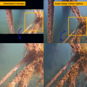 Voyis, a global leader in underwater optical sensor technology, is proud to announce the launch of the Deep Vision Optics, an advanced optical system designed to enhance image clarity and sharpness in subsea environments. This cutting-edge solution is being released for the Voyis’ Discovery Vision Systems and the Observer Imaging Systems, setting a new standard in underwater imaging performance.
Overcoming the Limitations of Underwater Imaging
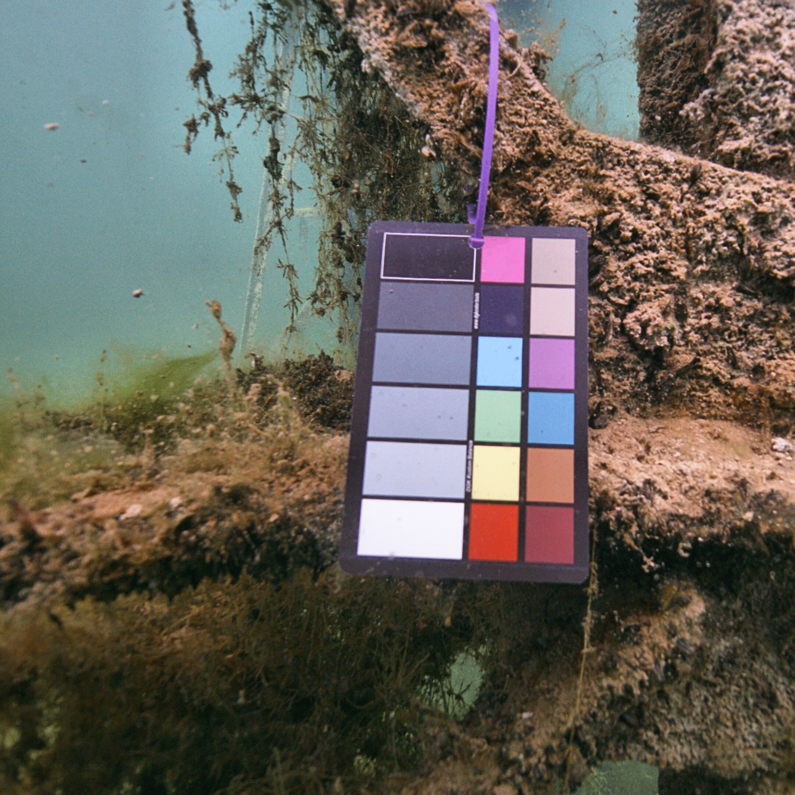
Underwater cameras face a significant challenge in maintaining focus across their entire field of view and working range due to the water medium. Traditional dome viewports affect image formation and focus, leading to poor corner focus that limit the usability of the camera’s field of view. They also reduce the depth-of-filed of the camera, meaning both close-up and far away targets cannot both have optimal sharpness. The result is image blur, reduced feature tracking accuracy, and inconsistencies in photogrammetry-based mapping applications.
The Deep Vision Optics: A Breakthrough in Optical Engineering
To address these fundamental imaging issues, Voyis has developed the Deep Vision Optics, integrating an advanced corrective optical design with three key objectives:
- Eliminating Image Blur in the Corners: By optically correcting for the effects of the dome viewport and water medium, the system ensures nearly equal sharpness across the entire field of view, allowing for full-sensor utilization.
- Enhancing Overall Image Sharpness: The new optical system removes distortions caused by the water medium, improving clarity not just in the corners, but at the center as well.
- Expanding the Depth of Field: With customized optical engineering, the Deep Vision Lens enables clear imaging of both nearby and distant objects, crucial for precision inspections and wide-area surveys.
Benefits for Underwater Operations
Deep Vision Optics delivers industry-leading image quality, maximizing field-of-view utilization to enhance situational awareness for ROVs and improve visual surveys with AUVs. Optimized image sharpness boosts feature and target detection, supporting machine learning applications with reliable automated analysis. Enhanced corner sharpness improves stability in photogrammetry and VSLAM processes, while higher depth of field ensures accurate photogrammetry, reducing manual intervention and accelerating data processing for faster, more reliable survey results.
Setting a New Standard in Underwater Imaging
Deep Vision Optics represents a significant leap forward in underwater imaging technology, empowering operators with the tools needed to conduct more precise, efficient, and automated subsea inspections. Voyis remains committed to advancing the field of underwater vision, ensuring that every detail beneath the surface is captured with unparalleled clarity.
For more information about the Deep Vision Lens and how it integrates with Voyis’ imaging and vision systems, please visit our website or contact the sales team at [email protected]
GEOXYZ launches first African branch in Namibia, strengthening Southern Africa presence
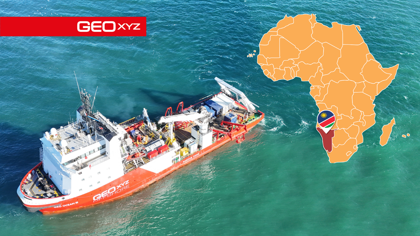
 GEOxyz proudly announces the opening of its first African branch in Walvis Bay, Namibia. This move marks a significant milestone in GEOxyz’s international expansion strategy and confirms a long-term commitment to serving the Southern African market with high-quality, locally adapted services.
Namibia was chosen as the company’s regional base due to its central location, strong business environment, and growing demand for survey services in both offshore and onshore infrastructure sectors. From this strategic location, GEOxyz will be able to efficiently support projects across Southern Africa.
The Namibian office will be led by Jacques Vancayseele, a seasoned industry expert with over seven years at GEOxyz and deep ties to both South Africa and Namibia. His leadership will ensure a strong bridge between GEOxyz’s European roots and its African ambitions.
“I’m excited to lead this new chapter for GEOxyz in Southern Africa,” said Jacques Vancayseele. “This region holds immense potential, and with a dedicated local presence, we’re better positioned to deliver tailored solutions that meet the specific needs of our clients while contributing to local growth and development.”
The new office will initially operate as a close collaboration between GEOxyz’s European and African teams, with a long-term goal of building a fully independent and locally led operation. GEOxyz is committed to hiring local talent, partnering with regional institutions, and investing in knowledge transfer to ensure that local teams benefit from the company’s extensive global experience. The company will also continue its tradition of working closely with local schools to train the next generation of marine data specialists and surveyors.
From Namibia, GEOxyz will provide a full suite of data services including offshore hydrographic and geophysical surveys, as well as onshore services such as infrastructure mapping for railroads and land development.
“Opening our Namibian office is a natural next step in GEOxyz’s global expansion,” said Patrick Reyntjens, CEO of GEOxyz. “Having someone as experienced and locally embedded as Jacques at the helm ensures we can grow with purpose—combining our international standards with a deep understanding of the Southern African context.”
While Namibia marks GEOxyz’s first footprint in Africa, the company remains focused on a broader global strategy, with future expansions expected in West-Africa, Asia and South America.