
Kraken Robotics Expands U.S. Footprint with Acquisition of 3D at Depth
Kraken Robotics Inc. announces that, through a subsidiary, it has signed a definitive agreement and plan of merger to acquire 100% of the shares of 3D at Depth, Inc., a leading American subsea technology and services company specializing in high resolution LiDAR imaging and measurements. Under the terms of the Agreement, Kraken will indirectly acquire 3D at Depth for US$17 million in cash subject to adjustment for, among other things, any debt indirectly assumed or paid out on closing and to customary working capital adjustments. The Transaction remains subject to customary closing conditions, including, without limitation, consent of Kraken’s primary lender and is expected to close on or about April 1, 2025. Transaction details are provided below.
3D at Depth Background
With a 15-year track record, 3D at Depth’s headquarters and production facility are based in Longmont, Colorado with offshore service operations based out of Houston, Texas, and satellite offices in Norwich and Aberdeen, UK. 3D at Depth employs 56 people and provides underwater LiDAR technology and services resulting in comprehensive, accurate data to enable informed decision making on underwater assets and infrastructure in a cost-effective, low risk manner. The company’s services are driven by its in-house, patented underwater LiDAR technology. 3D at Depth has grown revenue at a 20% CAGR over the last three years and reported 2024 unaudited US GAAP revenues of US$14 million, gross profit of US$8.4 million (60%), and US$1.1 million of Operating Income. Over the last three years, 3D at Depth has seen average project value increase by over 45% as demand for its subsea LiDAR technology is driven by customer needs for higher accuracy, enhanced data resolution, and insights for the safe and cost-effective management of underwater assets and infrastructure.
Strong Team with Extensive Operational Know-how – 3D at Depth has experienced management and highly specialized engineers, technical teams, and operational personnel that have completed over 450 projects in 18 countries across six continents. It offers a broad range of services including measurement, inspection, surveying, diagnostics, and asset monitoring and trending solutions with underwater LiDAR technology having been integrated onto various survey platforms including diver platforms, remotely operated vehicles (ROVs), remotely operated towed vehicles (ROTVs), crawlers, and uncrewed underwater vehicles (UUVs). 3D at Depth’s technical expertise, operational excellence and service delivery capabilities for the marine survey market are complementary to Kraken’s existing service business.
Strong Customer Relationships and High Client Repeatability – With proven technical solutions developed over the last 15 years, 3D at Depth has an attractive and diversified customer base consisting of leading companies in offshore oil and gas and other underwater industries. The company has more than 60 global clients and over 25 Master Service Agreements (MSAs). They are the preferred technological solution by underwater asset owners and are often written into the technical specifications of tenders. A significant portion of 3D at Depth’s offshore survey revenue is generated in the U.S., but it has completed over 1,000 service metrologies to date across six different continents.
Demand for Technology Solutions is Solid – We expect the demand for 3D at Depth’s data solutions to only increase, especially as offshore operators continue to embrace digital twin technology. 3D at Depth serves a blue-chip global client base in the energy sector, including offshore oil and gas, nuclear, hydroelectric industries, defense and security, and marine science and research fields. The main applications of underwater LiDAR are in dimensional control, subsea metrology, field mapping, leak detection, and asset monitoring and inspection. In addition to geographic expansion and existing client growth, it is well positioned to diversify in emerging markets such as offshore wind, aquaculture, and subsea mining.
Synergies Available – Kraken estimates the combined company can drive cost synergies across supply chain, facilities, insurance, and professional fees. In addition, Kraken will be able to take advantage of synergies to advance the development of technology on platforms more quickly and more efficiently. The combined company’s platforms will have a strong R&D feedback loop as new technologies are deployed, tested, and iterated in Kraken’s services business.
3D at Depth’s Subsea LiDAR Complements Kraken’s SeaVision Laser Scanner Expertise – Kraken began SeaVision development in 2017 and funded development through a combination of product sales, government project funding, and commercial service contracts with major oil and gas operators to drive R&D. Kraken’s SeaVision systems have acquired dozens of terabytes of subsea data for offshore oil and gas and renewable energy customers across multiple countries including Brazil, Canada, Denmark, Estonia, Germany, Nigeria, Norway, and Poland.
3D at Depth’s Underwater LiDAR technology complements Kraken’s SeaVision suite by providing extended range, particularly in challenging (>300m) water depth conditions, and unique capabilities, such as non-contact vibration and temperature measurement. 3D at Depth’s expertise in Remote Operations also enables scalable, fully remote metrology solutions.
With this combined capability, Kraken and 3D at Depth now offer customers a “best-of-breed” toolbox for subsea optical metrology and asset integrity measurement. Kraken will also expand its service and rental pool, featuring the largest fleet of leading edge, proprietary subsea optical LiDAR systems in the industry with more than 20 sensors available and additional units in production to meet growing customer demand.
Management Comments
“The acquisition of 3D at Depth builds upon Kraken’s expertise in subsea optical systems, developed through our SeaVision product line, and significantly expands our subsea service offering by adding high-value, high-margin solutions that feature differentiated capabilities,” said Greg Reid, President and CEO of Kraken Robotics. “With 3D at Depth, we are acquiring an industry leader with an established customer base, strong gross margins, and gain an expanded presence in the United States, with new offices in Texas and Colorado. This acquisition immediately strengthens our presence in the U.S. Gulf region, complementing our historically strong book of subsea services work in Northern Europe. This also provides Kraken with a strategic entry point into the U.S. market. Following completion of the acquisition, Kraken will be able to offer a more comprehensive suite of world-class subsea acoustic and optical imaging technologies and services, reinforcing our SAS, SeaVision and SeaPower capabilities. Additionally, establishing our first U.S.-based facilities enhances our ability to scale manufacturing operations in the U.S. as demand continues to grow.”
“We are excited to close this transaction and bring together our high-resolution LiDAR technology with Kraken’s advanced suite of subsea imaging products and services,” said Carl Embry, Founder and CEO of 3D at Depth. “Integrating with Kraken enables us to accelerate our growth plans by expanding into new geographic markets where Kraken already has an established footprint. In addition, our combined technology and service offerings allow us to bring enhanced and more complete solutions to both of our client bases throughout the lifecycle of their operations.”

Teledyne Marine Unveils Cutting-Edge Innovations at Ocean Business 2025
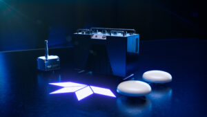
Meet Teledyne Marine at stand no T7 and for dockside demos at HS 02
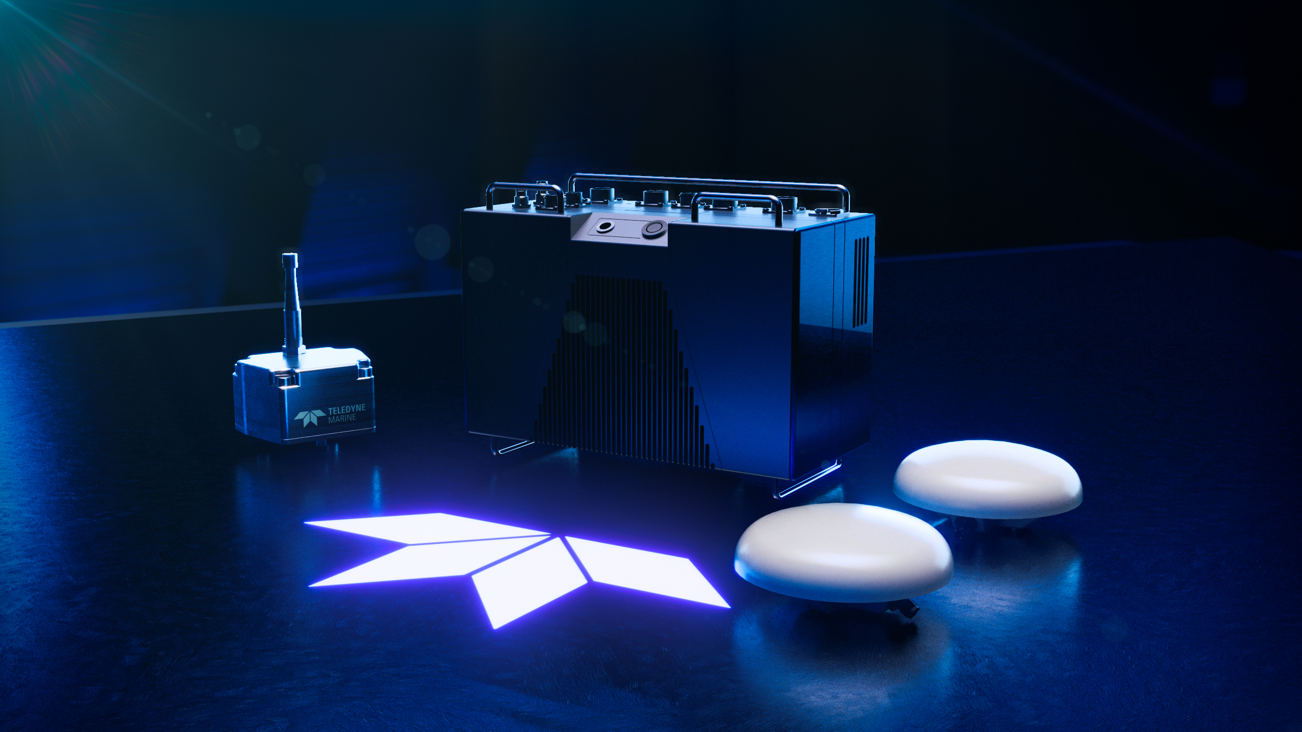
Teledyne Marine will launch an impressive line-up of cutting-edge marine technologies at Ocean Business 2025 in Southampton.
Teledyne Marine continues to push the boundaries of innovation and will showcase its latest advancements, including an exclusive unveiling of a brand new, groundbreaking product at Ocean Business. Visitors can explore the latest product launches at Stand T7 and dockside at HS 02, with exclusive demonstrations and expert-led sessions throughout the event.
Exclusive Product Launch
A highlight of Teledyne Marine’s presence will be the presentation of a revolutionary new product on April 8 at 4 PM at Stand T7. Attendees are invited to join this special event, enjoy refreshments, and be among the first to witness the latest addition to Teledyne Marine’s extensive portfolio.
Exciting Product Debuts
Visitors to Teledyne Marine’s stands in the exhibition hall and dockside will have the opportunity to explore its newest product launches and trusted industry solutions, including:
• Workhorse Proteus – Making its European debut, this evolution of the original Workhorse ADCP by Teledyne RD Instruments, provides ultimate flexibility and delivers unparalleled data on currents, turbulence, and particle distribution in the marine environment.
• Intrepid System – Designed for unmanned surface survey vessels, this new GNSS/Inertial Navigation System integrates with the SeaBat T20-ASV processor for precise positioning. Available for hands-on experience at Ocean Business on Teledyne Marine’s demo boats.
• SeaBat T51-S – launching at Ocean Business, this latest enhancement of the respected SeaBat T51 offers improved depth capability up to 6000m while maintaining data reliability and hands-free operation.
• Valeport pH Sensor –A game-changing, highly accurate, and robust pH sensor from Teledyne Valeport will launch at Ocean Business 2025.
• BlueStreamX2 – the cutting-edge upgrade for the Benthos modem families, as well as UTS topside systems, which doubles the data rate for Benthos Acoustic Modems (WideBand C frequency) to 4800bits per second, will also be introduced at Ocean Business 2025.
Live Demonstrations at Dockside HS 02
Teledyne Marine will showcase its technology with both on-water and dockside demonstrations, allowing attendees to experience these innovations firsthand:
• On-Water Demos – Experience the SeaBat T51-R multibeam echosounder and Lidar system aboard the CRC VOYAGER. These demonstrations will highlight Vertical Detection Mode, delivering superior quay wall and multi-path rich survey data collection.
• Dockside Demos – Get a hands-on look at Teledyne’s SeaBat sonars on marine vehicles throughout the event. Experts will be available to provide insights into the capabilities and applications of this advanced sonar technology.
Click here to book Teledyne Marine on-water demo sessions.
Expert-Led Speaker Sessions
Teledyne Marine’s industry experts will present insights into cutting-edge marine technology, providing attendees with invaluable knowledge and a chance to engage with leading professionals in the field. Key sessions include:
• April 8: Benthos acoustic updates & ropeless fishing, Workhorse Proteus ADCP introduction, deep ocean survey vehicle advancements.
• April 9: Future of subsea navigation, advanced Slocum glider training, Slocum Sentinel Glider advances.
• April 10: SeaBat sonar updates, marine construction technologies, and REPMUS 2024 glider exercise results.
These sessions will offer a deep dive into the latest advancements, challenges, and future trends in the marine technology sector. Attendees are encouraged to book their on-water demos and expert sessions in advance to secure their spots.
Click here to book the expert-led Teledyne Marine speaker sessions.
Meet Teledyne Marine at Ocean Business
Join us at Stand T7 and Dockside HS 02 to experience the next generation of marine technology firsthand.
www.teledynemarine.com
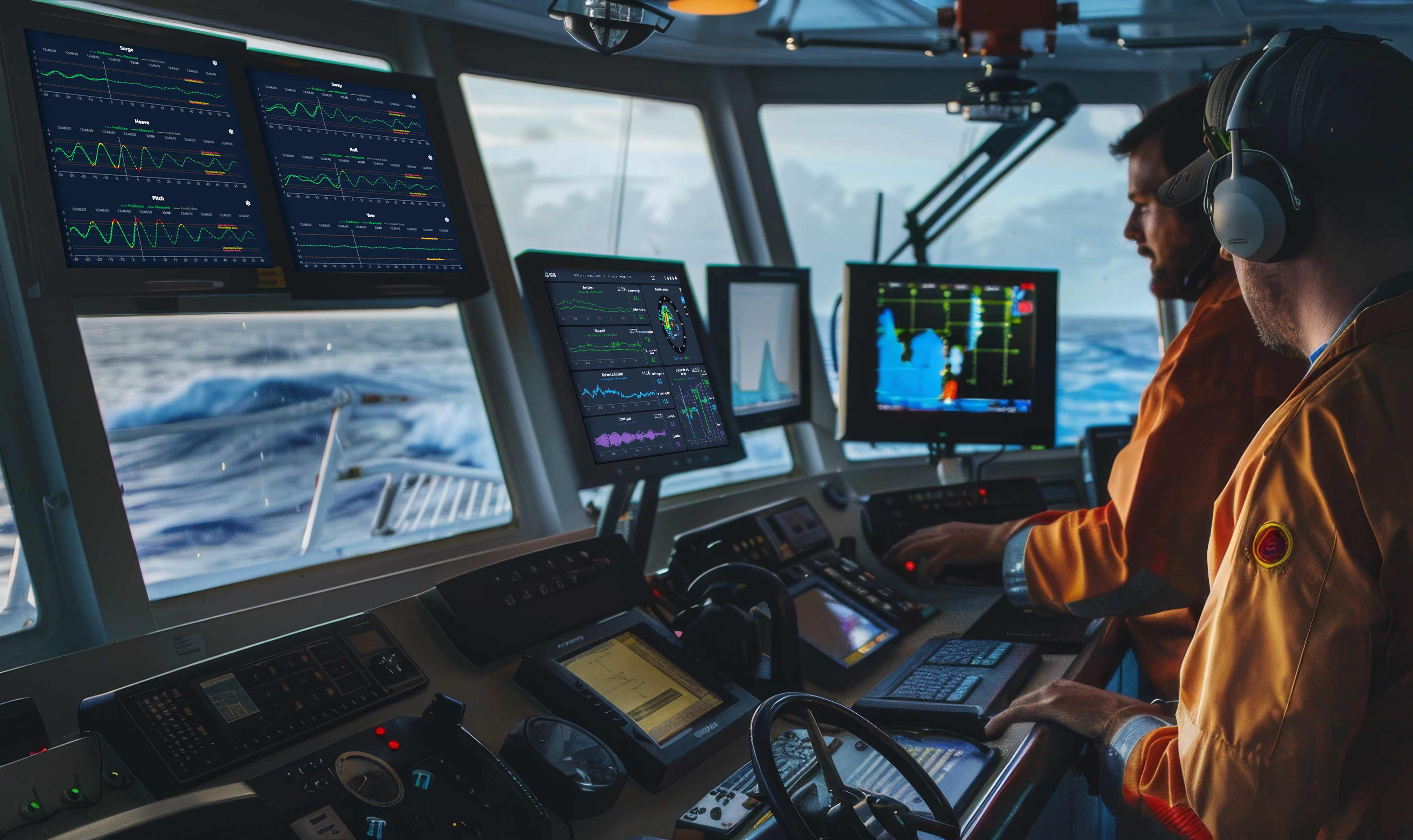
Seeing the Waves Before They Hit: The AI Innovation Shaping Offshore Safety
Imagine if offshore crews could anticipate every critical wave before it arrived, adjusting operations in real-time to maximize safety and efficiency. What once seemed like a futuristic dream is now becoming a reality with cutting-edge wave prediction technology. For decades, the offshore industry has relied on weather forecasts and experience navigating unpredictable seas. But today, thanks to advances in artificial intelligence (AI) and real-time data analytics, we stand on the brink of a technological revolution that could redefine how we operate at sea.
Wave prediction has long been a sought-after advancement in sea state monitoring, particularly within offshore operations. Companies eager to enhance operational efficiency and safety have long awaited its development and practical integration. Today, while wave prediction technology is still evolving, significant progress has been made, positioning it as a game-changer for offshore operations.
Two Approaches to Wave Prediction - Can We Predict the Unpredictable?
Wave prediction technology falls into two main categories: statistical and deterministic. Statistical prediction uses real-time data to estimate wave conditions and heights over extended periods, ranging from minutes to days. Deterministic prediction, on the other hand, leverages artificial intelligence (AI) and advanced analytics, combined with radar data, to monitor sea states and anticipate specific wave impacts within seconds to minutes. This technology alerts offshore crews to imminent wave events, allowing for better preparedness and response.
Enhancing Dynamic Positioning and Operational Decision-Making
When integrated with dynamic positioning (DP) systems, wave prediction technology has the potential to revolutionize offshore operations. DP systems, crucial in offshore activities since the 1960s, could benefit from real-time deterministic wave prediction that enables automatic adjustments in response to incoming waves—similar to the role of wind sensors today.
However, before full reliance on this technology, operators must thoroughly understand its capabilities and reliability. A key intermediate step is refining DP consequence analysis, where localized sea-state data enhances estimations of environmental forces acting on vessels. This allows for more precise risk assessments and informed operational decisions, such as adjusting thruster power, repositioning vessels, or postponing activities.
Breaking Barriers: Overcoming Technological Challenges
Despite recent advancements, some skepticism remains regarding the consistency and reliability of deterministic wave prediction in complex offshore environments. Traditional methods have struggled with challenges such as multimodal sea states, nonlinear ocean wave behavior, and limitations in radar installation configurations.
Additionally, the correlation between sea surface data and vessel motion has been difficult to accurately model.
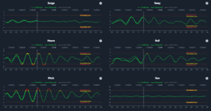
In response, Miros has developed a next-generation wave prediction system, PredictifAI®, which integrates multiple radar sources, AI-driven algorithms, and adaptive analytics. This system automatically adjusts to varying sea conditions, overcoming previous limitations and significantly improving predictive accuracy. By collecting and analyzing extensive real-world data, PredictifAI technology delivers precise predictions of sea surface heights and vessel motion, enhancing offshore safety and operational efficiency.
Why PredictifAI is a Game-Changer
Employing a combination of marine X-band navigation radar, at least one down-looking radar such as the Miros RangeFinder, and multiple motion sensors. A dedicated processing unit interprets data from these sources, with results displayed on a user-friendly, configurable graphical interface.
The system utilizes both established scientific models and AI-driven adaptive algorithms to fine-tune predictions in real-time. Performance is continuously assessed by comparing predicted outcomes with actual measurements. PredictifAI has demonstrated high correlation coefficients—typically around 0.9 or higher—between predicted and observed wave motion, with minimal root-mean-square (RMS) deviation.
Customization is a core feature of PredictifAI. The system can be tailored with different radar and sensor configurations, varied data inputs, and adaptable operational limits. The graphical user interface (GUI) further enhances usability by providing real-time insights, including uncertainty zones and system reliability indicators. For fixed offshore installations, the system offers sea surface height and air gap predictions without motion modeling.
Tested and Proven: What Does Real-World Validation Say?
During its development phase, PredictifAI technology underwent extensive field testing in diverse offshore environments, including a pilot program on a North Sea construction vessel. This real-world testing enabled continuous refinement of the system, with data being transmitted to Miros Cloud for further analysis and optimization. The result is a robust, reliable tool that empowers offshore teams with real-time wave predictions, ensuring safer and more efficient operations.
Advancing Offshore Operations with Cutting-Edge Innovation: Are You Ready to Stay Ahead of the Wave?
Radar technology has long played a crucial role in measuring sea states and currents. However, the advent of deterministic wave and motion prediction represents a major leap forward. By combining traditional measurement techniques with AI-enhanced analytics, PredictifAI delivers a flexible, high-performance solution that adapts to evolving offshore conditions.
For 40 years, Miros has led ocean technology innovation, pushing boundaries to enhance offshore safety and efficiency. PredictifAI turns a long-held vision into reality, transforming what once seemed like science fiction into a market-ready solution. This breakthrough reaffirms Miros’ commitment to pioneering the future of offshore operations.
OceanWise to Host 68th Marine Measurement Forum at award winning brewery
 OceanWise, a leading provider of marine data solutions, is delighted to announce that it will host the 68th Marine Measurement Forum (MMF) on June 11, 2025. This esteemed event will take place at the Hogs Back Brewery in Tongham, Surrey, bringing together professionals from across the marine industry.
The MMF is a series of one-day, non-profit events that have been running since 1983. It provides excellent opportunities for networking and the informal exchange of ideas, knowledge, techniques, and developments across a wide range of marine scientific measurement activities.
oceanwise-global.com
Attendees can look forward to a comprehensive agenda of expert-led talks, valuable networking opportunities, and insights into the latest technologies in the marine measurement field. The event will also offer optional brewery tours and tastings, providing a unique blend of professional development and leisure.
Event Details:
• Date: June 11, 2025
• Time: 09:00 – 16:00 (with optional tours from 16:00 – 17:00)
• Venue: Hogs Back Brewery, Manor Farm, The Street, Tongham, Farnham, Surrey, GU10 1DE
OceanWise is currently curating the event agenda and invites interested speakers to participate. Prospective speakers are encouraged to contact Katie Eades at [email protected]
Ticket bookings and additional event information are available at www.oceanwise.eu/marine-measurement-forum-68/. For further inquiries, please email [email protected]
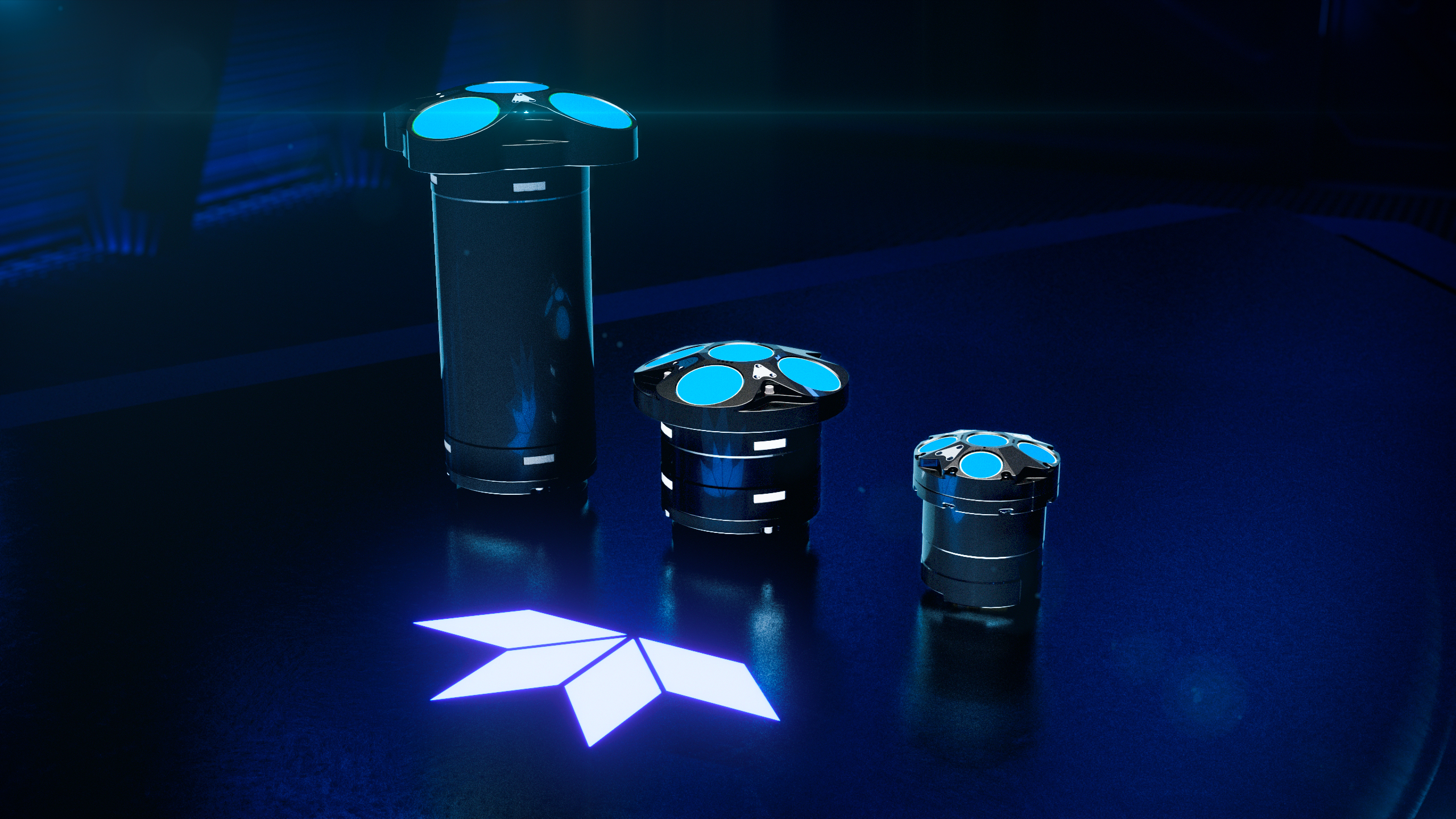
Teledyne Marine Unveils Multiple New Product launches at Ocean Business
Meet Teledyne Marine at stand no T7 and for dockside demos at HS 02
Ocean Business is the launch venue for an exciting range of brand new products from Teledyne Marine. Visitors to Teledyne Marine’s stands in the exhibition hall and dockside will have the opportunity to explore its newest product launches and trusted industry solutions, including:
• New Exclusive Product Launch - A highlight of Teledyne Marine’s presence at Ocean Business will be the unveiling of a groundbreaking new product on April 8 at 4 PM at Stand T7. Attendees are invited to join this special event, enjoy refreshments, and be among the first to witness the latest addition to Teledyne Marine’s extensive portfolio.
• New Workhorse Proteus – Making its European debut, this evolution of the original Workhorse ADCP by Teledyne RD Instruments, provides ultimate flexibility and delivers unparalleled data on currents, turbulence, and particle distribution in the marine environment.
• Show debut – Intrepid System – Designed for unmanned surface survey vessels, this new GNSS/Inertial Navigation System integrates with the SeaBat T20-ASV processor for precise positioning. Available for hands-on experience at Ocean Business on Teledyne Marine’s demo boats.
• New SeaBat T51-S – launching at Ocean Business, this latest enhancement of the respected SeaBat T51 offers improved depth capability up to 6000m while maintaining data reliability and hands-free operation.
• New Valeport pH Sensor –A game-changing, highly accurate, and robust pH sensor from Teledyne Valeport will launch at Ocean Business 2025.
• New BlueStreamX2 – the cutting-edge upgrade for the Benthos modem families, as well as UTS topside systems, which doubles the data rate for Benthos Acoustic Modems (WideBand C frequency) to 4800bits per second, will also be introduced at Ocean Business 2025.
Live Demonstrations at Dockside HS 02
Teledyne Marine will conduct live on-water and dockside demonstrations, offering attendees a firsthand look at the capabilities of its cutting-edge marine technologies.
• On-Water Demonstrations – Experience the advanced functionality of the SeaBat T51-R multibeam echosounder and Lidar system aboard the CRC VOYAGER, showcasing features like Vertical Detection Mode for superior quay wall/multi-path rich survey data collection.
• Dockside Demonstrations – Visitors can explore live the precision capabilities of Teledyne’s SeaBat sonars on various marine vehicles at HS 02 throughout the event.
Click here to book Teledyne Marine on-water demo sessions.
Expert-Led Speaker Sessions
Teledyne Marine experts will be delivering insightful presentations covering a range of marine technology advancements and industry trends, including:
April 8:
• Benthos acoustic updates & ropeless fishing innovations – Carl Mancuso (11:30-12:30)
• Introducing the new Workhorse Proteus ADCP – Paul Devine (13:00-14:00)
• Latest Advancements in Deep Ocean Survey Vehicles – Arnar Steingrimsson (16:00-17:00)
April 9:
• The future of subsea navigation – Rolf Christensen (10:00-11:00)
• Advanced Slocum glider training – Cordielyn Goodrich (14:30-15:30)
• Slocum Sentinel Glider Advances – Shea Quin (16:00-17:00)
April 10:
• The latest updates for the SeaBat sonar series – Pim Kuus (10:00-11:00)
• Teledyne Marine’s full suite of technologies for marine construction – Natasja Verboom (11:30-12:30)
• REPMUS 2024 – Glider exercise results – Cordielyn Goodrich (13:00-14:00)
Click here to book the expert-led Teledyne Marine speaker sessions.
Visit: Teledyne Marine stands T7 and dockside HS 02 at Ocean Business.
www.teledynemarine.com
Seabed 2030 and Ocean Mapping Training partner to advance global expertise in hydrography
The Nippon Foundation-GEBCO Seabed 2030 Project is pleased to announce a new partnership with Ocean Mapping Training, a renowned provider of specialised training in hydrography and ocean mapping. This collaboration will enhance capacity building efforts, equipping ocean professionals with the expertise needed to support the global mission of mapping the entire seafloor by 2030.
Ocean Mapping Training convenes and delivers the Ocean Mapping Group, University of New Brunswick – Center for Coastal and Ocean Mapping, University of New Hampshire (OMG UNB – CCOM UNH) Multibeam Training Courses.
With the rapid evolution of swath sonar technology, there is an increasing demand for specialised training to ensure the collection of high-quality bathymetric data. The first Multibeam Training Course was held in 1994, and over the past thirty years it has continued to develop – training nearly 4,000 individuals from over 70 countries.
Designed for those actively working in hydrographic surveying and ocean mapping, the course provides a comprehensive understanding of swath sonar technology, survey techniques, and data processing methods.
Seabed 2030 is a collaborative project between The Nippon Foundation and the General Bathymetric Chart of the Oceans (GEBCO), which seeks to inspire the complete mapping of the world’s ocean by 2030, and to compile all the data into the freely available GEBCO Ocean Map. The Project is formally endorsed as a Decade Action of the UN Ocean Decade. GEBCO is a joint programme of the IHO and the Intergovernmental Oceanographic Commission (IOC), and is the only organisation with a mandate to map the entire ocean floor.
Through this partnership, Ocean Mapping Training will support Seabed 2030’s mission by expanding the global network of trained specialists contributing to seabed mapping efforts. This collaboration will strengthen technical capacity, ensuring that high-quality hydrographic data informs scientific research, marine resource management, and sustainable development.
Seabed 2030 Project Director Jamie McMichael-Phillips said: "Ensuring the success of global ocean mapping requires not only cutting-edge technology but also highly skilled professionals to collect, interpret, and apply hydrographic data. By partnering with Ocean Mapping Training, we are expanding training opportunities and strengthening global expertise in ocean mapping."
Lindsay Gee, CEO of Ocean Mapping Training, added: "For three decades, the Multibeam Training Courses have helped professionals around the world develop the skills necessary for effective hydrographic surveying and ocean mapping.
“This partnership with Seabed 2030 reinforces our shared commitment to equipping specialists with the knowledge and tools needed to support a fully mapped ocean floor by 2030."
All data collected and shared with the Seabed 2030 project is included in the free and publicly available GEBCO global grid.
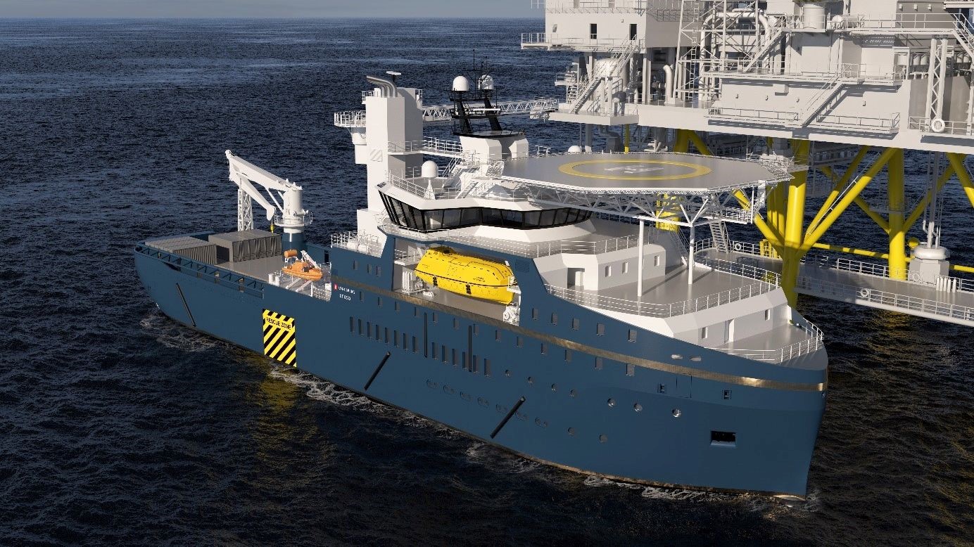
ST Engineering Marine Ltd selects Kongsberg Maritime design and equipment for new walk-to-work OSV
Kongsberg Maritime will supply the design and integrated equipment package for a new walk-to-work offshore service vessel (OSV), to be built by ST Engineering Marine in Singapore for a leading oil & gas company.
The 97-metre vessel of Kongsberg Maritime UT 5520 design will accommodate 106 people and features a motion-compensated gangway to enable safe transfer of personnel between to and from offshore installations.
The new design is a further development of Kongsberg Maritime’s extensive range of vessel types for the offshore energy market. It builds on recent experience with the successful UT5519DE CSOVs (commissioning service operation vessel), which are deployed on offshore wind projects in the North Sea.
It is designed for oil and gas operations and will have a greater endurance of up to nine weeks away from shore, compared to a CSOV industry standard of four weeks.
Per Kristian Furø, Sales Director - Ship Design, Kongsberg Maritime, said: “We are delighted to have been chosen by ST Engineering Marine to supply our latest UT5520 vessel design and an extensive range of Kongsberg Maritime technology for this new vessel.
“Our design teams have drawn on our extensive know-how from decades of offshore operations, to provide a vessel that is optimised for long-distance offshore operations, where efficiency, operational reliability, safety and crew comfort are key considerations.”
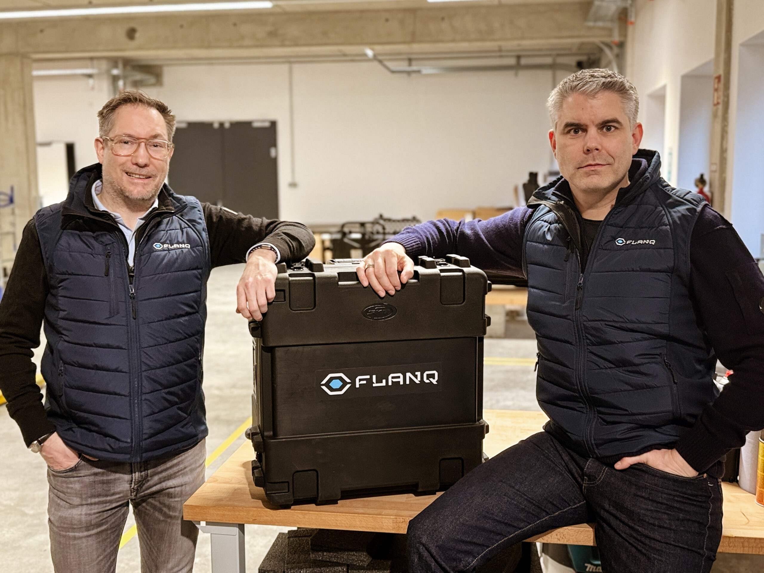
AI-powered autonomous maritime defence: FLANQ surfaces to enhance European security
In response to Europe’s growing security challenges in the maritime domain, FLANQ has launched as a new provider of autonomous defence products. The company offers a comprehensive suite of commercial-off-the-shelf (COTS) uncrewed surface vessels, underwater drones, and sensor payloads, powered by FLANQ’s proprietary artificial intelligence software and hardware stack. Headquartered in northern Germany, FLANQ is committed to put the latest technological progress at the heart of a safe, strong and united continent.
Building on decades of combined team experience in developing technology for offshore energy and ocean science, FLANQ specialises in integrating cutting-edge AI capabilities with proven COTS maritime hardware. These ready-to-deploy, surface and underwater platforms provide naval forces with enhanced situational awareness and autonomous mission capabilities to counter evolving maritime threats, all backed by through-life support services.
“FLANQ, supported by our trusted industry partners, is resolutely focused on strengthening Europe’s maritime security landscape,” said Sören Themann, Co-Founder and Chief Executive Officer of FLANQ. “National sovereignty across the region is being tested on an unprecedented level by shadow fleets conducting hybrid warfare. Our AI-powered uncrewed systems provide navies with the rapid response capabilities needed to safeguard critical marine infrastructure above and below the surface, expansive coastlines, and essential trade routes. FLANQ’s solutions are more than drawing board concepts; they are commercially available and ready for immediate deployment."
Innovation at the core
FLANQ’s COTS solutions help put mission-winning technology into the hands of naval forces – at pace, on time and on budget, offering:
• Complete marine intelligence: Edge data processing for superior real-time situational awareness.
• Platforms: Field-proven uncrewed surface and subsurface vessels built for endurance, reliability and interoperability with NATO systems.
• Payloads: Dual-use detection and monitoring technologies to sense, classify and monitor potential surface and underwater threats.
• Logistics and support: Flexible ownership models, customer-shaped support and infield logistics ensuring naval platforms and sensors stay mission-ready, always.
“FLANQ’s commitment to European security is at the heart of our new mission,” said Co-founder and Chief Commercial Officer, Daniel Esser. “Since 2019, our focus has been on marine autonomy for the commercial sector delivering safe, smart and sustainable surveys. Today, with launch of FLANQ, we’re applying our track record, our capability, our resources to support the defence of Europe. In fact we’ve already begun to deliver solutions to key defence customers that meet the highest standards of quality, reliability, and operational effectiveness, while ensuring alignment with strategic naval autonomy and interoperability goals."
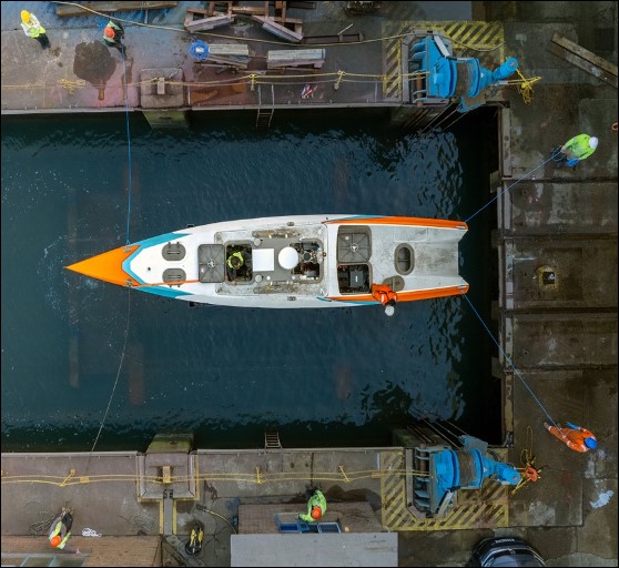
Zero usv’s oceanus12 hits the water pioneering world’s first fully autonomous usv fleet exclusively for charter
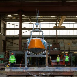
British SME ZeroUSV is one step closer to offering the world’s first charter fleet of fully autonomous uncrewed surface vessels after its inaugural Oceanus12 touched the water for the first time at Manor Marine in Portland, Dorset, this week.
 The fully equipped vessel is now ready for commissioning and integration trials from ZeroUSV’s home port of Plymouth. The launching of the first Oceanus12 represents the culmination of nearly 18 months of design, engineering and build effort from the team at ZeroUSV which has been built on the success of the Mayflower 400’s transatlantic autonomous voyage - a milestone achieved through the same inter-company collaborations between Zero USV’s parent company MSubs, their non-profit Promare, and sister marine software company MarineAI.
The launch of the first vessel in the Oceanus12 series, does not though mean any let up in the pace and the coming weeks will see a series of key milestones achieved, with vessel two due to be completed in late March and vessels three and four hot on their heels. An official boat naming ceremony is scheduled for the spring, with a line-up of VIPs on the guest list.
The Oceanus12, designed for long distance over-the-horizon operations, has also been designed to be mission agnostic, allowing a wide range of potential applications: from surveys and monitoring of critical assets to safety,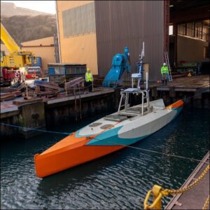 geophysical surveys, border control, fisheries, defence and more. Since the “charter” business model was first announced just under 12 months ago, significant interest has been generated which has led to exciting opportunities for these first two vessels, information on which will be announced in the coming weeks.
The Oceanus12 is groundbreaking in multiple areas of technology: from its hybrid-electric drive system, with twin drives for redundancy and efficiency coupled with sufficient onboard fuel for a cruising range of more than 2500 nautical miles, to the use of the only truly fully autonomous software stack on the market – MarineAI’s Guardian software. The Oceanus12’s represents a seismic shift in what is possible with an uncrewed 12m vessel. With ZeroUSV not only owning and operating the vessels, but also the ROC (remote observation centre), the Oceanus12 is a true “turnkey” package for charter customers.
Zero USV founder Matthew Ratsey, said: “Oceanus12 presents a quantum leap forward in autonomous maritime technology and this is a seminal moment for the team here at ZeroUSV.
“We’ve created the world’s first complete solution - not just a cutting-edge 12m over-the-horizon USV available for charter, but also full maintenance and support to ensure 24/7 operations with minimal downtime.
“Designed with safety and efficiency in mind, Oceanus12 can take on a wide range of offshore over-the-horizon tasks that would typically require a crew, eliminating on-water risks and associated costs, including significant environmental benefits afforded by it being crewless For clients, this means greater flexibility, enhanced operational efficiency, and zero crew expenses.”
Utilising a suite of world-class marine sensors, including the internationally renowned mm-wave Navtech Radar, Oceanus12 integrates multiple data streams into MarineAI’s GuardianAI autonomy software. This enables real-time processing and analysis, ensuring COLREG-compliant vessel control and navigation.
Oceanus12 Specifications:
Green Credentials
• Twin Electric Hybrid Drive giving redundancy and efficiency
• Low Fuel Consumption
• Solar charging for house and emergency loads
Customisable Design
• Adaptable payload bay
• Sensor agnostic
• Quick change keel (sensor strut) allowing preloaded sensors to be swapped in/out with minimal downtime
Full Autonomy
• GuardianAI full stack autonomy software by MarineAI installed as standard
• Fully loaded autonomous sensor suite including HD Radar from Navtech.
• Remote control option
Over-the-Horizon
• Large fuel capacity for extended missions c. 2500Nm
• Six knot cruising speed with sprint speed of 10 knots (subject to payload)
Technical specification
• Length Overall: 11.55m
• Waterline Length: 11.40m
• Max Beam: 2.33m
• Displacement: 6 tonnes
• Hull Type: Monohull
• Hull Construction: Aluminium
• Installed Power: software limited to 40Kw, available 80Kw.
• Speed: 6 knots cruising, 10 knots sprint.
• Endurance: 2000+Nautical miles
• Fuel Capacity: 1200 Litres
• Payload: up to 1 tonne
• Draft: 1.76m
The Oceanus12 fleet – comprising initially over 12 vessels, including the option for an XLR (Extra Long Range) version stretching to 13 meters in length and carrying over 4000 litres of fuel and ensuring Oceanus12 is capable of spending not just weeks, but months continuously operating on higher endurance journeys - will be available in the UK, North America, Canada and Australia as Zero USV rolls out its USVs with global partners. To register your interest, please email: [email protected] or [email protected]
Unveiling a New Perspective: Exclusive True-Colour Image of Endurance Shipwreck Released
Voyis and the Falklands Maritime Heritage Trust reveal unprecedented details of the legendary vessel using advanced optical technology.
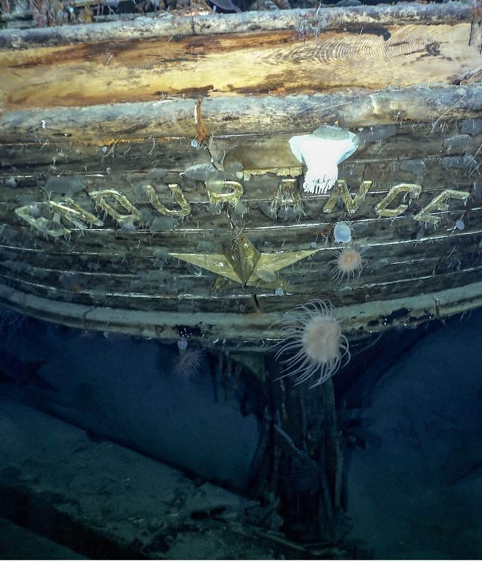
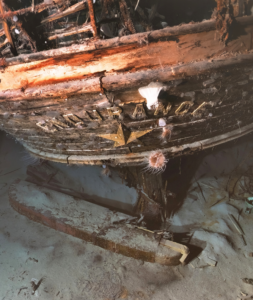
The Falklands Maritime Heritage Trust and Voyis Imaging proudly present an exclusive new image of the historic Endurance shipwreck. Captured using the cutting-edge Voyis Observer Imaging System, this latest image provides an unparalleled view of the vessel and the seabed, revealing intricate details with clarity never seen before.
Building on a previously released image of Endurance, this new capture showcases the ship’s preserved structure with remarkable precision, made possible through Voyis’ True Colour technology. Unlike traditional underwater imaging, which can suffer from colour distortion and reduced visibility, the Voyis Observer Imaging System accurately restores the shipwreck’s natural hues and textures, offering a more authentic representation of how Endurance appears in its final resting place beneath the Weddell Sea.
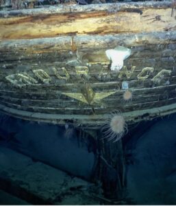
Since red wavelengths are absorbed more rapidly by water, the perceived colour of underwater objects is significantly altered. Standard cameras do not compensate for this underwater colour shift, as their colour formation models neglect the strong wavelength dependency of light in a submerged environment. As a result, shipwrecks and subsea assets often appear with unnatural blue or green tints.
Voyis’ True Colour technology addresses this challenge by leveraging machine learning to efficiently train a Colour Correction Model for the current survey location. This survey-grade imaging solution corrects the distortions caused by underwater light absorption, producing images that represent colours as they would be perceived in air. This advancement allows explorers to visualize the true colour of subsea assets, uncovering fine details that standard cameras fail to capture.
“This new image is a testament to the evolution of underwater exploration technology,” said Elena Lewendon, COO at the Falklands Maritime Heritage Trust. “The level of detail we can now see allows us to deepen our understanding of Endurance’s condition and better appreciate the remarkable state of preservation of this legendary vessel.”
Voyis’ Observer Imaging System was designed to overcome the challenges of deep-sea imaging by delivering high-resolution optical data with true colour fidelity. By eliminating artificial lighting inconsistencies and improving image sharpness, this system sets a new benchmark for underwater archaeology and heritage preservation.
“Voyis is honoured to have contributed to the exploration of Endurance,” said Luke Richardson, VP Sales & Marketing at Voyis. “Our Observer Pro Imaging System, with true colour correction, allows us to see the wreck as it truly is, preserving its legacy with the highest level of accuracy possible.”
This latest image serves as a powerful reminder of Endurance’s enduring story, a tale of resilience, exploration, and the boundless capabilities of modern technology in uncovering the past.