
First fleet of 10 autonomous gliders deployed by the CNRS to explore Mediterranean marine ecosystems
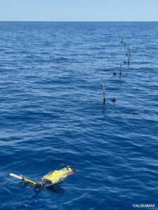 Ten autonomous underwater gliders were deployed in the Ligurian Sea in mid-June as part of Mission 6 under the “Deep Seabed” Priority Objective (Objective No. 10) of the France 2030 funding plan, entrusted to the CNRS.
This deployment marks the first milestone in the development of a multi-variable, multi-scale environmental data atlas for the northwestern Mediterranean Sea, based on the use of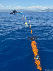 autonomous underwater gliders.
One of the ten strategic priorities of the France 2030 funding plan, “Investing in the Deep Seabed,” was launched by the French government to strengthen the country’s industrial competitiveness and accelerate the development of next-generation technologies. Among its objectives is the development of innovative technologies for deep-sea exploration, including highly autonomous exploration systems.
The Mission n°6, led by the CNRS, forms part of this initiative and is dedicated to creating a multidimensional environmental data atlas covering the northwestern Mediterranean and French Polynesia.
The mission aims to improve our understanding of the physical, biogeochemical and biological dynamics of marine ecosystems, as well as how they are evolving under increasing anthropogenic pressures such as maritime traffic, ocean acidification and climate change. It relies on an innovative approach combining coordinated fleets of autonomous underwater gliders, multi-parameter sensing technologies and intelligent mission management. This will enable researchers to investigate how ocean fronts and eddies influence the distribution of plankton communities, vertical nutrient and energy fluxes, and the impact of underwater noise on marine ecosystems. Particular emphasis will also be placed on biodiversity through the use of innovative monitoring technologies, including environmental DNA (eDNA) and in situ imaging.
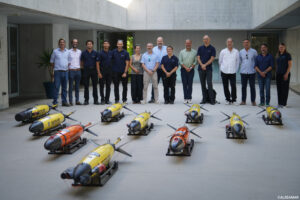
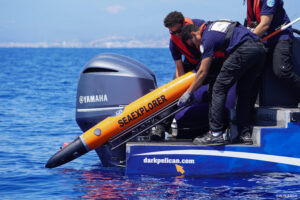 On June 17th 2026, the CNRS and ALSEAMAR—the industrial partner selected for the first phase of Mission n°6—deployed a fleet of ten SEAEXPLORER autonomous underwater gliders in the Ligurian Sea. Launched from the Institut de la Mer de Villefranche-sur-Mer, the gliders will operate for one month in an area characterized by intense hydrodynamic activity and located within a marine mammal sanctuary. Capable of diving to depths of up to 1,000 meters and transmitting data via satellite, the autonomous vehicles are equipped with acoustic and physical sensors to provide detailed observations of ambient underwater noise, ocean currents, eddies and their influence on marine ecosystems. The data collected will then be processed by the project’s scientific teams and incorporated into the multidimensional environmental atlas.
The next phases of Mission 6 include deployments in the Gulf of Lion in 2028 to test innovative sensors, followed by a campaign in French Polynesia in 2028–2029, where autonomous gliders and autonomous underwater vehicles (AUVs) will operate in coordination to explore seamounts. Between 2029 and 2030, the resulting data and scientific findings will be integrated into the environmental atlas and widely disseminated, supporting France 2030’s broader ambitions for ocean observation and preservation.