
Partnership secures funding to enhance robotics and data solution for seagrass mapping
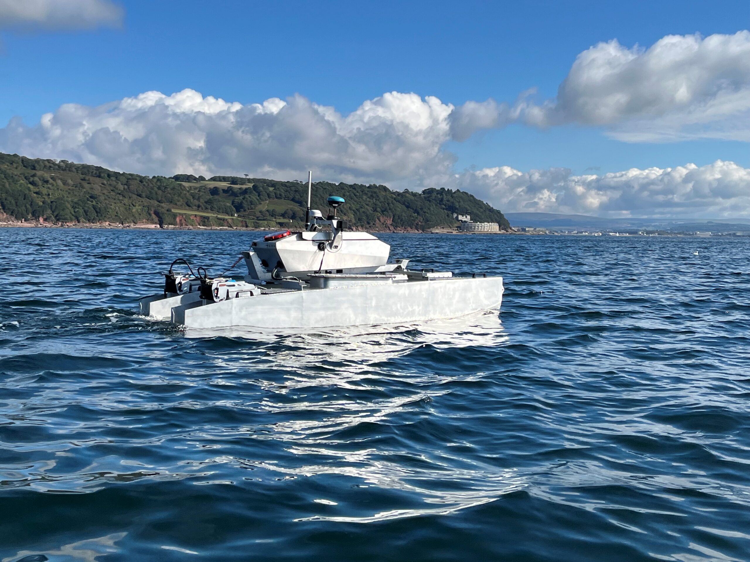
HydroSurv has won funding from Innovate UK to continue working with the University of Plymouth to enhance its technique of using Uncrewed Surface Vessels (USVs) to map seagrass coverage on the seabed.
Building on previous collaborations with the University and Valeport, the project aims to generate a comprehensive picture of seagrass meadows as well as to characterise the environment in which they are growing, enabling ecosystem health to be determined from the same survey campaign.
The project will see HydroSurv’s low impact, fully electric USV data acquisition platform developed further to deliver comprehensive, seagrass monitoring using an Acoustic Ground Discrimination System (AGDS) coupled with video and environmental data collection from new hull-mounted and underwater sensor arrays. These include two specialist cameras and a laser range finder, which is deployed to a constant altitude using an intelligently controlled cast winch on the HydroSurv REAV-28 USV.
A macro lens camera on the underwater skid will be lowered into sediment for close-up, hi-resolution photographs. Using an algorithm to ascertain grain size from the images, the type of ground in which the seagrass is growing can be determined. This enables stakeholders to monitor critical environmental parameters of seagrass habitats and to quantify meadow biomass and carbon sequestration potential, in turn informing better understanding of these habitats and their restoration.
The vessel’s sensor payload will also measure sound velocity, turbidity and chlorophyll levels, while machine learning algorithms, developed by the University, will objectively classify the seagrass beds using acoustic envelopes.
Processed data will be provided to coastal practitioners and scientists using an enhanced cloud-based data hosting and visualisation application developed by HydroSurv. This will enable them to create an enhanced picture of seagrass coverage, density and canopy height alongside improved environmental measurements and ground truthing video files, making actionable seagrass data wholly accessible.
HydroSurv COO, Ian Godfrey, commented: “The use of a non-invasive USV system to work in these sensitive environments reduces the risk of damage to the very habitat we are trying to protect. Beyond that, improved accuracy, low carbon emissions and reduced cost make uncrewed platforms an attractive proposition for survey and characterisation of seagrass meadows, even in waters that are difficult to access. HydroSurv is focused on providing a turnkey solution covering robotics and data processing in a single package that is readily accessible to industry stakeholders.”
The six-month project will culminate in a system demonstration involving key UK natural capital stakeholders actively involved in seagrass conservation projects and strategy, including DEFRA (co-funder), Natural England and the Environment Agency.
Dr Tim Scott, Associate Professor at the University of Plymouth said: “Collecting and processing ground truth images of seagrass habitats is currently an essential, but costly and time-consuming, activity. This project will dramatically improve our ability to monitor these critical ecosystems effectively and economically, facilitating the collection of regular and spatially comprehensive datasets that would not be possible without leveraging marine autonomy and advanced data analysis techniques.”

IIC Academy to host webinar on S-5B Hydrographic Surveying Program
Embark on an exciting career in hydrographic surveying with the S-5 Category B Programme, offered by IIC Academy. The programme is recognized by FIG/IHO/ICA International Board on Standards of Competence for Hydrographic Surveyors (IBSC) and is designed to equip aspiring and experienced surveyors with the knowledge and practical skills needed to excel in the field.
IIC Academy provide a comprehensive training programme where students will have access to a state-of-the-art web-based environment where they will attend live online classes, access pre-recorded lectures, and complete interactive e-learning modules that combines with practical exercises, fieldwork, and simulation exercises. Experienced instructors ensure that students receive the best possible education and graduate fully prepared to enter the workforce.
Hydrographic surveyors are responsible for collecting, processing, and analysing data to create accurate and reliable charts and maps of the world's oceans and waterways. With the S-5 Category B programme, students will learn how to use the latest technology and techniques to complete hydrographic surveys, including bathymetric surveys, topographic surveys, and side-scan sonar surveys.
If you're looking to start a career in hydrographic surveying, or simply want to expand your knowledge and skills, the S-5 Category B Programme at IIC Academy is the perfect choice. Join the IIC Academy today and discover the exciting world of hydrography!
Register to join the webinar taking place on 9th March at 14h00 at https://loom.ly/1bFxoLc
TDI-Brooks adds Manta-200 CPT to their geotechnical capabilities
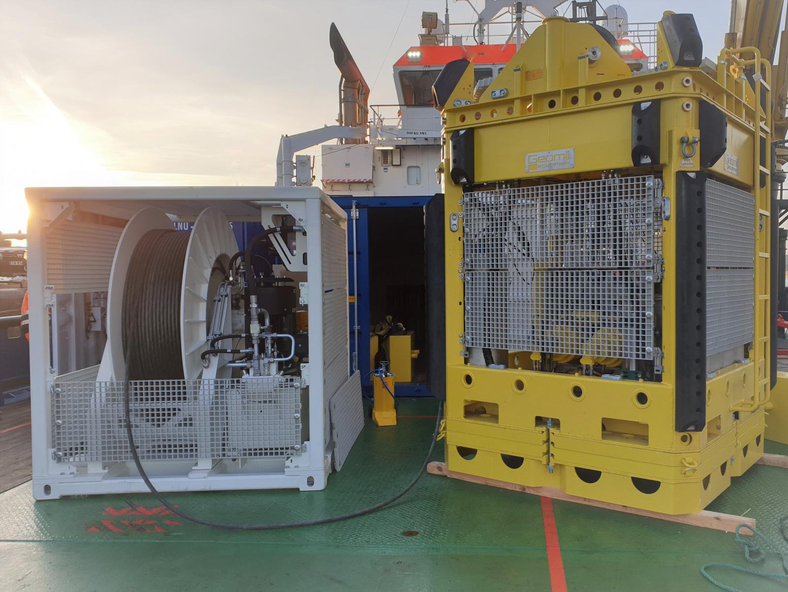
TDI-Brooks will be adding a Manta-200 CPT System to their geotechnical capabilities. The TDI-Brooks’ Manta-200 Cone Penetration Testing (CPT) system is suitable for almost any project in shallow water up to 150 meters. The Manta-200 represents the latest generation Cone Penetration Test (CPT) system for determining offshore seabed soil conditions.
Either deployed from TDI-Brooks’ DP vessel or off a charter DP vessel with a large 50-ton crane, the Manta-200 is designed for reliable results. During CPT operation the Manta is controlled from the surface with a real time link over a combined power and communication umbilical. Data can be viewed in real time allowing operators to manage the push and react to local sediment conditions to provide the highest quality data to the greatest depths possible.
The CPT system is powered by a unique Continuous Drive System (CDS) that was designed with a clear focus on durability and high production. It also guarantees uninterrupted penetration of the cone. Constant tension (CT) winches are used to support deployment at the working depth. The Manta-200 CPT system is a modular design capable of delivering results on even the most challenging of projects. Both casings and tubes can be operated simultaneously.
The Manta-200 CPT, along with the other TDI-Brooks’ suite of innovative geotechnical tools, are for soil sampling and measurement and also include box corers (BC), piston corers (PC), gravity corers (GC), jumbo piston corers (JPC), vibracorers (VC/pVC), cyclic t-bar instrument (TBAR), deep-reaching Shelby tube samplers (SPLR), and piezocone penetrometers including CPT-Stinger and Gravity CPT tools (gCPT).
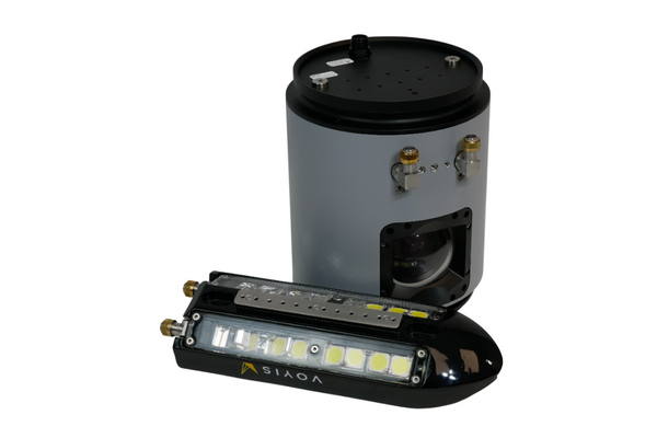
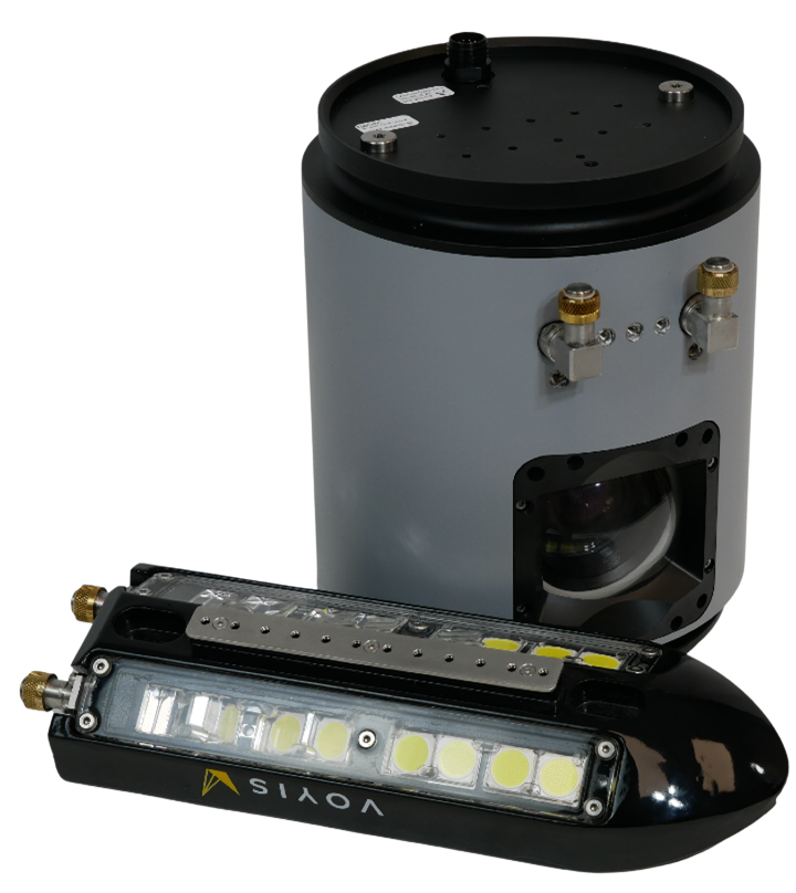
Voyis Imaging Inc. chosen as the camera package for HII REMUS vehicles
HII is a global engineering and defense technologies provider and recognized worldwide as America’s largest shipbuilder. With a 135-year history of trusted partnerships in advancing U.S. national security, HII delivers critical capabilities ranging from the most powerful and survivable naval ships ever built, to unmanned systems, ISR and AI/ML analytics. HII leads the industry in mission-driven solutions that support and enable an all-domain force. HII creates advanced unmanned solutions for defense, marine research and commercial applications. Serving customers in more than 30 countries, HII provides design, autonomy, manufacturing, testing, operations and sustainment of unmanned systems, including unmanned underwater vehicles (UUVs) and unmanned surface vessels (USVs).
With the goal of further improving the autonomous capabilities of its vehicles, HII has selected Voyis Imaging Systems as the standard camera option for all REMUS UUVs (REMUS 100/300/620/6000).
Voyis has developed the Recon UUV module, consisting of a highly advanced 4K stills camera and extremely efficient, high output external light bar, that enhances all REMUS platforms imaging capabilities in any operational situation. The Recon camera module offers extremely crisp stills imagery with on-the-sensor data processing for real-time, highly optimized datasets that improve in mission autonomy and analysis capabilities. These enhancements include improving image quality using image undistortion, true color correction, and image light leveling for consistent, actionable datasets available in-mission.
With Voyis cameras, navies are capable of completing the identification stage of MCM (mine countermeasure) operations, and improve target localization for neutralization/recovery completely submerged using REMUS platforms, improving operational covertness and efficiency. The high resolution imagery captured with Voyis’ Recon module provide increased confidence in subsea missions, ensuring REMUS customers receive safe, reliable, and efficient operations.
Another armoured cable for research vessel
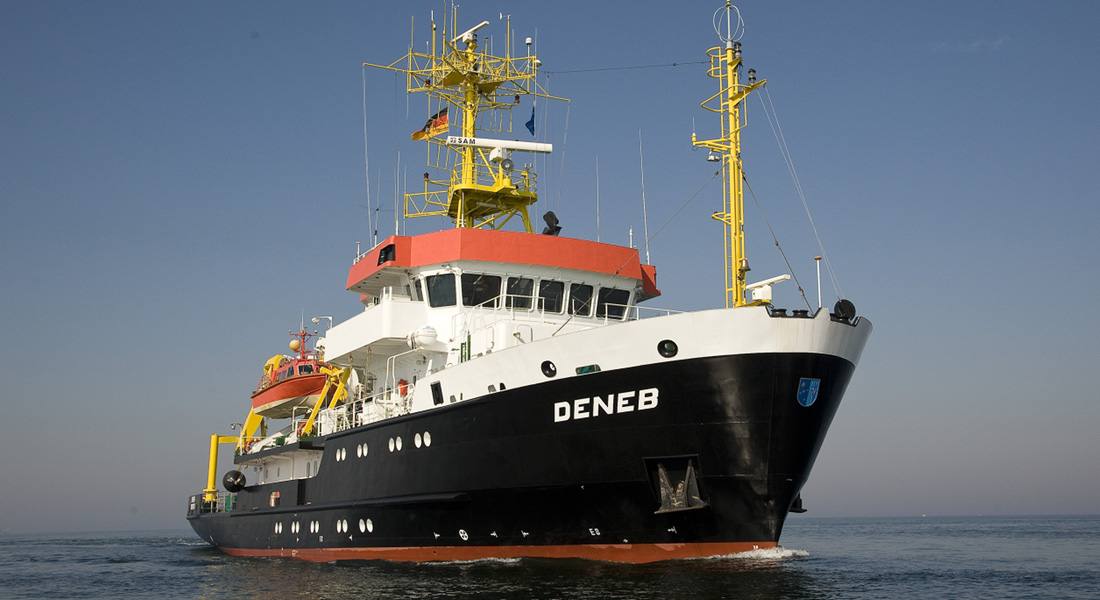
NOVACAVI has recently designed and manufactured a special coax double armoured cable for the German BSH Bundesamt für Seeschiffahrt & Hydrographie, the Federal Maritime and Hydrographic Agency of Germany. We have been asked to fulfil their requirements and to supply a custom cable solution for their VWFS Deneb research vessel.
We have been glad to develop another coaxial cable for oceanographic use enriching our range of variety of sizes containing either single or multiple coaxial elements in a reliable solution for demanding application tasks underwater and in harsh environments.
Specialist in custom cables design and manufacturing since 1975, NOVACAVI will showcase sample of this cable together with other selected custom cables on stand F12 at Ocean Business 2023, Southampton next 18-20th April.
OceanTools promote Brian Hector to GM
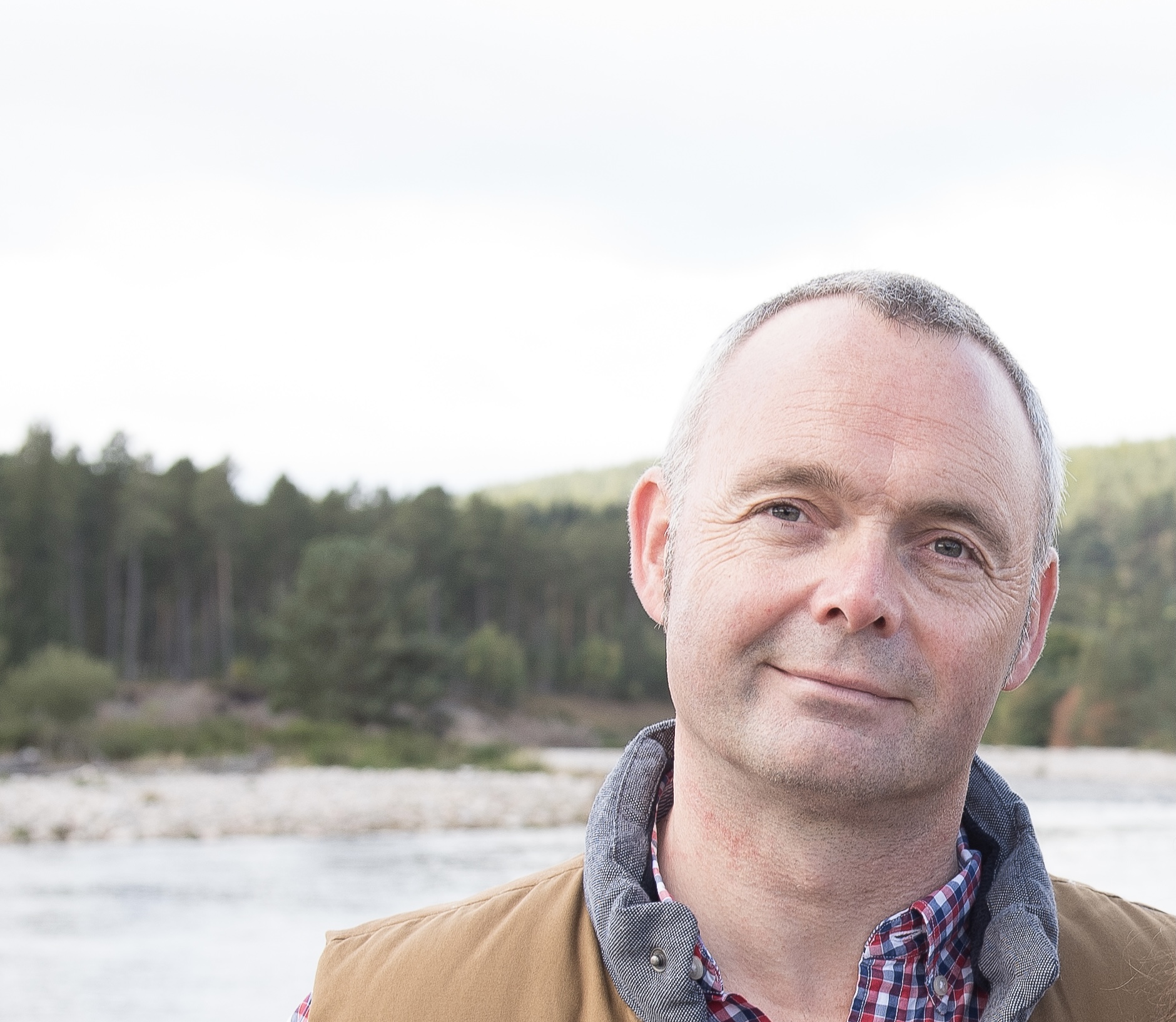
OceanTools Limited, a world-leading subsea engineering company based in Aberdeen Scotland, are delighted to announce the promotion of Brian Hector to General Manager. Brian has almost 30 years of experience in the subsea industry having progressed through the ranks from graduate engineer to Technical Director before joining OceanTools as Technical Sales Manager.
Managing Director Kevin Parker said “When Brian joined OceanTools in 2019 we were hardly involved in the camera market. Now, less than four years later, we have a comprehensive range of cameras and lights of which we’re selling many hundreds every year. This is largely due to Brian’s hard work and dedication, so I’m delighted to promote him to the position of General Manager”
Brian said “As my career has progressed, I have enjoyed the challenge of sitting between both technical and commercial departments. I’m really looking forward to my new role as General Manager at OceanTools driving the company forward”
OceanWise deliver Data Governance and Marine Spatial Data Training as part of the GEOMAC course at the UK Hydrographic Office
OceanWise’s Dr Mike Osborne recently delivered a short course as part of the latest Geospatial Marine Analysis and Cartography (GEOMAC) course held at the UK Hydrographic Office in Taunton. The course, ‘Data Governance and Marine SDI’, underlines the importance of data governance in increasing efficiencies and reducing risk when creating and maintaining traditional and e-navigational products and services.
The GEOMAC is a Nippon Foundation funded initiative under the International Hydrographic Organization (IHO) Capacity Building (CB) Programme and is open to individuals from all national hydrographic offices and maritime authorities who wish to expand their knowledge and understanding in this area. The programme “aims to provide an education programme for young nautical cartographers with cutting-edge knowledge and connects the nautical cartography community… The skill and knowledge of this community contributes to solving regional and global challenges beyond the SOLAS obligation”.
Why is data management important to hydrography?
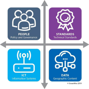
In recent years, the importance of data management to hydrography generally, and as a fundamental building block to marine cartography and source data receipt and assessment, has been highlighted. In addition, the concept of a Marine Spatial Data Infrastructure (MSDI) is increasingly being used to describe how marine geospatial datasets, including hydrographic datasets, are created, and how the data products based on them are maintained and made available to users. Although one of the drivers behind MSDI is to make hydrographic data more readily available for activities unrelated to navigation (e.g., Marine Spatial Planning), it is now accepted that the principles and components that make up MSDI can be applied across all other application areas, including in support of e-navigation.
OceanWise Training:
OceanWise was asked to supplement the GEOMAC course by introducing students to data governance theory and practices used in other geographical domains and application areas and how best practice data governance is fundamental to supporting the use of new technologies (e.g., machine learning, autonomous vessels, smart ports) and to making hydrography relevant more widely.
The current GEOMAC cohort included students from 15 countries including from West Africa, Middle East, South America and New Zealand. Particularly satisfying was that included in this group were students from IHO member states that have not participated in IHO MSDI related activities previously.
“[The course was] very helpful and opened my vision greatly”; “Instructor was top of his game. Great understanding of the topic and good delivery”; “Thank you for your time and effort – I will use all the knowledge when I return to my country”.
Several examples of student feedback from Dr Mike Osborne training in 2022
Ocean Business announces exhibitor list for 2023 show
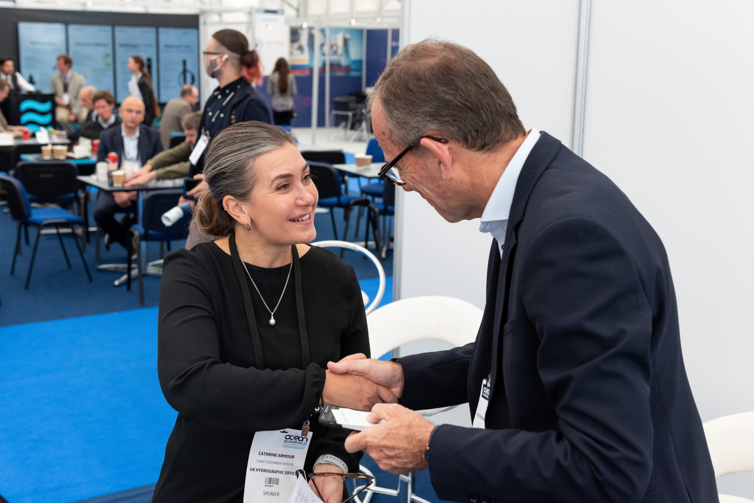
With just two months to go until Ocean Business 2023, more details can be revealed about the line-up of exhibitors at the global technology and science exhibition for marine industries.
More than 300 world leading manufacturers and service providers shaping the future of ocean science and technology have booked space at the sold-out show, which runs from April 18-20 at the National Oceanography Centre in Southampton.
The three-day event is open to all visitors for free by registering online at www.oceanbusiness.com.
This year’s exhibition, covering two halls and including a full programme of training and demonstrations on the dockside, on board vessels and in the classroom, promises to attract record crowds from around the world.
Visitors will be able to see the latest developments in transformational ocean technology, from cutting edge ROVs, to next generation sensors, to advances in automation.
Among the highlights, Framework Robotics is launching its new remotely operated vehicle, BUDDY, which can be adjusted to suit any mission, from exploration to surveying, inspection and more.
Leading UK scientific technology company ANB Sensors will present its state-of-the-art pH sensors, which operate to depths of 1,250m in fresh or saltwater environments, are virtually maintenance-free and allow for long-term remote monitoring.
Subsea cable specialist Novacavi, meanwhile, will provide updates on its range of solutions designed to meet the most complex needs of marine and underwater technology – expertise that has seen the company support projects from upgrading the infrastructure of the European Multidisciplinary Seafloor and Water Column Observatory, to supplying the INGV National Institute of Geophysics and Volcanology with cables deployed at 4,000m to monitor the sea.
UK company RoboSys Automation, which uses artificial intelligence and machine learning algorithms to provide scalable levels of autonomy, will introduce its smart shipping software, Voyager AI, that can transform a new or existing vessel into a fully autonomous USV.
Also taking a stand at Ocean Business is Terradepth, the company spearheading seafloor hydrographic and geophysical survey solutions through unique autonomous underwater vehicle technology. Find out more about Terradepth’s high resolution data collection and its data management and visualisation system, Absolute Ocean.
Tom Chant, CEO of the Society of Maritime Industries, said: ‘Ocean Business is simply an essential event for the MST sector. If you cut Ocean Business with a knife you’d see ‘collaboration and innovation’ written through the heart of it. It’s a really important component supporting the industry turnover of £1.6 billion per annum. We look forward to seeing you there.’
Cheri Arvonio, Event Director at show organiser Diversified Communications, said: ‘Ocean Business 2023 is gearing up to be a bumper show, providing unbeatable opportunities for doing new business, sealing deals, networking and hearing industry updates.
‘We can’t wait to welcome both Ocean Business regulars and first-time show goers for three days of exciting product launches, innovation and ideas from today’s ocean technology trailblazers.’
To see the full exhibitor list, please visit: https://exhibitormanual.oceanbusiness.com/
About Ocean Business: Ocean Business is a hands-on ocean technology exhibition and training forum which is owned and organised by Diversified Communications UK in partnership with the Society of Maritime Industries. Since its launch in 2007 it has been hosted by the National Oceanography Centre where the event benefits from utilising the facilities of a world class centre. In recent years the event has grown substantially and now attracts more than 360 exhibitors and 5,000 international attendees.
For further information, please contact:
Georgia Smith, Marketing Manager
t: +44 (0)1273 916528
e: [email protected]
Website: www.oceanbusiness.com
Cheri Arvonio, Event Director
t: +44 (0)1453 836363
e: [email protected]
BeeX, Sulmara and the University of Strathclyde secure international grant funding for a Targeted Autonomous Inspection Service for offshore wind
An international consortium has been awarded a prestigious Enterprise Singapore - Innovate UK grant to develop a next generation autonomous structural integrity inspection capability.
Autonomous robotics specialist BeeX, offshore survey and inspection specialist Sulmara, and structural integrity specialists at the University of Strathclyde share a vision to deliver an autonomous low carbon solution for windfarm integrity monitoring. Ultimately the end goal is a Robotics-as-a-Service (RaaS) solution drastically reducing the resources required to conduct essential underwater inspections and asset integrity assessment of offshore wind turbines.
This solution would contribute to meeting Europe’s net-zero commitments by slashing energy requirements and emissions related to inspection activities in the wind sector. Large diesel fuelled and carbon intensive vessels are currently required to inspect energy assets, making the introduction of optimised, automated, lower carbon solutions a crucial part of any net-zero future.
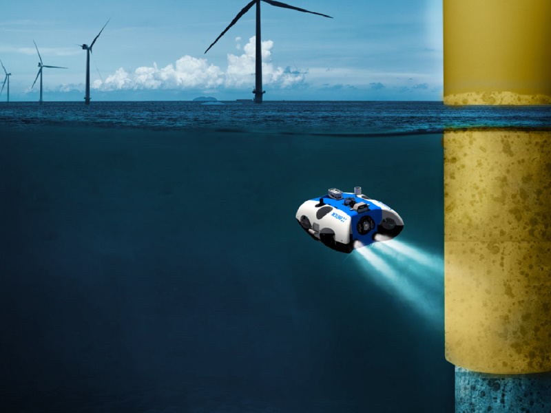
Assisted by the grant funding, BeeX will be delivering their next-generation Hovering Autonomous Underwater Vehicle (HAUV) specifically for Offshore Wind; carrying specific survey & inspection payloads suitable for monopile and jacket inspections, piloted by artificial intelligence to automate inspection tasks & deliver repeatable efficient inspection of windfarm monopiles from seabed to the air water interface. This HAUV platform will be enhanced with new features including enhanced endurance and improved sensor payload from critical learnings discovered from BeeX experience with their flagship HAUV, A.IKANBILIS on the Nordsee One windfarm, offshore Germany last year.
Sulmara’s scope will define the vertical asset inspection capabilities and sensor payloads needed for this next generation HAUV to meet the demands of the offshore wind sector as well as managing field trials and demonstration of the system alongside BeeX in 2024, with the ultimate aim to integrate the HAUV into a bespoke Unmanned Surface Vessel. The inspection missions will be optimised based on research by the University of Strathclyde, in developing a Structural Integrity framework to generate risk-based, fit-for-purpose, inspection missions that will feed into the HAUV automated mission control software.
Offshore wind is a critical and rapidly expanding sector with UK government targets to deliver 5 GW of floating wind by 2030. Underwater inspections are essential in ensuring its safety. In many cases, these inspections are also mandatory by governments and financial backers. Operations and Maintenance Costs at offshore wind farms remain the biggest operational cost. The costs are largely driven largely by the use of large, specialised Dynamically Positioned (DP2) vessels to deploy work-class remotely operated vehicles (WROVs). With low carbon and reduced cost at the forefront of this project, it is clear that an HAUV hosted from an Uncrewed Surface Vehicle (USV), both optimised for the offshore wind sector can build on and improve the capabilities of the current Work Class ROVs hosted from larger crewed vessels.
BeeX chief executive officer, Grace Chia, said: “By 2025, we expect BeeX’s fully autonomous systems to help wind farm developers and operators reduce costs and risks to a fraction of today’s, from consenting to end-of-life. This grant funding is a critical piece of financing that unlocks the partners’ abilities to enable safer and clean energy for all, and we look forward to deployments at more wind farms across Europe.”
Kevin McBarron, CEO Sulmara added: “BeeX next generation HAUV combined with Sulmara USV hosting has the potential to be an industry game changer, cutting costs and drastically reducing carbon emissions.”
Professor Feargal Brennan, Head of Department for Naval Architecture Ocean and Marine Engineering at Strathclyde said: “The climate emergency demands that we apply the very best innovation to ensure better underwater data collection methodologies. We look forward to delivering this research and to seeing our innovations applied to achieve breakthroughs in remote subsea inspection.”
Royal Netherlands Institute for Research acquires new Teledyne Gavia Osprey AUV
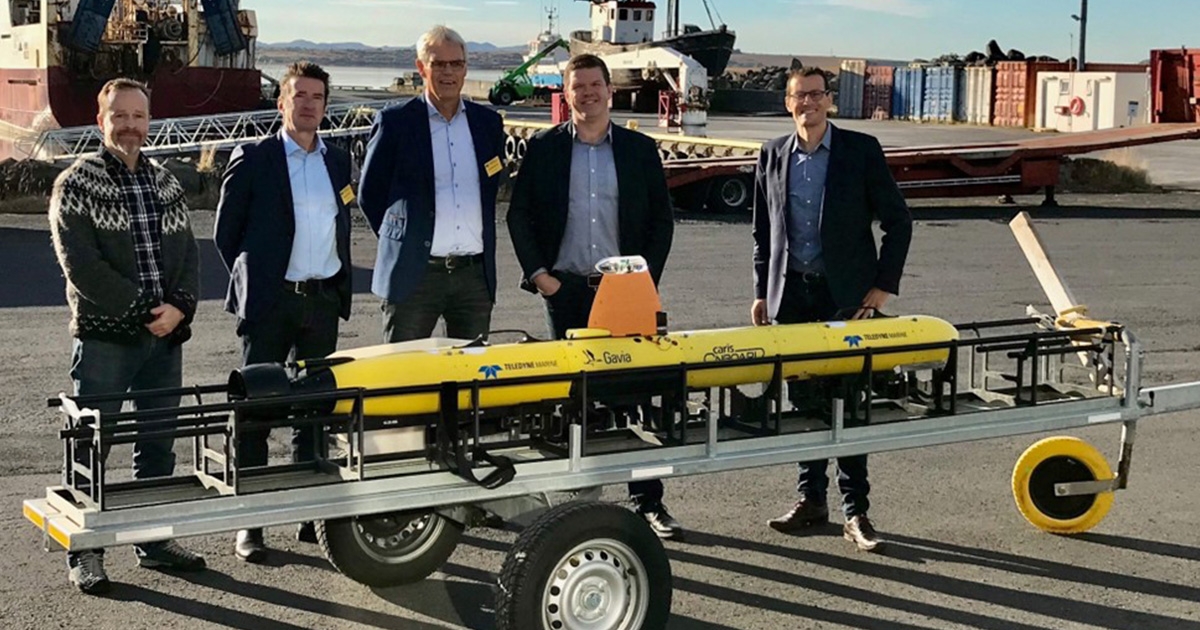
Teledyne Marine announces the acquisition of a new Gavia Osprey AUV by the Royal Netherlands Institute for Sea Research (NIOZ). NIOZ is the Netherlands' national oceanographic institute conducting multidisciplinary applied marine research to address major scientific questions about our oceans and seas. NIOZ acquired the Teledyne Gavia Osprey AUV to add to its ever-growing fleet to be used in scientific projects, like understanding the significant impacts of climate change on the seas and oceans, such as temperature increase and acidification. NIOZ studies the ocean's role in changing climate from equator to pole, from the continental shelf to the deep ocean, and from present to past.
Today, the ocean environment is changing rapidly due to external pressures, which will affect the diverse but poorly understood ocean processes that play an essential role in marine ecosystems and our future climate. The Osprey AUV is Teledyne's latest member of its underwater vehicle family and provides customers like NIOZ with longer endurance and greater payload capacity while maintaining true modularity. The Osprey AUV builds on the Gavia product line of the world's first truly open and modular AUVs. The Osprey extends operational endurance to over 24 hours (configuration dependent) combined with high-performance payloads like Synthetic Aperture Sonar and Teledyne Reson SeaBat series multibeams, making it the perfect tool for collecting high-quality data with consistency and accuracy.
“We are really looking forward to field operations and being a part of new developments with this most recent addition to the Teledyne Gavia AUV family. The Osprey will be a real modular AUV with a flooded payload bay that will allow us to interface and use our new in-house developed sensors. The Teledyne Osprey also makes logistics effortless because it can easily be moved around in Pelican cases.” Said Marck Smit, NIOZ Sea Research.