
Kongsberg Maritime launches Blue Insight, a powerful digital toolbox for ocean data management and analysis
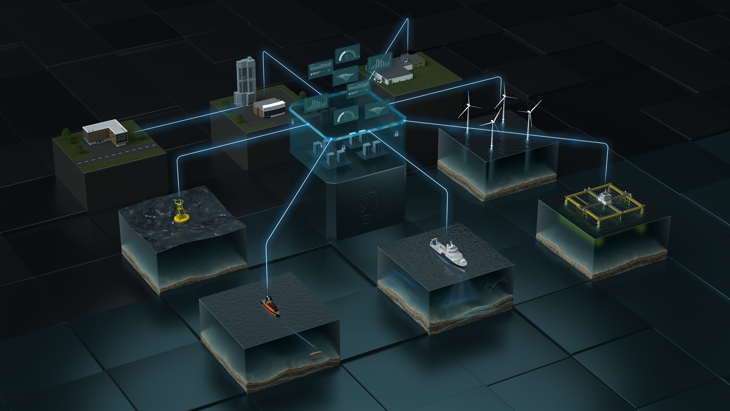
Kongsberg Maritime (KM) is delighted to announce the launch of Blue Insight, a powerful, cloud-based digital toolbox to enable state-of-the-art collection, visualisation, contextualisation, management and distribution of ocean data. Focusing on marine and meteorological information, the Blue Insight ecosystem is of key value to both scientific and industrial users of the maritime environment. Blue Insight provides an open, modular platform for the processing, visualisation and sharing of ocean data. The core module contains the cloud framework – which has been built to the highest cyber security standards – and an application-specific dashboard, teamed with data storage and management functionalities. Additional modules can be added to this framework to tailor Blue Insight’s functionality to suit all projects, however large or small.
Key to Blue Insight’s data-streaming functionality is the concept of sensor fusion, by which data is streamlined from various onboard sensors and a local database for seamless transmission into the cloud. In addition, the module serves as a link with KM onboard sensors for remote operation. Data can be collected from any platform, ranging from crewed to autonomous surface vessels or even underwater vehicles such as AUVs or gliders. Through ongoing delivery projects, several modules already exist to assist customers in obtaining the best results from Blue Insight, including Remote, a module that enables remote access to a KM.
Press Release
WORLD CLASS - through people, technology and dedication echosounder via a web interface; Ocean View, a powerful and comprehensive web-based visualisation tool for historic and real-time sensor or database data; and Data Forwarder, enabling data conversion into any common format and automated data forwarding to external cloud systems or databases. Science Analytics supplies an infrastructure for more in-depth data-handling capabilities, such as the implementation of machine learning and AI-enhanced data analysis on board or in the cloud. As an example, one of the first delivery projects has seen the module providing a framework on unmanned surface vehicles for the automated onboard classification of fish. The portfolio of modules and support for specific instruments will be continuously expanded, consistent with KM’s aim to provide customers with unprecedently swift access to data, even in heterogenous environments.
One of the first projects to take advantage of the functionality provided by Blue Insight is a collaboration between KM and Akvaplan-niva, gathering meteorological, oceanographic, biological and chemical data from unmanned autonomous glider vehicles. The project has been under way for several years, but recent funding from the oil & gas company ConocoPhillips Norway has focused efforts towards understanding the impact of offshore oil & gas facilities on selected marine species in the North Sea.
The project is continuing to evolve the glider concept into an operational system for research and industry while advancing the digital environment to introduce new, cutting edge management and analysis features. "Blue Insight has been an invaluable aid for managing the vast amount of data we collect at sea with our fleet of gliders, often for months at a time,” says Lionel Camus, Manager for Digital Solutions at Akvaplan-niva.
“This innovative digital toolbox has enabled Akvaplan-niva to deliver professional solutions and to share an unprecedented common experience via the cloud with our customers during each survey." “We’re very excited to be able to bring Blue Insight to market,” adds Tonny Algrøy, Sales Director Ocean Science, Kongsberg Maritime. “Our primary focus in developing this powerful, cloud-based framework for data collection, sharing and analysis has been to increase our knowledge of the ocean environment and act as a digital enabler for sustainability. It’s great to see that vision now becoming a reality. Collaborations such as the glider project with Akvaplan-niva and ConocoPhillips demonstrate how research institutions and industry can work together to benefit from contextualised data, furthering the joint aims of conservation bodies and global business operations.”

Valeport launches new marine sensing and monitoring instruments at Ocean Business
- new Bathy2 – an enhanced, robust integrated instrument to provide reliable and accurate density corrected depth data up to 6000m
- new miniIPS2 and uvSVX – with unique interchangeable pressure heads, these next-gen sensors benefit users who work at different depths
- new SWiFT CTD and SWiFT CTDplus – designed for a seamless workflow, these user-friendly profilers deliver improved accuracy and versatility to those requiring CTD measurements
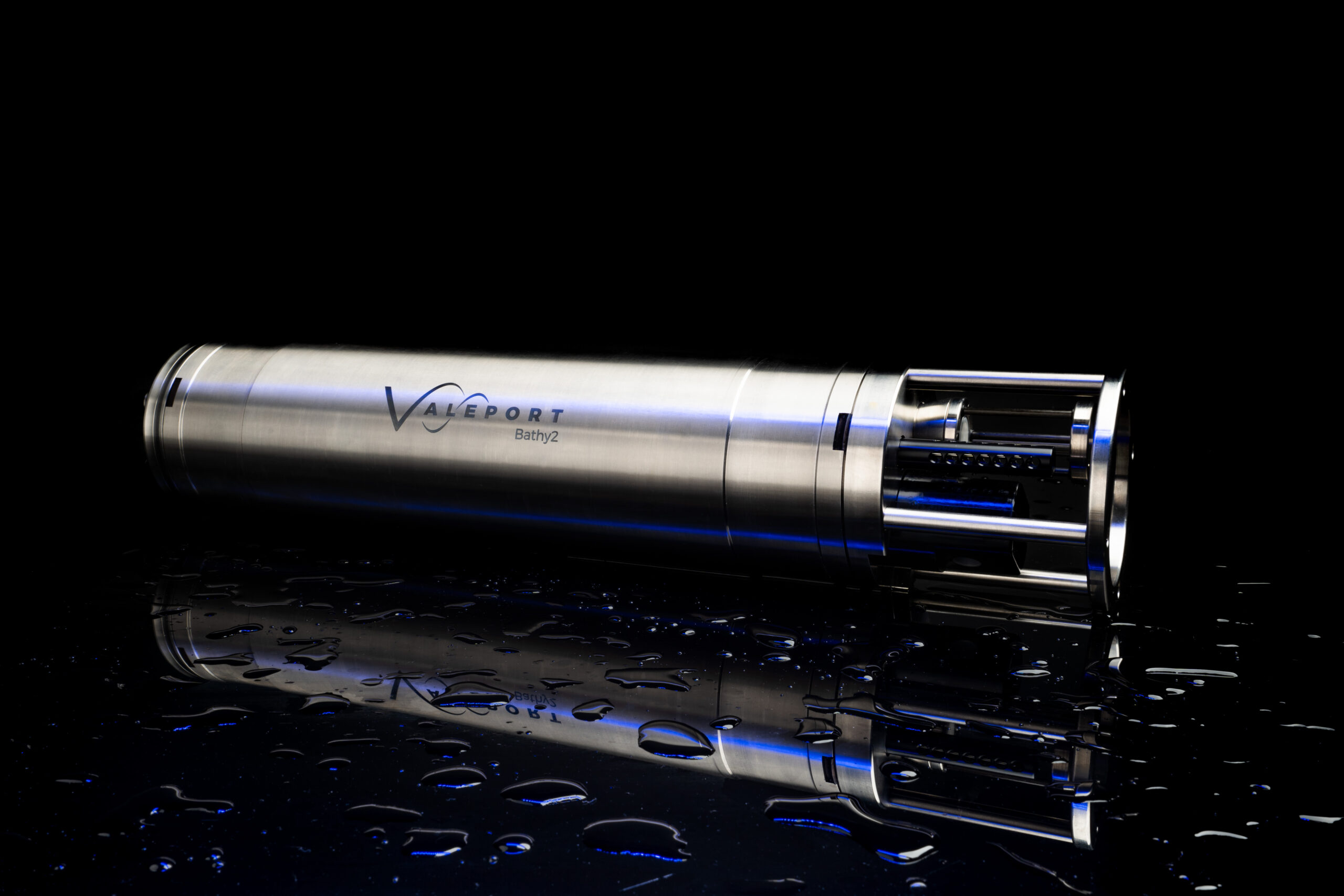
Ocean Business 21 was the launch venue for Valeport’s new Bathy2, an exciting evolution in the collection of bathymetric data, which will be shown for the first time ahead of its formal release in Q1/Q2 2022. Also making their debut on the manufacturer of environmental sensors stand, are four innovative instruments designed with ease of use at their core, where a much improved user experience is now available alongside the highest quality, precise data.
Bathy2 – on show for the first time ever, this new integrated sensor suite is designed to meet customer bathymetric requirements for a reliable, accurate and robust instrument with more functionality to suit specific operations up to 6000m in depth.
An enhancement of the popular Midas BathyPack, the new Bathy2 uses state-of-the art sensors to generate Sound Velocity and Density profiles for precision depth and height data.
 This evolution brings together the benefits of density corrected output directly from one instrument, alongside the flexibility of third party pressure sensor input and Valeport interchangeable pressure modules to allow users enhanced accuracy at different depths.
Improving the user experience has been a key driver in the development of this superior bathymetric instrument and the addition of a dedicated data output for INS allows bathymetric data to be efficiently communicated directly with users’ own operational software. Other helpful benefits include the flexible pressure options using Valeport’s interchangeable pressure sensors, these field-swappable sensor heads make it easy for users to select the correct pressure for their working depth bringing benefits of exceptional reliability and a higher degree of accuracy.
Designed for surveyors requiring bathymetric data from ROVs, underwater vehicles or drop structures, Bathy2 also has an external pressure sensor input option for Digiquartz referencing. This comprehensive bathymetric package offers other useful parameters such as Altitude and Bathy2 interfaces with the Valeport VA500 altimeter and other popular third party makes.
Data transfer is via Ethernet or RS232/RS485 interfaces and the Bathy2 Interpreter function via the Valeport Configure software allows data out on extra ports in industry standard formats, this facility also allows for an atmospheric pressure data input.
miniIPS2 - The smart miniIPS2 underwater pressure sensor with accuracy to 0.01%, offers a cost-effective solution to vehicle pilots who require highly accurate depth information in real time.
This innovative pressure sensor, with a unique interchangeable pressure module, allows the user to quickly and easily change the pressure transducers whilst in the field, with no tools required, to maximise operational specific depth requirements.

uvSVX - The compact uvSVX is designed for underwater vehicles where space is at a premium and it delivers calculated salinity and density data, along with SVP as standard. Like the miniIPS2 it also features field-swappable sensor heads, has a depth rating of 6000m and delivers 0.01% accuracy. The interchangeable pressure transducer, with integral calibration is easily changed in a couple of minutes without opening the instrument and is available in 10, 20, 30, 50, 100, 200, 300, 400 and 600bar variants.
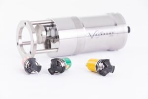
SWiFT CTD and SWiFT CTDplus – the latest addition to Valeport’s popular SWiFT profiler family, the SWiFT CTD profiler provides enhanced accuracy and versatility for those requiring CTD measurements. The SWiFT CTD profiler delivers survey-grade sensor technology coupled with the convenience of Bluetooth® wireless technology, rechargeable battery and an integral GPS module to geo-locate each profile.
2/3
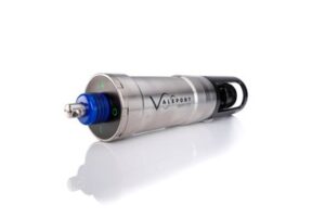
Using Valeport’s high accuracy sensor technology to combine sensors for multiple profiles in a single drop, the SWiFT CTD features a new fast response temperature probe and operates down to 500m as standard. With an operational battery life of up to five days and the convenience of charge via USB, the SWiFT CTD is intended for offshore, coastal, harbour and inland environmental and hydrographic survey use.
A CTDplus version is currently available with Turbidity at present and combines CTD measurements and Turbidity observations, in addition to providing computed Salinity, Density and Sound Velocity.
Guy Frankland, Valeport Head of Marketing commented: “Ocean Business is a great platform to introduce our newest developments and product upgrades prior to their general release. We’re particularly looking forward to seeking feedback on our Bathy2 instrument and its capacity to offer an increased survey grade performance, as well as getting Valeport’s unique range of interchangeable pressure sensors into the hands of potential users so they can get a real sense of the streamlining benefits they bring.”
Contact: Valeport www.valeport.co.uk Email: [email protected]
Exciting opportunity for a Senior Metocean Engineer - Partrac

We are known for delivering high quality and safe metocean monitoring campaigns to the growing renewable industries across Europe.
What you will be doing:
- Take a lead role in improvement of QHSE systems, survey operations and the technical capabilities of the metocean team.
- Leading project mobilisations and servicing of seabed systems, metocean buoys and fixed systems.
- Leading metocean engineers on site to deliver safe and successful site operations.
- Leading project operational documentation in line with legislation, industry best practice and client requirements.
- Excelling in communication with clients and subcontractors.
What you will have:
- Minimum 5 years’ in a marine technical or engineering role.
- A working knowledge of MS Office and sensor programming.
- A high level of professionalism
- Willingness to travel, predominantly UK and Europe.
- Fluent technical English
- Full driving licence
What you will bring:
- Demonstrable experience in the practical delivery of deployment/installation of instrumentation in coastal and offshore environments.
- Experience working from various platforms such as workboats/ /anchor handling vessels/offshore installations etc.
- Leadership in industry QHSE requirements
- Systematic and methodical approach with fine attention to detail.
- Ability to work to strict deadlines in a fast-paced environment.
What you’ll get:
Balance is important at Partrac. The metocean department is based in Devon, in the heart of the southwest, within striking distance of Dartmoor and amazing beaches. As well as new challenges, Partrac is a supportive workplace with opportunities for progression, we offer:
- Working in a market leading team with a high level of recognition
- A resilient company that is expanding in growth markets
- Competitive salary + benefits
- A friendly, supportive team
- Project allowances
- Training
To apply
Email your CV and a covering letter to [email protected] Ref: SENMETOSW
Metocean Engineer, Oceanographer, Project Manager & Tender Coordinator - Partrac
If you are an experienced oceanographer, metocean engineer or marine project manager or tender coordinator, with a passion for the marine environment and renewable energy, we want to hear from you. We are growing and need more specialists to join our team, in order to help our clients, plan and execute successful measurements projects offshore.
You will find yourself in a culture that champions continual improvement, openness, and teamwork. If you are on the lookout for new, better ways to do things and want to be supported by a talented team of peers, you will fit right in here.
Current vacancies are:
- Project Manager
- Senior Metocean Engineer / Party Chief
- Metocean Engineer / Oceanographic Technician
- Tender & Marketing Coordinator
What you’ll get:
Working at Partrac means you are trusted to use your initiative. We will give you the freedom to follow your ideas and to make an impact.
Our company is growing quickly, so there are plenty of opportunities for progression. As we are a market-leading team and well respected in our industry, working with us will be an excellent career move.
Some of the benefits our team love include: –
- Working in a market leading team with a high level of industry recognition
- Interesting and varied projects that make a difference.
- A resilient, dynamic working environment.
- A friendly, supportive team.
- Generous holiday allowances.
- Flexible working options.
- Competitive salary and benefits.
Balance is important at Partrac. The SW metocean department is based in Devon, in the heart of the southwest, within striking distance of Dartmoor and amazing surf beaches.
To apply:
Please visit https://www.partrac.com/careers for further information.
– Closing Date 1st November 2021
Sercel launches new Bluepulse acoustic marine source for seismic acquisition in sensitive areas
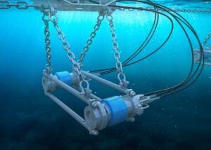
Sercel's new marine acoustic source for seismic acquisition in sensitive areas (image courtesy of Sercel).
Sercel announced today the launch of Bluepulse, an innovative marine acoustic source offering the most advanced frequency control technology on the market. Bluepulse is a purpose-built acoustic source designed to help protect marine wildlife from high-frequency emissions, while maintaining highly accurate and reliable results for seismic acquisition.
Bluepulse is compatible with all existing peripherals making it an easy choice for surveys requiring limited high frequency source emissions. Through intelligent engineering and design, existing G-Source and G-Source II units can be easily upgraded with Bluepulse technology, saving customers up to 40% on the cost of fleet conversions. The new units offer available range options in three different casings, twenty-two different volumes and with two frequency limits (100Hz and 200Hz) to comply with regulatory environmental standards and restrictions. The source array can thus be configured and customized to meet exacting survey requirements.
Emmanuelle Dubu, Sercel CEO, said: “Bluepulse is a perfect example of our continued commitment to providing high-quality data combined with the highest level of environmental responsibility. The ability to upgrade existing units and the wide variety of options also offers the highest flexibility for marine surveys all over the world.”

New global survey calls for greater coordination of seabed mapping activities
A new survey has given a major boost to efforts to map the entire seafloor by the end of the decade. Nearly 800 professionals representing 90 countries shared views on the value of seabed mapping and where activities to map using modern digital methods should be focused, as well as identifying some key challenges that need to be addressed in order to achieve the ambitious goal.
The findings are released as the UN Ocean Decade endorses a range of new global Actions covering activities across the world’s ocean basins. A new Call for Decade Actions is also set to launch today – the second of a series that will be launched every six months as part of the Ocean Decade.
The survey – commissioned by The Nippon Foundation-GEBCO-Seabed 2030 Project and managed by Blue Economy company NLA International – drew responses from across the scientific, academic, philanthropic and business communities, as well as from government and defence officials. Headline findings included:
• 40% of online respondents considered the main benefit of mapping the ocean floor to be ‘to advance scientific understanding of seabed characteristics’, with 11% highlighting the need ‘to monitor environmental challenges over time’.
• Bathymetric data (81.67% of respondents) was the most desired geospatial information, followed by environmental data (69%), oceanographic data (65.33%) and classification of seabed features (63.33%).
• Respondents were interested mostly in water depths less than 200m (33.57%) and greater than 5750m (31.12%).
• An overwhelming majority of respondents (58.31%) would want access to any data sets via an online marine data portal.
The survey aimed to develop a more consolidated global view of seabed mapping needs in order to move towards an agreed list of strategically important priority areas for further action. It also achieved its secondary aim of finding new data that could immediately feed into the emerging global map, with respondents identifying 154 potential sources of new data to be explored. Each new data set collected will help to develop models that can more accurately predict climate and weather patterns, tides, wave action, sediment transport, tsunami wave propagation and underwater geo-hazards.
There was universal recognition from survey respondents for the urgent need to map the world’s seabed, and equally compelling praise and support of the Seabed 2030 project’s objectives. However, some challenges were also identified. Many felt that current survey/environmental strategies and initiatives could do more to align within a more joined-up, coordinated approach. A consistent message emerged that scarce resources are not being used efficiently as they could be as too many programmes are seen to operate in isolation. In particular, seabed mapping programmes run by industry and environmental bodies were identified as not complementing national hydrographic office strategies.
Commenting on the findings, Seabed 2030 Project Director Jamie McMichael-Phillips said:
“We were completely bowled over by the volume and quality of the responses to our survey. The results have provided us with three new areas of value. First of all, it’s great to have identified over 150 new data sources, and our teams are already working to bring that bathymetric data into the master database. Secondly, we now have a previously non-existent base list of areas the global community would like to see surveyed, and the reasons why they feel it is important to do so. This provides us with a really robust platform from which to develop a more targeted list of priority activity areas to help us drive towards our target.
“Of equal importance was the rich level of detail the survey respondents provided in a wide range of additional comments. When viewed collectively, these provide a compelling, bottom-up picture of what more needs to be done – where links may have been overlooked, where partnerships need to be strengthened, where and how new effort needs to be applied in order to have the maximum impact. We look forward to revealing how we will respond to these ideas in due course. I would like to thank every single person who completed the survey, and the many organisations who helped us attract such a fantastic response in order to develop a strong global perspective.”
The survey was supported and promoted by a significant number of international bodies and agencies, examples of which included the Intergovernmental Oceanographic Commission (IOC); Baltic and International Maritime Council (BIMCO); United Kingdom Hydrographic Office (UKHO); and the European Marine Observation and Data Network (EMODnet).
The survey findings will now be converted into a draft global priority list for seabed mapping activities that reflects all maritime sectors and users of seabed bathymetric data. This draft priority list will be shared with the world’s hydrographic, oceanographic and policy agencies in order to move jointly towards an internationally recognised and supported prioritised list for seabed mapping that reflects potential cross-sector environmental, social and economic benefits across all areas.
The survey findings come amid a flurry of high-level global activity for the Seabed 2030 Project, which has been endorsed as an official Action of the UN Ocean Decade. Recently launched initiatives have also included forming partnerships with innovative data-gathering technologies and the signing of a Memorandum of Agreement with the New Zealand Government. The Seabed 2030 Project has already had a significant impact on the amount of the ocean floor that has been mapped to modern standards – steadily progressing the figure from six per cent in 2017 to 20 per cent in 2021.
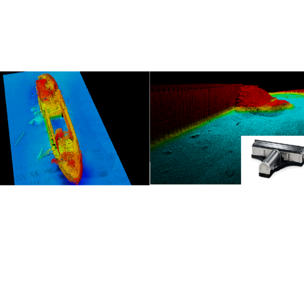
Manor Renewable Energy selects Teledyne RESON T51 multibeam as part of continued investment in survey department
Manor Renewable Energy (MRE) continues its investment in the company’s survey capability with the comprehensive refit of survey equipment onboard the Manor Brunel, MRE’s permanently mobilised survey vessel. The Brunel has undergone a series of engineering upgrades at the Manor Marine yard in Portland, Dorset in addition to the installation of a cutting-edge suite of hydrographic survey technology from Teledyne Marine.
MRE is excited to announce the order with Teledyne Marine for the revolutionary RESON Seabat T51 multibeam echosounder, offering a step change in the acquisition of high-resolution bathymetric data. The order also included an E20 singlebeam echosounder, SVP70 sound velocity probe and an upgrade to the vessel’s Applanix POS MV Wavemaster Inertial Navigation System. The installation of the T51 to take place in December 2021 completes the upgrade to the Manor Brunel.
Alex Richards, Survey Manager at MRE said,
“This investment in the department is a bold statement for the company; the introduction of a high specification, dedicated survey platform to the market will enable MRE to further extend its range of services to the industry.”
“We are delighted that MRE have chosen to partner with Teledyne in order to upgrade their new vessel, the Manor Brunel,” commented Ed Cheesman of Teledyne Marine. “The T51 marks a real advance in multibeam technology offering high resolution data across a wide swath using a dedicated 800kHz array. It is great to see Alex and the team set out from the beginning investing in the right tools to deliver the best results.”
Falcon across Turkey
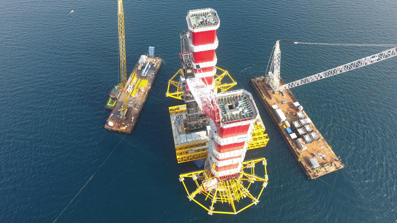
Turkey’s marine operations company, ARAS Marine, has chosen for its expansive operations the deep-rated Saab Seaeye Falcon as a key underwater robotics resource.
The versatility of the Falcon will support the wide range of projects undertaken by ARAS in both International and Turkish territorial waters.
These projects range from marine construction and offshore supply services, to seismic research support, emergency response and salvage and wreck removal.
Equipped for the wide array of tasks ahead, ARAS’s 1000m depth-rated Falcon comes complete with a fibre optic upgrade, manipulator, soft rope cutter, cameras, Tritech sonar and Applied Acoustics’ USBL system.
ARAS can add further systems any time as the Falcon can handle an array of cameras, sensors, tooling and complex systems typically found on much larger robotic vehicles.
The ease of adding systems comes from the Falcon’s iCON™ intelligent distributed control architecture. Module-focused iCON™ endows each device with its own microprocessor for individual control - a concept that also makes it future-flexible for evolving technologies.
As the world’s top selling robot of its class, the Falcon’s 20-year success comes from being a portable, metre-sized, intelligent, powerful, five-thruster, highly manoeuvrable, multi-tasking, easy to use vehicle, depth rated to 1000 metres.
With a reliability record covering over a million hours underwater, including deep tunnel work, the Falcon can remain stable in turbulent waters and strong currents whilst undertaking both robust and precision tasks.
ARAS see the Falcon as an ideally adaptable resource for their expanding future.
The contract was negotiated through Saab Seaeye’s Turkish distributor, Aspiro.
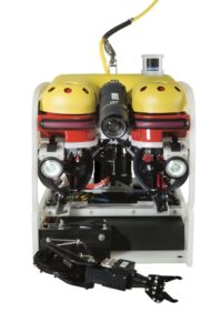
Falcon – the world’s top selling robotic vehicle can be equipped with a wide range of tools, cameras and sensors.
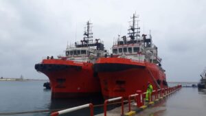
ARAS has a wide array of resources for an extensive range of projects.
Act now to protect coastal communities from rising sea levels
13 October 2021
Ahead of COP 26, the Institute of Marine Engineering, Science & Technology (IMarEST), is calling for leaders around the world to take action to mitigate the impact on coastal communities and infrastructure of rising sea levels. This includes a recommendation to standardise the way oceans are measured globally to provide the data needed for greater understanding and sustainable management.
The advice comes as the Institute prepares to host its fourth biennial Oceans of Knowledge conference on 26-27 October, the week prior to COP 26. The conference will focus on three themes:
- The sustainable use of the ocean and its resources
- The role of the ocean in natural and engineered climate mitigation
- Rising sea levels and coastal vulnerability
Ralph Rayner, Co-Chair, IMarEST Operational Oceanography Specialist Interest Group which is organising the conference, explains: “This is an opportunity to hear from leading climate change specialists and to gain an understanding of how mitigating and adapting to climate change will impact the use of the ocean and ocean resources. The day dedicated to rising sea levels will then explore impacts where the ocean meets the land, seeking to better predict and respond to the challenges of protecting coastal communities, infrastructure and the environment.”
World-leading speakers at the conference from Sir David King, Founder and Chair of the Centre for Climate Repair, Cambridge University, Rick Spinrad, who leads the US government’s climate agency, the National Oceanic and Atmospheric Administration, as well as speakers from the Schmidt Ocean Institute, the International Energy Agency and many more, will highlight current scientific understanding of the ocean-related aspects of climate change.
Given the misunderstandings about future rates of sea level rise, the morning sessions on October 27th about the realistic ranges by a group of experts should be very interesting and illuminating. The discussions will examine what we don’t know but need to know, and how to achieve it; providing insight into leading scientific understanding which can be turned into practical actions.
The two-day conference will also place national and international policy responses into the context of the UN’s 2030 Sustainable Development Goals and the UN’s Decade of Ocean Science for Sustainable Development, which is endorsing the conference.
“The next ten years are now widely accepted as critical for climate action; this is a global issue and we need global collaboration and action. The outcomes of our conference will be delivered at a side event and exhibition at COP26 and will make a key contribution to the UN Ocean Decade. ” Concludes Gus Jeans, Co-Chair, IMarEST Operational Oceanography SIG.
Day one: The Challenge; Use of the Ocean and its Resources; The New Blue Economy; Meeting the Challenge.
Day two: Rising Sea levels: What We Know; What We Don’t Know; Living with Uncertainty; and Meeting the Challenge.
The conference is partnered by the Royal Meteorological Society and supported by the Institute of Physics, Royal Geographical Society, Rising Seas, Society for Underwater Technology, Met Office, LSE, Institution of Mechanical Engineers, Institution of Environmental Sciences, Encounter Edu, and Nekton.
Sonardyne Group Limited changes name to Covelya Group Limited
The name change is effective immediately as the organisation positions itself for further growth and appoints Simon Partridge as its inaugural Chairman.
Sonardyne Group Limited, a family-owned global group of companies comprising Chelsea Technologies, EIVA, Sonardyne, Voyis and Wavefront, announced today that it is rebranding as Covelya Group Limited. Alongside the name change, the company announced that Simon Partridge will succeed Ralph Rayner as company Chairman with immediate effect. Ralph will remain on the board in a non-executive capacity. The announcement was made by Covelya Group CEO, Stephen Fasham.
Commenting on the change, Stephen explained:
“Following the restructuring of the group in 2020, the new name and identity gives us the launchpad from which to develop Covelya with a strong identity, culture and purpose.”
Stephen went on to say,
“Covelya’s role will be to continue supporting all our companies to grow and seek opportunities to add to our capability through internal and external investment, in addition to encouraging cross group collaboration. This will allow us to serve our customers better, amplifying our offer so that we become greater than the sum of our parts in all we do.”
Ralph Rayner commented:
“Simon has grown up in the business and has remarkable knowledge of technology, markets and customers across the whole group, making him uniquely placed to take up the Chairmanship. I look forward to working with Simon and Stephen to make the mission outlined by Stephen on behalf of us all, a reality.”
Simon added: “I’m delighted to be taking on the role of Chairman. I’d like to thank Ralph for his unequivocal support and focused leadership over the past 10 years. We’re on an exciting path as we launch Covelya - with Stephen at the helm combined with the leadership team across all the Covelya companies, I have great confidence that we will continue to sustainably grow the company for the next generation.”
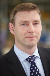

Simon Partridge and Stephen Fasham