
New marine discoveries underscore importance of ocean floor mapping as Seabed 2030 announces latest progress on World Hydrography Day
On the occasion of World Hydrography Day, The Nippon Foundation-GEBCO Seabed 2030 Project has announced the latest percentage of ocean floor mapped, marking an increase of 4.34 million square kilometres of new data – equating to an area the size of the European Union.
The global effort to compile a definitive map of the world’s entire ocean floor is being spearheaded by Seabed 2030 – a collaborative project between The Nippon Foundation and the General Bathymetric Chart of the Oceans (GEBCO), with the latter being a joint programme of the International Hydrographic Organization (IHO) and the Intergovernmental Oceanographic Commission (IOC) of UNESCO.
Seabed 2030 is also a flagship programme of the Ocean Decade – a framework to create a sustainable and well managed ocean.
The latest figure of 26.1% mapped is a testament to the continuous efforts and advancements in seafloor mapping technologies and activities. While the increase showcases progress in the portion of the seabed mapped, it’s important to highlight the remarkable discoveries made possible through this global effort to uncover Earth’s final frontier – discoveries that are essential for realising sustainable ocean management.
In the past year alone, ocean research has led to the characterisation of the largest known deep-sea coral reef habitat off the southeast U.S. coast. The multi-year campaign to map and explore this region was led by Seabed 2030 partner National Oceanic and Atmospheric Administration (NOAA) Ocean Exploration, in collaboration with a host of other government, academic, and private sector collaborators. The analysis of newly-mapped seafloor revealed an extensive coral habitat spanning over 6.4 million acres on the Blake Plateau.
"This strategic multi-agency effort to systematically map and characterise the stunning coral ecosystem right on the doorstep of the U.S. East Coast is a perfect example of what we can accomplish when we pool resources and focus on exploring the 74% of global marine waters that are still unmapped," said Derek Sowers, lead author of the study and Mapping Operations Manager at Ocean Exploration Trust.
Advanced sonar and imaging techniques documented 83,908 coral mounds, showcasing the immense biodiversity previously unknown in this region. This discovery, supported by imagery from 23 submersible dives, highlights the critical role of seafloor mapping in revealing previously unknown aspects of the ocean.
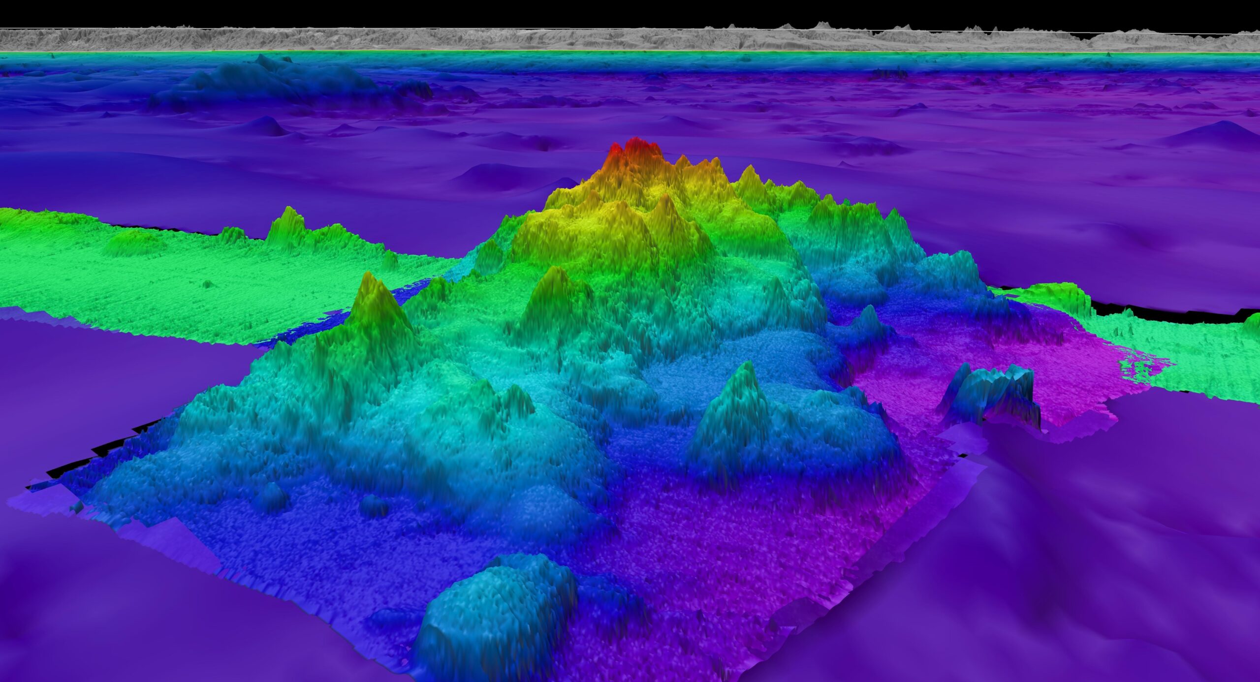
In another remarkable finding, the crew aboard the Schmidt Ocean Institute’s research vessel Falkor (too) made a groundbreaking discovery of four underwater mountains, with the tallest of these standing over 1.5 miles high, using multibeam mapping techniques. These seafloor features, revealed during a transit from Golfito, Costa Rica, to Valparaiso, Chile, had not been previously recorded in any bathymetric database. Additionally, scientists aboard the Schmidt Ocean Institute research vessel Falkor (too) have identified over 100 potential new marine species during a single deep-sea expedition, highlighting the vast, untapped biodiversity of the ocean.
Executive Director of Schmidt Ocean Institute Jyotika Virmani commented: "What lies beneath the waves is the largest mystery on our planet and the ocean continues to reveal magnificent new surprises. Schmidt Ocean Institute is proud to be a partner of The Nippon Foundation-GEBCO Seabed 2030 Project and a part of the phenomenal international effort currently underway to map our entire planet for the first time in human history."
These findings underscore the vital importance of seabed mapping in enhancing our understanding of marine ecosystems and informing frameworks for sustainable management.
Seabed 2030 Director Jamie McMichael-Phillips said: "Seabed mapping has proven to be a powerful tool in advancing our knowledge of marine ecosystems and biodiversity, and the impressive discoveries made this year alone highlight the critical importance of our mission.
“Commendable progress has been made since Seabed 2030’s inception in 2017, with over 94 million square kilometres of bathymetric data acquired through global partnerships, data mobilisation, and advancements in technological innovation, but much of the ocean still remains a mystery. The discoveries made over the course of the past year serve as a striking reminder of how much of our own planet we have yet to understand and, in turn, safeguard.
“The achievements made to date would not be possible without the concerted efforts of our global network of partners and the international maritime community. Now, as we strive towards the end of 2030, we need the collective support of all stakeholders – governments, industry, academia, and even the public – to help us realise our ambitious, yet necessary, goal of a fully mapped planet.”
All data collected and shared with the Seabed 2030 project is included in the free and publicly available GEBCO global grid.

Teledyne Marine Announces 2024 Photo & Data Contest
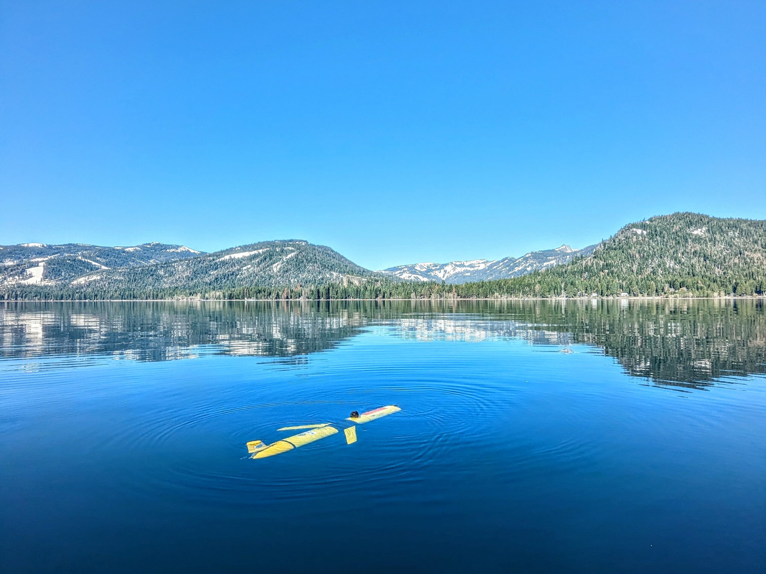
Teledyne Marine is excited to announce the launch of the 2024 edition of the Teledyne Marine Photo & Data Contest. We invite our customers to showcase their creativity and expertise by sharing photos of Teledyne Marine products in action, whether in the office, lab, or field, as well as data samples collected using our products. Share your work, gain inspiration from others, and highlight your unique perspective and achievements with a global audience. By participating, you join a vibrant community of professionals pushing the boundaries of marine technology!
Contest Details:
- Eligibility: This contest is open to all Teledyne Marine customers. Please note that government officials are not eligible for prizes as per the eligibility criteria specified in the contest rules.
Awards and Prizes:
- Voters’ Choice Award – Grand Prize:
- Prize: HERO12 Black Creator Edition ($500 value)
- Selection: The winner will be chosen from the top 10 images receiving the most votes.
- Category Awards:
- Categories: Best Data Award, Aversity Award, Moment of Zen Award, and Underwater Award.
- Prize Options: Winners can choose between a DJI OSMO Gimbal Smartphone Stabilizer, a KODAK PIXPRO WPZ2 Rugged Waterproof Digital Camera, or a Garmin Instinct 2X Solar - Tactical Edition Rugged GPS Smartwatch.
- Selection: A jury will select winners from all images with more than ten votes.
How to Participate:
- Submit your photos and data samples showcasing Teledyne Marine products in use. Read more here.
- Gather votes for your submission to be considered for the Voters’ Choice Award.
- Ensure your entry meets the criteria outlined in the contest rules.
We encourage all participants to read the contest rules to learn more about eligibility, submission guidelines, and other important details.
Join us in celebrating the innovative and diverse applications of Teledyne Marine products. Share your best moments, impress the jury, and you could be one of our lucky winners!
For more information about the contest, visit the Teledyne Marine Contest Page at https://go4.teledynemarine.com/contest
Teledyne Marine customers include those who purchase or use our products professionally. Due to contest rules, government officials are excluded from prize eligibility.
Kongsberg Discovery echo sounder upgrade opens new frontiers in Ocean Science
Ocean Science specialist Kongsberg Discovery is strengthening its industry-leading EK80 echo-sounder product family with unprecedented wide-band low-frequency capability that will enable customers across Governments, Academia, and Industry to gain a much more detailed picture of the ocean environment than has previously been possible, amid an increasing focus on sustainable management of the oceans.
The EK80 product family is part of Kongsberg Discovery’s portfolio of monitoring and measuring tools and is used for all types of ocean research. The product family has historically been used primarily for biomass assessments, but the instruments are seeing increased adoption for other biological, physical and chemical oceanography applications. An EK80 vessel-mounted system typically comprises six transducers operating at different sound frequency spectra, matched with transceivers, software, and planning tools. The transducers are calibrated to give highly accurate, quantitative metric values of application targets.
Increasing the wide-band spectrum
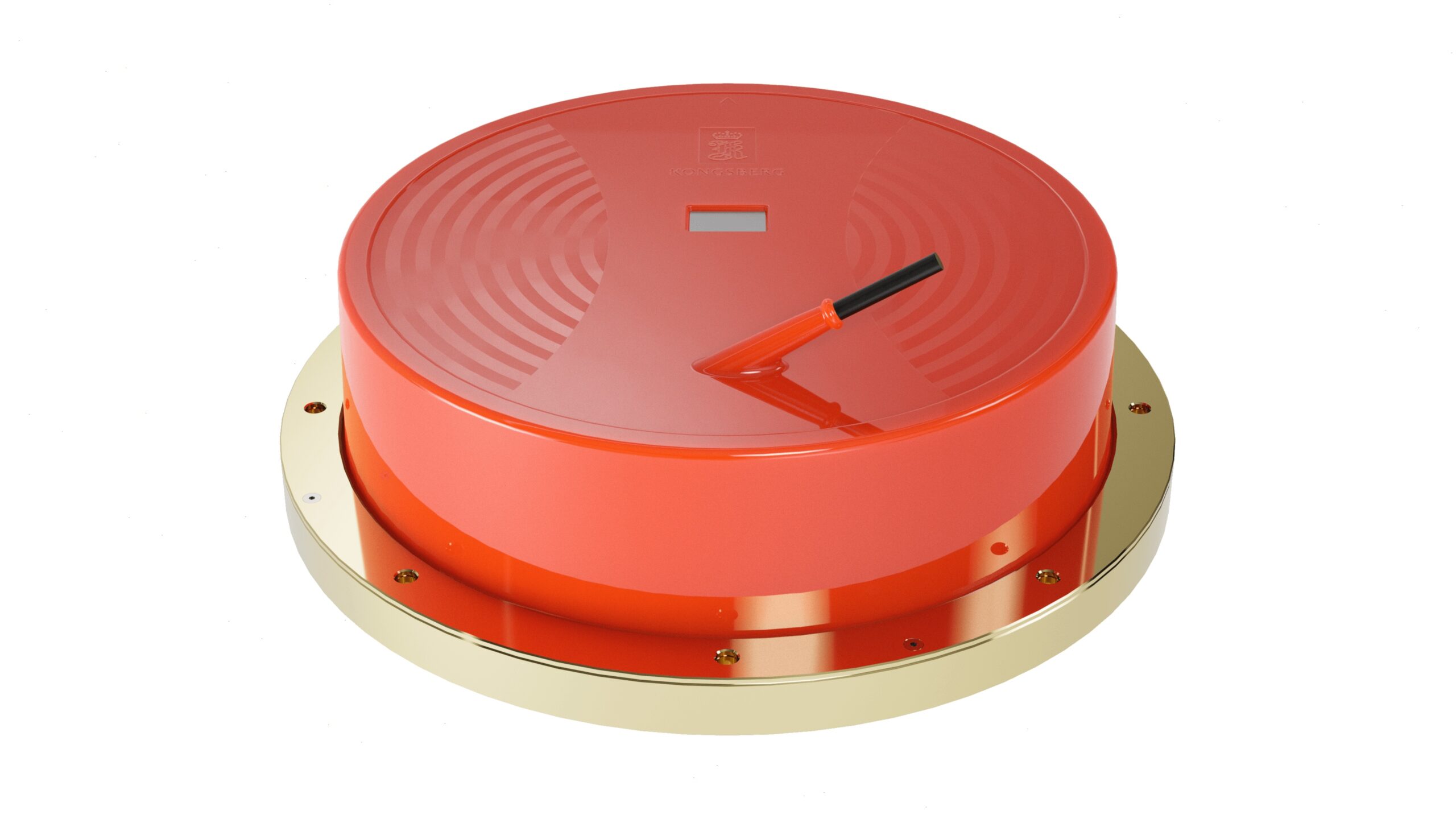
Kongsberg Discovery’s new ES18-11 MK2 transducer widens the operational frequency spectrum of its existing ES18 split-beam transducer from 18 kHz to at least 14 to 22 kHz, increasing the resolution of the data as well as providing more information for target identification from this frequency band.
The development project also led to an improvement in transducer element design reducing the challenge with ringing, which mean that the transducer can be used for both shallow and deep-water measurements.
“The ES18-11 MK2 further enhances the EK80's overall performance and brings us one step closer to uncovering the mystery of the oceans. It is an important innovation that we are certain will contribute to increasing knowledge of ocean biology, physics and chemistry, in line with UN SDG 14 Life Below Water,” says Lars Andersen, VP Ocean Science at Kongsberg Discovery.
Essential for fisheries management
The core application of ESI8-11 MK2 remains the identification of biological targets. The 18 kHz transducer is already common on most research vessels, but the wider bandwidth of ES18-11 MK2 can reveal the much richer biological diversity actually present. Findings can be used to fingerprint what species are present, and thus uncover components of the food chain in that area. “Any fish stock that is commercially fished must have a management plan, and the MS18-11 MK2 will help to generate more holistic ecosystem assessments so that authorities can make better stock management decisions,” Andersen says.
Understanding life in the water column is also key for environmental impact studies, for example in offshore wind-park development where EK80s already have been deployed to collect ecosystem data in Europe and the US.
Mesopelagic research
Understanding ocean ecosystems in the mesopelagic zone (roughly from 200 to 1,000 metres), home to the planet’s largest biomass of fish and marine organisms, is a growing field in oceanography and ocean management. With its expanded frequency, the ES18-11 MK2 can be used to quantify marine life through the entire water column, divulging size and quantity of targets in the 'Ocean Twilight Zone'.
Increased understanding of the mesopelagic ecosystem is essential to govern potential future harvesting of what is effectively the largest unexploited resource left in the world's oceans, with a recent global biomass estimate of around 10 billion metric tons. Deep sea mining might also influence through discharge of sediments midwater, which further enhance the importance and urgency to understand these ecosystems.
Physical oceanography
The ES18-11 MK2 can detect and quantify the interface between water masses, enabling improved detection and mapping of oceanographic layers (stratification), and changes in water salinity and temperature. This can help researchers understand, for example, how the ocean absorbs CO2 and to monitor climate change impacts. In addition to physical sampling, mapping water masses can also contribute to understanding the dynamic mixing of warm and cold-water fronts in the oceans and its effects on ocean gyres (circulation).
The sensor data can also be used as input to Conductivity, Temperature and Depth (CTD) analysis, reducing the expense and time needed for repeated CTD probes. In addition, improved understanding of sound propagation serves as important input for various acoustic instruments used for water-column object detection.
Seabed classification and suspended sediments in water column
The EK80 is the only calibrated broadband acoustic system that can measure backscatter to provide absolute values across sites and sensor platforms. Serving as a supplement to high-resolution seafloor mapping systems, the EK80 provides valuable information required to classify seafloor composition from acoustic surveys. In addition, recent publications have established a link between EK80 wideband data and sediment concentration in the water column, which is critical to monitor to understand influence on the local ecosystem during operations such as dredging or mining.
Quantification of gas leaks
The ES18-11 MK2 can identify and quantify both natural and anthropogenic seeps. Understanding the natural background seepage in an environment is critical to understanding the impact of human-caused leaks, whether they are from subsea pipelines, production and exploration wells, or undersea carbon sequestration sites. Not all leaks rise all the way to the surface, so the added detection range with low-frequency bandwidth enables identification of deep seeps that dissolve into the water column near the seafloor.
Continuous innovation
The EK80 system has been and will continue to be developed over decades with input from leading marine institutes worldwide, with the overall goal of improving marine ecosystem management. Over the last few years CRIMAC, a centre for research-based innovation in Norway, has been the focal point of this development. “Adding low-frequency wideband capacity is a game-changer for ocean research by providing much more details from a spectrum that holds a lot of information,” concludes leader of CRIMAC and senior Institute of Marine Research (IMR) researcher Nils Olav Handegard.
Normal production of the ES18-11 MK2 has started, with scheduled deliveries from August.
Sonardyne confirms next phase of On Demand Ocean Bottom Node project with Shell, Petrobras and SENAI CIMATEC in Brazil
Sonardyne is proud to announce the next phase of the pioneering On Demand Ocean Bottom Node (OD OBN) development project in Brazil. The project, which began in 2018, involves a collaboration between industry partners including Shell Brasil Petróleo Ltda, Petrobras and SENAI CIMATEC and is supported under the Research Development and Infrastructure funding clause of the Brazilian National Agency for Petroleum, Natural Gas and Biofuels (ANP).
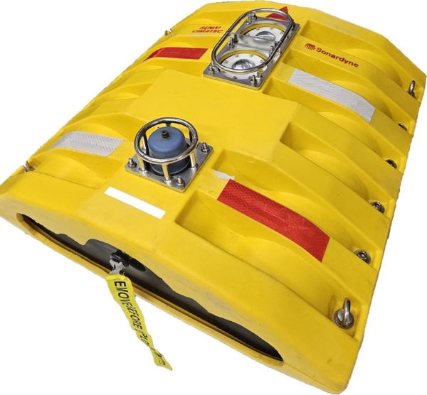
These highly innovative nodes might lead to the next generation of geophysical monitoring systems in the offshore oil and gas industry. Using Sonardyne’s proprietary optical and acoustic communications technologies, and drawing on its extensive experience of seabed monitoring, OD OBN expects to provide a versatile, lower cost, more resilient solution for time-lapse seismic and subsidence monitoring of producing reservoirs with better data and the capacity to be placed on the ocean floor for up to five years without human intervention.
The idea is that data from these nodes can be extracted using Sonardyne’s through water optical communications system to a nearby Autonomous Underwater Vehicle such as ‘Flatfish’ which was developed by Saipem and SENAI CIMATEC under another ANP funded program sponsored by Shell and Petrobras.
This latest phase was confirmed by the signing of contracts between SENAI CIMATEC and Petrobras in August 2023 and between Shell, SENAI CIMATEC, and Sonardyne in April 2024, to produce a pilot array of 600 prototype nodes expected to be deployed towards the end of 2025 at a preselected field offshore Brazil.
This pilot array is planned to be manufactured at a newly created pilot plant facility constructed by SENAI CIMATEC at CIMATEC PARK, in an industrial region called Camaçari, close to the city of Salvador in Brazil. The pilot plant has a design capacity to produce 600 nodes per year, featuring state of the art facilities including specialist parts machining and metals treatment, surface mount electronics production, a large and flexible manufacturing area and various environmental and functional testing apparatus, all of which are required to turn raw materials into completed nodes.
Shaun Dunn, Projects Director, Sonardyne, welcomed this latest project phase and commented “We have been developing the enabling technologies for semi-permanent seabed seismic and subsidence monitoring nodes for over a decade and are therefore naturally delighted that they will soon be used in the world’s first large scale field wide test. Our sincere thanks go to our research partners in Shell, Petrobras and SENAI CIMATEC for supporting this program since its inception several years ago.”
Shell and Petrobras have been trialling OD OBN prototypes during conventional OBN seismic campaigns, including at Sapinhoá and Itapu, in over 2,000 metres of water off the coast of Brazil.
"It is a great milestone to see that this technology, made in Brazil, with the support from ANP and in collaboration with national, international, and the two leading offshore operators, is closer to being deployed to monitor the large Brazilian Pre-salt fields.", says Jorge Lopez, Shell Brazil Subsurface Technology Manager.
The involvement of Petrobras, the state-owned Petroleum company of Brazil, has played a key part in the development of OD OBN and they intend to take delivery of the pilot array on completion for deployment at a jointly operated offshore field in the pre-salt region to the south of Rio de Janeiro.
“The OD OBN technology will be important in the reduction of greenhouse gas emissions during our seismic acquisition operations offshore. Besides that, it will provide a higher level of automation in our seismic field activities which will lead Petrobras and partners to be more efficient in reservoir seismic monitoring processes in the Brazilian pre-salt area.”, says Alexandre Silva, Senior Geophysicist Advisor of the Research Centre of Petrobras (CENPES).
Production of the pilot array at CIMATEC PARK is expected to commence later in 2024 and to involve the employment of a new workforce that will be recruited mainly from the local area and trained in the specialist skills required for high-volume manufacturing and testing of nodes that will be deployed and used for prolonged periods in the harshest of marine environments.
“Our partnership with Shell, Petrobras and Sonardyne has successfully developed this innovative node from a simple proof of concept towards readiness for full commercial production at CIMATEC PARK. We are therefore very excited to be moving on to the next phase of this challenging programme that will create hundreds of nodes for the upcoming field scale deployment. We have invested significant capital and intellectual resources to ensure that this phase is successful.”, states Valter E. Beal, SENAI CIMATEC Innovation Projects Leader.
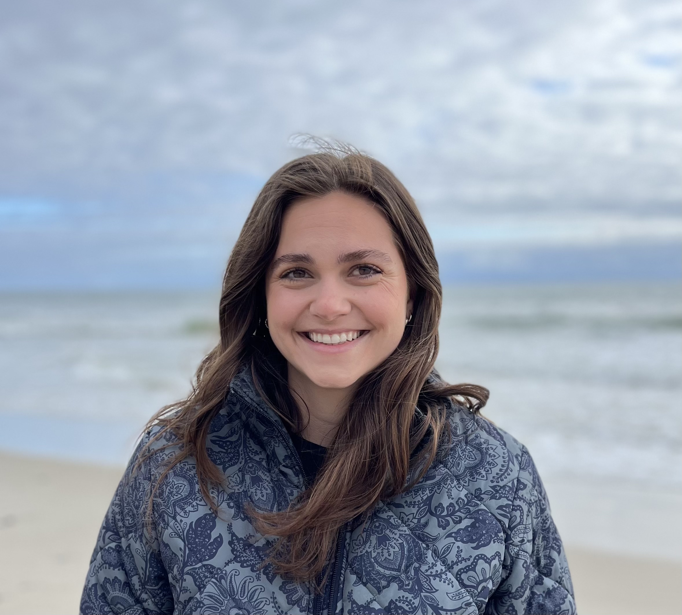
Dr. Sarah Ruth Merrigan Joins Teledyne RD Instruments
Teledyne RD Instruments (RDI) is pleased to announce the appointment of Dr. Sarah Ruth Merrigan as our new Technical Service and Support Engineer.
Sarah will be based out of RDI headquarters in Poway, CA. She joins Paul Chua, MMSci, and Chris Rockey on our field service team to enhance global support of Acoustic Doppler Current Profilers (ADCPs) and Doppler Velocity Logs (DVLs).
Sarah has a strong background in civil engineering, physical oceanography, water resources, and hydrology, with a BS and an MS from the University of Arizona and PhD from the University of California, Irvine. As a graduate research assistant, Sarah’s work focused on understanding the physical drivers of hypoxia in coral reef systems. She used analytical models and field observations to analyze the physical processes that affect the oxygen dynamics and water quality in these fragile ecosystems.
Grant Jennings, Product Line Director of RDI, commented on the appointment: “First off, I’d like to congratulate Sarah on her recently earned PhD from UC Irvine. And secondly, I’m delighted to welcome Sarah to the field service/support team at RDI. She brings a wealth of knowledge and experience in oceanographic data analysis, water resources, hydrology, and civil engineering. We look forward to her application of theoretical and practical knowledge to address our customers’ requirements."
Sarah adds, “I am excited to join the RDI team and look forward to leveraging my multi-faceted background to assist clientele with our products. This position combines my water resource background with my physical oceanography experience, including deploying and analyzing data from Teledyne RDI Workhorses, enabling me to help our customers problem-solve and collect robust observations in many settings.”
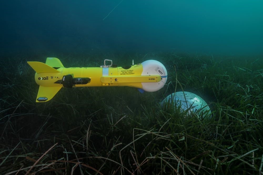
Exail selected by the European Commission to contribute to E-MCM Project
Exail, a world leader in robotics technologies, announces its selection to participate in the European Extended Mine Counter Measures (E=MCM) project. The objective of this consortium project, led by Naval Group Belgium, is to establish a future European sovereign capacity in mine warfare.
In response to the maritime mine threat and within the framework of the European Defense Fund, the European Commission is supporting European navies in enhancing their Mine Counter Measures capabilities. The primary aim of the E=MCM project is to integrate new functionalities into the next-generation toolbox (toolbox 2.0). These advancements are intended to effectively address the multifaceted threats posed by drifting, tethered, buried as well as the most modern mines.
Thanks to these new developments, the Toolbox 2.0 will go beyond the current new generation stand-off MCM Toolbox that Exail is developing and will be delivering as part of the replacement of the current MCM capabilities for the Belgian and Dutch navies. Leveraging scalable unmanned autonomous systems and intelligent platforms developed by Exail’s teams in both France and Belgium, the new functionalities and improvements will be smoothly integrated into Exail’s MCM ToolBox offer, enhancing operational efficiency and optimizing MCM operations.
“We are thrilled to have been selected as a key contributor to the E=MCM project. Exail brings extensive technological expertise to the forefront of the E=MCM project”, expressed Alain Fidani, Partnership and innovation funding Director. “Collaborating closely with Naval Group and other consortium partners, Exail will play a pivotal role in developing state-of-the-art technologies to counter maritime current and new mine threats effectively and deliver impactful solutions that strengthen Europe's defense.”
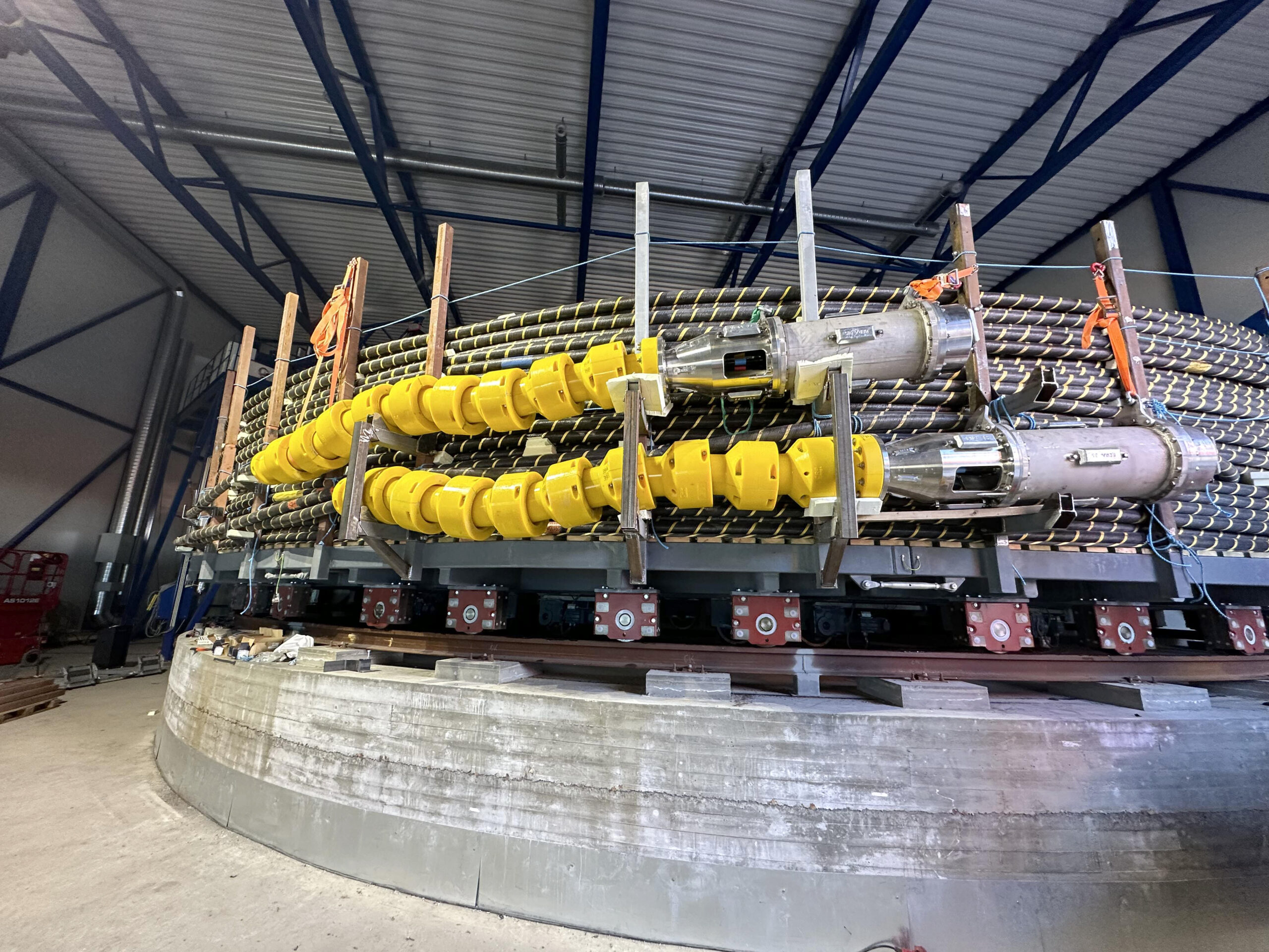
MacArtney's GreenLink enhances wave energy testing at world-class marine site
MacArtney's GreenLink terminations will connect innovative technology at PacWave South. This cutting-edge platform, run by Oregon State University, is for testing and optimising marine energy devices in open-ocean environments, driving the application of wave energy as a reliable power source.
Through PacWave South (PWS), a full-scale test facility featuring four offshore test berths, Oregon State University (OSU) provides the necessary infrastructure for U.S. and international wave energy innovators to feed the electricity grid with alternative power sources. The project received significant investment from the U.S. Department of Energy to support the development of carbon-free wave energy conversion (WEC) technologies. PWS covers an area of 2 square nautical miles and is licensed to support testing up to 20 commercial-scale WECs.
To ensure reliable grid connectivity from each berth to the shore-based facility, OSU and its selected prime marine contractor for the system manufacture, delivery and installation, RT Casey, collaborated with MacArtney to choose the proven GreenLink dry-mate solution. This will terminate the four dedicated PWS subsea power and fibre optic cables and connect client-supplied dynamic cables or umbilicals.
Scope of supply
MacArtney supplies five half GreenLink terminations for the four power transmission cables, including the termination work; four are allocated to the test site and one to mate and test them.
MacArtney technicians will help install and test the GreenLink terminations onsite at cable supplier NEXANS, Norway, a world leader in offshore control and high-voltage submarine cable systems. RT Casey will be overseeing the installation and testing of the GreenLink terminations onto the subsea cable in Norway at the cable factory, transportation of cable and connectors to Oregon, and the safe subsea installation of GreenLink from their cable installation vessel to the sea floor for future system connectivity.
Don Bryan, General Manager at MacArtney Inc., Pacific Northwest Operations, states: "We have a proven concept and a proven connector for harsh marine conditions already operative in global projects. Our end-to-end approach - from concept to installation - ensures we supply fit-for-purpose solutions based on years of research, development, and field deployment."
Advancing marine energy innovation
MacArtney's GreenLink range is designed for fast and flexible connectivity, making it ideal for the grid-connected PWS facility. The solution efficiently transfers its total potential power output of up to 20 megawatts (MW) from the berths back to the land-based electricity grid.
Furthermore, MacArtney's solution is scalable, making it attractive for both large commercial floating wind parks and small-scale systems. For instance, small islands and similar communities across North America, Alaska, and other regions currently relying on diesel for energy. This aligns with Oregon State University's goal of exploring the feasibility of wave energy as a reliable power source for remote communities.
Rewarding long-term relationship
MacArtney provided OSU with invaluable technical advice on connectivity solutions during the conceptual design phase of PWS, which started in 2012. Recognising that MacArtney had a proven connector that was well suited for the conditions, RT Casey opted for MacArtney's GreenLink solution for PWS, which includes MacArtney's extensive knowledge and expertise about the renewable energy sector compared to local suppliers who may need more experience in this specialised field.
“OSU sought expert advice from several companies during the design phase of PacWave South”, said Dan Hellin, PacWave’s Deputy Director. “MacArtney was consistently one of the most responsive and helpful. We were therefore delighted when our contractor selected MacArtney as the supplier of the dry-mate connectors for the PacWave test site.”
The PWS project underlines the power of connecting GreenLink to nature as a cutting-edge solution, reinforcing Oregon State University's leading role in WEC technology and power conversion infrastructure and advancing alternative energy as a key resource.
MARELEC conference returns to the National Oceanography Centre in Southampton, UK on 9 – 11 April 2025
We are delighted to announce that MARELEC 2025, the 13th international conference on marine electromagnetics, will be held at the National Oceanography Centre, Southampton, UK from 9 – 11 April 2025.
MARELEC is the only international conference whose primary focus is the exchange of ideas on electromagnetics in a marine environment. MARELEC 2025 provides the opportunity to discuss ocean-based electromagnetics with leading researchers from industry, government and military centers, and academic communities. Marelec will include presentations, posters, and exhibits on innovative technologies as applied to underwater electromagnetic surveillance, communication, vessel signature prediction and control, seafloor and sub-bottom geophysical and archaeological exploration, and oceanography.
The conference technical committee comprised of leading experts in the field invites paper and poster proposals in the broad areas of marine electromagnetics concerned with theoretical development and modelling, measurement and analysis, together with case histories where appropriate.
The call for papers topics and submission form will be available shortly.
Presentations are supported by an exhibition where there are a limited number of exhibit booths and a number of sponsorship opportunities available. Please contact Cheri at [email protected] or +44 (0)1453 836363 for more information.
Chris Levine unveils new artwork to highlight the health of our oceans on World Ocean Day
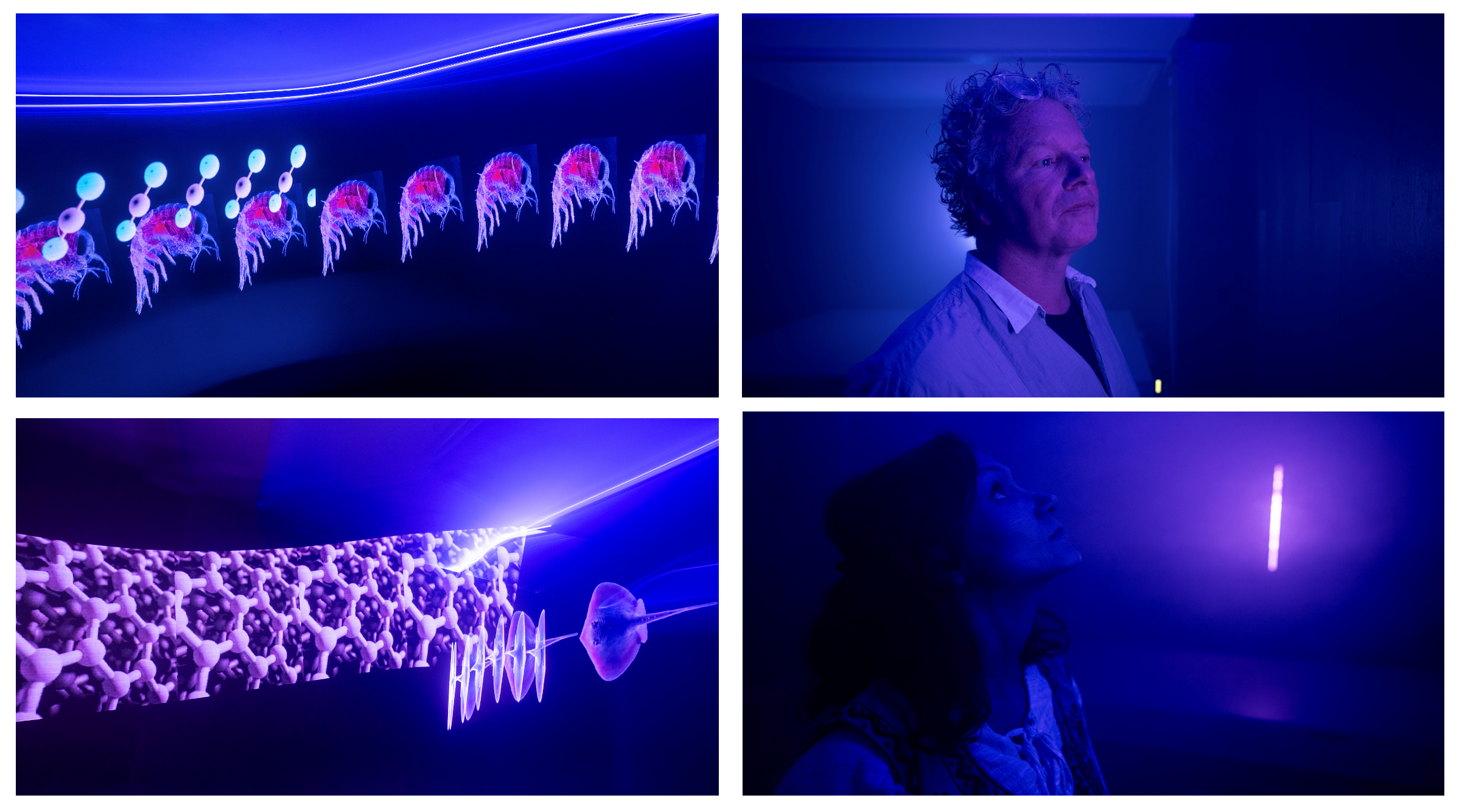
Globally renowned British light artist, Chris Levine has collaborated with the Convex Seascape Survey to create an immersive artwork that delves underwater and introduces viewers into the lesser-known role that the ‘Benthic Zone’ plays in the health of our oceans.
Titled ‘7.83 Hertz,’ and timed for World Ocean Day on Saturday, June 8th, Levine’s installation spotlights the mysteries of how the ocean's continental shelves, sedimentary seafloor and the creatures therein, form part of the slow carbon cycle, and play a vital role in the global ecosystem.
This echoes the work of the Convex Seascape Survey - a pioneering, five-year, multi-million dollar research initiative spearheaded by ocean conservation charity Blue Marine Foundation, University of Exeter and Convex Group Limited. Led by a team of experts, the project aims to harness nature's hidden superpower in helping combat climate change by uncovering the ocean's potential as a carbon sink. It will deliver new, reliable open-source data which will educate, inspire and enable informed decisions on ocean use.
7.83 Hertz
Known for his avant-garde exploration of light and perception, Levine’s latest work immerses individuals in an atmospheric zone of blue light, beneath the ‘water line,’ and is intersected by a vertical ‘blipvert.’ The work illuminates aspects of this strange, subaquatic netherworld, and takes people on an underwater journey of a Convex Seascape Survey marine biologist researching the critical area of carbon sequestration. Entitled 7.83 Hertz- a frequency also known as the Schumann Resonance and often referred to as the heartbeat of the Earth - Levine’s artwork encapsulates how all natural living processes, including the ocean, are connected, and harmonise together for an optimum healthy state.
At the forefront of laser technology, the blue ‘water line’ sited around the totality of the space, is designed to create a sense of being beneath the ocean. Viewers will experience imagery ‘swimming’ in and out of their field of vision and activating their subconscious awareness for this little-known submarine world. Immersing people even further, there will be sounds of the moving sea throughout.
Meanwhile, the vertical ‘blipvert’ is inspired by the methodology of scientific investigation into what lies beneath the water column, such as core samples and glass tubes that show transections of the ocean floor and the activity of bioturbation. Chris collaborated with soundscape collaborator Marco Perry to create the installation.
Chris Levine, Artist said “The crucial role of the ocean in understanding climate behaviour and marine biodiversity is often overlooked. Following a visit to the Convex Seascape Survey research laboratories at the University of Exeter, and the National Oceanography Centre, Southampton to learn more about the Benthic Zone, I knew the work had to encourage humankind to let the ocean rest. Let it be. When immersed in 7.83 Hertz, you can feel and hear the continuous work of the ocean, but it encourages you to slow down and celebrate its ability to protect us now and in generations to come.”
Gabriella Gilkes, Programme Manager, Convex Seascape Survey said “Over centuries humans have created harmful disturbances to the ocean and the seafloor. Once a bountiful underwater garden, the ocean floor has been dramatically altered since the advent of mechanical fishing, in particular bottom trawling, which indiscriminately scrapes the seafloor, destroying entire ecosystems, and disturbing what carbon has been stored there. Chris’ unique artwork highlights the precious nature of the ocean floor as a critical resource in the fight against climate change. The Convex Seascape Survey is delighted to see our scientific research into the ocean’s role as a carbon sink brought to life so beautifully through this immersive artwork. Importantly, this partnership will help raise awareness of the need to protect the ocean and let it rest, so it can continue to be enjoyed and sustained.”
Lisa Samos, Art Consultant, Blue Marine Foundation said "It has been very inspiring following Chris Levine’s creative journey inspired by the Convex Seascape Project, as he immersed himself in the Project’s scientific exploration of the marine Benthic Zone. Consistently innovative in his practice, he has created this series of sublime and mind-opening new works. The collaboration between a virtuoso light artist inventing new ways of seeing, with marine science at the forefront of scientific research, reveals itself as an important legacy project for the future.”
Experience it for yourself
The artwork will be available for public viewing in Chris Levine's studio in Mayfair from Monday, 10th June to Thursday, 4th July by appointment. It will then travel to further destinations for the public to experience - exact locations and dates to be announced.
Where: 5A Shepherd St, London W1J 7HW
When: Available to view from Monday, 10th June 2024 – Thursday, 4th July 2024
Monday – Thursday, 10am – 5pm
How: Please email [email protected] to book your appointment.
Impact Subsea Unveils Powerful New Features in seaView 3.1
Impact Subsea, a leading provider of subsea sensor solutions, today announced the release of seaView 3.1, a significant update to their popular operation, configuration and logging software suite.
seaView 3.1 empowers users with a range of new features designed to enhance efficiency and streamline subsea operations.
Seamless Video Integration
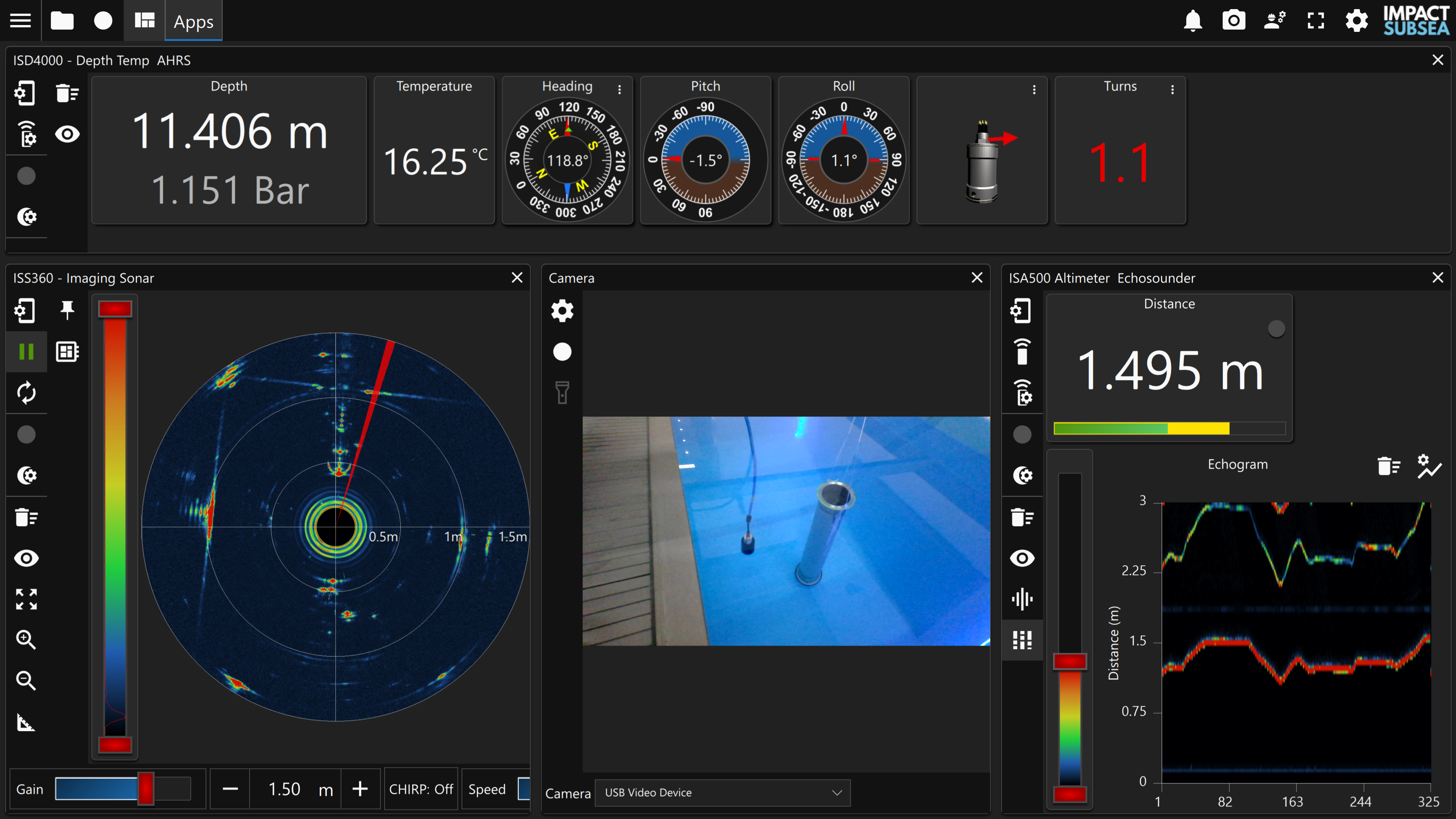
A major highlight of seaView 3.1 is the introduction of video support. Users can now directly view and record video streams from any connected video camera within the software.
This allows for a unified view of critical data, including video, sonar, altitude, depth, temperature, heading, pitch, and roll, all presented in a single, user-friendly interface.
Synchronized Global Logging and Replay
seaView 3.1 introduces a powerful global logging and replay functionality. This feature enables users to record data from multiple sensors simultaneously into a single file.
The recorded data can then be conveniently replayed within seaView, ensuring all sensor readings remain synchronised for in-depth analysis.
Streamlined Feature Activation with License Keys
seaView 3.1 replaces license files with a more convenient license key system. Users can activate specific features, such as FMD, AHRS, or ECHOGRAM, within a sensor's firmware by entering a simple one-time activation key.
Performance and Communication Enhancements
Beyond the headline features, seaView 3.1 boasts several behind-the-scenes improvements. The Flooded Member Detection application benefits from performance enhancements, while overall sensor communication has been optimised for increased reliability.
Commitment to Continuous Development
“At Impact Subsea, we are firmly committed to continuous development of our sensor solutions and seaView software,” said Alastair Mclennan-Murray, Technical Director at Impact Subsea, commenting on the release.
“seaView 3.1 unlocks exciting new capabilities for our users, and as always, this update is available free of charge to our entire user base.”
Download seaView 3.1 Today
Experience the power and convenience of seaView 3.1. Download the latest version at https://www.impactsubsea.co.uk/seaview-v3/