Teledyne Geospatial to showcase and present at Canadian Hydrographic Conference 2024
Teledyne Geospatial has announced CARIS AutoChart, a revolutionary nautical chart production solution. Traditionally, the production of nautical paper charts has been labor-intensive and time-consuming, often fraught with challenges related to manual data entry, complex chart formatting, and the integration of various data sources. Recognizing the need for a modern, technology-driven approach, CARIS AutoChart is a comprehensive software solution tailored specifically to the needs of nautical chart producers.
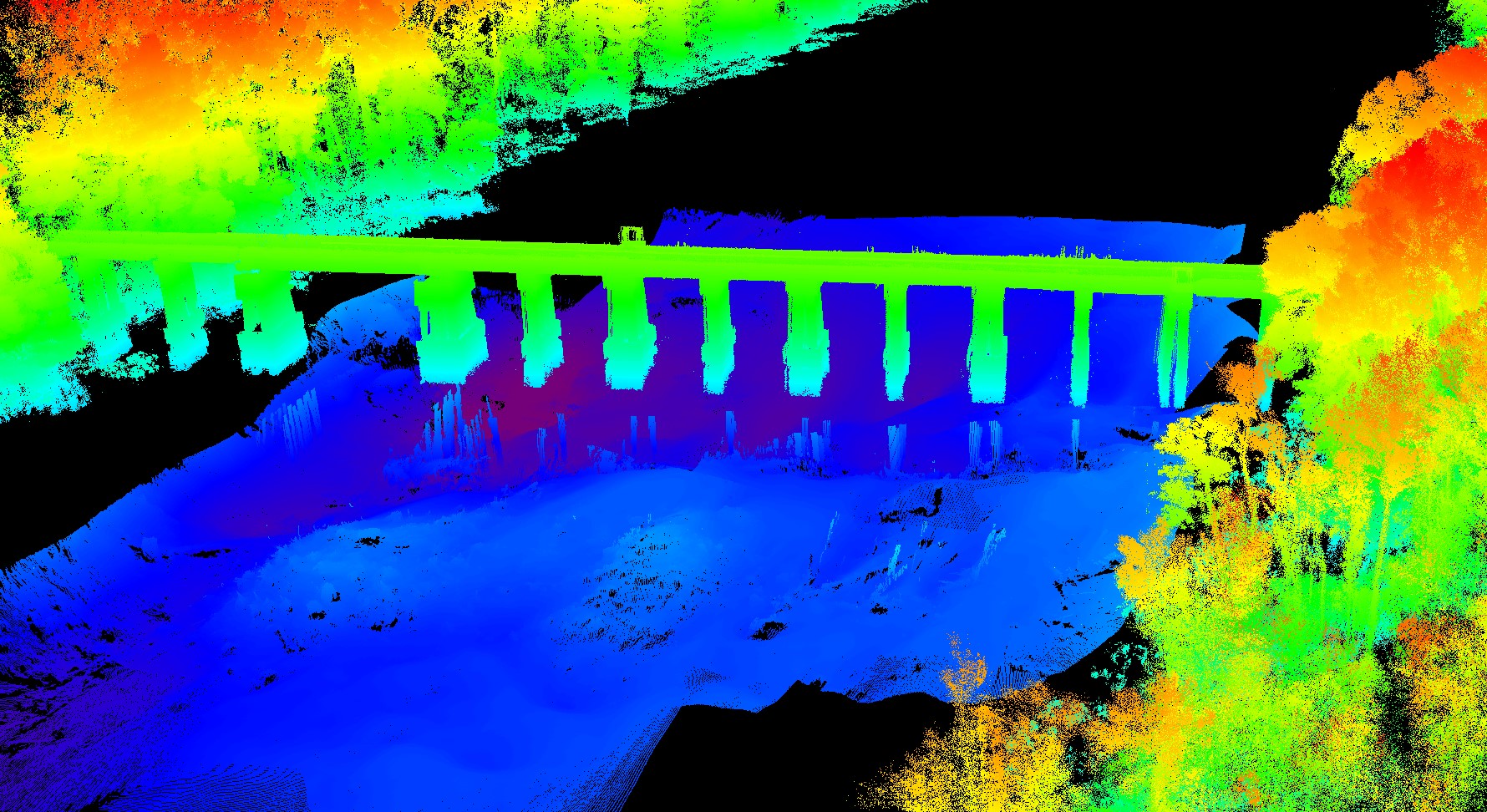
Visit us at the Canadian Hydrographic Conference, Booth #17, from May 27-30, 2024, to learn more about CARIS AutoChart and updates on HIPS and SIPS and CARIS Onboard and meet with CARIS software experts to see demonstrations of the software in different types of applications. Also on display will be the complementary Optech Compact Lidar which offers the opportunity to expand survey capabilities to capture data both above and below water. The CL-360 Marine, installed on a survey vessel can leverage standard sonar survey workflow tools, such as CARIS HIPS, for streamlined data collection and processing. The range accuracy and resolution capabilities of the CL-360 Marine enable users to unlock more detail at greater distances compared to any other system designed for application on marine survey platforms.
Presentations by Teledyne:
Monday, May 27, 2024, 9:00 AM to 12:00 PM | Room Bannerman 3
CARIS & 7Cs: S-100 - The journey so far
Presenter: Julien Barbeau, Teledyne Geospatial, Product Manager, Cloud Solutions
Learn about the latest updates on S-100 support in CARIS & 7Cs solutions. This S-100 themed workshop includes presentations, demonstrations, and discussions on transitioning to a S-100 production environment. The session will also include an overview of the latest updates on HIPS and SIPS and CARIS Onboard.
Tuesday, May 28, 2024, 3:30 PM to 5 PM | Bannerman Room 1
Paper sessions on Satellite Derived Bathymetry
Chairperson: Andy Hoggarth, VP Product Strategy, Teledyne Geospatial
Teledyne Geospatial unifies the hardware and software expertise of Teledyne CARIS and Teledyne Optech. The group provides customers with innovative integrated solutions. Offerings include turnkey systems, lidar and sonar integrated workflows and a range of systems and solutions that support holistic, precision data collection.

Unmanned Survey Solutions and Stehr Consulting Ltd Announce Pioneering ‘Unlocking the Potential for Mini-MASS in UK Waters’ Project
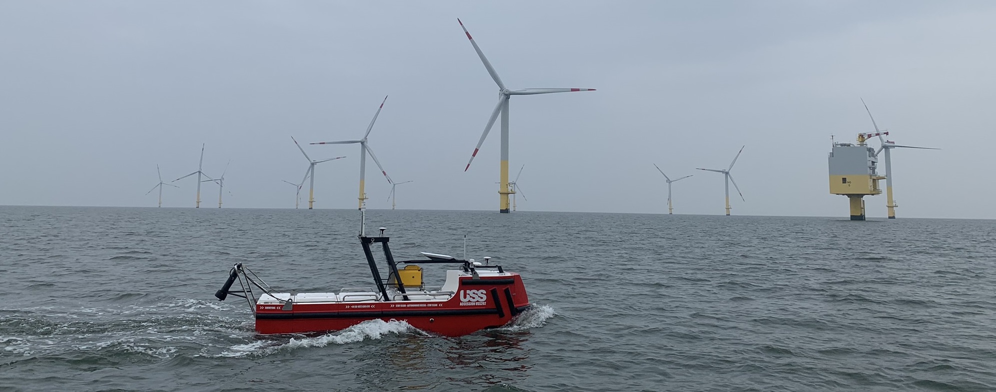
Unmanned Survey Solutions (USS), in close collaboration with Stehr Consulting Ltd, is excited to announce the launch of the groundbreaking project ‘Unlocking the Potential for ‘Mini-MASS’ in UK Waters.’ This innovative initiative, funded by Innovate UK under the Launchpad: Marine and Maritime in the Great South West - R1 MFA competition, aims to revolutionise the smaller Marine Autonomous Surface Ship (MASS) market.
Our partnership with Stehr Consulting Ltd brings together a wealth of technical expertise and extensive experience, making this collaboration the perfect fit to address a significant regulatory and certification challenges hindering the widespread adoption of smaller Uncrewed Surface Vessels (USVs) in UK waters.
The recent updates to the Workboat Code Edition 3 (WBC3) by the Maritime and Coastguard Agency (MCA) represent a major step forward, incorporating provisions for Remotely Operated Unmanned Vessels (ROUVs). However, WBC3 predominantly focuses on larger, higher-risk vessels within the sub 24m market, overlooking the unique characteristics and lower risk associated with ‘Mini-MASS.’ As a result, the current requirements present significant challenges for these smaller vessels, creating a barrier to innovation.
This project aims to break down these barriers by providing a comprehensive open-source report and templates that meticulously analyse WBC3 requirements. These analyses will identify requirements that are:
- Valid in the context of demonstrating safety for ‘Mini-MASS’.
- Partially valid.
- Not valid in the context of demonstrating safety for ‘Mini-MASS’.
For requirements in the latter two categories, the project aims to produce generate generic template safety argument patterns, streamlining the certification process for ‘Mini-MASS’ vessels and informing future policy development.
Building on the foundational work of the Surface Autonomy Subgroup of the Future Autonomous at Sea Technologies (FAST) Cluster, the largest marine autonomy cluster in the UK, this project aspires to minimise certification burdens while maintaining safety standards. James Williams, CEO of USS, and chair of the subgroup has championed engagement with the Department for Transport (DfT) and the MCA on 'Mini-MASS’ matters. The results of this project are expected to unlock the potential of ‘Mini-MASS’ in UK waters, catalysing business growth, and fostering innovation and economic development in the Southwest’s maritime sector.
USS is committed to driving innovation and economic growth through initiatives like these. We look forward to the transformative impact this project will have on the marine and maritime industry.
SeeByte awarded three-year contract to continue its UK Mine Hunting Capability programme support
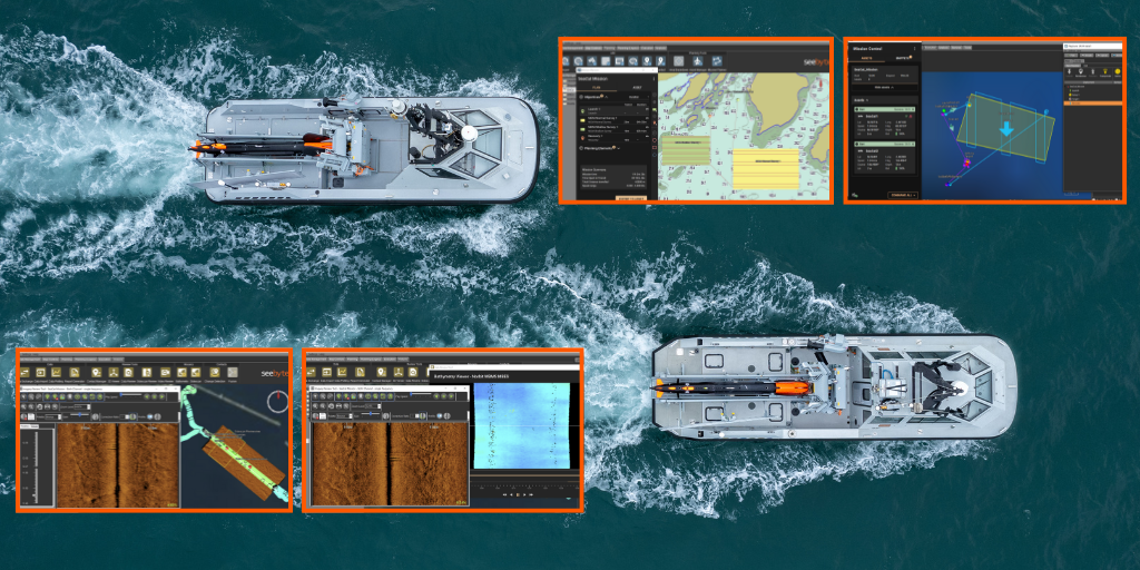
SeeByte Ltd (SeeByte) has been awarded a three-year contract by Defence Equipment & Support (DE&S), part of the UK Ministry of Defence, to provide its suite of C2, mission-level autonomy, target recognition, support, and development services to the Mine Hunting Capability (MHC) Delivery Team and related programmes in support of the Royal Navy.
The contract has a three-year initial term with options to extend the duration up to (2) additional years. The base contract award is £2.4M with the potential for future flexible tasking orders up to a maximum of £50M over the full contract term.
This multi-year award directly continues services first procured by DE&S in March 2022 and will secure the supply, support, and evolutionary development necessary to maintain the Royal Navy’s integration with SeeByte software which is now widely fielded in different applications by the Royal Navy and its NATO allies and works collectively and collaboratively to optimise the operation and effectiveness of its autonomous vehicles (both surface and underwater).
This also includes continued support and maintenance services for software products currently fielded by UK government agencies. These include their Multi Domain C2, Mission Level Autonomy and Automatic Target Recognition (ATR) solutions that are already fielded, operationally proven and in-service with the UK, US and NATO Navies.
Andy Lapsley, Mine Hunting Capability Team Leader at DE&S, said:
"The awarding of this contract strengthens our support for the Royal Navy and underpins our collective mission to make the disposal of sea mines safer, more efficient and effective, through enhanced capability.
The world-class software products offered by SeeByte will ensure that our ships and submarines are protected by cutting-edge autonomous mine hunting systems, enabling them to move freely at sea, and directly contributing to the continued prosperity and security of our nation."
Matt Fitchett, MHC Programme Director at SeeByte said:
“SeeByte are proud to have supported the MHC Programme over the last 2 years delivering C2 and Autonomy software solutions to enable operational integration of the heterogenous Maritime Autonomous Systems in use by MHC, with this new contract we look forward to delivering further enhanced capability to the MHC Programme and the Royal Navy”.
Greensea IQ and Seaward Marine Services Agree to a Strategic Multi-year Agreement to Enhance Marine Industry Services
Greensea IQ, the innovator behind EverClean, the premier always-clean hull service, and Seaward Marine Services, a leader in global ship husbandry, today announced a groundbreaking five-year agreement. This alliance aims to expand each company’s service offerings by integrating their expertise in underwater hull cleaning (UWHC) technologies and services across the marine industry.
Under this strategic collaboration, Greensea IQ and Seaward will combine their extensive experience and capabilities to deliver a unique and comprehensive solution for UWHC. Seaward will integrate Greensea IQ’s proactive EverClean service into its portfolio, enhancing its current offerings with cutting-edge technology. Concurrently, Greensea IQ will broaden its service range by incorporating Seaward’s diverse marine services, facilitated by skilled divers.
Greg Lee, President of Seaward Marine Services, expressed enthusiasm about the agreement, stating, “This relationship with Greensea IQ is a natural fit with Seaward’s 50+ year commitment and passion for exceptional service in UWHC. We look forward to working with the Greensea IQ team.”
This agreement enables both companies to offer a more integrated and complete suite of services to their customers, establishing a new benchmark in ship husbandry solutions.
John Dunn, COO of Greensea IQ, also commented on the alliance: “Greensea IQ is equally thrilled to embark on this partnership with Seaward Marine Services. Their longstanding dedication to excellence in underwater hull cleaning perfectly aligns with our mission to provide cutting-edge solutions in hull maintenance and maritime service technology. We eagerly anticipate the collaboration ahead, combining our expertise to deliver unparalleled service to our clients and the industry."
For more information about Greensea IQ and Seawards’ partnership, please visit their respective websites or contact either media contact directly.
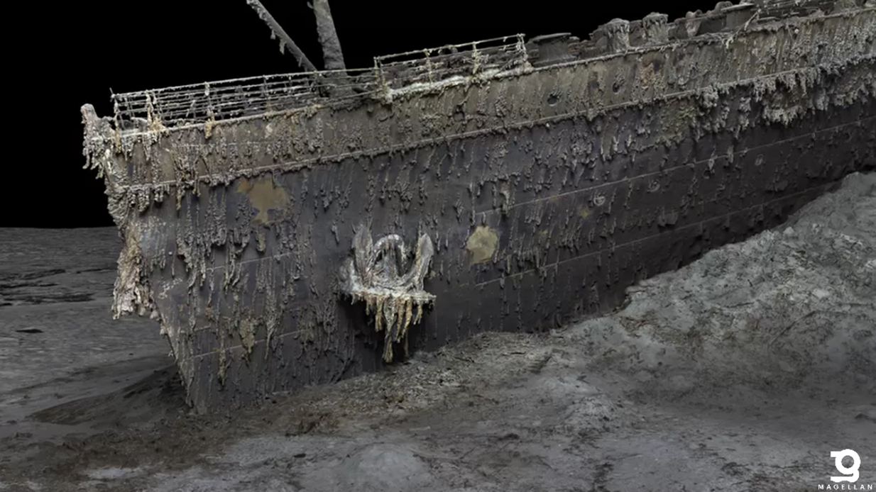
Illuminating The Unknown, the Making of the RMS Titanic Digital Twin
One year after Magellan’s public release of this incredible expedition, we shed some light on the making of the RMS Titanic Digital Twin.
Voyis, a leading provider of advanced underwater imaging systems in Waterloo, Canada, joined forces with subsea technology partners Sonardyne and EIVA to provide sensor systems to Magellan for their groundbreaking survey that captured the first complete Digital Twin of the RMS Titanic wreck site. This collaborative effort has resulted in an extraordinary scaled digital twin of the entire bow and stern of the famous wreck, along with the surrounding debris field, enabling researchers and scientists to start to re-explore the vessel with the greatest level of detail ever recorded. This 3D model showcases the site as if the ocean had been drained away, offering a snapshot in time of this iconic historical asset before it degrades beyond recognition (Magellan Digital Twin). The survey was completely non-intrusive thanks to Magellan’s deep water survey expertise, inhouse cameras systems, proven mapping equipment and Voyis’ long range optical systems. This offered a sustainable way to further understand the conditions of the Titanic without compromising the wreck or surrounding ecosystem.
The Titanic, resting at a depth of approximately 3,800 meters (12,500 feet) in the Atlantic Ocean off the coast of Newfoundland, Canada, has long been a subject of fascination and mystery since its tragic sinking in 1912. The aim of this ambitious project was to shed new light on the circumstances surrounding the disaster and utilize cutting-edge underwater optical technology to record the current state of this iconic wreck.
In summer 2022, Magellan Ltd, a leading deep-sea mapping and survey company, was provided with Voyis’ underwater imaging sensors to complement their own systems and conduct the extensive optical survey.
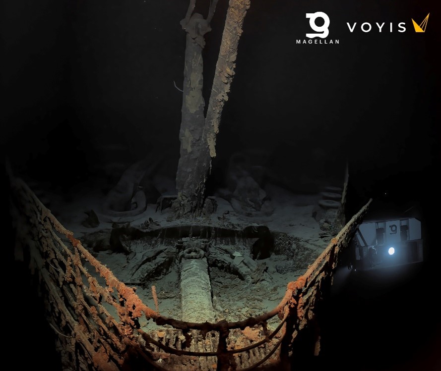
Figure 1: Image captured with Voyis Observer & Nova subsea imaging system. Reproduced with kind permission from Magellan.
Voyis’ Observer Subsea Cameras and Nova LEDs Illuminate Every Aspect of the Wreck
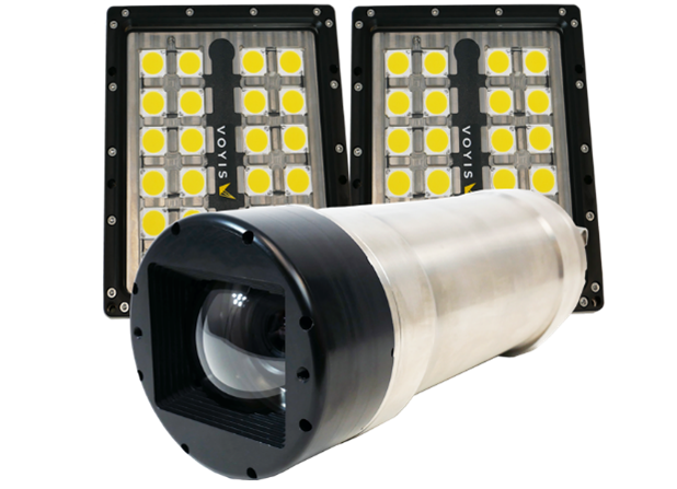
Voyis provided its state-of-the-art Observer & Nova subsea imaging system in support of this endeavour. With an actively cooled high-dynamic range camera and more than ½ million lumens of flash lighting, this setup enabled the best possible colour images of the wreck. Over 700,000 images were reliably captured during the multi-day survey of the region, recording millimetric details of every aspect of the site. At 3,800m below the sea, the Observer Pro delivered clear, accurate images that were automatically corrected for both colour & lighting. This delivered the image quality and consistency needed to produce Magellan’s seamless Digital Twin that you see today. This resolution and colour accuracy, powered by Voyis’ proprietary True Colour correction, has never been deployed on a wreck of this size, and was key in removing the blue and green hues that are typical in subsea optical survey. This precise visual data formed the foundation for generating the comprehensive 3D model of the entire ship, an immense processing undertaking by Magellan. Voyis is now able to release some of the colour corrected original images in full resolution.
In addition to the Observer & Nova, Magellan also trialled a Voyis Insight Pro laser system to scan the wreck and debris field. The Insight Pro underwater laser scanner may provide researchers with the quantitative capability to directly measure even the smallest features. The laser model can complement the image-based Digital Twin to help further understand the rate of degradation of the historic site and measure the profile and scour on the feature-limited seabed. Voyis is also sharing limited exports from the laser model.
 Critical Support from Covelya Group: Sonardyne and EIVA
Delivering fantastic images and an accurate 3D model requires more than great cameras, and trail laser scanners. Precise and accurate positioning throughout the survey is essential to ensure that complete coverage is achieved and to provide an accurate flight path for 3D model processing. As a renowned provider of innovative underwater positioning and navigation technologies, Sonardyne supplied Long BaseLine (LBL) equipment and an acoustically aided SPRINT-Nav Hybrid Navigator. Sonardyne and Magellan have worked extensively together to develop and refine these systems since Magellan invested in SPRINT-Nav across its fleet of 6k rated work class ROVs, with the result that the advanced INS/DVL/LBL technology ensured reliable and robust subsea navigation in the challenging operating conditions at the Titanic site.
Also critical to mission success is real-time feedback to the surveyors at the surface, and here EIVA, a sister company to Voyis and Sonardyne, contributed its advanced navigation and survey software capabilities to the project. EIVA’s NaviSuite software solutions facilitated the efficient collection and visualization of the vast amount of image and navigation data collected during the survey.
Unveiling New Insights into the Titanic's History
This sensor package offered to Magellan’s project by Voyis, Sonardyne, and EIVA represents a significant milestone in underwater innovation. Magellan’s unprecedented reconstruction of the Titanic has demonstrated the ability to generate incredibly accurate models of our oceans, allowing us all to see the depths like we see the surface. It is Voyis’ hope that this new technology will drive evidence-based research and a deeper understanding of not only this historic tragedy but offer tools to future explorers that unlock more of the ocean’s secrets without the need to disturb the environment. The findings from this project have the potential to reshape our knowledge of the Titanic’s sinking, bringing us closer to solving the lingering questions surrounding the event.
As leaders in their respective fields in underwater technology, Voyis, Sonardyne, and EIVA remain committed to pushing the boundaries of subsea exploration by advancing the sensors that make it all possible. By combining their technology with Magellan’s experience, deep water capability, assets and Intellectual Property, these companies have together achieved a significant milestone in underwater archaeology and ocean exploration.
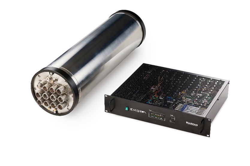
Empowering subsea connectivity with MacArtney's cutting-edge EMO Omni solution
The customisable EMO Omni multiplexer meets the evolving needs of underwater operations, from offshore energy projects and marine research to environmental monitoring. Offering unmatched adaptability and operational efficiency, it is an essential tool for today's subsea operators.
Built on the tried and trusted MacArtney EMO and NEXUS platforms, the new HD fibre optic video and multibeam EMO Omni multiplexer represents a significant advancement in underwater data acquisition, enhancing the performance and scope of subsea projects.
Positive initial customer feedback confirms that it confidently meets the growing demand for adaptable, robust telemetry solutions. Notably, end-user requests for bespoke multiplexers that deviate from the standard portfolio in terms of size or features further validate its market relevance.
Andrew Palmer, the General Manager of MacArtney Canada, highlights, “With the EMO Omni, we've expanded our lineup of dependable multiplexers, aiming to design a flexible product addressing varied industry demands worldwide. This achievement reflects our operations' adept collaboration across borders, illustrating our ability to oversee the entire product development process internally while benefiting from our global cohesiveness for success.”
Seamless connectivity and data efficiency
Uninterrupted connectivity beneath the waves is paramount for achieving operational goals and optimising data utilisation.
The compact EMO Omni ensures seamless data collection and analysis, enabling informed decision-making and streamlined operations. High data output and real-time communication capabilities support multiple instruments and sensors with integrated diagnostics and remote monitoring features.
This functionality enhances operational efficiency and minimises manual interventions, ensuring consistent connectivity and efficient data transmission and management in diverse underwater environments.
Customisation at its core
At the core of the EMO Omni lies its highly customisable nature, tailored to meet the unique requirements of each operation and adaptable to a diverse range of subsea applications within offshore energy, naval projects, ocean science, marine research, and environmental monitoring.
The EMO Omni's adaptability extends to system integration, power supply, and material requirements, drawing on decades of MacArtney's industry experience and exceptional workshop capabilities. Swift customisation, including bespoke harness cables, is readily available globally through our local workshops.
The connectors mounted will typically be from MacArtney brands, such as SubConn®, OptoLinkTM and TrustLinkTM. However, the versatility offers flexibility in choosing from a wide selection available at MacArtney.
Focus on ease-of-use
Focusing on long-term performance and user-friendliness, such as intuitive interfaces, the EMO Omni aims for minimal downtime through ease of maintenance, efficient troubleshooting, and quick issue resolution. It seamlessly integrates with existing systems, enhancing subsea project performance and mission success.
MacArtney's newest multiplexer addition is available globally via local operations in North America, Europe, and the Asia Pacific.
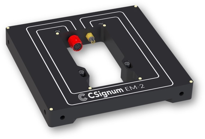
CSignum Launches EM-2 Wireless Underwater Communications for Maritime Security, Water Quality Monitoring and Energy Applications
CSignum, a leader in underwater and underground data networking, is proud to announce the launch of its latest innovation, the EM-2 wireless platform for IoT sensor data and control from above the surface to below.
The EM-2 interfaces to many common underwater sensors to wirelessly communicate data from under the water to above the surface or directly on land.
EM-2 represents a breakthrough in wireless communication technology employing electromagnetic fields to pass data through water, ice, concrete, and rock to overcome the limitations of traditional wireless technologies. By harnessing electromagnetic field signaling (EMFS), data can be transmitted from below the water's surface or underground to above-surface devices with unparalleled reliability.
With bidirectional data transfers of up to 200 meters, EM-2 ensures successful deployment in both saltwater and freshwater environments.
EM-2 is a vital asset for the reliable transmission and retrieval of sensor data essential to monitor and protect resources and critical infrastructure across a variety of key sectors including:
Maritime Security & Defence: EM-2 offers a robust solution for enhancing maritime security by providing real-time data transmission from below the water's surface to above-surface devices. This enables continuous monitoring of critical infrastructure such as ports and offshore structures, ensuring early detection and response to security threats.
Water Quality Monitoring: EM-2 revolutionizes water quality monitoring by facilitating wireless communication across the air-water boundary in both fresh and saltwater scenarios. It ensures reliable transmission of data from underwater sensors to above-surface devices, enabling timely assessment and management of environmental conditions in inland and coastal waterways, around offshore structures, and aquaculture installations.
Offshore Wind & Energy Applications: EM-2 presents a game-changing solution for offshore energy applications by enabling seamless communication between subsea infrastructure and topside facilities. This enhances operational efficiency and safety in offshore energy operations, including wind farms and oil and gas platforms as well as inshore hydropower facilities.
Underground Applications: EM-2 extends its capabilities to underground applications, providing reliable data transmission through various layers, including buried structures. This makes it invaluable for monitoring and controlling underground infrastructure such as tunnels, storm drains, and underground utilities.
"EM-2 represents a quantum leap in underwater and underground communications technology,” said Jonathan Reeves, CEO at CSignum. “With its ability to transcend the barriers of traditional methods, EM-2 empowers industries to explore, monitor, and protect our waterways and subsea environments with unprecedented efficiency and reliability."
EM-2 establishes a wireless communication link that transcends the limitations of acoustic, optical, and cabled underwater communications. It enables real-time data transmission from beneath the surface to shorelines or riverbanks, and even through ice or underground locations.
With bidirectional data transfers of up to 200 meters, EM-2 ensures successful deployment in both saltwater and freshwater environments. Its unique electromagnetic field-based communication method enables effective data transmission through mixed media scenarios.
Benefits of the EM-2 include:
Resilience: Unaffected by biofouling, turbidity, or environmental noise, ensuring consistent performance.
Flexibility: Easily integrated with various sensor packs and compatible with industry-standard data interfaces.
Environmental Compatibility: No adverse effects on aquatic life, making it ideal for sustainable monitoring solutions.
Diverse Environments: Operates through water, ice, rock and soil.
The versatility of EM-2 lends itself to diverse applications including Internet of Underwater Things, ship monitoring, offshore structural monitoring, inland and coastal environmental monitoring, underground data monitoring, and defense and security operations.
Monitoring and assessing ecological health are essential components in combating and mitigating problems in critical inland and coastal waterways. Remote sensing observations utilizing EM-2 provides rapid, accurate data to assess and act on ecosystem changes.
Traditional methods of underwater communication face numerous challenges, from cable entanglement and unreliable communications to signal degradation. EM-2 offers a reliable, cable-less alternative, providing flexibility in deployment and superior performance across various environmental conditions.
CSignum remains committed to advancing underwater and underground data transmission. Future plans include enhancing range, data rate, and battery life, while providing cellular/satellite backhaul and CSignum Cloud data analytical services.
For inquiries and further information, please visit www.csignum.com.
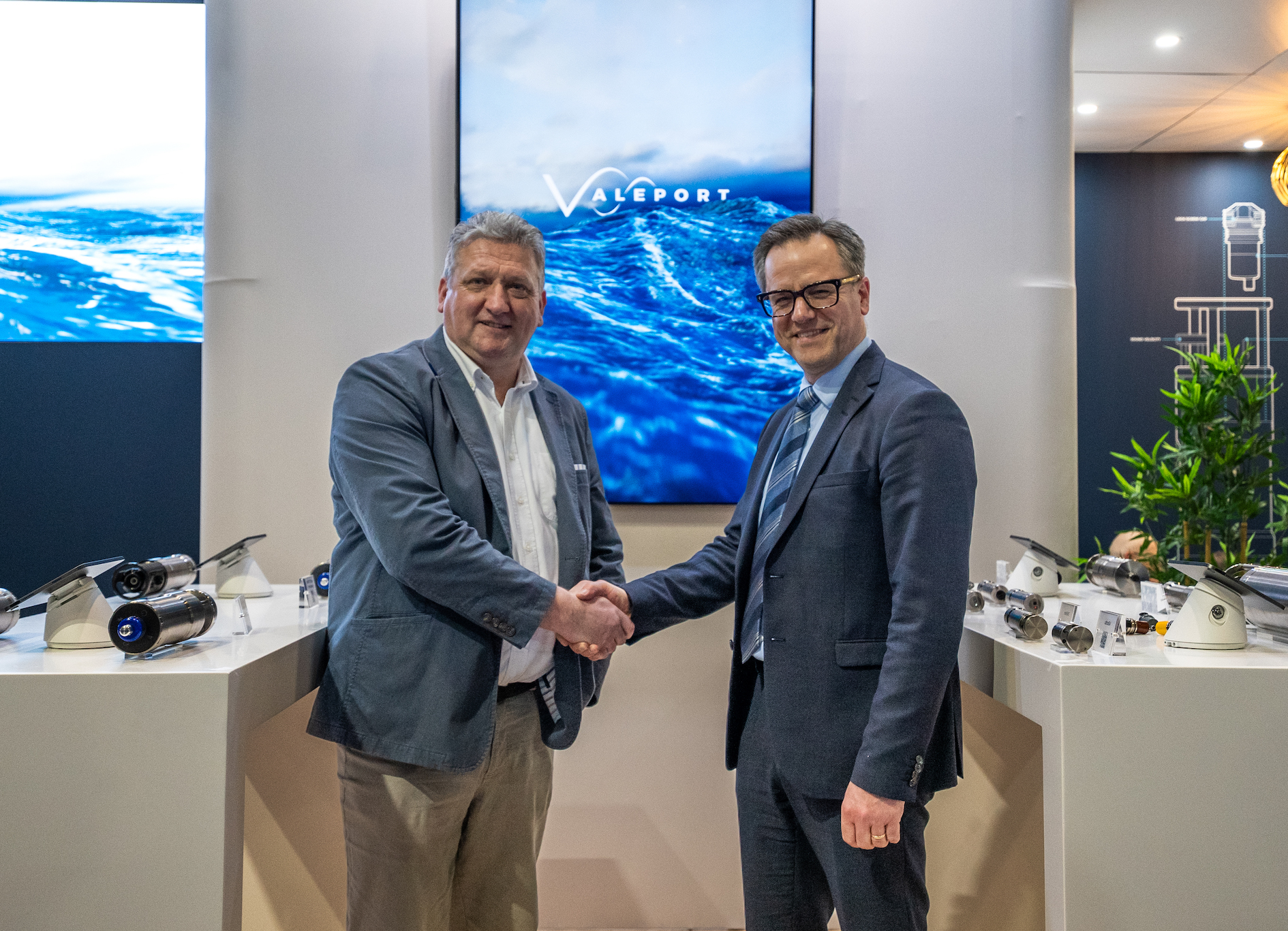
Teledyne Marine expands with acquisition of Valeport
Teledyne Marine has agreed to acquire Valeport a market leader in the design and manufacture of underwater sensors and profilers.
The acquisition expands the products and solutions offered by Teledyne Marine, a leading-edge subsea technology company. It sees Teledyne provide customers with a wider range of underwater solutions.
Valeport is one of the UK’s leading manufacturers of oceanographic and hydrographic instrumentation. The independent family-owned business, which was established in 1969, designs and manufactures instrumentation for the oceanographic and hydrographic communities with a worldwide customer base that includes: subsea, hydrographic, metrological and positioning, oceanographic, ports, harbours, dredging, energy and scientific research sectors.
Ole Søe-Pedersen, VP & GM Teledyne Marine Europe said: “We are delighted that Valeport will join Teledyne Marine and expand our technology offerings.
“Valeport is a respected and recognized brand of underwater sensors and profilers and will complement the Teledyne Marine portfolio of technologies and solutions.”
After 18 years at the helm, Matt Quartley and his leadership team will work with Teledyne Marine over the coming months to ensure a smooth transition for staff and customers alike.
Matt Quartley, Managing Director of Valeport said: “Our family is very proud of where we have brought Valeport so far, but the time is right for the next phase of its journey, and I am so pleased that this will be as a part of Teledyne Marine. The prospect of working with the rest of the Teledyne group to bring our customers an even greater range of superb, high-quality products is something that we are incredibly excited about, and will undoubtedly be to the benefit of Valeport, Teledyne, and most importantly, all of our customers.”

Ocean Business earns title as one of the ‘World's Leading Trade Shows’ with exceptional exhibitor and visitor NPS Scores
Leading Event Industry Benchmark Research Company Explori confirms that Ocean Business has one of the highest Exhibitor and Visitor Net Promoter Score results of all trade shows held across the world.
With an Exhibitor NPS of +61, Ocean Business belongs to a select club of international trade shows who are in the top one percent of all trade shows internationally.
Explori's benchmarks contain data from over 8,000 events held across all sectors on all continents and is considered the go-to benchmark for organisers and marketeers, to measure the customer experience at trade events all over the world.
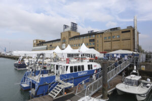 Visitor satisfaction is not far behind, with an NPS score of +50, which is considered ‘exceptional’, and in the top 10% internationally, according to Explori.
Portfolio Director Cheri Arvonio says: “Since it’s launch in 2007, Ocean Business has revolutionised the format of exhibitions in the ocean science and technology sector. Blending a traditional trade show with a conference, on-water demonstrations, and a huge social programme, it creates a truly unique experience for both exhibitors and visitors alike.
We have worked incredibly hard to ensure our events serve our communities to the highest standard, and we’re thrilled to be recognised in the top 1% of all trade shows across the world.”
The next edition of Ocean Business takes place on 8-10 April 2025 at the National Oceanography Centre, Southampton UK. For more information, please visit www.oceanbusiness.com.
NOTES: NPS stands for Net Promoter Score, a metric used in customer experience programmes. NPS measures the loyalty of customers to a company. NPS scores are measured with a single question survey and reported with a number from -100 to +100. A higher score is desirable.

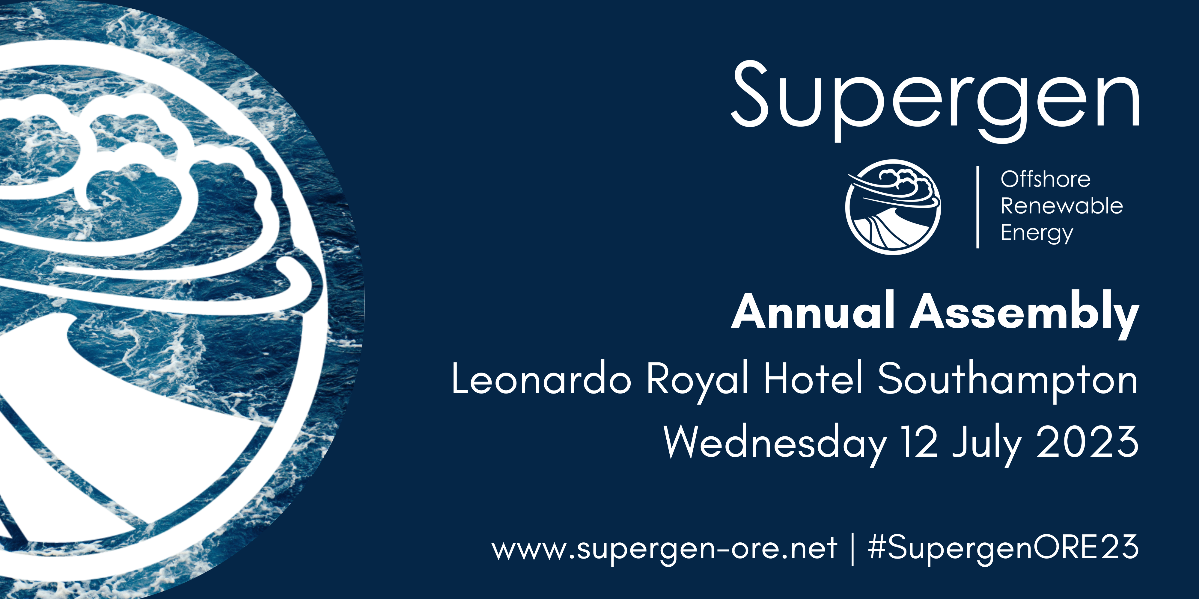
Supergen ORE Hub Annual Assembly 12 July
Supergen ORE Hub Annual Assembly
Wednesday 12 July | 8.30 – 17.30
Leonardo Royal Hotel Southampton Grand Harbour
The Supergen Offshore Renewable Energy (ORE) Hub organise an Annual Assembly to connect those working in the offshore wind, wave and tidal energy sectors as an opportunity to explore and debate cutting-edge research.
Find out about the latest opportunities and challenges and network with the offshore renewable community, including academics, industry professionals and policymakers.
Speaker announcements and agenda are to be released shortly.
Limited places are available, so please register to reserve your place.