MATS 2023: Themes Announced
The delivery committee are pleased to announce the themes for MATS 2023
During MATS 2023, our aim to explore Marine Autonomous Systems (MAS) seeks to underline the significance of MAS and to represent each key aspect of MAS through the themes outlined.
We are keen to encourage a wide range of presenters of all nationalities, genders and backgrounds including early careers or newly qualified engineers / technicians to enable the next generation to begin their journey.
This year we have a new theme: Applications of Artificial Intelligence and Machine Learning theme. We feel this will be a very exciting deep dive into this field.
- Theme 1: Sustainability and Net Zero Capability We are seeking to understand how sustainability is being implemented into organisations and their operations both now and in the future. Net Zero Capability is now a reality and exciting developments are driving this forward. How are MAS achieving this? Here we seek to understand the planning and development process already in play and how it can be advanced moving forward.
- Theme 2: Users & Applications Through this theme we are inviting presentations from Scientific, Industry, Government and Defence end-users of marine technologies. Presentations should focus on current and aspirational
- Theme 3. Applications of Artificial Intelligence and Machine Learning This new theme will explore the latest advancements and applications of Artificial Intelligence (AI) and Machine Learning (ML) in Marine Autonomous Systems (MAS) and marine data analysis. AI and ML are powerful tools increasingly used to improve the performance, efficiency, and usability of MAS, including in navigation, perception, environmental monitoring, and image analysis. While there are many benefits to integrating AI into MAS, there are also challenges. How much trust can we put in these technologies? How relevant are they to end-user applications and real-world contexts? How well do they support sustainable development? We are seeking presentations on a range of topics including autonomous navigation, planning, data collection and annotation, oceanography, and marine robotics to provide an insight into the latest trends and emerging technologies in marine autonomy, as well as the challenges and opportunities that lie ahead.
- Theme 4: Data Collection and Information Generation Sensing technologies are the eyes, ears, nose and touch of the MAS. This theme will focus on novel, innovative and emerging technologies that enable MAS to collect data for the end-user, through remote and physical sampling for chemical and biological detection. We are also seeking presentations that cover interaction with the environment and infrastructure. Data alone is of course not enough, generating information that meets end-user needs from the data collected is the ultimate goal of deploying the system. This theme will explore collected data and the novel methods of generating information products from MAS gathered data.
- Theme 5: Autonomous platforms and supporting technology Through this theme, we are seeking presentations that focus on existing and upcoming platforms within the next 12 months. Increased intelligence, operations have evolved from single platform to more of a systems approach. Operations are no longer limited to one or two vehicles deployed from a ship, but can be run by autonomous fleets utilising technologies such as digital twins, motherships etc. Presentations are sought that include, but are not limited to end to end systems, navigation, networking, collaboration and cooperation, residency, launch and recovery and novel vehicles including a forward look to future vehicle technologies. We are also encouraging presentations that look at the roles of cyber technologies and digital twins in operations. Presentations should demonstrate how step changes in MAS technology deliver improved performance through real examples of in field operation, be that with a single platform or a fleet of platforms.
To view the abstract submission guidelines and to submit an abstract please click here

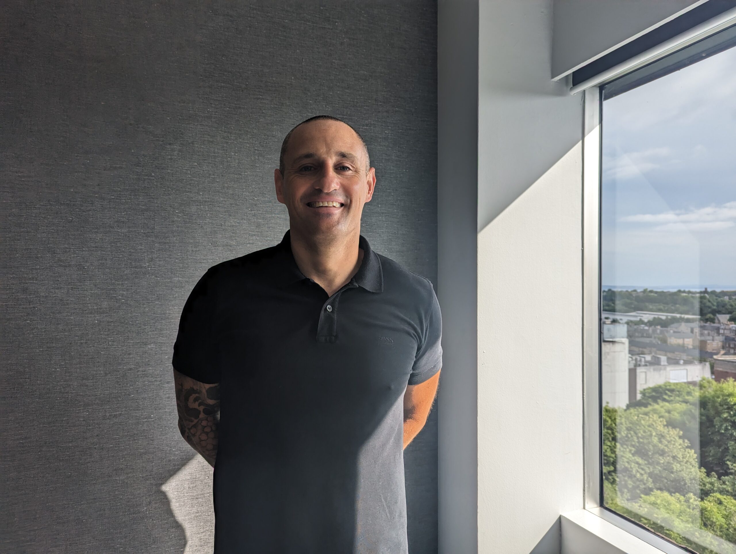
SeeByte appoints Sean Slee as Capability Delivery Manager
SeeByte, the global leader in software solutions for Robotic and Autonomous Systems is pleased to appoint Sean Slee as their Capability Delivery Manager.
Sean joins SeeByte with over 23 years of Mine Warfare experience within the Royal Navy, where he achieved the privileged rank of Warrant Officer First Class.
Sean will bring his operational military experience in Mine Warfare to support SeeByte’s global naval programmes.
“We are delighted to welcome Sean onboard at SeeByte. Sean’s experience will be a significant asset to SeeByte as our capabilities operational use continues to expand,” said Chris Haworth, CEO at SeeByte
Recently awarded a contract to provide C2 and autonomy architecture across the Royal Navy MHC programme, Sean joins SeeByte at this important phase in the company’s growth.
“This is an exciting time for me which will allow me to continue growing my Mine Warfare experience whilst working alongside the inspirational work force from the professional SeeByte organisation,” said Sean Slee, Capability Delivery Manager at SeeByte
SeeByte will be demonstrating their vendor agnostic Mission Management system at this year’s REPMUS event in Portugal and DSEI in London.
TDI-Brooks International Inc. Completes Final Report for Deepwater Atlantic Habitats II
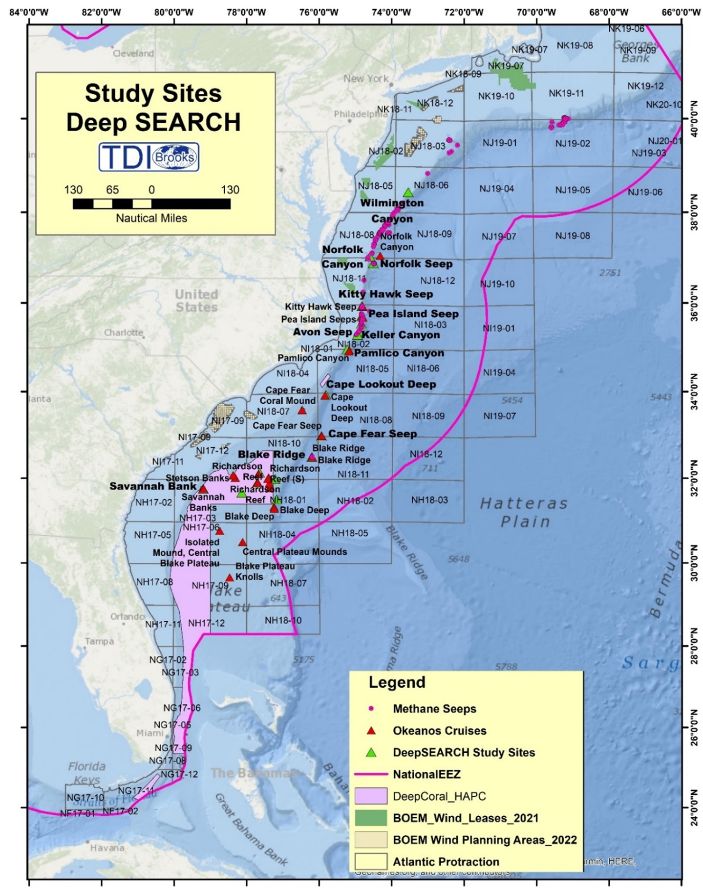
TDI-Brooks International, Inc. recently completed the final report for Contract M17PC00009, issued by the U.S. Department of the Interior, Bureau of Ocean Energy Management [BOEM]), titled “Deepwater Atlantic Habitats II: Continued Atlantic Research and Exploration in Deepwater Ecosystems with Focus on Coral, Canyon and Seep Communities.” This report is the final deliverable of the BOEM contract called Deep SEARCH, conducted in partnership with the U.S. Geological Survey. Initially, the study was a five-year, collaborative scientific research program focused on the outer continental shelf between Virginia and Georgia. The COVID crisis extended the program for another 18+ months. The region’s deep-sea coral, cold-seep and canyon communities as habitats of focus were surveyed. The overarching goal was to improve understanding of the functional role of these three habitat types in order to advance scientific knowledge and inform future management decisions. The intended application of the new science was to develop better predictive capacities for the community types encountered.
The sites were studied during five directly supported cruises, with detailed site descriptions of the geological, physical, chemical and biological conditions encountered. The results from six additional cruises conducted through collaboration with the ADEON project and NOAA-OER also contributed to the Deep SEARCH database The research results, analyses and findings include the oceanographic, geological and geochemical setting of canyons, seeps and coral environments, deep-sea soundscapes, community structure and trophic function from microbes to fishes, population connectivity, life history of selected species, habitat suitability modeling deep-sea corals and seeps and educational outreach to the public.
- The newly named Richardson Reef Complex is now understood to be one of the largest cold-water coral reef complexes in the world. Furthermore, the Richardson Reef Complex is part of one of the largest coral mound provinces in the world, the Million Mounds, which extends from Richardson in the northeast and south across the entire Blake Plateau, and down along the Florida coast to the Jacksonville Mounds.
- The seeps along the continental shelf edge, visited for the first time, are remarkable for their extremely high rates of methane release and oxidation. Their chemistry fuels biological productivity that appears to also support local pelagic communities.
- Pamlico Canyon was found to be home to a very high diversity coral assemblage, to have high overall diversity of infauna and to exhibit some of the highest densities of sediment infauna observed at this depth.
- Deep SEARCH data indicates high connectivity among all habitat and community types. For example, interactions between the diel vertical-migrating mid-water community and the benthic zone of the Richardson Reef Complex, as well as those of midwater organisms with the walls of the canyons and shallow seeps were seen.
- The unique oceanographic conditions in the region have a corresponding influence on the various communities. The Gulf Stream cuts through the center of the study area, causing vertical mixing in its core down to 1,000 m. This promotes a rapid translation of food to depth and nutrients to the surface, which brings elevated trophic and genetic connectivity of the components of the ecosystem. These currents are highly variable at the seabed, (apparently) inducing a high degree of adaptive resilience of the deep-sea corals of the region in response to rapidly changing environmental conditions.
Through this study, TDI-Brooks has filled major data gaps for poorly known deepwater ecosystems, aiding the refinement of regional management strategies. Our improved understanding of the habitats and communities in offshore areas of the Atlantic Large Marine Ecosystem augments the capacity to predict the distribution of sensitive areas concerning the potential development of energy and marine minerals managed by the Bureau of Ocean Energy Management.
Successful Integration of the RIEGL VQ-840-G Topo-Bathymetric Laser Scanner into the Schiebel CAMCOPTER® S-100 UAS
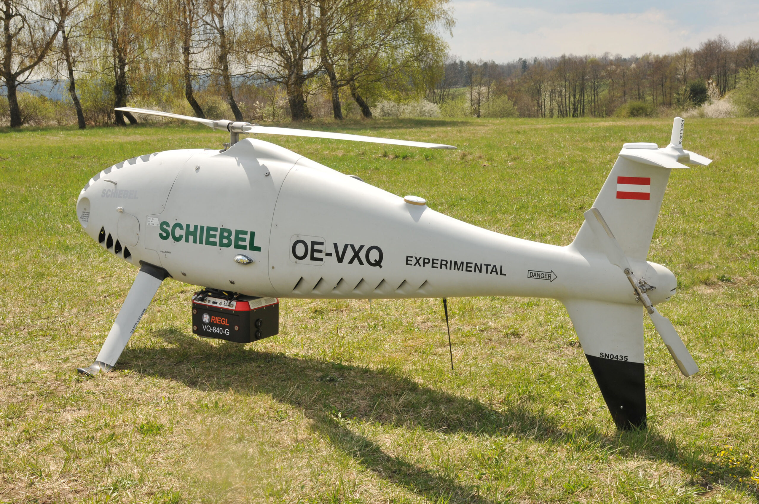
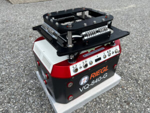
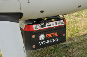
RIEGL Laser Measurement Systems GmbH and SCHIEBEL have successfully completed the integration of a high-end laser scanning system, the RIEGL VQ-840-G topo-bathymetric LiDAR sensor, on the Schiebel CAMCOPTER® S-100 Unmanned Air System (UAS).
Operating a high-end laser scanning system remotely on an Unmanned Air Vehicle (UAV) requires a tailored solution going beyond what is currently available off-the-shelf. In order to maintain the broad operating range of the UAS, it is imperative to keep the weight of the sensor payload low. In addition, the effective execution of the survey mission requires full remote control of the payload instruments and real-time feedback to the operator via a data link.
The compact topo-bathymetric laser scanner was designed for use in a variety of maritime and hydrographic environments. The LiDAR sensor payload system is controlled remotely via a data link, which is a crucial for the integration into the S 100 system.
The scanner is controlled by using the onboard software “RiACQUIRE-Embedded” via the available data link; data acquisition and laser safety are also monitored. Once the survey is completed, the raw data seamlessly integrates into the RIEGL data processing workflow.
The RIEGL VQ-840-G, combined with the outstanding technical specifications and performance of the CAMCOPTER® S-100 UAS, enables an efficient and secure way for surveying shallow waters, where monitoring from boats becomes a challenge. The applications of Airborne LiDAR Bathymetry (ALB) include the mapping of coastlines and river banks as well as the monitoring of natural habitats, water reservoirs and hydraulic engineering applications (e.g., canals, dams, bridges). In a single data acquisition mission, data below and above the water surface are covered.
Additionally, the topographic laser scanners RIEGL VUX-1UAV/-LR and VUX-12023 can be integrated in the front payload bay of the CAMCOPTER® S-100.
Sulmara and Safelane Global Announce a Strategic Partnership to Execute the Next Generation of Marine and UXO Mitigation Solutions
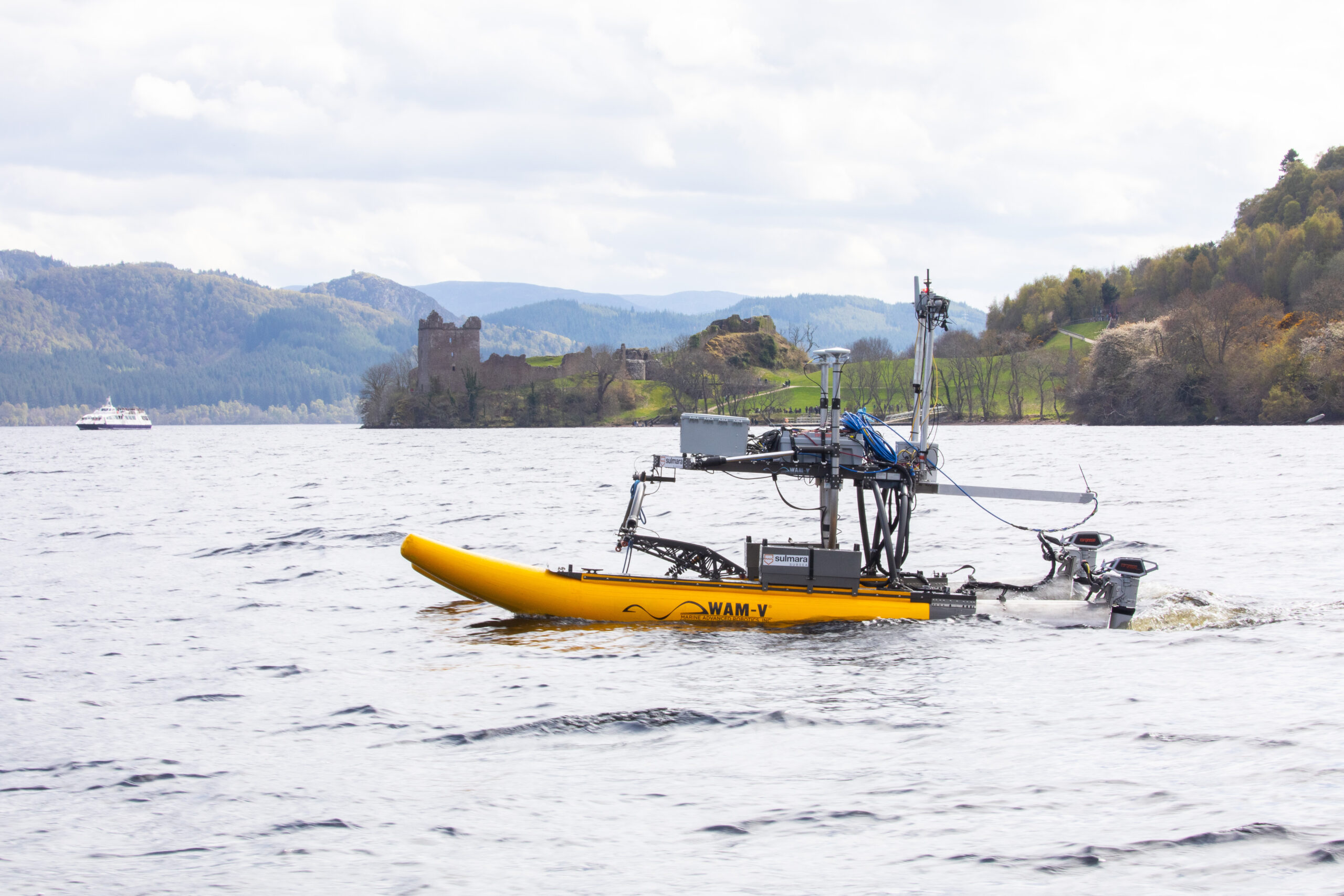
This partnership brings together two experts in their respective fields to accelerate the delivery of uncrewed marine UXO operations at a lower cost, reduced risk and with less environmental impact.
Sulmara is driving forward decarbonisation in the marine UXO survey industry by combining new technology with the expert UXO risk management knowledge of SafeLane Global. This will create new capabilities, extend the scope of operation, and reduce the risk to personnel and the impact on the environment.
The partnership builds on natural synergies and shared values between the organisations, with extensive experience in challenging frontier markets and some of the harshest environments around the world. Sulmara and SafeLane will offer a complete UXO service from threat assessment to clearance across Europe, North America, and the Asia Pacific regions, with more than 230 dedicated employees to support the energy sector development and support the humanitarian programs to clear post war and conflict areas of UXO with uncrewed systems.
Sulmara CEO, Kevin McBarron said:“Through the powerful synergy of SafeLane Global and Sulmara joining forces, we unlock an unparalleled level of UXO expertise and technologies. This aligns strongly with our net zero ambitions and will deliver improved efficiency and safety in accurately identifying underwater explosive hazards”.
Ryan Prophet, Director (Marine) at SafeLane said: "Together, we redefine the industry standard, offering a transformative solution that safeguards both human lives and the environment, while significantly reducing project timelines and costs. The alliance of SafeLane Global and Sulmara sets a new benchmark in uncrewed UXO services, revolutionizing the way we navigate the world of UXO with confidence."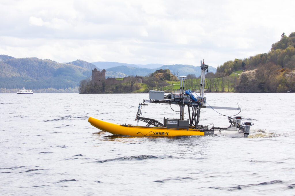
Dalhousie-led research program receives $15-million to investigate how the ocean can be leveraged to mitigate climate change
Dalhousie University has received nearly CAD$15-million from the Carbon to Sea Initiative to lead the Ocean Alk-align research program, a global five-year project that will bring researchers together from around the world to study ocean alkalinity enhancement – an approach for atmospheric carbon removal that aims to mitigate climate change.
The process of alkalinity enhancement is compared to adding an antacid to the ocean, the kind we take for heartburn or when our stomachs are upset. Over the past 200 years, the burning of fossil fuels has increased ocean acidification and reduced its ability to absorb carbon dioxide (CO2) from the atmosphere. Through targeted enhancement of ocean alkalinity, Dalhousie oceanographer Dr. Katja Fennel and her colleagues will study if they can reverse ocean acidification to make the ocean more receptive to CO2 absorption.
The Dalhousie-led Ocean Alk-align project is supported by the Carbon to Sea Initiative, a non-profit program funded by philanthropic foundations in the United States, Canada, and Europe. Carbon to Sea seeks to assess the conditions under which ocean alkalinity enhancement can become a safe, cost-effective, and scalable method for atmospheric CO2 removal. The $15-million CAD grant to Alk-align is the largest funding commitment of the initiative to date.
"Currently, ocean alkalinity enhancement is not a mature technology and its environmental impacts have not been assessed in the field,” said Dr. Fennel, who is the lead principal investigator of the Ocean Alk-align research program. “Our research consortium will tackle the three most pressing research issues: the efficiency and permanence of CO2 removal, its environmental risks and potential benefits, and the monitoring and verification of CO2 uptake.”
Dr. Fennel notes it is now widely accepted that global efforts to reduce CO2 emissions are not enough to veer us off a course toward catastrophic climate change. The United Nations’ Intergovernmental Panel on Climate Change says to meet these targets, the world needs to remove 10 giga tonnes (equivalent to one billion tonnes) of CO2 from the atmosphere per year by the middle of the century, and 20 giga tonnes per year by the end of the century. Ocean carbon alkalinity could be a key to meeting these targets.
“If we’re going to avoid the worst impacts of climate change, we need to aggressively reduce emissions and remove carbon from the atmosphere,” said Mike Schroepfer, board chair of Carbon to Sea and co-founder of Additional Ventures, a purpose-driven organization that started and spun-out Carbon to Sea.
“Scientists agree that ocean alkalinity enhancement has enormous potential to permanently remove and store carbon and more funding for research is needed. We are here to respond to the call for research funding and answer basic scientific questions about the safety and efficacy of various approaches to ocean alkalinity enhancement. If we find that ocean alkalinity enhancement can be applied at scale, we can unlock one of the most efficient, cost-effective approaches to carbon dioxide removal for humanity. I’m grateful to the whole network of funders, researchers, partners, and the amazing team at Carbon to Sea for their bold commitment to pursue this work."
As chief principal investigator, Dr. Fennel will facilitate collaborations between Dalhousie and a global team from some of the world’s foremost centres of ocean research, including GEOMAR Helmholtz Center for Ocean Research Kiel and Hamburg University in Germany, and University of Tasmania and Southern Cross University in Australia.
“As a global leader in ocean science, Dalhousie is perfectly positioned to take the lead in this emerging area in the fight against climate change,” said Dr. Alice Aiken, Dalhousie’s vice president research and innovation. “Under Dr. Katja Fennel’s direction, this research program will play a key role in advancing the science of ocean-based carbon removal. It’s a significant opportunity and it’s our responsibility to the world.”
At the end of April, Dalhousie was also announced the recipient of a $154 million grant from the Government of Canada to help fund the Transforming Climate Action research program to study the ocean’s central role in climate change. One of the three major themes of the program is focused on mitigation strategies and ocean-based CO2 removal in particular. Collaboration between the Ocean Alk-align and Transforming Climate Action research programs has the potential to enhance and substantiate global networks and data sharing with possibilities to significantly magnify impact.
“The math is relatively simple – we need to pair emissions reduction with environmentally responsible carbon dioxide removal solutions. My interest in ocean alkalinity enhancement is rooted in a deep love of the ocean, a recognition that climate change is a catastrophe for marine ecosystems, and the belief that our ocean can be a part of the solution,” said Dr. Antonius Gagern, executive director of Carbon to Sea. “The growing scientific community working on ocean alkalinity enhancement includes the best minds across a range of disciplines, from biogeochemistry to ocean engineering, and is focused on systematically testing this hypothesis.”
Dr. Fennel says it’s essential that researchers outside of the private sector play a central role in determining the future of ocean alkalinity enhancement, noting that an objective approach is required to ensure it is done correctly, if at all.
“It is of utmost importance that these issues are investigated by scientists who have no financial interests in the research outcomes and are driven solely by the desire to ensure safe implementation if, and only if, ocean alkalinity proves to be effective at removing CO2,” said Dr. Fennel. “This must happen before it is implemented and scaled up.”
Read the Carbon to Sea Initiative’s media release about its larger investment in Ocean Alkalinity Enhancement research.
The countdown to next week’s Ocean Business 2023 is on!
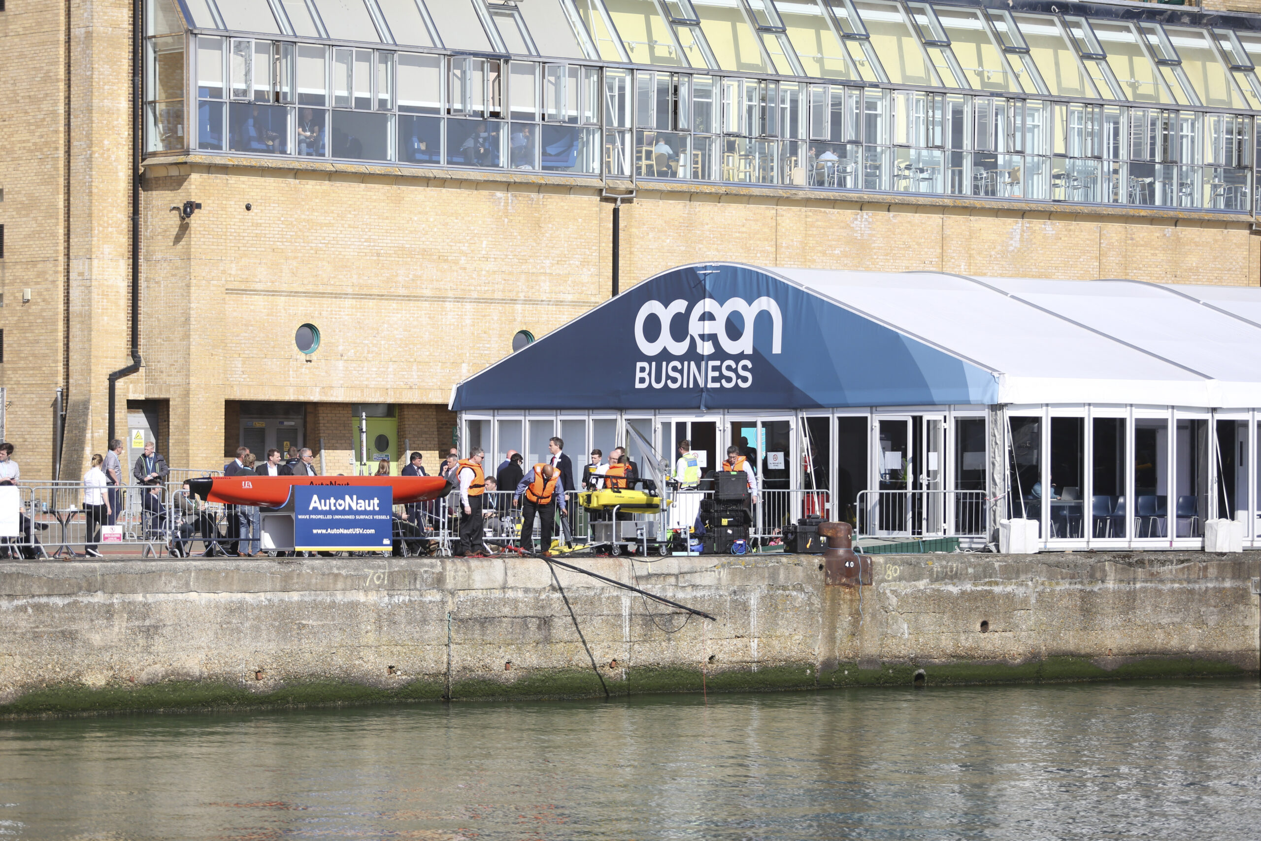
This time next week, Ocean Business 2023 will be in full swing, with three days of the very latest ocean technologies, new product launches, dockside demonstrations and networking opportunities with marine industry professionals from around the world.
With more than 300 manufacturers and service providers booked for the sold-out exhibition, this year’s edition of the global technology and science show for the marine sector is set to attract record crowds.
On day one, a line-up of industry leaders will share their insights during a free to attend conference, which will look at how the ocean science community is meeting challenges in the blue economy.
And a packed schedule of networking and social events – from the Wine Trail to the International B2B Matchmaking sessions – will ensure show-goers can catch up around the clock.
The exhibition, which runs from April 18-20 at the National Oceanography Centre in Southampton, is open to all visitors for free by registering online at www.oceanbusiness.com.
 Stakeholders have described Ocean Business as a ‘must attend’ event on the international ocean technology calendar, offering invaluable access to ground-breaking industry developments.
Visitors will have the chance to observe cutting edge technology close up and meet the top innovators in the sector, with 130-plus hours of demonstrations on the dockside, on board vessels, in a purpose built test tank and in the classroom in this year’s Training and Demonstration programme.
A major draw will be the range of autonomous vehicles, with ROVs, USVs and AUVs on display from Singapore, the US, Norway, Spain, Ireland and the UK.
Also on the dockside - which will be fitted with a 33m floating pontoon to accommodate the mobilisation of autonomous vehicles - Maritime Robotics will stage demonstrations of its Otter Pro, with the Norbit, Teledyne Marine and Kongsberg multibeam systems, the ultimate in unmanned survey platforms.
Other highlights, inside and outside the exhibition halls, include updates from uncrewed surface vessel specialist XOcean, advances in AUV technology from Singapore’s BeeX, Teledyne’s marine interconnect technology advancements, and EdgeTech’s 3D sub-seabed imaging sonar, eBOSS.
Nortek’s experts, meanwhile, will demonstrate their acoustic underwater sensors and explain how to achieve quality current measurements from a moving vessel.
Bringing together the best in transformational ocean technology from the Netherlands, the Dutch Ocean Group’s pavilion will feature WaveGuide wave radar from Radac, monitoring solutions from Tarka-Systems, N-Sea’s subsea infrastructures for the oil, gas and renewable sectors, and much more.
And, for the first time, the world’s only conference dedicated to marine electromagnetics – MARELEC - will run alongside Ocean Business. Delegates will hear from eminent scientists, engineers and academics of progress made in the past four years in the fields of geophysics, geotechnical engineering, oceanography and naval warfare.
For students, Ocean Careers, also running for three days, will provide advice on opportunities within the ocean technology, marine science and offshore sectors.
Cheri Arvonio, Event Director at show organiser Diversified Communications, said: ‘With just days to go, excitement is building among the Ocean Business team for a truly memorable show.
‘This year’s exhibition will showcase the most up-to-the-minute technology in today’s ocean space, as well as offering tantalising glimpses of tomorrow’s scientific and engineering breakthroughs.
‘We’re looking forward to welcoming exhibitors and visitors from across the globe for three days of serious business, lively discussions, meetings with new contacts, and reunions with Ocean Business regulars. See you all next week!’
Meet the exhibitor: Dutch Ocean Group
Visit the Dutch Ocean Group PaviliON at Ocean Business on stand S1. Here's the companies you'll meet on stand S1:
RADAC
https://www.radac.nl
 We are a Dutch company, based in Delft. Since 1996, Radac develop, manufacture and market the WaveGuide. We are proud that our professional systems are trusted across the industry.
Our highly accurate wave radar has proven itself for over 20 years. This easy to use, reliable and robust sensor is particularly suited for the extreme conditions offshore.
For offshore operations. Wave and tide data are of great importance during all stages of offshore wind farm development and operation. In all offshore operations weather is a major risk factor. Knowledge of the present site conditions assists the crew in determining an optimum weather window during which operations can be performed safely. This increases operational efficiency, reduces costs and prevents workability discussions.
Real time wave monitoring provides essential information for (jack-up) vessels during offshore operations. Jacking operations, crane operations, towing and such are typically limited by a maximum wave height of two meters or even less.
the WaveGuide is equipped to measure wave height and direction regardless of the most extreme conditions. From the development phase onwards, wave data is needed to calculate the wave load in order to define the requirements of the platform design. During its operation years, the actual wave climate is logged to determine the expected endurance. Accurate analysis of the possible exploitation period can make an enormous difference in cost.
During exploitation, real-time wave information is used to make operational decisions. The motions of the ocean surface is of great influence on activities like maintenance and supply.
The onboard wave radar measures the waves as they are encountered by the ship itself. This data is ideally used to determine the operational limitations of the vessel in all conditions. Therefore, the efficiency of the operations will be boosted while the costs are kept low (compared to water-based solutions). Besides, a vessel in transit can adjust its speed and course to avoid critical headings.
WANT TO LEARN MORE?
Please contact one of our representatives at stand S1.
DEEP
www.deepbv.nl
 Deep personnel want to see quality and endeavor to carry out every project to the desired end result. Due to the professional competence and commitment they are able to quickly solve difficult problems. This kind of enthusiasm ensures high dedication to the projects and clients.
At Deep the individual is most important to us and a strong focus is placed on the personal development of all our staff. The willingness to convey knowledge is high and unique for interns and new employees. Want to work at Deep? Have a look at our job page for new openings.
Projects are carried out by Deep with their own high-end equipment uses by our professional surveyors to get the best survey results.
The Deepers are technical professionals who are visibly enthusiastic about high-end survey equipment and thus see endless possibilities to make every project a good end result. You will see them in their element when new and innovative survey techniques are conceived and developed.
This enthusiasm and eagerness allows us to offer customized survey services. The expertise of both our surveyors and our own technical staff ensures that Deep gets the best out of its survey equipment.
The Deep survey vessels are flexible due to their fixed survey setups and the flexibility of our skippers and surveyors. Deep has a suitable vessel for every project.
Deepers love water and that’s reflected in the diversity of our fleet. The combination of various survey vessels makes it possible to carry out projects from shallow waters to rivers, canals, coastal zones, harbours and oceans. All vessels are equipped with high-end survey equipment and are manned by professional surveyors and qualified skippers.
Tailored work is what Deepers are crazy about: the art is in the process of combining it. Meaning by putting the right equipment on the most suitable measuring vessel, a fitting solution made for each project.
Deep Matters aims to maintain clean and natural rivers, seas and oceans, so that they continue to exist as a vital source of life for all life on earth. The foundation will endeavor to achieve its goal by carrying out all further operations that are in the broadest sense related or conducive to this objective.
WANT TO LEARN MORE?
Please contact one of our representatives at stand S1.
TARKA-SYSTEMS
https://www.tarka-systems.nl

TARKA-SYSTEMS is the one-stop solution to monitor your projects
Over 15 years of experience with the design, assembly and installation of monitoring/measurement systems combined with the knowledge of sensors, data-acquisition hardware and visualisation software TARKA-SYSTEMS provides complete monitoring solutions for field applications.
The main activities of TARKA-SYSTEMS are:
Products: Design and manufacture monitoring products for all kind of applications.
- Applications: Hardware selection/integration and Software development for completer monitoring projects.
- Services: Installation on-site, assist with setup and design of monitoring systems.
- Development: Create new solutions to improve monitoring systems. Hardware and software.
- Rugged cases: Client specific solutions based on rugged cases, for transport, for protection of special parts, for equipment
When you can specify your inputs and outputs TARKA-SYSTEMS can provide a monitoring solution.
- MARINE
- OFFSHORE
- SALVAGE
- CIVIL
WANT TO LEARN MORE?
Please contact one of our representatives at stand S1.
N-Sea
www.n-sea.com
 N-Sea is an integrated total subsea solutions provider in Survey, IRM & Construction, Subsea Cable Repair & Installation, and UXO ID & Disposal.
We deliver effective and cost-efficient solutions for subsea infrastructures and assets that meet the needs of the international oil, gas- and renewable industries. We meet our clients by providing effective and cost-efficient solutions for subsea assets and infrastructure, considering a safe environment.
We have the ambition to be the go-to total subsea solutions provider. We want to create a sustainable business and increase our profitability through solid project management and full client awareness.
To realise this ambition we develop our organisation to the level of best in class being fully synchronised with our ambition and strategy by contributing to the following key success factors constantly:
- Qualified and engaged people
• Long term client relationships
• Strategic partnerships
• Innovative solutions
• Safety and quality 100%
• Visible presence
• Full control over marine assets
N-SEA OPERATES GLOBALLY DELIVERING INTEGRATED SUBSEA SOLUTIONS THROUGHOUT THE PROJECT LIFE CYLCE OF YOUR SUBSEA INFRASTRUCTURE.
We serve clients who are active in renewable, utility and oil and gas markets. We listen, investigate, and assess the specific needs of your subsea asset, infrastructure, or project area. Every subsea challenge is approached best by providing the right mix of capabilities and understanding. Our bespoke services have a focus on a specific subsea capability.
By sharing a strong multidiscipline offshore operations department, we can integrate our bespoke capabilities in one project working as a fully subsea solution. We are a reliable partner to help you gain insight into your assets.
Our experienced specialist teams, sophisticated in-house technology, extensive fleet of vessels and data management capabilities enable us to offer a rapid response to your queries, without compromising safety, efficiency, or quality.
WANT TO LEARN MORE?
Please contact one of our representatives at stand S1.
Marine Sampling Holland
https://www.marinesamplingholland.nl
 Marine Sampling Holland B.V. (MSH) is specialist in offshore geotechnical, geological and environmental research. We have dedicated seabed Cone Penetration Test systems (CPT) for in-situ testing and a variety of dedicated equipment for seabed sampling.
We are specialized in geotechnical, geological and environmental research of offshore subsurface, riverbeds and sedimentary harbour and canal deposits. We have gained over 40 years worldwide experience, from the Arctic to the Antarctic area and all seas and oceans in between. We have several state-of-the-art units and other equipment to carry out the research. We also provide consultancy for a wide range of offshore projects.
For accurate underwater research we conduct cpt's and sampling with state-of-the-art equipment. In our laboratory a wide range of tests can be performed on the collected soil samples. We also provide consultancy for a wide range of offshore projects.
The Cone Penetration Test (CPT) is used for in-situ geotechnical characterisation of ground. It involves the measurement of the resistance of ground to steady and continuous penetration of a cone penetrometer with an angle of 60° and equipped with internal sensors. The measurements comprise penetration depth, cone resistance, sleeve friction and, optionally, pore pressure and inclination from vertical. These measurements permit interpretation of ground conditions.
Sampling of the sea floor is conducted for the reconnaissance of sedimentological or chemical composition. We have a broad range of equipment available to conduct superficial or deap-sea floor (untill 20 m) sampling.
For lowering equipment to the seabed, we have winches available with cable lengths between 1,000 to 5,000 m. A containerised mobile workshed allows the drilling technicians to perform on-board repairs when needed.
In our own laboratory a wide range of geotechnical and geohydrological tests can be carried out on the samples. To perform laboratory tests abroad we also have a specially equipped mobile laboratory.
Marine Sampling Holland has a dedicated team of marine geologists, geotechnical engineers and technical staff, providing acquisition and advice on soil investigation, laboratory testing and determination of geotechnical parameters for a wide range of offshore projects. With most advanced sampling equipment soil samples of the sea bed are collected, and our licenced geotechnical and geochemical laboratory is determining the required geotechnical parameters.
WANT TO LEARN MORE?
Please contact one of our representatives at stand S1.
Geomil
 Geomil started manufacturing soil investigation equipment in the 1930s and has been at the forefront of developing Cone Penetration Testing (CPT) equipment for over 85 years. In the early 1930s the Netherlands struggled with failures of railway embankments on the soft peat soils. One keen engineer Mr. Barentsen came up with an idea for a new soil testing method – the Cone Penetration Test.
Geomil is proud to have been the inventor of CPT technology and since those early innovative beginnings Geomil has continued to innovate, deliver quality equipment and provide unmatched service to become the ‘go to’ company for cone penetration testing advice and expertise.
Geomil engineers and manufactures equipment focusing on Cone Penetration Testing (CPT) for geotechnical site investigations. We have over 85 years of experience and were the first to patent and produce Cone Penetration Testing technology during the 1930s. Today we service our clients globally assisting them with their geotechnical requirements.
Our experience is extensive and Geomil prides itself on its innovation, ability to deliver outstanding quality and promote collaboration across all areas of our business – always pushing CPT technology forward.
In eight decades we have set benchmarks in our industry and have been recognized as one of the leading companies providing cost effective CPT equipment within the geotechnical world. Our expertise spans across cone penetration testing in onshore, near and offshore environments. Our equipment varies from our specialized cones to complete data acquisition systems as well as stand-alone penetrometers and heavy duty CPT units. Geomil projects are conducted globally.
Our success is greatly driven by certain key strengths built into our company culture. Together innovation, quality and teamwork are key driving forces which enable Geomil to lead and remain at the forefront of its industry.
WANT TO LEARN MORE?
Please contact one of our representatives at stand S1.
Nautikaris
www.nautikaris.com
Nautikaris is your best address for your needs for Hydrographic and Oceanographic Systems, Meteorological instrumentations and system solutions, Acoustic 3D Imaging Systems, Subsea communication, ROV systems, Positioning Equipment, Underwater Connectors, Rugged Data Collectors, Marine LED Navigation Lights and Wireless Small band Radio telemetry networks. Additionally we have Acoustic Real-Time 3D Imaging Systems for rental with experienced operators.
Since the founding of the company in 1965 our valued customers count on us for the high quality of our products combined with ease of use and a flexible and professional support team.
At Nautikaris we often say: “If you want to go fast, go alone; but if you want to go far, go together”. With this in mind we are always looking for people which we can expand our business or service with. We have been in business for over 55 years(!) and we will like to make it to another 55. So we want to go together, with our customers, engineers and suppliers. This means we are always looking for ways to make business together in every way possible. If at this point you think we can both benefit from a collaboration you can contact us by filling in the contactform below and we will arrange a meeting where we can talk about how we can make business together.
WANT TO LEARN MORE?
Please contact one of our representatives at stand S1.
Meet the exhibitor: Codevintec Italiana
Codevintec Italiana are exhibiting at Ocean Business on stand W62. Find out information about their product launch ASV marine drone CK-14:
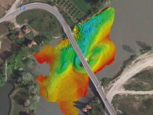
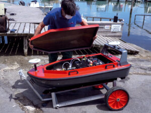
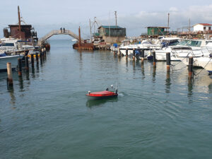
The CK-14 is a made in Italy ASV, CE Marked, used for various hydrographic applications in inland (rivers, lakes, dams, artificial basin etc.) and coastal waters (harbours, coastal areas, etc.). The vessel (carbon fiber and Kevlar hull) is equipped with a large moon pool where many scientific instruments can be placed. Ready to use, customizable with a wide range of hydrogaphic and oceanographics sensors.
Its sizes are as little as a van – 140 cm. length to only 15 kg body weight - and over 40 kg payload. Other significant features of this Codevintec Signature Drone are the high technological content, design, stability and firmness of the hull.
It is already used by some Universities, Civil protection, private companies with great satisfaction. It is versatile and is equipped according to various needs very quickly:
Echosounders Single e Multibeam
Lidar - Laser Scanner
SSS – Side Scan Sonar
SBP – Sub Bottom Profiler
ADCP – Acoustic Doppler Current Profilers
Magnetometers
CTD and multiparametrics probesPositioning systems GNSS
Inertial platforms
Typical uses
Lopes of riverbeds
detection of weakness at the base of load-bearing pylons of bridges and infrastructure
surveys in harbours
current profilies
river flow calculation
water quality profiling
temporary lakes, inland waters
It is used anywhere where there is a risk or impossible to use conventional manned vessels.
CK-14 ASV and its own equipment are controlled by remote device or total remote control by Sestante autopilot option.
Codevintec sells and rents the CK-14 marine drone in Europe and the Mediterranean sea.
Who is Codevintec company?
Codevintec is the reference point for high-tech instruments for Earth and Marine Sciences. Since 1973 it has introduced in the Italian market high cutting-edge technology systems for:
Earth and marine geophysical prospection
Coastal and marine surveys
Geophysical and infrastructure surveys
Volcanology and seismic monitoring
Qualified technical assistance laboratory
Job Advert: Offshore Geotechnical Engineers at Feritech
Feritech is looking for contract and permanent offshore geotechnical engineers for upcoming global projects.
If you have experience of mobilising, operating and demobilising CPTs, vibrocorers, piston, gravity corers and a variety of grabs, winches and launch and recovery systems we want to here from you.
The applicant will be responsible for setting up and operating equipment onboard operational vessels including mobilising and demobilising in an offshore environment. Liaising with clients and crew members, fault finding and participating in project kick off and debrief meetings.
A strong technical background will be required, preferably with experience of the offshore survey industry. Specific product training will be provided.
Offshore daily allowance is remunerated in addition to basic salary for a permanent position. A valid BOSIET/FOET, medical and driving licence is a preferred prerequisite.
If you are interested get in touch with us via our careers webpage https://www.feritech.com/careers/ or send your CV and a covering letter to [email protected]