FarSounder Partners with Propspeed for Biofouling Solution
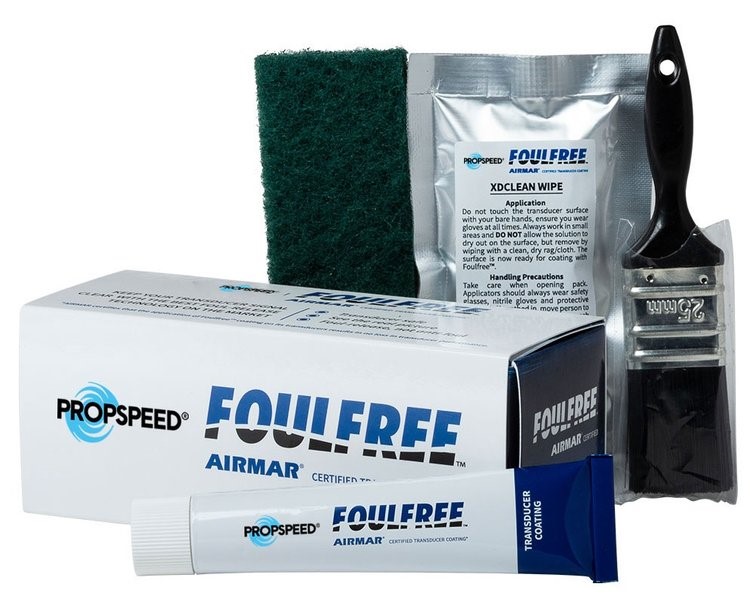
FarSounder has approved Propspeed FoulFree as an acceptable coating for the Argos sonar array face to limit biofouling. As a result, the companies have come together to offer the first application of FoulFree at no charge with each new Argos purchase.
FoulFree is a specialized foul-release coating that is biocide free and not harmful to marine life. Designed to limit the adhesion of biofouling, this product is certified by Airmar and results in no loss in transducer performance once applied. For a limited time, all new orders of Argos forward facing sonars are eligible for a complimentary FoulFree Application Kit. FarSounder customer should request the kit at time of order, and it will be included in the Transducer Module’s package.
Keeping your Transducer Module’s array face clean from marine growth is important for optimal sonar performance. While simple cleaning methods can be used to remove growth, applying a coat of FoulFree to the urethane can significantly reduce the amount of fouling to be cleaned.
The accumulation of biofouling can cause damage to the mechanics of a vessel over time, including a sonar array face. FoulFree is one solution that has been tested and proven to not be harmful to marine life or ship mechanics. This makes it an ideal product for environmentally continuous mariners and companies like FarSounder.

New C-Level Subsea Digital Display
OceanTools, global supplier of underwater technology, launch the new C-Level Subsea Digital Display adding to their extensive industry leading range of high specification subsea technology.
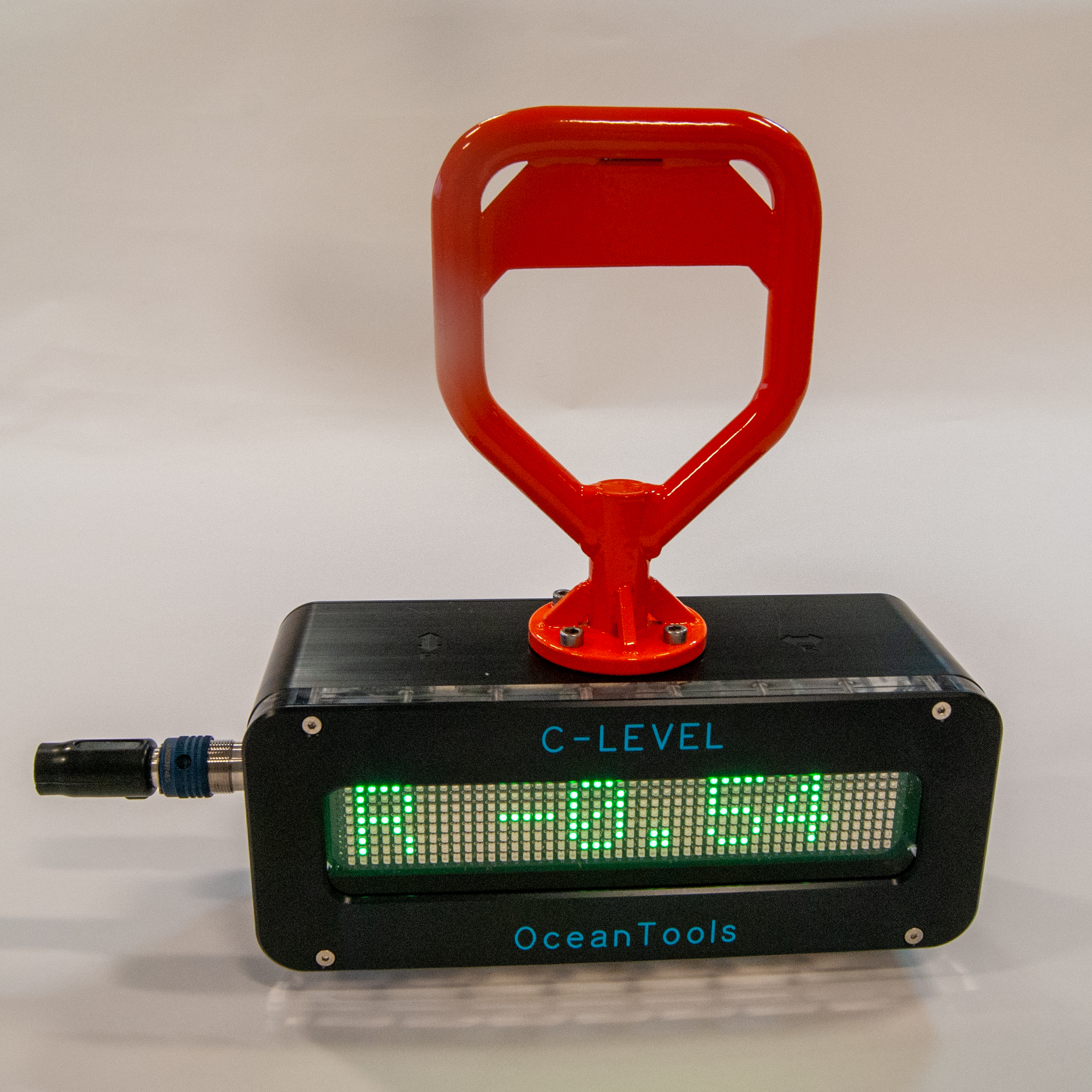
The C-Level is an ROV or diver deployed digital level that may be used to measure and display the inclination angle of underwater structures or mooring lines. An integrated inclination measurement and display unit, it combines the functionality of an OceanDISP subsea display and OceanTILT precision attitude sensor. The measured angle is shown in real time on a high visibility LED matrix display.
Building on the success of the DISTIL display and tilt sensor, it has a 300m depth rated acetal housing with anodized aluminium front plate and acrylic window. The unit has an integral 3.6Ah rechargeable battery pack, which is ample to power it for a full working day.
Custom handle options are available to aide deployment by ROV or diver. Mounting block guides can be fitted to the base to allow it to sit on a mooring chain or wire and measure the angle of the mooring, with a magnet base option also available.
Brian Hector (Technical Sales Manager) at OceanTools, said:
“We are delighted with the design of our C-Level as it utilises tried and tested technologies already used in other products. We have developed the product in response to customer requirements in a wide range of subsea engineering applications and we are confident that these can be fulfilled by the C-Level”
The C-Level can be deployed in any subsea engineering project requiring a high level of accuracy including construction, maintenance and decommissioning.
The C-Level Subsea Digital Display is the latest addition to the extensive range of pioneering underwater technology including our market leading DyeTection Systems and Subsea Cameras and Lights.
Partrac awarded 2 new EIA (Marine and coastal physical processes impact assessment) projects
Marine Environmental Impact Assessment (EIA) is a fundamental requirement of any proposed infrastructure development project in the marine sector. To ensure that a project can progress and obtain regulatory approval and consent, a fundamental understanding of the potential impacts of the development upon the physical aspects of the marine and coastal environment is a pre-requisite (physical processes impact assessment); this part also underpins many other aspects of a Marine EIA such as chapters on benthic habitats and marine contamination. The physical aspects includes due consideration of the impacts upon the wave climate and tidal regime, together with impacts on sedimentary processes and geomorphology. For the new generation of large scale floating offshore wind (FLOW) this assessment may also need to consider the impact upon water column processes and stratification; and scouring due to multiple anchorage arrays.
Over recent years Partrac’s consultancy division has completed numerous physical processes impact assessments in marine & coastal settings for Nationally Significant Infrastructure Projects (NSIPs), that include offshore wind, the nuclear sector, and a number of other proposed interconnector and coastal infrastructure developments. Our expertise in this technical area includes a full suite marine modelling (hydrodynamic, sediment transport and morphodynamic) capability and we maintain very good relationships with UK Regulatory authorities that have been developed over time. We pride ourselves on providing a consistently high quality service and navigate our clients through the consenting process from early scoping stage - to full EIA (including expert witness / representation at DCO hearings) - to discharging of consent conditions.
Partrac have recently been awarded two contracts for the provision of marine and coastal physical processes impact assessment, one in support of the Scotwind development and one in the Irish sector. We continue to successfully support major engineering and environmental consultancies, as part of their teams, to deliver our specialists inputs to scoping studies, comprehensive baseline chapters, impact assessments and ES summaries.
For further information on capabilities in this area contact Technical Director Kevin Black [email protected] 0798 400 6258.
Uncrewed vessel returns from first volcano caldera survey in Tonga loaded with ‘astounding’ data
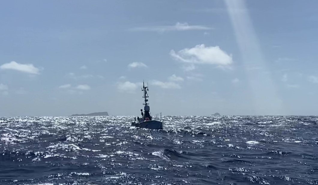
SEA-KIT International’s Uncrewed Surface Vessel (USV) Maxlimer has returned from an initial survey mission inside the caldera of the Hunga-Tonga Hunga-Ha'apai (HT–HH) volcano carrying a plethora of data and imagery to fill important gaps in current understanding and knowledge of the seamount and water above it.
For the ongoing second phase of the NIWA/Nippon Foundation Tonga Eruption Seabed Mapping Project – TESMaP, funded by The Nippon Foundation, USV Maxlimer is equipped with a Multibeam Echo Sounder (MBES) to acoustically measure depth and state of the seabed. Importantly, the vessel also has new winch capability for deployment of multiple sensors down to 300 metres to obtain direct water column measurements.
Data collected using a Conductivity Temp Depth (CTD) instrument, deployed using the winch, is providing important temperature and salinity information as well as dissolved oxygen and turbidity readings. A Miniature Autonomous Plume Recorder (MAPR), designed to detect chemicals in the water that are common in hydrothermal plumes, is recording light-backscattering for suspended particle concentrations, oxidation reduction potential, temperature and pressure from multiple winch dips and tows. The MAPR project is a joint initiative between NOAA in the USA and GNS Science in New Zealand.
On this survey mission, clear signs of continuing volcanic activity were seen inside the crater, with high particle concentrations in the water that are consistent with earlier observations of ash in the water column. The water in the caldera was also found to be homogenous between 150 and 300 metres depth, suggesting strong mixing inside the caldera. The previously observed oxygen minimum was not as distinct.
Sharon Walker, Oceanographer at NOAA’s Pacific Marine Environmental Laboratory said: “Early data shows ongoing activity within the caldera, though it is too early to tell if it is due to continuing eruption but at a reduced intensity, or hydrothermal venting driven by cooling lava, or both.”
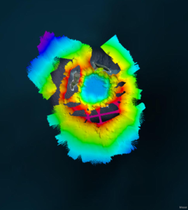
Maxlimer is returning to the caldera this week for a more detailed survey to fill gaps and better target volcanic plumes and hydrothermal vents with the CTD and MAPR.
Dr Mike Williams, Chief Scientist-Oceans at NIWA said: “The primary objective of phase 2 is to map the caldera and the hydrothermal vents within it and Maxlimer is crucial in achieving that. It is incredibly exciting to be able to look down into the caldera and see volcanic plumes. We now know that at its deepest point it is around 850 metres deep, so more than the height of two and a half Eiffel Towers. The data and imagery that Maxlimer has brought back is astounding and is helping us to see how the volcano has changed since the eruption.”
The 12-metre USV is being remotely controlled on its caldera missions from SEA-KIT’s base in Essex, United Kingdom, where a team of four operators work shifts for round-the-clock NIWA-Nippon Foundation Tonga Eruption Mapping Project operation. A global team of surveyors and scientists based in Australia, Egypt, Ireland, Mauritius, New Zealand, Poland and the USA are collaboratively monitoring and reviewing the data collected.
The UK’s Maritime Minister, Robert Courts, said: “I’m delighted that maritime technologies produced here in the UK are being used to understand the effects of the tragic Tonga volcanic eruption, all whilst being controlled remotely 16,000 kilometres away in the UK. This research will help protect the 680 million people living in coastal areas by providing a better prediction of similar natural disasters in the future and ensure that we are prepared if this does happen again.”
USV Maxlimer is also scheduled to map areas where telecommunications cables were damaged following HT–HH’s violent eruption in January 2022. During Phase 1 of the project, the crew of NIWA’s research vessel, RV Tangaroa, discovered that the severed domestic internet cable was buried under 30 metres of ash and sediment. Project and local stakeholders hope to gain a better understanding of the extent of the damage and how it was caused - likely due to fast-moving pyroclastic flows – from Phase 2. SEA-KIT’s USV may also be deployed to survey alternative sites suitable for replacement cables if needed before returning to the UK.
Ben Simpson, SEA-KIT CEO, said: “Maxlimer was the first SEA-KIT X-class USV to be built. There are now numerous X-class vessels working commercially around the world, but this project clearly demonstrates how crucial this technology is as a low-risk, non-invasive solution to reach, survey and understand places that are challenging or unsafe for people to access. Maxlimer experienced 3 metre seas on return from this first mission, which proves yet again how robust the design is. Demonstrating that this kind of work can be done using less than 2% of the fuel of a typical survey vessel is also a significant step on the industry’s path towards net zero emissions.”
Knowledge gained from the project will be invaluable to the Tongan authorities in preparing and planning for future possible eruptions.
The Nippon Foundation’s Executive Director Mitsuyuki Unno said: “Maxlimer’s technology has enabled our Nippon Foundation-GEBCO alumni to not only gain hands-on experience but also to come together as a team. We look forward to sharing the results of this voyage in the coming months and to exploring ways in which the findings can benefit the people of Tonga.”
Lucy Joyce, British High Commissioner to the Kingdom of Tonga, said: “I’m delighted to see SEA-KIT’s Maxlimer Uncrewed Surface Vessel working here in Tonga. The assessment of the Hunga-Tonga Hunga-Ha’apai caldera and the waters and seabed around it is of huge interest and importance to all of us here in Tonga who lived through the huge explosion and tsunami in January.”
Seabed data gathered by USV Maxlimer will also be contributed to The Nippon Foundation-GEBCO Seabed 2030 Project, a United Nations Ocean Decade endorsed programme, which aims to map the entire ocean floor by 2030.
Jamie McMichael-Phillips, Seabed 2030 Project Director, said: “The use of USVs is paramount to Seabed 2030’s mission of a complete map of the entire ocean floor. By surveying areas that may not be accessed by personnel for safety reasons, USVs, such as SEA-KIT’s Maxlimer, will greatly assist us in our ambitious goal.”
Findings from the TESMaP project will be presented at the American Geophysical Union (AGU) Fall Meeting in Chicago this December, a highly influential event dedicated to the advancement of Earth and space sciences.
South West England innovators collaborate to develop enhanced solutions for seagrass monitoring
A new, non-invasive method to measure and monitor seagrass biomass on the seabed around England’s South West coast is being developed as part of an ongoing, collaborative project.
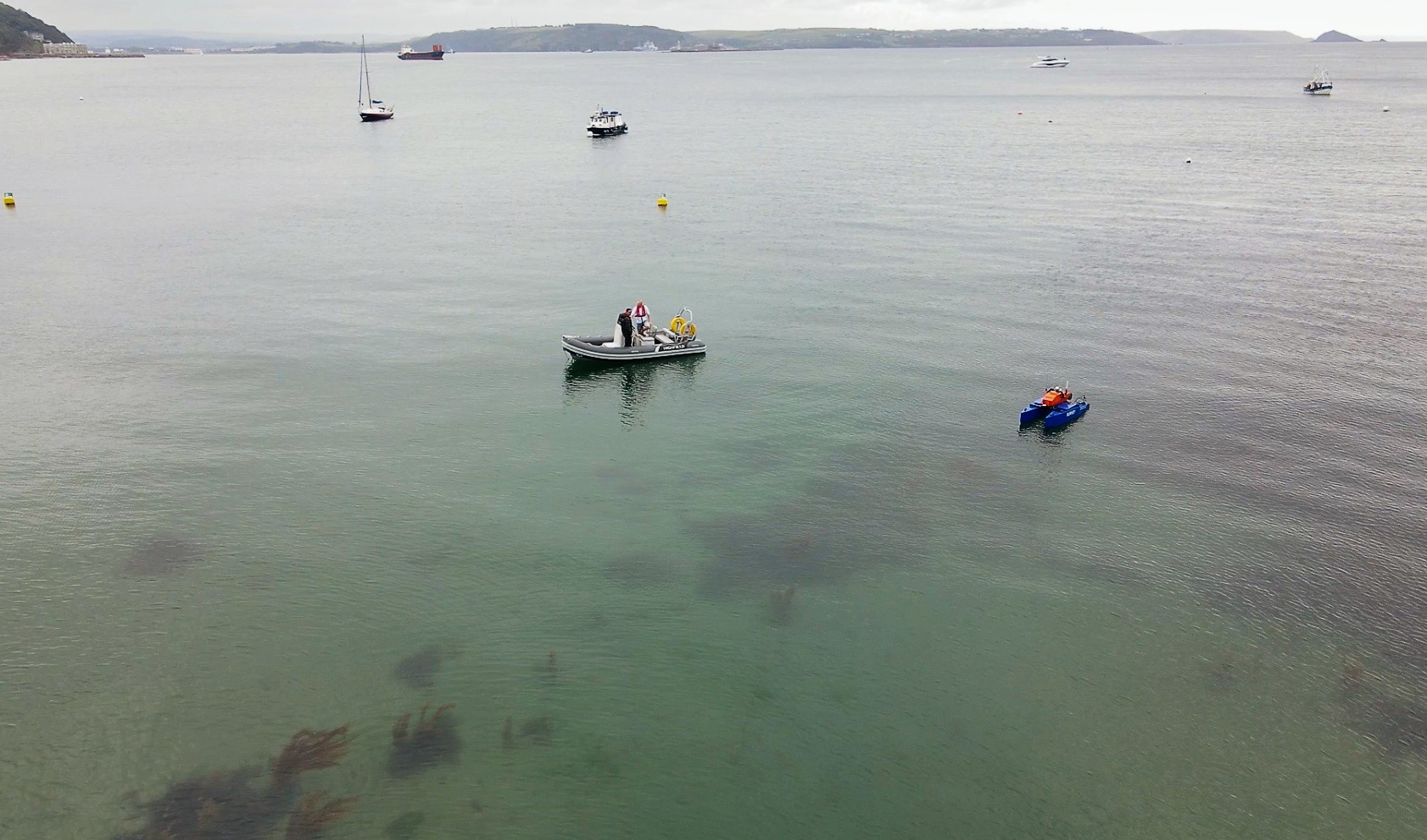
The innovative new technique is currently being trialled by local companies HydroSurv and Valeport, working with the University of Plymouth and Natural England, and supported by a grant of more than £266,000 from Innovate UK’s Smart Grants programme.
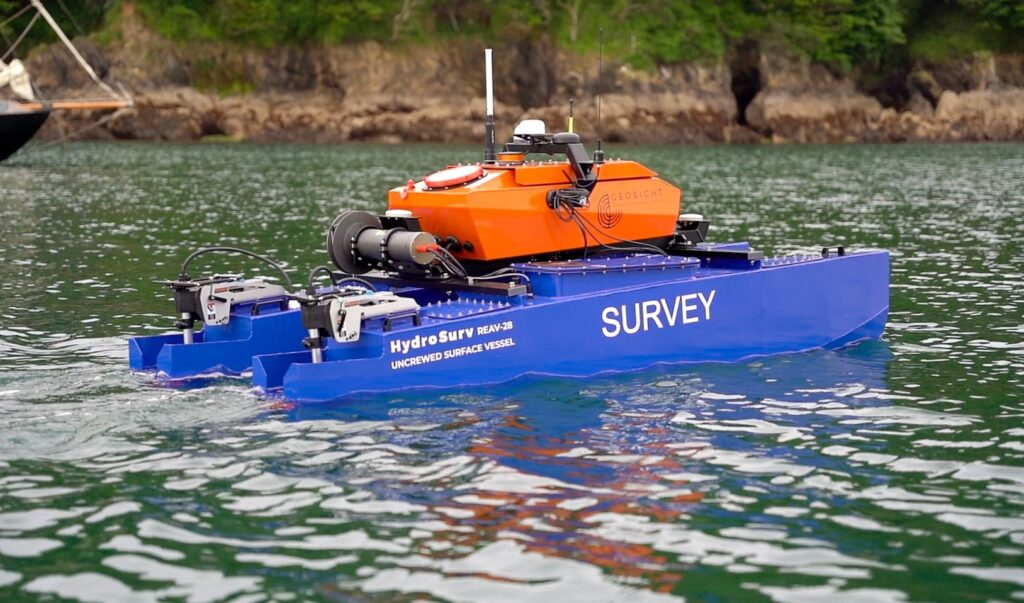
It builds on the concept of the acoustic reflectivity of seagrass providing valuable information to characterise submerged aquatic vegetation. A full-stack solution consisting of a Valeport VA500 altimeter installed onto a HydroSurv REAV-28 Uncrewed Surface Vessel (USV), specifically developed for this project, provides a non-invasive, cost-effective platform to survey seagrass sites. A large, validated signal library and deep learning algorithm, developed by the University of Plymouth, deciphers the survey data to predict seagrass distribution. The data is visualised and interpreted within a cloud application created by HydroSurv.
The USV platform facilitates accurate repeat surveys that can be compared to monitor temporal changes in seagrass coverage for the planning of protection and regeneration projects at biodiversity-rich worksites. The full solution, which was demonstrated successfully to project stakeholders for the first time in May this year, is set to change the way seagrass meadows are monitored in the future, complementing traditional diver surveys to cover much larger areas and enable rapid re-survey work as required.
Fiona Crouch, Natural England ReMEDIES Project Manager said: “To effectively conserve and restore seagrass meadows we need innovative solutions to enable cost effective, repeatable surveys of established meadows, plus areas being restored through projects such as ReMEDIES, to monitor change. I’m really excited to see where this new technology will take us in supporting our seagrass conservation efforts.”
HydroSurv, Valeport and the University of Plymouth form part of a fast-emerging South West England maritime innovation cluster. The project partners are engaging with the Environment Agency and Natural England to develop the solution further, with a second phase of demonstrations planned for September.
David Hull, Founder and CEO of HydroSurv said: “Staying true to our values of ocean and environmental stewardship, the work being carried out within this collaborative project will directly translate into impact addressing UN Sustainable Development Goal 14, ‘Life below water’. The ability to provide blended, non-invasive solutions that rapidly acquire, process and visualise the coverage and density of seagrass meadows is central to improving our understanding of these vital ecosystems and delivering regular and repeatable resurveys in-stride with the needs of coastal practitioners.”
The VA500 altimeter, which uses state of the art signal processing, was customised by the instrument manufacturer for this project.
Jim Gardiner, Research Scientist at Valeport said: “The VA500 altimeter was developed to deliver reliable underwater range measurements in a compact, robust package. Working with University of Plymouth and HydroSurv, custom firmware was developed to deliver low noise, high quality, correlated acoustic profiles at up to 10Hz to enable deeper analysis, exploration, mapping and classification of the acoustic information gathered by the VA500.”
Dr Tim Scott, Associate Professor of Ocean Exploration at the University of Plymouth, said: “As part of the project, the application of deep learning algorithms for the acoustic detection and characterisation of seagrass beds has introduced improved accuracy and efficiency over more traditional techniques. When combined with the advantages of lightweight autonomous survey platforms, this new combined survey solution introduces a step-change in accurate and repeatable seagrass mapping.”
Seagrass meadows are a crucial part of the marine ecosystem and are increasingly being recognised for their essential carbon capture abilities. As well as being as effective at storing carbon as woodland, seagrass also provides vital habitat for young fish, seahorses and jellyfish. It additionally cleans surrounding seawater and helps to stabilise the seabed, thereby reducing coastal erosion.
The UK has lost around half of its seagrass since the mid-1930s due to factors ranging from seagrass wasting disease (SWD) and pollution to physical disturbance from the anchoring, launching and mooring of leisure boats. The £2.5 million LIFE Recreation ReMEDIES partnership ‘Save Our Seabed’, led by Natural England and funded by the EU LIFE Programme, was launched in July 2019 to protect and restore these sensitive habitats.
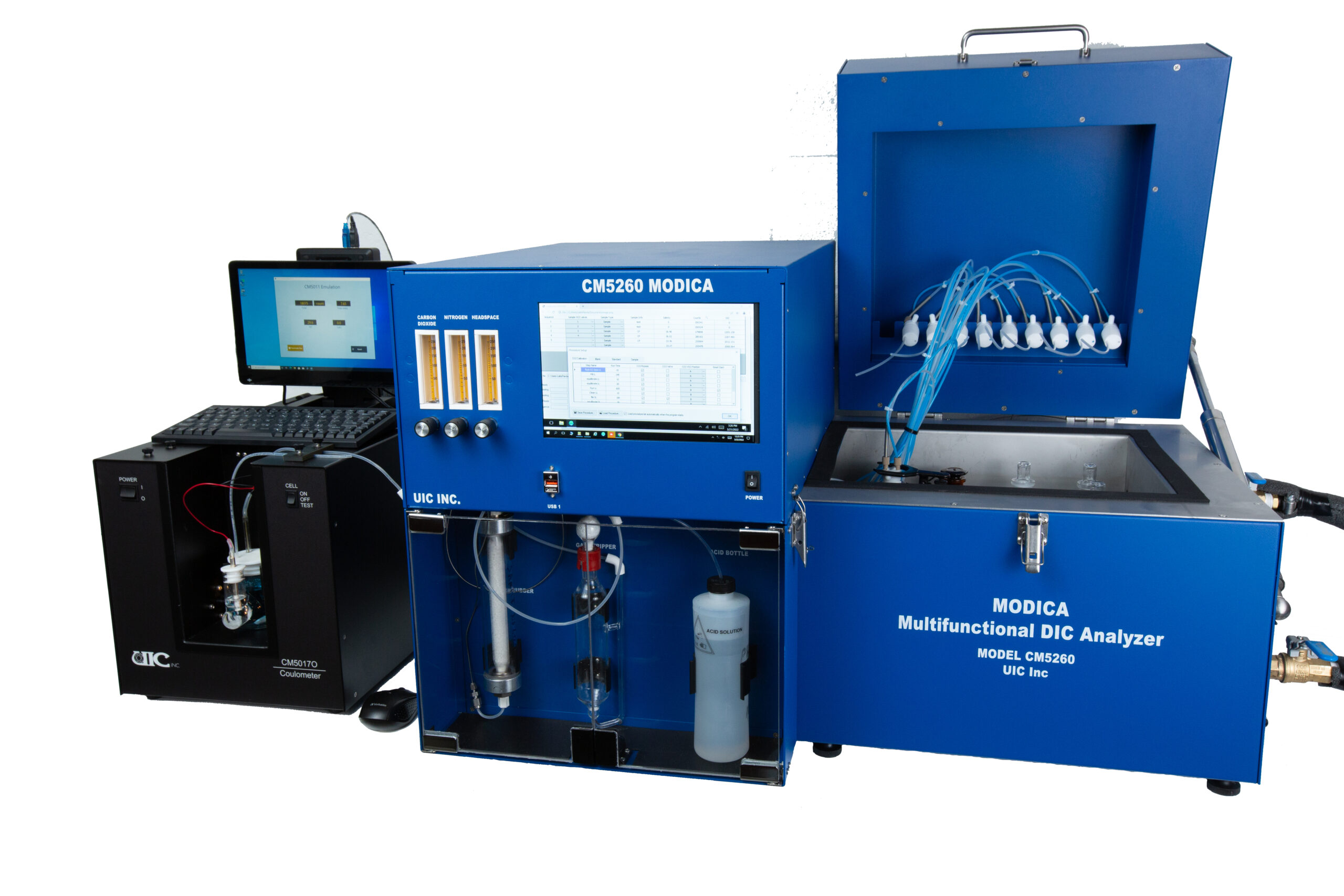
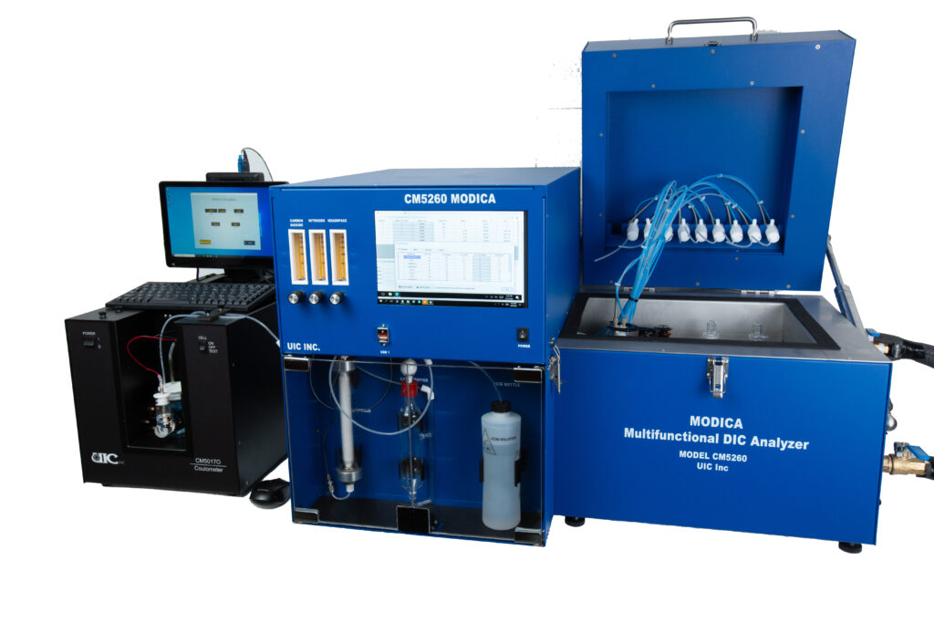
UIC Inc. introduces new automated Analyzer for Dissolved Inorganic Carbon (DIC) in seawater
The MODICA (Multifunctional Dissolved Inorganic Carbon Analyzer) is UIC’s newest addition in the line of reliable and precise instruments for carbon measurements in water samples. MODICA is combined with their CM5017O coulometer to provide highly accurate, absolute determination of dissolved inorganic carbon (DIC). MODICA retains all SOMMA's main design characteristics, such as headspace sample introduction and pure CO2 calibration with enhanced capabilities.
Different from SOMMA, MODICA is a multi-sample, multi-detector and multi-parameter capable instrument. MODICA can automatically process up to ten samples using predefined routines that include blank, CO2 calibration, CRM and samples in single batch run. MODICA has a built in computer and salinity sensor.
The powerful and reliable software enables users to set and go, making DIC measurements easy and fun. As an option, MODICA-pH is a dual-parameter instrument that measure both DIC and pH. The pH channel is based on spectrophotometric pH measurement using purified mCP dye. For those who have a Picarro CRD instrument, MODICA could link to a Picarro instrument so both DIC and C13 data can be obtained in single run with high precision.
Please see here a detailed PowerPoint of MODICA's capabilities. If you would like more information, please reach out to the sales department at [email protected]
A New Standard In Acoustic Flooded Member Detection
Impact Subsea has released a new generation of underwater, Flooded Member Detection system: ISFMD V3.
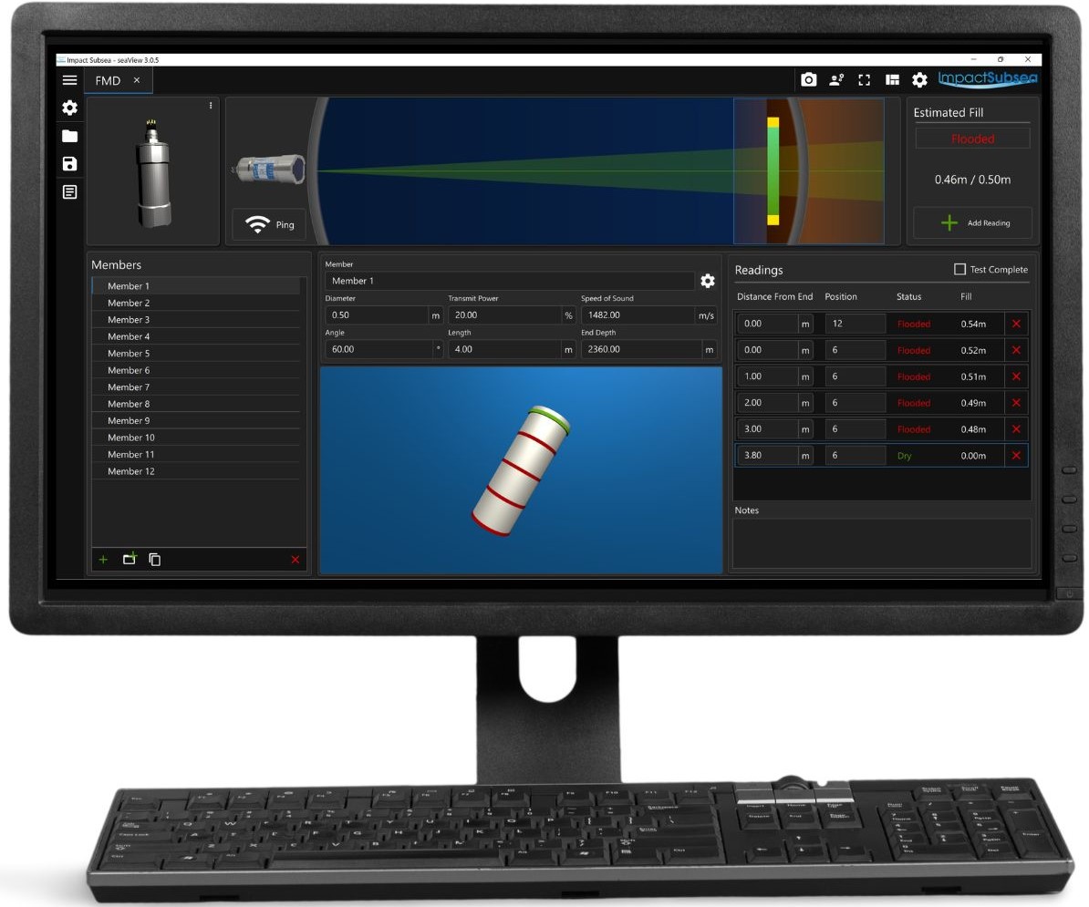
ISFMD V3 provides a highly intuitive yet simple to use flooded member detection system for deployment by divers or remotely operated vehicles.
The system provides capability to test and store results for multiple members at a time. Multiple members can be preconfigured prior to commencing the survey with details of diameter, length and angle. Multiple readings can be logged per member, including at different test positions around the member.
Members are automatically classified as flooded, part flooded or dry, using an advanced digital correlation detection technique. This technique allows acoustic returns to be detected even if the return is below the ambient noise level. This approach to detecting an acoustic return ensures exceptionally high accuracy and reliability in readings.
Commenting on the launch, Ben Grant, Managing Director, Impact Subsea stated: “Having worked closely with users of our original ISFMD system, V3 has been created to provide the ultimate, acoustic based Flooded Member Detection system. The user interface provides a high level of feedback in terms of probe position, acoustic readings and organisation of the complete FMD survey”.
The ISFMD V3 system operates by transmitting an acoustic pulse into an underwater member. If there is a liquid inside the member the pulse will transfer through the member, bouncing off the opposite member wall and back to the probe. If however the member is full of air the signal is attenuated and will not bounce back to the probe.
The use of acoustics to determine the presence of a liquid inside the member is a safer and logistically more simple solution than alternative gamma radiation based Flooded Member Detection systems. Moving away from the traditional analogue detection methods, used in some alternative acoustic based Flooded Member Detection systems, provides a step change in the system performance and reliability.
Users of the original Impact Subsea ISFMD system will benefit from a free upgrade to V3 as part of the company’s commitment to lifelong support of its products.
Full details of the ISFMD V3 system can be found here. A video overview of the new system software can be viewed here.
UK Met Office selects Sonardyne acoustic releases for mooring weather buoys
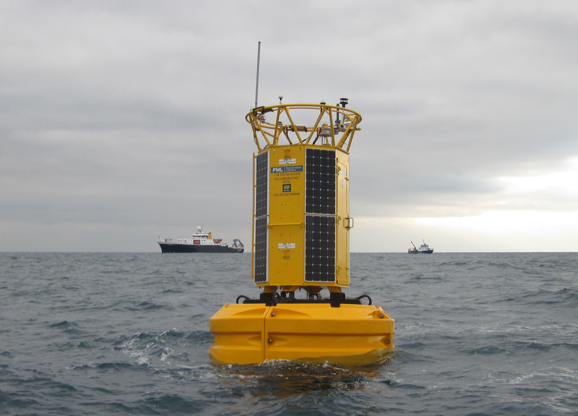
Acoustic release transponders from ocean science technology company Sonardyne have been chosen by the UK’s Met Office to secure its network of moored buoy Marine Automatic Weather Stations (MAWS) in the North Sea and Atlantic Ocean.
Under a call-off agreement, Sonardyne’s RT 6s and deck topside command units will be used to support deployment and retrieval of the MAWS buoys from their locations as far north as the Faroe-Shetland Channel and down to the southwestern approaches and the English Channel in the south.
The Met Office’s MAWS buoys are a key part of its Marine Observing Network, which gathers essential observations, including wind speed, air and water temperature, and wave height and period.
They contribute to an international network of World Meteorological Organisation (WMO) and the International Maritime Organisation (IMO) coordinated marine observations, which provide critical data for weather forecasting, atmospheric modelling and work on climate science, by the Met Office and other organisations.
Because many of the buoys are moored in more harsh North Atlantic waters, they have to be designed to withstand extreme conditions, including significant wave heights recorded at above 18 m. They also have to be serviced every two years, so the Met Office needs a safe and reliable mechanism to allow for easy release from and then redeployment to their seabed moorings.
Sonardyne’s RT 6 family of release transponders, operate using a secure acoustic signal from the sea surface, to activate a release mechanism connected to a seabed anchor. Moored instrument strings and oceanographic buoys can then be retrieved onboard a vessel for servicing or redeployment.
To support the MAWS deployments, each buoy will be fitted with two releases installed in a load amplification frame, providing a working load limit (WLL) of 15 tonnes. This configuration provides both equipment redundancy and the WLL needed to withstand harsh ocean conditions. Operators will command and control their RT 6s using Sonardyne’s newly developed Deck Topside. Rugged and portable, Deck Topside features a high brightness screen, inbuilt GPS receiver for recording deployment locations and a battery life of eight hours. A cabled, over-the-side dunker provides the secure acoustic communication link between the surface and RT 6s.
The Met Office expects the first deployment using their new Sonardyne equipment to be on the ‘K7’ buoy, which will be reinstalled about 150 km west of the Shetland Islands in 700 m water depth by the Northern Lighthouse Board’s lighthouse tender NLV Pharos.
Mark Hemnell, Marine Engineering Manager at the Met Office says, "The Met Office open ocean buoy network is often where forecast weather systems meet our measurement systems. Data from the buoys are used along with observations from many other sources to initiate model runs from which the UK's weather forecasts are derived. Met Office buoy moorings are designed to withstand the worst that the Atlantic can throw at them for deployments of four to six years. They take advantage of the properties of synthetic materials to do this, and it is our intention to remove all these materials from the ocean at the end of a deployment. Tandem release assemblies will ensure that this can be done reliable and safely, reducing our impact on the marine environment."
“Deployed far from shore in deep water, at significant operational cost, and exposed to some of the severest weather that the North Atlantic can generate, it’s vital that the Met Office’s buoys are moored securely for years at a time. Consequently, the selection of our RT 6 acoustic releases is a significant vote of confidence our technology,” adds Geraint West, Head of Science at Sonardyne.
“Acoustic release transponders have featured in Sonardyne’s product portfolio throughout our 50 years, so we’re delighted that, in our 50th year as a company, the UK’s national weather service has invested in UK technology, manufacturing and through-life support to help deliver their vital services.”
iXblue and ECA Group demonstrate successful subsea asset tracking to Polish Naval Academy
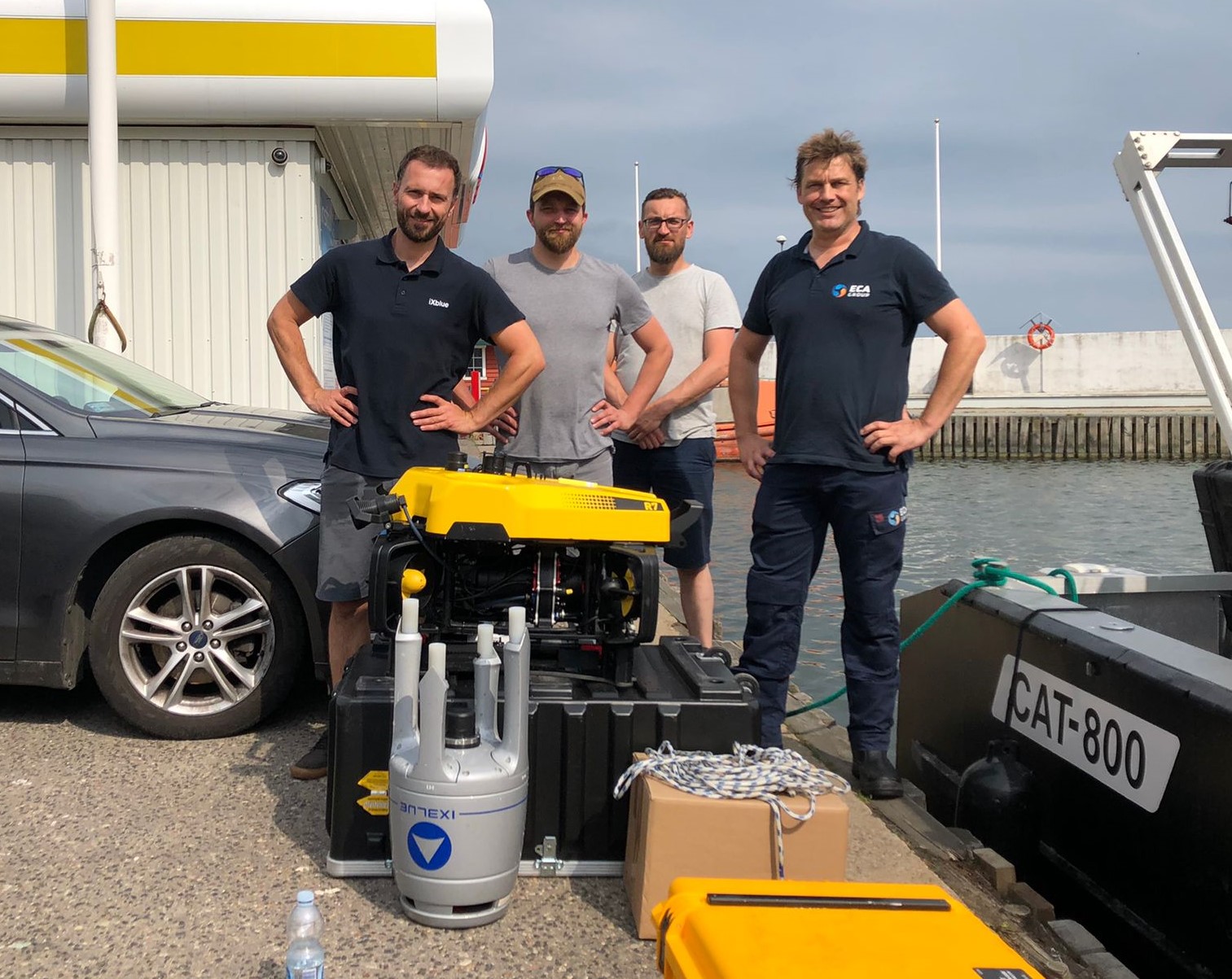
iXblue and ECA Group recently demonstrated successful subsea asset tracking in shallow waters using iXblue Gaps M7 USBL (Ultra Short BaseLine) positioning system and ECA Group new R7 ROV (Remotely Operated Vehicle).
Hosted by their local partner THESTA, a Polish company providing maritime navigation services and communication systems for the defense sector, the demonstration was organized for the Polish Naval Academy and NAVSUP 2022 attendees with the aim of showing that accurate positioning of underwater targets is possible in a potentially hostile and fast-approaching environment, in coastal regions characterized by shallow waters and often limited access.
As part of the mission scenario, ECA Group’s R7 ROV investigated objects and structures submerged in the shallow waters of the Baltic Sea in Gdynia harbor. iXblue Gaps M7 USBL acoustic positioning system was deployed to geolocate the R7 ROV and correct its trajectory in real time. A fixed transponder was also placed several hundreds of meters away from the vessel, at only 5 meters deep. The trials were carried out in water depths of 7 to 10 meters, surrounded by many docks and vessels causing significant acoustic echoes.
Despite challenging acoustic conditions, the positioning of the ROV and the transponder was stable and accurate. Extremely efficient in shallow waters, Gaps M7 ensured excellent horizontal tracking capabilities with omnidirectional coverage and 200° acoustic aperture. With no calibration required, it was easy to deploy and ready to use, saving precious operational time on the field.
The ROV inspection was successful despite the low visibility. Such environments make the use of traditional cameras impossible, but the HD acoustic inspection camera performed remarkably, providing high-resolution data with superior localization accuracy. The R7 combines the compactness and maneuverability of mini-ROVs with the performance and power of professional observation-class ROVs. It embeds a wide range of fast-equipped payloads and operates well under harsh sea conditions, making it the perfect ally of Navies for quick and efficient subsea interventions.
“The R7 ROV along with the Gaps M7 USBL acoustic positioning system is able to transmit information accurately, even in noisy and difficult acoustic environments. They both enable fast operation as well as regular and quick position updates, even in very shallow waters, which is a definite asset for the navies, given their need for a fast, clear and concise picture of the battlespace to quickly maneuver naval forces in the field.” says Cezary Majchrowicz, Technical Director at THESTA.
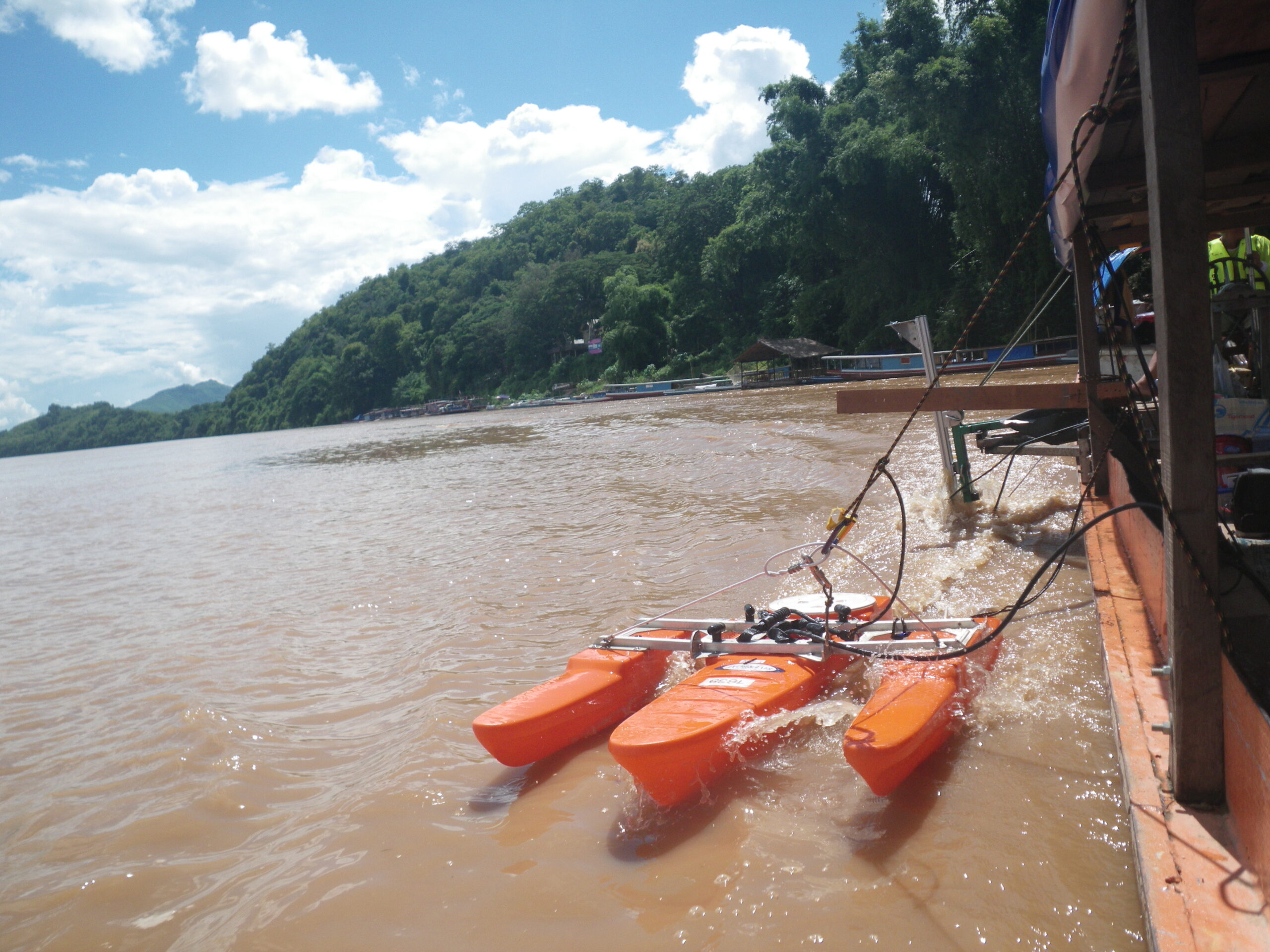
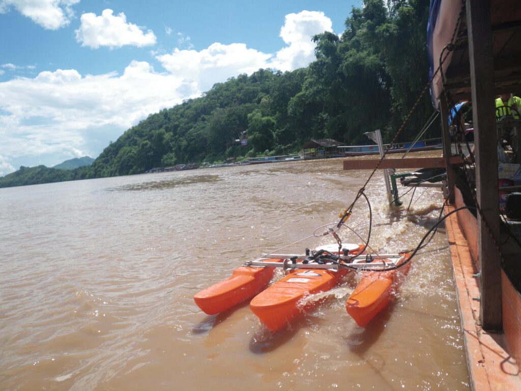
Teledyne RD Instruments Announces Expanded Sales Network in China
Teledyne RD Instruments (TRDI) has announced a restructure of their distribution network in China to improve service for local customers.
TRDI has expanded their existing relationship with Xiamen Lawlink Development Co., Ltd., located in Xiamen, China. Xiamen Lawlink will now distribute TRDI’s full line of ADCPs for water resources applications. To maximize their reach, they will continue to work with five existing regional representatives: Guangzhou Hestoon Electronic Technology Co., Ltd., Yellow River Hydro Science Co., Ltd., Jiangsu NAIWCH Co., Ltd., Nanjing Hengshui Technology Co., Ltd., and Wuhan Long Ya Technologies Co., Ltd.
TRDI has appointed Anda Strong as a new distributor for their Marine Measurement ADCP product line. Anda Strong, located in Beijing China is a long established distributor for TRDI’s sister company, Teledyne RESON, and has over 10 years of experience with the sales and service of coastal, deep water and vessel mounted ADCPs.
The TRDI office in Shanghai will continue to support and work closely with Xiamen Lawlink, Anda Strong and the regional distributors to maintain and grow the market in both the Water Resource and Marine Measurement markets in China.
Stephen Apsey, Teledyne RDI’s General Manager, adds “We are pleased to be represented by such professional local organizations, and believe our local customers are in very good hands. We look forward to continuing to strengthen our position and support for customers in this region.”