

Blue Ocean Seismic Services Makes Senior Appointments to Support Scale Up
Blue Ocean Seismic Services, the marine seismic survey disruptor, is delighted to announce two new senior appointments and the opening of a new office in London. Graham Philip has been appointed to the Blue Ocean Seismic Services board of directors as Non-Executive Chairman and Abdul Khan, FCCA, as Chief Financial Officer.
Both appointments bring significant expertise and experience to the Blue Ocean Seismic Services senior leadership team as the company advances into the operations phase of its development. In line with this strategy, Blue Ocean Seismic Services will be conducting multiple further sea trials during 2022 in various part of the world and then pre-commercial sea trials in 2023. Having achieved a 100% increase in the number of employees from 16 to 31 during 2021, the company also plans to continue growing its staffing levels in various parts of the business over the next 12 months and has opened a new office in the City of London.
Graham Philip is a highly experienced Non-Executive Chairman and company Director with a long track record of working with management teams to scale-up growth companies and build shareholder value in SME’s. During his extensive career, Graham has been CEO and Director of numerous international multi-location industrial / business service companies and has a particular specialism in the oil and gas services, offshore wind farm services and marine services. Amongst his recent experience Mr. Philip’s was CEO and then Non-Executive Director of Ashtead Technology, as well as a Non-Executive Director at North Star Shipping Ltd, White Light Ltd, Aubin Ltd, Oscar Propulsion Ltd to name a few. Mr. Philip started his long career as a chartered accountant at KPMG and attended Aberdeen University.
Abdul Khan (FCCA) has a wealth of experience as a Chief Financial Officer for international businesses in marine, oil and gas services, geophysical services and manufacturing across multiple geographies including UK, Europe, Middle East, and the USA. With expertise in Finance, Human Resources, IT and Supply Chain management, Mr. Khan has served as Chief financial officer for international marine related businesses including Kasamar Holdings, Gulf Marine Services PLC and Lamnalco Group. Mr. Khan is a Charted Accountant and Fellow of the Association of Chartered Certified Accountants.
Simon Illingworth, Managing Director & Chief Executive Officer, Blue Ocean Seismic Services said:
“Following a rigorous search and selection process, we are delighted to welcome both Graham and Abdul to the senior team at Blue Ocean Seismic Services. Both have decades of hands-on, senior level experience which will be critical for us as we transition from a technology company to an operating company. Their expertise will be immensely valuable as we plan our scale up to manufacturing, develop relationships with key stakeholders and suppliers and grow our geographical footprint particularly in the North Sea and the Gulf of Mexico. We have an exciting year ahead with a range of sea-trials planned to support the development of carbon capture storage and other sub-surface projects and I have no doubt that Graham and Abdul will make important contributions as we move forward to the next phase of our growth.”
Graham Philip, Non-Executive Chairman, Blue Ocean Seismic Services commented: “I am very excited to be working with the team at Blue Ocean Seismic Services as it scales up to an operations company. Its highly innovative and disruptive technology has already established itself as a well-respected leader in the market and I look forward to helping ensure its long-term success.”
Backed by industry leaders bp Ventures, Woodside Energy and Blue Ocean Monitoring, Blue Ocean Seismic Services’ underwater vehicles are innovating the offshore seismic sector to become cheaper, faster, safer, and much less carbon intensive.
Blue Ocean Seismic Services recently, successfully completed a series of passive and active sea trials in the North Sea using a DP2 class Multi Role Vessel. The success of these trials marks a significant milestone towards validating the efficacy of Blue Ocean Seismic Services’ revolutionary technology for identifying and optimising offshore renewable, carbon capture storage and oil and gas reservoirs located under the seabed.


Subsea Europe Service GmbH appointed as new GeoAcoustics Ltd partner
GeoAcoustics Ltd is pleased to report the recent signing of a partnership agreement with hydroacoustic technology specialist Subsea Europe Services GmbH, who will add the GeoPulse Sub Bottom Profiler technology to its subsea sales & rental portfolios. The agreement with the Hamburg, Germany-based marine survey sensors, services and solutions provider builds on the extensive worldwide partner network GeoAcoustics Ltd has established since becoming an independent company.
GeoAcoustics Ltd now has approved representation in 70 countries from China and Singapore to the USA and Scandinavia.
“With experience and access to the North Sea coastal zone and offshore sectors, as well as reach into European inland waterways, we expect our partnership with Subsea Europe Services to meet existing demand while opening up new areas and applications for our products,” said Richard Dowdeswell, General Manager, GeoAcoustics Ltd.
“The GeoAcoustics name is synonymous with reliability and effectiveness in the shallow water market, and we are pleased to bring the quality and functionality it represents into our portfolio for sales and rental customers,” said Sören Themann, CEO, Subsea Europe Services GmbH.
Find out more about Subsea Europe Services GmbH at https://www.subsea-europe.com and locate your nearest GeoAcoustics partner at https://geoacoustics.com/channel-partners.
Tropical seafloor secrets discovered as mission to map world's entire seabed gains momentum
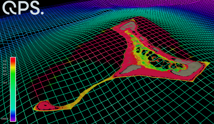
Satellite technology has been used to chart shallow areas of the Cook Islands’ seafloor in never-before-seen detail by scientists at the National Institute of Water and Atmospheric Research (NIWA) and Toitū Te Whenua Land Information New Zealand (LINZ) working with the satellite data analytics company, EOMAP GmbH. The work was carried out as part of The Nippon Foundation-GEBCO Seabed 2030 Project – a collaborative project aiming to bring together all available bathymetric data to produce the definitive map of the world ocean floor.
The discovery coincides with the One Ocean Summit, held in France, which saw UNESCO call on the international community to strengthen efforts in pursuit of mapping the remainder of the ocean floor – 20.6 per cent has been mapped to date.
The chart of Suwarrow and Pukapuka in the Cook Islands builds upon decades-old surveys, with more accurate positioning and wider coverage, including information on harder to reach areas such as shallow lagoons.
Kevin Mackay, a Researcher of Marine Geology at NIWA, also heads Seabed 2030’s South and West Pacific Ocean Data Centre – one of the project’s four Regional Centres, each responsible for data gathering and mapping in their territory.
Commenting on the use of satellites as a tool for measuring the shallow parts of the ocean floor, Kevin says “To measure the depth of the ocean, you would traditionally have to send out a boat with an echosounder, which costs a lot of money and can be dangerous in rough and shallow seas.
“With satellites, we can access extremely remote locations, with less carbon footprint, and without having to endanger people.”
The images are taken from two commercially owned satellites, World-View-2 and GeoEye-1, which provide extremely high-resolution pictures of the earth’s surface. As a result, data accuracy is greatly improved. Satellite derived bathymetry can be used to a maximum water depth of 30m.
Stuart Caie, Manager Hydrographic Survey from LINZ, said: “The technology and processes are very clever – the satellite can see the shallow sea floor in exquisite detail, but to derive the water depth the software needs to get rid of obstructions such as shadows and waves.
“The software therefore strips away the water and uses complex algorithms to produce depth estimations before creating a map with colourings of what the seafloor would look like without any water, which we then use.”
Seabed 2030 – which is formally endorsed as a flagship programme of the Ocean Decade – is a collaborative project between The Nippon Foundation and the General Bathymetric Chart of the Oceans (GEBCO) to inspire the complete mapping of the world's ocean and compile all bathymetric data into the freely available GEBCO Ocean Map. GEBCO is a joint programme of the International Hydrographic Organization (IHO) and the Intergovernmental Oceanographic Commission (IOC).
The South and West Pacific Ocean Regional Centre is made up of NIWA, GNS Science and LINZ, who are working together to map over 123 million km2 of ocean.
The nautical chart will be published in February and is hoped to improve ocean safety and scientific knowledge.
Fugro joins UN Ocean Decade Alliance to advance global marine science agenda
Fugro has accepted an invitation from the Intergovernmental Oceanographic Commission of the United Nations Educational, Scientific and Cultural Organisation (IOC-UNESCO) to join the Ocean Decade Alliance (the ‘Alliance’). Comprising an eminent network of global leaders and institutions, the Alliance aims to catalyse support for the United Nations Decade of Ocean Science for Sustainable Development 2021 2030 (the ‘Ocean Decade’) through targeted resource mobilization, networking and influence.
IOC-UNESCO Executive Secretary Dr. Vladimir Ryabinin extended the invitation to Fugro CEO Mark Heine based on the company’s demonstrated and sustained commitment to the vision of the Ocean Decade. Fugro’s recent partnership agreement with IOC UNESCO to transform the coordination of and access to global ocean science data, including privately-held Geo data assets, exemplifies this commitment. The agreement includes significant in-kind support from Fugro via loan of experts to the IOC-Secretariat in Paris for establishing and administering two key ocean science working groups.
As a member of the Alliance, Fugro will collaborate and coordinate with other Alliance members in leveraging existing commitments to raise awareness about Ocean Decade objectives and activities worldwide; create a platform for demonstrating the role and power of science in providing solutions for ocean sustainability; and establish a broad international network that stimulates additional actions and commitments in the framework of the Ocean Decade across all levels of society.
Fugro CEO Mark Heine stated:
“We are proud to support the Ocean Decade and honoured to be part of the Ocean Decade Alliance. It is critical that the private-sector help lead this global initiative, as we collectively have much to offer and much to gain from a sustainable and equitable ocean economy. I can personally attest that Fugro is up for the leadership challenge and will deliver on the trust that has been instilled in us.”
For more information please contact Edward Legierse [email protected].
About Fugro
Fugro is the world’s leading Geo-data specialist, collecting and analysing comprehensive information about the Earth and the structures built upon it. Adopting an integrated approach that incorporates acquisition and analysis of Geo-data and related advice, Fugro provides solutions. With expertise in site characterisation and asset integrity, clients are supported in the safe, sustainable and efficient design, construction and operation of their assets throughout the full life cycle.
Employing approximately 9000 talented people in 61 countries, Fugro serves clients around the globe, predominantly in the energy and infrastructure industries, both offshore and onshore. In 2020, revenue amounted to EUR 1.4 billion. Fugro is listed on Euronext Amsterdam.
About the Intergovernmental Oceanographic Commission of UNESCO
The Intergovernmental Oceanographic Commission of UNESCO (IOC-UNESCO) promotes international cooperation in marine sciences to improve management of the ocean, coasts and marine resources. The IOC enables its 150 Member States to work together by coordinating programmes in capacity development, ocean observations and services, ocean science and tsunami warning. The work of the IOC contributes to the mission of UNESCO to promote the advancement of science and its applications to develop knowledge and capacity, key to economic and social progress, the basis of peace and sustainable development.
Find more here > http://ioc.unesco.org
About the Ocean Decade
Proclaimed in 2017 by the United Nations General Assembly, the UN Decade of Ocean Science for Sustainable Development (2021-2030) (‘the Ocean Decade’) seeks to stimulate ocean science and knowledge generation to reverse the decline of the state of the ocean system and catalyse new opportunities for sustainable development of this massive marine ecosystem. The vision of the Ocean Decade is ‘the science we need for the ocean we want’. The Ocean Decade provides a convening framework for scientists and stakeholders from diverse sectors to develop the scientific knowledge and the partnerships needed to accelerate and harness advances in ocean science to achieve a better understanding of the ocean system, and deliver science-based solutions to achieve the 2030 Agenda. The UN General Assembly mandated UNESCO's Intergovernmental Oceanographic Commission (IOC) to coordinate the preparations and implementation of the Decade.
Find more here > http://oceandecade.org

Sonardyne launch wireless seabed unexploded ordnance disposal capability
Marine technology company, Sonardyne, is aiming to improve the safety and efficiency of unexploded ordnance (UXO) clearance during offshore energy projects with the introduction of a secure, wireless underwater initiation capability.
The company’s new Initiation Transponder 6 (IT 6) is designed to be connected directly to a remotely deployed, non-electric mine neutralisation device, such as a Viper MDS from ECS Special Projects. This allows explosive ordnance disposal (EOD) teams to send a wireless, acoustic command from their vessel, safely initiating a shock tube detonator. Recent demonstrations were conducted over distances in excess of 1,000 m away.
IT 6 is based on Sonardyne’s field-proven Wideband 2 digital signal technology, which offers a reliable and long-range underwater wireless communications link. The development of IT 6 means that technicians no longer need to wire UXO neutralisers up to signal relay buoys on the surface and are not restricted to good weather and daylight for setting up an initiation operation.
IT 6 is small, lightweight and designed to be placed by an ROV or diver for both high order detonation and low order deflagration. It features multiple layers of security to prevent unintended activation, including a hydrostatic switch, which only allows the unit to be armed when a pre-determined depth has been reached.
Operations using IT 6s are controlled using Sonardyne’s new rugged Deck Topside case and cabled dunker. Environmentally rated to IP67, the case features a daylight readable interactive 7-inch resistive touch screen and rechargeable battery, for when operating on small boats with no external power.
The user interface was designed in close co-operation with EOD technicians and enables operating parameters to be set and multiple IT 6s to be configured prior to deployment. During a live operation, two physical buttons provide an additional layer of security, requiring users to hold one button to arm, then simultaneously press the other to initiate.
The dunker, which is supplied with 10 m of cable, provides a secure two-way communications link between the surface and IT 6, and is simply lowered over the side of a vessel.
John Houlder, Product Manager at Sonardyne said; “European waters are littered with unexploded ordnance (UXO), the result of past military conflicts, training exercises, weapons development and dumping activities at sea. During the construction phases of wind farms, for example, the risk to personnel, assets and project timescales are significant.”
“When disposal rather than avoidance is deemed necessary for turbine or cable route placement, our new IT 6 and topside will help those involved with the hazardous task operate entirely wirelessly and in any weather, day or night. Underwater acoustic command and control is a core Sonardyne capability, so IT 6 can be considered as reliable and as secure as traditional methods involving shock tubes and a lot safer than electrical detonation lines.”
Image Captions:
Sonardyne_IT 6: IT 6 is used with Sonardyne’s new IP67-rated, touch-screen Deck Topside case and cabled dunker, which can be used without any need for an external power source. Photo from Sonardyne.
Sonardyne_IT 6_illustration: With IT 6, mine clearances operations can be performed wirelessly and remotely, making site preparation work safer and more efficient. Artist’s illustration.
Custom Umbilical for powerful ROV
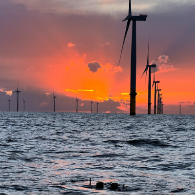
When a powerful Remotely operated vehicle ROV has to face tough offshore conditions, it has to be connected with the proper reliable umbilical cable. This is why Copenhagen Subsea addressed Novacavi for its Gorilla ROV new cable solution and Novacavi developed a custom neutrally buoyant fiber optic data umbilical cable for fast and noise immune transfer of data. The perfect mix of materials, correct configuration and production capabilities sort out in an umbilical cable able to guarantee manoeuvrability and reliability while supporting ROV operations in harsh and demanding environments such as offshore wind farms where strong currents activity is the norm.
Specialist in custom cable design & manufacturing for advanced technology since 1975, NOVACAVI develops any cable solutions with engineering expertise, comprehensive knowledge of materials and a high degree of manufacturing.
You can meet Novacavi at OI 2022 London on stand N250 next 15-17 March.
For more details, please contact [email protected] or visit https://www.novacavi.it/custom-umbilical-for-powerful-rov/.
Seafloor Systems to Deliver EchoBoat-240 USV to Newcrest Mining
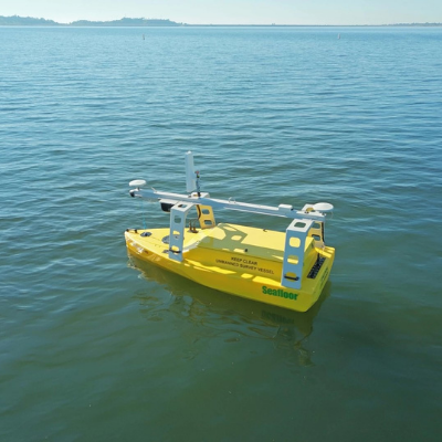
The Seafloor EchoBoat-240 is a 2.5m / 8ft remote vessel that excels in mapping confined or shallow waters where traditional multibeam survey methods are not suitable.
In a sale facilitated through Ultimate Positioning Group, one of our esteemed worldwide dealers in Australia, client Newcrest Mining has purchased an EchoBoat-240 USV for hydrographic survey missions in Papua New Guinea.
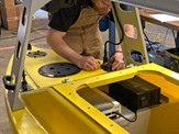
The Unmanned Surface Vessel, utilizing an integrated Teledyne SeaBat T50-ER multibeam sonar system, will remotely collect vital depth data in waters ranging from 5m-700m deep. The data results will be used to guide the planning and managing of waste disposal to support Newcrest Mining's operations.
Taking the client's operational needs into full consideration, the Seafloor team custom-designed this EchoBoat-240. From drawing board to production, our technicians performed the complete system integration, cable by cable.
Here's a breakdown of the build list:
• EchoBoat-240 USV with SmartCast Sensor Winch
• SeaBat T50-R Ultra-High Resolution Broadband Multibeam Sonar with ER Projector
• Seafloor HydroLite DFX-Plus Dual Frequency Echosounder Kit
• Applanix RTK Wavemaster II INS
• Valeport SWiFT SVP
• AML Oceanographic AML-1 SVS
• Hypack Hydrographic Data Software
Once delivered, Newcrest Mining will receive Seafloor's support to assemble the USV, confirm complete system functionality, and train members of the team on proper operation of the vessel. Through this partnership with Ultimate Positioning Group and Newcrest Mining, Seafloor will be able to proudly deliver another proven hydrographic survey solution.
UKHO contracts OceanWise to provide Marine Environmental Monitoring Systems
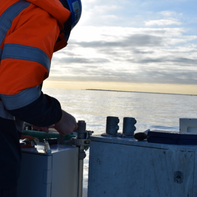
OceanWise has, through competitive tender been awarded the contract to supply, install, and maintain Marine Environmental Monitoring Systems (MEMS) globally as part of an initial 3-year Framework Agreement with the UK Hydrographic Office (UKHO). The framework also includes the provision of data collection, management and display system, which will be provided through OceanWise's Port-Log. The framework also includes shore control and GNSS surveys, as well as local training and mentoring. The UKHO has identified the installation and operation of MEMS as being an important component of a number of UK Government Programmes including the Overseas Territories Seabed Mapping Programme (OTSMP). Countries and territories can benefit from the MEMS through improved navigational safety and improving knowledge of the marine environment to assist with scientific research in understanding of the implications of climate change.
Under the framework agreement, OceanWise is responsible for the supply, installation, and support of professional grade environmental monitoring equipment (such as Tide Gauges and Weather Stations), as well as providing observational data to the local community and global initiatives, such as the Global Sea Level Observing System (GLOSS). OceanWise's data services can benefit the maritime community directly, through such things as the provision of tsunami and storm surge warnings, and via more accurate and up-to-date Tide Tables.
Ralph Bostock, Monitoring Business Manager at OceanWise stated, “We are delighted to be working with the UKHO and to have won this contract after a robust tendering process. We already support and maintain numerous tide gauges and weather stations around the world for our port and renewable energy customers, so this contract is a natural extension of our work. We are particularly looking forward to using our expertise and experience in environmental monitoring systems and applying it to unique and remote locations. Our in-depth technical knowledge of marine data acquisition, telemetry and data management will also be fully utilised in this contract as we support the UKHO in realising the full benefit that MEMS can offer”.
This contract win swiftly follows a series of other contracts awarded to the growing Hampshire based company, including the maintenance and upgrade of the UK National Tide Gauge Network. More details on this and other projects can be found www.oceanwise.eu/customer_case_studies.
About OceanWise
OceanWise Ltd is an independent company specialising in all aspects of marine
environmental data acquisition, data and knowledge management and GIS providing
customers with comprehensive and cost effective end-to-end marine and coastal data
management and decision support including:
- Intelligent Marine Mapping (Raster Charts, Raster Charts XL, Marine Themes and Marine Themes DEM)
- Marine Data Management Policy and Strategy Advice and Training
- Enterprise GIS and Productivity Tools (Maritime Toolbar and Workflow Extensions)
- Environmental Data Sharing and Publishing (Ocean Database and Port-Log.net)
For more information about OceanWise, please contact [email protected] or visit www.oceanwise.eu.
EOMAP awarded new survey contract by UKHO
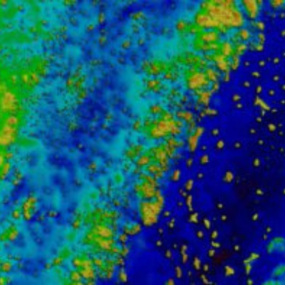
The UK Hydrographic Office (UKHO) have signed a new three-to-five-year framework contract for Satellite-Derived Bathymetry (SDB) with EOMAP. In the course of a competitive tender the German based experts for Earth Observation have – again– been ranked first-choice provider of SDB. The first batch covers 9,000 sqkm shallow waters of Belize.
Starting 2022, EOMAP will deliver high-resolution shallow water grids from SDB technology to UKHO, with the first survey covering the waters of Belize. This survey will be the first complete survey of some of these waters, including where uncharted coral pinnacles are currently noted on the chart.
“The UKHO is pleased to be continuing our partnership with EOMAP, leveraging cutting-edge survey technology like SDB to supplement existing hydrographic surveying and related charting products. SDB adds significant value and cost-effectiveness when surveying difficult-to-access areas of the ocean, while minimising the impact on the marine environment“, says Ian Davies, International Hydrographic Portfolio Manager, UKHO.
“It’s a pleasure to complement UKHO’s survey capabilities. We are already working on the first engagement: Mapping Belizean waters covering an area of 9,000 square kilometres”, explains Knut Hartmann, COO of EOMAP. “For us, this contract is a proof of trust in the quality of our satellite analytics. Moreover, it shows that our SDB technology is a must-have in the toolbox of modern hydrographers and surveyors, when it comes to mapping shallow waters.”
In 2015, EOMAP was selected as the first-choice provider by UKHO for the first time. Within this framework contract, their satellite analytics had been included in the ADMIRALTY Navigational Chart 2066 of Southern Antigua, Caribbean. In addition to surveyors and hydrographers, coastal zone managers, planners and engineers all over the world value these shallow water grids for their work.
SUT ANNOUNCES SECOND VIRTUAL OFFSHORE WIND INTRODUCTORY COURSE
The Society for Underwater Technology’s (SUT) second virtual Offshore Wind Renewable Energy course, held in association with Cranfield University, will take place on 19-20 October over two online interactive 4-hour morning sessions..
The introductory offshore wind course featuring acknowledged industry and academic experts as presenters is designed with two specific groups in mind: professional non-engineering staff, who would benefit from understanding the offshore wind energy industry; and for engineers and technical staff new to the sector or making the transition from another industry.
Following an introduction to the SUT, topics being covered over the two days are:
- Wind and the Net Zero Challenge inc Deepwater Floating Potential
- Planning, Environmental Studies, and Approvals
- MetOcean/Weather: UK and NW Europe Focus inc Deepwater for Floating Technology
- Fixed Bottom Offshore Structure Design and Integrity
- Offshore Site Investigation and Seabed Site Foundations
- Construction and Cables
- Floating Wind Structures
- Completion, Post Installation, and Ongoing Operation
Time is set aside for questions and for networking.
As Cheryl Burgess, Chief Executive of SUT explains:
“SUT is an international Learned Society with members in 40 countries. It covers all aspects of marine science and engineering involved in the seabed, the water column and surface piercing structures.
“An increasing number of our corporate and individual members in the UK and overseas are involved with the rapidly expanding global offshore wind industry. We were thrilled by the reaction to our first offshore wind virtual course at which we had delegates from all over the UK and from France and South Korea. Naturally we asked for feedback and were delighted by what we received:
- The course was well balanced, interesting, and enjoyable. Excellent presenters.
- Excellent value
- For me, it was perfect.
- I thought it was brilliant. Fast paced but very understandable. It was pitched at exactly the right level.
- All presenters were very informative and delivered subject matter effortlessly.
- This course is absolutely fantastic!
“Receiving feedback such positive feedback proved that we really ‘hit the spot’, we look forward to similar reactions from our October delegates.”
The full programme, details on the nine presenters, and registration information are online at www.sut.org/event/offshore-wind-renewable-energy-virtual-course/
Course fees are £325 for SUT members; and £415 for non-Members (excluding VAT where chargeable). The course is CPD approved. SUT Individual membership is £76 per year. To join, visit www.sut.org or e-mail [email protected].
ENDS
CAPTION: Cheryl Burgess, SUT’s Chief Executive
Notes to Editors:
About the SUT
The Society for Underwater Technology (SUT) is a multidisciplinary learned society that brings together organisations and individuals with a common interest in underwater technology, ocean science and offshore engineering.
SUT was founded in 1966 and has members from more than 40 countries, including engineers, scientists, other professionals, and students working in these areas. In recent decades many SUT members have come from the offshore hydrocarbon sector, today there are growing numbers of members from offshore renewables, marine autonomous systems, and the policy, law and insurance sectors who support offshore activities of many kinds.
The Underwater Association which also commenced operations in 1966 had a long-standing relationship with SUT, and merged with the SUT in 1992, having played a key role in establishing safer diving practices in consultation with the UK Health & Safety Executive. Their legacy can be particularly seen in the work of the SUT’s Diving & Manned Submersibles Committee.
Officers of the Society for Underwater Technology
Cheryl Burgess is the SUT’s Chief Executive.
SUT’s Council’s Elected Officers:
President - Judith Patten MBE
Chairman and Vice President - David Saul
Honorary Secretary - David Brookes
Honorary Treasurer - Mick Cook
www.sut.org Twitter handle @SUT_News