
The UK Hydrographic Office announces new tender opportunity for a global Hydrographic Survey Services framework
The United Kingdom Hydrographic Office (UKHO) is the UK’s agency providing hydrographic and geospatial data to mariners and maritime organisations across the world.
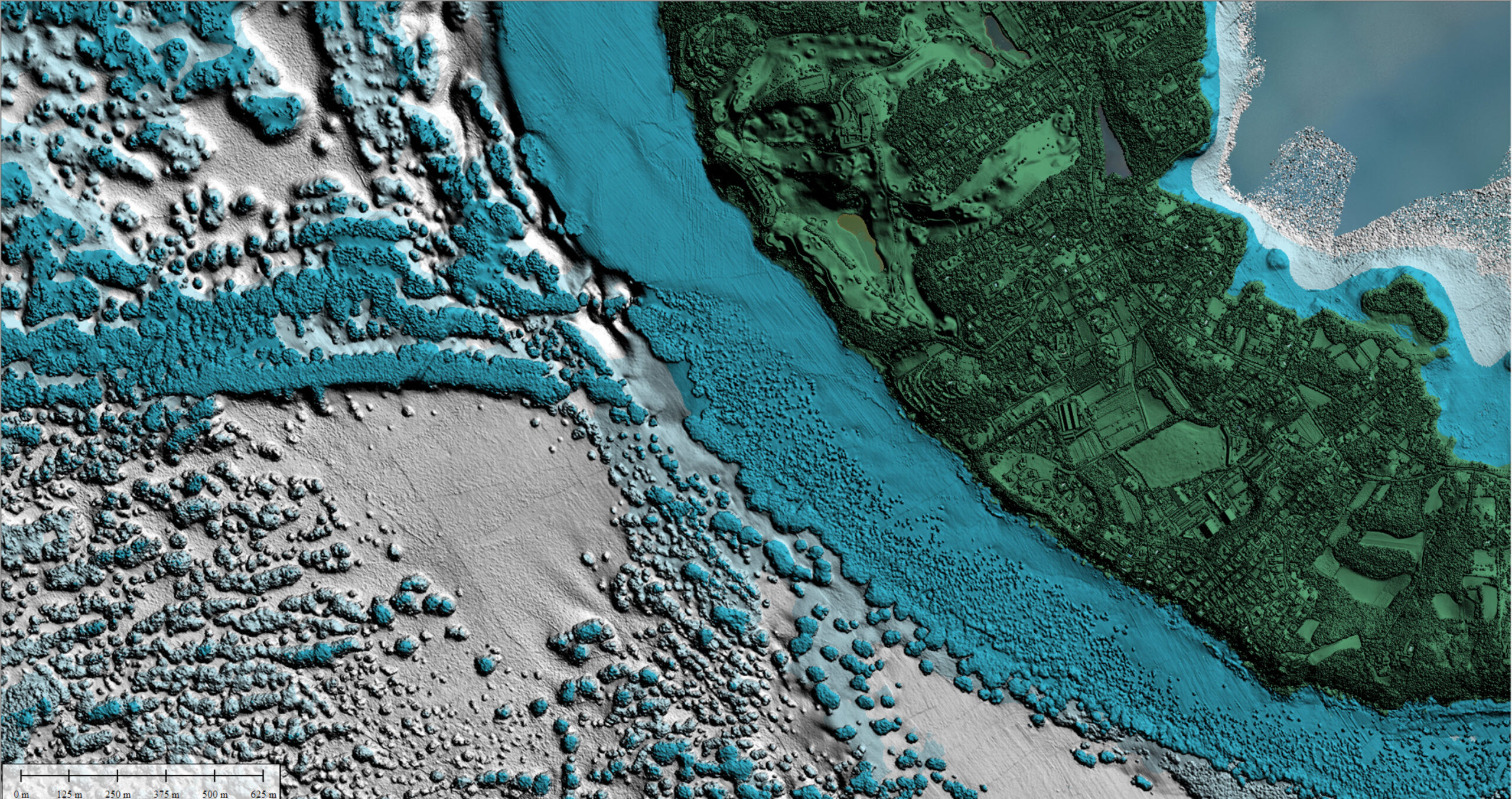
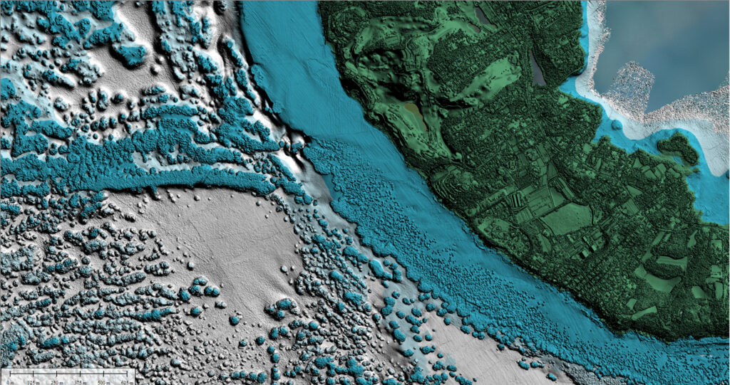
Feeding into a number of UK Government Programmes, this framework will cover offshore, coastal and nearshore work, and looks to leverage the latest advances in hydrographic equipment and platform technology to deliver high quality, low carbon hydrographic data. Data collected will assist the UKHO in updating navigational charts and publications, while also supporting the management and protection of the marine environment.
For more details on the tender and details on how to register your interest, please visit https://www.delta-esourcing.com/tenders/UK-UK-Taunton:-Hydrographic-surveying-services./M83PW2966B. Tenders are due on the 14th July 2022.

Tonga eruption discoveries defy expectations
New findings from the record-breaking Tongan volcanic eruption are “surprising and unexpected”, say scientists from New Zealand’s National Institute for Water and Atmospheric Research (NIWA).
NIWA’s research vessel, RV Tangaroa, has returned from a month-long expedition as part of the Nippon Foundation-funded Tonga Eruption Seabed Mapping Project (TESMaP), where scientists were studying the effects of January’s eruption of Hunga Tonga–Hunga Ha'apai (HT – HH).
Due to the power of the explosion, researchers expected to find dramatic changes to the volcano, but instead found it largely intact.
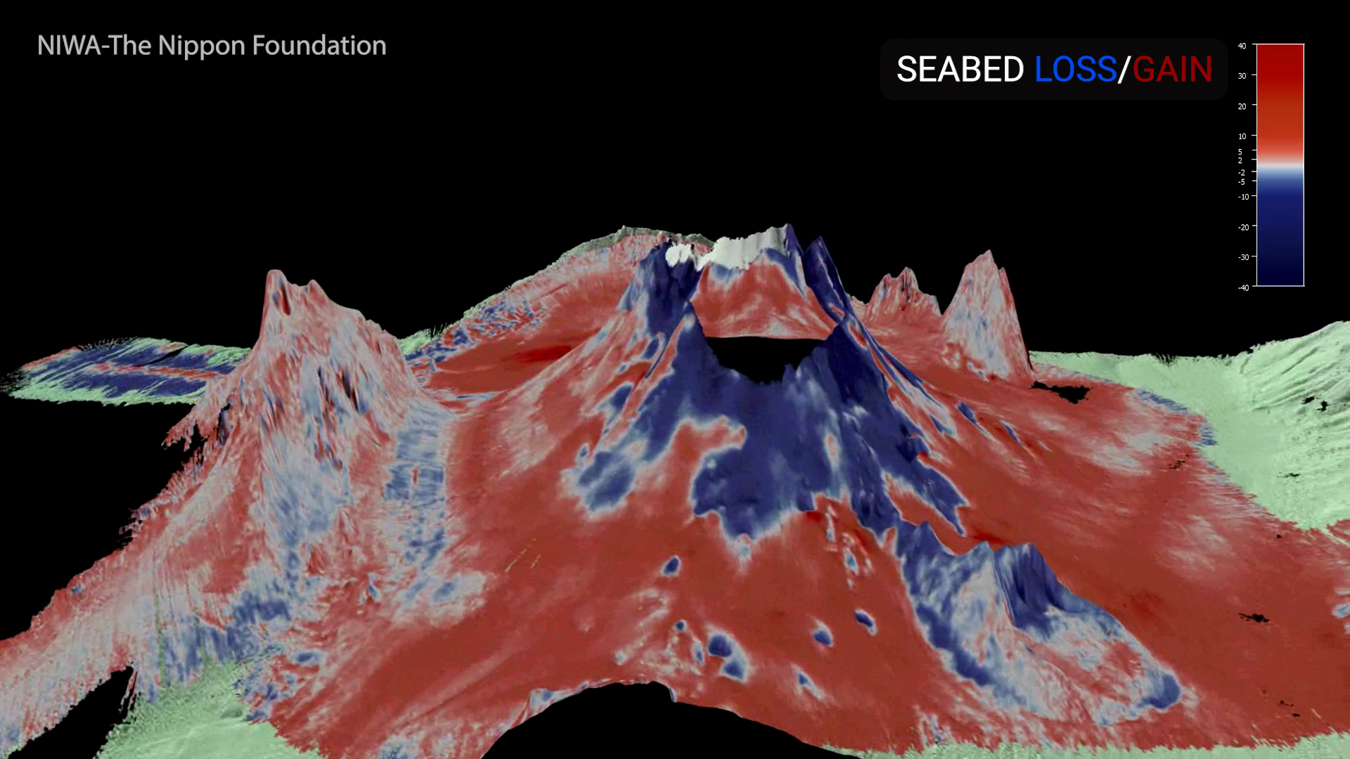
The research is also supported by The Nippon Foundation-GEBCO Seabed 2030 Project which aims to map the world’s ocean floor by 2030. NIWA mapped 22,000 square kilometres of the surrounding seafloor, which showed changes covering an area of 8,000 square kilometres.
NIWA scientists recorded up to seven cubic kilometres of displaced material – the equivalent of 5 Wellington Harbours or 3 million Olympic-sized swimming pools – but there is likely more yet to be seen. Tonga’s domestic internet cable that was broken and cut off communication is buried under 30 metres of ash and sediment.
The voyage leader, NIWA marine geologist Kevin Mackay, says that he was completely taken aback by what they first saw.
“With an explosion that violent – the biggest ever recorded – you would expect that the whole volcano would have been obliterated, but it wasn’t. While the volcano appeared intact, the seafloor showed some dramatic effects from the eruption. There is fine sandy mud and deep ash ripples as far as 50 kilometres away from the volcano, with gouged valleys and huge piles of sediment.”
The team also studied impacts on the ecosystem. The volcano is devoid of biology, but remarkably there are features as close as 15 kilometres away that still have abundant and diverse populations of fish and other animals. Scientists speculate that they escaped impact by being out of the eruption flow’s pathway, or far enough away to avoid thick ash fall.
NIWA marine biologist Dr Malcolm Clark says that having healthy life close by is a positive sign.
“Although the seafloor on the volcano is largely barren, surrounding seamounts have pockets of normal biodiversity, such as corals, sponges, starfish, and mussels, indicating the resilience of such marine ecosystems and giving some hope for recovery. More work needs to be done before we can be confident of how the ecosystem will respond, but these surviving animal communities indicate what kind of life may repopulate HT-HH. The sites sampled during the voyage give us a baseline for monitoring recovery in the future.”
NIWA also tested the water column for physical and chemical characteristics, including temperature, nutrients, and oxygen concentration.
Preliminary data shows that the water column is still recovering, and some airborne ash is yet to completely settle on the seafloor. There is also evidence that the volcano may still be erupting, with a dense ash layer found in the upper water column near the volcano.
NIWA biogeochemist Dr Sarah Seabrook says the persistence of ash they saw in the water column has a myriad of impacts on the ocean ecosystem.
“In the immediate aftermath of an eruption, volcanic ash fertilises microscopic ocean algae thanks to the ash’s concentration of nutrients and trace metals - in this case, there was a bloom of life so big that we could see it from space.
“However, the unexpected persistence of the ash in the water column is creating prolonged impacts. For example, spikes in volcanic ash were coupled to the appearance of oxygen minimum zones – where oxygen levels in the water are at their lowest - which could have implications for important services provided by the ocean, such as food production and carbon sequestration.”
Scientists also collected hundreds of samples during their mission, including seabed cores, various corals and 250 kilograms of rock, some of which were newly formed from the eruption.
The TESMaP project provides a unique opportunity to study the effects of an undersea volcano, which has huge implications for nations and ecosystems that live near these natural wonders.
Fisheries are a vital part of Tonga’s economy and subsistence, with species such as snapper and tuna being key to the region. There has been a reduction in some of Tonga's fleet, with many boats damaged in the tsunami which followed the eruption. Rebuilding the fleet is the highest priority and it will be a while before it is fully understood how fisheries have been impacted.
The mission has also given important insight into the fate of the broken domestic internet cable, with strong indications that this will need to be fully replaced.
Tonga’s Deputy Secretary for Lands and Natural Resources Taaniela Kula says this work is vital for the recovery of Tonga.
“The eruption sent shockwaves around the world, but the effects were felt most keenly in Tonga. It was a miracle to lose so few lives (God rest their souls), but our streets, crops, air, and waters were devastated.
“We, along with other nations on the Pacific Ring of Fire, know only too well how at mercy we are to nature. By studying an unprecedented event like this in such detail, we will gain invaluable knowledge and experience so we can recover quickly and be prepared for the next time something like this happens.”
The Nippon Foundation’s Executive Director Mitsuyuki Unno mirrored Mr Kula’s words.
“The eruption of Tonga’s underwater volcano is not ‘fire on the opposite shore’ but is also of great relevance to us living in Japan. We enjoy the ocean’s rich blessings but are faced with the risk of natural disasters that come with being an island nation on the Pacific Rim.
“This project is being conducted in the hope that understanding the effects of the volcanic eruption will contribute to the recovery of Tonga, where the sea is an important resource, and to the disaster preparedness of many countries, including Japan.”
The second part of the TESMaP mission will see the caldera mapped by an uncrewed surface vessel (USV), which was built by SEA-KIT International and is currently being transported from the UK. The caldera was unable to be surveyed during NIWA’s voyage because of safety reasons.
CEO of SEA-KIT Mr Ben Simpson says their vessel will fill in the final pieces of the puzzle.
“Our USV Maxlimer will map the current shape of the caldera and measure environmental conditions of the water above it, which are things we don’t yet know. Maxlimer will be controlled remotely from Essex in the UK, which is 16,000km away! The unmanned vessel will also use an innovative winch and sensor deployment capability to map any new volcanic activity. This is a truly global effort to get the full picture of a globally significant event, and we’re delighted to play our part in it”.
The unmanned part of the research mission to study the caldera is expected to be completed in mid-July.
Project Hydrographic Surveyor required to join world leading geophysical survey team in Portchester
You will be responsible for data quality, working with field teams to deliver the project objectives and the Project Managers and clients shaping the project.
You will coach and mentor team members; promoting quality and ensuring industry-leading data is delivered. You will gain exposure to a variety of projects, data types, and markets (including renewables, UXO, pipeline inspection), processing different hydrographic data. Although office based you will have the opportunity to go offshore.
This job is for you if:
- You have strong technical understanding of hydrographic data sets including multibeam echosounder, GNSS tides, SVPs, USBL and backscatter.
- You have experience of hydrographic data processing and report writing.
- You have excellent attention to detail.
- You are confident managing a team and interacting with clients.
- You are highly numerate and literate.
Here’s what a typical week would be like:
- Three days a week processing data, undertaking data QC and providing feedback.
- Half a day managing the hydrographic processing element of a project; tracking progress, planning tasks, assigning resources and managing the project delivery schedule.
- Half a day leading or attending meetings with the client, Project Manager and project team as the project technical lead.
- Half a day writing or completing QC on technical reports.
- Half a day assisting the vessel with calibrations, technical issues or planning.
Who we’re looking for:
- Hydrography, ocean science or similar qualification.
- Strong knowledge of hydrographic survey techniques.
- Experience of hydrographic processing software (Teledyne CARIS, Fugro Starfix or Applanix POSPac).
- Good verbal and written skills.
- Management, coaching and training experience.
- Project management experience.
- Able to work offshore for up to 4 weeks at a time
- Offshore experience in related field
You will need to pass an offshore medical prior to employment.
Benefits include a competitive salary plus a contributory pension scheme, life assurance, 24 days of annual leave, and private medical insurance.
Please head to fugro.com for more information and to get in touch.

Seabed 2030 and Ocean Research Project announce new partnership and ambitious expedition to uncharted polar territory
The Nippon Foundation-GEBCO Seabed 2030 Project has entered into a memorandum of understanding with the Ocean Research Project (ORP). The parties will work together to support the global effort in pursuit of mapping the world’s ocean floor, especially in polar regions through ORP’s upcoming expedition, GO-MARIE.
The GO-MARIE (Glacier-Oceans Mapping & Research Interdisciplinary Effort) program is a 2022 expedition which is also the motivation for the maiden voyage of the organization’s flagship, the RV Marie Tharp. A 22m Bruce Roberts steel schooner, the vessel is custom-built to navigate uncharted polar territory. There will be a base crew of ten including rotating ocean science experts joining legs of the voyage.
“We are delighted to partner with Ocean Research Project, and to support the launch of GO-MARIE,” commented Seabed 2030 Project Director, Jamie McMichael-Phillips.
“Throughout her voyage, RV Marie Tharp will no doubt play an invaluable role in helping us get closer to mapping the gaps and solving this puzzle – especially as she ventures into complex uncharted polar and sub-polar regions.”
Just under 80 per cent of the Earth’s seabed is yet to be mapped, including much of the coastline of the Greenland Ice Sheet. As the sea ice retreats, these coastal areas – which are critical spatial datasets required to improve global climate models – become accessible for bathymetric survey.
ORP’s Science Director Nicole Trenholm is coordinating the international science mission of higher latitudes for GO-MARIE. “It is essential that we extend mapping activities across the glacial impacted coastal oceans,” Nicole explains, “data from these regions will be used to enhance the accuracy of regional climate model estimates on glacial melt due to global warming.
“In addition to supporting the Seabed 2030 mission, this expedition will take action towards the United National Sustainable Development Goals relative to oceanographic research.”
Seabed 2030 is a collaborative project between The Nippon Foundation and GEBCO to inspire the complete mapping of the world's ocean by 2030, and to compile all bathymetric data into the freely available GEBCO Ocean Map. GEBCO is a joint programme of the International Hydrographic Organization (IHO) and the Intergovernmental Oceanographic Commission (IOC) and is the only organisation with a mandate to map the entire ocean floor. Seabed 2030 is a flagship programme of the Ocean Decade.
ORP is a non-profit organisation committed to eco-friendly ocean discovery. The organisation identifies expeditions which enable small, core teams of researchers to gather critical data from remote and sensitive areas worldwide – this information will better enable us to make decisive factors impacting the ocean’s health.
RV Marie Tharp will set sail in the summer for an extensive two-month mission in southern Greenland.
All data collected and shared with the Seabed 2030 Project is included in the GEBCO global grid, which is free and publicly available.
RBR now guarantees instrument calibration in three weeks or less
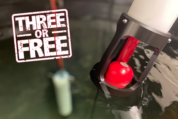
RBR, a global leader in oceanographic instruments, now guarantees to complete calibration of qualifying instruments in three weeks or less. The new Three or Free guarantee bucks current COVID-related trends towards longer lead times on products and services, at a time when global oceanographic research activity is picking up the pace.
"We want to get RBR users back in the water as fast as possible", says RBR President, Greg Johnson. "That's why we've invested heavily to expand our calibration lab and increase capacity. We're proud that we can offer a reliable three-week turnaround time and stand behind it with our new Three or Free guarantee."
The guarantee is simple. RBR will inspect, calibrate, and ship qualifying instruments within three weeks of receiving them or the calibration is free. Most instruments will qualify, with the exception of titanium instruments, instruments in cages, thermistor strings, non-RBR sensors, or instruments integrated into floats, gliders, or AUVs. "We'll even cover multiple instruments in one shipment, up to a total of 15 channels of calibration", says Mark Stacey, Technical Support Manager.
"If instruments don't qualify or we find they need repair, we will provide an expected completion date within a couple of business days", says Stacey. "We want to simplify deployment planning for our customers, so great communication is as important as fast, efficient service."
Marine Measurement Forum (MMF) Date Change for 2022 Event
Due to several overlapping engagements, the MMF64 event will now take place in July instead. After a two-year break, the long-standing MMF series of events has finally returned. MMF64 will be held in person in Port Solent Marina (Portsmouth, UK) on 6th July 2022.
The MMF is a series of one-day, non-profit events that provide opportunities for the informal exchange of ideas, knowledge and developments across the marine measurement and ocean technology industries. Businesses and Institutions across the UK ocean technology sector take turns to host MMF meetings, and RS Aqua have been selected to host MMF64.
RS Aqua are accepting speaker abstract submissions for presentation on the day. Up to twelve speakers will be selected, and the theme for this event will be cross-sector collaboration. Presentations that feature insightful stories about collaborative activities are particularly encouraged.
Please send speaker abstracts / talk summaries to [email protected] by 31st May at the latest.
Ticket sales are now open for the event (here), which includes all-day access, multiple networking breaks, lunch and refreshments and more, all for £37.50 (plus VAT) per person. The event is non-profit, with any surplus income to be donated to charity (Hampshire & Isle of Wight Wildlife Trust). Ticket sales will close on 20th June.
The event venue in Port Solent Marina can comfortably cater for up to 100 people but not more, so don’t delay, book your ticket today!
OSIL - Graduate Applications Engineer
Oceanography, Maritime, Subsea engineering. Office based, supportive culture, 25 days annual leave, up to 20% travel, discretionary bonus.
About OSIL
OSIL is a leading manufacturer of oceanographic equipment for offshore and coastal applications into the environmental, engineering, subsea & offshore markets. Operating on a global basis from our UK base, we offer metocean & sampling solutions through cost-effective, high quality and technically advanced equipment. The Applications Engineer role will focus on working with the Sales Manager developing our global reach and driving sales in an international market on a daily basis.
To continue to drive our growth and further develop the market for our products, we are looking for an energetic passionate, intelligent Applications Engineer to help develop our existing high profile client relationships, work with the whole OSIL team to enable further development of our maritime and subsea business domestically and globally.
The Role
You will respond to, develop and convert business opportunities for new and existing OSIL products & systems. You will be communicating directly with end users from environmental, offshore energy, subsea engineering manufacturers and shipyards on a daily basis, and work with the Sales Manager to develop these leads to a successful conclusion. Our product offerings cover met-ocean data buoys, sediment sampling, oceanographic systems, sub-sea and ASV products. You will be expected to maintain a high level of scientific & technical competence across these product and application areas.
Deliverables
- Develop and convert new business opportunities for OSIL.
- Represent OSIL at client meetings, conferences and industry events.
- Grow existing client relationships for the benefit of the end user and OSIL.
- Assist our systems & engineering groups to ensure product and system sales are designed and delivered to the highest possible standards.
- Assist with the tendering process, develop quotes and proposals on a daily basis.
- Work with OSIL’s global resellers and distributors for the benefit of both parties.
Experience & Qualifications
- Higher education in the fields of marine / maritime / engineering.
- Some sales or commercial success in the maritime or subsea domains.
- Experience of working with marine technical or engineered products and systems, for instance met/ocean systems, robotic platforms and sensors in private, government or applied research sectors.
- Strong head for business/ relationship development.
- Experience with marine sampling equipment, electrical or software systems integration, systems engineering or similar, would be beneficial but not essential.
- Evidence of Continued Professional and Personal Development inside and outside of your career to date.
Personal attributes
- Passionate and dynamic by nature.
- A high-level communicator, in person, in writing, and online.
- Collaborative; able to thrive in a high-performing team environment.
- Willing and able to travel.
- You must have the right to work in the UK, and you must be able to pass detailed background security checks.
- This role is suitable for a recent graduate with the right attributes and skills.
What We Offer
OSIL operates a dynamic, team-based working environment within an exciting and developing market, providing long-term potential for you to develop your skills and career. Salary for this position will be dependent on experience. OSIL also offers 25 days of annual leave, a generous pension scheme, life assurance.
Please submit CV & covering letter to [email protected].
Job Type: Permanent, full-time position
No agencies please.
Repositionable Dredge Monitoring Buoys assist Baltic Pipe Project
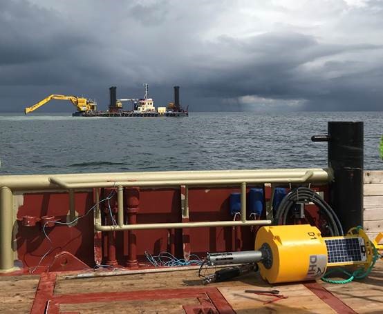
Leading international marine systems manufacturers Ocean Scientific International Limited (OSIL) have provided a number of lightweight repositionable environmental monitoring buoys to DHI A/S for the Baltic Pipe Project.
Dredging activities are vital to the successful outcome of the project, and OSIL have produced a total of 17 of their 0.6m buoys for DHI A/S, a number of which have been in continual use monitoring the turbidity levels and other environmental conditions around the active dredging sites.
The buoys are very lightweight and easy to deploy, and on this project have been repositioned to follow the dredger movements and debris plume on an almost daily basis. The relocations were undertaken by minimal crew on board the dredger support tug, using a grapnel to catch the buoys and the vessel’s handling system to lift the anchor weight and tow the buoy to its new position. DHI A/S reported that the crew were very happy with this arrangement.
These buoys join a large number of existing OSIL dredge monitoring networks, will well in excess of 500 data buoy systems now installed worldwide. The OSIL buoys have proved highly successful due to their robust nature and small/manoeuvrable size.
MacArtney appoints new Managing Director for UK from own ranks
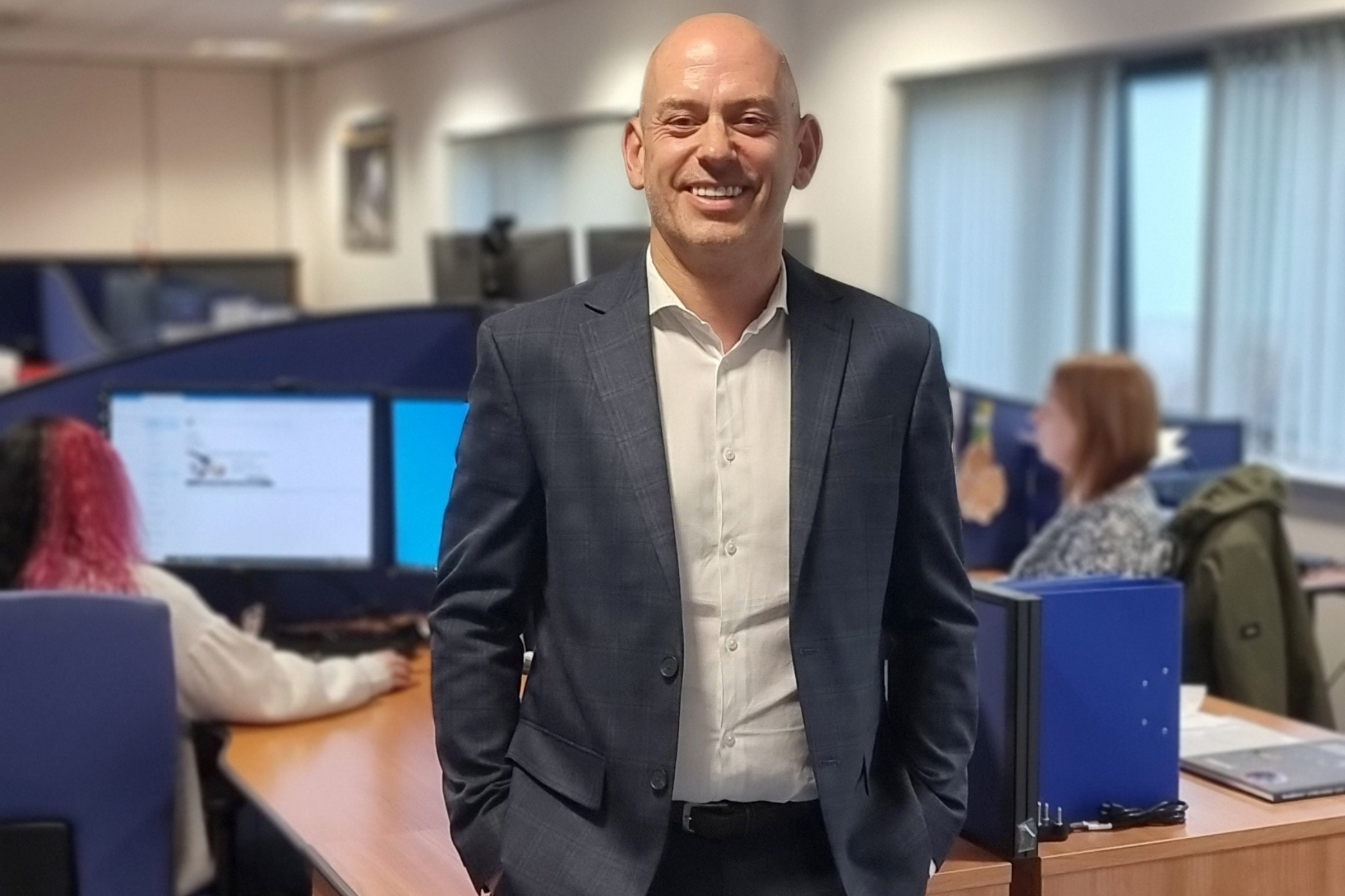
MacArtney, the world leader in underwater technology, has appointed 52-year-old Kevin Murray as the Managing Director of MacArtney UK, based in Aberdeen. Murray has held the position of Sales Director since joining the company in March 2021 and looks forward immensely to taking on a much broader role with the company.
"I'm delighted to be able to take over from Phil, even after such a relatively short time with MacArtney. We have worked closely together, and I have benefited enormously from the gradual transition combining our expertise and knowledge of the industry. At Group level, we have identified goals for the UK. With my background, I can put my efforts into further refining processes and efficiency and strengthen both sales and operations to achieve them. My aim now is to carry on growing MacArtney UK within the fields of offshore energy, ocean science and defence, marketing MacArtney's world-class products within connectivity, data systems and Launch and Recovery".
Murray gained a BA in Business Studies and the CIM Diploma in Marketing in 1992, working in fields such as media and hospitality before moving into the underwater technology field in 1999 with CDL. He made his first contact with MacArtney there, as CDL were a MacArtney agent at the time. He later moved to Ashtead Technology – another MacArtney agent at the time – where he spent a total of 10 years, rising to Sales Director. He takes over the position of Managing Director from Phil Middleton.
Business philosophy
Murray’s background in sales has ingrained a solid belief in building strong customer relationships on a one-to-one basis, something not made easy over the last couple of years of lockdown. Under his leadership, the sales team will keep focusing on meeting their customers and building personal relationships, trust, and confidence to provide input and further collaboration. Murray believes the result is long-term sustainability for MacArtney and for the customer. As he puts it: “The use of Teams, Zoom and the like during the pandemic has provided a good alternative, but I still firmly believe in primarily meeting the customer face-to-face and will continue to make that part of MacArtney UK’s philosophy.”
Challenges and opportunities
MacArtney’s UK operations are one of the Group’s largest outside of Denmark and offer the complete MacArtney range of underwater connectivity and technology products and solutions. This includes workshop facilities, where the focus is on the company’s core competencies, such as moulding cables and servicing the UK market with high-quality connectivity products. Opportunities for growth exist in the offshore sectors, including wind power, where the UK is a world leader in offshore wind farms. The UK government is funding transition to offshore wind, a sector in which MacArtney’s products are invaluable.
With Kevin Murray at the helm, the Group looks forward to continued growth and optimisation of the rich UK market potential. MacArtney CEO Niels Peter Christiansen rounds off:
“I am very happy to see an internal candidate ready to step up as Managing Director for MacArtney UK. Kevin will ensure continuity in the management team at a time of profitable growth”.
New Multibeam Sonar System Launched by Seafloor System
Introducing SeaRAY™: Seafloor's extremely compact multibeam sonar system designed for a multitude of hydrographic survey applications. Its minimal footprint allows for simple integration on uncrewed surface vessels, from which it can be mobilized into areas such as ponds, lakes, rivers, and dredge pits. A hydrodynamic, energy efficient design makes optimal use of battery power, prolonging survey longevity in the field.
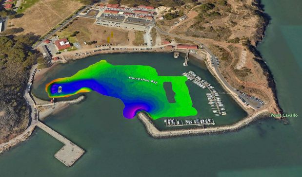
Ideal for integration on USVs like Seafloor's EchoBoat-160™, the SeaRAY™ offers simple installation, intuitive setup, and efficient data collection. The team at Seafloor Systems took a SeaRAY-equipped EchoBoat-160 to Horseshoe Bay, California to collect precision depth data and put the new system through its paces. The resulting digital terrain map: