TCarta Opens Canadian Affiliate Office to Provide Hydrospatial Mapping Services Across Canada
Baffin Island Project Announced
TCarta Marine, a global provider of hydrospatial products and services, has announced the formation of TCarta Canada based in Ottawa, Ontario. Offering the complete line of TCarta satellite-derived bathymetry (SDB) services and Trident SDB Toolbox software, the affiliate office is a partnership between TCarta Marine and Prof. Anders Knudby, a well-known marine geospatial researcher and consultant in Canada.
TCarta made the announcement at the Canadian Hydrographic Conference 2022, which ran on June 9 in Gatineau (Ottawa), Ontario, Canada.
TCarta Canada announced its first contract – a pilot project to update bathymetric navigation charts for Baffin Island’s Cape Hooper and Kangok Fjord with SDB technology. The contract is administered by the Canadian Hydrographic Services, which has previously purchased SDB maps from TCarta.
The partnership between TCarta Marine and Knudby is an ideal merger of complementary technologies. Knudby, who will serve as Managing Partner for the new office, has pioneered development of SDB algorithms for Canada’s coastal waters as a consultant and associate professor at University of Ottawa. TCarta has recently focused on expanding its SDB techniques for application in Arctic regions. Knudby’s algorithms are being incorporated into the TCarta Project Trident SDB workflow.
"TCarta Canada will accelerate our research and push the boundaries for how we deliver marine geospatial products. The Canadian Arctic is an enormous area, difficult to access, often covered in cloud, ice, and darkness, and poorly charted,” said Knudby. “But maritime traffic is increasing as the Arctic Sea ice recedes, and mariners crossing these waters need up-to-date information for safe navigation. TCarta Canada will play an important role here, turning satellite imagery into the information products that mariners need."
At the heart of TCarta Canada’s offerings will be the new Trident (SDB) Toolbox, now available as a software-as-a-service product. The Toolbox is a series of software applications that operate within Esri ArcGIS Pro and allow organizations to perform their own extraction of bathymetric measurements from satellite, aerial, and UAV imagery.
With offices in the United States and Jamaica, TCarta has built an international business on cost-effectively and safely deriving onshore and offshore data sets using multispectral imagery captured by Earth observation satellites – without negative impact on the natural habitat. TCarta products and services are relied upon by governmental, insurance, oil & gas, environmental, and infrastructure development clients in applications as diverse as natural resource monitoring, tsunami modeling, disaster & hazard response, and hydrologic studies.
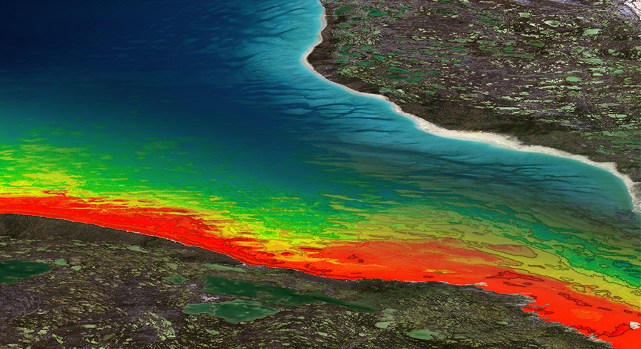
Image shows 10m SDB and bathymetric contour lines produced from numerous Sentinel 2 images in the Fox Basin, Arctic Canada.

Teledyne Marine Annual Photo Contest Now Open
Teledyne Marine has announced the return of its annual photo contest. All Teledyne Marine customers and users are encouraged to submit their favorite photos showing any of Teledyne Marine’s products in action, data collected using a Teledyne Marine product, or photos taken using a Teledyne Bowtech camera.
This year’s contest, which closes on August 31, 2022, includes eight entry categories. The grand prize winner will be awarded a DJI Mini 3 Pro Advanced Mini Camera Drone; and the remaining seven winners will select from three prizes to match their interests.
All are encouraged to visit the contest page to submit an image and/or vote for their favorites. A link to full contest details, online submission and voting can be found at: www.teledynemarine.com
About Teledyne Marine
Teledyne Marine is a group of leading subsea technology companies that are part of Teledyne Technologies Incorporated. Through acquisitions and collaboration, Teledyne Marine has evolved into an industry cornerstone, bringing Imaging, Instruments, Interconnect, Seismic, and Vehicle technology together to provide total solutions to our customers.
Safer at sea: Wave and current research improves metocean forecasts
A new study has documented the first simultaneous observations of waves and currents in Norway’s Lofoten Maelstrom – one of the world’s strongest open-ocean tidal current systems. The observations, born out of a collaboration between the Norwegian Meteorological Institute, the Norwegian Coastal Agency and Nortek AS, will help make fishing and seafaring in the area safer.
The Lofoten Maelstrom is famed for its powerful waves, eddies, whirlpools and fast-flowing currents that have wrecked ships and put seafarers in grave danger for centuries. It also inspired stories such as Jules Verne’s Twenty Thousand Leagues Under the Sea and Edgar Allan Poe’s A Descent into the Maelström.
Generally, current speeds of two meters per second are classed as exceptionally fast. In a study , the authors recorded speeds of up to three meters per second. The authors believe that currents are even faster in other parts of the Maelstrom.
Gathering unique dataset of waves and currents with advanced acoustic technology
The authors gathered a unique dataset of simultaneous observations of waves and currents and observations of bubble depth using a Signature500 current profiler (ADCP) . This advanced acoustic instrument is capable of “seeing” the ocean in three dimensions.
“It’s very rare that you get simultaneous observations of waves and currents, especially where you have such a strong tidal current,” explains co-author Trygve Halsne, scientist at the Norwegian Meteorological Institute and PhD student at the University of Bergen.
Understanding the way the ocean moves helps seafarer and fishers
Using observations recorded with this advanced acoustic technology, the researchers estimated wave height and the speed and direction of the currents. They found wave breaking to be particularly vigorous when the waves traveled in the opposite direction to the currents.
The observations also revealed a more unusual phenomenon – strong wave breaking when waves and currents travel in the same direction.
“When you talk to people like fishermen, they always say it’s when the current is opposing the waves that you get the strong breaks. However, we also saw strong breaks when the waves and currents moved in the same direction,” says Dr Øyvind Saetra, deputy head of the Norwegian Meteorological Institute’s division for Ocean and Ice, and lead author of the study.
The data can be fed into models that drive metocean (ocean and meteorological) forecasts. Seafarers and fishers can use these forecasts to plan their activities to avoid the most dangerous conditions.
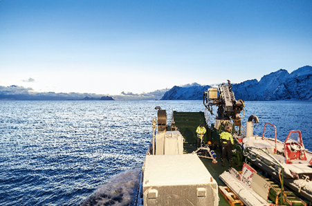
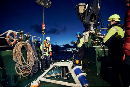
(Image left) Moskstraumen, one of the world’s strongest open-ocean tidal currents, lies in the Lofoten archipelago in the north of Norway. (Photo: Raymond Engmark)
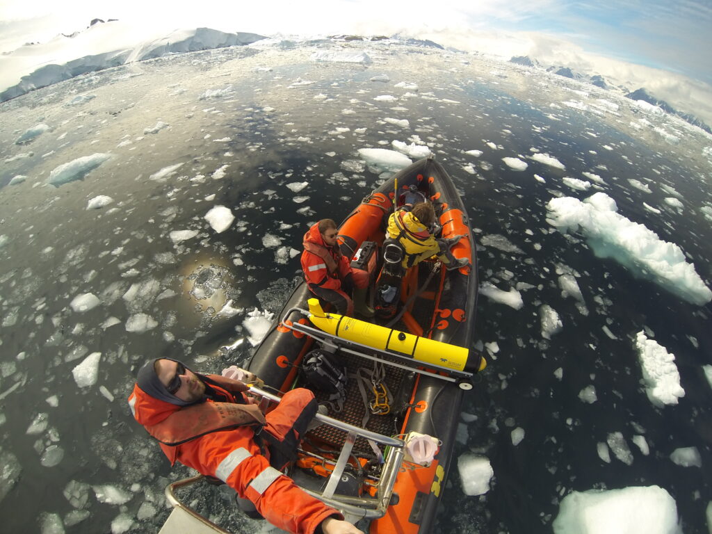
(Image right) Scientists from the Norwegian Meteorological Institute and Nortek’s Tom Christian Ambrosius Mortensen (left), with the support of the Norwegian Coastal Agency, deployed the Signature500 ADCP in the challenging ocean environment of Norway’s Lofoten Maelstrom. (Photo: Raymond Engmark)
Geocuba Estudios Marinos, deploys Metocean buoy off Havana Bay
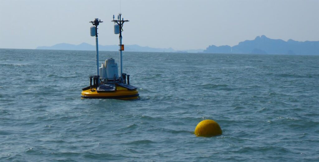
Geocuba Estudios Marinos in Havana, Cuba are pleased to announce that they have successfully deployed a Metocean buoy off Havana Bay.
The buoy transmits met data as well as wave height , surface current and sea water temperature, conductivity, salinity, pH and ORP.
The data from the buoy is received at Geocuba EM’s base at Regla, at the back of Havana Bay. It is available for the harbour authority and Environment agency. The harbour authority will use the data to permit large vessels to enter the harbour, and the Environment Agency are using the data to study pollution streams from the rivers which feed into Havana Bay. Local fishermen can check the sea conditions before heading out to catch.
Angel Lenin Rodriguez, Director of Operations at Geocuba EM, said “We are very pleased to have this first Metocean buoy installed and operational, after a long delay followed by lack of a suitable vessel with a crane for the anchor weight. We are grateful to our friends at SERMAR who made a vessel available to us for the deployment.”
Geocuba has plans for a full network around the island outside all major harbours.
Fugro aids safe delivery of development assets for Jumbo in US Gulf of Mexico
Jumbo Maritime has awarded Fugro a positioning and metocean services contract to help guide the safe transport and installation of a new floating production system (FPS) for Vito, a deepwater development in the US Gulf of Mexico. Fugro services will support both inshore and offshore towing of the 24,000-ton structure as it leaves the coast of Texas and travels 800 km to the Vito field for final positioning and hook-up. The project is expected to be executed in summer 2022.
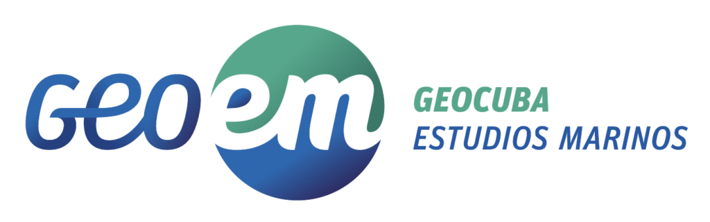
Asset positioning will be accomplished using a remotely enabled Fugro Starfix® solution. The approach will provide real-time knowledge of all vessel locations, both in relation to each other and the FPS, while limiting the number of surveyors required in the field. Given the number of assets required for the project— eight inshore and offshore towing vessels, two anchor handling vessels and the FPS— the remote technology will significantly reduce health and safety exposure, as well as carbon emissions. During installation, positioning data will be complemented by real-time current monitoring information to support situational awareness and safe working conditions.
Dan Matthews, Fugro’s Commercial Director for Asset Integrity in the Americas stated: “As a long-time global contractor to Jumbo, Fugro is pleased to support the tow-out and hook-up of the new Vito FPS. Working in partnership with Jumbo, we’ve designed a highly technical solution that will help to ensure a safe project outcome and support efficient operations in the field.”

Italian Navy's NAV-80 homologation
NOVACAVI proudly obtained the Italian Navy’s NAV-80 homologation for cables suitable onboard naval units enriching its range of special defence cables with:
NOVANAV miniaturized and flexible cables for electrical and electronic interconnection according to NAV-80-6145-0003-14-01B000
and
NOVANAV zero-halogen electrical and electronic interconnection cables, replacing MIL-DTL-24640 cables not buffered according to NAV-80-6145-0006-13-01B000.
These products are designed and manufactured according to Italian Navy Norms to be applicable on-board Military Naval Vessels for power supply and signal interconnections (fixed laying) between the units of systems, subsystems, and equipment and for power and signal wiring in these vessels.
Samples will be showcased at UDT 2022, Rotterdam on NOVACAVI’s stand A33 next 7th -9th June.
Specialist in custom cables design and manufacturing for harsh and demanding environments since 1975, NOVACAVI provides the most efficient cable solution to face and support all activities in the most challenging scenarios.

Innovative FerryBox system ready to track climate change effects in Chile’s subantarctic waters
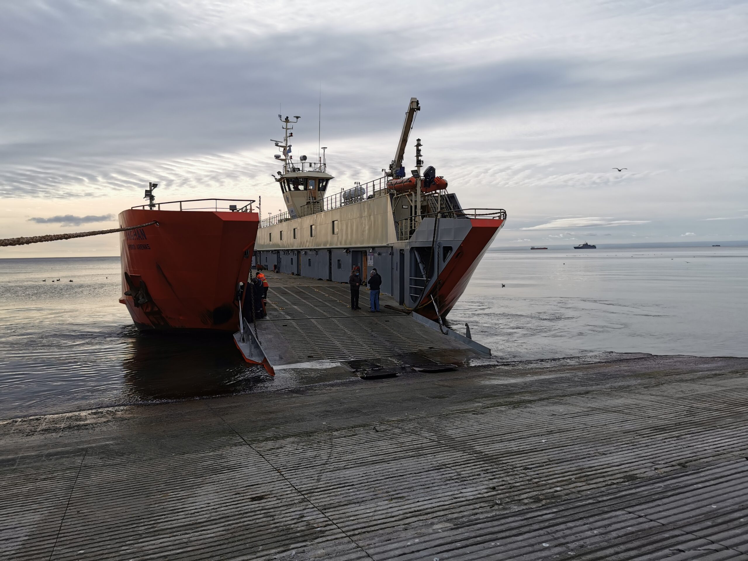
Sea water sensor and measuring system manufacturer -4H-JENA engineering has just completed the installation of a sophisticated sea water monitoring system aboard the Yaghan ferry, which operates on a 587 km route between Puerto Williams and Punta Arenas in the south of Chile.
A first of its kind in the Southern Hemisphere, the installed ‘FerryBox’ has been configured to measure diverse parameters that will enable a team from the Austral University of Chile and FONDAP IDEAL Center, led by Dr Ricardo Giesecke, to map ecosystem deviations and apply the data to create new models that will help the region adapt to the effects of man-made climate change.
FerryBox is a highly customisable all in one solution for precise and continuous measurements of sea water from (moving) platforms such as merchant ships and ferries, as well as manned or unmanned research stations in remote regions. The FerryBox system on the Yaghan ferry measures water temperature, oxygen, salinity, chlorophyll-a, pCO2 concentration, pH, nitrate, crude oil, yellow substance, and turbidity. It also includes a set of radiometers provided by the ICBM (Uni. Oldenburg) installed on the bridge of the ship, to measure optical properties of the water.
“Together with the Austral team, we configured the FerryBox to measure factors that will indicate changes in the marine environment caused by melting glaciers,” said Dr Maik Grunwald, Head of R&D, -4H-JENA engineering. “There has been little study of the marine ecosystem in the region so the measurements in the subantarctic waters and fjords of Southern Chile will prove vital to scientists working to establish the effects of glacier melting and climate change in subantarctic environments.”
The Yaghan ferry FerryBox will analyse sea water samples every minute along the entire 36 hours trip between Puerto Williams and Punta Arenas, with six sailings per month. Over time, the data collected will contribute towards helping Chile to tackle important questions such as the impact of human activities in still pristine environments, measure the impact of climate change on a wide spatial scale with high temporal resolution, and define processes involved in keeping high biological productivity in certain areas.
This information will also be available for local governments to development strategies for the protection of high productive ecosystems as well as for policy orientated initiatives for the responsible management of marine coastal ecosystems.
Ashtead Technology bolsters team with new senior appointment
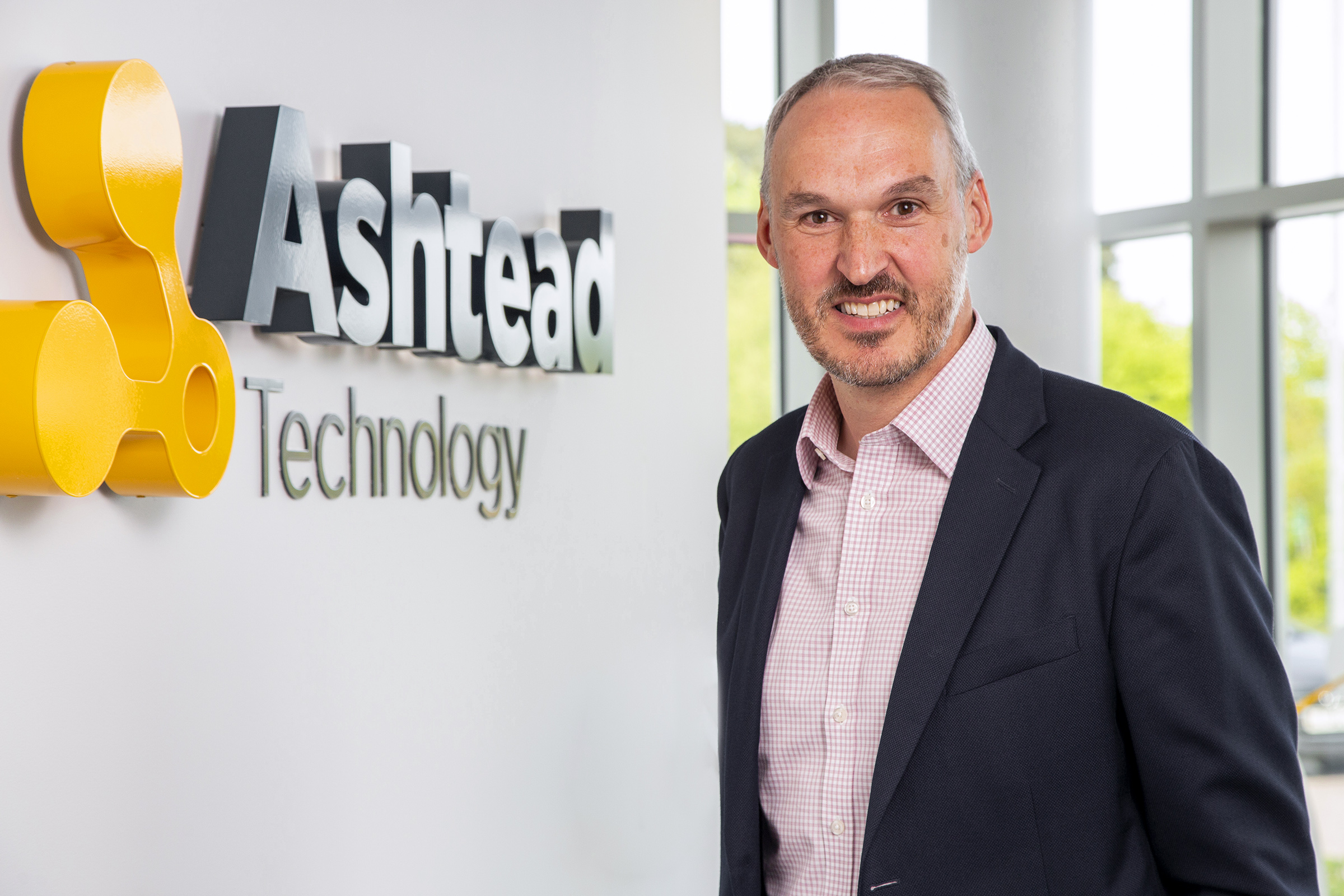
International subsea equipment rental and solutions specialist Ashtead Technology has appointed Phil Middleton as Survey and Robotics Director.
The appointment underlines the company’s strategic growth plans as it looks to further strengthen its market-leading market position internationally for its survey and robotics service line.
Mr Middleton brings a wealth of experience to the role having held various senior positions in the subsea technology sector, most recently with MacArtney Group where he was UK Managing Director. Prior to that, Phil was Group Managing Director at Seatronics, a post he held for over five years during his 17 years with the business.
In his new role, Phil will work with the senior management and regional teams to further strengthen existing capability across Ashtead Technology’s core markets and drive forward the company’s ambitious growth strategy.
Allan Pirie, Ashtead Technology’s CEO, said: “Attracting someone of Phil’s calibre into the business is a great endorsement of our strategy and ambition. He has strong industry experience, as well as considerable knowledge of the subsea equipment rentals sector which will complement the talent, expertise and capabilities of our existing team.
“Phil’s appointment will help accelerate the delivery of our growth plans as we continue to enhance our capabilities and expand our technology and service offering across all key offshore energy markets to support our customers globally.”
Phil Middleton, Ashtead Technology’s Survey and Robotics Director, said: “Ashtead Technology is an ambitious company with a first-class reputation. Through strategic acquisition and ongoing investment in people and new technologies, the company has significantly enhanced its expertise, subsea equipment rental fleet and service offering over the years to become the market-leader in its field.
“I am thrilled to be joining the talented team at Ashtead Technology and playing a key part in the next stage of its growth.”
MacArtney ramps up offshore wind activities and recruits a highly experienced General Manager
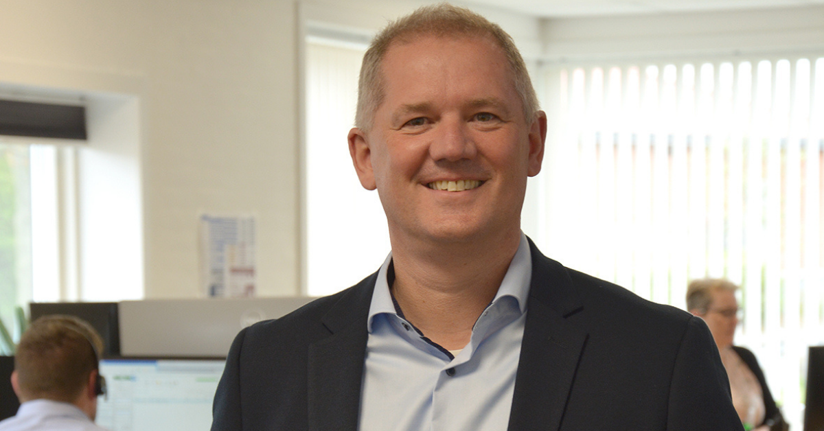
MacArtney Offshore Wind Solutions, part of the MacArtney Group, recruits Bjarne Siig as the new General Manager. With over 20 years of global experience at top management level in the wind energy sector, he will bring the division through growth.
Bjarne Siig will head MacArtney’s wind division, supplying handling and installation equipment, including cable carousels, offshore power quadrants, tensioners and service solutions.
"I'm enthusiastic about this new task with MacArtney Offshore Wind Solutions. A hub for experience and expertise; comprising many great people with the will to succeed and establish the framework for solving future tasks together. I am happy to be here!" Bjarne states.
Partner with the industry
MacArtney Offshore Wind Solutions near Holstebro in Denmark is a division under the MacArtney Group. It builds on more than 40 years of experience producing handling equipment for the marine segment. Its currently 45 employees are well equipped to continue own production, development, sales and service of the product portfolio targeted at offshore wind customers.
Bjarne Siig wishes to motivate the entire value chain and MacArtney's own employees through inspiration, vision, values, teamwork and challenging each other. Backing this is the aim to partner with the wind industry, delivering unique equipment and customised solutions to support effective installation and service offshore.
"Our strength - and standing - lies in complete system solutions. We own and include all value chain steps from engineering, automation and production to service. We offer smart solutions bringing value to the customer," Bjarne Siig continues.
Furthermore, there is an ongoing priority on maintaining good and close customer relations, enabling guidance, support and availability in the rapidly increasing wind market.
40 years of experience
Bjarne Siig believes there is a significant market for MacArtney to exploit within the installation of wind farms. It is a strength that MacArtney has more than 40 years of experience in product development and technology from the maritime market, which is directly applicable to the offshore wind segment.
MacArtney CEO Niels Peter Christiansen supports this premise:
"We are happy to see Bjarne Siig join MacArtney Offshore Wind Solutions as General Manager. Bjarne brings many years of experience from the industry, which will be instrumental for expanding the division’s product portfolio and increasing the activities in a growing offshore wind market."
Bjarne Siig is 51 years old, married with two sons and lives in Ulfborg, close to MacArtney's factory in Bur, where he will be based. Before his time with Gurit, Siig spent many years with Vestas in the Blade Production division, based in Denmark, Germany, and China.
Fugro and Underwater Survey Technology 21 extend successful collaboration in marine site characterisation for buoyant South Korean offshore wind market
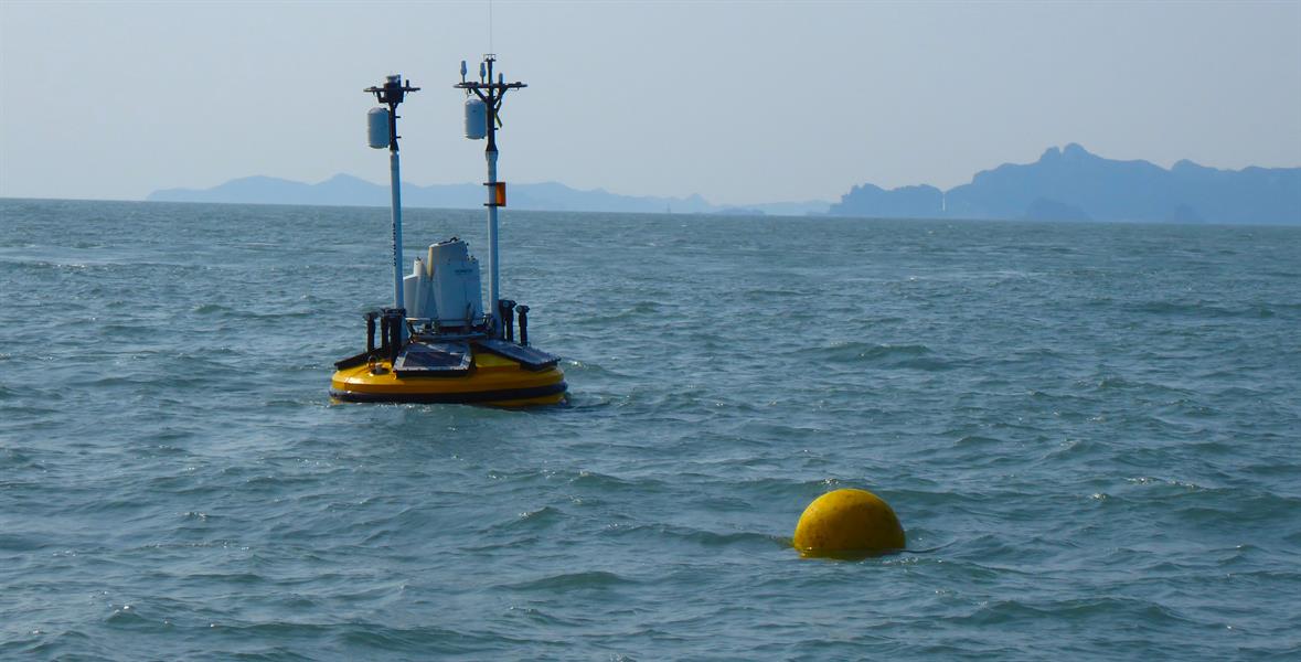
Fugro has extended its Memorandum of Understanding (MOU) with Underwater Survey Technology 21 (UST21) following strong demand for combined geophysical, geotechnical and metocean data services, launched 2019, to support South Korea’s ambitious expansion of wind power assets.
The two-year renewed agreement will enable Fugro, assisted by UST21’s local hydrographic expertise, to provide a comprehensive package of Geo-data collection, interpretation and advice to help a growing client base achieve successful outcomes.
Fugro has drawn on its full range of marine site characterisation services over the past three years, with UST21’s hydrographic mapping capabilities being integral in creating a unique synergy and scope of services between Fugro and UST21, along with a clear understanding of the regional market and its operational challenges. The extended MOU signals that Fugro and UST21 are committed to longevity in South Korea and inspiring client confidence that delivery excellence in the geoscience data they need is available within the fast growing offshore wind market.
Jerry Paisley, Fugro’s Regional Director for Marine Site Characterisation, said: “We are pleased to announce the extension of our Memorandum of Understanding with UST21 in South Korea. We believe it demonstrates Fugro’s commitment to this emerging market and our desire to establish long-term relationships within Korea. Our aim is to maximise the value and benefits of our innovative digital solutions, experienced personnel and regional resources in the delivery of market-leading geoscience data, precisely tailored to the needs of the client and their wind energy challenges.”