
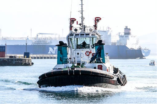
Robosys and SEA.AI collaborate to provide intelligent autonomous navigation
Robosys and SEA.AI have joined forces to develop and deliver the world’s first intelligent maritime autonomous surface navigation and collision avoidance system integrating computer-based AI machine vision.
Developed for an Indian shipping operator operating in the Mumbai region, this is the world’s first commercial vessel to feature this integrated Perception System to support both crewed and uncrewed operations including for remote and autonomous maritime operations. Integration of Robosys’ Voyager AI intelligent navigation software together with SEA.AI’s Sentry enables vessels to benefit from market-leading obstacle and collision avoidance that is further enhanced by non-fatigue optical algorithms.
The Robosys-SEA.AI’s systems seamlessly integrate via software interfaces to provide early alerts to crews and remote operation hubs regarding objects on the surface of the water. Using the latest camera technology in combination with artificial intelligence (AI), SEA.AI detects and classifies objects, including those that are not obvious when using conventional systems such as Radar or AIS. Installation of the integrated Robosys’ Voyager AI and SEA.AI’s system is now complete, with the first vessel due to start sea trials.
Whilst the machine vision system primarily enhances safety, provides superior, no fatiguing, 360° situational awareness and surveillance for commercial vessels, government craft, first responders and motor yachts, Voyager AI itself also brings wider benefits such as improved fuel efficiency through smart path planning.
The integrated SEA.AI machine vision system analyses all the pixels coming from the set of thermal and low light cameras to detect and assess the level of risk of the floating objects around the vessel. This pioneer technology uses latest deep learning capabilities and ever-growing proprietary database of 9+ millions of annotated marine objects to classify the type of floating hazards detected.
The Voyager AI System fuses the Machine Vision’s target data with other track sources such as from Radar and AIS and then either recommends or manoeuvres the vessel taking in to account all navigation, shipping and ENC hazards. Voyager AI is proven onboard vessels up to 320m.
The System has a far-reaching detection range, combined with the widest ¬detection angle and fastest ¬detection frequency available, which improves performance in unfavourable sea conditions.
Nigel Lee CSO says, “In 2022 Robosys and SEA.AI first identified the need to provide the additional optical reassurance to crewed and uncrewed vessels, through providing the visual aspect of watchkeeping, thereby supporting COLREGS Rule 5 Visual Lookout, without fatigue and enhanced consistency. It is great to experience the first vessel now utilising this unique and essential solution, which will contribute to helping create safer seas and potentially save lives.”
"Seeing our collaboration come to life with Robosys is truly exciting”, said Marcus Warrelmann, CEO of SEA.AI. “Our unique Maritime Machine Vision provides optical reassurance to crewed and uncrewed vessels, and represents a significant step towards safer seas and enhanced maritime safety. This achievement reaffirms our dedication to innovation and our mission to make a positive impact in the industry."

SeaRegs taps HydroSurv for state-of-the-art training USV
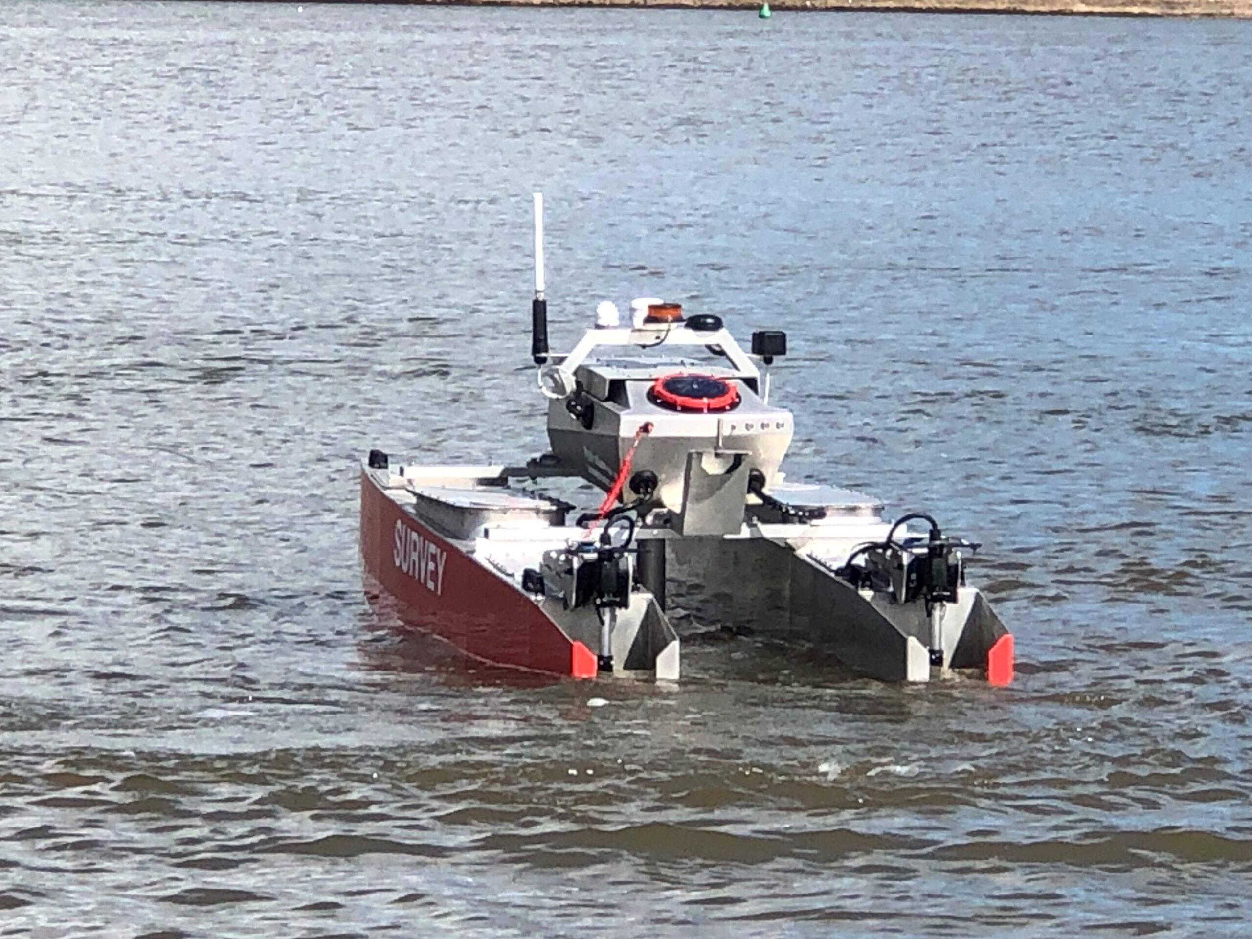
SeaRegs Training, specialists in internationally recognised maritime courses and marine apprenticeships, has ordered a customised REAV-28 Uncrewed Surface Vessel (USV) from Exeter-based HydroSurv. The vessel will be used to provide industry leading training for USV operators around the UK.
This will be HydroSurv’s most advanced REAV-28 build to date and the company’s first USV to be fitted with state-of-the-art command and control software, VOYAGER AI, developed by marine autonomy leaders Robosys Automation.
VOYAGER AI enables advanced autonomous navigation and platform control through radar, AIS, perception systems, sonar and LIDAR, as well as sensor integration for autonomous collision, obstacle and grounding avoidance. These features will allow SeaRegs trainees to develop the knowledge and skills required to understand and operate cutting-edge and complex navigation solutions for autonomous craft.
Nigel Lee, CSO of Robosys commented: “VOYAGER AI is the first choice for many of the world’s leading maritime training establishments, so it’s great that Robosys has teamed with two outstanding British companies to provide this to UK-based USV remote operations teams.”
SeaRegs’ stringent training programme requirements have also contributed to the custom design, which will be used in the provision of courses for safe and efficient operation of mid-sized to large seagoing USVs. With its compact size, the REAV-28 is portable and practical for the training school to operate alongside existing vessels. It will, however, be equipped with a suite of situational awareness sensors typically seen on larger USVs, supporting SeaRegs’ aims to set new standards in the conversion of existing and new skippers to USV operation, with hands-on experience as part of its training portfolio.
Simon Jinks, Director of SeaRegs, said: “SeaRegs has always strived to be at the cutting edge of technology in training for the commercial vessel sector and we’ve been training USV operators for seven years now. We see this vessel and the relationships with HydroSurv and Robosys as a positive step forward in ensuring that new operators can learn USV operation, mission planning and regulation in a practical and hands-on way. Our aim is to have an accredited five-day training course available in the near future.”
David Hull, Founder and CEO of HydroSurv, added: “HydroSurv has consistently showcased ambition through its dedication to continuous innovation and product development. With a strong focus on establishing leadership on regulatory compliance and safety, this new partnership with SeaRegs and Robosys amplifies this commitment by putting a ground-breaking training asset into the hands of new operators.”
The new training vessel is expected to enter service at SeaRegs’ Turnchapel Wharf facility in Plymouth at the end of summer 2023.
Survitec expands UK servicing capability with new service centre at port of Southampton
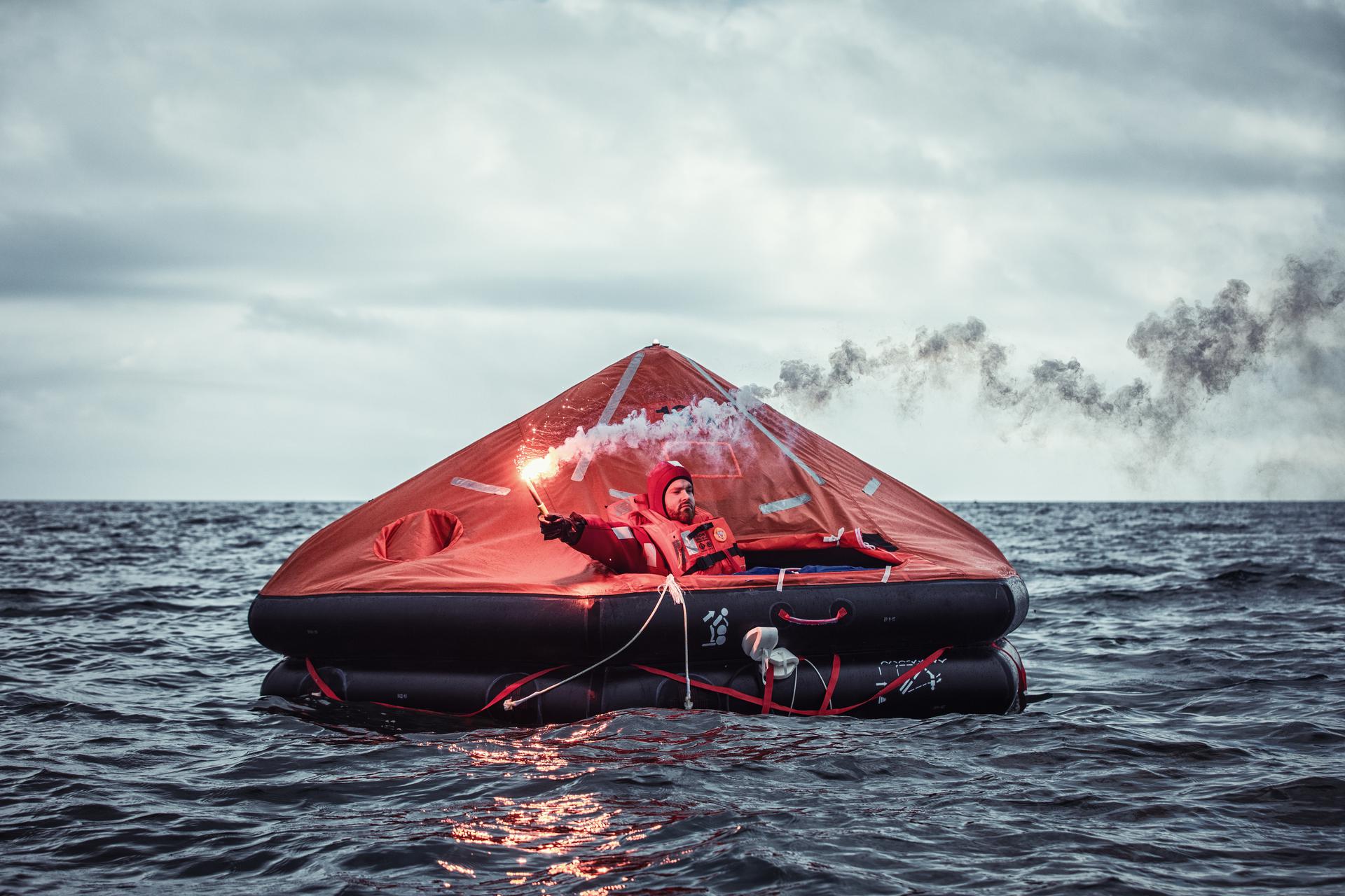
Global Survival Technology solutions provider Survitec has completed a major expansion of its UK servicing capability with the opening of a new service centre in the Port of Southampton.
The 10,000 sq. ft building, newly fitted out with equipment and facilities for the servicing and repair of liferafts, lifejackets, immersion suits and other safety equipment, will deliver increased capacity and faster turnaround times when meeting the needs of customers in the cruise, defence, Border Force and commercial shipping sectors.
“Our new Service Centre is strategically positioned in Southampton to be closer to our customers in the port – it will allow us swift access in and out of the docks to provide an enhanced service to ships,” said Iain Allan, Survitec’s Operations Manager based in Southampton.
“We spent many months searching for and fitting out the right facility in Southampton. We will now have the capability to service more than 2,000 liferafts a year, with room in our new location to expand to meet customer needs.”
Alongside reducing servicing turnaround by up to 50%, Survitec has increased its headcount to meet the demands of the new Service Centre by 20%.
A 3,000-litre water tank has been installed for testing liferafts and rescue boats, equipped with a davit launch frame for load testing. The centre also features a dedicated lifejacket servicing and repair area with a special platform to accommodate 151-man liferafts, a compressor for inflation and calibrated tools.
“The location of this new Service Centre effectively allows us to manage and build upon our offering to support our customers in the region.,” said Ronnie Vettese, Survitec’s Managing Director, UK Marine.
“Longer term, the new facility will enable us to expand upon our customer offering and to provide fire, lifeboat and mooring equipment services.”
Survitec’s latest Service Centre launched this week to coincide with Seawork, Europe’s largest commercial marine and workboat exhibition in Southampton.
The opening of the new Service Centre reinforces Survitec’s position as a world leader in the supply, inspection, testing, servicing and repair of safety and survival equipment, adding to a global footprint of more than 400 service centres covering 2,000 ports worldwide.
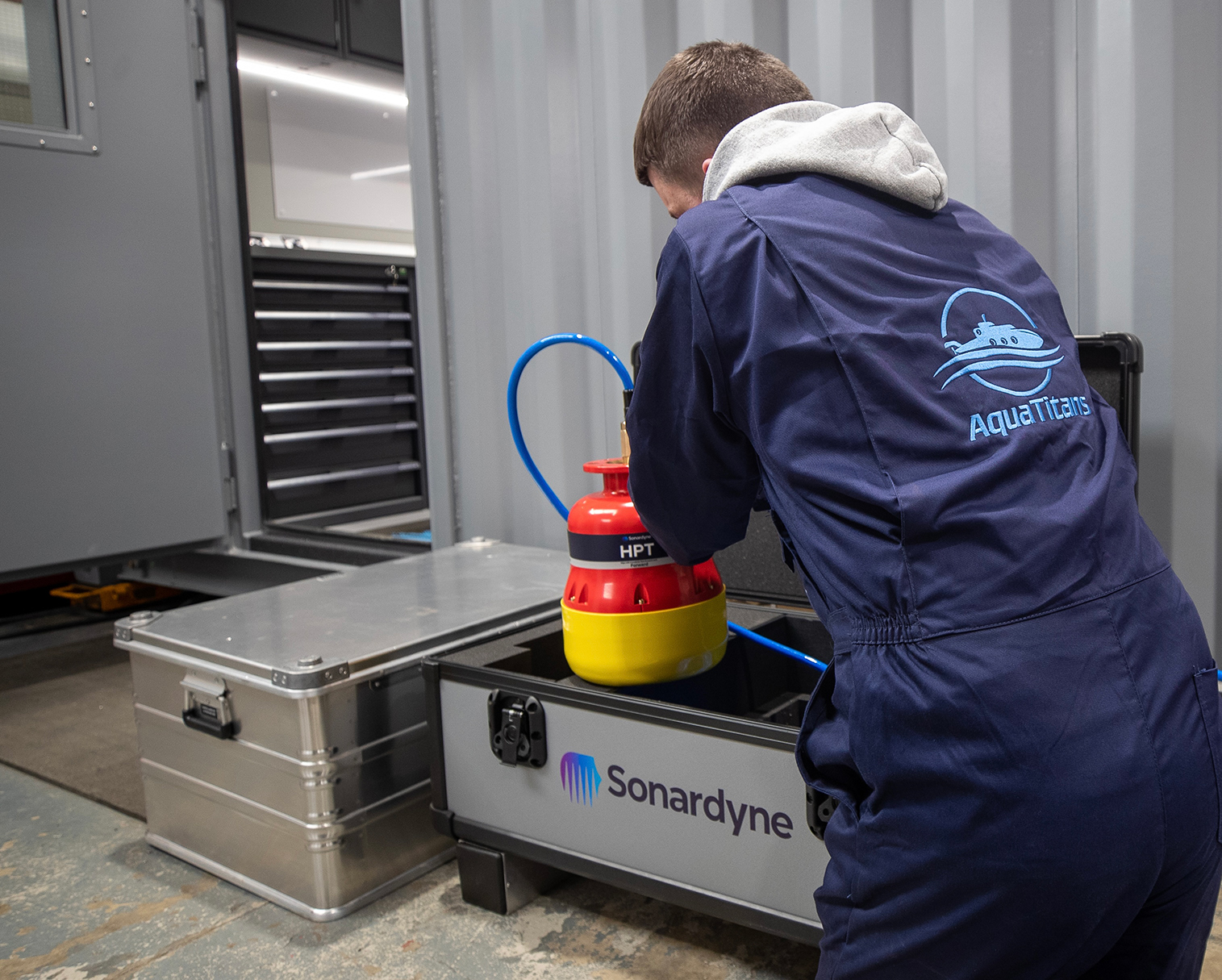
AquaTitans selects Sonardyne tracking for submersibles package
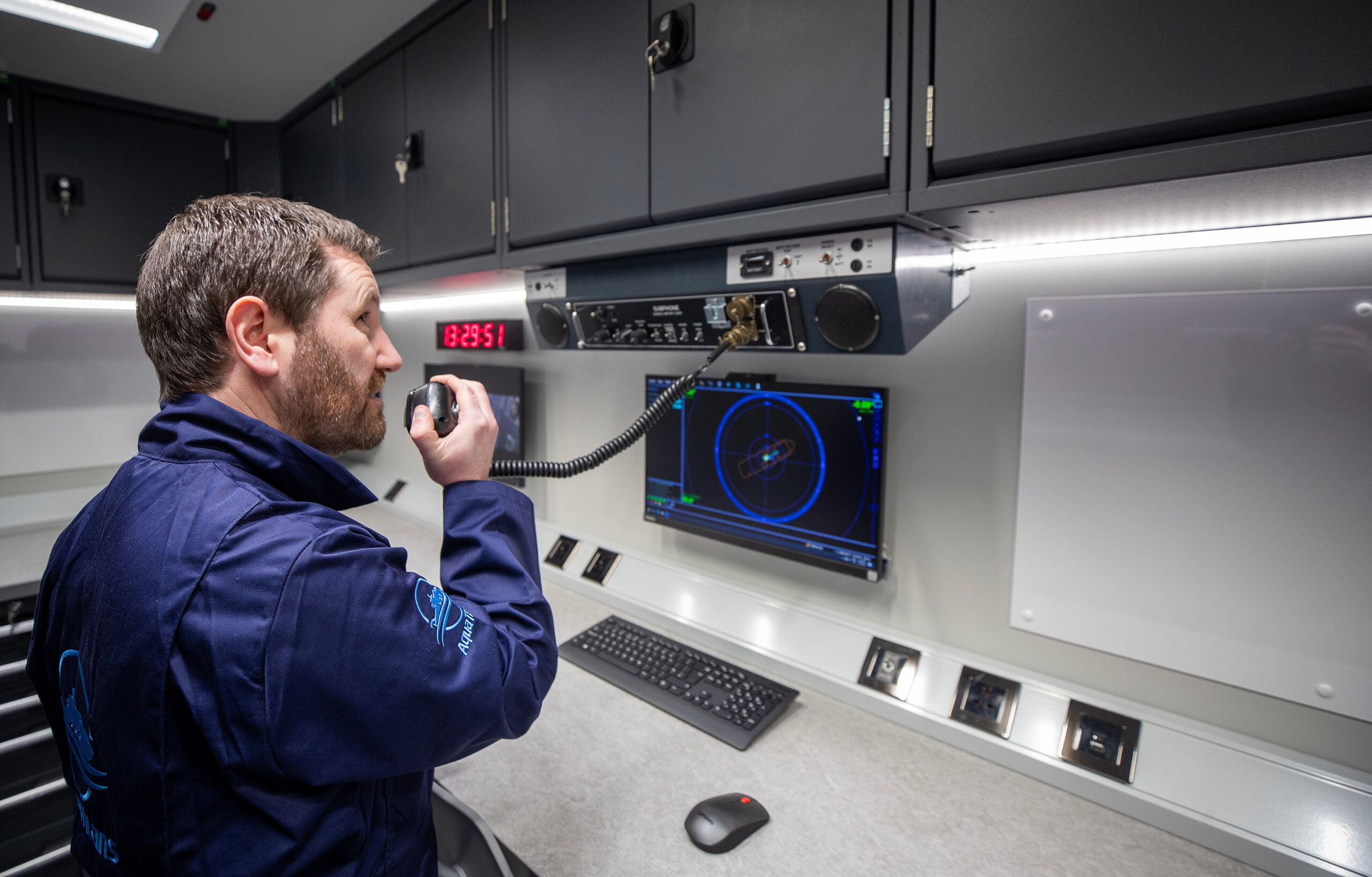
Newly formed specialist manned submersible services provider AquaTitans has chosen underwater tracking systems from marine technology company Sonardyne to support underwater vehicles used by scientists, researchers and filmmakers.
The Glasgow-based company, formed by submersibles specialists Alan Green and William Arthur in 2022, will use Sonardyne’s Mini-Ranger 2 Ultra-Short BaseLine (USBL) positioning system as part of its new containerised submersible support system.
For use from small expedition vessels to large, open-decked offshore support ships, vessels of opportunity or even quaysides, the AquaTitans container concept comes with everything needed to operate submersibles. The package includes dedicated support equipment for underwater communications, re-charging batteries, oxygen and air re-supply, together with accurate and reliable underwater tracking.
The company’s first two 20 ft containerised systems will be used with Triton 3300/3 submersibles; three-man vehicles built by Triton Submarines that are able to carry science and research specialists to depths of 1,000 m. The first delivery was made in Q1 2023.
For work with underwater platforms like submersibles, Mini-Ranger 2 offers a portable and quick to mobilise, versatile tracking and communications system. It provides submersible pilots with the confidence, accuracy and safety assurance they need on critical tasks during dives, saving valuable operational time.
It is ideal for use on vessels of opportunity and even from the quayside, offering performance, without cost and complexity of a permanently installed USBL system. It is able to track up to 10 underwater targets out to 995m operating range, as standard, using Sonardyne’s market-leading 6G hardware and Wideband 2 digital acoustic technology.
The operating range is extendable to 4,000m and, with an optional robotics pack, Mini-Ranger 2 can also provide underwater vehicle command and control.
Alan Green, who has been working with submersibles since his first job working with submarine rescue company Rumic in 2002, says Mini-Ranger 2 was an obvious choice for their containerised solution for submersible operators.
“Sonardyne’s deep water USBL systems are deployed on a number of projects and when we spoke with the submersible pilots and operators, this was the preferred system” he says. “We didn’t need to look elsewhere. The Mini-Ranger 2 has been proven to be reliable, accurate and easy to use; all critical factors when selecting subsea equipment. With confidence in the tracking data, the pilot can quickly locate targets subsea and avoid losing valuable dive time transiting to the wrong location. It is all part of ensuring that the scientists and researchers are able to maximise their time underwater and receive the best experience possible.
“We’re pleased to be supporting AquaTitans in their new venture,” says Alan MacDonald, Sales Manager at Sonardyne. “Both Alan and William are highly experienced operators and their containerised solution will make submersible operation from vessels or even waterside locations far easier, reducing equipment set-up and integration complexities. Mini-Ranger 2 fits perfectly into that ethos.”
Kraken Robotics announces $9.5 million contract with the Navy of a large Asia Pacific country
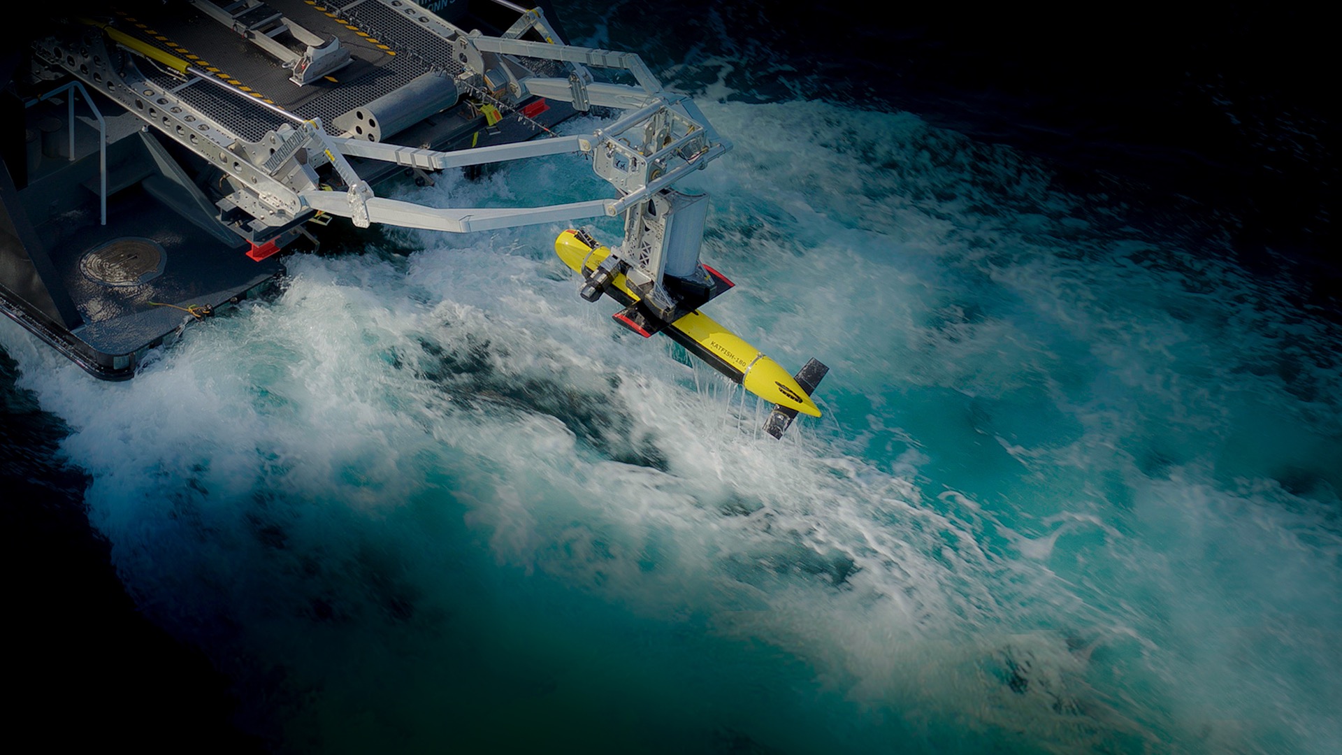
Kraken Robotics Inc. announces a $9.5 million contract to supply high-resolution seabed mapping sonar equipment to a navy in Asia-Pacific. The customer cannot be named at this time. Under the scope of the contract, Kraken will deliver its KATFISH™ high-speed minehunting solution. The contract also includes a variety of support and sustainment options, including training, spares and operational support.
Under the acquisition contract, Kraken will deliver its KATFISH towed Synthetic Aperture Sonar, Tentacle® Winch and Autonomous Launch and Recovery System (ALARS) in Q2, 2023. Kraken’s equipment will be integrated onboard a vessel of opportunity selected by the customer. Continuing to build off successful KATFISH deliveries with various NATO navies, this represents Kraken’s first KATFISH system sale in the Asia-Pacific region.
This contract follows the results of a successful in-country demonstration of KATFISH™ for the customer in Q1 of this year. Kraken’s team worked in concert with a local survey company to complete a 200 km seabed survey that provided real-time ultra- high-resolution imagery and bathymetry of the seafloor along coastal waters.
Kraken is seeing continued opportunities for growth in all regions of the world as several trends are driving demand for Kraken’s synthetic aperture sonar technology. These include:
- A heightened focus on maritime security and protection of subsea infrastructure.
- An industry upgrade cycle and a gradual shift to smaller unmanned surface vessels for mine hunting. There are over 300 manned mine hunting vessels that are more than 20 years old and need to be upgraded over the next 5-10 years. Many of these will be replaced with smaller, unmanned vessels.
- Strong growth in the commercial market from growing requirements for high resolution data for seabed surveys and subsea asset inspection in the offshore oil and gas and offshore wind sectors.
New software introduces AI-powered bathymetric data processing
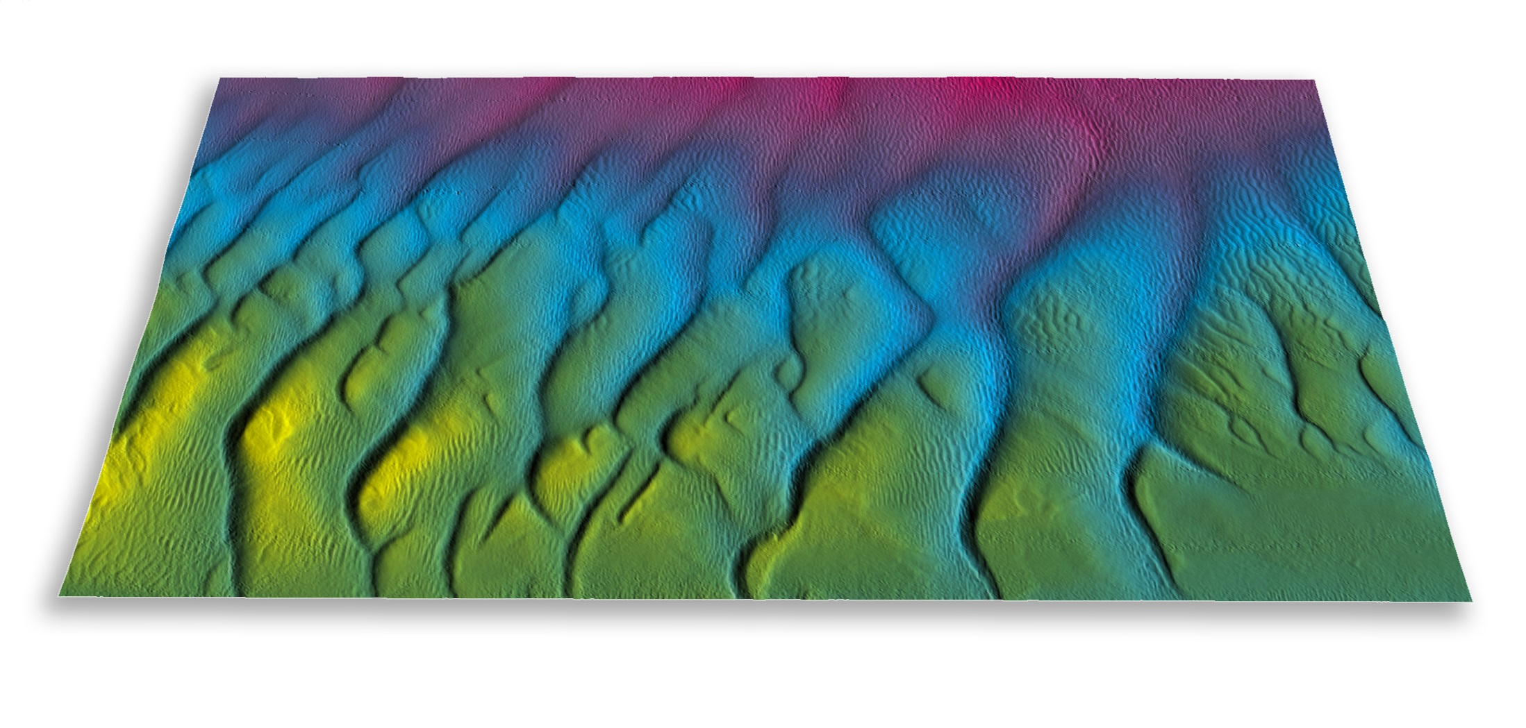
Hydroacoustic technology specialist GeoAcoustics Ltd has officially released GS4 software v1.0.25 for GeoSwath bathymetric sonars, adding several upgrades including an Artificial Intelligence data processing system developed in collaboration with the University of East Anglia.
The software update is available free of charge1 for customers already operating GS4 software v1.0.24 and will be demonstrated this week on the GeoAcoustics stand at OCEANS 2023 in Limerick, Ireland.
The new AI processing augments the existing automated filtering in the GS4 software by removing surplus and undesired data autonomously; during acquisition, the system is designed to log clean data, without any user intervention in the cleaning process, enabling better operational agility and decision support, while cutting the time to final data in post-processing.
The processing happens in real-time, so users only need to oversee data quality and coverage during acquisition, while at the post processing stage, the focus can be purely on georeferencing the bathymetric data using deterministic calculations. The final, noise free and high-resolution bathy products will be fully reproducible with minimal human intervention.
“Our new AI provides real-time actionable bathymetric data on the survey vessel, providing scope for checking coverage and target detection while out on the water,” said Richard Dowdeswell, General Manager, GeoAcoustics Ltd. “It negates the need for a return survey as the quality of the data acquired is known before returning to shore, which reduces the potential for cost overruns and accelerates delivery of the final data to the client.”
GS4 software v1.0.25 adds further operational improvements including Survey Accuracy indication, and an auto mode for side scan data processing.
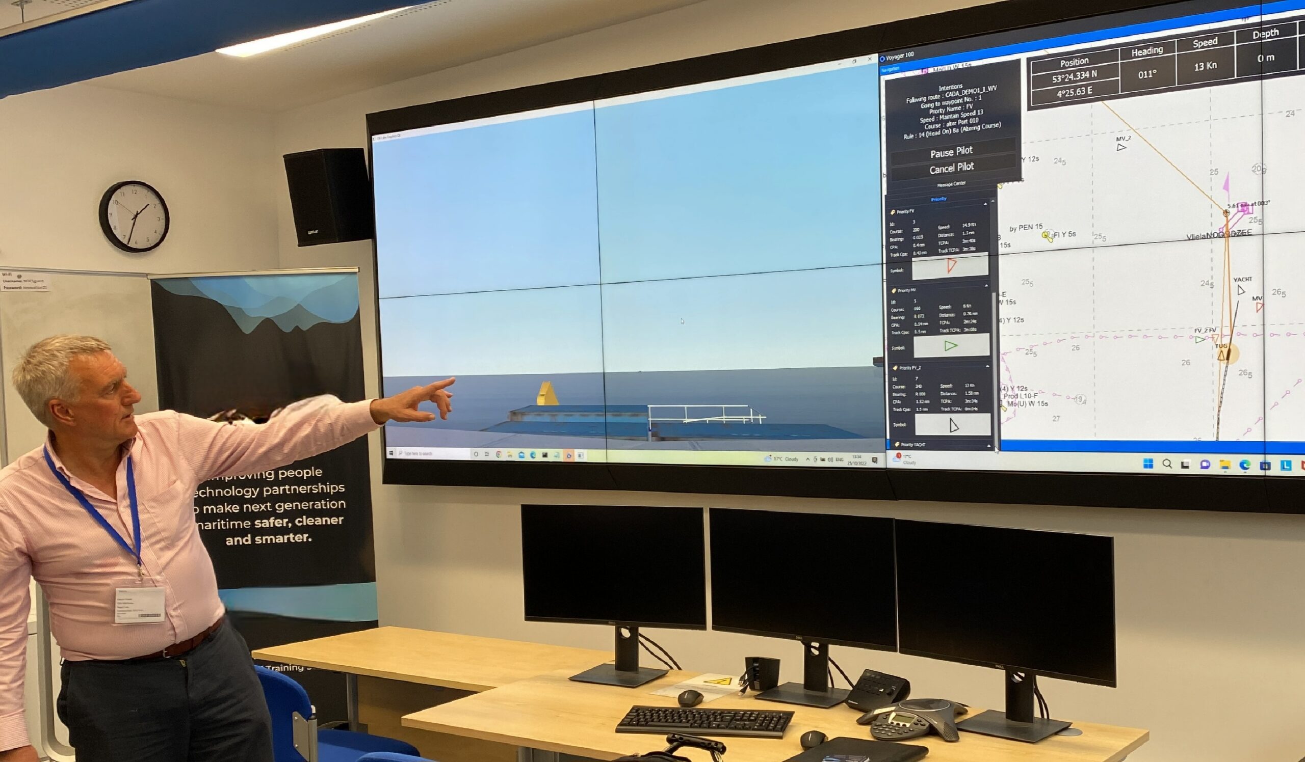
Robosys’ nextgen Voyager 101 intelligent autonomous navigation system goes live at MARIN
Robosys’ Voyager AI’s unique capabilities to deliver intelligent thinking to maritime autonomy navigation was the original driver for MARIN to operate the solution with its own Dolphin Simulation software.
MARIN successfully trialled the original Voyager 100 in its Ship Simulator as part of the Netherlands Joint Industries Project, which, in 2019, culminated in North Sea trials with three ships.
Part of the project’s objectives were to measure compliance of autonomous navigation software, with the IMO international collision regulations (COLREGS), comparing candidate test software systems with Robosys’ Voyager 100 reference software.
Following this, in 2020, MARIN and Robosys announced a collaboration to enhance its testing of autonomous navigation, using Robosys’ Voyager 100 system as the benchmark. MARIN is developing a testbed with which it can test the safety and COLREGs Compliancy performance of Obstacle Avoidance Systems.
Following Robosys’ simulated and worldwide live testing, including India, Canada and Australia, from its UK headquarters at the UK’s NOC, combined with data from its recent customer deliveries, the ground-breaking latest edition of Voyager AI was launched, featuring myriad benefits.
MARIN has welcomed Robosys’ improved nextgen system, the Voyager AI. Dimitri van Heel, Senior Project Manager for MARIN comments, “Robosys Voyager 100 was tested in our simulator environment and performed well in the 2019 tests, therefore we are looking forward to evaluating the improvements included in their latest version.”
Boasting improved collision avoidance and enhanced unique twinning to vessel operational characteristics and mission profile, the new and improved collision avoidance algorithms were devised through extensive utilisation of simulation software combined with real-time challenges.
Multi-vessel avoidance manoeuvre scenarios have also been tested and further enhanced, with Voyager AI featuring improved Explainable collision regulations’ (COLREGs) compliance.
Taking advantage of advances in CPU design and their performance, Voyager AI ‘s core algorithms have also been optimised to run even faster than Voyager 100, to deliver enhanced autonomy at higher speeds and in more challenging shipping situations.
In addition, the Loss of Communications (LoC) function is now a licensable feature of Voyager AI, providing peace of mind to operators by enabling mission continuity in the event of a breakdown in communications.
Furthermore, improved vessel track and dynamic navigational path changes are made in accordance with a vessels’ specific manoeuvrability and its other performance characteristics, which results in a manoeuvring path matched to that particular vessel’s characteristics.
Navigational paths are now set and validated according to user-selected chart parameters, Voyager AI can now be swiftly tuned according to the specific vessel operating area, such as ocean, coastal, or inshore waters.
An exciting addition to Voyager AI has been the addition of an integrated Remote & Autonomous Platform Alarm, Monitoring & Control System (AMCS) tailored by Robosys to provide full support for both uncrewed and lean crewed craft.
Voyager AI now also integrates and controls multiple ship’s hardware, including vessel systems, switches, relays and monitoring systems and alarms. This can range from deck and hull sensors, through to creating an auto-response to initiate an automatic fire extinguisher thanks to tailored pre-set values.
Key to platform integration is the alignment of payload control with vessel control systems and thus Voyager’s AMCS now integrates payload control and the vessel’s performance for seamless USV maritime operations which is specifically aligned to best suit the mission.
Nigel Lee CSO says, “we value this long term partnership with MARIN and are proud of the continual evolution of Robosys’ Voyager AI. MARIN’s ethos matches ours in the quest for a smart, safe and sustainable blue green economy”.
Kongsberg launches unified and simplified K-Chief marine automation system
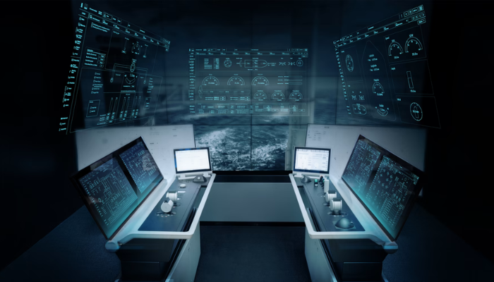
Kongsberg Maritime has unveiled its new K-Chief marine automation system, offering ship owners more efficient operations from a single platform to integrate all Kongsberg equipment on board.
Launched at the 2023 Nor-Shipping marine expo in Oslo, the new K-Chief provides a platform for seamless integration of Kongsberg equipment and easier operations on board the ship. The company has evolved its K-Chief systems over the past 40+ years, with around 20,000 installed on ships worldwide.
This latest development of K-Chief offers a harmonised solution, which can be installed on all ship types. Instead of having multiple platforms suited to a specific market segment, Kongsberg can now offer the benefits of K-Chief on a common platform.
K-Chief has become even more versatile for all types of vessels - from low complexity alarm systems to highly integrated control and monitoring systems.
Erik Korssjøen, Product Director Vessel Control Systems, Kongsberg Maritime, said: “K-Chief is a popular and proven automation platform, and this latest version combines the strengths of our existing platforms to provide shipowners and operators with a better technical and operational solution, and improved integration when they’re selecting more than one system from Kongsberg.
“It provides the basis for one common platform on board the ship to integrate the Kongsberg equipment. For the crew, this simplifies operations making their job more efficient, easier and safer”.
The enhanced integration of the new K-Chief brings benefits through integrating operation of multiple systems. Extensive investments in research and development have resulted in a system, which will reduce costs, improve the operation of the onboard equipment and reduce the likelihood of human errors, improving safety.
Miros launches unique dual sensor for measuring directional wave spectra
Ocean insights leader Miros releases a new unique dual sensor for measuring directional wave spectra, developed by the offshore wind industry.
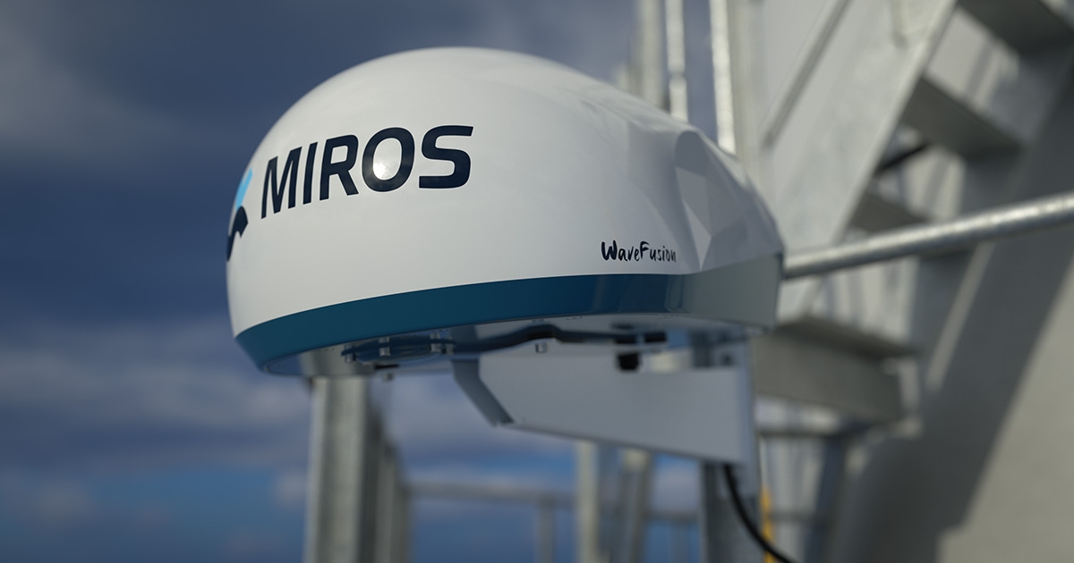
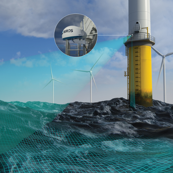
WaveFusionTM is the first of the new next-generation wave radar series by Miros. The directional wave radar provides more visibility and insights over the sea state in all-weather critical maritime operations including shallow waters. The sensor accurately measures data in real-time by utilizing up to 13 sample areas which are at different distances from the turbine.
Combining the footprints, complemented by smart processing algorithms enables new levels of data performance, reliability and redundancy providing a better understanding of the sea state not impacted by the shadowing effect created by the structure.
WaveFusion was developed following industry feedback expressing the wish for a high-quality sensor that reliably measures waves at multiple locations around a wind turbine without compromising on accuracy. The unmatched new sensor combines downward looking and remote sampling measurements taken further - approximately 200m away - from the turbine to ensure accurate assessment of all directional and non-directional waves between one to 30+ seconds.
Earlier this year, the company also launched Data Explorer, a new solution allowing the easy creation of purpose-oriented all-in-one sharable dashboards to analyze real-time and historical data from one or multiple offshore wind sites.
The data from WaveFusion can be integrated into the Data Explorer dashboards, providing an intuitive and easy-to-use solution. The system helps operations and maintenance teams significantly reduce energy consumption levels and emissions caused by cancelled offshore operations due to uncertainties around weather conditions and site access. This supports organisations in achieving environmental and sustainability targets.
Jonas Røstad, Chief Commercial Officer at Miros: “One of the key challenges facing offshore wind operators is accurately measuring directional and non-directional waves around a wind turbine. We are pleased to now have a great sensor to offer. We think the combination of measuring both at the spot of interest and further away from the structure to avoid interference and reflections and choosing the best and most relevant samples during processing will give the most reliable data in all sea states.
“I am proud of our team’s efforts in developing the new sensor. We are committed to remaining at the forefront of innovation and ensuring that our customers have access to the latest technology. We constantly challenge the technology, the material, and the markets we operate in, but the one core area we have never challenged is the definition of quality. Customer satisfaction has always been central to our business.”
WaveFusion is available through the company Sea-State-as-a-Service, which provides customers with access to the data and 24-hour technical support under a subscription model, without the need to purchase, insure, or maintain the equipment.
OceanWise connecting land and sea for global awareness
A summary of Phase 4 of the Federated Marine Spatial Data Infrastructure (MSDI) Pilot
The Federated Marine Spatial Data Infrastructure Pilot is an Open Geospatial Consortium (OGC) Innovation Programme initiative that aims to enhance the understanding and uptake of MSDI and demonstrate the power of Findable, Accessible, Interoperable, Reusable (FAIR) data in the context of the marine environment. These aims parallel MEDIN's aims but with a focus on marine geospatial data standards and technologies.
Phase 4: Connecting Land and Sea for Global Awareness’
The latest phase of the pilot (Phase 4) entitled ‘Connecting Land and Sea for Global Awareness’ is being sponsored by the Maritime Port Authority of Singapore (MPA), the US National Oceanic and Atmospheric Administration (NOAA), the Canadian Hydrographic Service (CHS) and the UK Hydrographic Office (UKHO) and involves participants including MEDIN and OceanWise Ltd.
Phase 4 aims to build on the success of the first three phases – an initial MSDI Concept Development Study, the individually themed Maritime Limits and Boundaries (MLB) Pilot, and the development of a more
generic Arctic Spatial Data Pilot– and comprises three areas of interest (selected by the sponsors) with common threads (Figure1).
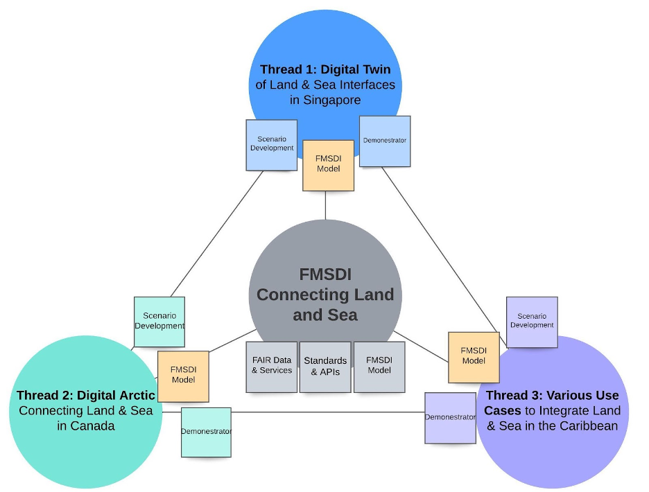
As with similar OGC initiatives, the pilot aims to establish interoperability through the application of stateof-the-art concepts and technologies in the form of an engineering report and several scenario-based
demonstrators (and use cases) from global community experts showcasing how using OGC, IHO, and other open standards can enable the marine and maritime communities to find, obtain, use, share, interoperate,
and re-use data.
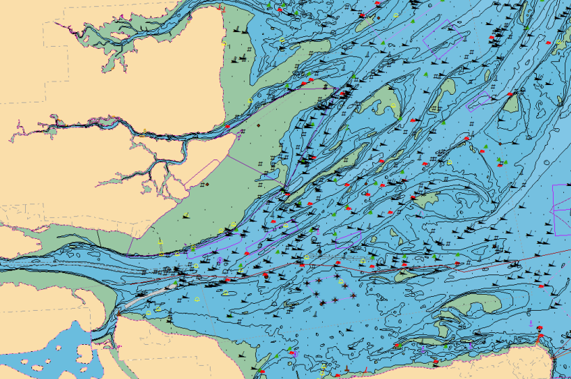
One such technology is the OceanWise’s Marine Themes dataset which utilises source data from responsible authorities and unencrypted navigational data from hydrographic offices. Marine Themes, already available and used widely across the regulatory and energy sectors in the UK, NW Europe, and the Middle East (Figure 2), will be created for selected Caribbean Islands, thus testing the accessibility and efficacy of the required data inputs for use in various scenarios and the ease by which Marine Themes can be mapped onto International Hydrographic Organisation (IHO) S-100 based specifications, such as the MLB specification (S-121).
Demonstrators will be prepared and hopefully made available publicly, each one focused on a particular scenario, such as renewable energy development, human health, and emergency planning and response.
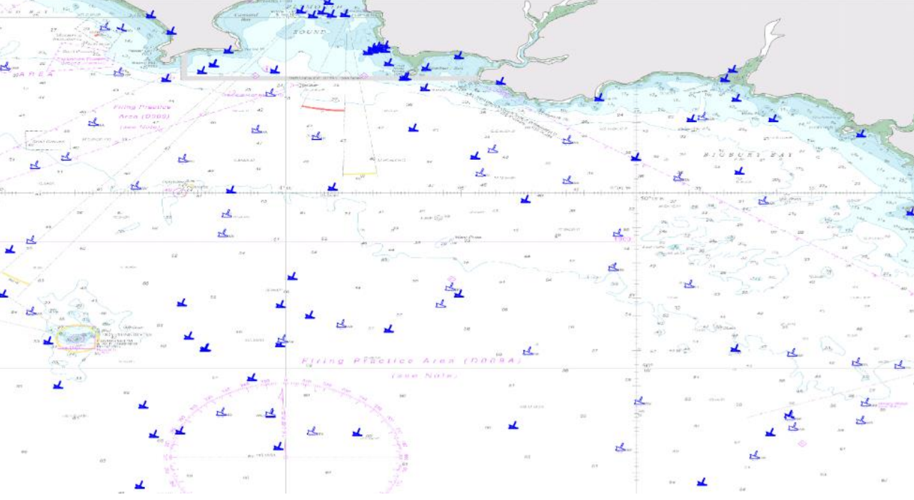
The various data inputs – and therefore Marine Themes – will be tested for land-sea interoperability and the sources assessed against the Integrated Geospatial Information Framework Marine Maturity Index (IGIF-M) and Operational Framework (IGIF-H) recently published by the UN Committee of Experts on Global Geographic Information Management (UN-GGIM). It is hoped the pilot will lever the IGIF and promote the benefits of FAIR principles, with the aim of improving how datasets are managed and shared by data holders. Outputs from the pilot will include lessons learned and identified gaps to inform the development of relevant OGC and IHO standards.