
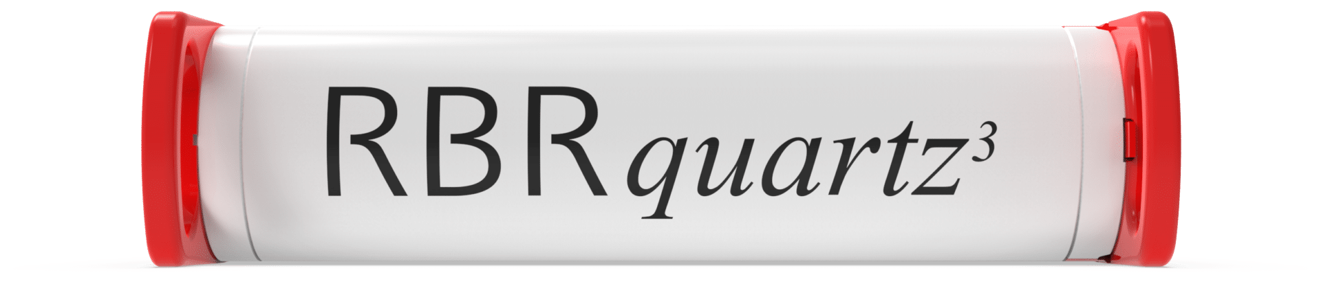
RBR Ltd. releases the new RBRquartz³ Q|plus pressure logger
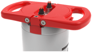
RBR Ltd. is pleased to announce the commercial release of the new RBRquartz³ Q|plus pressure logger to meet the demands for high-accuracy, long-term measurements of sea level, tidal, and wave dynamics by coastal oceanographers worldwide. At the heart of the RBRquartz³ Q|plus is an integrated Paroscientific Digiquartz® pressure sensor for best-in-class initial accuracy, resolution, and low-drift performance.
Learn more: https://bit.ly/3t0JO3Z

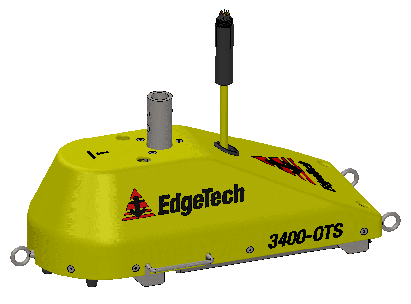
EdgeTech Introduces Two New 3400-OTS Lightweight Pole Mount Sub-Bottom Profiling Systems
EdgeTech, the leader in high resolution sonar imaging systems and underwater technology, has recently introduced two new Pole Mount Sub-Bottom Profilers to the family of 3400 Sub-Bottom Profiling Systems.
Building on the long running success of the EdgeTech sub-bottom profiler product line, the new Ultra-Lightweight Shallow Water and Lightweight Shallow Water over-the-side pole mount 3400-OTS systems provide users many unique enhancements to current sub-bottom profiler systems. The 3400-OTS transmits wide band Frequency Modulated (FM) pulses utilizing EdgeTech’s proprietary Full Spectrum CHIRP technology. The systems use flat multi-channel hydrophone arrays to generate high resolution images of the sub-bottom stratigraphy in oceans, lakes, and rivers and provides excellent penetration in various bottom types. The 3400-OTS receiver array is segmented for standard sub-bottom profiling operations or “pipeline” mode for optimal location and imaging of buried pipelines or cables. The system offers real-time reflection coefficient measurements. This unique function of the EdgeTech sub-bottom profiler system allows users the ability to collect complex ‘analytic’ data using linear system architecture to measure sediment reflection and analyze sediment type determination. Additionally, the system has discrete transmit and receive channels allowing for continuous data collection resulting in a high ping rate particularly important for construction and pipeline surveys.
The lightweight 3400-OTS systems are ideal for shallow water surveys using small boats of
opportunity. The sub-bottom profiling systems come as a complete package including EdgeTech’s DISCOVER sub-bottom acquisition & processing software. The 3400-OTS can also be interfaced to 3rd party software.
For more information please visit: www.edgetech.com.

Extensive underwater camera network to monitor and protect ocean wildlife and blue economies
The ocean wildlife and diverse ecosystems of the UK Overseas Territories (UKOTs) will soon be more visible than ever thanks to pioneering work to establish a major network of underwater camera deployments.
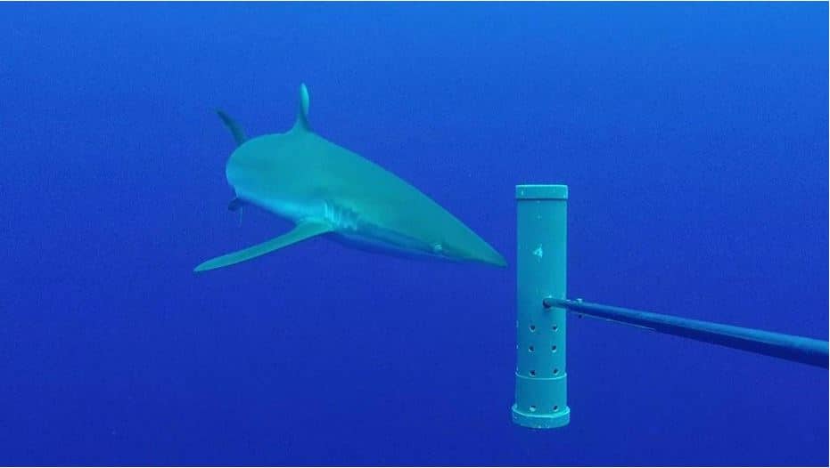
Funded as part of the UK Government Blue Belt programme, scientists from Cefas, the University of Western Australia and partners in the UKOTs are working with Blue Abacus, in a world first to supply and analyse the data collected from 66 non-intrusive stereo-Baited Remote Underwater Video Systems (BRUVS), which will be deployed in open ocean and coastal habitats.
Together these BRUVS will form the Global Ocean Wildlife Analysis Network, which will provide information on ocean biodiversity and ecosystems found in the vast maritime and coastal areas of the UKOTs in the Atlantic, Indian, Pacific and Southern Ocean.
The UKOTs involved in the project are: Anguilla, Ascension Island, British Antarctic Territory, British Indian Ocean Territory, British Virgin Islands, Cayman Islands, Montserrat, Pitcairn, St Helena and Tristan da Cunha.
BRUVS will enable researchers to see below the surface and provide a benchmark of scientific understanding of the marine species within their maritime area, allowing the UKOTs to take more informed decisions about protecting and managing these diverse ecosystems.
The data the cameras collect will provide a standard measure of the status of both open ocean and reef species, letting scientists and the UKOTs set benchmarks for diversity and abundances. This will form valuable information on the many migratory species of open ocean and coastal reef fish species, assist in the management of data-poor fisheries and also improve our understanding of the functioning of pelagic and benthic ecosystems.
Co-founder of Blue Abacus and Professor at the University of Western Australia, Jessica Meeuwig said:
“The world’s tunas, sharks and large reef fish continue to decline in numbers and this trend must be reversed. This programme will give decision makers the evidence they need to act decisively in support of their blue economies.
“We are delighted that the UK Government and Overseas Territories support the drive for increased knowledge as we rebuild our oceans. Our refinements to conventional underwater cameras are what makes possible the rollout of this programme over four ocean basins, the largest single such government-supported initiative globally.
“We look forward to working with the communities in the Overseas Territories, building on their local knowledge and experience.”
The Global Ocean Wildlife Analysis Network of underwater stereo-baited cameras supports ongoing work amongst the UKOTs, many of which are part of the UK Government Blue Belt Programme, which now covers more than 4 million square kilometres of ocean.
Cefas project lead, Dr Paul Whomersley said:
“The UKOTs are taking a global lead on protecting their oceans and the wildlife and livelihoods that it supports.
“Global Ocean Wildlife Analysis Network will provide UKOTs with a world-first network of stereo-baited remote underwater video systems which will enable us all to better understand the biodiversity, functioning and connectivity of these ocean areas, while providing valuable and necessary data to inform and develop UKOTs marine management and protection strategies.”
The project has received support from UK ministers and UKOT representatives.
Timothy Austin, Deputy Director, Research and Assessment, Cayman Islands Department of Environment said:
“The Cayman Islands Department of Environment is very excited at the opportunity to participate in the Global Ocean Wildlife Analysis Network that will bring the BRUV network into the Caribbean region for the first time.
“Nearshore benthic BRUVs have been an important research tool for informing marine species and protected area management in the Cayman Islands. The opportunity to take this technology further offshore will greatly enhance the Cayman Islands’ ability to implement meaningful and effective conservation regimes for this data limited, poorly understood, but crucially important ecosystem.”
Diane Baum, Director of Conservation and Fisheries, Ascension Island Government said:
“Ascension is committed to safeguarding its vast 445,000km2 Marine Protected Area, but we recognise how challenging this will be. The support of the Blue Belt Programme and the opportunity to join Global Ocean Wildlife Analysis Network will help us to meet that challenge.
“Our previous use of BRUVs has given us an insight into the amazing diversity of our open ocean ecosystems and enabled us to identify hotspots of biodiversity that need special protection. Being part of this initiative will provide Ascension with the information we need to take good local management decisions.
“It will also strengthen the network of UK Overseas Territories that is driving improvements in marine conservation at a global scale. Ascension aspires to be the best MPA in the world by basing its management on sound evidence, adopting new technologies and seeking inspirational international partners; this project achieves all three.”
Dr Simon Morley, British Antarctic Survey, representing British Antarctic Territory said:
“Science is constantly striving to find innovative solutions to monitor the marine environment and these baited cameras offer a solution to help us better understand mid-water communities close to shore along the Antarctic Peninsula. This global network, gives us an excellent opportunity to compare different oceans and understanding the impact of our changing climate."
Over the next few months, complete sets of carbon-fibre stereo-BRUVS and associated equipment will be delivered to the UK Overseas Territories.
This initiative builds on progress to date through the Blue Belt programme to improve our understanding of the marine environment of the UKOTs, and to ensure these diverse ecosystems are protected and managed for future generations. Through the programme, the UKOTs have put in place large-scale marine protection and management measures which cover an area of over 4 million square kilometres.
For more information visit www.cefas.co.uk.
Transmark Subsea new representative for Boxfish Remotely Operated Vehicles in Europe
Transmark Subsea becomes the European distributor of ROV systems from Boxfish Research, New Zealand, expanding their offering of high-tech subsea solutions to help their customers operations stay relevant and effective.
Boxfish Research designs and manufactures industry leading, actively stabilised, ultra-high definition underwater ROVs and 360 cameras for submerged asset inspection, defence & security, marine science, energy, aquaculture, police and search & rescue, VR/ AR and cinematography. A tetherless, autonomous option is pending – stay tuned!
Distribution of Boxfish Research ROV systems complements Transmark Subsea’s diverse range of underwater solutions which include WiSub pinless connectors, DeepSea Power& Light cameras and lighting, as well as the company’s in-house range of subsea cabling and termination solutions.
“Boxfish Research is excited to be able to better serve our clients in Europe and expand our regional capabilities in partnership with Transmark Subsea,” said Craig Anderson, Co-Founder of Boxfish Research.
“Transmark Subsea is proud to become the European representative for this reputable product line”, said Transmark Subsea’s Managing Director Leif Hugo Arntsen. “Boxfish’s superior product range aligns very well with our development of Subsea resident solutions and swappable tools.”
For more information, please visit: www.transmark-subsea.com
Top Mississippi State University Oceanographers Select SeaTrac SP-48 for Environmental Monitoring and Threat Assessment
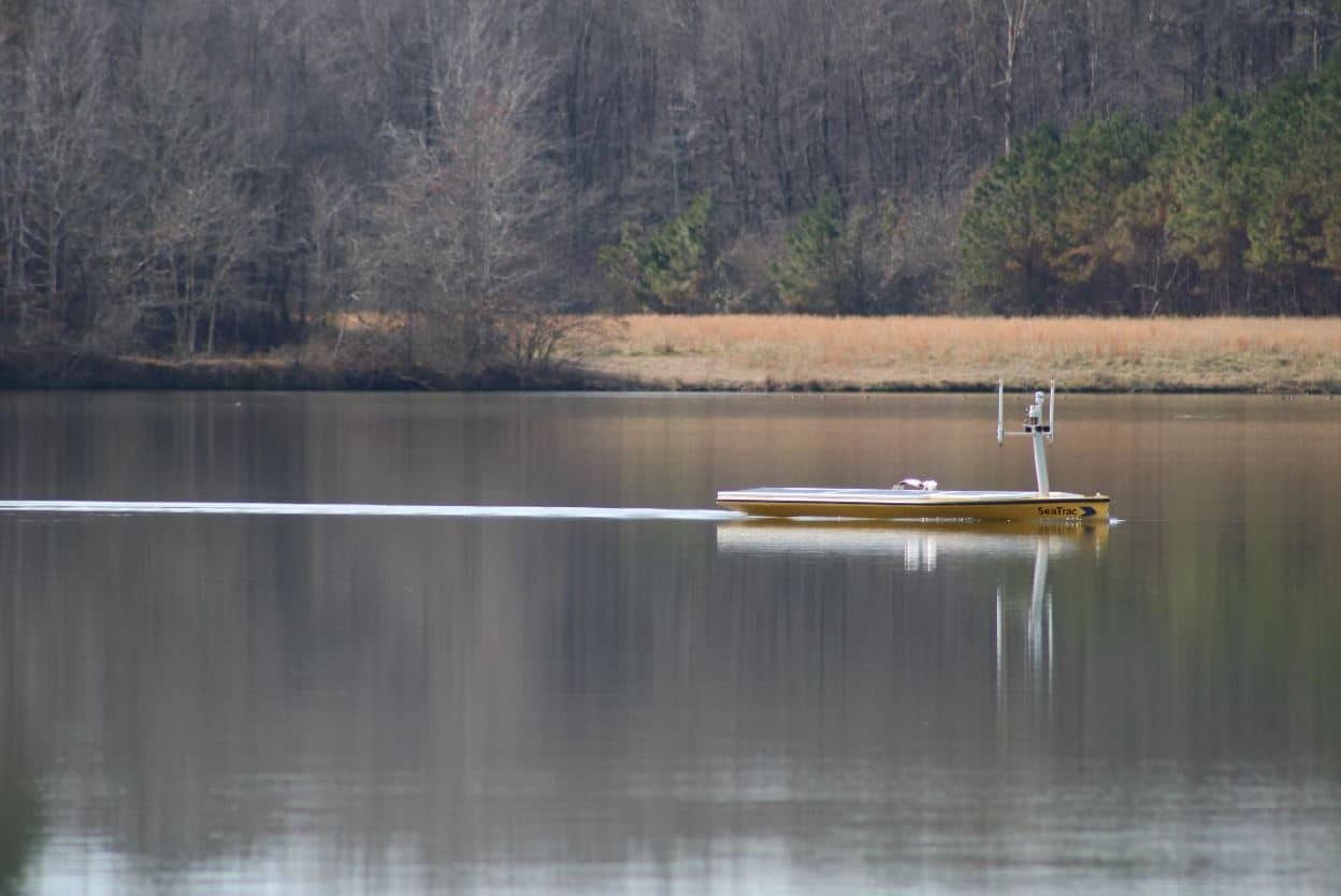
SeaTrac Systems, Inc. (SeaTrac) is pleased to announce the sale and delivery of one of its SP-48 persistent Uncrewed Surface Vehicles (USVs) to a team at Mississippi State University’s (MSU) Geosystems Research Institute (GRI), in Starkville, MS. GRI selected the SP-48 to support a research study funded by the Army Corps of Engineers to study real time water quality monitoring and threat assessment of navigable waterways of the Gulf of Mexico region. GRI develops, operates, and maintains an increasingly integrated research and transition program, the results of which raise awareness and understanding of the Gulf region.
The MSU team was attracted to the SeaTrac platform for its ease of use and versatility to navigate in a variety of waterways, as well as its ample available power to support a rich payload over long durations. The custom payload includes the following: Pro Oceanus CO2-Pro CV sensor, Seabird SBE 63 dissolved oxygen sensor, 3 Seabird ECO Triplets, AML CT Sensor and AML pH Sensor.
“The team at SeaTrac is first rate; they can integrate anything and have been a pleasure to work with, pushing the envelope to fit into their boat all of our complex demands,” notes Dr. Robert Moorhead III, Director of GRI. “Because of its versatility, we plan on deploying the SP-48 in a number of our waterways, ranging from very shallow waterbodies to the open ocean in the Gulf.”
“Increasingly customers’ missions have grown in complexity requiring a range of sensors, and they’re looking for less costly, less resource-intensive and more flexible solutions to carry out a variety of tasks simultaneously in challenging marine environments,” said Buddy Duncan, Co-Founder, SeaTrac Systems. “We are pleased to help the MSU team achieve its real-time monitoring and data-collecting goals.”
The SP-48 is designed for users who require a flexible data gathering and communications platform that adapts to a wide variety of operational scenarios and payloads. The solar-powered, 4.8m SP-48 is a low-logistic, sensor-agnostic persistent USV with Automatic Identification System (AIS) collision avoidance, speed of 5kts, 500W payload power, and 70Kg payload capacity that can host a variety of sensors perfect for the collection and communication of real-time ocean data over long durations. Built to operate in all marine environments—from inland, near shore to open ocean—the SP-48 has a self-righting hull and efficient electric motor that frees it from reliance on wind or waves for propulsion. It is easily deployed from a boat ramp, pier or ship. Communications is achieved by line-of-sight Radio Frequency (RF), cellular, high-bandwidth satellite or custom networks.
For more information, please visit: www.seatrac.com.

Industry Leader Q&A with Prof Edward Hill CBE
 Professor Ed Hill is Chief Executive of the National Oceanography Centre (NOC) having been appointed as Executive Director in 2010, previously holding the position of Director at NOC since 2005 and the Proudman Oceanographic Laboratory (NERC) in Liverpool 1999-2005. Professor Hill has served and continues to serve on numerous national and international advisory bodies, including: the International Steering Group of the Global Climate Observing System (GCOS), the European Marine Board (EMB), the cross UK Government UK Marine Science Coordination Committee (MSCC), the Governing Board of the National Partnership for Ocean Prediction (NPOP).
Professor Hill’s research background is in physical oceanography, specialising in the circulation of continental shelf seas and participated in over 20 research ship expeditions, half of these as Principal Scientist. Professor Hill received his MSc and PhD degrees in oceanography from Bangor University and his BSc in applied mathematics from the University of Sheffield, and subsequently recognised by both universities with the award of an Honorary Fellowship (Bangor) and an Honorary Doctorate of Science (Sheffield). He was appointed a Commander of the Most Excellent Order of the British Empire (CBE) for services to environmental sciences.
-
How is your business adapting to the challenges of these uncertain times?
Like many organisations we had to adapt quickly to home working which we found worked well. A lot of science could be done remote which reduced the amount of staff working onsite. We found that engagement in large meetings was easier to manage when run as a remote event.
However, the biggest challenge was operating the research vessels which required scaling back. We made the most of this opportunity by having a period of maintenance with ship refits over the summer and were able to resume the expedition programme from September 2020, with reduced scientific parties involved.
We put in various layers of protection including the use of quarantining and made use of testing as and when it became available.
We continued to develop technology for ocean observations but the ability to test and trial is something we are looking forward to resuming as things get back to normal. Ultimately, science is a creative and social business that benefits largely from interaction with each other.
-
Please tell us more about how you are supporting your teams and/or local communities?
- Wellbeing programme – webinars, EAP, newsletters, virtual Pilates
- Staff trained in wellbeing to be point of contact for those who need it
- Open staff meeting – regular communication
- Regular check ins from line managers to staff
- Flexible working – allowances for home schooling
- Encouraging staff to look after mental health – encouraging daily walks, being flexible in work, not to stress about achieving as much as they would in normal circumstances
- We provided PPE to local hospitals during the first wave, which were printed at our facility by our staff
-
How do you think the industry will change? Are there potential opportunities?
Our primary focus is research and development. We are likely to see more flexible working in the future and we had already been looking to limit extensive travel, especially internationally, to reduce our carbon footprint. The restrictions on travel has given us an opportunity to participate in large international conferences remotely without the need to travel. We do expect to see more remote communications, although for early career researchers, networking face to face is extremely beneficial.
The pandemic also seems to have made the public more aware of the role of science. Science has clearly been important for providing solutions to the pandemic, and I think there is a great respect for science being used to deliver solutions.
-
What do you think are the main challenges ahead?
The scientific advice given to Government during the pandemic has underpinned some unpopular choices e.g. lockdown, which had an enormous impact on lives and businesses. Consequently, public and media has had a closer scrutiny on what scientists are saying, questioning the data and conclusions drawn from epidemical models. This is not necessarily a bad thing. Science based advice into government may expect greater public scrutiny especially when leading to major impacts on peoples like such as NET ZERO/green energy transition.
The main challenge, in a nutshell, is to continue great science with increased public interest and scrutiny at the same time recognising science is less about facts and more about uncertainty and therefore navigating the uncertainty of decision making based in science advice which is based on incomplete information.
-
What’s the most rewarding aspect of your job?
Seeing great science being done by very bright people across the institute and watching early career researchers develop and grow - making a real impact.
-
And the most challenging?
Recognising the scale and importance of what needs to be done to measure, observe and understand the ocean. Whilst the recognition that sea blindness (out of sight, out of mind) means that securing the resources to be able to do this is a continual challenge.
-
Who or what inspires you to be even better?
When I’m feeling frustrated, one of the best things is to take a walk around the building. I always learn something new from someone who perhaps has just discovered something or got an interesting idea about something. I’m inspired by their enthusiasm. I go back to my desk thinking, “Yes, this is totally worth it”.
-
Tell us a fun fact about yourself that most people don’t know.
I’ve climbed the Old Man of Hoy, a 449-foot (137-metre) sea stack. 8 hours up 2 hours down – not a world record!
-
What’s the best advice you’ve ever been given?
By my former boss once said: “I expect my Directors to direct. If you screw up, come and tell me. I won’t blame you, I just need to know. If you screw up repeatedly, I might begin to question your judgement.”
-
What advice would you give to someone starting out in the industry?
Anything is possible. Don’t limit yourself or your own ambitions. If you put your mind to it, it’s possible.
-
Why is innovation so vital to the ocean technology sector?
The ocean is an economic, environmental, geopolitical and technological frontier and we need new technologies to both measure and operate in the ocean, in ways that enable us to operate at scale and to have a continuous presence in the ocean. The technology that enables us to do this, are the technologies of the future, e.g. robotics, communications, autonomy, AI and big data analysis. These are the only things that are absolutely essential.
-
How important is Ocean Business to the ocean technology sector? Why would you recommend a visit?
As the CEO of the National Oceanography Centre, I would say it was very important and a unique opportunity to bring people together from across the industry; to be actually able to undertake hands-on demos of equipment in the water, with conferences and networking opportunities and with the opportunity to informally socialise and engage in the city of Southampton. All taking place in one of the top research institutions.
With a really great atmosphere, I definitely recommend a visit! If you come once, you will be back.
High Speed Transfers future proofs fleet with triple order from BAR Technologies and Chartwell Marine
HST places order for two BARTech 30 CTVs and an additional Chartwell 24 in high-tech boost for offshore wind
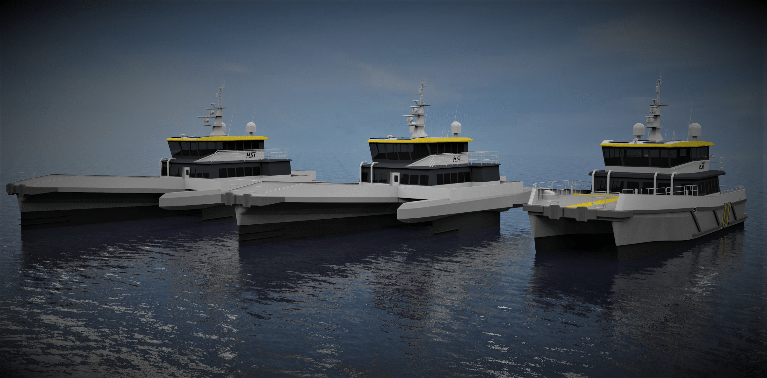
High Speed Transfers (HST), an innovative crew transfer vessel (CTV) operator that supports the offshore wind energy and oil and gas industries worldwide, has confirmed its order of two BARTech 30 CTVs from innovative simulation-driven marine engineering consultancy, BAR Technologies, and an additional hybrid Chartwell 24, with BAR Technologies’ Foil Optimised Stability System (FOSS), from Chartwell Marine, a pioneer in next-generation vessel design. The vessels will be built at Diverse Marine, on the Isle of Wight, UK.
As offshore wind technology continues to evolve, and projects are developed further out to sea, the operational profiles that wind farm operators require have become diversified. Versatile fleets have become increasingly prized in the race to scale the sector in new markets. Equally, as decarbonising the vessel supply chain becomes a key imperative for wind farm owners and operators, BAR Technologies’ CTV is set to provide HST with fuel – and therefore emissions – savings of up to 30%.
Additionally, to ensure that new projects can be safely and efficiently maintained, vessel designers have risen to the challenge to deliver the next wave of innovation in offshore wind’s maritime supply chain – without sacrificing the proven characteristics that have underpinned the sector’s success to date. The two BARTech 30 vessels will offer HST the flexibility to operate year-round, benefiting from a significant reduction in vertical acceleration to ensure optimal performance.
HST’s order will ensure that the business is able to continue to provide the highest standards of comfort for passengers during voyages to wind farms even in regions that typically see higher sea states such as the US. The proven Chartwell 24 vessel formula will be further enhanced with BAR Technologies’ FOSS, offering improvements in seakeeping and boosting efficiency.
Crucially, the vessels will all have the same layout of the console, seating and bridge, adhering to HST’s strict safety specifications and ensuring operational familiarity for crew and passengers. All three vessels will be equipped with Reygar’s BareFLEET technology to give HST a granular view of fuel use and operational efficiency, delivering savings to clients and using data to demonstrate the concrete benefits of the vessel platforms to wind farm operations.
Tom Nevin, CEO, High Speed Transfers, said: “Offshore wind owners and operators have shown a real appetite for efficient, low-carbon vessel platforms. It is exciting to work with vessel designers such as BAR Technologies and Chartwell Marine who understand what the industry needs and have the expertise to deliver next-generation designs without overcomplicating the vessels. BAR Technologies’ FOSS is fast becoming a ‘must have’ and we are keen to demonstrate the capabilities of our new vessels to the market.”
John Cooper, CEO, BAR Technologies, said: “Offshore wind is about to enter a golden era, but the sector needs to be ready for rapid growth – and this means building out a solid global fleet. We are proud to support forward looking vessel operators such as HST as they tackle the challenges of future offshore wind operations head-on by adopting the latest innovations in vessel design.”
Andy Page, Managing Director, Chartwell Marine, said: “We looked at a broad suite of propulsion options for the vessel before deciding on the configuration that suits HST’s needs best, as we understand how important it is to maintain the core HST identity while continuing to innovate. By opting for a full complement of BARTech 30 and Chartwell 24 CTVs, HST has continued to show leadership in offshore wind by taking the next step in performance.”
John concluded: “Decarbonisation is the next great challenge for the offshore wind sector as it continues to expand into new markets. A crucial element of net-zero in offshore wind is reducing emissions in its maritime supply chain, using hydrodynamic expertise to deliver vessel platforms designed to reduce energy waste, opening the door to battery-electric drivetrains and cutting the carbon footprint of existing fuels.”
For more information, please visit: www.hst-marine.com, www.bartechnologies.uk or www.chartwellmarine.com
Sonardyne’s forward looking sonar now supported in NAUDEQ’s ECDIS
Marine technology company Sonardyne has announced its Vigilant Forward Looking Sonar (FLS) is now available as an external sensor interface for NAUDEQ’s electronic chart display and information system (EDCIS) MASTER-DEQ.
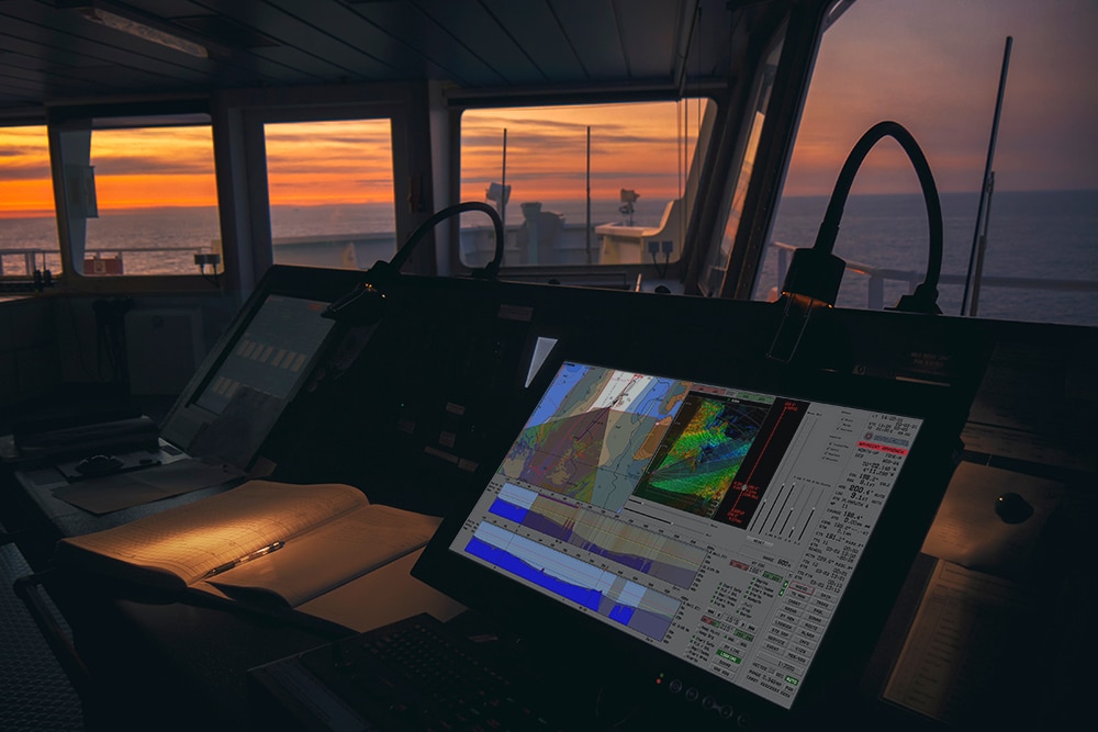
Sonardyne’s Vigilant FLS shows captains and crews where it is safe to navigate and alerts them to potential underwater dangers that could result in a collision or grounding. It can be used as standalone system or overlaid into third party ECDIS systems such as MASTER-DEQ. This means NAUDEQ’s naval, merchant and fishing vessel users can now take advantage of this valuable aid to navigation through Vigilant’s enhanced reality imaging overlaid on their MASTER-DEQ bridge display.
Using the sonar data from Vigilant, NAUDEQ’s MASTER-DEQ builds and displays cut profiles and 3D maps of the seabed, taking into consideration the tide level. Through MASTER-DEQ, mariners can also view cut profiles looking at their course over ground, obstacle avoidance coinciding with heading and a profile in a user-defined direction. By superimposing reliable Vigilant data on the seabed topography, built using NAUDEQ’s technology and using ENC S-57 data, a comparative analysis can also be run. Any discrepancies between the chart data and the real-world returns from Vigilant are then clear to see.
For more information visit: www.sonardyne.com

Amphibious vehicle auto-pilot for British Army
The team at Dynautics recently worked closely with Ultrabeam Hydrographic on a MoD Defence and Security Accelerator (DASA) funded project, ‘Map the Gap’, run on behalf of the Defence Science and Technology Laboratory (Dstl). Ultrabeam, in conjunction with Foundry Cube Ltd (a subsidiary of Ultrabeam Limited), was awarded one of five contracts to develop a remotely-operated reconnaissance aid to help British Army troops safely and stealthily advance across water obstacles in enemy territory.

Crossing challenge
Currently, the only way of identifying suitable water crossing points is to send Royal Engineer reconnaissance troops to survey both banks of the river – exposing them to danger which also risks compromising the operation by signalling interest in that location to the enemy. The aim therefore is to ultimately remove personnel from these dangerous tasks with a remote system that allows more crossing locations to be surveyed, increasing the choices available to commanders and giving an opportunity to surprise the enemy.
Tailored solution
Ultrabeam’s goal was to demonstrate the capabilities of their autonomous and amphibious hydrographic survey vehicle – the Argocat – in meeting the challenges of this crucial work.
As a strategic partner, Dynautics is sharply focused on the ultimate goals of its customers and the team immediately started work on honing autopilot specifications to support the Ultrabeam team in achieving their mission. Dynautics’ key task was to develop its MicroSPECTRE autopilot hardware to drive the Argocat. This included the consideration of: joystick-based remote operation; the ability to follow a straight-line heading or pre-planned mission tracks; steering, heading control and track keeping both for land and waterborne operations and collision avoidance measures.
“We thrive on new integration challenges to existing systems. The team had never attempted to control a vehicle both on land and in the water before, but we were able to adapt our SPECTRE Autopilot quickly and effectively. It goes to show really how robust and capable our solutions are.”
Henry Robinson, Dynautics CEO

Successful field trials
Dynautics’ autopilot products enable tight heading and speed controls, track following (including event management at waypoints), vehicle following, collision avoidance, attitude and depth control as well as hovering and dynamic positioning. Traditionally used for marine vessels, such as uncrewed surface vessels (USVs), adapting MicroSPECTRE for an amphibious vehicle was a new challenge that the team rose to, with successful field trials being completed in December 2020.
Moving forward
The second phase of the Map the Gap project has now been launched and Dynautics continues to work closely and collaboratively with Ultrabeam Hydrographic. More news coming soon!
Watch the video for more info on the Argocat and phase 1 trials:
For more information visit: www.dynautics.com/2021/02/26/amphibious-vehicle-auto-pilot-for-british-army