
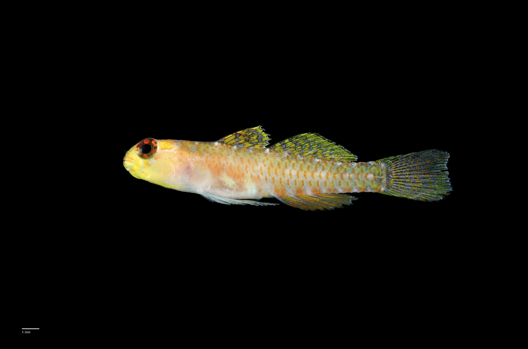
Scientists discover over 1,100 new marine species in landmark Ocean Census
- Scientists have found 1,121 previously unknown species, fast-tracking discovery and marking a 54% jump in annual identification.
- Discoveries from depths of up to 6,575m include a new species of deep-sea ghost shark, a symbiotic bristle worm living within a ‘glass castle’, as well as corals, crabs, shrimps, sea urchins, and anemones.
- Led by The Nippon Foundation-Nekton Ocean Census, this global effort included 13 expeditions and 9 species discovery workshops with leading scientists across the world.
World’s largest mission to accelerate species discovery reveals extraordinary new life forms from some of Earth’s most extreme and unexplored environments.
Scientists have discovered 1,121 marine species in a single year, marking a significant step forward in efforts to document life in the world’s oceans. From the ‘Ghost Shark’ Chimaera, a distant relative of sharks and rays in the Coral Sea, to symbiotic worms on volcanic seamounts in Japan, the findings uncover a complex array of life beneath the ocean surface.
The Nippon Foundation-Nekton Ocean Census, the world’s largest mission to accelerate ocean species discovery, marks a pivotal third year with 13 expeditions across some of the world’s most remote and least explored ocean regions, in partnership with JAMSTEC, CSIRO and the Schmidt Ocean Institute.
With up to 90% of ocean species still undiscovered, the findings highlight both the sheer scale of life yet to be documented and the importance of building scientific data that policymakers and marine managers need to protect the ocean.
Dr. Michelle Taylor, Head of Science at Ocean Census said: "With many species at risk of disappearing before they are even documented, we are in a race against time to understand and protect ocean life. For too long, thousands of species have remained in a scientific 'limbo' because the pace of discovery couldn't keep up. We are now breaking that bottleneck. By accelerating discovery and sharing data globally, we are not just finding new life, but generating the evidence needed to drive global science and policy at a critical moment."
Species spotlights:
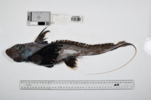
The ‘Ghost Shark’ Chimaera (Chimaera sp. 1)
Location: Coral Sea Marine Park, Australia
Depth: 802–838 metres
Often called "ghost sharks," chimaeras are among the most mysterious inhabitants of the deep ocean. Distant relatives of sharks and rays, they diverged into a distinct evolutionary lineage nearly 400 million years ago - predating the dinosaurs. The species was discovered by taxonomist Dr William White during a CSIRO expedition to the Coral Sea Marine Park, off the Queensland coast. Today, a third of sharks, rays and chimaeras are vulnerable to extinction.
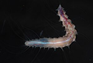
‘Life in a Glass Castle’ Symbiotic Worm (Dalhousiella yabukii)
Location: Shichiyo Seamount Chain, Japan
Depth: 791 metres
Discovered on a volcanic seamount during the 2025 Ocean Census JAMSTEC-Shinkai Japan expedition, this polychaete worm makes its home inside a ‘glass castle’: the intricate chambers of a glass sponge, a creature with a skeleton made of crystalline silica. Named after the mission's principal investigator, Dr Akinori Yabuki, this discovery was made by Dr Nato Jimi and published in The Zoological Journal of the Linnean Society.
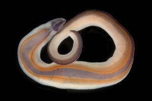
Ribbon Worm (Drepanophoridae sp.1)
Location: Timor-Leste
Depth: 1-5 metres
The striking pigmentation of this ribbon worm may serve as a visual warning to predators; a signal of the potent chemical defences common to the phylum Nemertea. Beyond their ecological role as predators, these worms may have biomedical significance; some of their unique toxins have been investigated as potential treatments for Alzheimer’s and schizophrenia. Discovered by Dr Svetlana Maslakova, the worms are less than 3cm long and their vivid pigmentation serves as a warning to predators, signalling potent chemical defences.
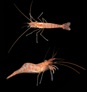
Mediterranean Shrimp (Caridion sp. 1)
Location: Marseille, France
Depth: 15-35 metres
A striking new species of shrimp found in a sea cave off Marseille proves that major marine discoveries are still being made right on Europe’s Mediterranean coast. Defined by its vivid orange banding and intricate appendages, the specimen was identified by taxonomist Dr Hossein Ashrafi, building critical data for effective conservation in the pressured Mediterranean region.
Mitsuyuku Unno, Executive Director of The Nippon Foundation said: "This year, Ocean Census has shown what is possible when scientific ambition is matched by global collaboration at scale. Through expeditions reaching polar depths to tropical seas, and the science to turn samples into discoveries, this team is revealing the extraordinary richness of ocean life.”
Powering Ocean Discovery: New Open Access Platform NOVA
Historically, the average time between a species' initial discovery and its formal ‘description’ in scientific literature is 13.5 years - meaning species are at risk of extinction before they are even catalogued. To address this, Ocean Census and collaborators are recognising ‘discovered’ as a formal scientific status that can be immediately recorded in NOVA, a new digital platform for marine species data.
Ocean Census NOVA makes collected data available within weeks, or even days, through a systematic, transparent and open access approach. Driving NOVA and Ocean Census is a science network of over 1,400 contributing taxonomists and scientists from 660 institutions in 85 countries.
Bridging the Knowledge Gap for Global Action
These 1,121 new marine species represent the outputs from a coordinated global alliance committed to transforming the speed at which we can discover marine life. High-quality data of this kind is the foundation for international action, providing the vital science required for the High Seas ‘Biodiversity Beyond National Jurisdiction’ Treaty and the Kunming-Montreal Global Biodiversity Framework. As the Ocean Census scales, its global network and open-access platform, NOVA, will help ensure that this critical data is available to inform global decision-making.
Ocean Census has spent three years building the systems, networks, and infrastructure required to discover ocean life at speed and scale. The method is proven - now it must be applied at the pace the challenge demands. Ocean Census co-founder, Nekton, is seeking $100M in catalytic capital to unlock $75M+ already pledged by partners, driving progress toward the ambition of discovering 100,000 new marine species.
Oliver Steeds, Director of Ocean Census said: "We spend billions searching for life on Mars or going to the dark side of the moon. Discovering the majority of life on our own planet - in our own ocean - costs a fraction of that. The question is not whether we can afford to do this. It is whether we can afford not to."


Next GeoSolutions awarded a new contract in the North Sea with Dutch TSO TenneT worth approximately €9 million
 Next Geosolutions, one of the leading international players in marine geoscience and offshore construction support services for the energy sector and listed on Euronext Growth Milan market, announces the award of a contract by TenneT TSO B.V. with a total value of approximately €9 million.
The contract covers the execution of marine survey activities in the offshore wind area “Voordelta – Nederwiek 3”, part of TenneT’s Roadmap 2030, aimed to assess the technical feasibility of the cable corridor, identify any seabed obstacles and supporting the design and engineering phases of the infrastructure, thereby reducing operational risks during the installation of the export cables connecting the offshore wind area to onshore facilities.
Specifically, operational activities will include geophysical and geotechnical marine surveys along the cable route, based on the acquisition and processing of geophysical data for seabed mapping, complemented by deep geotechnical sampling and analyses down to 40 metres, aimed at characterize the subsoil, as well as the identification of any unexploded ordnance (UXO) and obstacles along the route.
Operations will take place within the offshore wind area “Voordelta – Nederwiek 3”, in nearshore and tidal areas, with completion of activities expected by Q3 2026.
Valentina De Rienzo, CCO of Next Geosolutions, commented: “This new contract further strengthens NextGeo’s positioning as a reference partner for marine survey activities supporting thedevelopment of offshore energy infrastructures. The collaboration with TenneT demonstrates the trust placed by a leading European operator in the Group’s technical expertise and integrated approach. NextGeo continues to stand out for its ability to deliver reliable and efficient solutions in complex environments, contributing to the development of the offshore energy transition.”
The award forms part of TenneT’s broader European offshore power grid development programme and contributes to one of the most advanced infrastructure plans at continental level, in a context characterised by a growing demand for renewable energy.
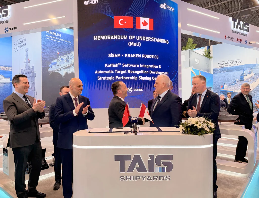
Kraken Robotics signs Memorandum of Understanding with SEFINE SISAM
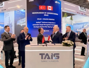 Kraken Robotics Inc. announces it has signed a Memorandum of Understanding (MOU) with SEFINE SISAM (Strategic Unmanned Systems Research Center) during the SAHA exposition in Türkiye.
As part of the agreement, Kraken will work with SISAM to integrate KATFISH into its mission planning software and develop automatic target recognition (ATR) capabilities for Kraken Synthetic Aperture Sonar.
“We’re pleased to continue our work with SEFINE following a successful at-sea demonstration earlier this year,” said Bernard Mills, Executive Vice President of Defence at Kraken Robotics. “This partnership poises us to rapidly develop and deliver relevant capability in a region that combines industrial excellence and operational need. Together, we are advancing fully integrated, autonomous solutions for seabed warfare and mine countermeasures—enhancing the speed, accuracy, and efficiency of maritime security operations.”
Kraken and SEFINE recently demonstrated Kraken’s KATFISH and unmanned surface vessel (USV) launch and recovery system from SEFINE’s RD-22 USV off the coast of İstanbul, Türkiye, validating rapid, high-resolution detection and classification of mine-like objects and critical underwater infrastructure in an operational environment.
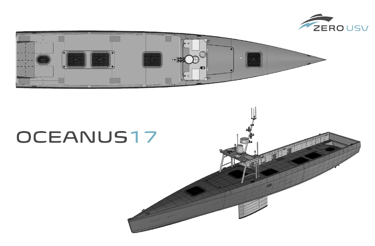
ZeroUSV accelerated Oceanus17 build as next generation USV takes shape
 ZeroUSV is rapidly progressing the build of its next-generation uncrewed surface vessel, Oceanus17, with the USV set to be launched in July after just 14 weeks into construction
Oceanus17 has been designed for long-range, deep-water and over-the-horizon operations, combining increased payload capacity with modular mission integration.
The vessel features a 4-tonne payload capacity, enabling integration of complex and power-intensive mission systems. A 20ft ISO-compatible mission deck supports containerised payloads and rapid reconfiguration between roles, allowing a single platform to be deployed across multiple mission profiles.
A dedicated payload integration phase will follow ahead of significant tasking by the Royal Navy at the NATO led Exercise REPMUS in Portugal during the whole of the month of September.
Oceanus17 is being developed as a scalable, multi-role platform, supporting ISR, hydrography, subsea survey, environmental monitoring and maritime security operations. The design reflects increasing demand for persistent uncrewed capability in complex and remote maritime environments.
Matthew Ratsey, Managing Director, ZeroUSV, said: “Oceanus17 represent a spiral development of the highly successful Oceanus12 USV, andreflects a clear shift towards larger, more payload capable uncrewed platforms. With a 4-tonne payload and ISO-standard modularity, as well as over 30kW of power available for external payloads, it enables operators to integrate complex systems and reconfigure quickly for different missions. At ZeroUSV we believe the bleeding edge of USV development is the capability of the platform through the integration of mission relevant payloads whether for deployment for defence or commercial applications”..”
The programme builds on operational experience from ZeroUSV’s existing fleet, including Oceanus12, and supports the company’s strategy to expand its portfolio of long-range autonomous surface vessels.
Further technical detail on Oceanus17 will be shared during a ZeroUSV webinar on 15th May at 1.30pm.
To take part in the deep-dive webinar, sign up here: zerousv.com/webinars/oceanus17
Fugro partners with SSE for Berwick Bank Project
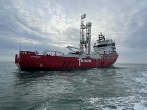
Fugro geotechnical survey to support Berwick Bank B offshore wind farm
Fugro has been awarded a major geotechnical survey contract by SSE for Berwick Bank B, part of the landmark Berwick Bank offshore wind project in the North Sea. Berwick Bank B is the second phase of Berwick Bank, which is targeting the delivery of 4.1 GW of offshore wind capacity across three phases. If built to its full capacity, Berwick Bank could become the world’s largest offshore wind farm, capable of generating enough clean electricity to power more than six million UK homes annually.
Located off Scotland’s east coast, Berwick Bank is a nationally significant development that could add up to £8.3bn to the UK economy, support over 9,000 jobs and strengthen long‑term energy security through reliable, homegrown power. In January, Berwick Bank B secured a long‑term Contract for Difference through the UK’s Allocation Round 7, a major milestone that underscores the project’s significance within the offshore wind market.
Building the foundations for a cleaner energy system
Fugro is carrying out a full geotechnical investigation to enable the design of fixed‑bottom turbines planned at the Berwick Bank B site. This area represents 1.4 GW of the overall 4.1 GW total capacity.
Fugro is drilling boreholes to depths of up to 50 metres below the seabed to collect high‑quality soil and rock samples. These samples will provide the Geo-data needed to design safe and efficient foundations for the turbines.
Advanced technology for challenging conditions
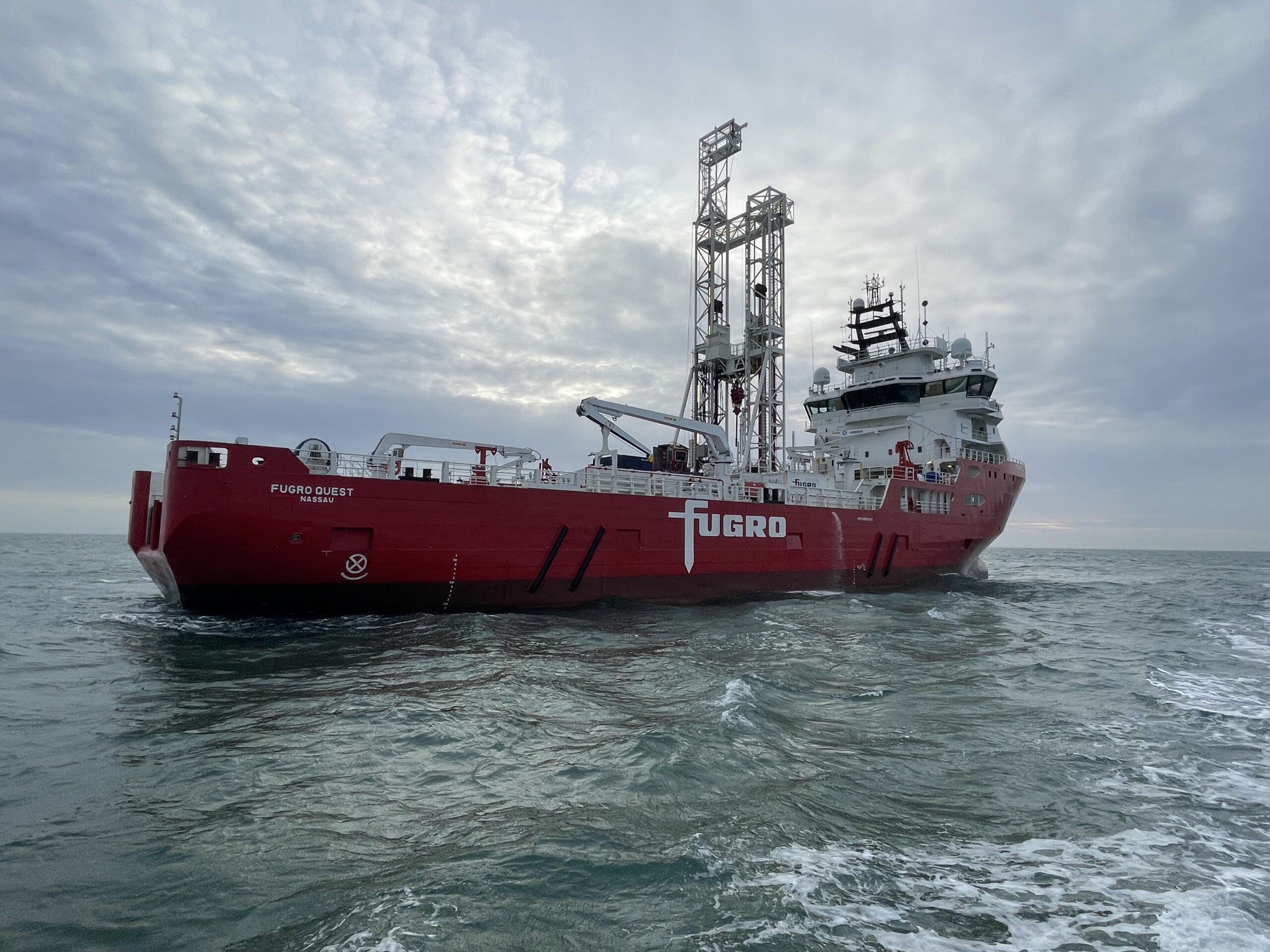
The work is being delivered by Fugro’s geotechnical vessels, Fugro Quest and Fugro Zenith, using specialist coring and conventional sampling techniques. These methods are well-suited to the site’s complex ground conditions and will help reduce construction risk.
“The commencement of a geotechnical investigation campaign to inform the final design of Berwick Bank B’s turbine foundations is an important milestone and demonstrates our commitment at SSE to disciplined and derisked project delivery. As we progress the project towards the final investment decision (FID), we are pleased to continue our longstanding relationship with Fugro and look forward to delivering a safe and successful geotechnical investigation programme at Berwick Bank B,“ said Gordon Rae, Geotechnical Package Manager for Berwick Bank at SSE Renewables.
“This award reflects the confidence SSE has in Fugro’s geotechnical expertise and builds on our established partnership supporting the Berwick Bank project,” said Remmelt de Jong, Fugro’s Director for Marine Site Characterisation in Europe and Africa. “Our advanced coring capabilities and strong offshore track record will support safe and efficient foundation design. We’re proud to continue working with SSE on one of the world’s most significant offshore wind developments.”
Longstanding collaboration supporting the energy transition
This new work builds on Fugro’s ongoing involvement at Berwick Bank, where the company has been delivering surveys since 2019. By providing accurate and reliable Geo‑data, Fugro continues to support the UK’s clean energy transition and the delivery of large‑scale offshore wind in increasingly complex marine environments.
This project was already incorporated into Fugro’s 12‑month backlog as of March 2026.
Global seabed mapping reaches new milestone as five million square kilometres added in a year
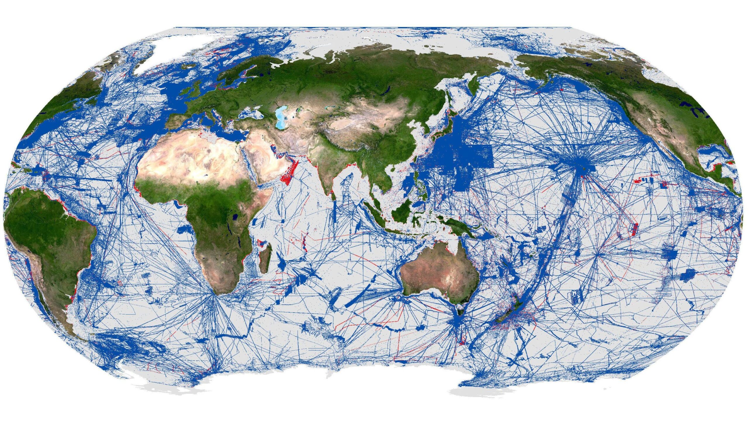
 The Nippon Foundation-GEBCO Seabed 2030 Project today announces that 28.7% of the world’s ocean floor has now been mapped, with almost five million square kilometres of data added over the past year.
The 2026 figure was announced by Mitsuyuki Unno, Executive Director of The Nippon Foundation, at the Assembly of the International Hydrographic Organization (IHO), currently underway in Monaco.
Bringing together delegations from 104 Member States, alongside observers from international organisations, maritime authorities and industry, the triennial Assembly provides an opportunity to review global progress in hydrography and set priorities for the years ahead. The announcement also reflects a long-standing connection as the General Bathymetric Chart of the Oceans (GEBCO) was initiated in 1903 by Prince Albert I of Monaco – a pioneering oceanographer who recognised the need for a coordinated global effort to map the planet’s seafloor.
Established in 2017, Seabed 2030 is a collaborative project between The Nippon Foundation and GEBCO, which seeks to accelerate the complete mapping of the world’s ocean, and to compile all the data into the freely available GEBCO Ocean Map. The Project is formally endorsed as a Decade Action of the UN Ocean Decade. GEBCO is a joint programme of the IHO and the Intergovernmental Oceanographic Commission (IOC) of UNESCO, and is the only organisation with a mandate to map the entire ocean floor.
The latest update represents approximately 104 million square kilometres of mapped seabed – an area equivalent to more than two-thirds of the Earth’s land surface. Over the past year alone, a further five million square kilometres of data have been incorporated into the GEBCO Grid.
This progress reflects ongoing contributions from a growing and increasingly diverse global community. A total of 220 organisations have now contributed, including 15 new contributors over the past year, with first-time data contributions from countries including Malaysia, Morocco, Papua New Guinea and Saudi Arabia, among others.
Commenting on the announcement, Seabed 2030 Director Jamie McMichael-Phillips said: “This update reflects what the global community can achieve when data is shared openly and collaboratively. Seabed 2030 exists to help bring those contributions together, and we are seeing that collective effort translate into meaningful results. We are grateful to The Nippon Foundation and GEBCO for their ongoing support, which enables us to accelerate progress towards a complete map of the ocean floor.”
Announcing the update, Mitsuyuki Unno, Executive Director of The Nippon Foundation, said: “The progress reflected in the 2026 Grid demonstrates what can be achieved through sustained international collaboration. At The Nippon Foundation, we are committed to supporting people and organisations working to deepen our understanding of the ocean, and to strengthening the connections between them – helping to ensure that knowledge of the seabed can be built upon and passed on to future generations.”
Evert Flier, GEBCO Chair, added: “The GEBCO Grid is a global, collaborative dataset that brings together bathymetric data from a wide range of sources into a consistent and authoritative reference. This is the work of hundreds of people from around the world, working behind the scenes and forming an ever-growing GEBCO community. With each update, it provides an increasingly robust foundation for ocean science and related applications – and today’s announcement reflects the steady progress being made in building a more complete picture of the ocean floor.”
The 2026 update includes significant regional increases in mapped coverage. The ROPME Sea Area more than tripled in coverage, increasing from approximately 6.4% to 20.5%. Coverage also increased across the Eastern Atlantic, North Indian Ocean, Meso American and Caribbean Sea, and North Sea regions. At the national level, substantial increases were recorded within several Exclusive Economic Zones (EEZs).
Further highlights from the past year include the incorporation of a wide range of new and previously unshared datasets, including:
- Significant contributions from major data repositories, including NOAA-NCEI and PANGAEA
- Expanded coastal mapping through datasets such as the Global Coastal SDB Dataset from Copernicus/EOMAP, adding new coverage in areas not represented in previous Grid releases
- Notable satellite-derived bathymetry from the Greenwater Foundation, in partnership with TCarta and Caladan Oceanic
- Additional bathymetric data from the Japan Agency for Marine-Earth Science and Technology (JAMSTEC), expanding coverage in the North Pacific
- Deep-water mapping data from NOAA-led Seascape Alaska campaigns
- Multibeam survey data contributed by the Directorate of Hydrography and Navigation of the Brazilian Navy
- Multibeam data around the Comoros, contributed by the Bureau de Recherches Géologiques et Minières (BRGM), marking a new contributing organisation
All data collected and shared with the Seabed 2030 project is included in the free and publicly available GEBCO global grid, supporting ocean science, policy and informed decision-making.
For more detailed information on The Nippon Foundation-GEBCO Seabed 2030 Project, please visit: Home — Seabed 2030
Kongsberg Maritime wins simulator contract with the French Naval Academy in Lanvéoc
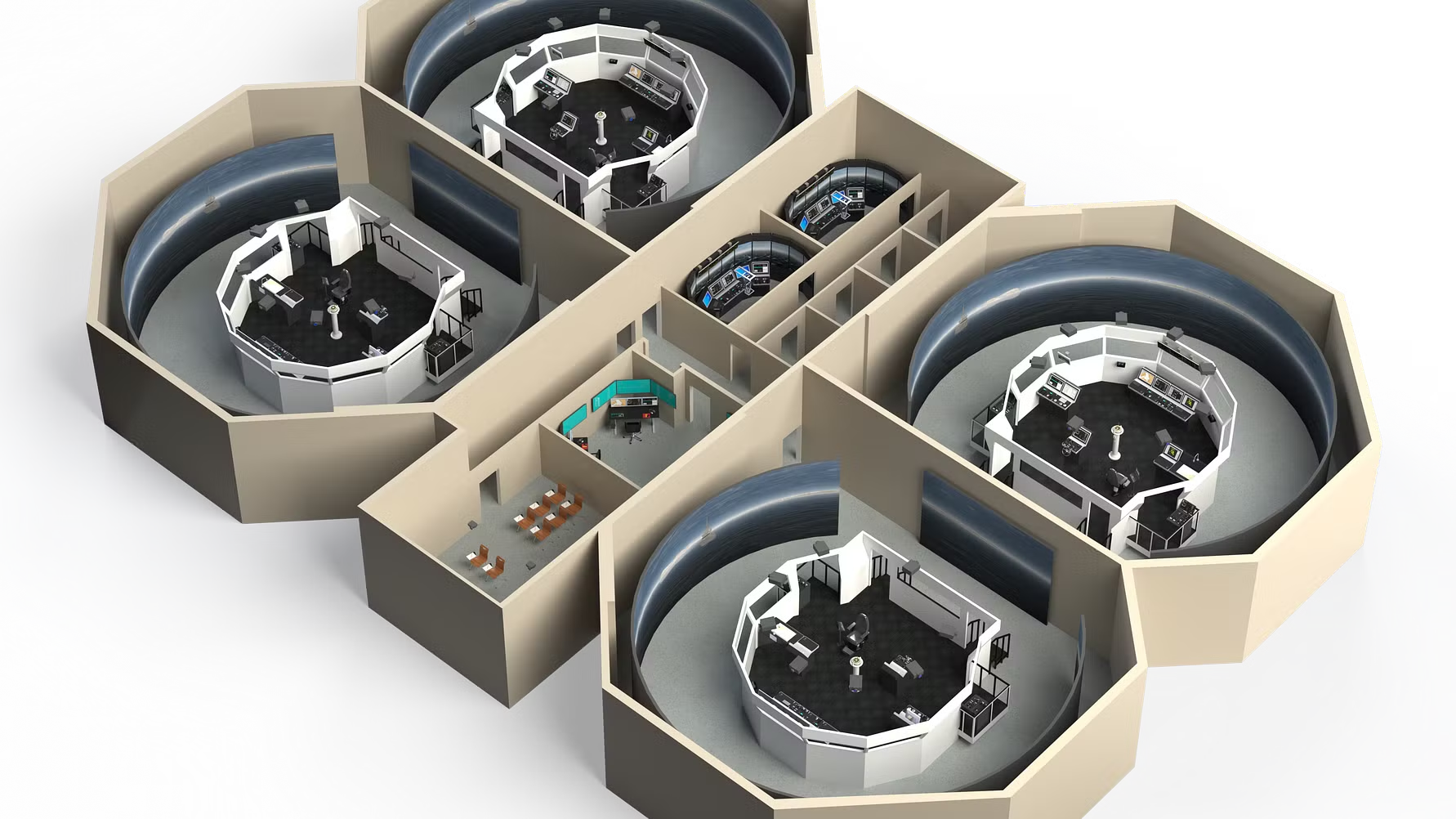 Kongsberg Maritime, a global marine technology company providing innovative and reliable technology solutions for all marine industry sectors, has been awarded a contract by the French Navy (Ministère des Armées et des anciens combattants) to deliver advanced ship bridge simulation systems to the French Naval Academy, École Navale, located in Lanvéoc near Brest, France.
The contract was awarded following a competitive tender process in which Kongsberg Maritime achieved the highest overall evaluation score. The new simulation systems will support the academy’s longstanding mission of educating and training naval cadets and officers. With more than 200 years of history, École Navale is widely recognised as one of the world’s most prestigious naval education institutions.
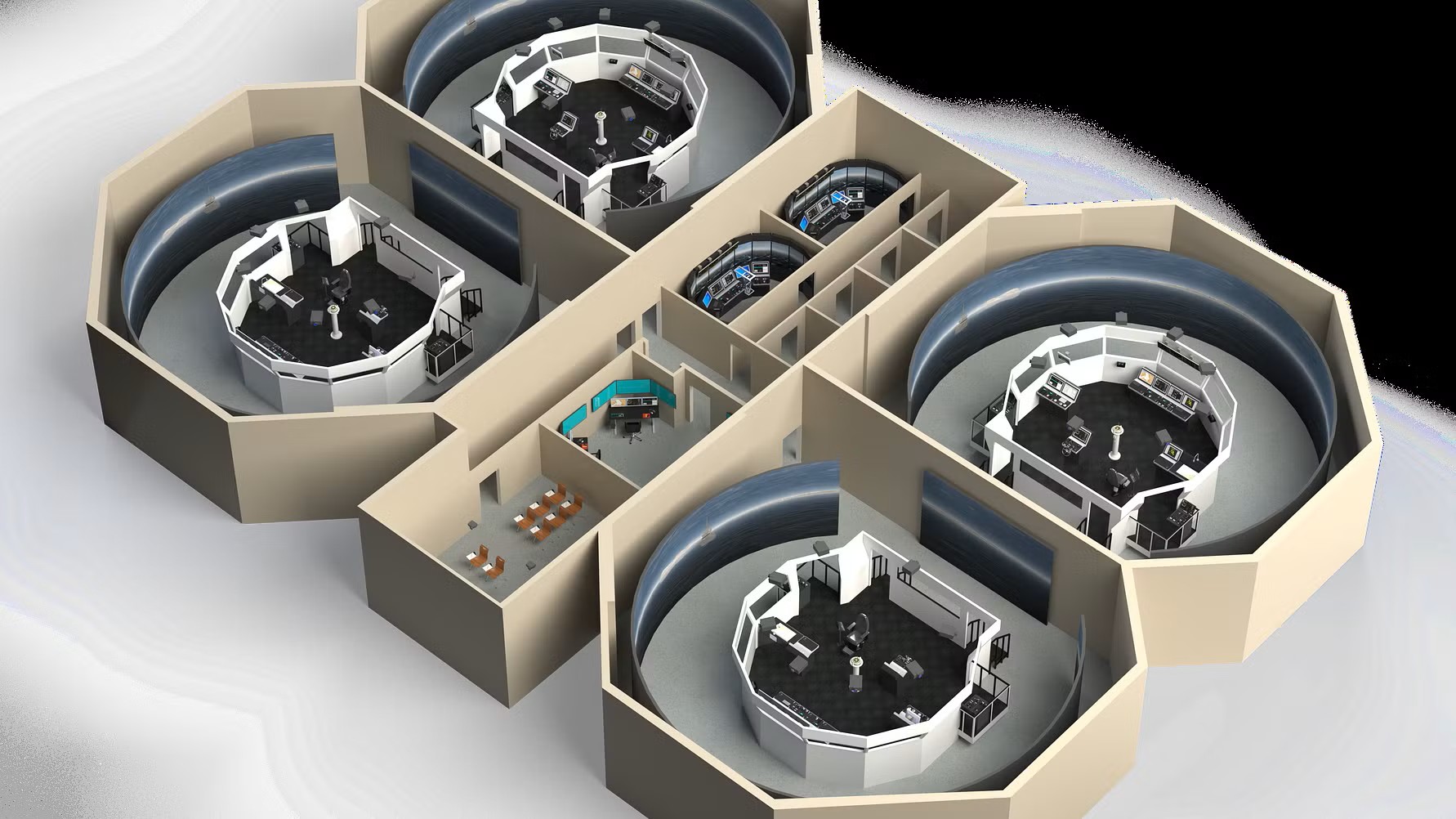
The delivery, scheduled for October 2026, will include four fully equipped K-Sim Navigation high-fidelity ship bridge simulators. Each simulator will feature integrated radar systems and a 270-degree visual environment using high-end projection technology to enable realistic and immersive team training scenarios.
The project also includes integration of Virtual Reality and Mixed Reality 3D visualisation, two hybrid bridges designed for multi-purpose training, as well as desktop simulators configured for ECDIS training in a classroom environment. In addition, Kongsberg Maritime will develop several customised warship models and sailing areas tailored to the operational requirements and training objectives of the French Navy.
Commandant Gabriel, French Navy, comments: “This simulator investment will replace our previous training system, and we are pleased that Kongsberg Maritime met our expectations for a high-end training solution. The new simulators will provide access to high-quality simulation technology with advanced navy functionality enabling highly realistic and effective training for our cadets and officers.”
“Approximately 30 years ago, we delivered simulators to the French Navy for the first time. We are therefore very pleased to confirm our relationship and continue supporting the high-quality training of their cadets and officers,” says Are Føllesdal Tjønn, Managing Director - Simulation at Kongsberg Maritime. “With this investment, the French Naval Academy will join a global community of leading naval academies that rely on Kongsberg Maritime simulation technology for immersive training and education.”
With this delivery, Kongsberg Maritime further strengthens its long-standing position as a trusted partner to navies worldwide. The solution delivered to École Navale combines high-fidelity simulation, advanced visualisation technologies, and tailored naval functionality to support safe, effective, and future-ready training.
The new simulators will enable the French Naval Academy to train cadets and officers in complex operational scenarios, enhance team performance, and prepare crews for real-world missions in an increasingly demanding maritime environment.
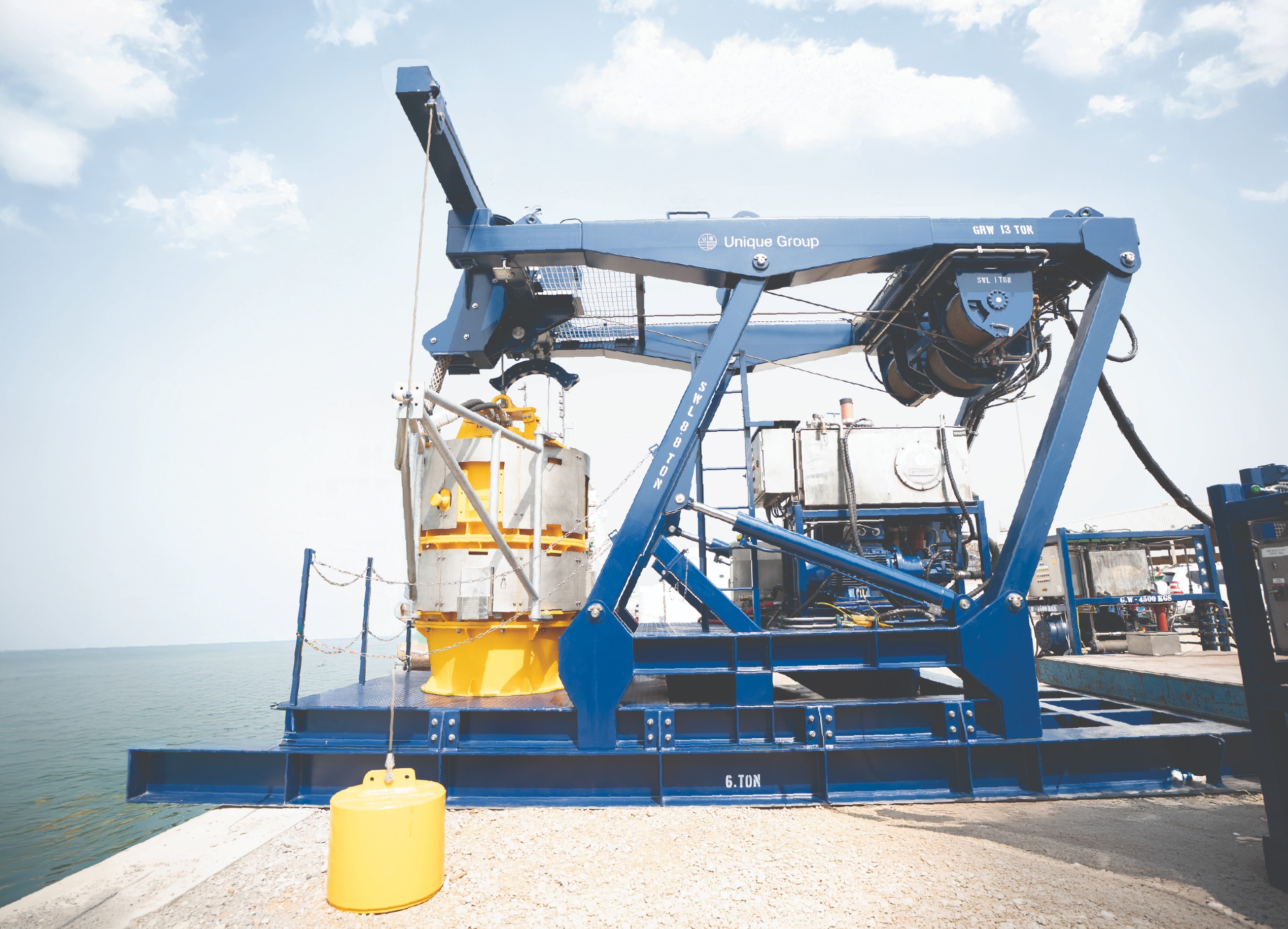
Unique Group Expands Global Subsea Mechanical Division with Multi-Million Dollar Investment
 Unique Group, global leader in subsea technologies and engineering, has announced a multi-million-dollar investment to expand its Subsea Mechanical division globally, strengthening its capabilities across subsea decommissioning, installation and construction projects.
The investment reflects the company’s continued evolution from its origins in survey rental to a broader subsea technology and engineering provider. The expanded mechanical portfolio supports an integrated delivery model combining survey, excavation, buoyancy, cutting, lifting and recovery services within a single framework.
A key element of the division’s capability is the proprietary Uni-FlowX Controlled Mass Flow Excavation (CMFE) system. The system enables non-contact trenching, de-burial and controlled asset exposure, supporting both construction and late-life decommissioning scopes where seabed preparation is required prior to cutting or recovery.
The mechanical solution asset base has been expanded to include hydraulic subsea shears for controlled severance, high performance diamond wire saws, twin recovery grabs for heavy lift retrieval, mattress recovery tools and advanced back deck support equipment. Supporting systems such as hydraulic power units, spoolers and engineered buoyancy solutions further enhance the company’s ability to execute integrated offshore removal campaigns.
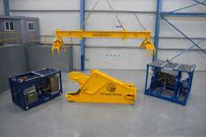
Unique Group has also established strategic partnerships with RenOcean, broadening access to precision cutting technologies within its mechanical offering while maintaining full engineering oversight and delivery control.
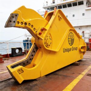 Unique Group’s mechanical capability is supported by a global workforce of more than 650 professionals, including over 200 in house engineers, providing structural analysis, lift calculations, Pre-FEED and FEED engineering studies, vessel interface design and bespoke tooling development. This engineering capability enables mechanical systems to be designed and delivered as coordinated, project-specific solutions. The company delivers bespoke engineering solutions backed by global manufacturing and assembly facilities across key energy regions and provides experienced offshore personnel to support project execution from mobilisation through completion.
“This investment strengthens our ability to deliver integrated mechanical spreads at scale,” said Karl Dale, Vice President – Subsea Mechanical, Unique Group. “There is an increasing demand for coordinated solutions that reduce interface complexity. Our focus is on engineering-led delivery and accountable project support.”
With 18 global locations, Unique Group combines regional manufacturing, assembly and mobilisation capability with consistent international engineering standards across major energy markets.
The expansion reinforces Unique Group’s commitment to delivering engineered, lifecycle-focused subsea solutions that reduce risk, simplify execution and support the offshore industry’s evolving project demands.
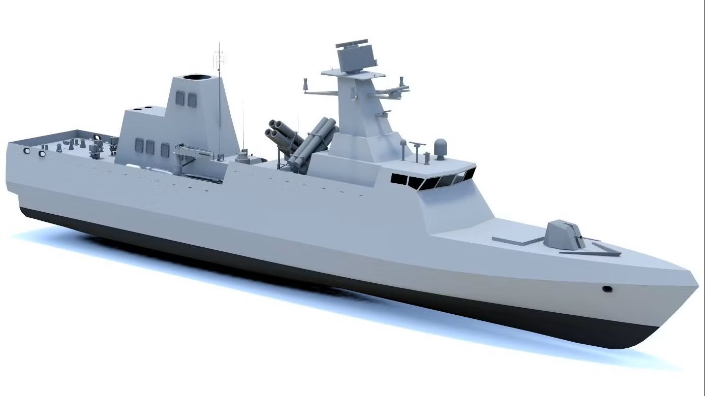
Kongsberg Maritime secures largest-ever waterjet contract for Indian Navy’s Next Generation Missile Vessels
Kongsberg Maritime has signed a landmark contract to supply 18 large Kamewa waterjets for the Indian Navy’s Next Generation Missile Vessel (NGMV) programme. Each of the vessels will feature waterjets, delivering exceptional speed and manoeuvrability for high-performance naval operations.
The NGMV fleet is being built by Cochin Shipyard Limited and will play a critical role in India’s maritime defence strategy.
This contract marks Kongsberg Maritime’s largest single waterjet order to date and signals a strong return to large waterjet manufacturing after a relatively quiet period over the past decade.
A spokesperson for Cochin Shipyard Limited, said: “We are pleased to collaborate with Kongsberg Maritime for the supply of the waterjet propulsion system for the Naval project currently under construction at CSL for the Indian Navy. Kongsberg Maritime has been a valued and reliable partner to CSL across several commercial projects in the past, and the association has been marked by strong technical cooperation and mutual confidence.
“CSL looks forward to Kongsberg Maritime delivering a high-quality and reliable system in line with the exacting standards required for this important project and to their continued support in achieving an important milestone for CSL.”
Anders Valkeinen, Vice President, High-Speed Craft at Kongsberg Maritime, said: “This is a milestone project for Kongsberg Maritime and a testament to the trust placed in our waterjet technology for demanding naval applications. Our Kamewa waterjets will deliver the speed, agility, and reliability required for these advanced missile vessels.”
Anette Holte, Country Manager – India at Kongsberg Maritime, added: “We value our long-standing relationship with the Indian Navy and Cochin Shipyard and are committed to supporting India’s naval ambitions. This contract underlines our dedication to growing our presence in India and delivering world-class technology for critical defence programmes.”
Delivery of the waterjets will align with the NGMV construction schedule at Cochin Shipyard.
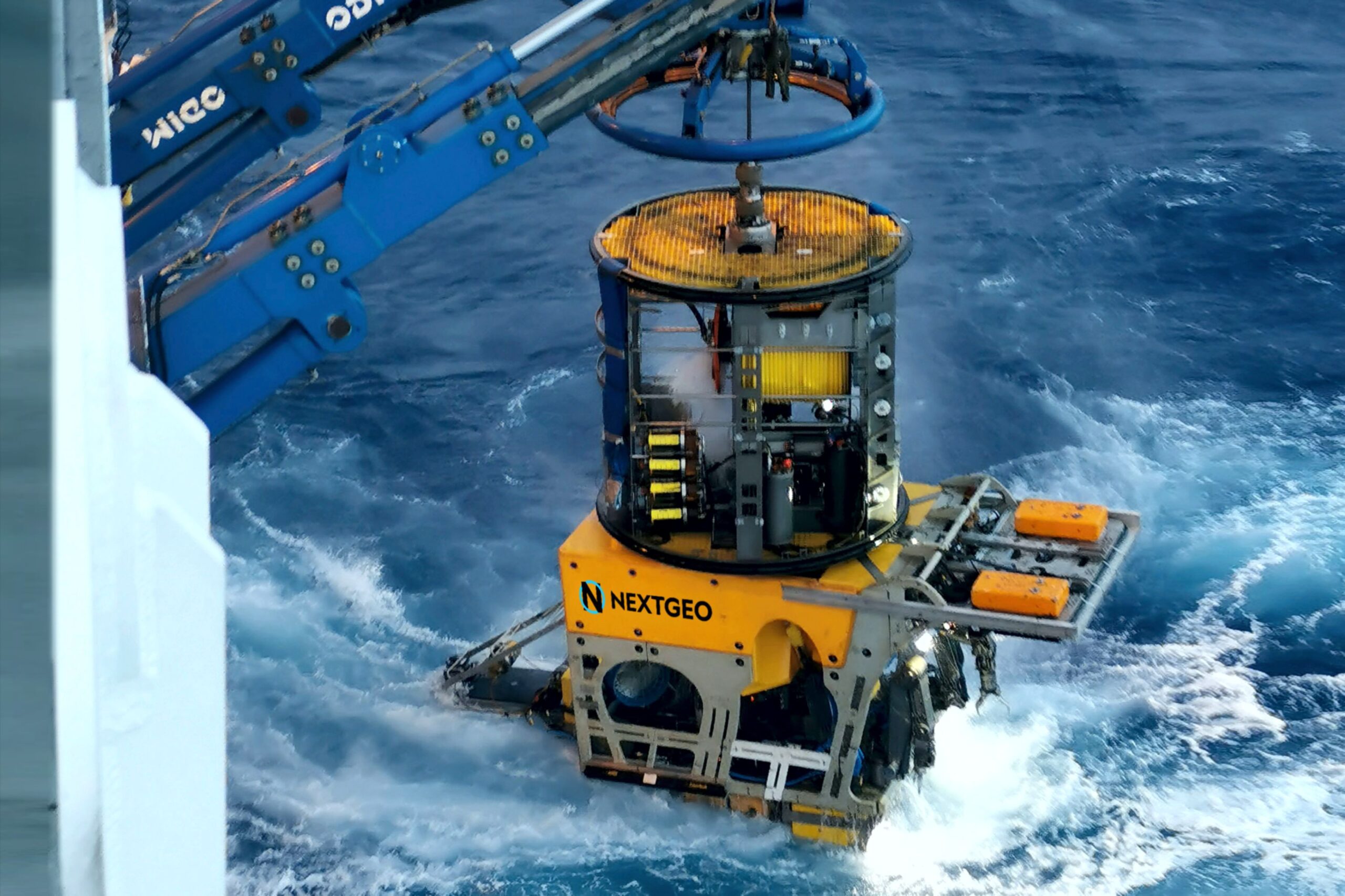
Next Geosolutions awarded, as lead partner in a temporary consortium, Terna tender for preliminary marine survey and environmental characterization of the new HVDC Milan–Montalto link
 CONTRACT VALUE EXCEEDS €28 MILLION
Next Geosolutions (“NextGeo” or the “Company”), one of the leading international players in marine geoscience and offshore construction support services for the energy sector and listed on Euronext Growth Milan market, announces that it has been awarded – as lead partner of a Temporary Consortium (“RTC”) – a tender by Terna S.p.A. (“Terna”) for “preliminary marine survey and environmental characterization” services related to the new HVDC Milan–Montalto connection. The RTC is composed of NextGeo, acting as lead partner with an approximately 84% stake, together with CONISMA (National Inter-University Consortium for Marine Sciences), Poliservizi Srl, and CIBM (Inter-University Center for Marine Biology and Applied Ecology “G. Bacci” of Livorno). The project, which will connect Lazio and Lombardy through a marine route of approximately 280 kilometers, is part of Terna’s innovative Hypergrid initiative, aimed at increasing energy flows between Central-Southern Italy and Northern regions.
The award follows the tender procedure launched on May 28, 2025, with publication in the Official Journal of the European Union (S 102/2025 – 345476). At the end of the process, following technical and economic evaluation and a subsequent negotiation phase, the consortium led by NextGeo achieved the highest overall score, ranking first and securing the maximum contract value, exceeding €28 million.
The project activities will include preliminary marine surveys and environmental characterization along the route of the new high-voltage direct current (HVDC) electrical link connecting southern Milan to Montalto di Castro. The objective is to perform high-precision surveys of cable corridors in order to gather detailed information on seabed morphology, shallow stratigraphy, sediment characteristics, as well as the distribution and status of phyto-zoobenthic communities in both nearshore and offshore areas. The submarine cable section will run from Montalto di Castro (Viterbo) to the area near Avenza (Massa-Carrara). The operational phase is expected to commence in the second half of 2026 and will involve the use of multiple survey vessels.