
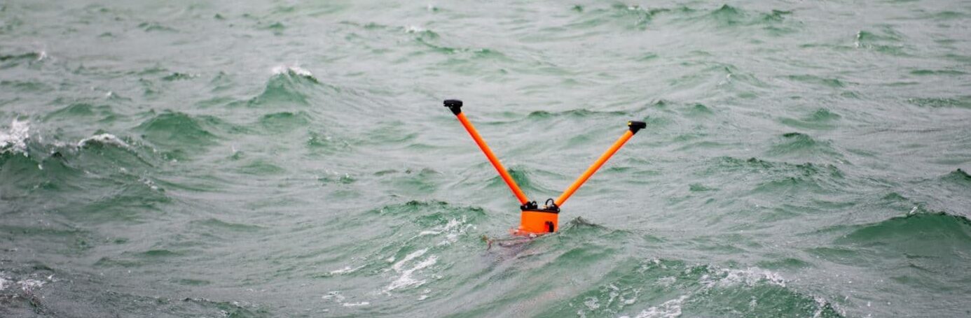
EvoLogics launches a fully integrated USBL buoy
EvoLogics are happy to announce the new USBL buoy, a fully integrated solution based on the company’s S2C USBL devices.
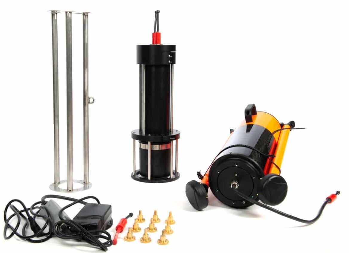
The buoy comprises a USBL transceiver with a built-in battery, mounted to a floating unit with an on-board PC, GNSS receiver with dual antennas, and a Wi-Fi access point.
 The design concept of the system derives from fishing floats that remain highly stable even in rough seas thanks to their long stems and minimal cross-section near the surface.
This allows the elongated buoy to remain stable in harsh conditions, and when deployed close to a vessel hull or pier walls, where the waves are taller.
This integrated system eliminates the need to use external GNSS receivers for geo-referenced positioning of underwater targets. Dual GNSS antennas provide accurate yaw measurements without being affected by magnetic interferences. The optional RTK increases precision and accuracy. Moreover, as both sensors are part of the same hardware assembly, it is not necessary to calibrate the relative position of the USBL and the GNSS receiver.
The on-board PC runs the pre-installed SiNAPS, EvoLogics positioning software. The user can access USBL positioning data by connecting to the Wi-Fi access point of the buoy and opening the web-based SiNAPS interface. SiNAPS allows to operate the system and visualize the location of the buoy and target transponders. Furthermore, positioning data can be streamed as NMEA strings and input into other applications that can process this information in real-time.
The buoyant body of the unit is made of carbon and glass fiber composites, making it lighter, more compact and robust than conventional designs with foam-based floatation collars. The system packs up into a single case and can be easily transported, assembled and deployed by a single operator.
Launching in December 2020, the buoy is available with all models of the EvoLogics S2C USBL range.
For more information visit: www.evologics.de


Special Solution for tactical wearable Connectivity System
NOVACAVI has recently engineered and manufactured a special custom power and data cable to be integrated in a tactical wearable connectivity system for infantry war fighters.
Our extremely thin, light, flexible and tough cable has been conceived to be seamlessly built-in into a comprehensive, rugged and reliable new gear for the defense & security market with integrated “plug and play” connectivity and power management system.
Incorporating our tailored size, weight and power cable solution, Wearin’TM, the new spin-off of Fischer Connectors Group, developed the outstanding connected vest achieving the goal of optimized power and cable management and technological upgraded usability and maintenance for enhanced safety and operational field performance.
Specialist in custom cable design & manufacturing for advanced technology since 1975, NOVACAVI develops any cable solutions with engineering expertise, comprehensive knowledge of materials and a high degree of manufacturing.
For more details, please contact [email protected] or visit www.novacavi.it/news

New SUT Chief Executive appointed
The Society for Underwater Technology is delighted to announce that Dr Cheryl Burgess will join the SUT as Chief Executive in January 2021, bringing over three decades’ experience in the energy industry including oil & gas (both offshore and onshore); renewables; and utilities. She takes over from Steve Hall who has held the post for the past four years.
 Prof Ralph Rayner, President of the SUT said: “We look forward to welcoming Cheryl in January; and in the meantime would like to thank Steve Hall for his sterling service to the SUT and its members and to wish him well for the future.”
The former Director General of the Pipeline Industries Guild, Cheryl Burgess’ extensive international expertise from her years with UK Trade & Investment and the Society of British Gas Industries will bring benefit to the SUT’s international Branches and interests. A strong advocate for organisations she has represented, she is also committed to engaging students, graduates and young professionals in the industries the SUT represents.
“I am very excited to be joining the SUT team,” said Cheryl. “The SUT has wonderful history and is uniquely positioned to capitalise on its Special Interest Groups and Global Branches as we all look to the future of underwater technologies.”
Further information at www.sut.org, contact via [email protected]
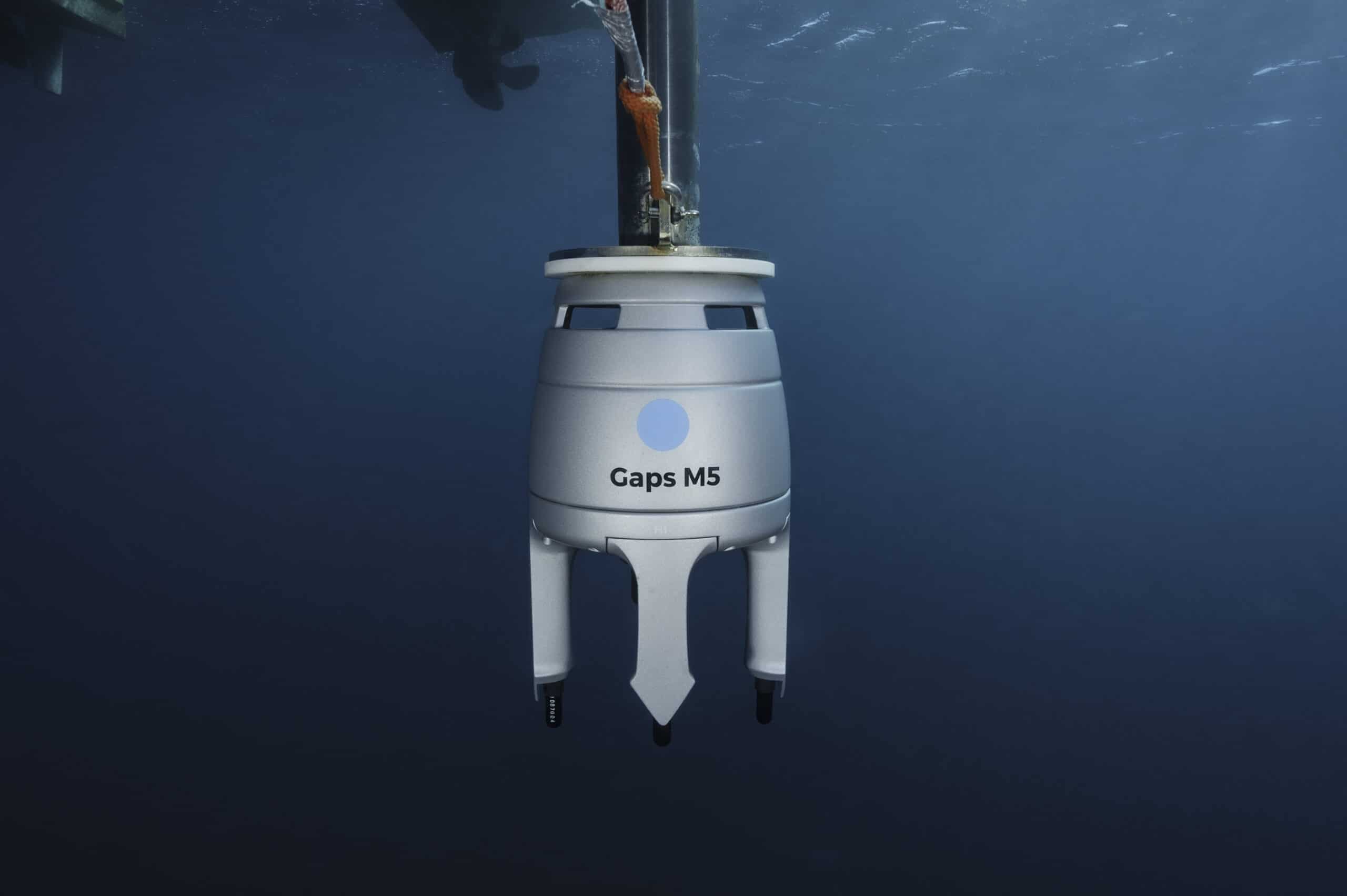
STR adds iXblue new Gaps M5 USBL system to its rental pool of equipment
iXblue new Gaps M5, has been selected by global rental company Subsea Technology & Rentals (STR) to offer a practical, easy to export and cost-effective USBL solution to their global base of customers. Broadening STR’s existing pool of subsea equipment, Gaps M5 addresses the accuracy and performance needs and requirements for vertical and horizontal tracking applications.
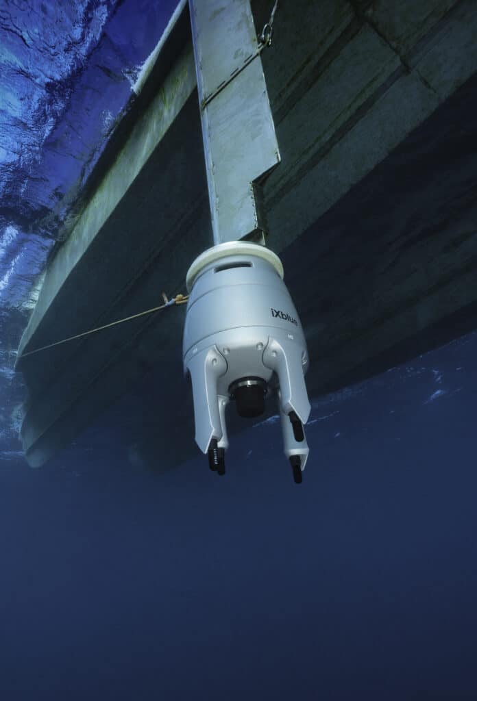 Latest addition in iXblue’s USBL product range, Gaps M5 is a compact, export-free and omnidirectional USBL system that offers accurate location, positioning and tracking of subsea assets. It integrates an Attitude and Heading Reference System (AHRS) for stable heading roll and pitch compensation and a true north reference. Smaller, lighter and easy to install, Gaps M5 is a ready-to-use and calibration-free system that offers an accuracy better than 0.5% up to 995m operating range. The USBL system is extremely efficient in shallow water and horizontal conditions and is suitable for any tracking operations, from diver- to multiple subsea assets- or inspection ROV- tracking.
“We’ve been offering iXblue products for over 20 years now, including their INS, AHRS and USBL systems. As a global leader which proven technology is recognized worldwide within our industry, their systems are great assets to have and they’ve always met our customer’s’ requirements,” explains Scott Johnstone, Group Managing Director at STR. “USBL, in particular, are critical components of our rental offer, and the new Gaps M5 is perfectly suited to our customers’ needs and jobs. Our new Gaps M5 is already being utilised by our customers on geophysical surveys for offshore windfarms site investigation, and other tracking and towed services and we received very positive feedback on the performance, lightweight, and compact nature of the new system.”
“We’re very happy to see our latest Gaps USBL system already benefitting subsea operations worldwide and we want to thank STR for their longstanding partnership and continued trust in our navigation and positioning technology,” states Régis Blomme, Sales director at iXblue. “We now look forward to supplying STR with other high end products in order to meet their demanding requirements as they strive to always offer the latest industry solutions available to their customers.”
For more information visit: www.ixblue.com
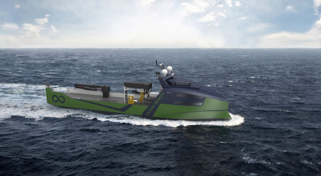
Ocean Infinity adds world's largest marine robotic vessel to its Armanda fleet
Spearheading Marine Industry Movement to Carbon Neutral Operations
Ocean Infinity is excited to announce plans for the next phase of its Armada fleet of robotic vessels with a signed contract for eight 78-metre, optionally crewed robotic vessels.
Designed for today’s tasks but with tomorrow’s in mind, these exceptionally fuel-efficient, onshore-controlled vessels will initially only utilise a skeleton crew onboard. In due course they will be capable of working with no personnel offshore whilst also consuming solely renewable fuel such as ammonia.
“The impact and the scale of this robotic fleet will spark the biggest transformation the maritime industry has seen since sail gave way to steam. With our new fleet we will be able to provide sustainable services to all corners of the industry from offshore energy, to logistics and transport”
“We, as an industry, have to embrace the need to be carbon neutral. It is not, however, something that will be achieved overnight or indeed in a year, rather it will be a journey over time requiring bold leaps forward and challenge to all convention. This move is a giant step forward towards that goal”.
“Expanding our Armada fleet to include these larger vessels will enable us to support a wider spectrum of maritime activity, which from the outset will provide more sustainable outcomes with smaller crews and less power consumption than traditional vessels, whilst also creating new, safer job opportunities for the ‘seafarer of the future’”.
Oliver Plunkett, CEO, Ocean Infinity.
The 78-metre vessels will supplement the current Armada fleet of nine 21-metre and 36-metre vessels, which are already in production and expected to operational by early 2021. The first 78-metre vessel is expected to launch in mid-2022.
The vessels are being designed and built by VARD, the international shipbuilding group headquartered in Norway.
“We are honoured to be chosen as Ocean Infinity’s preferred partner in this unique project. We are working closely on unique custom design features and system integration allowing for remote operation, and the introduction of sustainable fuel such as green ammonia in close cooperation with regulatory bodies. Other features including high DP2 performance, vast deck space, and twin moonpools make the vessels ideally suited for various extended payload operations requiring precision such as ROV and AUV deployments and logistics.”
Alberto Maestrini, CEO, VARD
For more information visit: www.oceaninfinity.com

SVAROG awarded geomatics contract for Sakhalin-2 project
Sakhalin Energy Investment Company Ltd. (Sakhalin Energy) prolongs cooperation with Svarog LLP for onshore survey for oil and gas assets of Sakhalin-2 project.
Svarog executes onshore survey under a 7-year contract for the safe processing and transportation of hydrocarbons. Geodetic, topographic survey and geodynamic measurements shall provide actual data for river pipeline sections and their landfalls. LNG storage and transportation facilities monitoring shall be executed as well.
Prolongation of this project is the result of completion of Svarog similar work for Sakhalin Energy under a 5-year contract. The experience gained within its execution made it possible to plan realisation of a new contract optimally and provide possibility of its extension.
Svarog has all permits, its own equipment and qualified personnel to carry out the works.
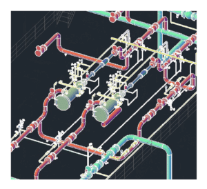
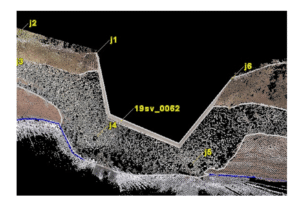
Sakhalin Energy is a pioneer using unique technologies and management decisions to ensure industrial and environmental safety, which became largely innovative for Russian oil and gas industry. Svarog maintains high standards of Sakhalin Energy work and is actively working to study the latest contemporary technologies and adapt them to Russian regulatory requirements and difficult climatic conditions. Svarog provides summarised information to Sakhalin Energy and the companies make decisions on introduction of new technologies and working methods into the project in addition to standard technologies. 3D laser scanning is an example of using new technologies. This method was used to create 3D models of separate objects. 3D laser survey is now widely used to monitor and control state and conditions of objects and structures. Similarly, and engineering survey with UAV (Unmanned Aerial Vehicles) is finding way into increasing application as well.
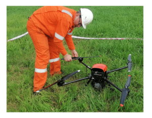
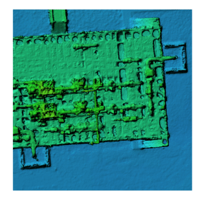
The equipment and personnel of Svarog are prepared to perform both regular works and unscheduled surveys, which can be required during long-term operation of oil and gas infrastructure.
Director of Svarog branch in Yuzhno-Sakhalinsk Vladimir Shelpov highlights: “Svarog pays great attention to implementation of modern international and Russian technologies and equipment. Participation in scientific conferences allows us to monitor Russian developments as well and implement into the company's work”.
Svarog constantly organises training and certification of its personnel, and updates technologies, equipment and software to perform works in the interests of Sakhalin Energy in accordance with the advanced standards of oil and gas industry to ensure safe development, production, processing and transportation of hydrocarbon resources for clients and environment.
For more information please visit: www.svarog.ru
Plymouth home to world’s first 5G ocean-based marine testbed
Plymouth Sound is to be home to the world’s first 5G ocean-based marine testbed, putting the city at the forefront of marine and maritime innovation.
Part of the Marine Business Technology Centre’s (MBTC) testing and proving ground Smart Sound Plymouth, the testbed will benefit from a 5G mobile private network built by Vodafone using Nokia equipment. The network, known as Smart Sound Connect, will enable ultrafast download speeds and low-latency 5G connectivity to support the development of new marine technology.
Eligible businesses will have free access to the testbed to test 5G use cases including advanced applied autonomy, clean propulsion, smart ports, smart shipping, and environmental monitoring using the Internet of Things (IoT).
The full testbed will be available from early 2021. It will also form the basis of a proposed virtualised testing platform, to allow companies to validate ideas and test adjustments in a virtual environment. With few testbeds offering connectivity beyond the shore’s edge, Smart Sound Connect can support use cases that others cannot.
“We’re really making waves here with another world first for Plymouth. It goes without saying we’re incredibly excited to be able to provide this globally significant testbed, which further cements our city’s reputation as the UK’s centre for advanced marine technology development.”
Councillor Tudor Evans, Leader of Plymouth City Council
“Smart Sound is a brilliant initiative from Plymouth City Council that will show just how powerful 5G can be for businesses looking to innovate. 5G can accelerate developments in marine technologies, and this is another area where the UK can be a global leader with the right digital tools and skillset.”
Anne Sheehan, Business Director, Vodafone UK
“With Smart Sound Connect, the MBTC is able to provide a complete innovation service that allows businesses to utilise one of the most high-tech and comprehensive test and proving environments in the world.
“Not only will our clients be able to benefit from the expertise, research capabilities and advanced equipment of our partners, they will also be able to work closely with Vodafone and Nokia to develop 5G solutions specifically for the marine sector.”
Rob Watson, MBTC Director
The MBTC is a £4.5 million European Regional Development Fund (ERDF) supported partnership between Plymouth City Council, Plymouth Marine Laboratory, the University of Plymouth, the University of Exeter and the Marine Biological Association that works to facilitate innovation in the marine and maritime sector. The partnership received £1.8 million in funding from the Heart of the South West Local Enterprise Partnership (HotSW LEP) to develop Smart Sound Connect.
“Smart Sound Connect is an excellent project that we’re investing part of our Growth Deal funding in. We know that Digital and Marine are key sectors to the recovery and future prosperity of the Heart of the South West, and this scheme will further enhance our area’s specialisations in both. Added to that, the MBTC is part of Oceansgate, one of HotSW’s portfolio of Enterprise Zones, offering favourable conditions for business growth.”
Chair of the Heart of the South West LEP Karl Tucker
“Smart Sound Plymouth is firmly established as the leading location in the UK for trials and demonstration of cutting-edge marine technologies. The addition of the Smart Sound connect communications network has created a multifaceted solution unrivalled in the UK and placing Plymouth very firmly on the global stage.”
Dr James Fishwick, Head of Smart Sound Plymouth
“Working in partnership with Vodafone and MBTC on this ‘world-first’ and helping to drive world-leading marine and maritime innovation is an exciting prospect. This ocean-based deployment will highlight all the flexibility and performance advantages that industrial-grade 5G private wireless can bring to organisations that need connectivity in challenging conditions.”
Stephan Litjens, General Manager, Nokia Digital Automation
Vodafone will provide 4G and 5G connectivity using four mobile sites at the inlet, and an additional site offshore. The network will utilise Nokia Digital Automation Cloud (DAC), a digitalisation platform capable of providing high-bandwidth, hyper-fast private networking and edge computing capabilities. A compact, plug-and-play system that comprises network equipment and a cloud-based operation monitoring system, Nokia DAC enables users to securely collect, process and host all generated proprietary data on site.
Smart Sound Connect will build on the research already being supported by the MBTC, which has recently included the launch of the UK’s first sea-going electric ferry and the development of an innovative new method of gathering data about the marine environment.
Find out more about Smart Sound Connect at a free webinar on Wednesday 16 December
Book online now at www.oceansgateplymouth.com/events-schedule
For more information visit www.smartsoundplymouth.co.uk.
First aerial drone-dipping sensors take off with Valeport
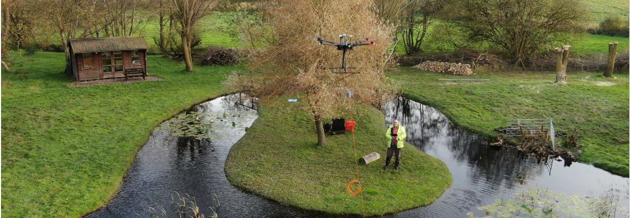
A cutting-edge new system for autonomous airborne hydrographic survey has been launched by THURN Group. The THURN QuickDipTM system of data collection uses aerial drones to carry Valeport sensors on pre-planned survey routes to deliver an efficient and repeatable method of gathering highly accurate survey data from inaccessible or dangerous waters.
UK-based THURN Group developed the innovative QuickDip technology for inland and coastal waterways to offer a range of benefits including: rapid data collection from multiple sites of interest, repeatable map-based surveys to monitor change detection, the ability to safely collect data from difficult-to-access and dangerous waters as well as restricted-access waters, such as reservoirs.
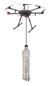
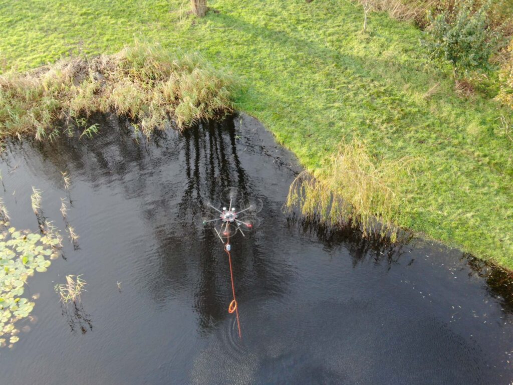
THURN QuickDip integrated drone-based system uses a Valeport sensor, a cable, a rotocopter drone and UgCS SkyHub/True Terraine Following (TTF) hardware - from leading software developer for unmanned aerial systems SPH Engineering. THURN’s integration of hardware and software allows the drone to fly at an accurate fixed height over water using a map-based pre-programmed autonomous survey pattern and dip the Valeport sensor into the water to take readings.
As Tom Hiller, General Manager, THURN Group commented there are many options with the QuickDip technology:
“Using a drone to deploy sensors has distinct advantages over a boat; it is compact as well as easy to transport and deploy. Drones can be used in any location where there is a small area for take-off and landing, near the surveyed water. What makes this new system so exciting for autonomous data collection is a drone’s ability to precisely follow planned survey lines using the map-based interface in UgCS and therefore deliver accurate, repeatable map-based surveys in previously difficult to access waters.
“We’re launching the THURN QuickDip with the miniSVS and Hyperion range of Valeport sensors which are respected for their high levels of accuracy, but this is just the first in an expanding range of drone-dipped sensors for coastal and inland water survey.”
The compact and robust Environmental range of optical sensors from leading oceanographic and hydrographic instrument manufacturer, Valeport, are being offered as part of the QuickDip system, including the Hyperion range of environmental sensors for the measurement of Turbidity, Chlorophyll a, Fluorescein, Rhodamine or Phycocyanin as well as their popular miniSVS and SWiFT SVP.
Valeport’s Head of Sales, Kevin Edwards added:
“THURN’s integrated drone-dipping sensor system offers an exciting step change in autonomous data collection and Valeport is proud to our support for innovation in the survey sector. Although this technology is launched with Valeport’s miniSVS and Hyperion range, it is easy to expand the capability of the system with the addition of other field-swappable Valeport sensors.”
Valeport has supplied the subsea sector for more than 50 years and continues to innovate and lead the way in the design and manufacture of precision instrumentation for the hydrographic and oceanographic communities.
THURN Group provides underwater survey technology, offshore project consulting and training to inland waterway authorities, engineering companies, ports, oil and gas, and renewable clients worldwide.
For more information please contact: www.valeport.co.uk and www.thurngroup.com

OSIL engage with University of Rhode Island on collaborative research project
The University of Rhode Island (URI) had a recent requirement for two oceanographic buoy systems and land-based deck unit for ongoing oceanographic research under the Rhode Island Consortium for Coastal Ecology Assessment Innovation & Modeling (RI-CAIM), a five-year grant program funded by the National Science Foundation (Award #OIA-1655221). Representatives from the University approached leading global data buoy manufacturers Ocean Scientific International Ltd (OSIL) with their specifications, and OSIL are delighted to be providing suitable systems to the project.
Researchers have requested systems that can utilise a new array of sensors and equipment, called the integrated Bay Observatory, that has already been acquired by URI through RI C-AIM. The data from this platform will be sent back to a computer system hosted at URI’s Bay Campus and parsed to a networked database, RI C-AIM’s Rhode Island Data Discovery Center, for real-time or near-real time data display. This database would operate within a suitable software system that would allow users to change settings or trigger samplers remotely (using either programmed interval sampling, or manually triggered by a user). OSIL have an established reputation for providing fully integrated systems that consistently deliver high quality data to the end user in practical formats.
OSIL are providing two of their 1.2m Tern Buoys for the project, tough and durable systems that can withstand the harshest of conditions and are ideal for extended coastal monitoring deployments. The Tern buoy hull design incorporates a stainless steel sub frame with a moon pool for instrument protection, and its modular manufacture makes the buoy easy to ship and assemble on-site following delivery. The buoy frame design has also been modified to allow an autonomous water sampler system to be connected to the bottom of the buoys.
The buoys are to be deployed year-round in Narragansett Bay, while the land-based deck unit is to be housed in a permanent monitoring station set up within a disused lighthouse. All systems will host a range of SeaBird sensors in addition to a full suite of meteorological instruments and GPS tracking fitted to the data buoys.
For further information or sales enquiries please contact: [email protected] or call +44 (0) 2392 488 240.
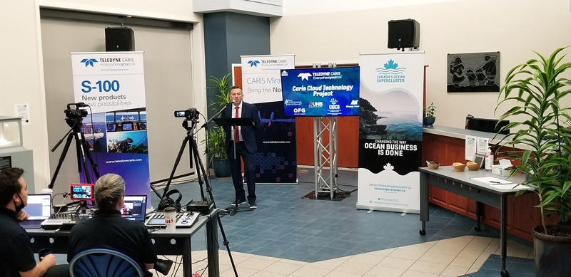
Teledyne CARIS receives Canada’s Ocean Supercluster award through the Accelerated Ocean Solutions Program
The CARIS Cloud Technology Project will break down technical barriers to entry for hydrographic processing and charting in support of remote operations.
Teledyne CARIS, a Teledyne Technologies [NYSE:TDY] company, is pleased to announce significant funding from Canada’s Ocean Supercluster award to develop software for remote operations survey processing. This is in alignment with the company’s leading AI strategy.
Teledyne CARIS’ project aims at three targeted deliverables:
- The enhancement of its desktop-based product line to leverage the cloud to deliver consistent access for global users in every possible circumstance
- Support for remote mapping operations to underpin advancements in ocean robotics
- Infusing its passion for future ocean mappers with access to virtual training through the CARIS Cloud Platform.
The company has partnered with Ocean Floor Geophysics (OFG), a pioneering CARIS customer with vast experience using the company’s software with autonomous vehicles. This real-world experience (and location on Canada’s West Coast) made them an ideal collaborator and provide a national perspective.
In addition to OFG, Teledyne CARIS will be working with other stakeholders to assist on training, including the University of New Brunswick and Memorial Universities Marine Institute. Both universities offer CARIS software as part of their curriculum. Other stakeholders include CIDCO from Quebec and H2i a consultancy from Ottawa specializing in Ocean Mapping strategy.
“We are excited to continue innovating in support of remote operations through the design and execution of the CARIS Cloud Program. Collaborating with Canada’s Ocean Supercluster is something we have been keen to do and through the Accelerated Ocean Solutions Program we have found our platform. This project has special meaning to Teledyne CARIS as a Canadian endeavor with a global impact.”
Andy Hoggarth, VP Sales and Marketing at Teledyne CARIS.
See the full CARIS Cloud Project award announcement from Canada’s Ocean Supercluster here: https://youtu.be/NKXDV1H2LIg
For more information visit: Teledyne CARIS