

Valeport gets on board with the Mayflower Autonomous Ship project
The Mayflower Autonomous Ship which is set to self-navigate across the Atlantic autonomously in Spring 2021, will be fitted with the new Valeport uvSVX and a Valeport Altimeter to provide vital precise underwater depth data which will help protect the vessel and the onboard technology on its epic journey.
Sailing from Plymouth, UK, to Plymouth, USA, the Mayflower Autonomous Ship (MAS) will trace the route of the original 1620 Mayflower to commemorate the 400th anniversary of the famous voyage. With no human captain or crew, it will become one of the first full-sized, fully autonomous vessels to cross the Atlantic.
Marine research organisation, ProMare is leading the development of the MAS. Throughout the 3220-mile journey the MAS will function as a science laboratory and Valeport’s uvSVX and VA500 Altimeter will be used to enhance the operational capability of the MAS. The MAS will also be one of the first applications for Valeport’s new compact and lightweight SVP profiler, the uvSVX. Fitted through the hull of the MAS the uvSVX features Valeport’s Sound Velocity, Temperature and Depth technology and delivers salinity, conductivity and density data, along with SVP as standard. The new uvSVX has been designed specifically for vehicles where space is a premium and high accuracy is assured with the addition of Valeport’s interchangeable pressure module that allows users to maximise operational specific depth requirements.
Powered by hybrid wind, solar and diesel propulsion system, the MAS vessel will carry research pods for sensors and scientific instrumentation. Scientists coordinated by ProMare, with support from IBM, will use the data from the research pods to advance understanding in several areas including: maritime cybersecurity, marine mammal monitoring, sea level mapping and ocean plastics.
Valeport’s instruments are ideally suited for deep ocean applications. The compact and robust Valeport uvSVX and VA500 Altimeter have state of the art signal processing technology which provides stable, repeatable readings that deliver high accuracy data performance.
MAS project director, Brett Phaneuf commented: ‘We’ve worked with Valeport for many years, integrating their equipment onto our marine vehicles, and when it comes to the Mayflower Autonomous Ship, we prise reliability, precision, low power and exemplary data above all else, and the uvSVX and VA500 Altimeter provide exactly what we need to safely navigate and enable great science at sea.’
The original Mayflower travelled at a maximum speed of around 2.5 knots and took more than two months to reach its destination, landing in Plymouth Massachusetts on 21 December 1620. The modern, upgraded autonomous Mayflower travels at up to 15 knots and should arrive in less than two weeks.
Valeport’s Head of Sales, Kevin Edwards added: “With sensor technology guiding the MAS decision making, this is an exciting demonstration of autonomous seafaring technology and we are immensely proud that our instruments are involved in the project.”
Valeport has supplied the subsea sector for more than 50 years and continues to innovate and lead the way in the design and manufacture of precision instrumentation for the hydrographic and oceanographic communities.
For more information, visit www.mas400.com and www.valeport.co.uk

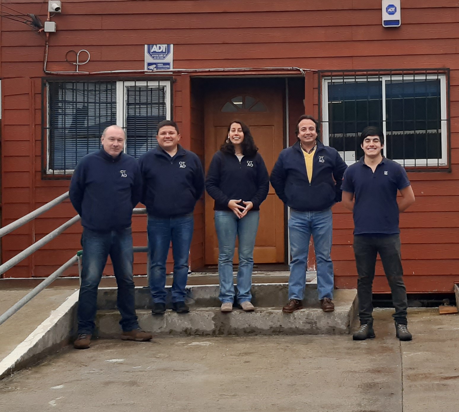
OTAQ expands Chile office to accommodate growth
World class underwater company, OTAQ Group, recently announced their Chile division has acquired a larger office space following a number of project wins, also resulting in the creation of several new positions.
The 100m2 office space, three times the size of the previous office, will accommodate the team of five, an increase from a headcount of two in just 12 months. Future team growth throughout the remainder of 2020 is also expected as OTAQ continue their drive for growth, developing their range of marine technology products.
OTAQ’s specialist product range is ideally suited to specialist Chilean sectors, especially mining and oil and gas. The highly innovative company first opened its Chile base in July 2016, providing services in Agriculture, specifically SealFENCE and SealFENCE portable, with plans to introduce the wider range of standard OTAQ products to the Chilean market.
Phil Newby, Chief Executive Officer, OTAQ Group, said: “Having established the OTAQ name and our products in Chile, we’re delighted to be moving into a bigger space which will allow us to expand our capabilities. The move to larger premises now sets the stage for us to establish a full-service offering in Chile over the coming years.”
OTAQ Group’s Chief Operations Officer, Steve Burns who head up the Chile office, said: “This is fantastic news for the group and shows our continued commitment and confidence in the region. Our team in Puerto Montt have done a truly excellent job getting the new facility up and running so quickly.”
Offering world class technology for aquaculture, OTAQ has 36 staff members across the four worldwide locations; Puerto Montt in Chile and Lancaster, Aberdeen and Ulverston in the UK.
Find out more on the website otaq.com
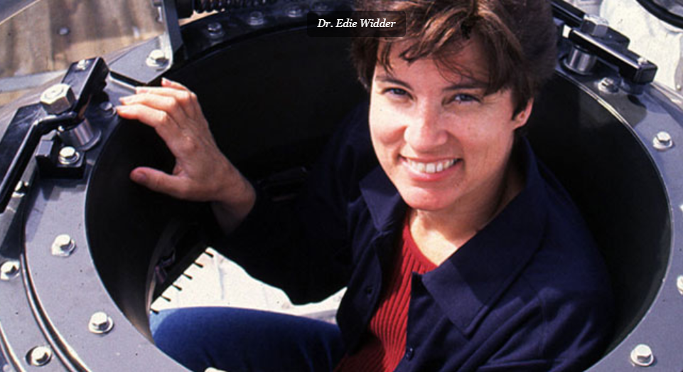
Dr Edie Widder to receive inaugural Captain Don Walsh Award for ocean exploration from the Marine Technology Society and the Society for Underwater Technology
Dr Edie Widder to receive inaugural Captain Don Walsh Award for ocean exploration from the Marine Technology Society and the Society for Underwater Technology - recognising her outstanding, sustained, international contribution to the development, application, and propagation of marine technology toward the advancement of ocean exploration.
The Marine Technology Society and The Society for Underwater Technology have announced that Dr. Edie Widder is the inaugural recipient of the Captain Don Walsh Award for Ocean Exploration. Dr. Widder is an MTS member, MacArthur Fellow, a deep-sea explorer, and conservationist who combines expertise in oceanographic research and technological innovation with a commitment to reversing the worldwide trend of marine ecosystem degradation.
Awarded jointly by the Marine Technology Society and the Society for Underwater Technology, this esteemed award is named after American oceanographer, explorer, retired naval officer, and marine policy specialist Captain Don Walsh. Walsh and co-pilot Jacques Piccard were aboard the bathyscaph Trieste when it made its daunting record descent on January 23, 1960 into the deepest point of the world’s oceans – the Challenger Deep in the Mariana Trench. The award recognizes outstanding, sustained, international contribution to the development, application, and propagation of marine technology toward the advancement of ocean exploration.
“Don Walsh is one of my superheroes – right up there with Marie Curie, Jacques Cousteau, and my mother – so to be the recipient of this first ever Don Walsh Award for Ocean Exploration is a huge deal,” said Dr. Widder. “I’m incredibly grateful to MTS and SUT for this honor and for all that they do to promote the development of tools for exploring the least explored regions of our ocean planet.”
A specialist in bioluminescence (the light chemically produced by many ocean organisms), Dr. Widder has been a leader in helping to design and invent new submersible instrumentation, and equipment to enable unobtrusive deep-sea observations. Working with engineers, she has conceived of and built several unique devices that enable humans to see beneath the waves in new ways, including HIDEX, a bathyphotometer which is the U.S. Navy standard for measuring bioluminescence in the ocean; important information for keeping submarines hidden from above. Dr. Widder also built LoLAR, an ultrasensitive deep-sea light meter that measures light in the deep ocean, both dim down-welling sunlight and bioluminescence - both important determinants of animal distribution patterns. She helped found the Ocean Research & Conservation Association in 2005 - an organization dedicated to the study and protection of marine ecosystems, and the species they sustain through development of innovative technologies, science-based conservation action, and public education. In the summer of 2012 Dr. Widder, along with several other scientists, filmed the giant squid in its natural habitat for the first time ever. The historic footage aired on Curiosity on the Discovery Channel in January of 2013. Her innovative work earned her the 2018 Explorers Club Citation of Merit; she became one of just six women to earn this honor.
“MTS couldn’t be prouder to bestow the inaugural Captain Don Walsh Award For Ocean Exploration upon Dr. Edie Widder,” said Marine Technology President Zdenka Willis. “From helping to devise cutting-edge marine technologies to logging hundreds of hours exploring the depths aboard deep sea submersibles to sharing her discoveries with her peers and the global community alike, Dr. Widder is well deserving of an award named for one of the foremost pioneers in our field. We are honored to count her as a colleague and cannot wait to see where her expertise takes her next.”
“As well as recognizing outstanding individual achievement, a key objective of the Captain Don Walsh Award is to spotlight role models who will inspire early career marine technologists, scientists and engineers” said Society for Underwater Technology President Ralph Rayner. “Edie Widder is a perfect exemplar of what young members of our community can aspire to. She and Don Walsh provide an inspiration to us all.”
To find out more visit www.mtsociety.org
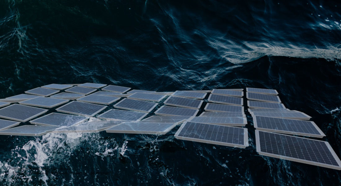
Novacavi for floating solar power plant system
The Novacavi team were recently asked to develop and manufacture a prototype of a rugged and reliable custom-engineered cable solution for an innovative floating solar electricity system for marine environment installed in Oslo fjord, Norway.
Being challenged by its specific permanent application on top of floating fully supported solar panels above water level, Novacavi managed to engineer a water blocked composite power and signal cable with polyurethane outer sheath to ensure maximum performance without losing elasticity in constant cold climates, water splashing or submersion and sun exposure.
“Proud to apply our technical and manufacturing expertise and deliver our cable as a relevant component of this innovative floating solar power plant system with high energy production capacity and limited environmental impact”, said Francesca Faverio, business development manager, Novacavi.
As a specialist in custom cable design & manufacturing for advanced technology since 1975, Novacavi develops any cable solutions with engineering expertise, comprehensive knowledge of materials and a high degree of manufacturing.
For more details, please contact [email protected] or visit www.novacavi.it/news
Applied Acoustics launches Pyxis Integrated Inertial USBL System - The new normal in subsea positioning
Applied Acoustic Engineering (AAE) has announced the launch of their next generation USBL system, Pyxis USBL. Taking its name from the constellation Pyxis Nautica - the mariner’s compass - Pyxis USBL takes the best of AAE’s subsea acoustic tracking technology with a highly advanced inertial navigation system (INS) from one of the most respected names in the industry, to create a state of the art, inertially aided Ultra Short Baseline system capable of accurate subsea tracking with survey grade performance.
The combination of AAE’s Sigma 2 acoustic protocols and SBG Systems high precision Navsight Apogee Marine INS brings together two leading names in the field of marine technology, resulting in AAE’s most accurate and long range positioning system to date, and in the process providing many time, cost and performance benefits to global survey operators.
As a tightly coupled, factory fitted package, Pyxis USBL is a portable, calibration free system able to immediately operate from any vessel as soon as the work site has been reached. The MEMS based INS does not fall under ITAR regulations, and the range restricted option means the whole system can be shipped unhindered and without export control to almost anywhere in the world. A feature of the Pyxis system is the ability for the operator to deactivate the range restriction in the field under an export-controlled regime.
A spokesperson for SBG Systems commented “AAE and SBG Systems have collaborated for several years on different projects and have established an excellent relationship. We are thrilled that Applied Acoustics has selected our Navsight Apogee OEM high performance system to be integrated into the first-ever USBL to embed a MEMS INS”.
Available with short range omni-directional or long range directional transceiver options, the versatility of Pyxis USBL makes it ideal for very shallow operations such as diver monitoring, for deeper applications where ROV’s and AUV’s might be deployed, and for tracking short or long range towed sensors such as magnetometers and side scan sonars.
Applied Acoustic Engineering is an independent designer and manufacturer of highly regarded subsea electronic-acoustic products, and a founding member of the AAE Technologies group of companies. Founded in 1989, the company has an established international client base covering many industry sectors, backed up by overseas offices and service centres and supported by a dedicated global distributor network.
To watch the launch animation visit their YouTube channel.
Teledyne CARIS AI software onboard successful UTAS USV mission
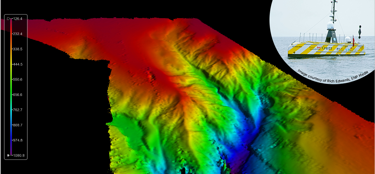
Teledyne CARIS, a Teledyne Technologies [NYSE:TDY] company, was an integral part of the illustrious team involved in the ground-breaking uncrewed offshore survey mission in the Atlantic Ocean. Teledyne CARIS’ Mira AI and CARIS Onboard software were present on the vessel to enable autonomous survey and real-time processing operations. The mission’s Uncrewed Surface Vehicle (USV) built by SEA-KIT mapped over 1000 sq kms of the ocean floor in 22 days, while being continuously monitored via satellite communications at its Remote Operations Center in Essex, United Kingdom. A specialized team comprised of the GEBCO-Nippon Foundation Alumni Team operated the survey equipment and provided quality control of the data from various ‘work-from-home locations’ around the world.
The SEA-KIT USV surveyed a predominately unsurveyed area at the southwestern edge of the UK Continental shelf. The image displays the initial results following a fully automated processing workflow. Final processing is currently being completed using CARIS HIPS software to produce the final deliverable for the survey.
The success of the Teledyne CARIS tools in the UTAS project demonstrates its software capabilities to support uncrewed surveys in the future and the crucial role it will play in The Nippon Foundation-GEBCO Seabed 2030 project. Seabed 2030 is an ambitious effort between GEBCO and The Nippon Foundation to complete the global mapping of the ocean floors in the next 10 years.
“Teledyne CARIS is uniquely positioned to underpin Seabed 2030 goals through its AI capabilities, web services and automated data processing workflows,” said Andy Hoggarth, VP, Sales and Marketing at Teledyne CARIS.
“The success of this first leg is a tribute to the strong leadership of SEA-KIT and the unique capabilities and insights of all of the member organizations–̶ we are delighted to play a part in this mission.”
Teledyne CARIS is part of the Teledyne Imaging group. For 40 years, Teledyne CARIS has been the leading developer of marine mapping software. We offer a highly effective solution for near real-time processing, robust quality control of sonar data, and the creation and distribution of maps, charts, and digital datasets.
Teledyne Imaging is a group of leading-edge companies aligned under the Teledyne umbrella. Teledyne Imaging forms an unrivalled collective of expertise across the spectrum with decades of experience. Individually, each company offers best-in-class solutions. Together, they combine and leverage each other’s strengths to provide the deepest, widest imaging and related technology portfolio in the world. From aerospace through industrial inspection, scientific research, spectroscopy, radiography and radiotherapy, geospatial surveying, and advanced MEMS and semiconductor solutions, Teledyne Imaging offers worldwide customer support and the technical expertise to handle the toughest tasks. Their tools, technologies, and vision solutions are built to deliver to their customers a unique and competitive advantage.
For more information, contact
Jennifer Parham, Marketing Manager, Geospatial
Teledyne CARIS
+1 905 660 0808
[email protected]
Hexagon | VERIPOS launches SPAN GNSS+INS technology for hydrographic survey applications
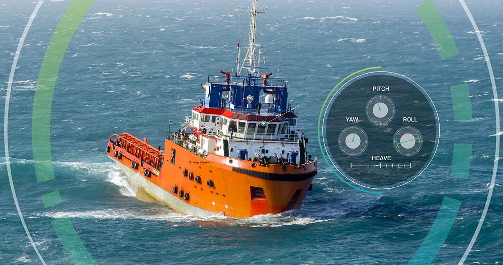
Hexagon | VERIPOS introduce SPAN GNSS+INS technology from NovAtel, also part of Hexagon, into the offshore oil and gas marine market. NovAtel and its SPAN technology have accelerated development in GNSS positioning, sensor fusion and inertial navigation systems for over 15 years. Now, VERIPOS brings this proven technology to the marine market to optimize your positioning solution with GNSS and inertial measurement units (IMUs) to provide heading, attitude and heave measurements on the open water. Through deep coupling, SPAN technology fuses measurements from the GNSS receiver and the IMU together to calculate a robust and reliable position, heading, velocity, attitude and heave. This process delivers a holistic and precise 3D solution, powering hydrographic survey applications through extended GNSS outages.
The solution is scalable with multiple different IMUs, the VERIPOS LD900 receiver, and Quantum visualization software. “The LD900 with dual-antenna functionality is able to unlock the SPAN GNSS+INS integration technology that has a long and successful track record,” explained Hexagon | VERIPOS Marine Segment Portfolio Manager Dr. David Russell.
“The latest evolution of SPAN technology for marine has improved performance through deep coupling to provide exceptional positioning, velocity, attitude and heave measurements in highly demanding offshore hydrographic survey applications. The simple upgrade path to INS capability with the LD900 makes it a great choice for users in the market.”
To learn more about SPAN technology for offshore hydrographic survey applications, visit veripos.com
Sonardyne’s Solstice MCM sonar now MINTACS compatible for Royal Australian Navy
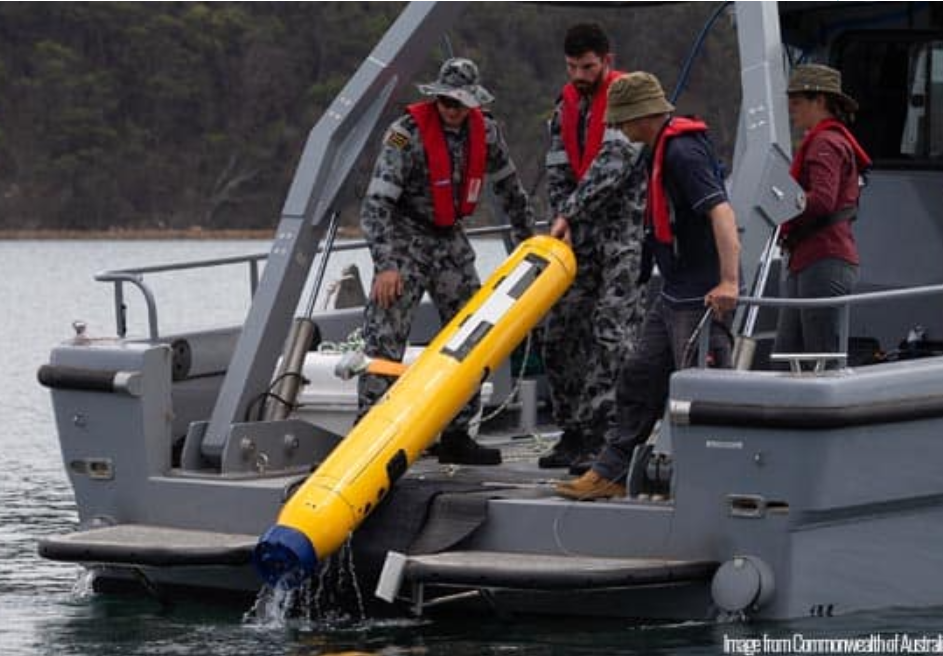
Marine technology company Sonardyne has announced that its Solstice multi-aperture sonar has been integrated into mine warfare command software used by the Royal Australian Navy (RAN). Through a collaboration with Australian defence software engineering company Solutions from Silicon (SfS), data collected by Solstice during mine counter measure (MCM) missions can now be imported, processed and displayed in the most recent release of the MINTACs (Mine Warfare Tactical Command Software) which is in service with the RAN.
Sonardyne’s Solstice is widely considered as a force multiplier for MCM operations, enabling substantially higher area coverage rates (ACR) using low-cost, low-logistics autonomous underwater vehicles (AUVs). It provides 200 m wide swath with an unrivalled 0.15° along-track resolution and consumes just 18 Watts, maximising vehicle endurance.
MINTACS provides the operator with the ability to not only read and display the Solstice data but also mark mine-like objects (MLOs) of interest and process the images with its powerful onboard automatic target recognition (ATR) capability. MINTACS is in service with host of countries around the world including the national navies of the UK, Australia, Malaysia, United Arab Emirates, New Zealand and Sweden.
For more information visit www.sonardyne.com
Teledyne RD Instruments launches new Wayfinder DVL for micro vehicles
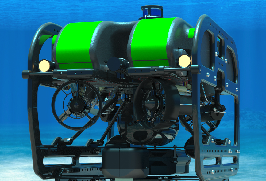
Teledyne RD Instruments announced the launch of its new Wayfinder Doppler Velocity Log (DVL). The Wayfinder has been designed to provide Doppler navigation capability for micro vehicles, which are often constrained by stringent size, weight and budget limitations. Measuring just 10 x 10 x 7 cm and weighing in at .51 kg, Teledyne RDI’s new Wayfinder is ideally suited to address the needs of our industry’s proliferation of increasingly smaller subsea vehicles.
Stephen Apsey, General Manager at Teledyne RDI explains, “Teledyne RDI has been the leader in Doppler navigation for over 25 years, providing the highest quality, most precise and reliable DVLs available to the industry’s preeminent vehicle manufacturers. We’re now bringing this technology to the next generation of micro ROVs and AUVs by drastically reducing the size and weight to deliver Teledyne quality at a price point that will meet their unique needs.”
From the outset, the Wayfinder DVL has been designed with micro vehicle manufacturers, universities, and hobbyists in mind, delivering a 200 m depth rating, ease of integration and operation, as well as self-serve online support documentation and online purchasing. The Wayfinder rounds out Teledyne’s full family of DVL products servicing the defense, commercial and academic markets.
For more information on the new Wayfinder DVL, visit: www.teledynemarine.com/wayfinder
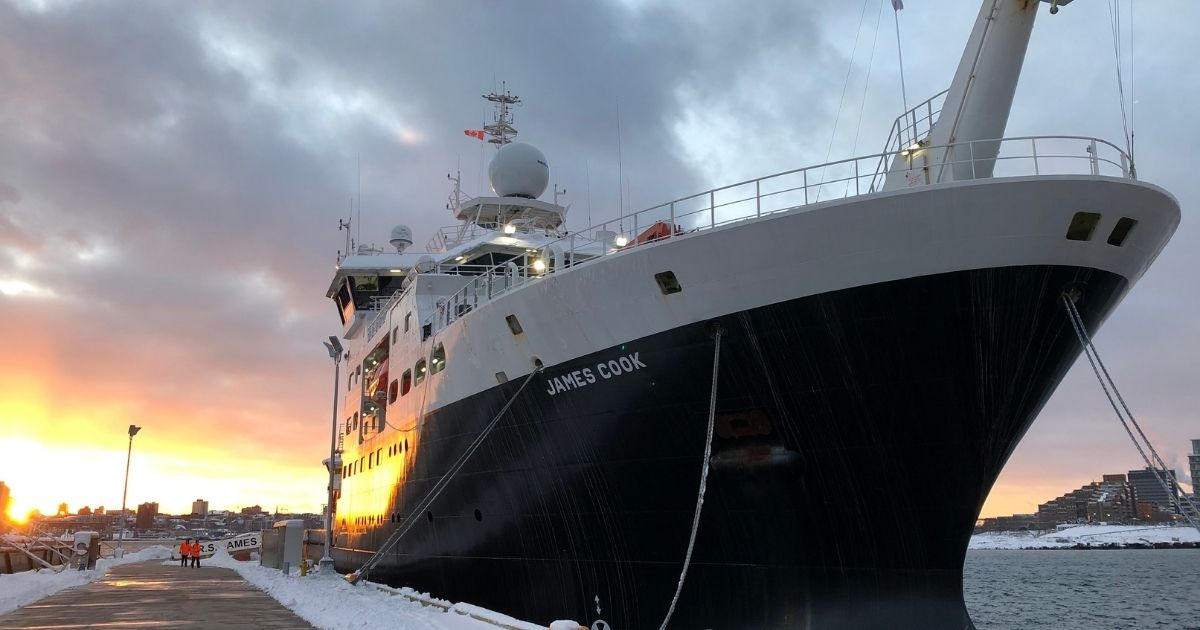
NOC leads marine community towards zero-carbon future
An ambitious scoping project, led by the National Oceanography Centre (NOC), has launched to investigate how to move towards low or zero-carbon oceanographic research. The aim of the NZOC (Net Zero Oceanographic Capability) project (NE/V013068/1) is to bring together the marine science community and key stakeholders to consider how NERC can maintain and enhance its research infrastructure in the future whilst adhering to the UKRI’s objective of becoming a ‘net-zero’ organisation by 2040.
Leigh Storey, NOC Associate Director National Marine Facilities and NZOC Principal Investigator commented, “The replacement of a modern research ship is normally a decade-long process. However, the advances in technology are opening up opportunities which require a genuinely strategic view to be taken regards the UK’s next generation of oceanographic research infrastructure. The 20th century paradigm must give way to a low-carbon system and that shift must consider the science and policy needs alongside the technological opportunities.”
NZOC will run for approximately one year and include six work packages, investigating:
- Future science need (led by Dr Kate Hendry, University of Bristol),
- Policy & regulation (led by Professor Steve Fletcher, University of Portsmouth),
- Future ship technology (led by Colin Day, NOC),
- Marine Autonomous Systems (led by Dr Maaten Furlong, NOC),
- Future sensor systems & networks (led by Professor Matt Mowlem, NOC), and
- Data ecosystems (led by Dr John Siddorn, Met Office).
- Dr. Peter Collinson (independent) will work with the leadership team to provide an industry perspective.
The project leadership seeks participation from the global academic and maritime community to ensure our collective impact on the ocean and wider environment is a positive one, thus supporting a sustainable ocean for all.
The initial focus of the project will be on engaging as widely as possible through surveys and virtual workshops. More information about the project aims, deliverables, workshops, as well as how to get involved, can be found on the project site here.
The work streams will inform a detailed report to NERC/UKRI as well as a public-facing report to be presented at an event at the end of the project.
The project will undertake equality impact assessments to ensure we have understood the impact of the proposed solutions and can make recommendations to NERC on how to increase access and inclusivity. Ways of working will be utilised which remove the requirement for travel.
The NOC is uniquely placed to lead this collaboration as core National Capability long-term science is the foundation of our research base and our mission is a sustainable ocean for all. To enable this we operate and manage, on behalf of NERC/UKRI, large-scale facilities and capabilities for use by the UK's marine science community and international partners. This includes the Royal Research Ships RRS James Cook and RRS Discovery, the National Marine Equipment Pool, the infrastructure (including workshops, laboratories, testing facilities and warehouses) and the mariners, technicians, engineers, project managers, logisticians and operation's managers that deliver the NERC/UKRI Marine Facilities Programme.
For more information visit www.noc.ac.uk