
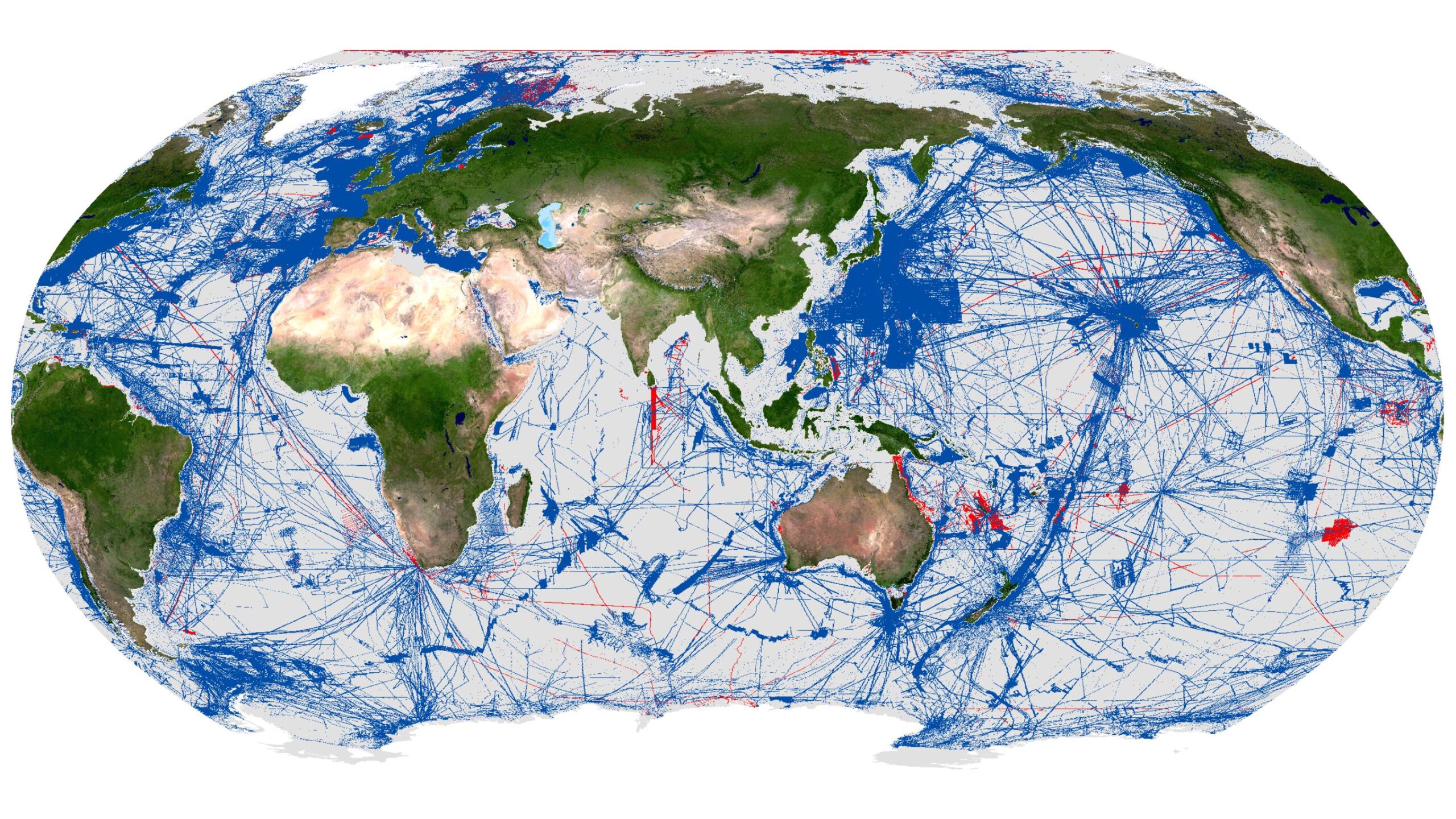
Seabed 2030 announces millions of square kilometers of new seafloor data on World Hydrography Day
New data contributions add over four million square kilometers of seabed to the definitive map of the ocean floor in the last year
On World Hydrography Day, The Nippon Foundation-GEBCO Seabed 2030 Project has announced that 27.3% of the world’s ocean floor has now been mapped to modern standards. The increase in data represents more than four million square kilometres of newly mapped seafloor – an area roughly equivalent to the entire Indian subcontinent.
This milestone comes at a pivotal moment. Just last week at the third UN Ocean Conference in Nice, the global ocean community united in a call for urgent, inclusive and transformative action – recognising the ocean’s central role in addressing some of the planet’s greatest challenges, from climate resilience to food security. Yet despite covering more than 70% of Earth’s surface, the ocean remains our least understood environment.
Established by the International Hydrographic Organization (IHO), World Hydrography Day raises awareness of the critical role hydrography plays in advancing our understanding of the ocean. This year’s theme, ‘Seabed Mapping: Enabling Ocean Action’, highlights how bathymetric data underpins the blue economy – supporting sustainable marine energy, coastal tourism and fisheries – and contributes to global efforts to protect biodiversity and tackle climate change.
Seabed 2030 is a collaborative project between The Nippon Foundation and the General Bathymetric Chart of the Oceans (GEBCO), which seeks to accelerate the complete mapping of the world’s ocean floor and compile all the data into the freely available GEBCO Ocean Map. As a flagship programme of the Ocean Decade, Seabed 2030 is helping to close one of the largest data gaps in ocean science.
From improving tsunami early-warning systems to guiding the installation of undersea cables and identifying biodiversity hotspots, seafloor data enables informed, real-world action.
Over the past 12 months, Seabed 2030 has welcomed data contributions from 14 new organisations – including first-time contributions from five new countries: Comoros, Cook Islands, Kenya, Mozambique and Tanzania. With data now contributed by over 185 organisations worldwide, the project continues to galvanise global support towards a fully mapped ocean floor.
Commenting on the latest milestone, Seabed 2030 Project Director Jamie McMichael-Phillips said: “Mapping the seafloor is not just a scientific exercise – it’s a global imperative, foundational to everything from climate action and coastal resilience to sustainable development.
As we reach the midpoint of the UN Ocean Decade – a defining moment for ocean action – I urge governments, industry, research institutions and individuals alike to contribute to this global effort. Together, we can deepen our scientific understanding of the ocean and help secure the future of the blue planet.”
Executive Director of The Nippon Foundation, Mitsuyuki Unno, said: “The Nippon Foundation is committed to building on the achievements made through Seabed 2030 by continuing to support global collaboration to acquire bathymetric data, the promotion of innovative ocean mapping technologies, and the training of future ocean mappers.”
Chair of GEBCO Evert Flier added: “The progress captured in this update reflects the extraordinary value of global collaboration. Every contribution strengthens the GEBCO Grid – helping to complete the picture of the ocean and deliver benefits for science, society and the planet.”
All data collected and shared with the Seabed 2030 project is included in the free and publicly available GEBCO global grid. A joint programme of the IHO and the Intergovernmental Oceanographic Commission (IOC) of UNESCO, GEBCO is the only organisation with a mandate to map the entire ocean floor.

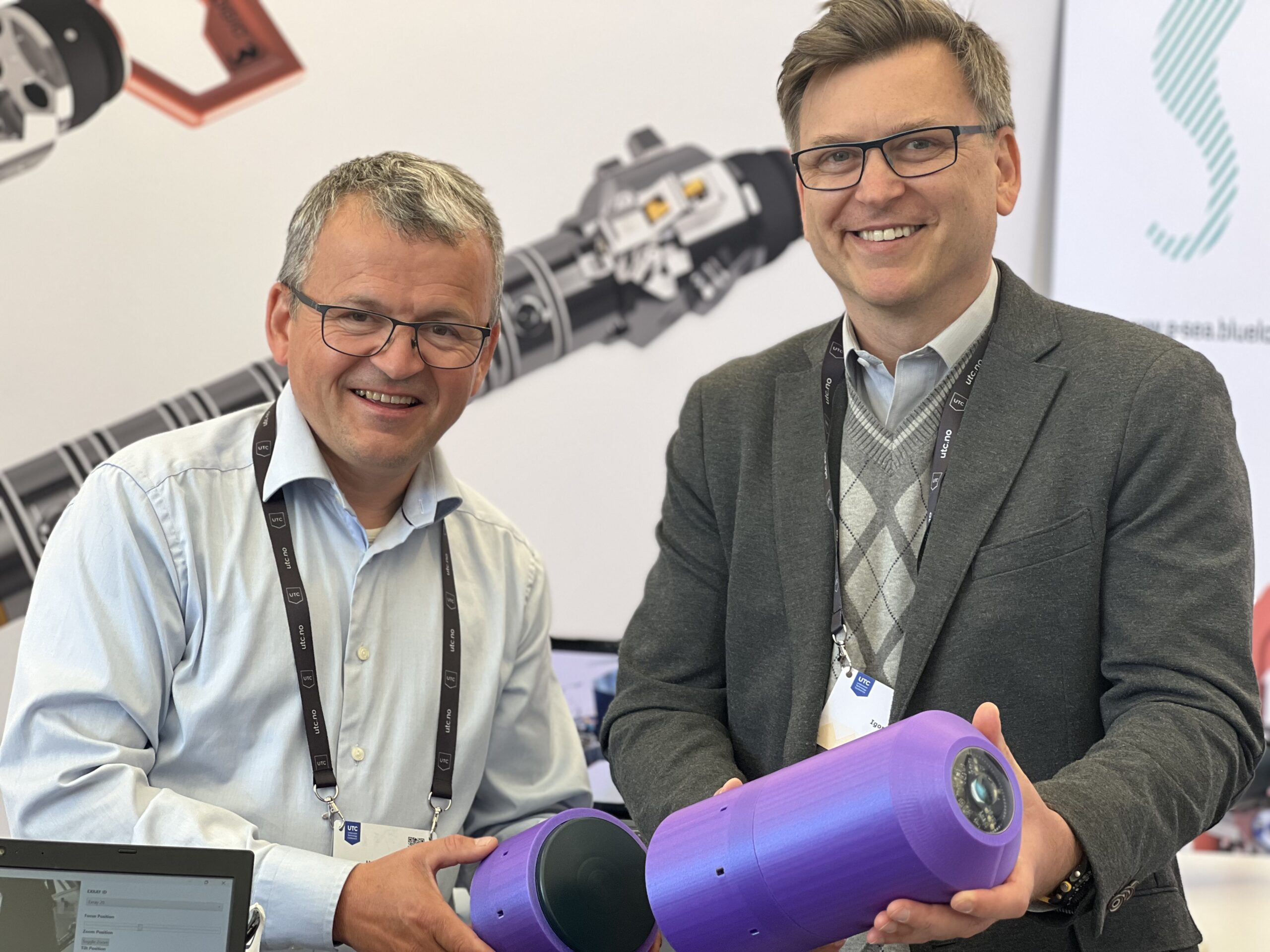
Blue Logic and Hydromea Announce Groundbreaking Partnership to Accelerate Subsea WLAN Deployments for Offshore Oil & Gas and Critical Undersea Security Sectors
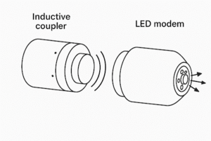 Hydromea, a leader in high-speed wireless subsea optical communication, and Blue Logic, a pioneer in underwater inductive power and data transfer, today announced a strategic partnership to revolutionize wireless communications beneath the waves enabling human in the loop remotely piloting an underwater drone without an umbilical. This collaboration integrates Blue Logic’s advanced inductive technology with Hydromea’s free-space optical (FSO) solutions, enabling unprecedented speed, reliability, and flexibility in subsea WLAN deployments for critical data offloads and wireless remote control of Unmanned Intervention Drones (UIDs).
A New Era for Subsea Wireless Communications
The partnership brings together two commercially proven technologies: Blue Logic’s Subsea USB® inductive connectors, which provide robust underwater power and data transfer without galvanic contact, and Hydromea’s LUMA™ optical modems, which deliver real-time, high-bandwidth communication through water at speeds up to 10 Mbit/s. The combined solution allows for seamless data flow and accurate remote operation of subsea assets, reducing deployment risks around critical subsea assets for service companies and asset owners. This partnership also dramatically reduces time to market for this combined solution in highly regulated environments by negating the need for expensive certifications.
Key Benefits of the Partnership
-
Accelerated WLAN Deployments: The integration of inductive and FSO technologies enables rapid, flexible setup of subsea wireless networks, supporting real-time data streaming and remote control of UIDs.
-
Extreme Deployment Flexibility: The combined system works across a wide range of subsea environments, from splash zones to depths of 6,000 meters, and is suitable for both new installations and legacy infrastructure retrofits.
-
Enhanced Reliability and Safety: Inductive technology eliminates the risk of corrosion and short circuits, while Hydromea’s optical communication ensures high-speed, low-latency data transfer and remote control without requiring direct line of sight.
-
Ready for Deployment: Both technologies are fully commercial and can be deployed today, offering immediate value to offshore operators and defense organizations.
Executive Quotes
“This partnership is a win-win for both companies and the industry at large. By combining our strengths, we are making advanced subsea wireless technology more readily deployable and significantly reducing the risks for UID service companies and asset owners. Our goal is to empower the offshore and defense sectors with the tools they need to operate more efficiently and safely underwater,”
— Igor Martin, CEO and co-founder, Hydromea
“With this partnership, our induction packs now seamlessly pass LUMA™ data through while keeping LUMA™ modems charged. This breakthrough means that subsea vehicles and infrastructure can stay powered and connected for longer, enabling continuous operations and real-time monitoring. The result is greater efficiency, safety, and sustainability for our customers,”
— Helge Sverre Eide, CO-Founder, Blue Logic
Industry Impact
The Blue Logic and Hydromea partnership is set to transform subsea monitoring operations in the offshore energy, defense sectors, and ocean research. By enabling wireless, real-time communication and remote control of UIDs, the combined solution will reduce reliance on supply vessels, lower operational costs, and minimize the carbon footprint of underwater missions. The technology is already proven in commercial deployments and is ready to support the next generation of subsea digitalization.
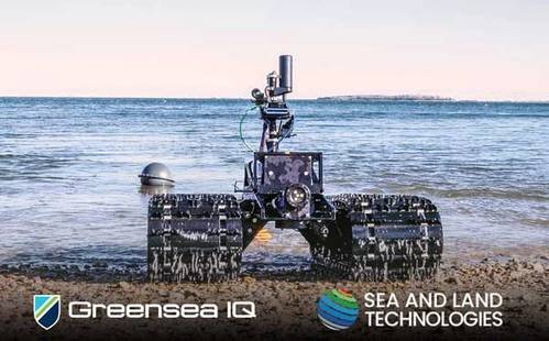
Greensea IQ Expands Southeast Asia Presence with Appointment of Sea and Land Technologies (SALT) as Regional Representative
 Greensea IQ, a leader in advanced subsea robotics and autonomy, is proud to announce a new partnership with Sea and Land Technologies Pte Ltd (SALT), appointing the company as the exclusive regional sales representative for its Bayonet line of Autonomous Underwater Ground Vehicles (AUGVs) across Southeast Asia.
Under the agreement, SALT will represent Greensea IQ’s Bayonet products in Singapore, Indonesia, Malaysia, the Philippines, Thailand, Vietnam, Brunei, Cambodia, and Laos.
“Southeast Asia is a strategically important region for Greensea IQ,” said Rob Howard, Chief Growth Officer of Greensea IQ. “With their proven track record of deploying innovative maritime technologies and supporting complex customer missions, SALT is the ideal partner to help us introduce Bayonet AUGVs to new defense, commercial, and scientific users across the region.”
SALT, based in Singapore, is a trusted supplier of high-tech solutions for the marine, offshore, and defense industries. With extensive experience in representing cutting-edge sensor and robotic technologies, SALT will provide local sales, integration support, and customer engagement for Greensea IQ’s Bayonet vehicles—rugged subsea crawlers built for operations in surf zones, shallow water, and other dynamic nearshore environments.
“We are excited to add Greensea IQ’s Bayonet systems to our portfolio,” said Phillip Thomas, Head of Operations, IHO certified Cat "A" Hydrographer at SALT. “Their technology offers new capabilities in autonomous seabed operations, especially in challenging environments where other platforms struggle. We look forward to bringing these powerful solutions to our customers across Southeast Asia.”
The Bayonet family of AUGVs is purpose-built for crawling missions along the seafloor in the surf and littoral zones. Bayonet vehicles are used for mine countermeasures, UXO detection, payload deployment, coastal mapping, and amphibious reconnaissance, with full autonomy and advanced navigation powered by Greensea IQ’s OPENSEA architecture.
Nordic partnership between Tykoflex and Kongsberg Discovery aims to advance smart subsea infrastructure
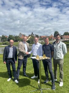
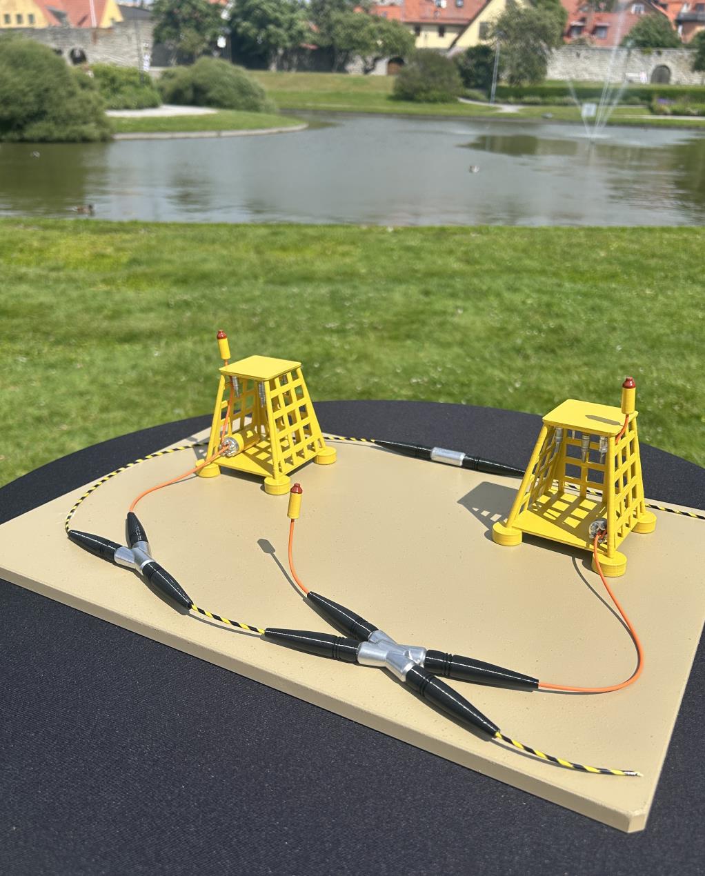
Tykoflex AB and Kongsberg Discovery have entered a strategic partnership to explore how Tykoflex’s proven fiber optic subsea closures can serve as a platform for integrating Kongsberg Discovery’s advanced sensor, communication, and positioning technologies.
The partnership aims to deliver modular, secure and intelligent subsea infrastructure solutions by combining their complementary strengths.
Kongsberg Discovery brings decades of offshore and subsea experience, including integrated solutions for surveillance, satellite connectivity, and infrastructure protection. Tykoflex contributes robust closure technology, widely deployed across the Baltic Sea and global subsea communication and power cable networks. Together, the companies offer a solid foundation for dual-use technologies that serve both civilian and defense needs.
Potential Applications
The joint solution exemplifies dual-use innovation at its finest. On the civil side, it enables continuous underwater monitoring for marine research, including the study of noise pollution and its impact on marine wildlife. For defense and civil protection, it enhances situational awareness and safeguards critical subsea infrastructure through distributed sensing and secure communications.
“This partnership has the potential to unlock something truly significant. By combining proven infrastructure with advanced sensing and communication technologies, we are laying the groundwork for a persistent, intelligent subsea network. The innovation potential is just beginning to surface, like a Starlink beneath the sea. We welcome and encourage additional partners to join us in shaping the future of resilient and innovative undersea systems,” says Richard Petersson Wigh, CEO of Tykoflex AB.
“This partnership highlights the strength of bringing together world-class Nordic expertise. By combining Tykoflex’s proven subsea technology with Kongsberg Discovery’s capabilities in radar, sensors, and autonomous systems, we can deliver integrated solutions that meet tomorrow’s challenges. Together, we are creating system-level innovation to protect the critical infrastructure that modern societies rely on, says Nils Waltre, Senior Sales Manager at Kongsberg Discovery.
Strategic Context
Recent damage to subsea cables and pipelines in the Baltic Sea has underscored the vulnerability of undersea infrastructure.
“This collaboration comes at a critical moment. Given growing geopolitical tension and increased focus from NATO and EU actors, there is a clear need for innovative, resilient solutions. Our joint development is timely, offering not only advanced monitoring but also the potential to act or mitigate threats through integrated systems, including Kongsberg Discovery’s autonomous underwater vehicles. Together, we aim to help shape new ways of protecting and securing the seabed in an era of emerging risks, says Martin Wien Fjell, President of Kongsberg Discovery.

APPG launches new inquiry into sustainable ocean policy

The All-Party Parliamentary Group for the Ocean has launched an inquiry into what can Sustainable Ocean Policy Deliver for the UK? This will be the APPG’s first inquiry since the General Election and will focus on:
- Demonstrating the untapped potential of the ocean in delivering key government priorities.
- Promoting the understanding of the ocean as a driver of innovation.
- Identify opportunities for policy coherence and cross-departmental collaboration in ocean governance.
- Highlight the enabling role of marine science, data, and innovation in maximising ocean-based solutions to inform policy making.
- Promote integrated approaches to marine environmental protection, recognising sustainability as a foundation for future ocean investment.
- The APPG will accept written evidence until 23.59 on the 18th of July. There will be up to two oral evidence sessions held with dates to be announced in due course. The APPG hopes to publish the report in the Autumn.
Respondents are asked to submit evidence and any questions to: [email protected]
When emailing the APPG, please also indicate your interest in providing oral evidence, and note that all responses limited to 500 words per question. This inquiry will cover Great Britain, Northern Ireland and British Overseas Territories.
The full questions and terms of reference for the inquiry are below.
Commenting, Sarah Champion MP, Chair of the APPG for the Ocean said:
“I am delighted to launch the APPGs first inquiry of this parliament.
“Our oceans have a vital role to play in delivering on the Government’s key priorities both nationally and internationally and it is vital that a sustainable and deliverable oceans policy lies at the heart of Government’s agenda.
“We look forward to hearing from all interested parties about how to tackle the challenges that we face, conserve our ocean and crucially, how we can maximise the role of marine science, ocean research and innovation, and a sustainable blue economy to meet our UK and International objectives.”
Inquiry Questions
1. Building a Sustainable and Inclusive Blue Economy
How can the UK grow a sustainable blue economy that delivers long-term jobs, prosperity, and innovation?
- What is the potential economic value of the UK's marine industries?
- What are the barriers and opportunities to scaling blue economy sectors, including renewable energy, sustainable fisheries, marine technology, and coastal tourism?
- What infrastructure and investment are needed to support ocean innovation
- How can the UK ensure marine conservation and protection is upheld during future ocean initiatives?
2. International Leadership
How can the UK maintain and strengthen its leadership in global ocean governance?
- What future role can the UK play in global marine conservation and ocean diplomacy? What is needed to achieve this?
- Does, and if so how, the UK's international commitments, agreements or frameworks (e.g., UN Ocean Decade, BBNJ Treaty, Commonwealth Blue Charter) support domestic policy?
- How can the UK promote sustainable ocean finance and knowledge-sharing internationally?
3. Climate Change and Net Zero
What is the role of the ocean in meeting the UK’s climate and Net Zero goals?
- How can ocean-based climate and net zero solutions (e.g., offshore wind, blue carbon habitats) contribute to the UK’s targets?
- How can sustainable ocean management contribute to the UK’s Net Zero goals and wider environmental targets?
- What is the role of ocean conservation (e.g., marine protected areas, habitat restoration) in building long-term climate resilience?
- How can marine research and science support adaptation and resilience in the face of climate change?
- What are the benefits and challenges to the ocean and coastal waters from human interactions including tourism, leisure cruising and recreation including water sports?
4. National Security and Ocean Resilience
How does the ocean contribute to the UK’s national security and resilience?
- What are the emerging risks and threats linked to ocean health and national infrastructure, and how can these be overcome?
- How do ocean observations support the protection of the UK marine assets?
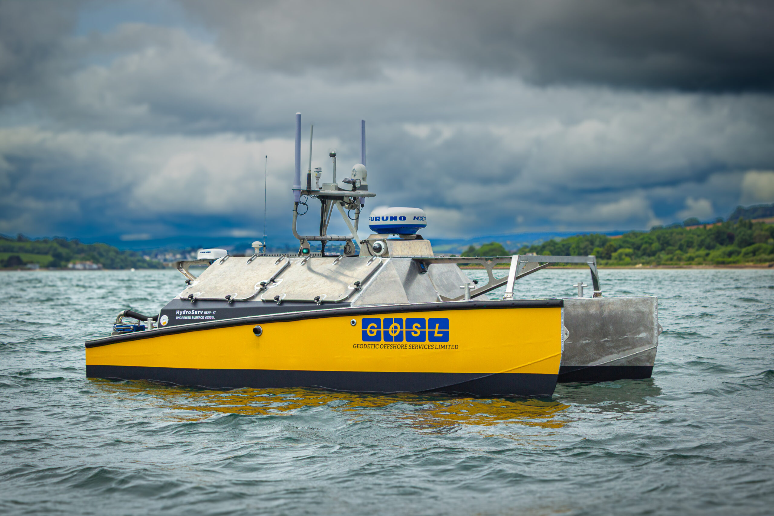
GOSL Nigeria Expands Uncrewed Survey Capability with HydroSurv REAV- 47 Order
 HydroSurv today announced the sale of a REAV-47 uncrewed surface vessel to Geodetic Offshore Services Limited (GOSL) for hydrographic and geophysical survey operations. The sale marks the company's first delivery to Nigeria where GOSL are a leading provider of offshore survey services.
The battery-hybrid REAV-47 will be integrated with an advanced payload consisting of a Ping DSP 3DSS-IDX interferometric sonar alongside Innomar's Compact Parametric Sub-Bottom Profiler. This payload configuration will enable concurrent wide-swath bathymetric mapping and high-resolution sub-bottom imaging for comprehensive landfall survey capability on offshore infrastructure projects.
“GOSL Nigeria Limited is proud to be associated with HydroSurv for this milestone achievement in the deployment of the REAV 47 USV which will help revolutionize the way hydrographic surveys are being conducted within Nigeria and indeed West Africa.” said Emanuel Ekpeyong, Managing Director, GOSL Nigeria Limited.
“USVs are the way of the future as it helps reduce human and carbon footprints and guarantees efficient seabed mapping delivering project objectives in record time at a minimal cost.”
GOSL will operate the multipurpose REAV-47 USV as a standalone survey system, and as a mothership force-multiplier. As a new product introduced into HydroSurv's portfolio in 2024, the design is an evolution on the company's existing seagoing USV platform. The vessel can sustain survey operations for up to 72-hours with a battery-hybrid system consisting of a 12kW Mastervolt battery system and a 4kW Fischer Panda generator.
The REAV-47 uses HydroSurv's advanced Virtual Watchkeeper Vessel Control System, alongside trusted autopilot technology from Dynautics and an advanced navigation and situational awareness spread from Furuno and TimeZero. The vessel's 5.0kW rim driven electric propulsion from RDT minimises entanglement risk whilst delivering exceptional performance.
“We are proud to be partnering with GOSL as our first customer in the region,” said David Hull, CEO of HydroSurv. “The REAV-47 is a versatile, commercial-duty mid-size USV, ideally suited to support the integration of both the PingDSP and Innomar sub-bottom profiling systems. We look forward to collaborating closely with GOSL’s highly experienced survey team to maximise the platform’s capabilities across a range of operational applications.”
GOSL will station the new USV at the company's operating base in Port Harcourt. The company's experienced survey team have extensively delivered survey projects for ExxonMobil, Shell, Chevron and Total Energies.
In addition to the REAV-47, GOSL has also acquired a REAV-28 Inland Multi-Purpose USV. This smaller, battery-electric vessel complements the longer-endurance capabilities of the REAV-47, enabling a flexible and efficient survey solution across diverse environments - from agile inland and sheltered water operations to more demanding coastal and landfall missions.
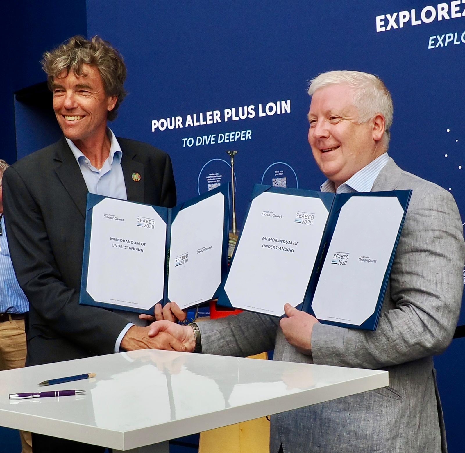
Seabed 2030 and OceanQuest announce partnership at UN Ocean Conference to advance ocean mapping and discovery
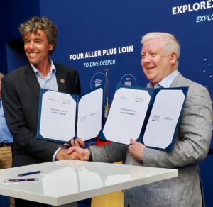
The Nippon Foundation-GEBCO Seabed 2030 Project and OceanQuest have signed a Memorandum of Understanding (MOU) at the 2025 UN Ocean Conference in Nice, France. The partnership marks a significant step forward in international collaboration to advance our understanding of the ocean through comprehensive seafloor mapping and deep ocean exploration.
The announcement follows OceanQuest’s recent Around Africa Expedition, delivered in collaboration with OceanX. In just four months, the mission mapped 120,036 square kilometres of seafloor – an area roughly the size of Greece – gathering vital data on deep-sea ecosystems and contributing to Seabed 2030’s mission. The 2025 expedition was an endorsed Action programme of the United Nations Ocean Decade framework (2021-2030), recognised for its contributions to capacity building and advancing scientific understanding of the ocean.
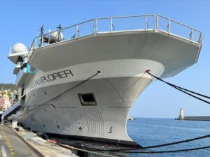
The partnership was announced on board OceanXplorer – OceanX’s state-of-the-art research vessel – during the third UN Ocean Conference, currently underway in Nice. Seabed 2030 was itself launched at the inaugural UN Ocean Conference in New York in 2017, when just six per cent of the ocean floor had been mapped to modern standards. That figure has since grown to over a quarter of the entire seabed mapped.
Seabed 2030 is a collaborative project between The Nippon Foundation and the General Bathymetric Chart of the Oceans (GEBCO), which seeks to accelerate the complete mapping of the world’s ocean by 2030, and to compile all the data into the freely available GEBCO Ocean Map. The Project is formally endorsed as a Decade Action of the UN Ocean Decade. GEBCO is a joint programme of the IHO and the Intergovernmental Oceanographic Commission (IOC), and is the only organisation with a mandate to map the entire ocean floor.
OceanQuest is a Saudi Arabian not-for-profit foundation committed to advancing ocean discovery. The organisation seeks to inspire a new era of deep-sea exploration and global knowledge-sharing.
“Mapping the entire ocean floor by 2030 is an undertaking that requires collaboration, innovation and global commitment,” commented Jamie McMichael-Phillips, Project Director of Seabed 2030. “OceanQuest’s recent work is a testament to the progress that can be made when those qualities come together. We are delighted to welcome them to our growing network of partners and look forward to what we can achieve together.”
Martin Visbeck, CEO of OceanQuest, said: “We are proud to partner with Seabed 2030 and contribute our data, expertise and passion for ocean discovery to a global effort that benefits all of humanity.
“Our recent expedition highlights just how much of the ocean remains unexplored. By joining forces with Seabed 2030, we can ensure that new discoveries are integrated into global science and help shape a more informed, sustainable future for our ocean.”
As part of the partnership, OceanQuest will contribute seafloor mapping data to Seabed 2030, and the organisations will also collaborate on promoting innovative technologies and practices in ocean science. All data collected and shared with the Seabed 2030 project is included in the free and publicly available GEBCO global grid.
Impact Subsea Launches ISA200: Next-Generation Long Range Altimeter & Echosounder
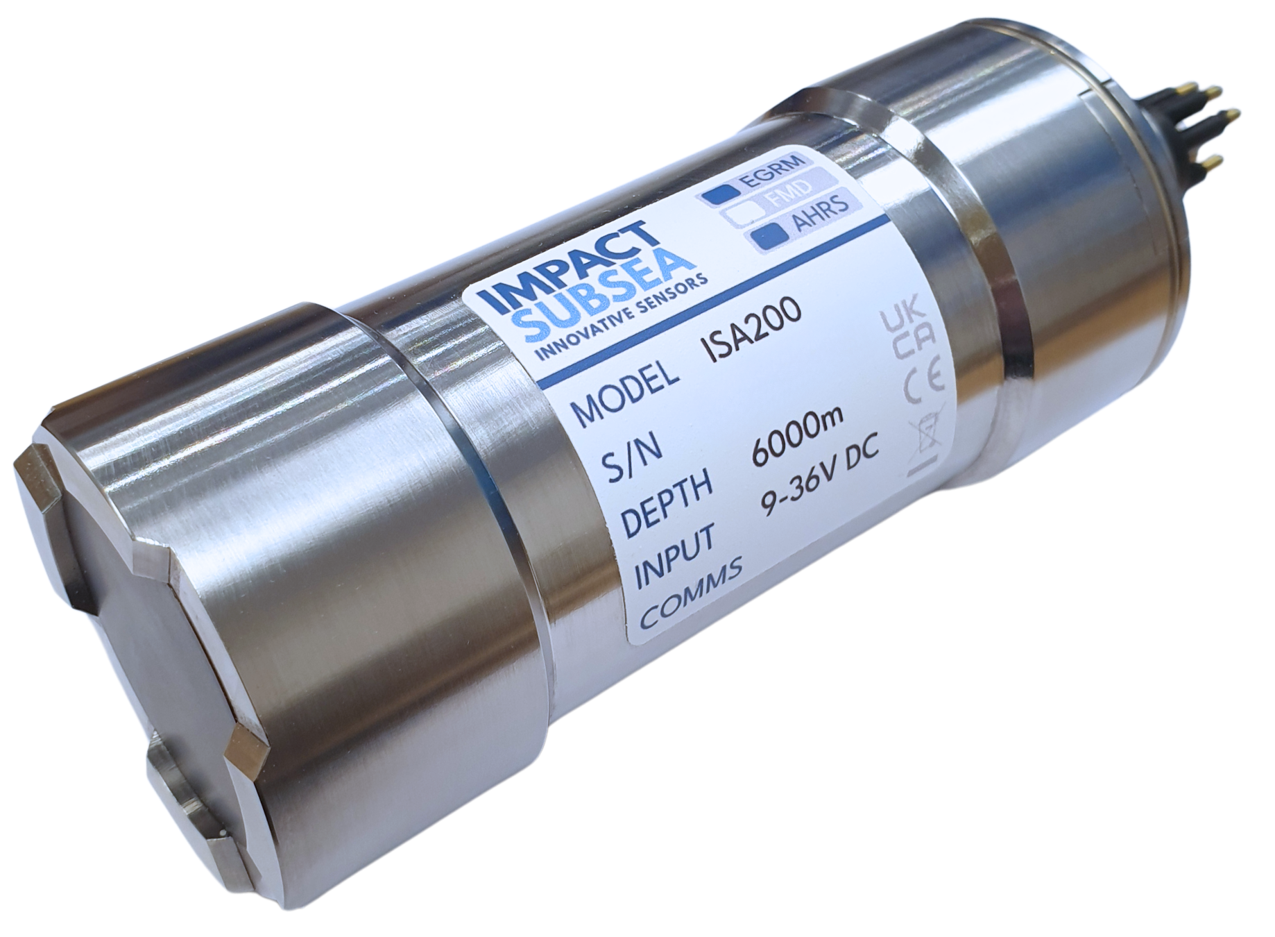
Impact Subsea is pleased to announce the launch of the ISA200, the latest addition to its advanced range of underwater altimeters and single beam echosounders.
Operating at 200kHz, the ISA200 offers an impressive measurement range exceeding 250 meters (820 feet) with exceptional accuracy to within 1mm. Engineered for the most demanding subsea environments, the ISA200 is depth rated to 6,000 meters (19,685 feet) and delivers a precise 15.2° conical beam, providing reliable long-range performance for a wide range of applications.
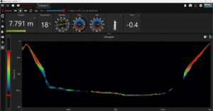
Designed to function both as an underwater altimeter and as a high-performance echosounder, the ISA200 offers flexible measurement capabilities for AUV, ROV and hydrographic survey operations. When operating as an echosounder, the ISA200 delivers detailed sonar backscatter data, providing up to 2,000 sample points per ping, each with associated energy and correlation values enabling comprehensive seabed analysis.
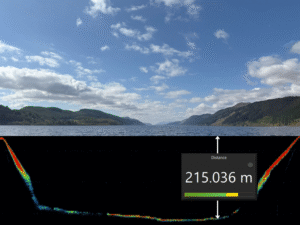
Designed to function both as an underwater altimeter and as a high-performance echosounder, the ISA200 offers flexible measurement capabilities for AUV, ROV and hydrographic survey operations. When operating as an echosounder, the ISA200 delivers detailed sonar backscatter data, providing up to 2,000 sample points per ping, each with associated energy and correlation values enabling comprehensive seabed analysis.
Data from the ISA200 can be easily viewed and logged using Impact Subsea’s seaView software or seamlessly integrated into third-party systems. For straightforward integration, the sensor supports simple ASCII data output, while the Impact Subsea Software Development Kit (SDK) provides developers with complete control over the sensor’s operation and data handling.
Commenting on the product launch, Ben Grant, Managing Director of Impact Subsea, said:
"We are excited to expand our altimeter and echosounder range with the introduction of the ISA200. This sensor offers exceptional long-range measurement capabilities and will deliver significant benefits to users in AUV, ROV and hydrographic survey applications."
ISA200 full specification can be found here: https://www.impactsubsea.co.uk/altimeter/
Fugro partners with Ocean Visions to advance safety of ocean-based carbon removal
Ocean-based climate solutions just got a major boost. Selected by the non-profit Ocean Visions, Fugro will lead the development of a standardized Environmental Impact Assessment Framework for marine carbon dioxide removal (mCDR), a set of emerging technologies that enhance the ocean’s natural ability to store carbon. This initiative aims to support the permitting of mCDR projects by providing a transparent, evidence-based approach to environmental review.
Carbon removal is increasingly seen as a critical complement to emissions reductions in meeting global climate goals. By drawing carbon dioxide out of the atmosphere, mCDR can help offset residual emissions and contribute to climate stability. mCDR strategies include approaches such as enhancing ocean alkalinity, cultivating seaweed and extracting carbon dioxide directly from seawater. While these methods show promise in helping to meet global climate goals, they must be carefully evaluated to ensure they are safe for marine ecosystems and the communities that depend on them.
“Marine carbon dioxide removal has the potential to become a powerful tool in the fight to stop climate change—but first it must be able to pass the dual tests of safety and effectiveness,” said Brad Ack, CEO of Ocean Visions. “Fugro brings deep expertise in environmental impact assessments, framework development and offshore environmental monitoring, making them an ideal partner to lead this foundational work toward scalable ocean-based solutions.”
“We’ve spent decades helping industries assess and manage environmental risks in offshore environments,” said Céline Gerson, Fugro’s Group Director for the Americas and President of Fugro USA. “Now we’re applying that expertise to help ensure mCDR is done responsibly and earns public trust.”
The two-year project will involve designing, refining and testing a framework that can be applied across a range of mCDR strategies. Joining Fugro on the project are US-based Integral Consulting and the UK’s National Oceanography Centre. The final framework will be openly accessible and is expected to serve as a critical tool for researchers, regulators and communities evaluating whether and how to host mCDR projects. Ocean Visions plans to publish the completed framework in 2027.
Learn more: https://oceanvisions.org/mcdr-eiaf/
IMCA Publishes New Guidance for ROV Simulator Approval

IMCA guidance on ROV Audits now revised
A suite of guidance documents, primarily for those owning and operating ROVs (remotely operated vehicles) and ROV simulators, has been published by the International Marine Contractors Association (IMCA).
One is a revision of an existing document, retitled to – IMCA R006 ‘ROV System Inspection’; the other two are newly developed guidance documents ‘Requirements for IMCA-Approved Class A ROV Simulator Accreditation’ – IMCA R028, and supporting governance document ‘Interim scheme for IMCA approval of simulator systems used for work and skills’ – IMCA G014.
“All are aimed at advancing safety consistency and competency in the offshore industry and were requested by members and their clients” explained IMCA Technical Adviser, Roger Moore.
“The governance document sets out requirements for the approval of simulator systems (in general) with the technical requirements for an ROV Simulator approval detailed in R028.
“The content of R006 has been reviewed and revised to ensure our offering remains a robust and effective auditing process and also allows for future integration with the IMCA eCMID system. Developed in collaboration with committee workgroups and industry experts and aligned with best practice, the documents will support IMCA members and training providers in delivering robust, approved programmes that meet modern operational needs, and reflet IMCA’s commitment to promoting technical excellence and competence across the marine contracting sector.”
Summaries of the three publications
IMCA R006 – ROV Audit (Revision 2.0)
This document provides guidance aimed at offshore contractors, detailing the audit process for ROV systems, which includes equipment checks and compliance with operational standards. It replaces previous versions from 2001 and 2020, reflecting current industry practices and requirements. The document emphasises the importance of maintaining equipment inventories and following manufacturers’ instructions to ensure compliance with operational procedures. In the imminent future, a feature for ROV audits will be integrated into the eCMID platform, accessible via the eCMID application, allowing ROV Audits to be undertaken digitally. This feature will complement the R006 ROV Audit document.
IMCA R028 – Requirements for IMCA-Approved Class A ROV Simulator Accreditation
This new document establishes the criteria for the accreditation of Class A ROV simulators, which are defined as high-fidelity, fully immersive training systems. The document sets out the minimum capabilities, performance benchmarks, and evaluation procedures for simulators to qualify as Class A. The goal is to ensure these simulators offer realistic, effective training that mirrors offshore operational conditions. Accreditation helps assure industry confidence in simulator-based learning and supports the continued development of skilled, competent ROV personnel.
IMCA G014 – Interim scheme for IMCA approval of simulator systems used for work and skills
This is a guidance document for the approval of simulator systems (in general). The scheme enables members to verify their simulators meet IMCA guidelines. The document outlines the scheme and provides detail on Eligibility for Approval, Fees Structure and Application Process. This document has been written so that future iterations can include any simulator system (e.g. DP), however the only type of simulator that can be approved at the moment, is an ROV simulator. The document was written to support document R028.