
Greensea IQ announces Neotek as exclusive representative for France and Belgium
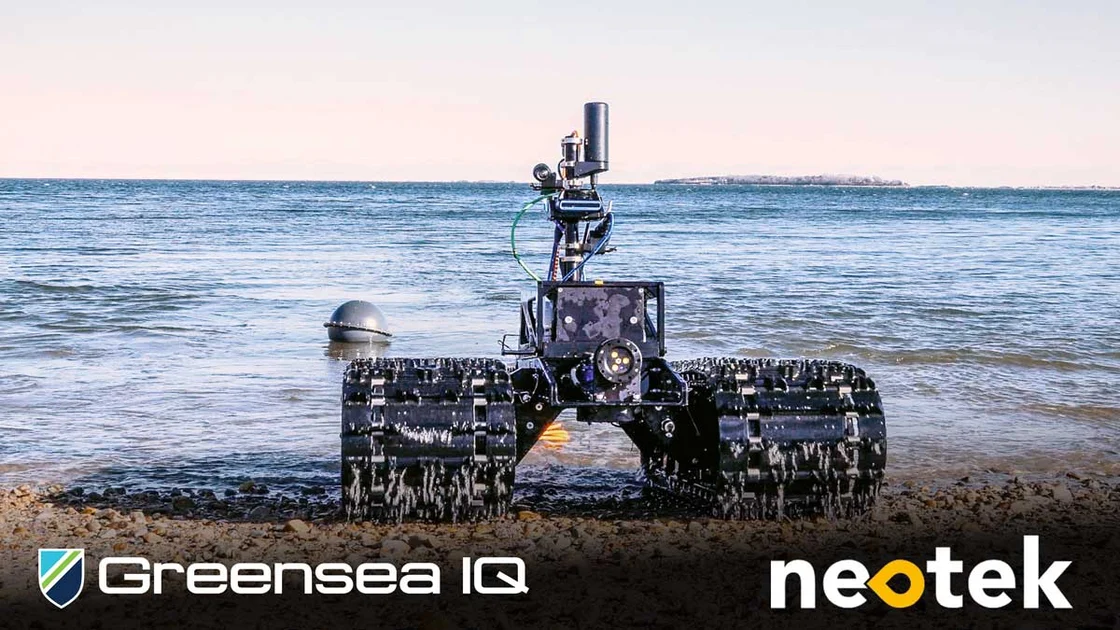
 Greensea IQGreensea IQ, a leader in autonomous robotic systems for the maritime and defense industries, is pleased to announce a new exclusive representation agreement with Neotek, a well-established provider of marine technologies headquartered in Lorient, France. Under this agreement, Neotek will represent Greensea IQ’s Bayonet line of surf-zone autonomous vehicles and IQNS navigation and situational awareness systems in France and Belgium.
This partnership marks a strategic expansion of Greensea IQ’s international sales network, bringing two of its core product lines to new markets through a highly respected regional expert in marine systems integration and distribution.
“Neotek brings deep technical expertise and strong customer relationships in the maritime and defense sectors across France and Belgium,” said Rob Howard, Chief Growth Officer of Greensea IQ. “We’re excited to partner with a company that understands the operational challenges of the surf zone and the value of precise navigation and autonomy. Together, we’ll support customers seeking new capabilities for littoral and seabed defense operations.”
The Bayonet family of Autonomous Underwater Ground Vehicles (AUGVs) provides robust, adaptable solutions for operations in the surf zone and shallow water—delivering applications including mine countermeasures (MCM), UXO detection, beach surveys, and payload delivery. IQNS, Greensea IQ’s Integrated Navigation System, enables accurate and reliable positioning, communication, and control across complex subsea missions.
“We are proud to become the exclusive representative for Greensea IQ in France and Belgium,” said Antoine HANOY, Defense Sales Manager at Neotek. “The Bayonet and IQNS systems fit perfectly within our portfolio and address growing demand in the region for advanced autonomous technologies. We look forward to supporting Greensea IQ’s growth and bringing these powerful capabilities to our customers.”
This agreement strengthens Greensea IQ’s ability to serve regional defense, scientific, and commercial users with integrated robotic solutions designed for mission-critical success.
About Neotek
Neotek is a wholly owned French company by Sea Vorian, specializing in the distribution and integration of marine technologies. With more than 30 years of experience, Neotek serves customers in defense, oceanography, offshore energy, and environmental monitoring by providing best-in-class instrumentation and engineering support. Based in Lorient and Toulon, Neotek is able to provide large scale of services such as leasing of equipment, turnkey operation including manpower and data analysis, and services including maintenance, repair and obsolescence treatment. Learn more at https://neotek-web.com.

Voyis launches Deep Vision Optics: a new era in underwater imaging
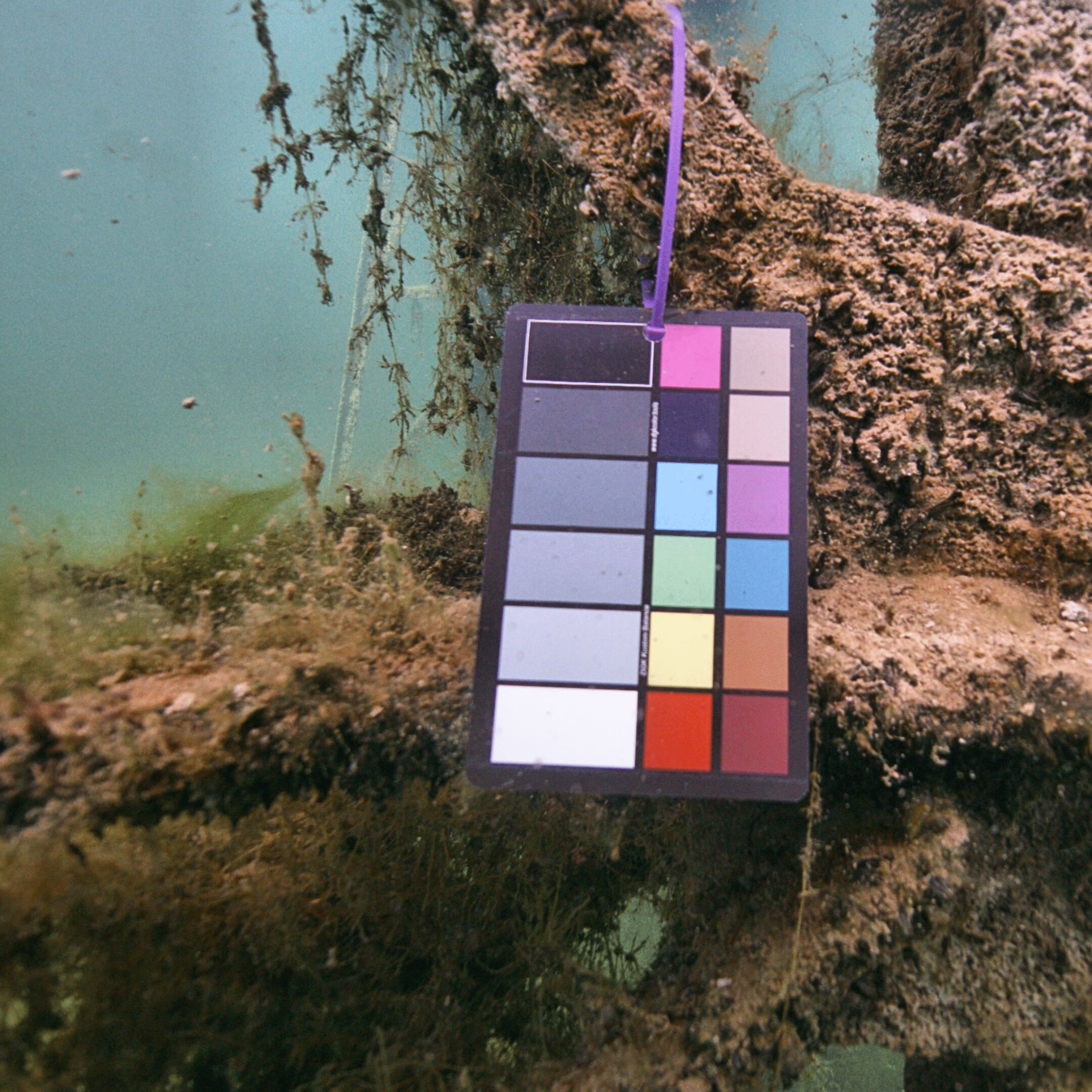
 Voyis, a global leader in underwater optical sensor technology, is proud to announce the launch of the Deep Vision Optics, an advanced optical system designed to enhance image clarity and sharpness in subsea environments. This cutting-edge solution is being released for the Voyis’ Discovery Vision Systems and the Observer Imaging Systems, setting a new standard in underwater imaging performance.
Overcoming the Limitations of Underwater Imaging
Underwater cameras face a significant challenge in maintaining focus across their entire field of view and working range due to the water medium. Traditional dome viewports affect image formation and focus, leading to poor corner focus that limit the usability of the camera’s field of view. They also reduce the depth-of-filed of the camera, meaning both close-up and far away targets cannot both have optimal sharpness. The result is image blur, reduced feature tracking accuracy, and inconsistencies in photogrammetry-based mapping applications.
The Deep Vision Optics: A Breakthrough in Optical Engineering
To address these fundamental imaging issues, Voyis has developed the Deep Vision Optics, integrating an advanced corrective optical design with three key objectives:
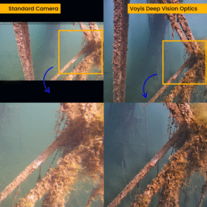
- Eliminating Image Blur in the Corners: By optically correcting for the effects of the dome viewport and water medium, the system ensures nearly equal sharpness across the entire field of view, allowing for full-sensor utilization.
- Enhancing Overall Image Sharpness: The new optical system removes distortions caused by the water medium, improving clarity not just in the corners, but at the center as well.
- Expanding the Depth of Field: With customized optical engineering, the Deep Vision Lens enables clear imaging of both nearby and distant objects, crucial for precision inspections and wide-area surveys.
Benefits for Underwater Operations
Deep Vision Optics delivers industry-leading image quality, maximizing field-of-view utilization to enhance situational awareness for ROVs and improve visual surveys with AUVs. Optimized image sharpness boosts feature and target detection, supporting machine learning applications with reliable automated analysis. Enhanced corner sharpness improves stability in photogrammetry and VSLAM processes, while higher depth of field ensures accurate photogrammetry, reducing manual intervention and accelerating data processing for faster, more reliable survey results.
Setting a New Standard in Underwater Imaging
Deep Vision Optics represents a significant leap forward in underwater imaging technology, empowering operators with the tools needed to conduct more precise, efficient, and automated subsea inspections. Voyis remains committed to advancing the field of underwater vision, ensuring that every detail beneath the surface is captured with unparalleled clarity.
For more information about the Deep Vision Lens and how it integrates with Voyis’ imaging and vision systems, please visit our website or contact the sales team at [email protected]
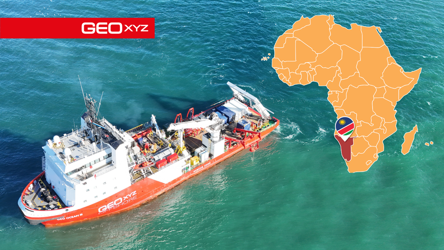
GEOXYZ launches first African branch in Namibia, strengthening Southern Africa presence
 GEOxyz proudly announces the opening of its first African branch in Walvis Bay, Namibia. This move marks a significant milestone in GEOxyz’s international expansion strategy and confirms a long-term commitment to serving the Southern African market with high-quality, locally adapted services.
Namibia was chosen as the company’s regional base due to its central location, strong business environment, and growing demand for survey services in both offshore and onshore infrastructure sectors. From this strategic location, GEOxyz will be able to efficiently support projects across Southern Africa.
The Namibian office will be led by Jacques Vancayseele, a seasoned industry expert with over seven years at GEOxyz and deep ties to both South Africa and Namibia. His leadership will ensure a strong bridge between GEOxyz’s European roots and its African ambitions.
“I’m excited to lead this new chapter for GEOxyz in Southern Africa,” said Jacques Vancayseele. “This region holds immense potential, and with a dedicated local presence, we’re better positioned to deliver tailored solutions that meet the specific needs of our clients while contributing to local growth and development.”
The new office will initially operate as a close collaboration between GEOxyz’s European and African teams, with a long-term goal of building a fully independent and locally led operation. GEOxyz is committed to hiring local talent, partnering with regional institutions, and investing in knowledge transfer to ensure that local teams benefit from the company’s extensive global experience. The company will also continue its tradition of working closely with local schools to train the next generation of marine data specialists and surveyors.
From Namibia, GEOxyz will provide a full suite of data services including offshore hydrographic and geophysical surveys, as well as onshore services such as infrastructure mapping for railroads and land development.
“Opening our Namibian office is a natural next step in GEOxyz’s global expansion,” said Patrick Reyntjens, CEO of GEOxyz. “Having someone as experienced and locally embedded as Jacques at the helm ensures we can grow with purpose—combining our international standards with a deep understanding of the Southern African context.”
While Namibia marks GEOxyz’s first footprint in Africa, the company remains focused on a broader global strategy, with future expansions expected in West-Africa, Asia and South America.
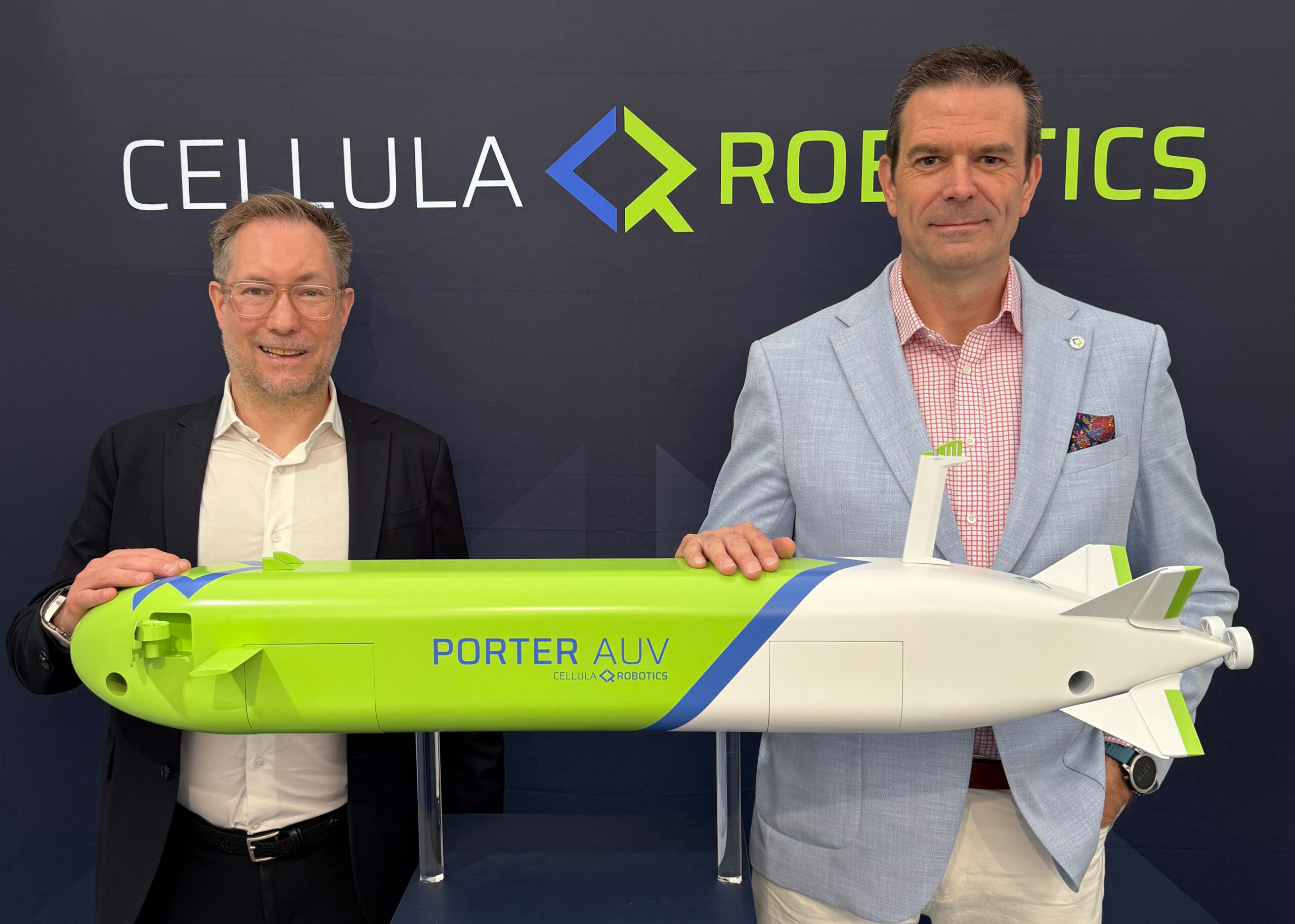
Cellula Robotics partners with Subsea Europe Services and FLANQ to expand AUV Market reach in Northern Europe
Cellula Robotics Limited has entered into a sales and representation agreement with Subsea Europe Services GmbH (SES) and its defence division, FLANQ. This strategic partnership will expand the market presence of Cellula’s advanced autonomous underwater vehicle (AUV) technologies across Northern Europe.
Under the agreement, SES will promote and represent Cellula’s full AUV portfolio—including the Envoy, Porter, and Guardian AUVs, the Subsea Warden Hovering AUV for ship signature management, and the Subsea Sentinel system for passive acoustic monitoring—in both commercial and scientific sectors. SES will focus on customers in academic research, offshore survey, and geophysical industries, while FLANQ will engage with defence, maritime security, and government clients.
This new partnership will support customers in Germany, Denmark, Norway, Sweden, Poland, Lithuania, Latvia, Estonia, and Finland, offering local expertise and direct access to Cellula’s underwater platforms and sensors.
Richard Mills, Chief Commercial Officer at Cellula Robotics said: “We have worked with SES and FLANQ co-founders, Sören Themann and Daniel Esser, for many years now. We’ve watched Subsea Europe’s strong, year-on-year growth and been impressed with their successful launch of FLANQ in 2024. Their laser focus on the customer’s mission and exceptional support and service, made today’s announcement a natural step. We have full confidence in their team’s professionalism and commitment to delivering for our organisation.”
Daniel Esser, Co-founder and Chief Commerical Officer of Subsea Services Europe and FLANQ added: “We’re excited to join forces with Cellula Robotics in Europe. They have an immensely impressive product portfolio – a portfolio which aligns perfectly with the challenges Europe is facing now across the maritime domain. Everything from trading challenges to protecting critical undersea infrastructure and strengthening sovereign defence capability.
As Richard has mentioned, Sören and myself know the Cellula leadership team very well, and we know they understand, respect and fully support their channel partners in the market. We know this team will excel together, by focusing on delivering reliable, solutions that deliver operational and domain advantage to our clients in energy, science and defence.”
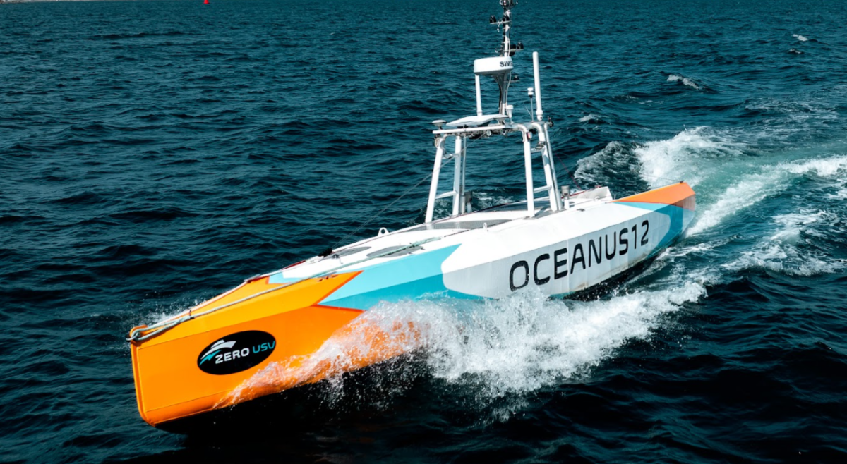
ZERO USV expands portfolio with new XLR Oceanus 12 for incredible 7500NM deployments
 Zero USV, pioneers behind the world’s first charter fleet for over-the-horizon unmanned surface vessels (USV), has today announced the expansion of its portfolio with the introduction of the new extra-long-range (XLR) Oceanus12, offering users even more options for high endurance maritime operations.
The original Oceanus12, launched earlier this year, is engineered to excel in voyages of up to 20 days or 2500 Nautical mile duration. However, the new XLR version builds on the hybrid electric technology developed for Oceanus12 and can increase overall mission duration to an incredible 7500 Nautical Miles or approximately 60 days with no outside assistance. It is also built for missions in remote areas or regions where access to traditional fuelling points is limited, ensuring that operations can continue uninterrupted.
The XLR Oceanus12 has all the power and onboard functionality of the core variant but boasts an increased overall length from 11.55m to 13m. While the original Oceanus12 has a fuel capacity of 1200 litres and approximately 2500 nautical mile range or a 20–25-day mission, the XLR can carry 4000 litres of fuel and travel more than 7500 nautical miles, the equivalent of 60+ day missions.
Matthew Ratsey, founder and managing director of Zero USV, said: “Uncrewed vessels are a force multiplier. The ability to conduct sustained operations at sea without the need for regular refuelling or crew-related logistics is becoming increasingly crucial as operational pressure on resources and time become more demanding. This is even more pronounced as international tensions rise, particularly in regions with contested maritime boundaries, heightening the need for reliable, high endurance long range USVs. In fact, they never been more critical.
“The Oceanus12 XLR is designed to meet these demands, offering unparalleled endurance for missions that require extended periods at sea, whether for surveillance, environmental monitoring, or strategic defence operations. By offering more flexibility and the ability to conduct longer missions, Zero USV’s XLR version responds directly to the strategic challenges of today’s global security environment.”
XLR Oceanus12 Specifications:
Green Credentials
- Twin Electric Hybrid Drive giving redundancy and efficiency
- Low Fuel Consumption
- Solar charging for house and emergency loads
Customisable Design
- Adaptable payload bay
- Sensor agnostic
- Quick change keel (sensor strut) allowing preloaded sensors to be swapped in/out with minimal downtime
Full Autonomy
- GuardianAI full stack autonomy software by MarineAI installed as standard
- Fully loaded autonomous sensor suite including HD Radar from Navtech.
- Remote control option
Over-the-Horizon
- Large fuel capacity for extended missions c. 7500Nm
- Six knot cruising speed with sprint speed of 10 knots (subject to payload)
Technical specification
- Length Overall: 13m
- Waterline Length: 11.40m
- Max Beam: 2.33m
- Displacement: 8 tonnes
- Hull Type: Monohull
- Hull Construction: Aluminium
- Installed Power: software limited to 40Kw, available 80Kw
- Speed: 6 knots cruising, 10 knots sprint
- Endurance: 7500+Nautical miles
- Fuel Capacity: 4000 Litres
- Payload: up to 1 tonne
- Draft: 1.76m
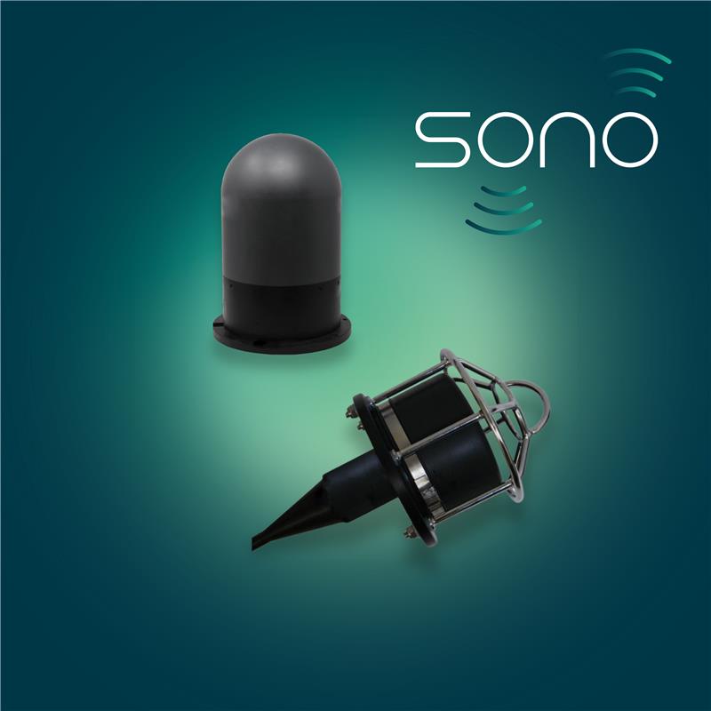
New Product Range Announcement
 Chelsea Technologies are excited to announce the launch of the new SONO product range, designed specifically to meet the evolving demands of oceanographic research and underwater acoustic applications. This innovative suite of sensors and tools leverages advanced technology to deliver unmatched precision, reliability, and performance in marine environments. The SONO range encompasses various solutions tailored for applications such as underwater communications, telemetry, and sonar test and evaluation.
Launched with the aim of empowering scientists and researchers, the SONO range is the culmination of Chelsea Technologies’ decades of expertise in marine sensor development. Designed to withstand the harshest conditions while maintaining exceptional accuracy, these products are poised to set a new standard in the field. Visit Chelsea Technologies’ website today to explore the full SONO range and discover how it can elevate your research to the next level here.

New Coral Gardens and Hydrothermal Vents Found in the Icy Depths of the Remote South Sandwich Islands
An Ocean Census Flagship expedition and GoSouth team of scientists found suspected new species, discovered one of the island chain’s shallowest hydrothermal vents, and explored the deepest trench in the Southern Ocean.

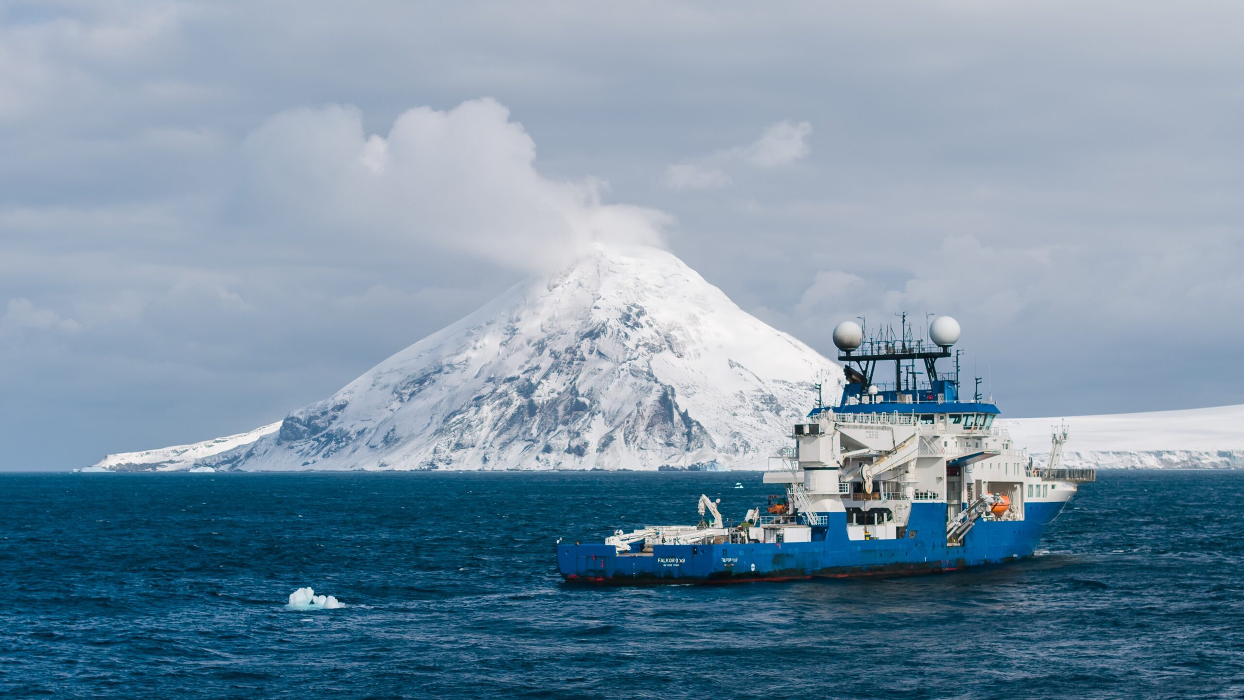
An international team of scientists on a recent 35-day deep sea expedition to one of the most remote island chains in the world observed thriving polar ecosystems, discovered new hydrothermal vents, coral gardens and many suspected new species. The Ocean Census Flagship expedition aboard Schmidt Ocean Institute's research vessel Falkor (too) explored the South Sandwich Islands, including one of the coldest and most isolated submarine trenches on the planet, and also found evidence of explosive volcanism. This was the same expedition that filmed the first confirmed sighting of a juvenile colossal squid
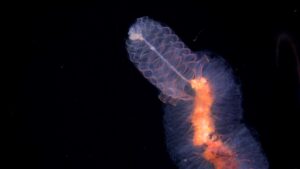
The expedition was part of the Nippon Foundation–Nekton Ocean Census programme, the world’s largest initiative to accelerate the discovery of ocean life. The Ocean Census scientists led the species discovery efforts, uncovering a wide range of potentially new marine life–including corals, sponges, snails, sea urchins, benthic ctenophores, and sea stars. The exact number of new species will be announced later this year following an Ocean Census workshop, where taxonomic experts will formally assess and catalogue the findings. The GoSouth team—a collaboration between the University of Plymouth (UK), GEOMAR (Germany), and the British Antarctic Survey (UK)—investigated the effects of geohazards, including tsunamis, volcanoes, and earthquakes.

“This expedition has given us a glimpse into one of the most remote and biologically rich parts of our ocean. This is exactly why the Ocean Census exists—to accelerate our understanding of ocean life before it’s too late,” said Dr. Michelle Taylor, head of science and expedition principal investigator at the Ocean Census, and senior lecturer at the University of Essex. “The 35 days at sea were an exciting rollercoaster of scientific discovery; the implications of which will be felt for many years to come as discoveries filter into management action.”
Mother Nature threw everything she had at the expedition, said Taylor, including a subsea earthquake, tropical storm force winds with hurricane-level gusts, eight-metre (26-foot) waves, and icebergs to navigate.
Located in the South Atlantic, the South Sandwich Islands are part of a rich mosaic of geologic features such as hadal zone trenches, underwater volcanoes, and spreading centres — features created by tectonic forces that have supported the evolution of species found nowhere else on the planet. It took eight days for the research vessel to travel to the islands from the port of Punta Arenas, Chile.
The GoSouth team, led by Co-Chief Scientist Dr. Jenny Gales, discovered two pockmarks in the mapping data of an underwater caldera— a bowl-shaped depression in the seafloor, left after a volcano erupts. Pockmarks can indicate hydrothermal activity. Using a “nested” approach, the team deployed Schmidt Ocean Institute’s remotely operated vehicle, SuBastian to map the pockmarks at a higher resolution and confirm the presence of vents.
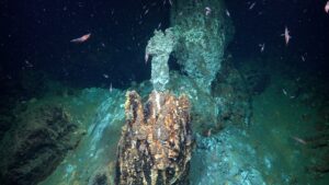
The larger pockmark contained three hydrothermal vents, and the smaller contained one. Located at 700 metres depth (nearly 2300 feet), they are one of the shallowest hydrothermal vents to have been discovered near the South Sandwich Islands, and the only ones to be explored using a remotely operated vehicle. The tallest vent chimney was four metres (13 feet), making it about as tall as a basketball hoop. Each vent was covered with an array of life dependent on chemosynthesis, including sea snails and barnacles. Thriving coral gardens and large sponges were found in close proximity to the vents–an unusual observation, said Taylor.
“Discovering these hydrothermal vents was a magical moment, as they have never been seen here before,” said Gales, an associate professor in Ocean Exploration at the University of Plymouth (UK). “It's an incredible discovery that provides valuable insights into the area’s tectonic activity. Making such a discovery is rare. It highlights the importance of ocean exploration and seafloor mapping.”
In addition to the vents, other notable observations during the expedition included:
• In the trench, scientists found snailfish eggs that had been laid on a black coral, as well as a potential new sea cucumber species;
• large pumice blocks, indicating that the South Sandwich Islands are capable of explosive volcanism;
• a vibrant coral garden located west of Saunders Island at a depth of 120 metres (394 feet);
• Capturing the first footage of Akarotaxis aff. gouldae, a species of dragonfish that was discovered two years ago.
“The challenging ocean and weather conditions and the isolated location of the South Sandwich Islands capture the imagination of the boldest explorers - often the closest humans to the vessel were on the International Space Station,” said Schmidt Ocean Institute’s Executive Director, Dr. Jyotika Virmani. “We are proud to have collaborated with Ocean Census in their mission to advance discovery of marine life and GoSouth in their quest to better understand the geological nature of this dynamic corner of the world.”
Okeanus Delivers 20-Ton A-Frame to ThayerMahan
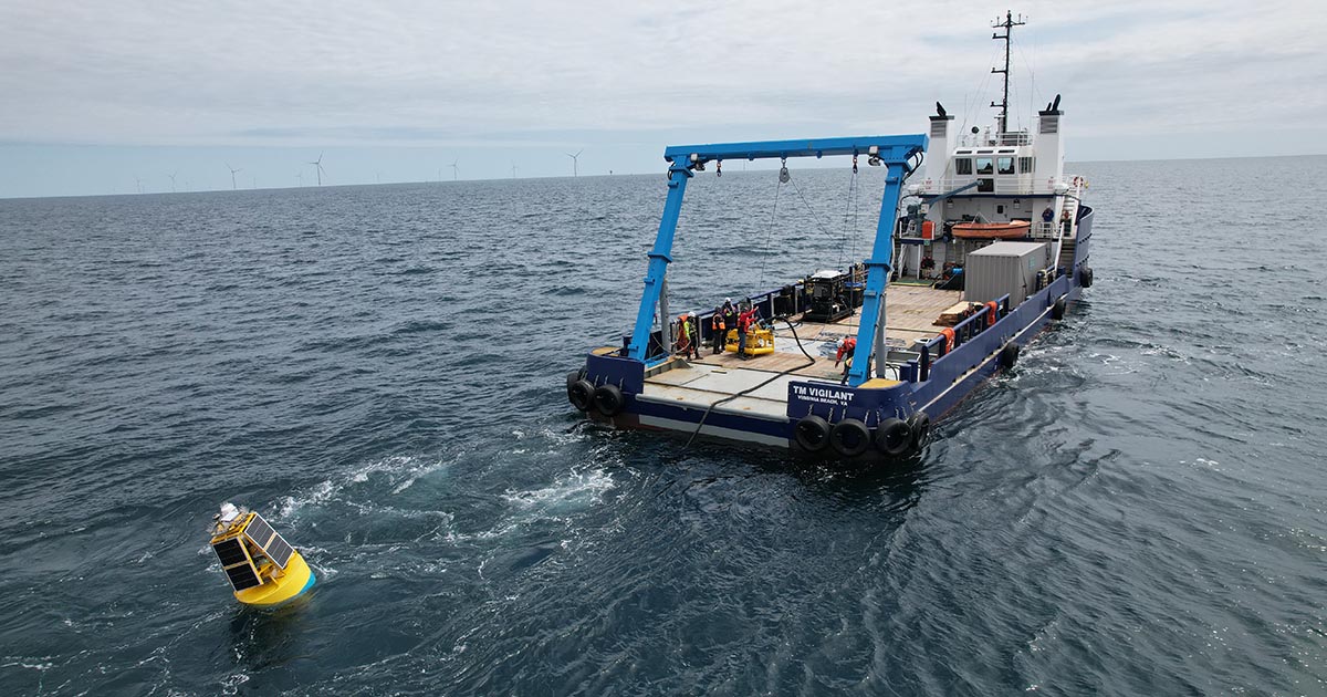
Okeanus Science & Technology, LLC, an international provider of specialized ocean equipment and marine engineering services, recently delivered a 20-Ton A-Frame to ThayerMahan, a leading defense and commercial maritime technology company, for their newly acquired vessel, TM Vigilant. The A-Frame is now permanently installed on the vessel, which has been engineered to support the launch and recovery of monitoring and surveillance assets for both environmental survey campaigns and defense-related missions.
While the 20-Ton A-Frame is a standard product from the expanding Okeanus portfolio, the engineering and manufacturing team, based out of the firm’s production facility in Houston, TX, worked with operators from ThayerMahan to customize certain specifications, including making the A-Frame 5’ wider than is standard, allowing the client the ability to use the full width of the aft deck to handle more sizeable deployments. Final hydraulic assembly and factory acceptance testing were conducted at Okeanus’ Houma, LA facility, and the system was immediately sent out on its first deployment.
“We are grateful for the efforts of the engineering and development teams at Okeanus to deliver this capable custom solution,” said ThayerMahan’s Fleet Manager, Chris Gasiorek. “With its new 20-Ton A-Frame and our seasoned crew, the TM Vigilant is now equipped to execute an even wider range of missions and operations for our commercial and defense customers.”
“We were delighted to work with ThayerMahan on this project and are excited to see another of our 20-Ton A-Frames out in the field,” said Benton LeBlanc, Chief Commercial Officer Okeanus. “As operators and their customers look to safely and reliably handle larger and more sophisticated payloads in deeper waters from support vessels like the TM Vigilant, we understand that there is a continued need for versatile solutions that are reliable enough to serve as a permanent installation on the deck of the vessel, but designed and built with rapid mobilization and demobilization in mind should the need arise to remove the equipment from the vessel. To optimize any deck-handling system’s versatility, we work with the customer, as we did with the team from ThayerMahan, from initial consultation to final installation to advise on and incorporate any necessary customization to ensure a fit-for-purpose and turnkey package.”
The Okeanus 20-Ton A-Frame is available as both a build-to-order offering and as part of the company’s extensive rental lineup. Okeanus’ rental portfolio provides offshore operators with access to a range of advanced deck systems and cutting-edge technologies available around the world for rapid mobilization. For more information, visit the Okeanus website here.
Fugro selected for pioneering USV seabed mapping initiative in Norway
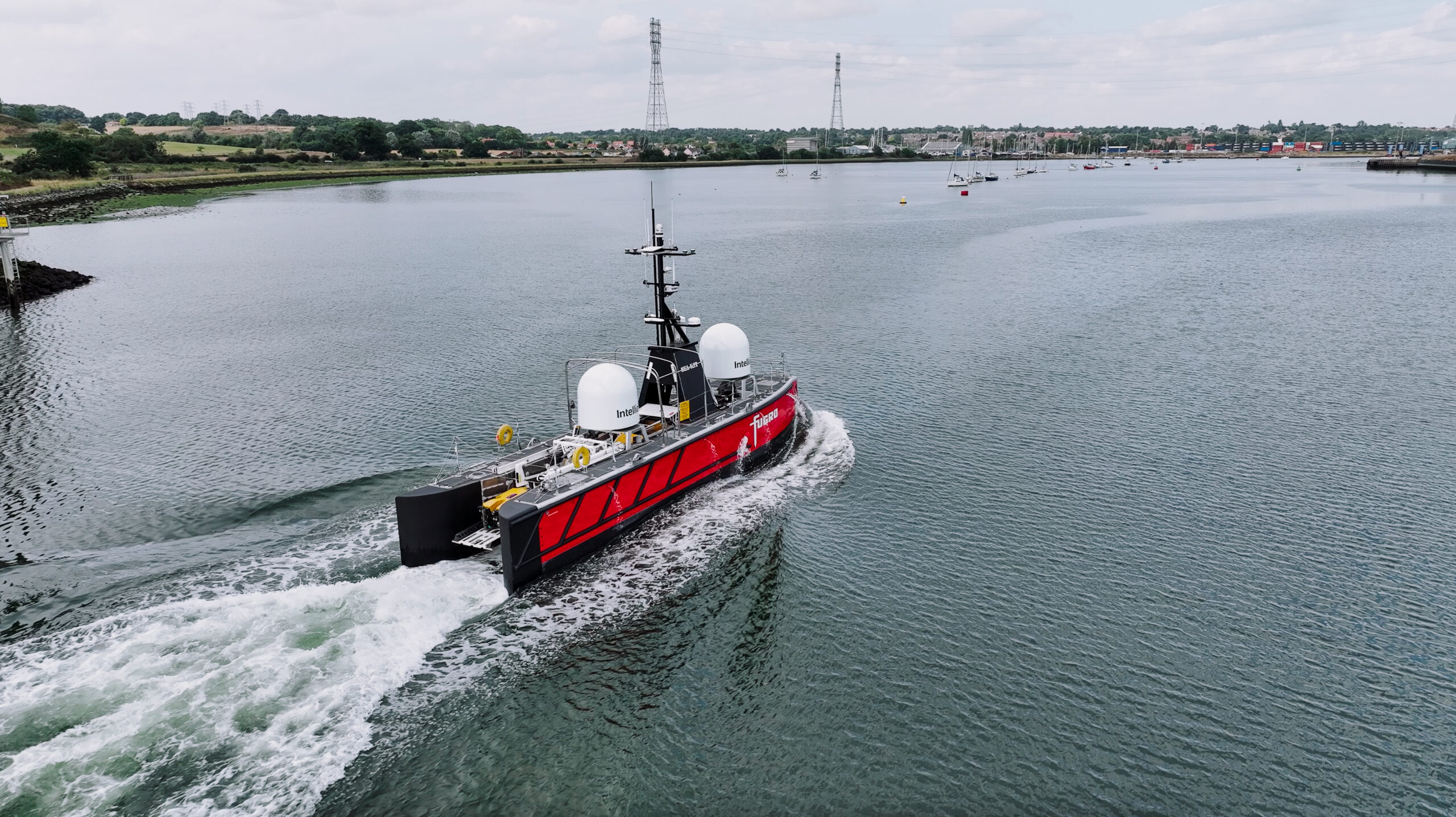
Fugro has been awarded a contract by the Norwegian Hydrographic Service (NHS) to support the 2025 MAREANO seabed mapping programme. For the first time in its history, MAREANO will use uncrewed surface vessel (USV) technology to acquire the data, with Fugro deploying its new 18 m Blue Eclipse® USV for the initiative. This innovative approach aims to advance the move towards lower carbon emissions in seabed mapping while ensuring high-quality data acquisition for the responsible management and preservation of Norway’s marine resources.
The Blue Eclipse®, the largest USV in Fugro’s fleet, will survey over 675 km² region in the North Sea, with water depths ranging from 90 to 250 metres. Equipped with advanced high-resolution, high-density multibeam echo sounders and sub-bottom data acquisition systems, the USV will gather comprehensive datasets, including bathymetry, water column data, acoustic backscatter data, and sub-bottom profiler data to understand the seabed’s topography and geology.
A key advantage of using the Blue Eclipse® is its significantly reduced fuel consumption – up to 90 % less than traditional survey vessels – directly contributing to more sustainable operations. Controlled remotely from Fugro’s remote operations centre in Aberdeen, the USV’s long endurance and real-time data transfer capabilities will ensure efficient operations and reduce potential delays in the challenging North Sea environment, factors crucial for the success of the MAREANO programme.
Helge Welde, Chief Engineer at the Norwegian Mapping Authority, Hydrographic Service said: “The MAREANO programme wants to accelerate the shift towards lower carbon emissions in seabed mapping. Use of USVs is one way to achieve this goal. Experiences from this year's seabed mapping with USV technology will give us direction for opportunities in future surveys.”
Nick Simmons, Fugro’s USV Services Director said: “This award marks a significant milestone for Fugro and the commercial debut of our advanced Blue Eclipse® USV. The NHS’s decision, following a thorough evaluation process, highlights our technical capabilities, operational strategy, and commitment to knowledge sharing. We are confident that the Blue Eclipse® and our expert team will deliver high-quality results for this important environmental mapping programme."
Fugro has a well-established history of supporting the MAREANO programme since 2006, having acquired over 147,000 km² of data to date. This latest contract further demonstrates Fugro’s ongoing leadership in the development and application of uncrewed vessel technology for marine surveys, contributing to more sustainable and efficient data acquisition practices.
About Fugro
Fugro is the world’s leading Geo-data specialist. With our unique map, model and monitor solutions, we provide project critical insights into the built and natural environment. Fugro supports clients by delivering solutions in support of the energy transition, large-scale infrastructure development and climate resilience. With expertise in site characterisation and asset integrity, clients are supported in the safe, sustainable and efficient design, construction and operation of their assets throughout the life cycle. In line with our purpose, we are extending our know-how and solutions to the understanding and preservation of ecosystems.
Employing approximately 11,000 people in 52 countries, Fugro serves clients around the globe, mostly in the energy, infrastructure and water industries, both offshore and onshore. In 2024, revenue amounted to EUR 2.3 billion. Fugro is listed on Euronext Amsterdam.
Natural hazards responsible for 25% of subsea cable damage, study finds
A study led by the UK’s National Oceanography Centre (NOC) has found that natural hazards account for around a quarter of all recorded instances of subsea cable damage between 1965 and 2019, posing a threat to the growing infrastructure underpinning global connectivity.
While human activities like fishing and anchoring remain the primary causes of damage, the study warns that climate change is intensifying many natural hazards, increasing risks to these vital networks.
The threats from natural hazards range from earthquakes and submarine landslides to powerful underwater currents triggered by river floods.
“These events can damage cables, bury them under sediment, or render them inoperable,” said Dr Isobel Yeo, a researcher at NOC and co-lead on the project. “With climate change driving more extreme weather, rising sea levels and sediment-laden river discharges, the frequency and severity of these hazards are expected to grow, amplifying the challenges of maintaining resilient subsea infrastructure.”
The vulnerabilities were starkly illustrated by the 2022 Hunga Volcano eruption in Tonga. Underwater density currents generated by the eruption destroyed Tonga’s sole international cable, isolating the nation for weeks and severely hindering emergency response efforts.
Similarly, powerful turbidity currents in the Congo Canyon, driven by record-breaking floods, have repeatedly damaged cables, disrupting internet services across West Africa.
To mitigate these risks, the researchers advocate for improved cable routing, enhanced repair readiness and investment in complementary technologies such as satellite backups. Initiatives like Seabed 2030, which aims to map the entire ocean floor by 2030, are also critical for identifying potential hazards and guiding safer infrastructure development.
The study’s lead author Dr Lucy Bricheno adds, “At NOC, we dedicate our expertise to understanding and mitigating the risks natural hazards pose to subsea cables. We map geological events like earthquakes and landslides, analyse cable fault data to understand the causes and damage mechanisms and recognize the significant role of climate change in exacerbating these hazards.”
With the increasing interconnectedness of the modern world, safeguarding subsea cables against mounting natural and climate-driven challenges is essential to maintaining global connectivity and economic stability.
The study was conducted in partnership with the National Grid (UK), Victoria University of Wellington (Aotearoa, New Zealand), the Departments of Earth Science and Geography at Durham University (UK), Ocean-IQ (UK), Tonga Cable Limited (Tonga), and the International Cable Protection Committee (ICPC).
Read the full paper, “The diversity, frequency and severity of natural hazard impacts on subsea telecommunications networks”, in Earth-Science Reviews.