
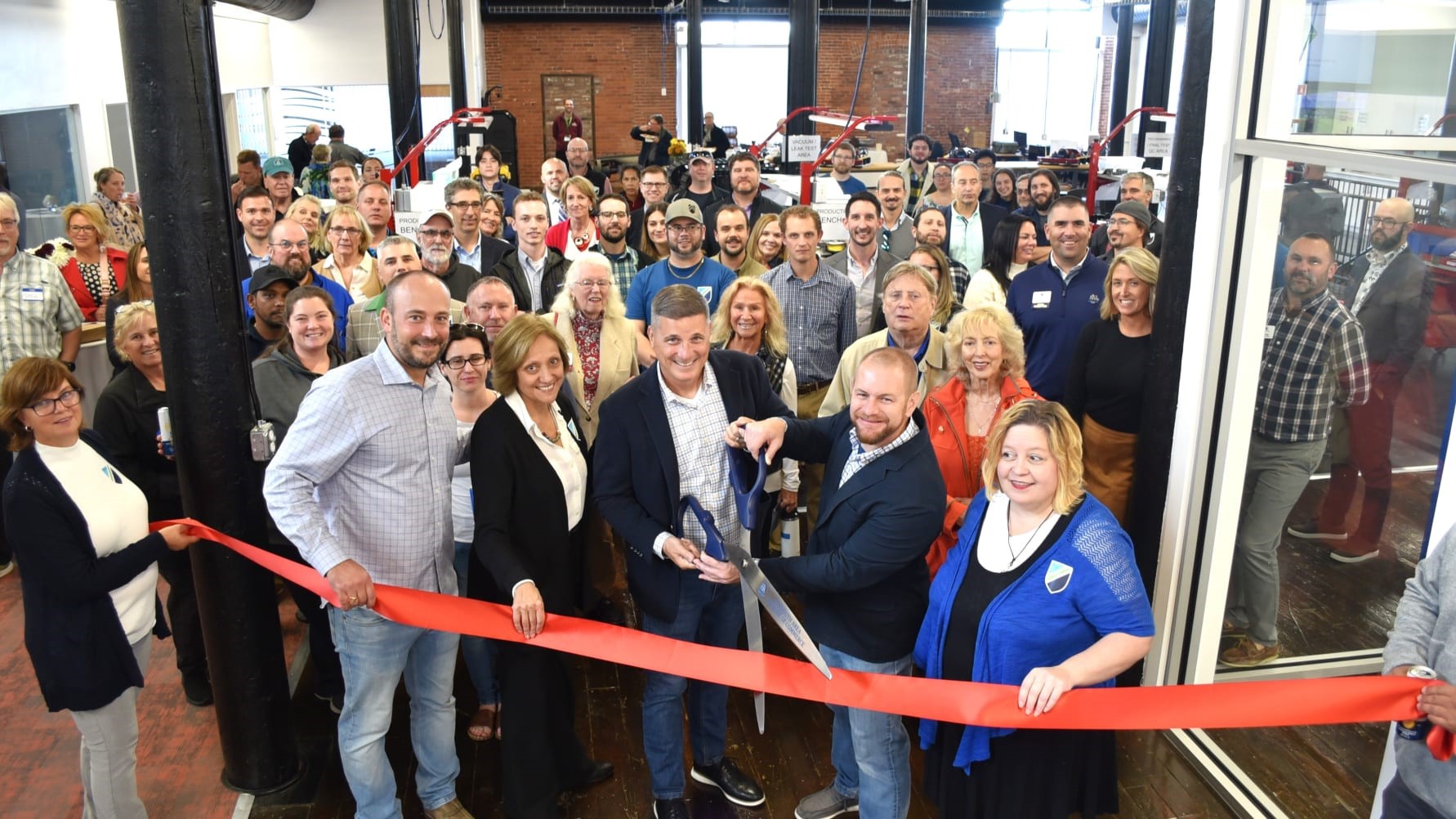
Greensea IQ celebrates expansion of its production facility in Plymouth, MA
Greensea IQ celebrated the 25,000 square foot expansion of its Cordage Park production facility on October 17th. This new expansion establishes a manufacturing center for the production of several navigation and robotics systems including the Bayonet line of surf zone crawlers, EverClean hull cleaning robots, RNAV3 diver navigation systems, and OPENSEA Edge autonomy hardware.
Greensea IQ Chief Growth Officer Rob Howard, states “We were excited to open our newly expanded facility to the public for the first time and welcomed local blue tech businesses, community leaders and others from the marine industry.”
He continues, “This expansion is the next step in Greensea IQ’s transition from doing custom development work to delivering fully integrated intelligent products for working in the ocean. The new facility will support the planned growth and worldwide expansion of our robotics-as-a-service program, EverClean, while it gains adoption as fleet owners work to meet increasingly demanding carbon emissions requirements and increased hull performance throughout the cruise and shipping industries. Plymouth will also allow us to quickly scale to meet demand for the new Bayonet line of AUGVs as we start delivering the platform to defense and commercial customers for use in near shore MCM, EOD, UXO and surf zone survey applications.”
Greensea IQ’s expansion celebration took place immediately following an on water demonstration as part of the Blue Future Conference held in Plymouth, Massachusetts held at the Cordage Park Marina, Greenea IQ’s on water testing area. In addition to the Bayonet 250 other participants at the demo included Jaia Robotics, SeaTrac, and students from Massachusetts Institute of Technology.

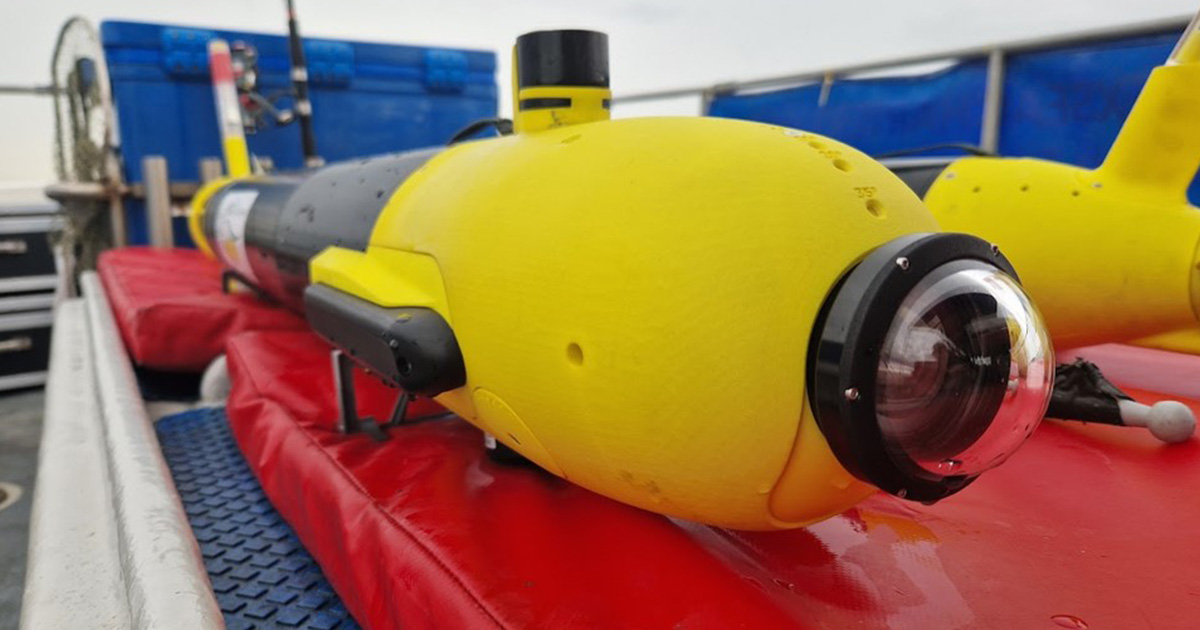
First deliveries of ecoSUBm5-Power+ AUV with ecoCAM
ecoCAM is a brand new 4k video and still image camera developed by the ecoSUB team, fully integrated into the ecoSUBm5-Power+ AUV system. The camera system has been designed to provide extremely high-quality video and still images, whilst being an ideal solution for machine learning applications. A 1.1” Sony IMX267 global shutter CMOS sensor, coupled with a Computar fixed 8mm lens provides high resolution, high frame rates and noise free image reproduction (8.85 MPix (4096 x 2160 px) at 33.0 fps). The camera is an underwater first, running with Subsea USBC data transfer, to provide excellent data speed for video encoding on a Jetson Orin Nano computer.
Both new users from the US and Germany intend to use the ecoCAM for machine vision applications, benefitting from the power of the Nvidia Jetson backseat computer, enabling edge computing. In one case the camera feed is being used with a navigation algorithm to pilot the vehicle into a docking station.
The ecoCAM module is a compact unit, rated to 2,500m, suitable for ecoSUBm-series AUV platforms, and is mounted in a custom nose cone that allows the camera to be orientated from forward looking to downward looking for seabed imaging. Subsea lighting packages can be provided for low/zero light applications. Onboard our ecoSUBm5-Power+ AUV platform, the ecoCAM can be coupled with side scan sonar, DVL and acoustic modem for underwater coms and USBL, if required.
Use case: SPARUS II AUV for critical underwater infrastructure inspection
99% of the communications occurring in the world today happen through underwater fiber optic networks. There are more than 420 submarine lines in the world, totalling 1.3 million kilometers which allow us to communicate and operate in the way we do as a society. These infrastructures are equally important today as oil and gas pipelines, since the volume of financial transactions, very relevant to the system, run through these underwater cables.
Underwater environments are hazardous and especially difficult to monitor for two main reasons: firstly, the locations themselves may be areas of difficult access either for their depth, the existing currents, or even the movements of the seafloor and, secondly, the technologies that are commonly available in the surface, like GPS or WiFi will not work. So, there is a clear vulnerability for the security of these infrastructures.
On average, there are over a hundred breaks of submarine cables every year, caused in general by the fishing boats that pull the anchors. But, being identified as critical infrastructure, they are also a target for potential sabotage. The first attacks registered date back in 2017. Although they remain unknown to the general public, they are no less worrying and prove the capacity of external powers to separate Europe from the rest of the world.
Keeping this context in mind and in the framework of “Robotic Experimentation and Prototyping using Maritime Uncrewed Systems” (REPMUS) exercise, multiple technologies for automatic underwater cable detection and inspection were tested in a simulated complex scenario. Led by NATO, the event takes place annually in the Lisbon coastal area hosted by the Portuguese Navy.
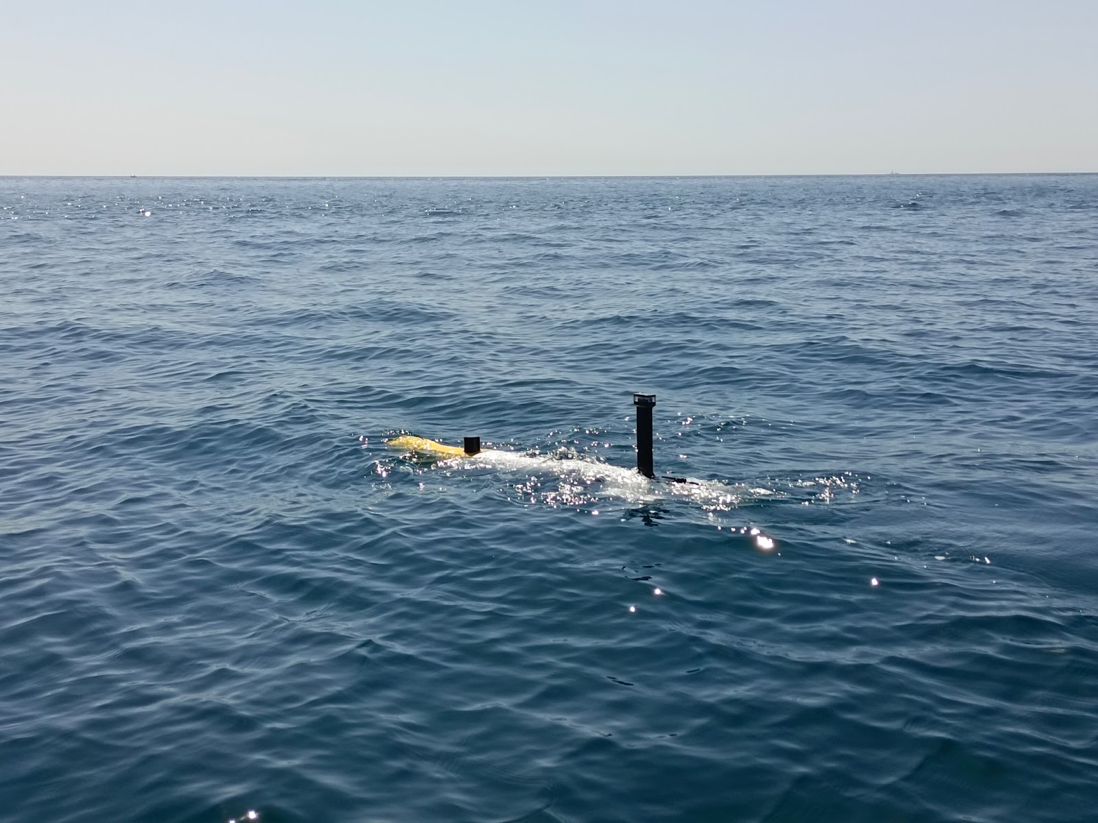
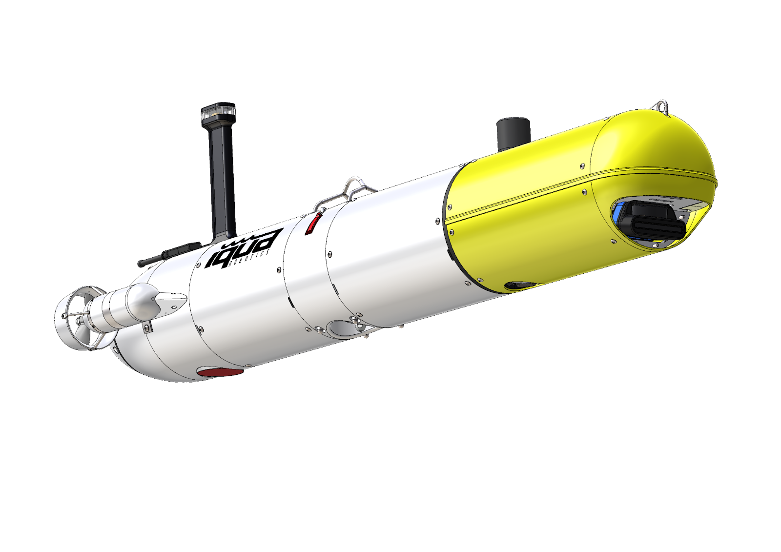
IQUA robotics participated in REPMUS 2023 exercise, invited by the Spanish Navy to prove the capabilities of its vehicle SPARUS II AUV for the described mission. The goal of the mission was to, in a completely autonomous way, locate the cable and inspect it from nearby to be able to identify potential threats to it.
One of the characteristics of the SPARUS II AUV is its possibilities to be configured according to the mission needs, in this case, the vehicle was equipped with an optic camera system developed by IQUA and a commercial forward looking sonar.
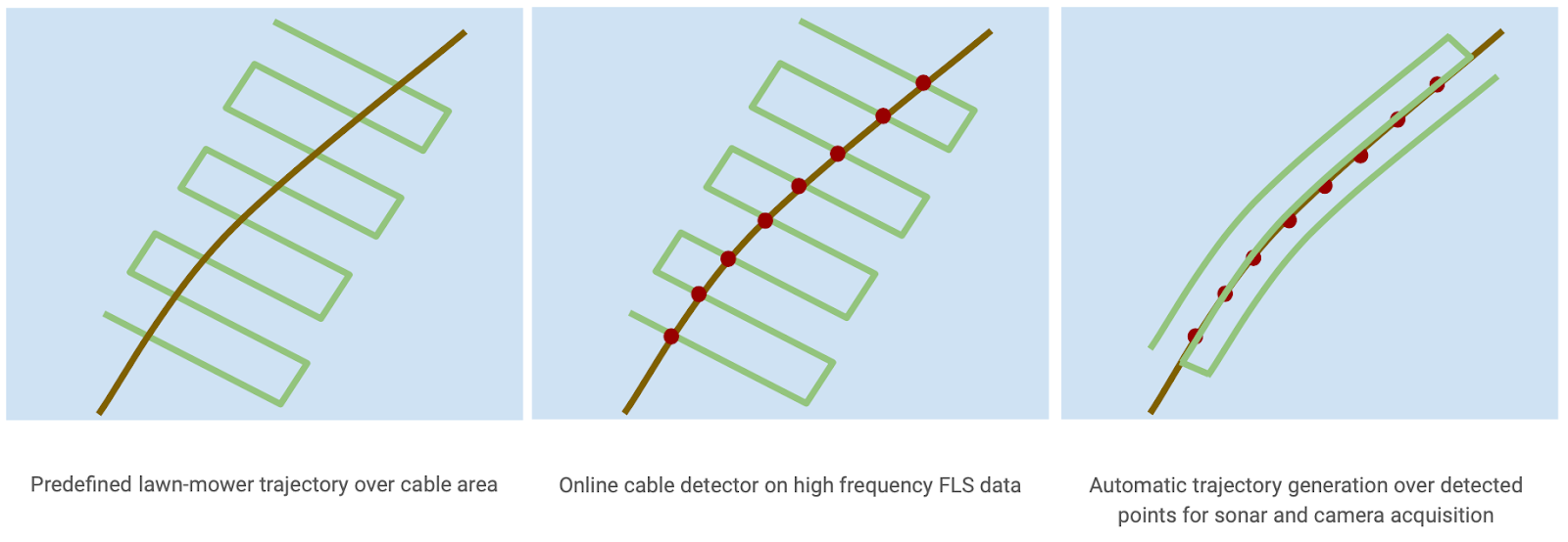
The IQUA Robotics strategy for addressing the assigned task consisted of the following steps:
- Deploying the AUV in proximity to the supposed cable location.
- Executing a predefined autonomous mission within the area, while employing an automated algorithm to continuously analyze incoming forward-looking sonar data to detect the cable presence.
- Without human intervention and without requiring resurfacing, the AUV automatically plans a trajectory connecting all potential cable locations observed in the sonar images.
- The AUV then follows the planned trajectory close to the seafloor, enabling the camera system to capture images of the cable along its route.
- Returning to the surface with the collected data.
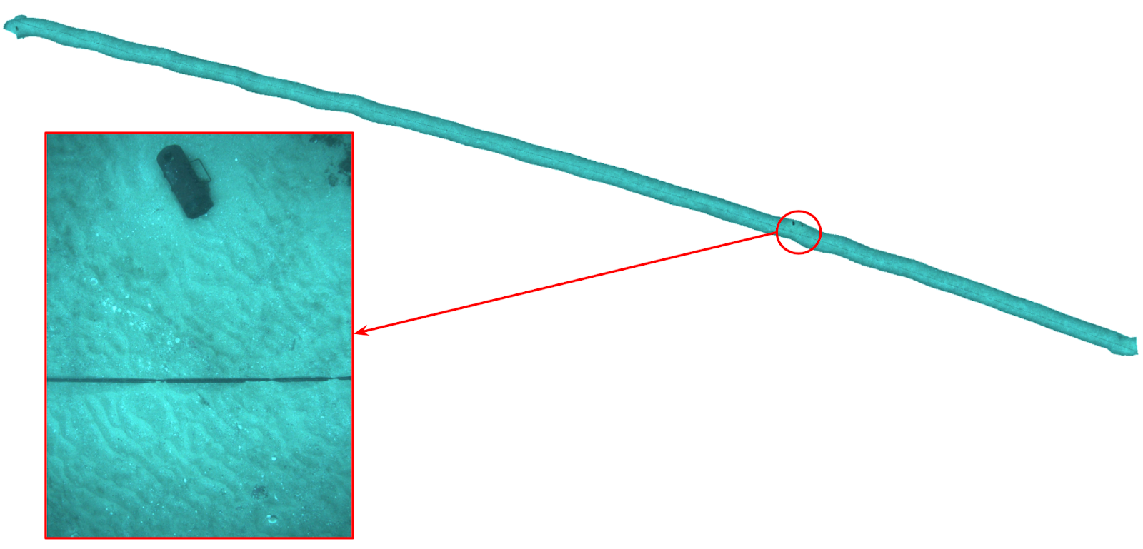
Throughout the mission, real-time monitoring was conducted from the surface through the IQUAview user interface, which visualized data transmitted by the AUV via an acoustic modem. The collected data allowed the creation of acoustic maps and visual reconstructions along the cable.

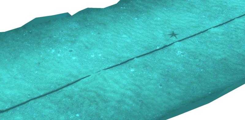
The image below shows a mosaic of approximately 150m long x 2.5m wide where one suspicious element is clearly identified (60x20cm) and can be seen with high resolution for its interpretation. The capability of finding such objects closeby the cables without human intervention can be key to the future of the security of critical underwater infrastructures.
MacArtney's all-electric eLARS supports Jan De Nul's green profile
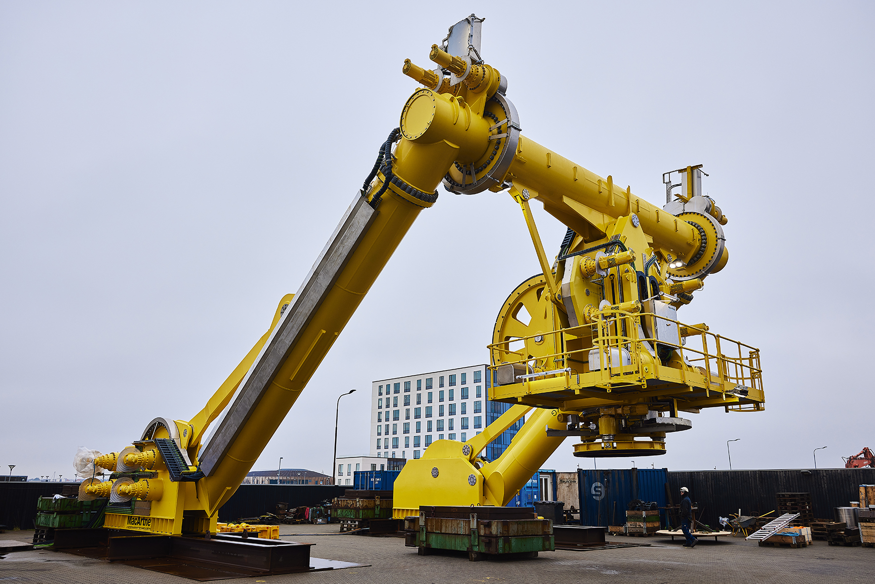
MacArtney successfully delivered the world's first and largest all-electric Launch and Recovery System (eLARS™), aligning with Jan De Nul's dedication to a sustainable energy transition. Jan De Nul was intrigued by MacArtney's eLARS™ for their Offshore Support Vessel Symphony and the new cable trencher Swordfish.
Investing in its modern offshore installation fleet, Jan De Nul found MacArtney's break from conventional hydraulic systems consistent with the wish to implement innovative technology providing operational reliability and supporting the commitment to a needed energy transition.
Operational reliability through clever design
Built on MacArtney's tried and tested technology, the all-electric eLARS™ provides benefits that ensure reduced downtime, increased operational efficiency and reliability.
"It is indeed a remarkable system," the Jan De Nul team states. "It is precise, easy to operate and monitor, and implements well with the entire set-up and our effort to support the green transition. The cooperation with MacArtney has been constructive with good sparring on the technical details."
Compared to traditional hydraulic systems, the eLARS™ significantly lowers maintenance costs via reduced spare parts requirements and no need for regular hose changes and filter replacements. Furthermore, the absence of pressurised oil over water enhances safety and environmental sustainability.
Its compact design optimises deck space utilisation, allowing for efficient installation and operation.
A notable feature is the intelligent self-assessment capability for preventive maintenance. It identifies and notifies users of potential failures, enabling proactive measures to be taken before any critical issues arise. The eLARS™ also boasts a high level of redundancy, ensuring continuous functionality even if one or more electrical systems are damaged.
The next-level integrated control system can be operated remotely from shore, enhancing convenience and streamlining operations.
Scope of supply
The supplied eLARS™ system includes an eA-Frame, Docking Head, and Winch. The leg height of the eA-Frame is 14 metres, with an 11-metre distance between them. The 500 kN A-frame has a safe working load of 50 tonnes and advanced PLC technology, allowing full remote system control.
Collaboration leading to a world premiere
Joining expertise and an environmentally friendly approach, the collaboration between Jan De Nul and MacArtney led to the development of an optimal solution, based on the smaller eLARS™ prototype, for their large-scale launch and recovery needs to operate their innovative new-built trencher - the Swordfish.
Koos van der Zee, MacArtney's Head of Project Management, is enthusiastic about the teamwork:
"We have put the world's first and largest eLARS™ system to sea. Client engagement played a crucial role in shaping the final layout. Together, we optimised and introduced new technology supporting the needs of Jan De Nul now - and in the future."
Energy shift in maritime industries
"There is a genuine wish to support the energy shift in the maritime industries," Sales Director Marine & Offshore, René Rasmussen, concludes, "and the eLARS™ solution has generated significant interest with several upcoming projects in the pipeline."
The early prototype and visionary approach of moving away from tradition to embrace innovation validate MacArtney's 45 years of expertise in underwater technology and market relations.
KONGSBERG to provide science equipment for Germany’s new ocean research vessel
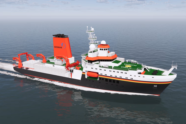
KONGSBERG will provide scientific sensors and scientific handling equipment for Germany’s new ocean research vessel, the 135-metre Meteor IV. The new 10,000GT vessel will be able to house 35 scientists plus 36 crew.
Meteor IVwill be built by MeyerFassmer Spezialschiffbau (MFSB) for the German Federal Ministry of Education and Research. The vessel, due for delivery in 2026, replaces existing research vessels Meteor and Poseidon.
“We need to build a better understanding of our changing climate and the effect it has on the marine environment to protect our oceans and future generations, Ocean research is now recognised as critical to our understanding of climate change, as well as a host of conservation issues,” said Executive Vice President Stene Førsund, Sales and Marketing, Kongsberg Discovery. “A top priority of marine scientists is to map the entire seafloor by 2030, an enormous task that will require instruments and equipment with extremely precise calibration.”
Kongsberg Discovery will supply Meteor IV with the EM 124 and EM 712 multibeam echo sounders, used for seabed mapping at various depths. Kongsberg Discovery will also provide the Seapath 380 with Motion Gyro Compass (MGC) R3, whose sensors use GNSS signals and inertial measurements. These combine with the EM series of echo sounders to create an exact picture of the seabed.
To monitor ecosystems and marine life, Meteor IV will use Kongsberg Discovery’s EK80, a high-precision scientific echo sounder with acoustic doppler current profiler capability, which may be used to measure the velocity of fish in a water column. The EK80 measures speed and direction of currents in a water column, which helps researchers understand how organisms, nutrients, and other biological and chemical constituents are transported through the ocean.
Kongsberg Maritime will supply a complete integrated scientific handling system for Meteor IV, enabling safe and efficient operations with cables and ropes up to 12,000 metres in length.
The scientific winch system comprises two direct pull winches, two conventional twin drum traction winch systems and a third traction winch system, which includes Kongsberg Maritime’s field-proven cable traction control unit (CTCU) for superior performance with synthetic fibre rope.
The delivery also includes overboard handling units; a stern A-frame, two handling beams, and a corer handling system, as well as cranes.
The control system, fully developed and maintained in-house by Kongsberg Maritime, features the proprietary predictive active heave compensation (AHC) algorithm providing accurate winch system response matched to vessel motion, by aid of Kongsberg Discovery’s motion reference unit (MRU).
Meteor IVis designed for worldwide multifunctional and interdisciplinary research, with a focus on the Atlantic Ocean. The new vessel will make important contributions to national and international marine science, particularly in the areas of climate and environmental research.
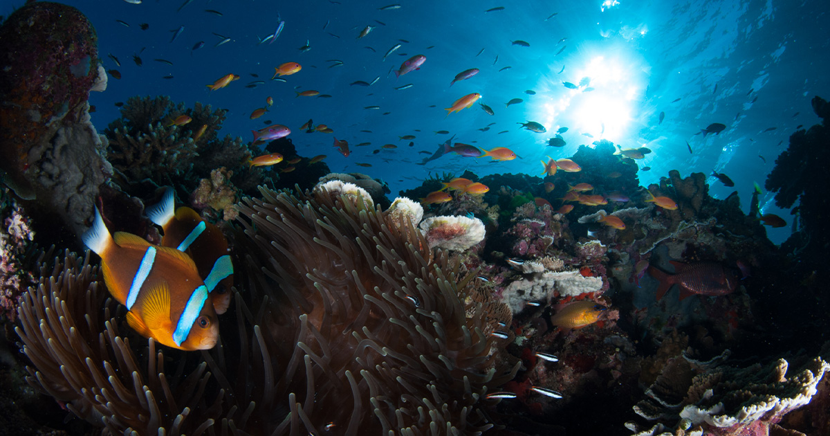
Cyber-Taxonomy: Set to transform our knowledge of life on Earth with Ocean Census
Groundbreaking initiative, coordinated by The Nippon Foundation and Nekton, harnesses major technology advances to accelerate the discovery and documentation of ocean life, tackling the significant knowledge gap in marine biodiversity.
A landmark new approach to the discovery of life - cyber-taxonomy - has been revealed in Frontiers of Marine Science. Co-designed by dozens of international experts, the new approach creates digital twins of each species and provides the revolutionary potential that is underpinning Ocean Census, a large-scale strategic science mission, designed to significantly accelerate the discovery and documentation of marine species.
The initiative tackles the pressing knowledge gap surrounding the diversity and distribution of marine life by deploying an innovative cyber-taxonomy approach, merging traditional taxonomy methods with cutting-edge technologies such as DNA sequencing, high-resolution digital imaging and machine learning.
The ocean, the largest ecosystem on Earth, harbours an unrivalled area of wilderness, making the preservation of its biodiversity crucial for ecological equilibrium and human well-being. Understanding the myriad forms of marine life is imperative for realising its societal benefits and mitigating human impacts to sustain healthy marine ecosystems.
“Life has evolved in our ocean for three times as long as life on land and holds the clues to four billion years of our evolutionary heritage. Cyber-taxonomy will enable Ocean Census to discover, sequence and decode the DNA of ocean life, increasing the speed and scale of the discovery exponentially.”
Yohei Sasakawa, Chair of The Nippon Foundation.
Although it’s estimated that between 1-2 million species inhabit our ocean, around 75% to 90% remain undescribed. The longstanding void in the knowledge and observation of marine species is concerning, with potential unrecorded extinctions and declines aggravating the prevailing biodiversity crisis. It is very difficult to protect what is not yet known. It currently takes one to two years to several decades to describe a species from its initial collection, necessitating an expedited approach to marine discovery.
Launched this April by The Nippon Foundation of Japan and UK-based marine research charity Nekton, Ocean Census harnesses the latest DNA sequencing digital imaging technologies and machine learning with conventional taxonomy, optimising the species identification and description process. Through these approaches, a digital twin, or ‘Digital Life Form’ of each specimen is created.
Taxonomists then draw on the data to determine if the species are new to science. Ocean Census aims to utilise cyber-taxonomy with an ambitious target of 100,000 new species discovered within the decade.
Through the digitization of specimen collection data and the creation of a cyber-biodiversity system for data distribution, the initiative grants far greater and more equitable access to biodiversity knowledge, propelling species discovery to unprecedented levels and galvanising conservation efforts.
"Ocean Census is not merely about discovering the unknown but reshaping the way we understand marine biodiversity. The integration of advanced technologies with traditional taxonomic studies is pivotal. It rejuvenates our pursuit of knowledge in marine biology, addressing the urgent need for detailed information on diverse marine species to counter the prevailing biodiversity crisis."
Prof. Dr. Alex Rogers, Science Director at Ocean Census and leading co-author of the paper.
Cyber-taxonomy emerges as a distinctive, transformative methodology, intertwining technology and taxonomy to drive humankind closer to Ocean Census’ ambitious scientific, exploration and conservation goals. This approach empowers scientists to address critical questions in marine biology and conservation more effectively, fostering an enriched understanding of global patterns and processes in marine ecosystems.
"The cyber-taxonomy approach is at the heart of Ocean Census. It is not only innovative but essential in revolutionising our approach to discovering and studying marine life. Through this, we can disseminate knowledge at an unprecedented scale, allowing more discoveries to be made rapidly.”
Dr. Tim O’Hara, co-author and Senior Curator at Museums Victoria, Australia.
Ocean Census is constructing a global network of scientists and Biodiversity Centres, fostering collaboration to enhance ocean life discovery efforts worldwide, including in low- and middle-income countries. By ensuring equitable involvement and knowledge sharing, discoveries made under this initiative are universally accessible, enriching global biodiversity comprehension.
"This mission is a testament to the power of global collaboration. By bringing together minds and resources from around the world, we are ensuring that the discoveries made are not just advancements in science but contributions to global knowledge, accessible to all."
Dr. Punyasloke Bhadury, co-author and professor at the Indian Institute of Science Education and Research Kolkata.
The groundbreaking paper, published on 27 September, does not merely shed light on the immense possibilities of discovering unknown marine species but also emphasises the critical necessity of such discoveries in the face of the escalating global biodiversity crisis. The preservation of knowledge, including genomic data of species on the brink of extinction, is integral to sustaining and revitalising the rich tapestry of marine life.
“This paper accentuates the pivotal role of technology-infused taxonomy in expediting the unravelling of oceanic mysteries, ultimately contributing to the conservation and sustainable management of our oceans' invaluable biodiversity. The taxonomic achievements with an inclusive initiative with the countries without natural history museums will raise the basis of natural science globally.”
Dr. Hiromi K Watanabe, co-author and malacologist at the Institute for Extra-Cutting-Edge Science and Technology Avant-Garde Research (X-Star), Japan Agency for Marine-Earth Science and Technology (JAMSTEC).
OSIL Buoy for Dublin City University PREDICT multidisciplinary project
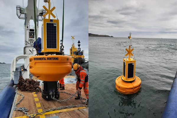
A multidisciplinary data buoy platform manufactured by Ocean Scientific International Ltd (OSIL) has been installed in Dublin Bay as part of the PREDICT multidisciplinary project. This project will provide a coordinated program of coastal ocean observations that will be used to validate, calibrate and extract as much information as possible from satellite earth observation data as an experimental proof of concept with the aim of generating AI models that can be used to predict environmental change in a range of environments.
The 1.9m OSIL Fulmar buoy is recording and transmitting a variety of environmental parameters including salinity, temperature, pH, partial pressure of CO2, turbidity, dissolved oxygen and chlorophyll, in addition to a full suite of meteorological measurements.
Data from the buoy is relayed via GSM, with an Iridium satellite Short Burst Data back-up. The data is immediately available to the public via a web portal, and data from all sources will soon be publicly available on the easy to use PREDICT Data Portal. The environmental data is catalogued, mapped & displayed in an interactive web environment, facilitating collaboration and partnership planning.
The intention is to predict and assess coastal vulnerability by systematic and sustained monitoring of physical, chemical and biological processes occurring in coastal zones, by integrating mathematical modelling, remote and in-situ sensing, physical and chemical oceanography and seabed mapping from various sources including the Dublin Bay buoy. These models will then contribute to future planning in a diversity of areas such as coastal mapping, flooding prediction, marine habitats and fisheries, climate change, environmental protection and policy.
The scheme has been funded by Science Foundation of Ireland (SFI), the Geological Survey of Ireland and the Marine Institute (MI). The project is coordinated in Dublin City University (DCU) with Principal Investigators in Maynooth University (MU), University College Cork (UCC) and the GSI.
SBG Systems unveils Qinertia 4 packed with much awaited new features
SBG Systems, a leading provider of advanced inertial navigation systems and software solutions, is pleased to announce the release of Qinertia 4 on November 7th. This version introduces several innovative features that provide users with a complete solution for precise trajectory and motion analysis.
Qinertia, the de facto choice of surveyors, is a superior post-processing software delivering better precision and reliability compared to RTK systems. It is continually updated to incorporate user feedback and add new features. Its latest version, Qinertia 4, features a multitude of new capabilities and enhancements.
Qinertia 4 is packed with an array of innovative functionalities that push the boundaries of navigation capabilities. Its enhanced Geodesy engine boasts an extensive selection of preconfigured Coordinate Reference Systems (CRS) and transformations, making it a versatile solution in applications that use diverse geodetic data. Whether you are in land surveying, hydrography, airborne surveys, construction, or any other field requiring precise positioning, the engine ensures seamless and accurate processing in the right datum and coordinate system.
To tackle the challenges of variable ionospheric activity, Qinertia 4 introduces Ionoshield PPK mode. This cutting-edge feature compensates for ionospheric conditions and baseline distances, allowing users to perform Post-Processing Kinematics (PPK) even for long baselines and/or harsh ionospheric conditions. This ensures surveyors achieve centimeter accuracy even in regions with unpredictable ionospheric disturbances.
Another exciting addition to Qinertia 4 is the extended CORS network support. This feature gives users access* to a vast network of 5000 SmartNet Continuously Operating Reference Stations (CORS) for reliable GNSS data processing. These base stations add to the already impressive network of base stations directly available in Qinertia, bringing the total to over 10,000 bases in 164 countries. This global coverage ensures that Qinertia remains a reliable and efficient solution, regardless of geographic location. In addition, users can import their own base station data and verify its position integrity with Precise Point Positioning (PPP).
For data that cannot be processed using PPK (for example, in regions without a nearby base station), Qinertia 4 offers an alternative solution with its new tightly coupled PPP algorithm. This new processing mode, available for all customers with active Qinertia maintenance, provides post-processing anywhere in the world without a base station, with a horizontal accuracy of 4cm and a vertical accuracy of 8cm.
“We are very proud about the launch of Qinertia 4,” said Léa Lian, Software Product Manager at SBG Systems. “It is an exciting milestone for us! With its cutting-edge functionalities and user-centric approach, Qinertia 4 simplifies the post-processing of global navigation and positioning data for professionals. We are confident that it will provide our users with the tools they need to excel in their specialized fields and set new standards of excellence.”
Qinertia’s new functionalities will be demonstrated live at the next Intergeo exhibition in Berlin.
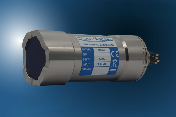
Introducing ECHOGRAM: Bringing underwater imaging to the ISA500 Altimeter & Echosounder
Impact Subsea, a leading provider of underwater sensors, has announced the addition of a new feature to their ISA500 range of Altimeter & Echosounders – ECHOGRAM.
This new feature adds a full backscatter capability to the ISA500, enabling the underwater Altimeter to be upgraded to have a full single beam imaging sonar capability.
Underwater Altimeters typically provide only a single range reading per ping. However, with the addition of ECHOGRAM, the water column and seabed can be fully visualized, allowing for visual identification of targets. This provides up to 2,000 samples per ping, with each sample representing the correlation level of acoustic signal return at its particular point in the range.
The ISA500 is available in Titanium or Acetal and can be used at depths ranging from 1,000m to 11,000m. It is also optionally available with or without an integrated AHRS providing Heading, Pitch, and Roll. Additionally, it is available for use as part of a Flooded Member Detection System.
Ben Grant, Managing Director of Impact Subsea Ltd, said;
“Since the launch of the ISA500 in 2015, we have continued to add capabilities and features to this range of sensors. The addition of backscatter capability is one which we are very excited about. As a firmware update, all ISA500 sensors can have this feature enabled - even the very first sensors produced back in 2015.”
The ECHOGRAM capability can be added to all ISA500 Altimeters through a firmware and software upgrade, complete with a one-time activation license.
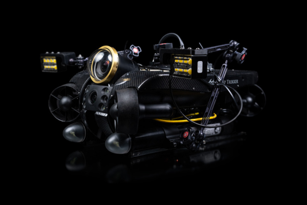
Discovery Camera and REVOLUTION ROV: Canadian integration triumph
Two Canadian underwater technology powerhouses, Voyis and Deep Trekker, have joined forces to achieve an exceptional integration: the successful fusion of Voyis' cutting-edge Discovery camera with Deep Trekker's REVOLUTION ROV (Remote Operating Vehicle). This landmark collaboration showcases the prowess of Canadian innovation and ingenuity, propelling the field of underwater surveys and inspections into an unprecedented era of advancement.
Deep Trekker's REVOLUTION ROV stands as a testament to Canadian engineering excellence. This robust underwater vehicle, designed to conquer the most unforgiving aquatic conditions, boasts unparalleled stability and maneuverability. With a unique rotating head facilitating optimal positioning of attachments such as imaging sonar and grabbers, the REVOLUTION ROV is poised to excel across a spectrum of tasks. Capable of descending to depths of up to 305 meters, the ROV employs six powerful thrusters for precise control in both vertical and lateral movements, even in challenging currents. This adaptable thruster configuration not only ensures stability but also fine-tuned adjustments during inspections and surveys. Its rugged construction, featuring a carbon fiber shell, anodized aluminum, stainless steel body, and sapphire lens cover, underscores its durability and reliability.
Voyis' Discovery Cameras, enhanced by the Nova Mini Lights, bring a new dimension to underwater exploration. These cutting-edge cameras capture 4K video with minimal latency while simultaneously generating high-resolution still images and IMU data. The resulting assets can be processed through edge computing to produce intricate 3D models. These capabilities find applications in intelligent ROV piloting and comprehensive inspections. The cameras produce clear stills suitable for advanced machine vision and 3D modeling, complemented by real-time image enhancement, an ultra-wide field of view (130°x130°), and distortion correction for comprehensive situational awareness. Designed with compactness in mind and incorporating integrated lights, along with DDS data architecture and ROS2 support, the cameras streamline vehicle integration, particularly for autonomy-driven applications.
A New Era in Underwater Exploration
The collaboration between Voyis and Deep Trekker was tested and proven successful during trials in Tobermory, Ontario. Both teams worked together to achieve this success and test the ROV capabilities for piloting and inspection, with the Discovery Camera.
By seamlessly integrating the Discovery Camera with the REVOLUTION ROV, professionals gain access to a suite of unparalleled tools for underwater surveys, inspections, and explorations. The amalgamation of the REVOLUTION ROV's ruggedness and maneuverability with the Discovery Camera's imaging precision and increased situational awareness opens new horizons for industries spanning marine research, aquaculture, defense and security, infrastructure inspection, and offshore energy asset inspection.
"We are excited to achieve this successful integration with Deep Trekker's REVOLUTION ROV, representing a significant stride in Canadian technology collaboration," said Chris Gilson, CEO at Voyis. "Together, we are pushing the limits of imaging technology and creating solutions that empower professionals to navigate and explore the underwater world with unmatched clarity."
Sam Macdonald, Managing Director at Deep Trekker, echoed this sentiment: "The seamless integration of Voyis' Discovery camera with our REVOLUTION ROV signifies a new chapter in underwater exploration. This harmonious blend of leading-edge technologies will reshape how professionals navigate and inspect underwater environments."
The combined efforts of Voyis and Deep Trekker herald a new era in underwater exploration and inspection, reflecting the excellence of Canadian innovation. With the successful integration of the Discovery Camera and REVOLUTION ROV, professionals can anticipate elevated capabilities, heightened precision, and transformative insights that will redefine industries dependent on precise underwater data.