Sonardyne appoint Aquatic Sensors as resellers in expanding US market
Sonardyne Inc are delighted to announce the appointment of Aquatic Sensors as resellers as part of their growth in the US marine technology market.
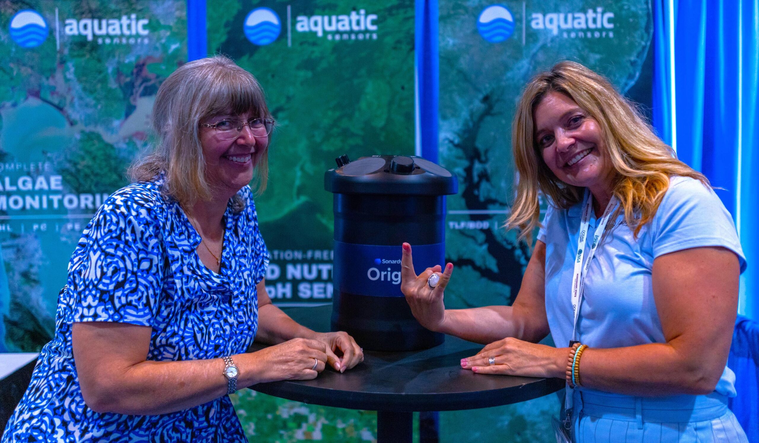
Making the announcement whilst exhibiting at OCEANS 2023 in Mississippi, Sonardyne welcomed Aquatic Sensors as their latest US resellers.
Having worked with Sonardyne sister company Chelsea Technologies for over 20 years, Aquatic Sensors bring a wealth of industry knowledge and experience of the environmental water monitoring community across the USA and Canada. Their initial focus will be on the Origin 600 and providing the latest intelligent ADCP technology to the North American market.
Commenting on the appointment, Sonardyne Inc Vice President Simon Reeves said “We’re thrilled to welcome Aquatic Sensors onboard as our North American resellers. Having worked with Chelsea Technologies for so many years, their knowledge of the industry is second to none, as is their experience of the North American market. We are confident that they will provide our customers with the best possible support and service.”
“Aquatic Sensors is excited to partner with Sonardyne and to offer their cutting-edge environmental monitoring technologies to our customers in the USA and Canada. Having partnered with their sister company, Chelsea Technologies, over the past twenty years; we have had a strong awareness and appreciation of the level of quality that Sonardyne brings to the industry. From next-generation ADCPs and acoustic releases, to high-quality USBLs and DVLs, we are excited to assist our marine, coastal, and freshwater customers in new and innovative ways.” – Andrea Zappe. Sales and Marketing Director - Aquatic Sensors.

Ocean Census engages UNEP-WCMC data expertise in groundbreaking ocean discovery initiative
In a significant move to reveal the mysteries of the deep, Ocean Census is joining forces with the UN Environment Programme World Conservation Monitoring Centre (UNEP-WCMC). This strategic alliance will merge UNEP-WCMC's unparalleled data expertise with Ocean Census's ambitious scientific, exploration and conservation goals.
Launched by The Nippon Foundation and Nekton in April 2023, Ocean Census has set an ambitious target to discover 100,000 new marine species in the next decade. Through its global partner network, the initiative will generate open-access data for scientists, governments, decision-makers and the general public, fostering a collective understanding of marine biodiversity and promoting its sustainable and equitable conservation.
Although it’s estimated that between 1-2 million species inhabit our ocean, little more than 10-25% have been documented. Ocean Census is collaborating with partners from various sectors to bridge this knowledge gap. By leveraging state-of-the-art technologies such as DNA sequencing, high-resolution imaging and machine learning, the initiative will conduct a series of global expeditions to discover ocean life and gather new insights on marine ecosystems and biodiversity. A growing network of international taxonomists will then classify and describe these discoveries.
Ocean Census has already undertaken two pioneering expeditions with partners in the Barents Sea and in Johnston Atoll, Pacific Ocean and will soon embark on two major flagship expeditions, the first of dozens being planned.
UNEP-WCMC, a global leader in biodiversity knowledge, will support the management of the huge amount of data that will be generated during these expeditions, assisting in the development of a cloud-based system to store this knowledge.
Doing so provides a wealth of information to scientists, policymakers, the private sector and civil society. This work will draw from and contribute to ongoing efforts to document life in the ocean, in order to inspire philanthropists, governments, policymakers, businesses, scientists, the media and civil society, and encourage much-needed action to preserve and protect this fragile habitat.
Rowana Walton, Programme Officer in UNEP-WCMC’s Nature Restored team, emphasises “Our ocean is fundamental to life on Earth, yet the life it contains is being impacted and lost at an alarming rate. We need to act quickly to safeguard the wonders of the ocean for future generations, but we cannot protect what we don’t know exists. This project will significantly advance our understanding of ocean species such as sponges, which are relatively understudied despite the important role they play structuring habitats in shallow and deep waters.”
Ocean Census, with its diverse array of partners including scientific institutions, government entities, and media outlets, epitomises collaborative effort. The Nippon Foundation of Japan, a private, non-profit foundation for social innovation, and marine research charity Nekton, a UK-based marine science and conservation institute, are coordinating partner activities along with funding and managing the Ocean Census Science Network, species discovery, expeditions, and public and policy engagement activities.
Oliver Steeds, OBE, Director of Ocean Census, adds ‘‘Collaborating hand-in-hand with UNEP-WCMC underscores our commitment to establishing an openly accessible and equitable data system at the heart of Ocean Census. Together, we're not just exploring the ocean; we're ensuring that every discovery, every data point, can help inform the protection and sustainable governance of ocean life for generations to come.”
Charity PADI Aware Foundation, education agency Encounter Edu, and the Oceanographic Magazine are involved in the communication of the project, while institutions such as Wellcome Sanger Institute, Schmidt Ocean Institute, Oxford Nanopore Technologies, World Register of Marine Species, Monaco Explorations, Minderoo Foundation and the Ocean Exploration Trust are among the scientific research and expedition partners.
Full navigation capabilities for small subsea vehicles with integrated INS on Nucleus1000
The Nucleus1000 navigation sensor suite from Nortek is now available with full INS (inertial navigation system) capabilities, enabling absolute position outputs obtained using the Nucleus’s on-board inertial and acoustic sensor package.
Equipping the sensor package with a full INS enables true navigation (latitude/longitude or X/Y output) for small AUVs, ROVs and USVs.
With these new capabilities, people working in the subsea industry now have access to the most compact, most affordable and most accurate complete inertial/acoustic navigation system of its class available on the market.
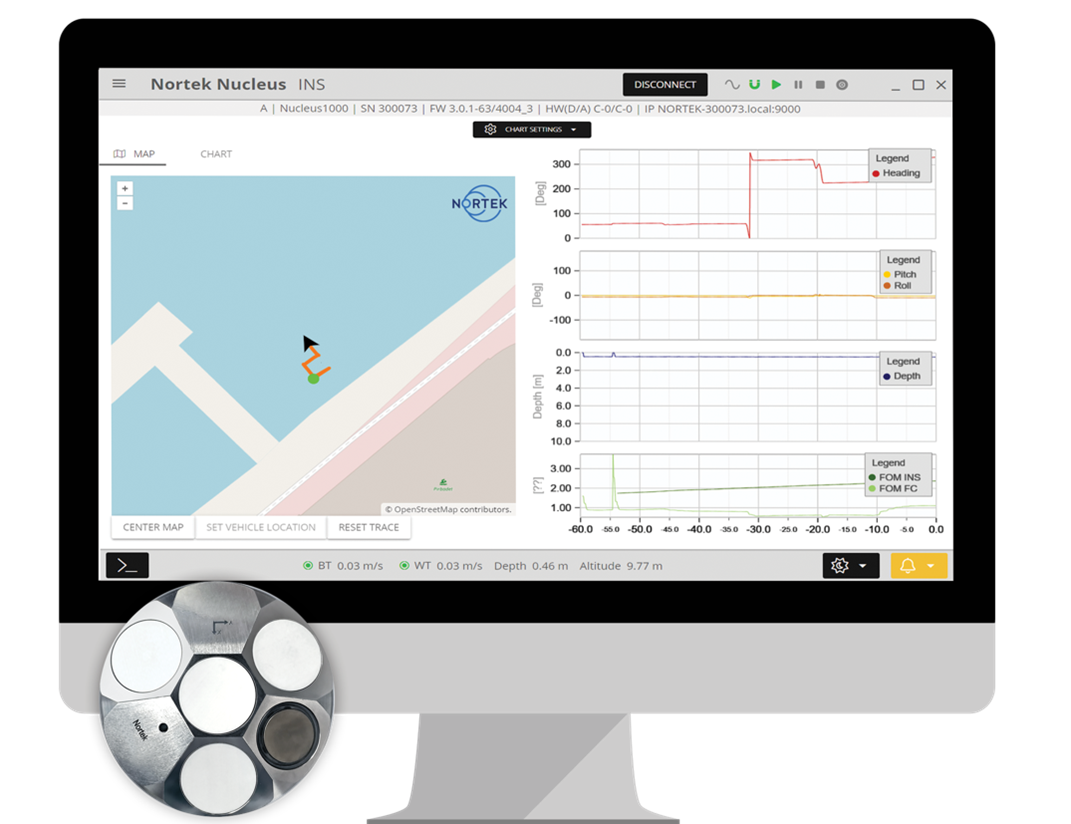
In addition to a dedicated INS data stream, the Nucleus software can show a vehicle’s location in real time on a map using inputs from its sensors and Nortek’s navigation algorithms.
A preconfigured, pre-synchronized navigation package
Users can now add a convenient source of basic positioning to their vehicle without substantial time, cost and payload demands. The Nucleus only needs to be provided with a GPS position to begin navigating using absolute positioning.
Providing earth-referenced position to a vehicle control system means that users who need to know where they are, where they’ve been and where they’re going now have a preconfigured, pre-synchronized navigation package.
Prior to this, users would have to fuse data from multiple different sensors to obtain a reliable position output, either through their own software or additional third-party packages.
A compact, affordable and accurate inertial/acoustic navigation system from Nortek
With a heading sensor that measures relative to magnetic north, as well as integrated pressure and temperature sensors, the Nucleus with INS introduces the most compact, most affordable and most accurate complete inertial/acoustic navigation system of its class available on the market.
Fugro supports coastal resilience in Florida with new seafloor mapping contract
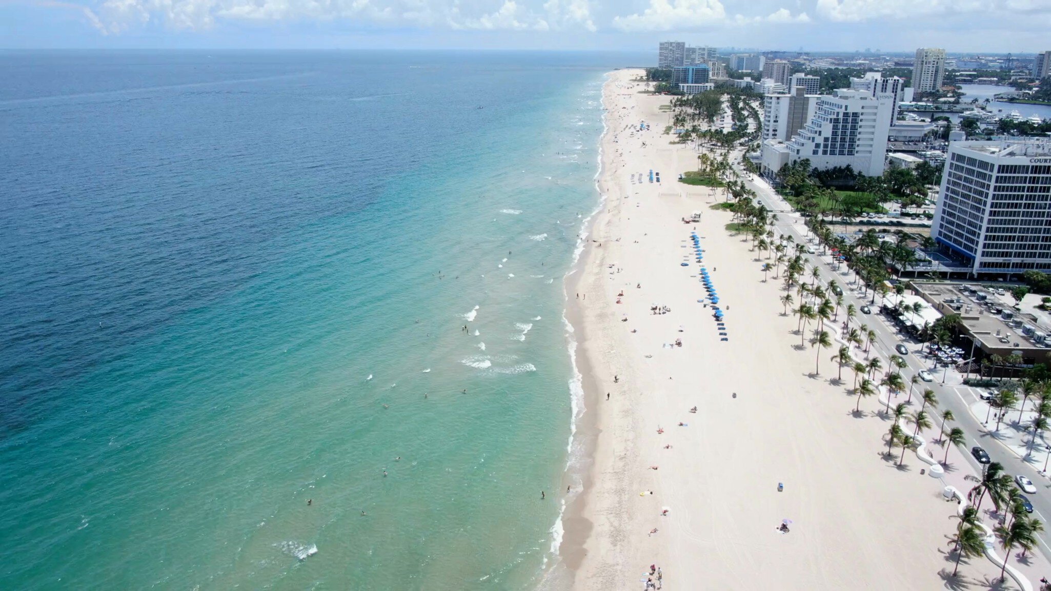
Fugro has been selected by the Florida Department of Environmental Protection (FDEP) to map the Atlantic coastal waters of Florida, spanning from Georgia to Miami. The contract was awarded as part of FDEP’s Florida Seafloor Mapping Initiative (FSMI), a multiyear programme to bolster coastal resilience in the state. Geo-data developed under the FSMI will help inform critical climate adaptation strategies, including infrastructure development and maintenance, habitat mapping, environmental restoration, emergency response, coastal hazard studies and more.
While the FSMI will eventually require a mix of airborne and vessel-based mapping methodologies, Fugro’s current task order is focused on bathymetry using airborne lidar technology. Data acquisition for the project is underway and will continue through autumn using the company’s Rapid Airborne Multibeam Mapping System (RAMMS). The compact and lightweight system is unique in its ability to meet international accuracy and quality standards while reducing carbon emissions by up to 80% compared to legacy airborne lidar bathymetry systems.
Céline Gerson, Fugro’s Group Director in the Americas and President of Fugro USA, expressed enthusiasm for the project, stating, “We understand the importance of seafloor mapping to Florida’s future and are well prepared to deliver on the state’s pressing Geo data needs. As a leader in coastal resilience solutions, we offer FDEP not only cutting-edge technology, but also robust capacity and demonstrated experience to ensure any task order assigned to us will be completed safely, efficiently and sustainably.”
Seabed 2030 and SEABER announce new partnership advancing ocean exploration
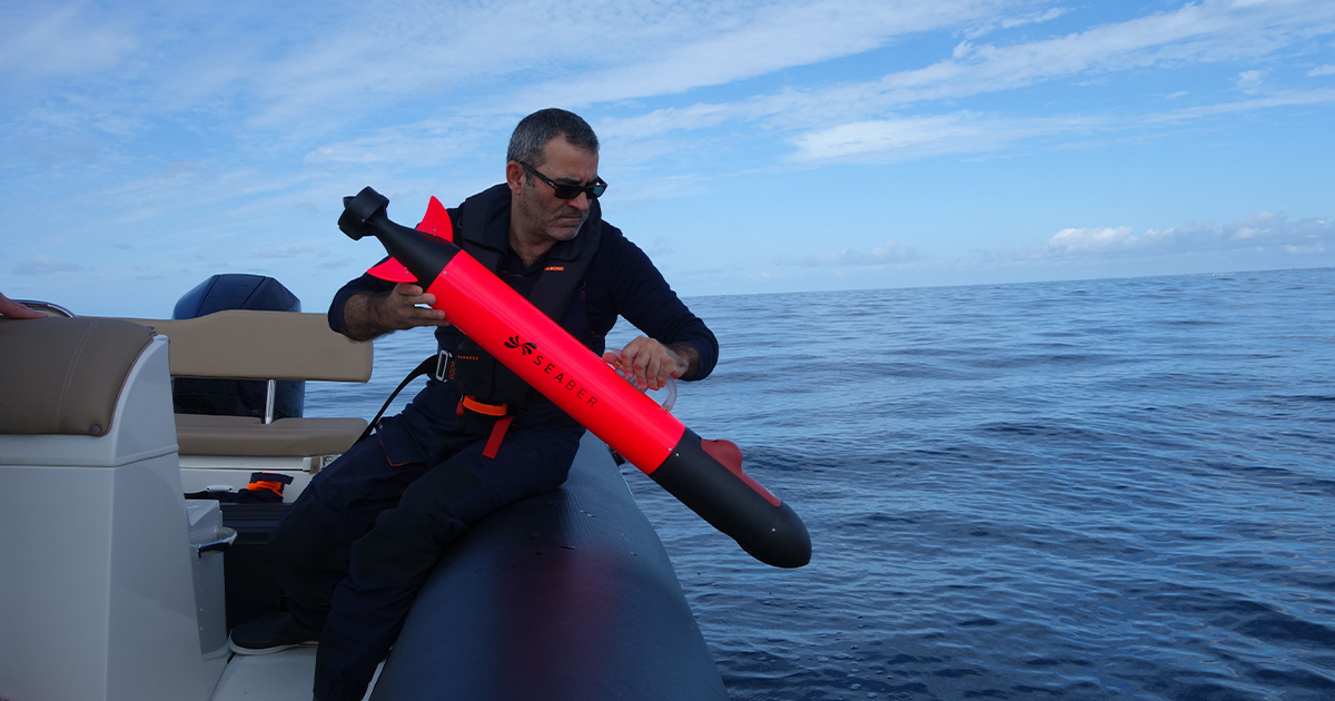
The Nippon Foundation-GEBCO Seabed 2030 Project has entered into a new partnership with SEABER, a French-based company that designs and manufactures autonomous underwater vehicles (AUVs) for research and commercial oceanographic applications. The two parties will work together in support of the global effort to achieve a complete map of the entire ocean floor.
Seabed 2030 is a collaborative project between The Nippon Foundation and GEBCO to inspire the complete mapping of the world’s ocean by 2030 and to compile all bathymetric data into the freely available GEBCO Ocean Map – it is also a formally endorsed Decade Action of the UN Ocean Decade. GEBCO is a joint programme of the International Hydrographic Organization (IHO) and the Intergovernmental Oceanographic Commission (IOC), and is the only organisation with a mandate to map the entire ocean floor.
Established in 2020, SEABER is the sole European company entirely dedicated to micro-AUVs capable of navigating depths of up to 300 metres and operating autonomously for eight to ten hours. The YUCO micro-AUV is designed for extensive use across the entire continental shelf and is equipped to carry various scientific instruments. Thanks to its accessibility, user-friendly interface, and an affordable pricing strategy, the YUCO has swiftly become a favoured tool within the oceanographic research community. Specifically, it serves as a complementary resource for ocean observation, extending the capabilities of traditional vessel-based manual measurements and fixed observatories with its micro-AUV technology.
This partnership brings together Seabed 2030's dedication to advancing the comprehensive mapping of the ocean, together with SEABER's technological developments and expertise in underwater exploration.
“Identifying technology gaps in bathymetric mapping and encouraging innovation in these areas is key to Seabed 2030’s mission,” commented Project Director Jamie McMichael-Phillips. “It’s a pleasure to welcome SEABER to our growing network of partners, and their range of AUVs will no doubt be invaluable in supporting our goal as they’re deployed on various missions.”
“Like Seabed 2030, we believe that everyone has a part to play in this journey of ocean discovery,” said Vidal Texeira, co-Founder and CEO of SEABER. “As such, we’re committed to building AUVs that are more affordable and accessible, while maintaining their reliability and efficiency.
“We look forward to collaborating with Seabed 2030 in a partnership that will greatly advance our understanding of the ocean.”
All data collected and shared with the Seabed 2030 project is included in the free and publicly available GEBCO global grid.
GEOXYZ acquires new offshore survey vessel: Geo Ocean VII
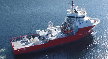
GEOxyz is overjoyed to welcome the latest addition to its fleet: introducing its new offshore survey vessel, the Geo Ocean VII.
Currently in the final stages of preparation in dry-dock before embarking on its maiden voyage, the Geo Ocean VII is being equipped with the most advanced and up to industry-standards technologies to ensure seamless operations.
Measuring an impressive 56 meters in length, the Geo Ocean VII boasts station-keeping capabilities (DP0) and is outfitted with two moon pools, an A-frame and a large 6t deck crane.
Starting in November 2023, the Geo Ocean VII and its experienced crew will be fully prepared to conduct geophysical, shallow geotechnical (VC, CPT), and environmental surveys.
“Welcoming the GO VII to our fleet not only enhances our survey capabilities but also equips us to optimize our adaptability when planning our clients’ projects.” - Patrick Reyntjens, CEO GEOxyz
AI for seabed mapping project shortlisted for Knowledge Transfer Partnership award
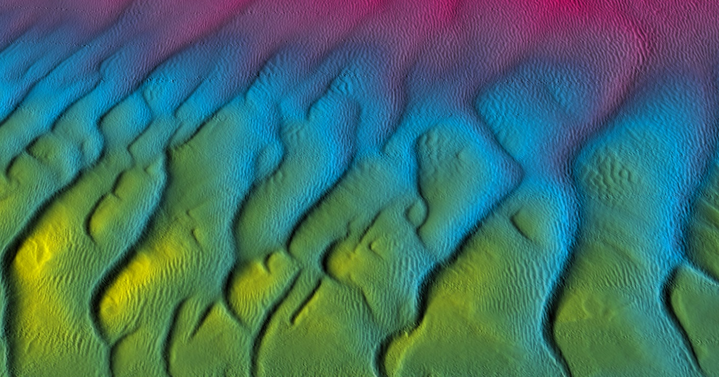
GeoAcoustics Ltd in partnership with the University of East Anglia’s School of Computing Sciences has been named as a finalist in the category of Technical Excellence at the national Knowledge Transfer Partnership awards, following the collaborative development of an innovative AI solution to improve the speed and ease of seabed mapping in real-time.
Seabed mapping is used to produce a bathymetric (or water depth) profile of a given area of seabed using sonar technology. Sonar works by sending sound pulses into the water and measuring the echoes reflected from the seabed and any underwater structures that may be present. However, many unwanted data points are also generated and these need to be filtered out after the survey to produce a true representation of the seabed profile which can be a resource-intensive, expensive and time-consuming task.
GeoAcoustics Ltd, based in Great Yarmouth and a manufacturer of high-quality sonar equipment for seabed mapping, approached UEA’s School of Computing Sciences. A feasibility study was first undertaken to see if AI technology could automatically remove unwanted noise from sonar data. This was carried out by two MSc Computing Science students, supervised by Dr. Wenjia Wang and Dr. Ben Milner, and a team from GeoAcoustics.
Following encouraging results, further research and development grants were awarded; an Enabling Innovation: Research To Application (EIRA) award, and an Innovate UK Knowledge Transfer Partnership (KTP). These enabled an AI module to be developed which was then evaluated using various benchmark data sets and sea trials.
This established that the AI was able to produce accurate and consistent results comparable to that of an experienced surveyor, without needing any human intervention and operating at a fraction of the time. The AI module was integrated into the company’s existing software and is capable of processing survey data in real-time, saving days or weeks of post-processing by trained human users.
Dr. Danny Websdale, the Knowledge Transfer Partnership Senior Research Associate at University of East Anglia for the duration of the AI development project and now an AI/ML Research Scientist at GeoAcoustics Ltd said: “Designing an AI system that can process and quality control sonar data was a challenging process over the course of two and a half years, but together with the project team we were able to meet the intended goals and even exceed them by developing a system that provides real-time data on board the survey vessel, which is a unique capability that improves data quality while saving GeoAcoustics’ customers time and money.”
The new system has since been released by GeoAcoustics Ltd to its customers and has put the company into a world-leading position in the industry. Dr. Richard Dowdeswell, Chief Operating Officer at GeoAcoustics Ltd said: “The AI system was integrated in our flagship seabed mapping product GeoSwath 4 and provided to customers as a free update. Feedback has been wholly positive, and we’re delighted with how the KTP, and the excellent collaboration with Danny and the UEA School of Computing Sciences, turned out.”
Dr. Wenjia Wang, Associate Professor of Artificial Intelligence and Course Director of MSc Computing Science at UEA, said: “This successful project represents an acknowledgment not only of the cutting-edge knowledge and skills of staff and students within UEA’s School of Computing Sciences, but also the ways in which we can further develop relationships with businesses to produce innovative real-world solutions that are recognised nationally and internationally as sector leading.”
The AI project, which was graded ‘Outstanding’ by Innovate UK, has been named as one of three finalists in the Technical Excellence category at the national KTP Awards, with winners announced on Thursday 18 October.
EIVA to supply UK MoD containerised ROTV solution to the Royal Navy
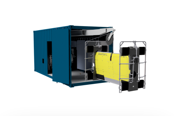
Danish subsea engineering specialist EIVA a/s has been awarded a contract by the UK Ministry of Defence (MOD) with a total value of approximately €3.8 million (£3.2 million). The contract entails the delivery of a containerised remotely operated towed vehicle (ROTV) solution displaying data in NaviSuite software.
When delivered, The ROTV, an EIVA ScanFish L, will be integrated into the Royal Navy’s seabed warfare system of systems. Capable of operating from different host platforms, this system will enable the simultaneous operation of multiple acoustic survey sensors and instruments.
Able to operate beyond the continental shelf the containerised ROTV solution provided by EIVA will be capable of performing various functions, including but not limited to:
- Pipeline inspection
- Large area searches and mine countermeasure (MCM) operations
- Site surveys and seabed mapping
- Cable route surveys
- High-resolution object detection
- Oceanographic data collection through the water column
This solution will provide integrated and enhanced operational capabilities for the Royal Navy, demonstrating both modularity in the ScanFish setup and flexibility of employment through the containerised solution.
As part of the contract, EIVA will deliver a fully equipped 20' Cube container module and launch and recovery system, supplied by SH Defence, part of SH Group. The ScanFish L ROTV will be equipped with multiple sensors, including but not limited to Sonardyne’s SPRINT-Nav Mini hybrid INS/DVL and Voyis’ Observer Pro optical camera and Insight Pro laser scanner. The system will benefit from EIVA's NaviSuite software for efficiently processing and analysing the collected data, enhancing users’. Moreover, the presence of two dedicated workstations within the container will ensure the system's full operational capability and independence of employment, as there is no need to be plugged into the military ship Command & Control (C2) system.
‘We are thrilled to have been awarded this contract by the UK MOD and to be delivering capability for the Royal Navy,’ said Flemming Hjorth, Acting CEO of EIVA. ‘We are excited about this opportunity to continue to provide our expertise in the defence market. We have been working in partnership with Forcys, a global maritime defence company and EIVA’s sister company in Covelya Group, to market the system to allied nations. It’s a great tool to enhance our customers’ seabed warfare capabilities and the protection of critical maritime infrastructures.’
‘As a former navy officer, it is a true privilege to contribute to the Royal Navy's mission. We eagerly anticipate seeing our ScanFish ROTV in action, performing a wide range of tasks from MCM operations to underwater cable and pipeline inspections.’ Cdr ITA-N (Ret'd) Antonio J. Belfiore, EIVA's Business Development Manager for Defence.
Sonardyne welcomes MSDS Marine as UK reseller
Marine technology company, Sonardyne is expanding its reach by appointing MSDS Marine as their latest UK reseller.
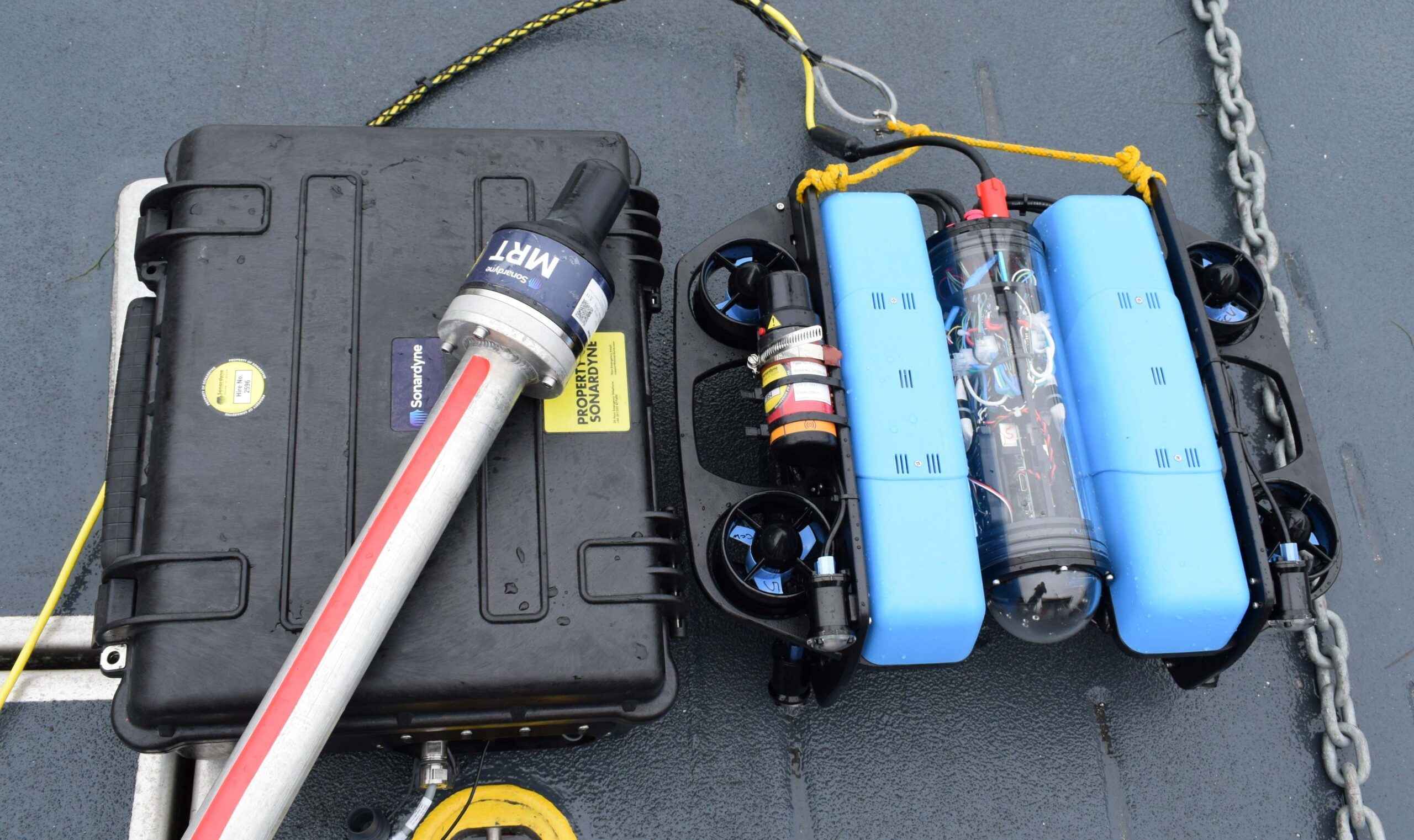
MSDS Marine are a specialist marine and coastal contractor specialising in providing scientific and archaeological support across a variety of sectors including; offshore development, archaeological and ecological surveys, and asset monitoring and recording. Their work includes the use of Remotely Operated Vehicles (ROVs), divers, and geophysical and hydrographic survey and they offer a complete package from planning to execution, and subsequent processing, visualisation, and interpretation. MSDS Marine are now able to provide additional support to their customers through the supply of the latest marine technology from Sonardyne, not only by continuing to use the technology during projects, but also as an official re-seller.
MSDS Marine rely on technology for the majority of our underwater operations, with reliability being crucial to works in the marine environment. As a company we have used Sonardyne acoustic tracking for a number of years, tracking divers, ROVs, and geophysical equipment. Not only have we found the technology to be incredibly reliable and easy to use, but we have always been very impressed with the level of support that Sonardyne offer. We are proud to be able to continue to promote the systems as a re-seller, using our firsthand experience in the scientific and archaeological sector to do so. – Mark James, MSDS Marine Operations and Technical Manager.
MSDS Marine have used Sonardyne technology for a number of years, and the SCOUT, Micro and Mini Ranger USBL systems have played an important in the recent investigations of the archaeologically significant designated sites of the Rooswijk (sunk 1740), the London (sunk 1665), and the Bronze Bell wreck (sunk in the 18th Century). The precise, reliable positioning, along with the ease of use, have allowed for the accurate mapping and survey of the sites.
“It’s great to have MSDS Marine as resellers for our shallow water USBL systems. It is quite unusual to have a reseller who also uses the equipment to the extent that MSDS Marine do. They bring a wealth of experience and expertise that will allow them to support customers from initial enquiry through to frontline support. We’re delighted to have such a strong advocate on board as a reselling partner.” Duncan Rigg, Sonardyne Sales Manager
Exail opens new office in Norway to support growth in the Scandinavian region
Exail announces the opening of a new business office in Norway, that will support the company’s growth in the Scandinavian region. Located in the Oslo area, this new office is led by Lars Sorfang, who is acting as General Manager for Exail AS, as well as Regional Sales Manager for Scandinavia.
A former officer for the Norwegian military, Lars previously held various business development positions at Kongsberg working on strategic defense programs, and Teledyne Flir, where he was Sales Director for the European region.
“I am very proud to be part of this new adventure with Exail, as I am deeply convinced, as a previous user of the technologies the company develops, that they are the right fit for the region that requires highly innovative and high-end products.” Lars explains. “With this new office, we will be able to provide increased support to our growing base of customers in Norway, and more generally, Scandinavia.”
Exail has won major contracts in the region over the past years, both in the civil and defense markets. This includes the sale of Inertial Navigation Systems for Norway’s U212 submarines and Coast-Guard vessels, Finland’s Multi-role corvettes, as well as Sweden A19 and A26 submarines. Exail has also established strong partnerships with civilian Scandinavian companies such as Teledyne Gavia, Nortek and RTS.