
Greensea IQ Demonstrates Autonomous UXO Detection with Bayonet 350 in Live Deployment
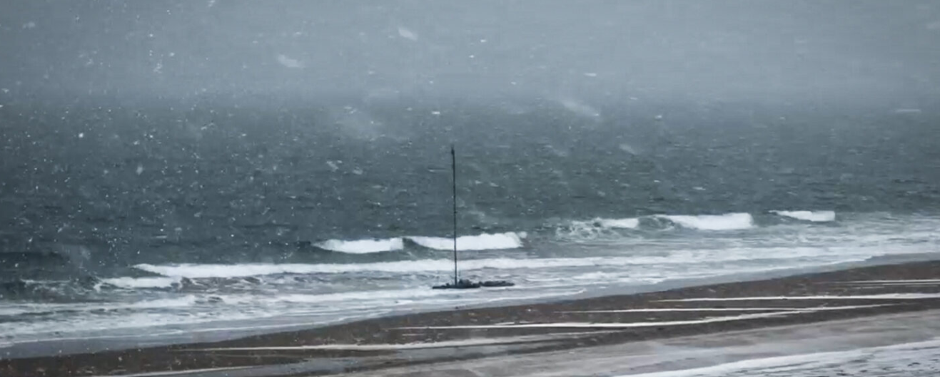
 Greensea IQ successfully supported a live autonomous Unexploded Ordnance (UXO) detection and classification demonstration at the former Maine Bombing Area. Showcasing the Bayonet 350 Autonomous Underwater Ground Vehicle (AUGV) operating in surf, shallow water, and nearshore environments while towing a UXO detection sensor sled. The deployment demonstrated reliable, high-accuracy data collection, as well as autonomous operations in complex coastal conditions.
Greensea IQ’s Bayonet 350, outfitted with an RTK-GPS system, supported the deployment and operation of White River Technologies’ APEX three-dimensional electromagnetic (3D EM) system. Greensea IQ and White River Technologies have partnered to create a viable and commercially available solution for maritime UXO detection, classification, and mapping.
Unexploded Ordnance (UXO) refers to the munitions that were deployed but failed to detonate and remain in the environment. These materials are commonly found in former military training and testing areas, including coastal regions, beaches, and nearshore waters. The former Maine Bombing Area is a Formerly Used Defense Site (FUDS) located in Reid State Park and the site of a World War II bombing range. This demonstration, funded through the Department of War’s Strategic Environmental Research and Development Program (SERDP) and the Environmental Security Technology Certification Program (ESTCP), aimed to validate emerging UXO detection capabilities in real-world operational conditions.
UXO presents a significant risk to both public safety and the environment. These hazards can remain active for decades, posing danger to civilians, marine operations, and coastal development. In many cases, large areas of seabed and shoreline remain restricted due to the presence or suspected presence of UXO.
Historically, identifying and classifying UXO in nearshore environments has been a complex and resource-intensive process. Traditional methods typically require manual surveying in hazardous areas and can struggle to distinguish between actual threats and benign metallic debris. As a result, many impacted areas remain unaddressed due to the difficulty, cost, and risk associated with large-scale detection and classification. Greensea IQ CEO Ben Kinnaman explains:
“Unexploded ordnance is a major issue in the ocean, especially on beaches, sounds, and marshes. UXO presents both a public safety risk and an environmental hazard. Historically, these areas have been difficult to address because there has not been a reliable way to efficiently search large areas and accurately distinguish UXO from typical seabed trash. The Bayonet AUGV, paired with the APEX system from White River Technologies, enables autonomous surveying of large seabed areas while producing accurate maps of classified threats. This allows for more efficient and precise mitigation. This technology provides a cost-effective way to address a significant public safety challenge and reopen impacted areas for recreation and public use.”
Over five days of field operations, including through a New England blizzard, the Bayonet 350 conducted autonomous surveys over approximately eight acres of surf zone, swash zone, and shoreline with no downtime due to system failures or issues.
Data collected during demonstration was processed by White River Technologies using advanced geophysical classification (AGC) methods to generate maps and identify Targets of Interest for follow-on investigation by the U.S. Army Corps of Engineers.
The operation demonstrated the Bayonet 350’s ability to:
- Autonomously survey hazardous nearshore environments in harsh weather conditions
- Collect high-resolution geophysical data with precise positioning
- Reduce risk by eliminating the need for personnel in dangerous surf and swash zones
- Support scalable, data-driven UXO response operations

Fugro to conduct geotechnical campaign for South America’s first licensed offshore wind project
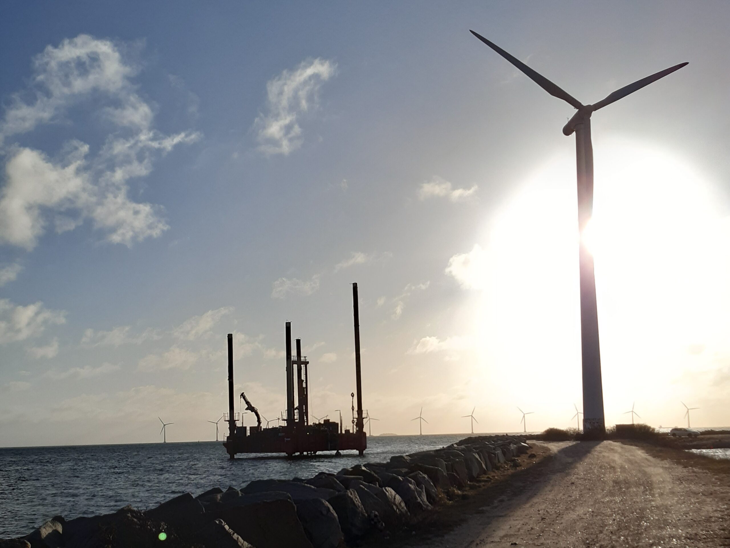
Petrobras has selected Fugro to deliver a geotechnical site investigation for the Rio de Janeiro Offshore Wind Pilot Project, the first offshore wind development in South America to advance under a formal environmental licensing process. The 18 MW pilot marks an essential step in energy diversification as countries in the region begin to establish regulated pathways for the responsible development of offshore wind.
Working within a nearshore study area off São João da Barra, Fugro will acquire the Geo‑data needed to inform safe and efficient design. Activities include soil sampling, in situ testing and laboratory analysis across four coastal and shallow‑water locations, along with onshore investigations to support cable landfall and routing. Field operations and analysis will begin in April and continue through Q3 2026, with final reporting scheduled for 2027.
The project stands to benefit from Fugro’s work on early‑stage offshore wind developments in emerging markets worldwide, ranging from initial pilot studies to full site characterisation. For this effort, Fugro’s Brazil‑based teams will lead delivery, pairing nearshore operations from the Rio das Ostras hub with laboratory analysis at the Pinhais facility. This combination of local insight and global experience will help ensure consistent, decision‑ready data for Petrobras.
“As South America moves forward with its offshore wind ambitions, early Geo‑data is one of the most important tools for reducing uncertainty and setting projects up for long-term success,” said Céline Gerson, President and Group Director for Fugro in the Americas. “By partnering with Petrobras at this early stage, we’re helping establish the technical foundation needed to progress offshore wind responsibly and expand future energy options in Brazil and across the wider region.”
North Sea Hydrographic Commission joins Seabed 2030 as partner
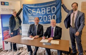
The Nippon Foundation-GEBCO Seabed 2030 Project is pleased to announce a new partnership with the North Sea Hydrographic Commission (NSHC), bringing together a regional network of hydrographic offices to support seabed mapping efforts across the North Sea and surrounding waters.
Established in 1962 in The Hague, the NSHC comprises Belgium, Denmark, France, Germany, Iceland, Ireland, the Netherlands, Norway, Sweden and the UK. The Commission provides a longstanding framework for cooperation on hydrographic surveying, charting, and the exchange of maritime information, including coordination of survey activity beyond national waters.
Seabed 2030 is a collaborative project between The Nippon Foundation and the General Bathymetric Chart of the Oceans (GEBCO), which seeks to inspire the complete mapping of the world’s ocean by 2030, and to compile all the data into the freely available GEBCO Ocean Map. The Project is formally endorsed as a Decade Action of the UN Ocean Decade. GEBCO is a joint programme of the International Hydrographic Organization (IHO) and the Intergovernmental Oceanographic Commission (IOC), and is the only organisation with a mandate to map the entire ocean floor.
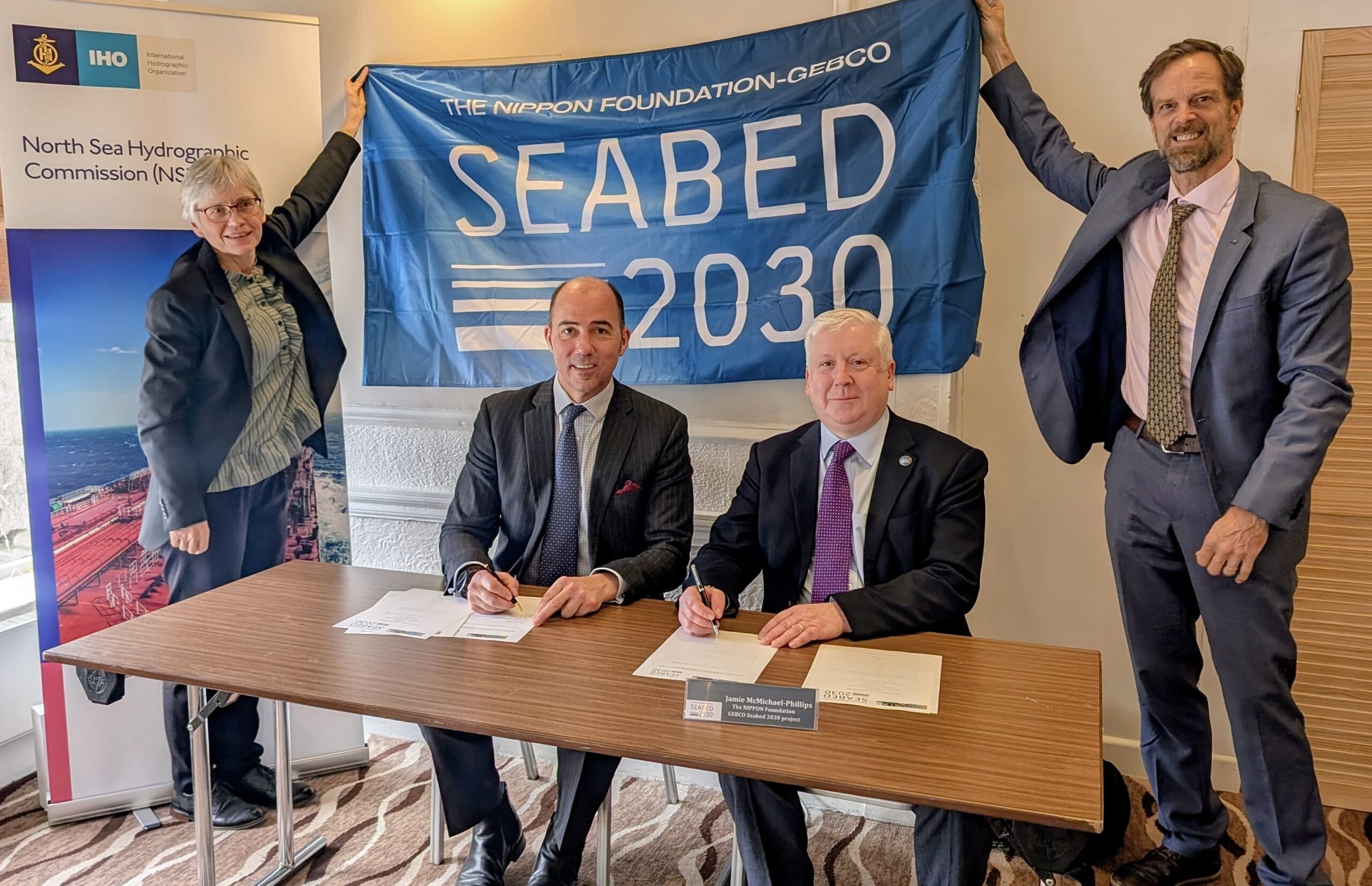
The new partnership was formalised with a Memorandum of Understanding signed at the 39th Meeting of the North Sea Hydrographic Commission in Aberdeen, Scotland, by Rear Admiral Angus Essenhigh OBE, UK National Hydrographer and Director of Data Acquisition and Defence at the UK Hydrographic Office, on behalf of the NSHC and Seabed 2030 Director Jamie McMichael-Phillips.
By bringing together multiple national hydrographic offices under a single framework, the partnership strengthens regional coordination, supporting data sharing and reinforcing the collective commitment of North Sea nations to advancing seabed mapping.
Commenting on the announcement, Jamie McMichael-Phillips said: “The North Sea region has a long history of hydrographic excellence and cooperation, and we are delighted to formalise our partnership with the Commission in support of Seabed 2030’s global mission.
“Partnerships of this nature help ensure that data collected at national and regional levels can be brought together effectively, strengthening the global bathymetric dataset and supporting progress towards a complete map of the ocean floor.”
Rear Admiral Angus Essenhigh OBE said: “The NSHC has a long-standing commitment to cooperation in support of safe navigation and improved understanding of our waters. This partnership with Seabed 2030 builds on that legacy, enabling Member States to further coordinate survey activity and contribute bathymetric data.”
GEBCO Chair, Evert Flier, added: “The NSHC represents a strong and well-established model of regional collaboration. Its partnership with Seabed 2030 highlights the importance of coordinated hydrographic efforts in ensuring that high-quality bathymetric data is shared, integrated and made available for the widest possible use. This includes providing high quality bathymetric data to the GEBCO grid via EMODNet and Seabed 2030.”
All data collected and shared with the Seabed 2030 project is included in the free and publicly available GEBCO global grid.

IMarEST sets new standard for Marine Technology

The Institute of Marine Engineering, Science and Technology (IMarEST) has strengthened its commitment to supporting professionals working in marine technology and innovation with the launch of a reimagined, and future‑ready, professional registration standard. Its new Technology Register will help candidates demonstrate that they meet the evolving needs of the global marine sector and the expectations of international regulators.
As the only professional body in the world offering dedicated professional registration for the marine technology and innovation community, the IMarEST continues to champion professionals whose work extends beyond traditional engineering and science.
Backed by its prestigious Royal Charter, the Institute offers members the opportunity to achieve the professional titles of Marine Technician (MarTech), Registered Marine Technologist (RMarTech) and Chartered Marine Technologist (CMarTech). These accolades recognise excellence and promote the highest standards across the global marine industry.
The updated standard supporting these titles now provides clearer and more robust guidelines, enables smoother career progression, and reflects modern workplace practices such as digital literacy, data‑driven decision‑making and sustainability. Requirements for Continued Professional Development (CPD) have also been significantly strengthened, with reflection, planning and professional growth now feeding directly into how candidates are assessed.
Naomi Taylor, membership and professional services director at the IMarEST said: “As part of our work to help create a united, safe and sustainable future for the marine industry, we are laser focused on driving professional standards. I am continually inspired by the work our members do in areas such as ocean technologies and sustainable marine solutions, and I’m proud that this new standard reflects the calibre of their contribution to our sector.
“If you’re working in any aspect of marine technology and innovation, I strongly encourage you to get in touch and explore your options.”
The types of roles that fall under marine technology are diverse and include (but are not limited to): fleet managers, hydrographers, marine superintendents (deck), meteorologists, pilots, marine logisticians, deck officers and ratings, marine surveyors, shipping professionals, harbour masters, college lecturers, navigators, radar/sonar maintenance experts, warfare officers and ratings, and naval officers and ratings.
www.imarest.org/professional-registration
UK Royal Navy Awards Teledyne Contract for Autonomous Underwater Vehicles and Floats
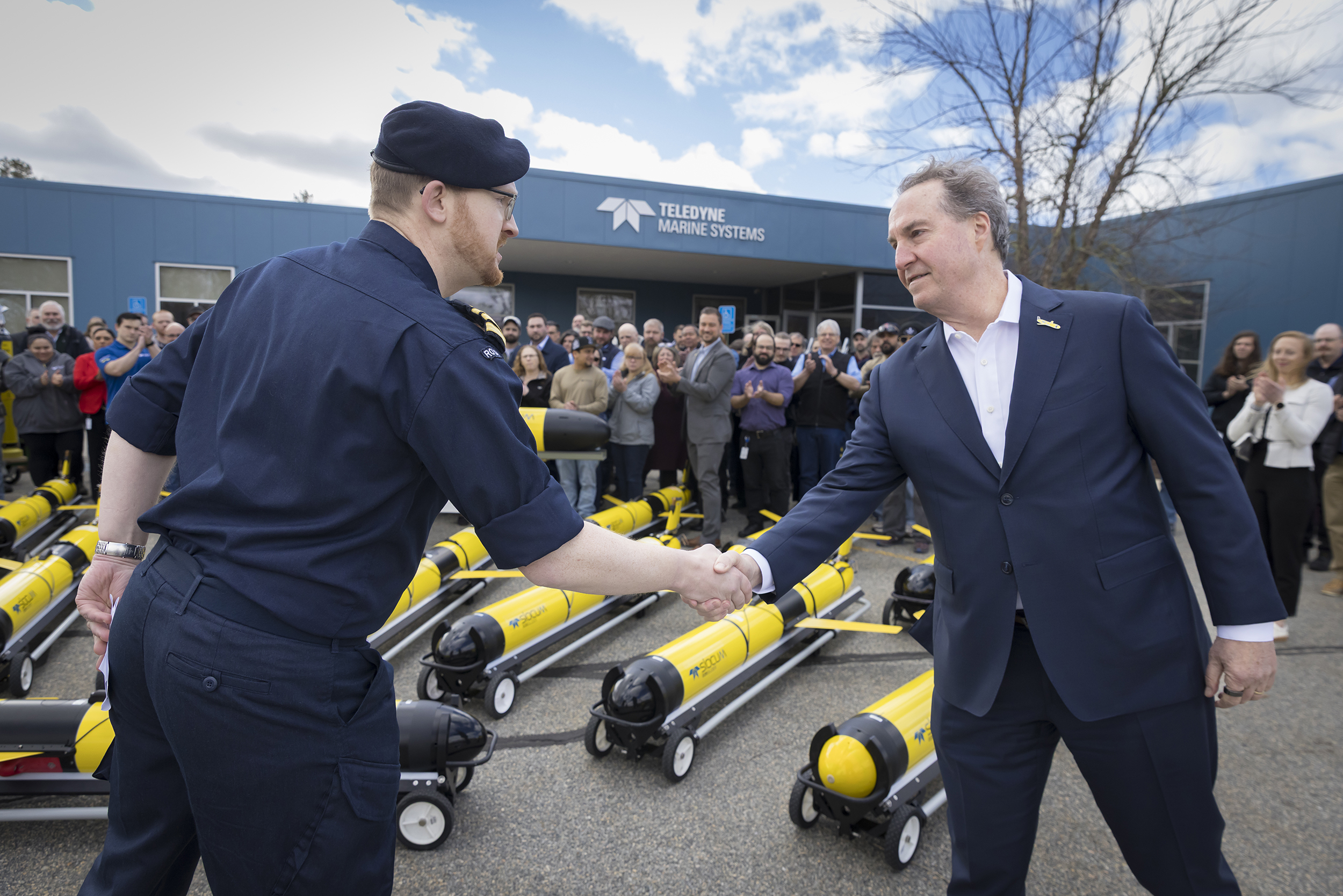
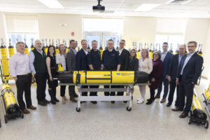 Teledyne Marine, part of Technologies Incorporated (NYSE:TDY), is pleased to announce that it has been awarded a contract by the UK Ministry of Defence (MOD) in support of the Royal Navy’s Future Maritime Data Gathering (FMDG) - Persistent Oceanographic Data Collect, strengthening the Royal Navy’s oceanographic and environmental data collection capabilities.
Under this contract, Teledyne will supply numerous autonomous ocean observing systems, including Sentinel and Slocum gliders, APEX floats, and associated services, enabling the Royal Navy to expand its fleet of advanced unmanned technologies to collect high-quality oceanographic data in support of operational planning, maritime safety, and defence activities, directly supporting Atlantic Bastion.
Under the FMDG program, Teledyne’s systems will deliver long-endurance data collection from complex and remote maritime environments, providing the Royal Navy with actionable and reliable environmental intelligence. The program builds on the Royal Navy’s use of Teledyne Slocum gliders since 2015 and reinforces the growing role of unmanned systems in Royal Navy and NATO naval operations. According to the Royal Navy’s Direct award justification “Teledyne remains the only supplier able to guarantee seamless interoperability, security compliance, and mission readiness into the Current RN Glider Fleet.”
“This award reflects the Royal Navy’s continued confidence in Teledyne’s autonomous underwater vehicles and ocean observing technologies, and our established partnership in delivering proven, mission-ready solutions,” said George Bobb, President and CEO of Teledyne. “We are proud to support the Royal Navy’s Future Maritime Data Gathering program and to contribute capabilities that deliver high-quality ocean data to enable critical defense and maritime missions.”
“This investment in autonomous ocean sensing strengthens the Royal Navy’s ability to understand and operate in an increasingly contested North Atlantic, supporting Atlantic Bastion. As we take this forward under the First Sea Lord’s Hybrid Navy agenda, this capability will be delivered directly to frontline Information Warfare Meteorological and Oceanographic (IW METOC) Operators. Persistent data from systems such as these enhances our understanding of the Underwater Battlespace, enabling Tactical Exploitation of the Environment and delivering the operational and information advantage Commanders need,” said Commander Butcher, Royal Navy, Capability Sponsor.
Since 2015, Teledyne has supported the Royal Navy’s oceanographic and environmental monitoring requirements through Slocum gliders, APEX floats and Gavia autonomous systems designed to operate reliably in demanding operational conditions. Teledyne’s unmanned systems are widely used by naval, commercial, and scientific organizations worldwide for ocean observation and environmental data collection.
Proven Performance
Teledyne Marine is a leading provider of unmanned underwater vehicles and ocean observing systems. Teledyne has delivered more than 12,000 APEX floats and 1,290 Slocum gliders, including over 600 systems in service with NATO naval users. Gavia AUV systems have been purchased by 18 navies worldwide, and Teledyne systems are operational with numerous NATO and AUKUS navies, including the Royal Navy.
UK Presence
Teledyne employs approximately 2,700 people across 18 main sites in the UK and is committed to supporting current and future UK defense priorities through proven technology, local expertise, and long-term partnerships.
FET sets new standard for subsea operations with Ice® Unity Remote-Connect
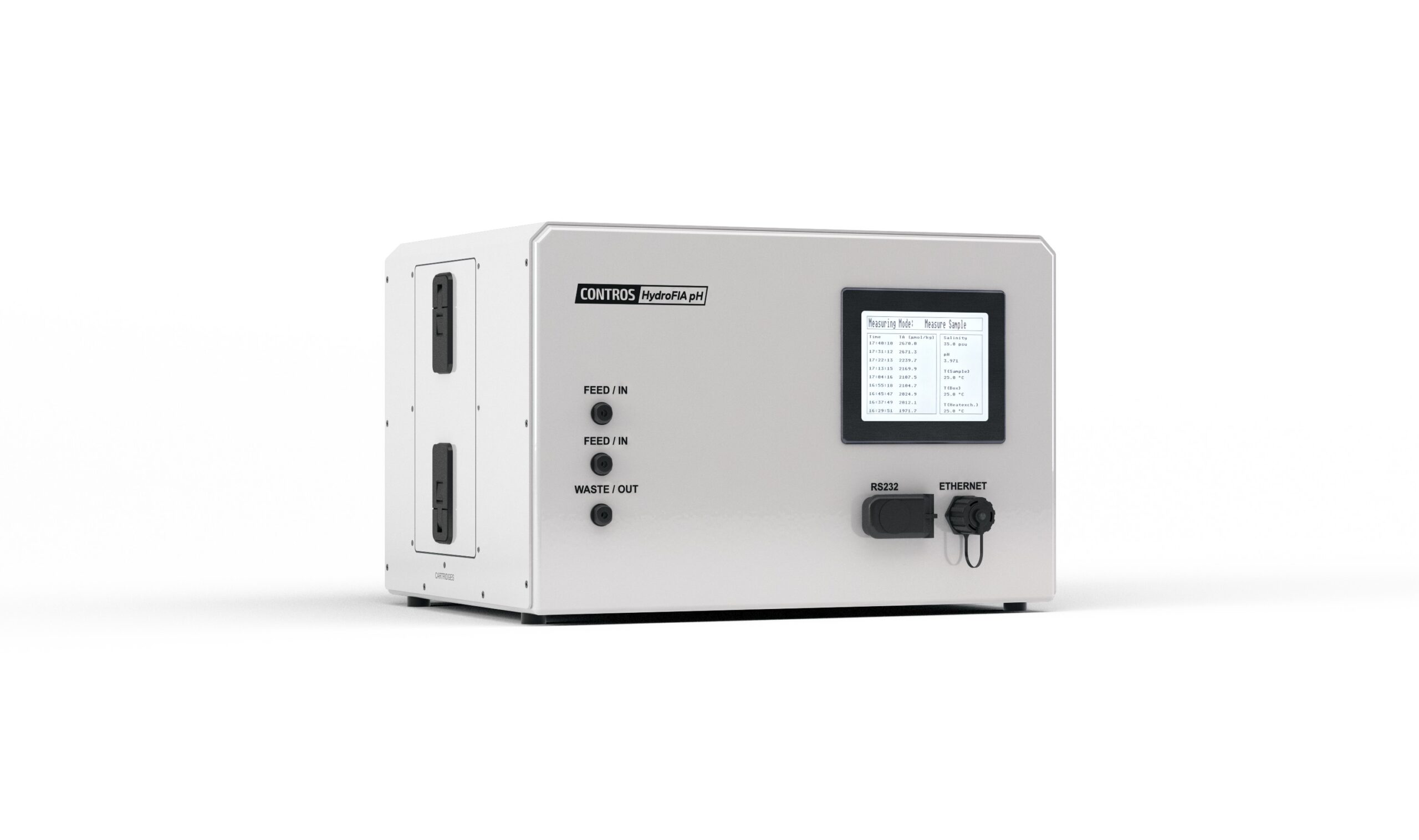
 -4H-Jena engineering GmbH has become the only commercial provider with the ability to offer large-scale purification of meta-Cresol Purple (mCP) for spectrophotometric seawater pH measurement. The capability is now available in direct support of its CONTROS HydroFIA™ pH analyser, addressing a long-standing challenge in marine carbon system monitoring.
Spectrophotometric pH measurement using indicator dyes such as mCP is widely recognised for its precision and suitability for high-quality ocean monitoring. However, impurities in commercially available indicator dyes can introduce systematic bias, even when apparent precision is high. Manufacturer and batch-dependent variability has been shown to shift reported pH values by up to 0.01 units, limiting data comparability and undermining confidence in long-term time series.
Until now, there has been no commercially available, scalable source of purified mCP. Laboratories and monitoring programmes have either relied on limited research-grade supply or undertaken their own purification, often at significant cost and effort. These approaches are typically time-intensive and difficult to scale for global monitoring needs.
By establishing the world’s first commercial in-house purification capability, -4H-Jena engineering is removing this bottleneck for users of the CONTROS HydroFIA™ pH system. The company can now deliver rigorously quality-controlled, ready-to-use purified mCP as part of its overall solution, reducing the technical and operational burden on customers while improving traceability and comparability of pH data
“High-quality indicator dye is fundamental to unlocking the full potential of spectrophotometric pH measurements,” says Dr. Katharina Seelmann, Project Manager Research & Technology Management, -4H-Jena engineering GmbH. “By offering purified mCP as a commercially available product, we are eliminating a key source of systematic bias and giving monitoring programmes greater confidence in the reliability and comparability of their data. This is an important step towards more robust long-term ocean observation.”
For operators of the CONTROS HydroFIA™ pH analyser, the development strengthens the system’s position as a complete and traceable measurement solution. By combining proven spectrophotometric technology with a secure supply of high-purity indicator, -4H-Jena engineering enables more consistent data across platforms and programmes, supporting applications from coastal monitoring to open-ocean research and high-resolution time-series studies.
Visitors to Oceanology International 2026 are invited to discuss this new capability and other recent -4H-Jena engineering developments on stand B201.
FET sets new standard for subsea operations with Ice® Unity Remote-Connect
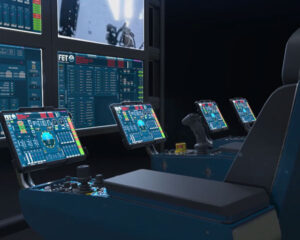 Forum Energy Technologies (FET), a leading provider of remotely operated vehicles (ROVs), has unveiled its new remote control station, enabling clients to operate ROV systems safely from any location.
The station operates using the latest ROV control system ICE® Unity, released in 2025, and facilitates any combination of the following:
- Remote operations
- Live streaming of survey data
- ROV system monitoring including FET Remote Support and updates.
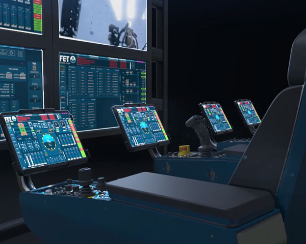
Supplied as an option with new systems, or as an upgrade to existing systems running ICE® Unity, the package includes FET Subsea advanced control chair(s), Remote-Connect gateway enclosures and VisualSoft’s video streamer and network player.
The option to operate from anywhere offers customers greater flexibility without compromising performance. The remote stations will facilitate many advantages including availability of specialist expertise, lower costs and improved safety.
Kevin Taylor, Vice President – Operations, Subsea Technologies at FET, said: “Innovation is key to FET’s long-term strategy, FET 2030, and this development represents a significant step forward in how ROV operations can be delivered. By enabling full system control from any location, we are giving our customers greater flexibility in how they deploy personnel and manage operational costs, without compromising performance or reliability.”
FET is demonstrating the remote station this week at Oceanology 2026, where an ROV will be piloted at the company’s UK headquarters in Kirkbymoorside, North Yorkshire, from a FET Subsea Advanced Control Chair at the conference in London – over 300km (190 miles) away.
All new hardware is manufactured and delivered from Kirkbymoorside in the UK. FET expects the introduction of full remote control capability to support evolving customer requirements across offshore energy, defence and other subsea markets.
Greensea IQ Launches Bayonet AUGV Operator Training Simulator
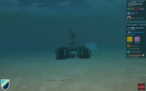 Greensea IQ, a leader in subsea robotics and autonomous systems, today announced the launch of a new simulator designed to help operators learn, practice, and refine their skills using the company’s Bayonet Autonomous Underwater Ground Vehicles (AUGVs).
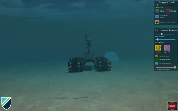
Developed in-house by Greensea IQ, the training simulator is built in a virtual game environment providing a realistic experience with an accurate physics engine. The game engine integrates with the operator’s console of the Bayonet robot, taking the place of a live robot, and simulates a fully operational system. Operators interact with the simulated system just as they would with a deployed robot, utilizing Greensea’s operating software, conducting real-life mission scenarios, responding to environmental events, and supervising the robot in both autonomous modes of operation as well as piloting the system in open-loop modes of operation.
The Bayonet AUGV simulator is designed for training scenarios and supporting operational work-ups of real-life missions. Trainers can specify environmental conditions, import geography and bathymetry, place targets, and create mission objectives. A fish-eye view in the trainer’s console allows the trainer to watch as an operator executes a mission. Realistic POV video from the AUGVs camera and simulated high-fidelity sonar data provide the operator an accurate experience while working within Greensea’s Workspace software. Operators can use the Workspace software just as they would in a live exercise, practicing scenarios, learning the software, and understanding their role as partners with an autonomous system. All of Bayonet’s autonomous features are fully enabled and available, from mission execution, obstacle avoidance, and target interrogation, to Automatic Target Recognition. Workspace’s data management systems are also fully functional, supporting data recording and playback as well as integration with TAK systems and Greensea’s post mission analysis toolchain.
“Helping operators learn how to work efficiently and effectively with intelligent systems is critical to success,” said Greensea IQ CEO Ben Kinnaman. “A great product is one that just works. But, that also relies on the operator developing and maintaining the proficiency to execute the desired missions. This simulator helps the operator do that.”
The Bayonet AUGV Simulator is built on Greensea’s new simulation engine for Greensea’s software systems. Training simulators for Greensea’s EOD Workspace and EOD Edge software platform available on the Mission Specialist Defender ROV systems by VideoRay (an AeroVironment company) and well as training simulators for Greensea’s RNAV system for combat swimmers will be available in the spring of 2026.
The launch of the simulator reinforces Greensea IQ’s commitment to pairing advanced autonomy with practical tools that support operators across the full lifecycle of subsea missions from training and rehearsal to real-world deployment.
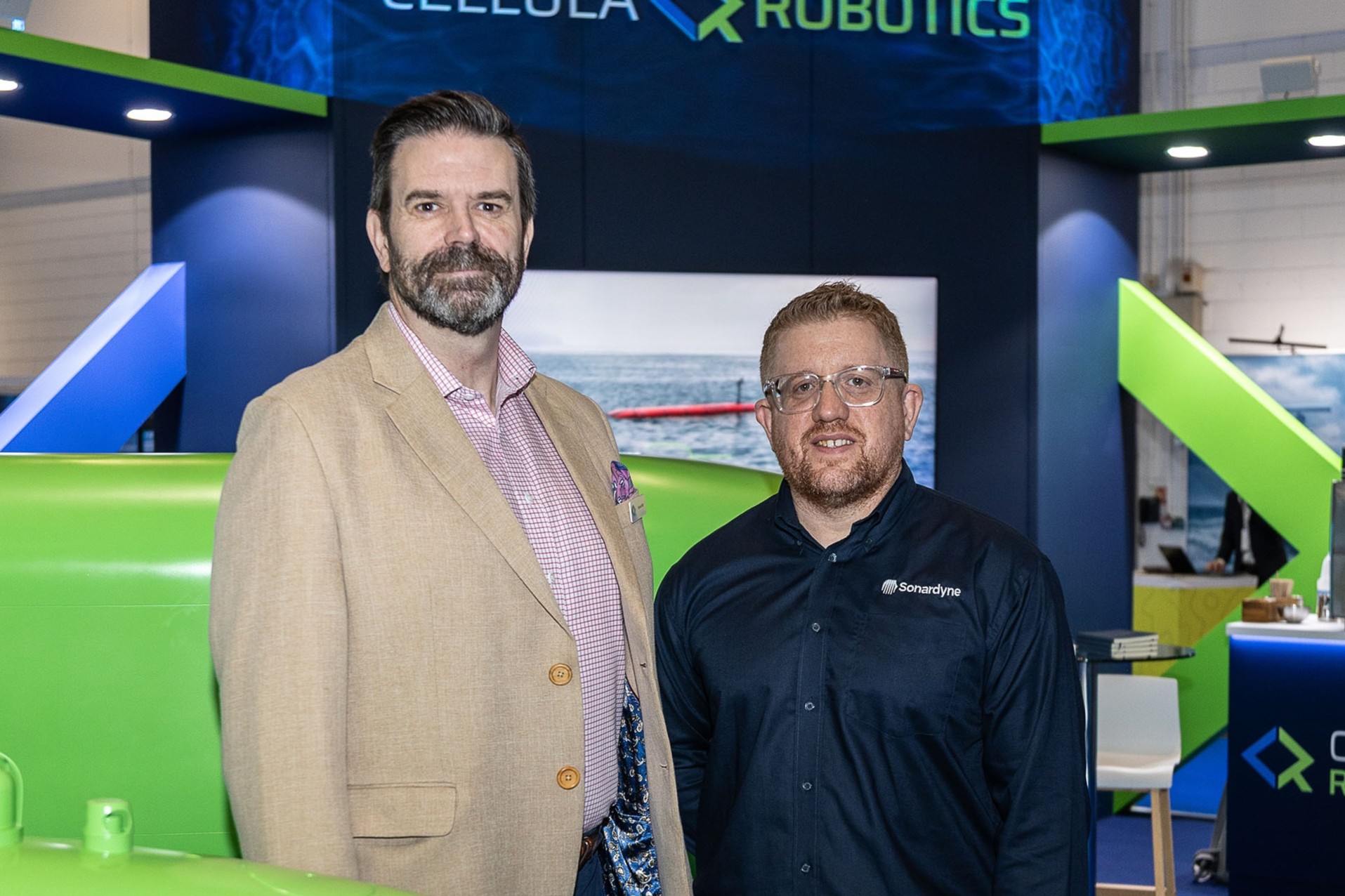
Cellula Robotics selects Sonardyne for long-range AUVs
Leading autonomous subsea robotic systems developer Cellula Robotics has chosen Sonardyne navigation and positioning technology for its long-range autonomous underwater vehicle (AUV) platforms.
For a number of AUV programmes, the company has ordered multiple Sonardyne SPRINT-Nav X navigation systems - Sonardyne's highest grade and underwater navigation system.
The company has also selected Sonardyne’s AvTrak 6 for tracking, communications and mission control. Part of the package/purchase is multiple Sonardyne Ranger 2 Ultra-Short BaseLine (USBL) positioning and communications systems for both AUV end users and demonstration and testing.
The move reflects Cellula’s focus on delivering the most reliable, persistent and accurate performance available for detect, inspect and protect missions.
“Our users need certainty,” says Richard Mills, Cellula’s Chief Commercial Officer. “Our AUV platforms provide persistent, long range and long endurance missions. Knowing where they are is an essential requirement at all times.
“Subsea security is a system‑of‑systems mission, our mantra of detect, inspect, and protect is aided by Sonardyne’s products to help ensure we deliver that certainty on every deployment.”
Cellula’s range includes the almost 12 m-long hydrogen fuel-cell powered Guardian and Porter AUVs, supporting long-range surveillance and cargo delivery respectively. Both have up to 45 days endurance and a 5,000 km range enabling extended deployments, with 5,000 litre capacity payload bays for flexible configuration.
Cellula has the 8.5 m-long Envoy AUV. Also hydrogen fuel cell powered, it’s designed for surveillance and data gathering, including by anchoring at the seabed for periods.
“Cellula is shifting the dial on what underwater endurance and persistence look like,” says Aidan Thorn, Marine Robotics Business Development Manager at Sonardyne.
“Sonardyne’s navigation and positioning technologies ensure their AUVs can fulfil demanding security, survey and research missions, where accurate navigation and reliable communications are absolutely critical.”
Cellula’s Ranger 2 systems are Gyro USBL variants. These combine heading, pitch, roll and an acoustic transceiver in one pre‑calibrated unit, simplifying vessel deployment and boosting accuracy.
Exail announces first sale of DriX H-9 for civil offshore operations to a European client
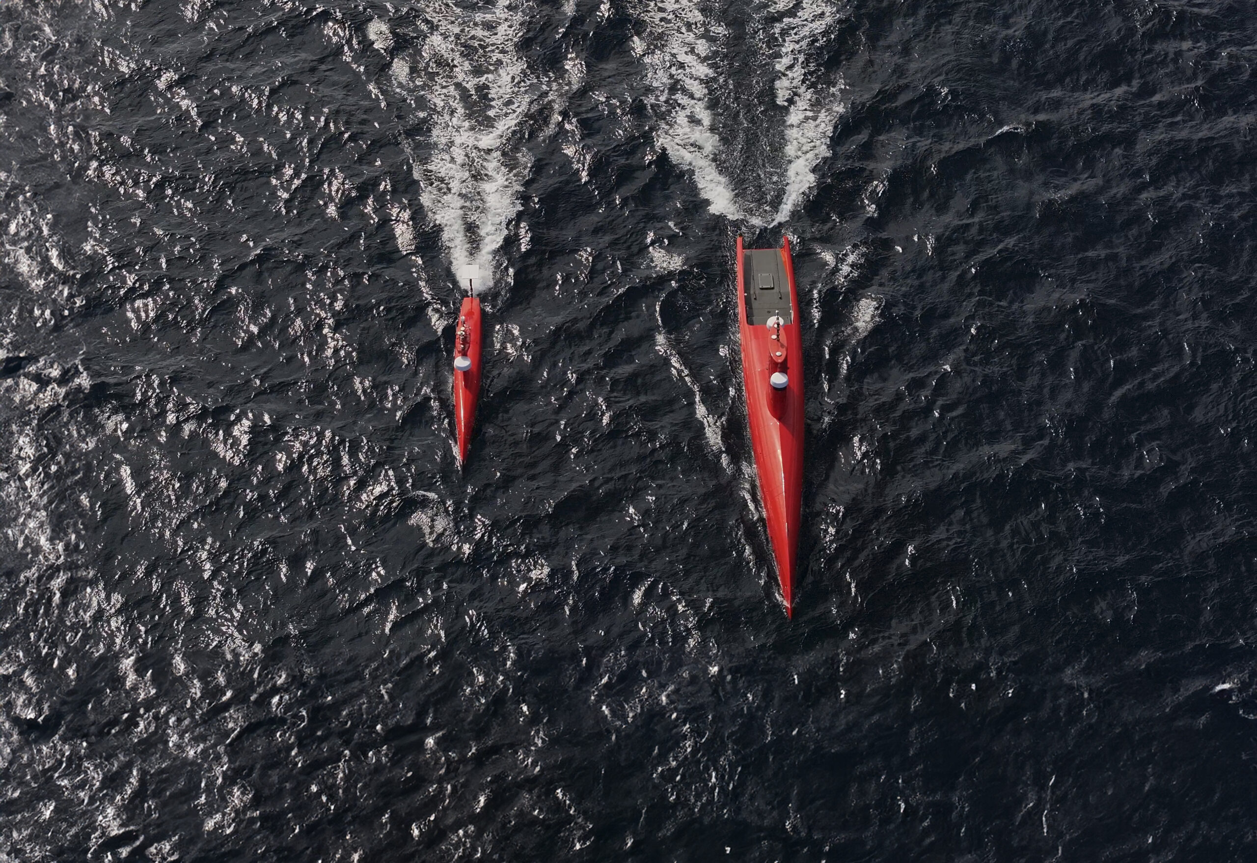
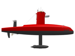 Exail, a leader in marine robotics technologies, announces the sale of its DriX H-9 Uncrewed Surface Vessel (USV) for civil offshore operations to a European client. The DriX H-9, equipped with a Multibeam Echosounder (MBES), Side Scan Sonar (SSS), Sub-Bottom Profiler (SBP) and magnetometer, will be deployed for offshore infrastructure survey operations.
As demand for efficient, precise and lower-footprint offshore surveying continues to grow, Exail’s DriX series — comprising the H-8, H-9 and O-16 models — addresses the evolving needs of the offshore market. Each platform offers different endurance and payload capacities, enabling operators to select the most suitable configuration for their mission profile. The DriX H-9 is particularly suited for complex offshore survey operations, combining long endurance with the ability to carry a full geophysical sensor suite while reducing operational costs and environmental impact.
Olivier Cervantes, VP Maritime Autonomy Solutions at Exail
“Our approach to better serve offshore customer requirements by offering a range of USVs with various endurance and payload capacities is clearly gaining momentum. With the DriX H-9, clients can operate over the horizon with up to 20 days of endurance while deploying a complete geophysical spread including MBES, SSS, SBP and magnetometer. We are delighted to see our client acting as a pioneer survey company in Europe by leveraging this capability.”