
COAST announces successful clean energy Innovation Challenge participants developing solutions for priority Canadian Coast Guard needs
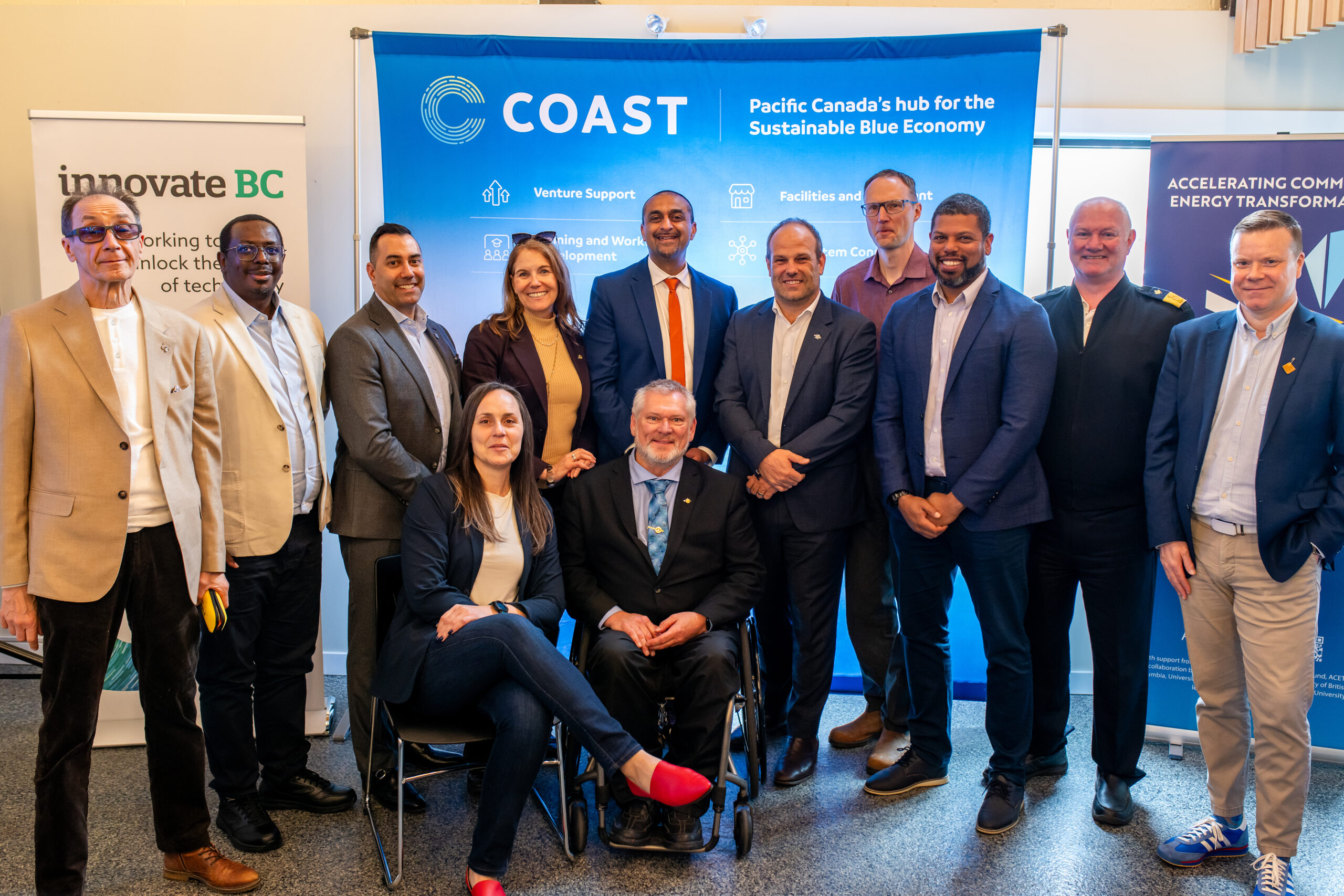
 Four B.C.-based companies are the successful participants of an Innovation Challenge to be delivered through Innovate BC’s Integrated Marketplace and enabled by the BC Marine Energy and Decarbonization Hub, a joint initiative of COAST and the University of Victoria.
This Innovation Challenge is designed to help address the Canadian Coast Guard's goal to decarbonize land-based operations in remote coastal areas of British Columbia. It targets new innovations that can displace diesel at remote locations, utilizing renewable energy sources (including marine renewables), as well as advanced energy management and storage solutions.
The systems must be rapidly deployable, modular, and scalable to meet the Coast Guard’s operational constraints at remote, often hard-to-access sites.
Ascent Systems Technologies, Cleohydron Innovation Inc, Mostar Labs Inc and Voltai Inc will receive funding of 50% of eligible project costs, up to $100,000, as well as access to office and lab space at the Marine Technology Centre in North Saanich, and direct access to the Canadian Coast Guard technical teams and Accelerating Community Energy Transformation (ACET) researchers to support their development goals.
Ascent Systems Technologies is adapting its Autonomous Environment Monitoring and Surveillance (AEMS) platform into AEMS-COAST, a rugged, modular clean-energy unit. The system integrates renewable generation, storage, smart power management and communications to operate autonomously. The company will reconfigure and enhance the system for long-term deployment in harsh coastal and marine environments.
Cleohydron Innovation Inc is developing “Hydrogen at the Edge,” a clean hydrogen production system tailored to remote coastal facilities that currently rely on diesel. It will advance the technology from lab-validated components to an integrated, deployment-ready prototype that can be safely and reliably operated under site-relevant conditions.
Mostar Labs Inc’s Lighthouse LilyPad is a modular floating renewable energy platform designed to provide reliable clean power to remote coastal operations and displace diesel use. The company will demonstrate consistent renewable generation, high system availability, stable three-phase power and robust storm performance, while establishing repeatable processes for deployment, maintenance, and decommissioning.
Voltai Inc’s WaveNexus project is advancing a modular wave-energy system intended as a rapidly deployable microgrid component for remote coastal infrastructure. Through its participation in the Challenge, the company will integrate and test the system in a relevant near-shore environment to generate credible performance and emissions-reduction data and show how wave energy can operate as part of a hybrid microgrid.
Strong results from this Challenge will help inform future procurement specifications and could position innovations for consideration through federal procurement processes, subject to operational needs and performance.
To be eligible for this Innovation Challenge, companies had to be registered, licensed or certified to do business in B.C., with at least two years of operating history and ready to run a test or pilot. COAST is an initiative of the South Island Prosperity Partnership, Greater Victoria’s economic development alliance. COAST received Catalyst Funding from Pacific Economic Development Canada (PacifiCan) and the B.C. Ministry of Energy and Climate Solutions to catalyze an ocean innovation cluster in Pacific Canada.

Sonardyne Fetch precision for new deep-sea neutrino telescope
A new, world-class deep-sea neutrino detector being built to transform our understanding of the universe is to use precise positioning from underwater technology company Sonardyne.
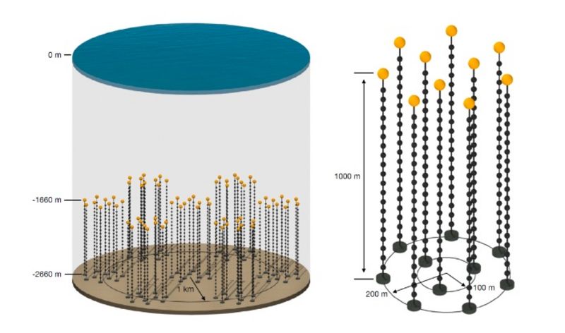
An array of Sonardyne's Fetch instruments will provide the precise and stable underwater positioning the 3,000 m deep Pacific Ocean Neutrino Experiment (P-ONE) needs to accurately detect and analyse high-energy neutrinos.
P-ONE – a multi-national, multi-institute scientific collaborative project – will help scientists to unlock insights into extreme cosmic phenomena like black holes and supernovae.
The next generation cosmic neutrino telescope will be built off the coast of British Columbia, Canada, leveraging Ocean Network's Canada's existing world-class advanced deep-sea infrastructure.
Alongside exploring the universe, P-ONE will also deliver vital data for oceanography, climate science and tectonic research, advancing both astrophysics and marine technology.
Simon Fraser University (SFU), in British Columbia, is one of the collaborators on the P-ONE project and is coordinator of the array’s acoustic positioning.
Professor Matthias Danninger, principal investigator at SFU, says, "The P-ONE collaboration’s goal is to create a unique observational facility, as part of a global effort to improve our understanding of high-energy and ultra-high-energy cosmic neutrinos, their sources and their role in astro and particle physics.
"The positioning system is critical to its success. Critically, we need to know precisely where our detector is in the absolute geo-reference frame and also where each component is relative to each other at any time, as, although anchored the ocean currents will move the detector lines constantly.
“With Sonardyne’s Fetch system, we'll achieve the precision we need and continuous monitoring to maintain alignment, safeguarding data integrity and enabling P-ONE to unlock insights into extreme cosmic phenomena."
The P-OnE detector will involve the anchoring of a three-dimensional array of thousands of advanced optical sensors creating a vast detection grid. These will detect the faint light (Cherenkov radiation) created when high-energy neutrinos interact with water molecules.
The P-One collaboration’s goal is to build a full detector array that would cover multiple square kilometres. The initial pilot array – and a potential future full array – will be connected into ONC's existing cabled infrastructure, which spans thousands of kilometres in the Cascadia Basin.
Thanks to the ONC infrastructure, P-ONE has readily available power and data transmission capabilities, enabling real-time monitoring and analysis.
“We’re incredibly proud that our Fetch technology is playing a pivotal role in the P-ONE project, supporting international, collaborative science,” says Michelle Barnett, Ocean Science Business Development Manager/Kim Swords, Sales Manager, Sonardyne.
“By ensuring precise sensor positioning and stability, we will be enabling pioneering discoveries in cosmic phenomena and demonstrating how innovative underwater technology can advance global scientific research.”
Designed as a long-life autonomous seabed node, Fetch can operate for up to 10 years, making it ideal for extended deep-sea monitoring campaigns.
Its adaptable design allows for a range of sensors to be integrated, supporting everything from seabed deformation studies to broader ocean science.
With a robust, deep-rated housing and seamless integration into Sonardyne’s positioning ecosystem, Fetch is a pivotal tool for advancing research in the deep sea.
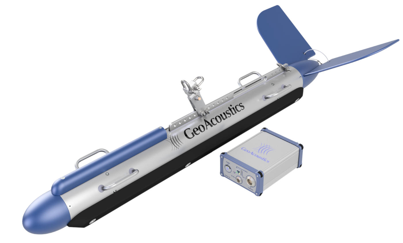
GeoAcoustics Ltd appoints Celestial Tech as Channel Partner in Bangladesh
GeoAcoustics Ltd has appointed Celestial Tech as its official Channel Partner in Bangladesh. The agreement will see Celestial Tech represent the full GeoAcoustics product portfolio, including the new GeoMB multibeam echosounder, GeoScan side scan sonar systems, and GeoPulse sub-bottom profilers.
Celestial Tech is a technology provider with focus on delivering advanced engineering and geospatial solutions across Bangladesh’s growing marine, inland waterway, and infrastructure sectors. With increasing demand for accurate hydrographic data to support port development, dredging operations, river management, and offshore energy projects, the partnership strengthens local access to GeoAcoustics sonar systems.
“Bangladesh is a strategically important market with significant investment in coastal and inland waterway development,” said Richard Dowdeswell, Chief Commercial Officer at GeoAcoustics Ltd. “Celestial Tech is a well-established and trusted player in the market, and brings strong regional insight as well as proven technical capability. This makes them well placed to support our end-users working in complex and dynamic survey environments, and we are pleased to welcome them to our global Channel Partner Network.”
Through the partnership, Celestial Tech will provide sales, integration, and first-line support for GeoAcoustics systems. This includes solutions optimised for shallow water bathymetry, sediment characterisation, and high-resolution seabed imaging, which are all key requirements for inland waterway and coastal survey applications in and around Bangladesh.
“GeoAcoustics systems are well regarded for their robustness and data quality in challenging environments,” said Captain (retd.) Nayeem Muktadir BN, Director Hydrography and Oceanography at Celestial Tech. “With technologies such as the new GeoMB multibeam and field-proven sub-bottom profiler and side scan systems, we see strong alignment with the needs of our clients. We look forward to supporting surveyors, researchers, and marine contractors with reliable and efficient solutions from such a highly regarded subsea technology company.”
The agreement reflects GeoAcoustics’ ongoing commitment to supporting customers through a network of expert regional partners. By working with local specialists, the company ensures that its hydroacoustic systems are deployed effectively and supported throughout their operational lifecycle.
As hydrographic and geophysical survey requirements continue to expand across South Asia, partnerships such as this play a key role in enabling efficient data acquisition and informed decision-making for marine and inland water projects.
ZeroUSV Hosts Defence Leaders in Plymouth as £50m Growth Deal Announced
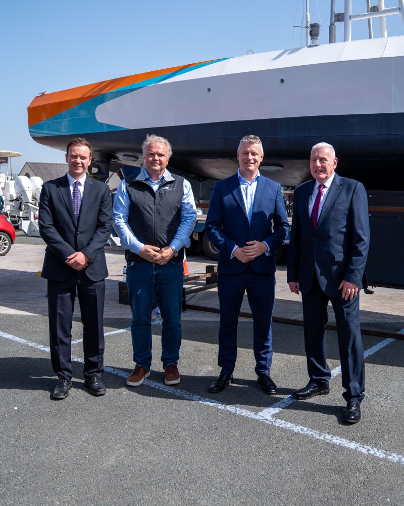
Maritime autonomy specialist ZeroUSV welcomed senior defence leaders to its Plymouth base, as a a major £50 million investment in the region’s defence sector was unveiled, to showcase its OCEANUS class and take part in roundtable discussions on how Plymouth can continue its path to becoming not just a National centre for marine autonomy but a global leader and centre of excellence of maritime autonomy.
Minister for Defence Procurement Lord Coaker, alongside Luke Pollard MP and Fred Thomas MP, visited ZeroUSV’s facilities at Turnchapel Wharf on Wednesday (8 April), where they were given a tour of the company’s facilities including the Oceanus12 USV.
During the visit, ZeroUSV were able to show first hand how the highly successful OCEANUS12 class has been able to provide the benchmarkfor the spiral development of the new OCEANUS17 (17m vessel) currently under construction and due for launch later this summer.
The visit coincided with the announcement of the government’s £50 million Defence Growth Deal (DGD) for Plymouth and the South West – a significant boost aimed at accelerating defence innovation, supporting high-growth businesses, and strengthening the UK’s maritime capabilities.
It also provided an opportunity to highlight ZeroUSV’s role within the National Centre for Maritime Autonomy (NCMA) ecosystem, alongside discussions around the company’s pace of development, scalability, and future growth.
Following the visit, ZeroUSV joined industry leaders and local stakeholders in a roundtable discussion focused on how Plymouth can capitalise on the investment and cement its position as a global hub for maritime autonomy.
Matthew Ratsey, Managing Director of ZeroUSV, said: “The UK has a real opportunity to lead the world in maritime autonomy, and Plymouth is at the heart of that. It was a privilege to welcome Lord Coaker, Luke Pollard and Fred Thomas to our base and demonstrate how quickly sovereign, operational capability can with the right support be delivered from the UK.
“The £50 million Defence Growth Deal is a strong vote of confidence in the region. It creates real momentum for innovation, investment and collaboration across Team Plymouth, and we’re excited to play our part in that journey.”
The Defence Growth Deal is expected to unlock new opportunities for companies developing advanced technologies, including uncrewed and autonomous systems, while supporting job creation and skills development across the South West.
With its strong naval heritage and growing innovation ecosystem, Plymouth is increasingly seen as a focal point for the future of maritime defence – with companies like ZeroUSV helping to drive that momentum.
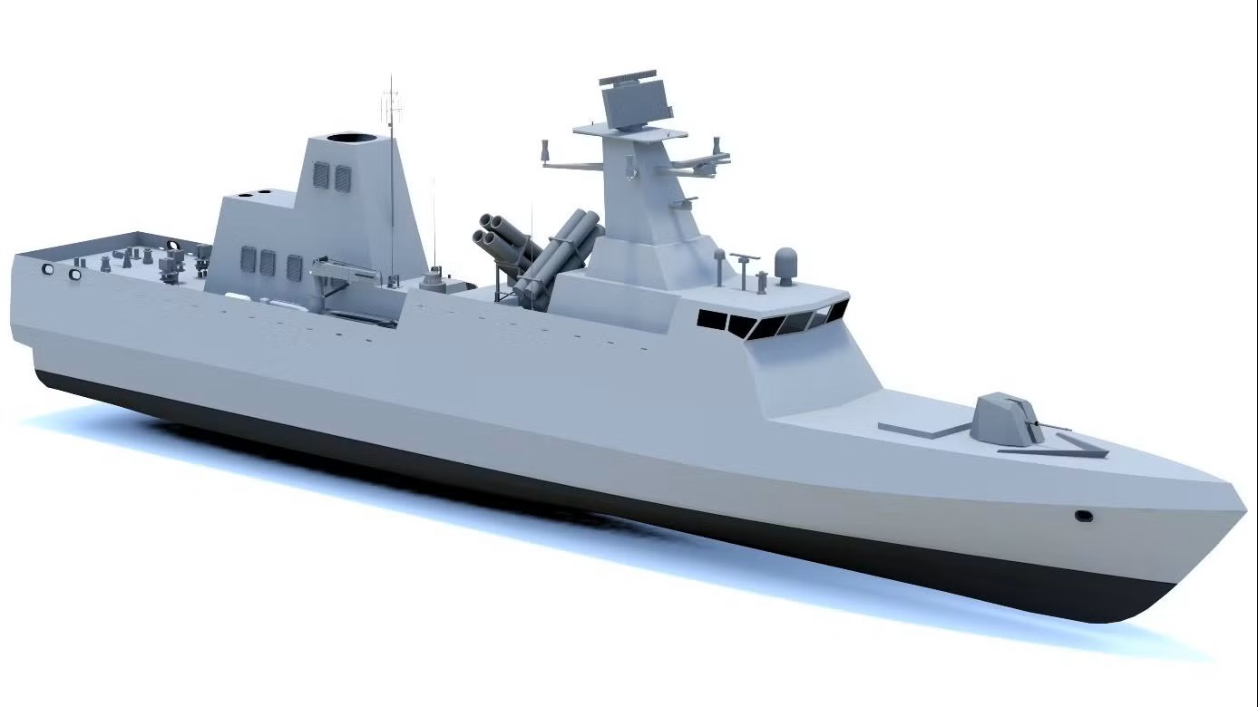
Kongsberg Maritime secures largest-ever waterjet contract for Indian Navy’s Next Generation Missile Vessels
Kongsberg Maritime has signed a landmark contract to supply 18 large Kamewa waterjets for the Indian Navy’s Next Generation Missile Vessel (NGMV) programme. Each of the vessels will feature waterjets, delivering exceptional speed and manoeuvrability for high-performance naval operations.
The NGMV fleet is being built by Cochin Shipyard Limited and will play a critical role in India’s maritime defence strategy.
This contract marks Kongsberg Maritime’s largest single waterjet order to date and signals a strong return to large waterjet manufacturing after a relatively quiet period over the past decade.
A spokesperson for Cochin Shipyard Limited, said: “We are pleased to collaborate with Kongsberg Maritime for the supply of the waterjet propulsion system for the Naval project currently under construction at CSL for the Indian Navy. Kongsberg Maritime has been a valued and reliable partner to CSL across several commercial projects in the past, and the association has been marked by strong technical cooperation and mutual confidence.
“CSL looks forward to Kongsberg Maritime delivering a high-quality and reliable system in line with the exacting standards required for this important project and to their continued support in achieving an important milestone for CSL.”
Anders Valkeinen, Vice President, High-Speed Craft at Kongsberg Maritime, said: “This is a milestone project for Kongsberg Maritime and a testament to the trust placed in our waterjet technology for demanding naval applications. Our Kamewa waterjets will deliver the speed, agility, and reliability required for these advanced missile vessels.”
Anette Holte, Country Manager – India at Kongsberg Maritime, added: “We value our long-standing relationship with the Indian Navy and Cochin Shipyard and are committed to supporting India’s naval ambitions. This contract underlines our dedication to growing our presence in India and delivering world-class technology for critical defence programmes.”
Delivery of the waterjets will align with the NGMV construction schedule at Cochin Shipyard.
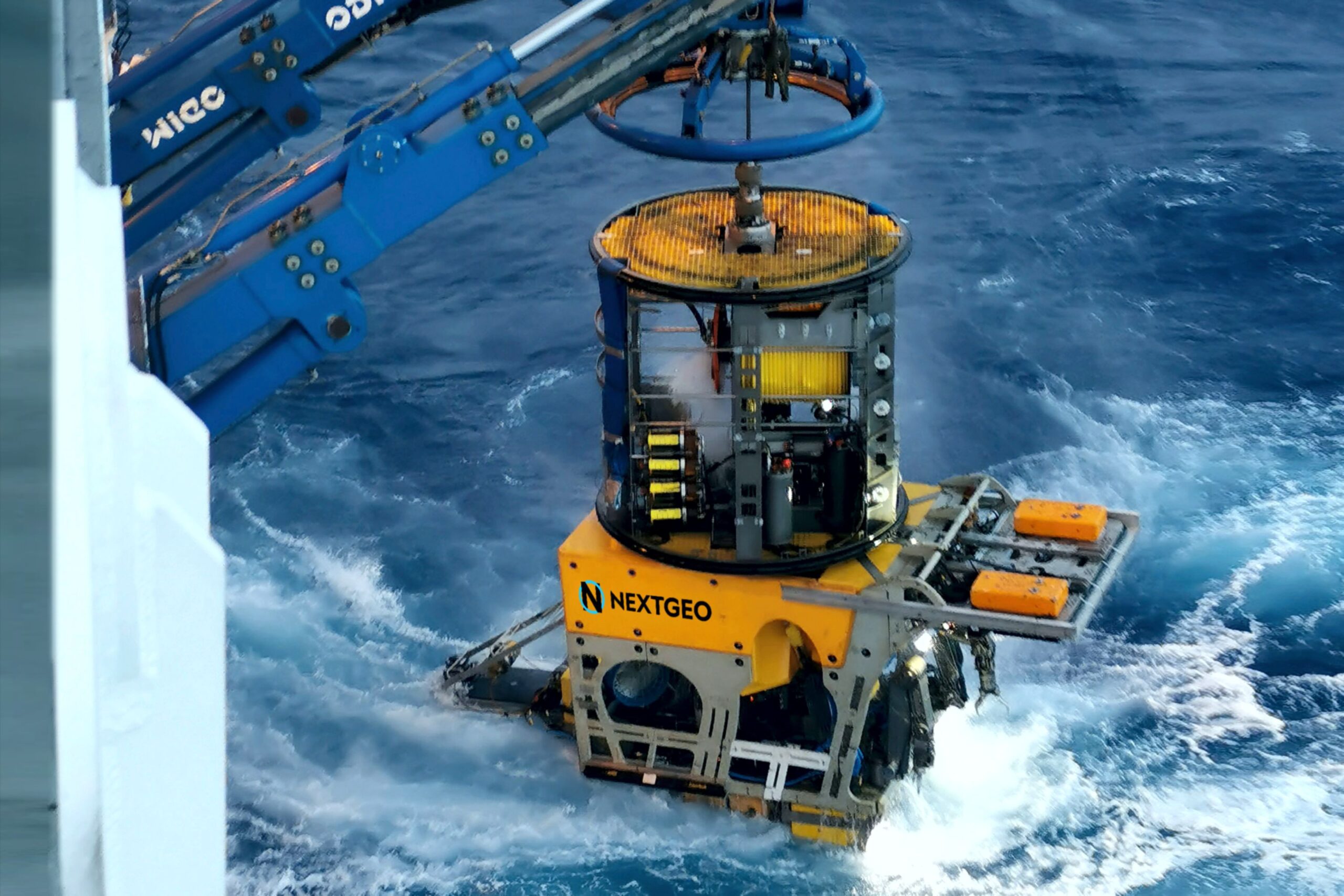
Next Geosolutions awarded, as lead partner in a temporary consortium, Terna tender for preliminary marine survey and environmental characterization of the new HVDC Milan–Montalto link
 CONTRACT VALUE EXCEEDS €28 MILLION
Next Geosolutions (“NextGeo” or the “Company”), one of the leading international players in marine geoscience and offshore construction support services for the energy sector and listed on Euronext Growth Milan market, announces that it has been awarded – as lead partner of a Temporary Consortium (“RTC”) – a tender by Terna S.p.A. (“Terna”) for “preliminary marine survey and environmental characterization” services related to the new HVDC Milan–Montalto connection. The RTC is composed of NextGeo, acting as lead partner with an approximately 84% stake, together with CONISMA (National Inter-University Consortium for Marine Sciences), Poliservizi Srl, and CIBM (Inter-University Center for Marine Biology and Applied Ecology “G. Bacci” of Livorno). The project, which will connect Lazio and Lombardy through a marine route of approximately 280 kilometers, is part of Terna’s innovative Hypergrid initiative, aimed at increasing energy flows between Central-Southern Italy and Northern regions.
The award follows the tender procedure launched on May 28, 2025, with publication in the Official Journal of the European Union (S 102/2025 – 345476). At the end of the process, following technical and economic evaluation and a subsequent negotiation phase, the consortium led by NextGeo achieved the highest overall score, ranking first and securing the maximum contract value, exceeding €28 million.
The project activities will include preliminary marine surveys and environmental characterization along the route of the new high-voltage direct current (HVDC) electrical link connecting southern Milan to Montalto di Castro. The objective is to perform high-precision surveys of cable corridors in order to gather detailed information on seabed morphology, shallow stratigraphy, sediment characteristics, as well as the distribution and status of phyto-zoobenthic communities in both nearshore and offshore areas. The submarine cable section will run from Montalto di Castro (Viterbo) to the area near Avenza (Massa-Carrara). The operational phase is expected to commence in the second half of 2026 and will involve the use of multiple survey vessels.
General Oceans Enters Purchase Agreement with MRV Systems, LLC
 General Oceans has announced that it has entered into a purchase agreement with MRV Systems, LLC.
The addition of MRV to General Oceans expands the Company’s capabilities in long-duration, autonomous data collection and strengthens its position as a global leader in underwater technology. MRV Systems has around 22 employees and has offices in San Diego, Wood Dale (HQ) and Seattle, increasing General Oceans’ US footprint. The Transaction will further enhance General Oceans’ growth strategy and enable collaboration between MRV and its existing brands, realising the benefits of the Group’s global capabilities. It marks yet another acquisition in accordance with General Oceans’ growth strategy and expands the recent track record of successful acquisitions.
About the MRV acquisition, Atle Lohrmann, President of General Oceans, said:
“MRV is a great fit for General Oceans, and we’re excited to have them join our growing Group. General Oceans has a proud tradition as a provider of advanced instrumentation and sensors to the scientific community making MRV a natural fit. With access to the Group’s extensive sales network and engineering experience, we believe we can develop MRV’s global presence quickly and explore new revenue opportunities as we move forward.”
Founded in 2010 as a spin-off from the Scripps Institution of Oceanography, MRV has become a trusted supplier of advanced profiling vehicles for ocean research, climate monitoring, and maritime domain awareness. It currently contributes meaningfully to the U.S. commitment of profiling floats to the Argo program. MRV is well established with strong US presence and serves customers such as NOAA, NASA, the U.S. Naval Oceanographic Office.
About joining General Oceans, Shawn Vasquez, President & CEO of MRV said:
“I am excited for the future of MRV as part of General Oceans. Collaborating across the Group will allow MRV to accelerate delivery of innovative solutions to meet our customers’ ocean technology needs. MRV is delighted to join a Group with a shared passion for continuously growing our knowledge of the ocean through ongoing research, development and innovation in the ocean technology space.”
Regarding the MRV sale, Fred Maas, outgoing Executive Chairman of MRV, stated:
"We are thrilled to participate in the announcement of General Ocean's acquisition of MRV Systems. From a tiny lab in San Diego with only the Scripps and Woods Hole Institutes of Oceanography as its customers, MRV grew to 3 offices in 3 states and over 30 customers. Most importantly, MRV has participated in a vast expanse of our knowledge of the world's oceans. We look forward to watching its continued success."
For more information on MRV, visit https://www.mrvsys.com/.

Mapping the Unmappable: Sulmara Discover and the Nunavik EAUFON-3 Project
 Set in the Arctics harsh and challenging environment and in waters too shallow for traditional vessels and systems, the Nunavik EAUFON-3 Project required a new approach. That was the challenge facing Seaforth Geosurveys while assessing the seabed for a planned fibre-optic cable installation in Ungava Bay, Canada.
Sulmara's answer was Sulmara Discover: a bespoke technology stack combining a high-resolution 3D Synthetic Aperture Sonar (SAS) sub-bottom system with inertial navigation and positioning sensors. This was mounted on a remotely operated Uncrewed Surface Vessel (USV) to acquire data, with in-house software packages for processing, interpretation and delivery. It's the only system of its kind.
"Seaforth selected as our unique solution to deliver the performance they needed in a remote location with incredibly challenging seabed conditions," said Darius Rivera, Sulmara Project Manager.
A Platform Built for the Challenge
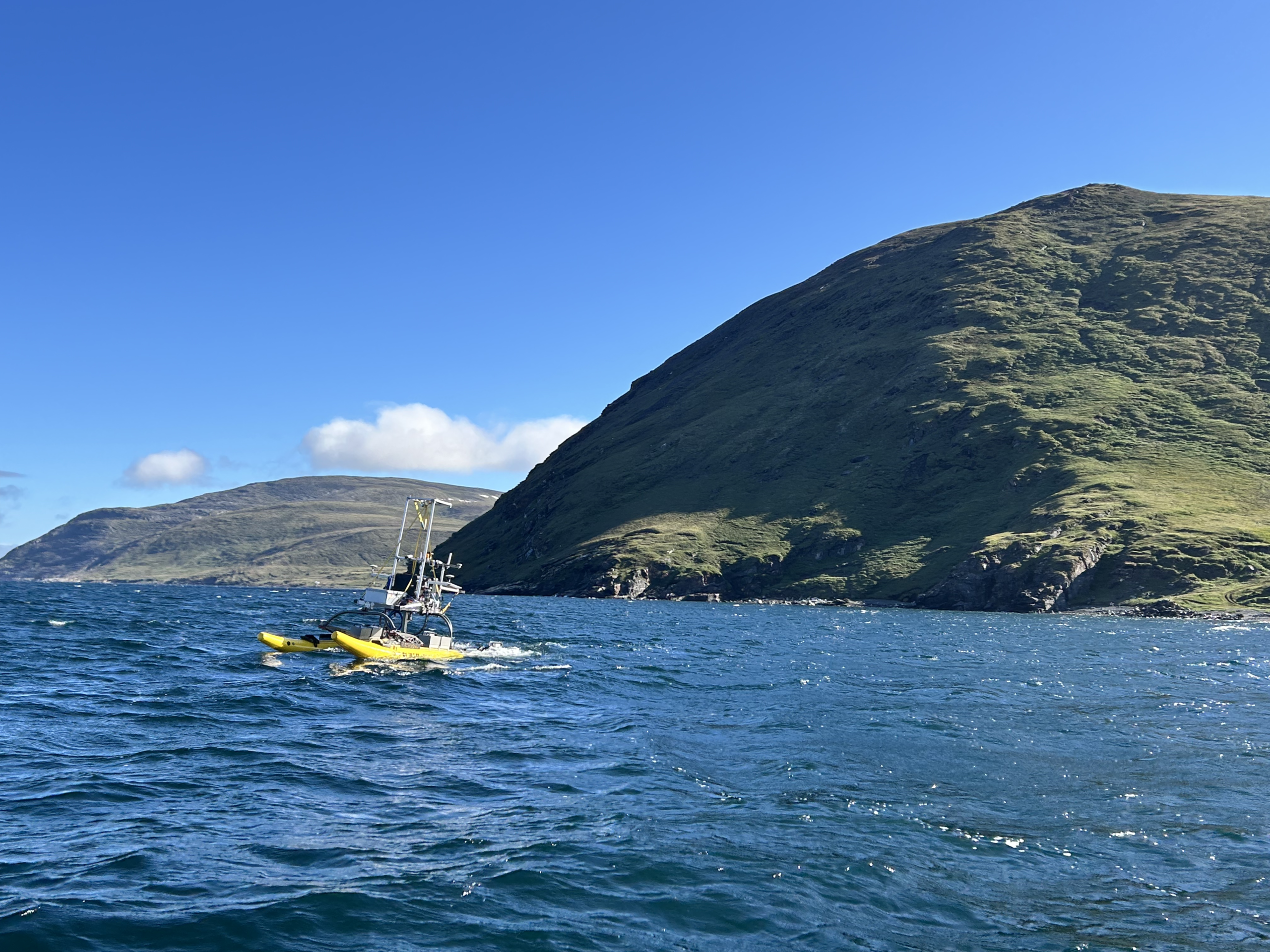
Sulmara used the WAM-V 16 USV, working closely with Seaforth to launch by crane from the Coriolis II mothership. The stability provided by the WAM-V 16’s independently mobile pontoons, along with the shallow draft, provides the perfect platform. The system was operated both locally and over-the-horizon from Sulmara’s Remote Operations Centre in Glasgow, UK.
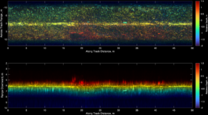
As part of the Sulmara Discover package, the WAM-V 16 was equipped with the EdgeTech Buried Object Scanning Sonar (eBOSS), providing high-resolution, three-dimensional sub-bottom data in an area with some of the world's largest tidal ranges along a cable route littered with boulders above and below the seabed. This full-volume sub-bottom data set at 5cm resolution is collected across a 120° swathe, enabling rapid coverage over large areas.
Surface and buried boulders were mapped in size, depth and density to allow the end client to assess cable burial or protection measures at several landfall locations.
“This survey represents a significant advancement in the ability to map both surface and subsea boulders. Conducting nearshore operations with the WAM-V 16 reduces costs while extending high-quality ground model coverage closer to shoreline landings. In contrast, a traditional survey approach, relying on sub-bottom profiling and side scan sonar, would require substantially more time and yield lower-quality information. The data provided by Sulmara Discover is invaluable for detecting and avoiding buried hazards, enabling better-informed decision-making for cable routing and burial operations,” said Kevin Rychert, Sulmara’s Principal Acoustic Scientist.
This was a team effort with Seaforth, with the companies working closely together through planning, execution and delivery phases of the project. The Discover deliverables were developed and adjusted according to feedback from Seaforth before being combined with data collected by Seaforth to deliver a comprehensive dataset of the seafloor and subsurface.
Ben Wentzell, Senior Geologist at Seaforth said, “Sulmara’s commitment to quality was evident from initial mobilisation through to final reporting. Their field and office teams worked closely with all parties, while consistently innovating and adapting to meet project specifications and deliverables. The use of the Discover workflow provided a turnkey geophysical and subsurface hazard solution for an exceptionally challenging environment.”
Solving a New Kind of Problem
Previous projects using ROVs or ROTV systems operate at a fixed, controlled distance from the seabed. This survey was different. Water depths shifted dramatically from less than one metre to 20 metres in a few metres, requiring continuous sensor adjustment and an entirely new approach to eBOSS data processing. This was made possible with Sulmara's in-house software, developed specifically for eBOSS datasets. “Historically, they would be running on an ROV at a precise height above the seafloor,” highlights Dennis Wilson, Principal Development Scientist at Sulmara. “As we move to surface-mounted systems, the challenge is interpreting datasets acquired at a dynamic range in a single pass.”
Ultimately, the collaboration between Sulmara and Seaforth Geosurveys delivered a unique, high-quality dataset that gives the end client confidence to move forward to cable installation, safely, efficiently and with certainty.
IQUA Robotics validates the use of AUVs for autonomous ship hull inspection
The ESCABVENTS project, developed by the company IQUA Robotics in collaboration with the Zamakona Yards shipyard, has successfully concluded its proof of concept tests, demonstrating the viability of using Autonomous Underwater Vehicles (AUVs) for naval inspection tasks. This initiative, integrated into the Sail2future project, seeks to improve efficiency and safety in the preventive maintenance of vessels. The project has been funded by the European Union – NextGenerationEU through the PERTE NAVAL aid managed by the Spanish Ministry of Industry, Trade and Tourism, within the Recovery, Transformation and Resilience Plan.
Advances in autonomy and data capture
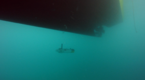
The research has focused on overcoming the limitations of current methods, which usually rely on divers or tethered robots (ROVs). The use of an autonomous vehicle like the Sparus II AUV allows for systematic hull scanning without direct intervention from an operator in piloting.
Throughout the project, several key technical capabilities have been validated:
- Adaptive tracking: The vehicle uses a multibeam sonar to detect the hull profile in real-time, adjusting its navigation to maintain a constant distance.
- Systematic navigation: The system executes adaptive “lawnmower” type trajectories that ensure complete and uniform coverage of the inspected area to collect hull images.
- Operational safety: Protocols have been implemented that allow the vehicle to perform automatic escape maneuvers towards free zones in case of experiencing a failure and ensure that the vehicle does not get trapped under the hull
Results and practical applications
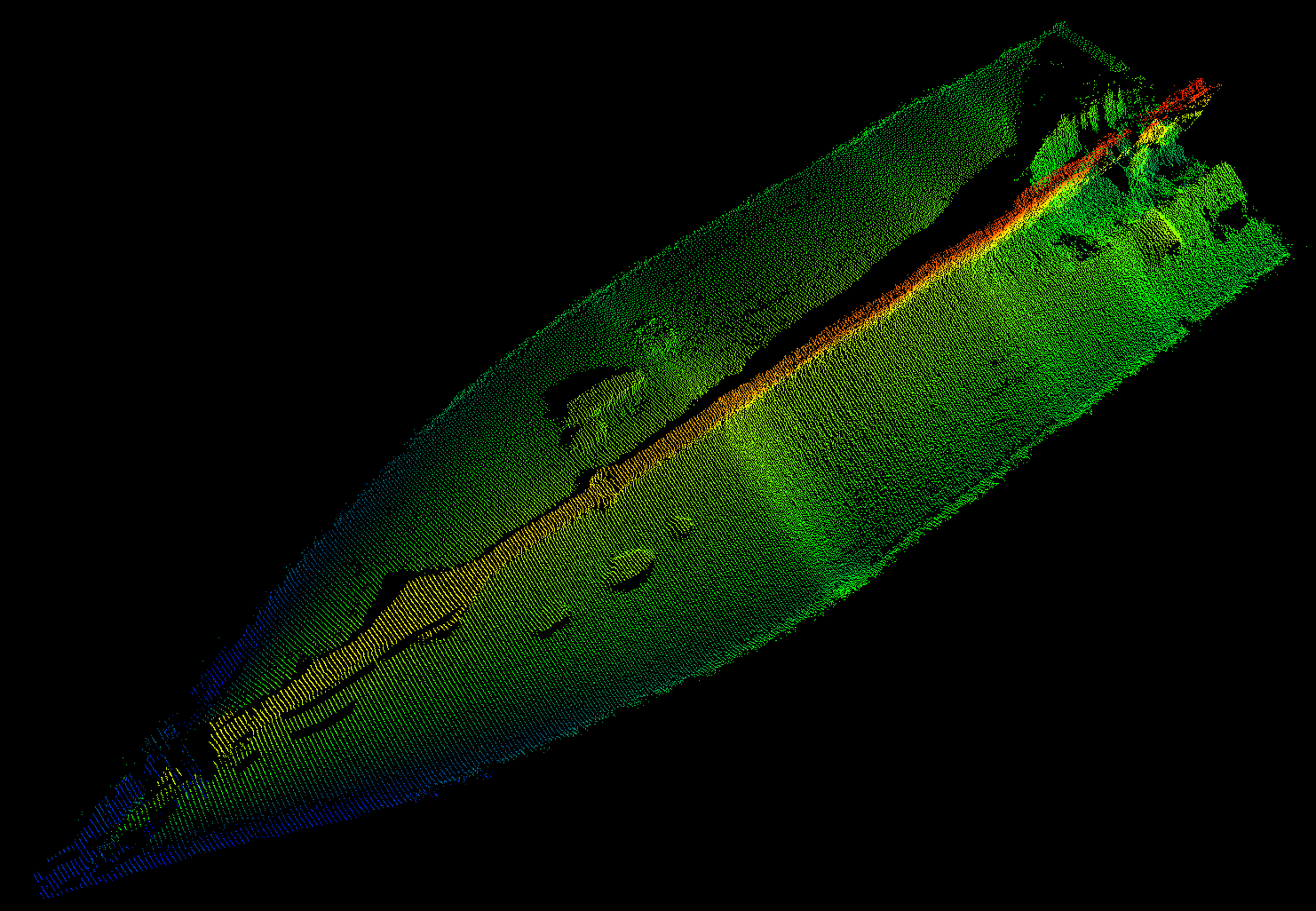
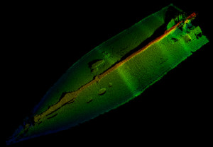
Experimental tests, carried out in collaboration with the Zamakona Yards shipyard and the staff of Reparaciones Navales Canarias, have been fundamental to validate the system in real port environments. These campaigns allowed the collection of multiple datasets on four vessels of different types, including fishing, research, and defense ships. The results show that it is possible to obtain 3D reconstructions with centimetric resolution, facilitating the identification of corrosion, marine fouling (biofouling), or paint damage.
Next steps toward specialization
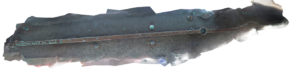
Although the system has proven effective in the uniform sections of the hull, research has identified challenges in areas of complex geometry, such as the stern (propellers and rudders), where acoustic reflections complicate automatic tracking. Likewise, difficulties have been detected in taking images of the sides of the vessel, as the high light contrast of the surface causes underexposure in these areas. Therefore, future technical steps include:
- The design of new payloads with multi-camera systems and artificial lighting to improve visual quality.
- The exploration of 3D sonars to anticipate abrupt changes in the vessel’s profile and improve the vehicle’s control response.
In addition to industrial maintenance, this technology is expected to be applicable in port security for the inspection of critical infrastructure or the detection of threats and contraband adhered below the waterline.
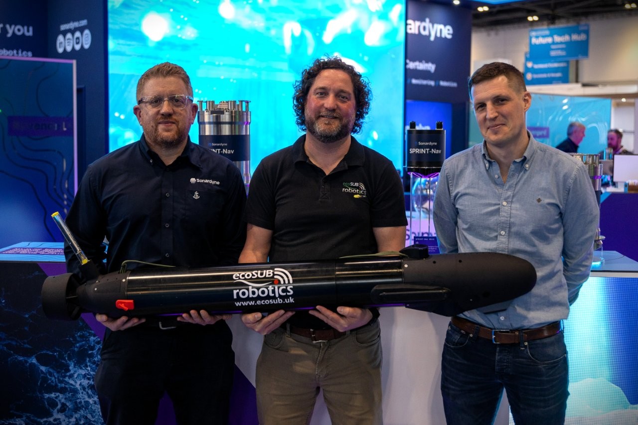
Njord Survey selects Sonardyne navigation for ecoSUB AUVs
Swedish innovator Njord Survey has chosen Sonardyne navigation technology for its ecoSUB Robotics autonomous underwater vehicles (AUVs) to transform subsea survey operations.
Using Sonardyne’s smallest navigator, SPRINT-Nav U, on ecoSUB’s low-logistics AUVs, Njord Survey is targeting at-scale survey operations, starting with UXO surveys.
Underpinned by accurate navigation, deployment at scale will enable parallel operations, reducing vessel dependency, logistics, cost and time for these types of survey.
Combining detection and verification and allowing re-tasking, with the same easily transportable platforms, also means surveys can be delivered faster and more flexibly, without compromising data quality, says Gothenburg, Sweden, based Njord Survey.
Anders Wikmar, Survey and Technical Director, at the company, which provides high‑quality, low‑carbon hydrographic and geophysical surveys, says, “Our goal is bringing smart and cost-effective solutions to the market by pushing the boundaries working with partners like ecoSUB and Sonardyne.
“Using ecoSUB’s small AUVs at scale lets us move beyond one-platform, one-vessel operations and deploy multiple platforms in parallel, dramatically improving survey efficiency.
“By reducing vessel dependency and combining detection with visual verification on the same platform, we cut false targets, save further vessel time and can re-task vehicles quickly – delivering faster, more flexible surveys without compromising data quality.
“This can only work if each vehicle can collect data that is spatially reliable enough for detection, correlation and verification. SPRINT-Nav U provides the level of navigation performance we need, making these operational gains possible and that’s not something logistically possible or cost effective before.”
Iain Vincent, Director & General Manager, at ecoSUB Robotics, says, “With SPRINT-Nav U providing reliable, survey-grade navigation into our one person-portable AUVs, we’ve been able to move from standard, off-the-shelf designs to a more engineered, project-focused approach.
“This means creating vehicles that can carry high-quality payloads, operate independently and adapt to evolving customer needs. Together with Njord survey, we’re transforming small AUVs into scalable, primary survey platforms.”
Njord Survey plans to put its ecoSUB straight into operation on client projects to demonstrate benefits from day one as it proves and evolves its survey offering.
Aidan Thorn, Marine Robotics Business Development Manager, at Sonardyne, adds, “In the past, small-scale AUV navigation has been the limiting factor, because position accuracy hasn’t matched survey requirements.
“SPRINT-Nav U removed these limits. It is unlocking collaborations like this that show how by working together we can bring new, smart and cost-effective safe, secure and environmentally sound solutions into the market.”