
Ocean Infinity acquires Geowynd
Ocean Infinity, the marine robotics company, is excited to announce that it has acquired marine geotechnics experts, Geowynd.
Based in the UK and serving clients all over Europe, Geowynd’s team of geotechnical engineers provides consultancy services to aid the safe and optimal development of offshore renewable energy projects.
Geowynd’s market leading geotechnical analysis services include developing smart site investigations, advanced laboratory testing strategies and optimised de-risked foundation design and installation solutions.
The acquisition comes as Ocean Infinity continues to develop its ‘Armada’ robotic vessels to serve the offshore renewables industry with the provision of geophysical, geotechnical and operation and maintenance services. Whilst Geowynd will continue to operate under its own brand and service its well-established client base, the acquisition will present opportunities to combine Ocean Infinity’s robotic vessels, data, artificial intelligence, and low emission operations with Geowynd’s geotechnical expertise to provide sustainable, data-driven services to the renewables sector.
Oliver Plunkett, Ocean Infinity’s CEO, said:
“There is no question that renewable energy is the key to a sustainable future. Striving towards a cleaner and greener future is hugely important to Ocean Infinity, it drives everything we do. The role that Geowynd is playing in making renewable energy a reality makes them a natural fit for our business. There will of course be opportunities to combine our complementary expertise and capabilities, particularly as we move closer to mobilising Armada, to build upon Geowynd’s existing work in sustainably supporting the energy industry in its necessary transition to renewables. On behalf of everyone at Ocean Infinity I extend a very warm welcome to the team.”
Andrew Galbraith, Geowynd Director, said:
“We are thrilled to join forces with Ocean Infinity to combine our advanced geoconsulting business with new innovations in marine robotics and geotechnics. Together, we will drive the offshore renewables industry forward as we connect offshore site characterisation and laboratory testing to cutting-edge foundation design methods. We are very excited to join our new colleagues, who share the same goal as the Geowynd team, to deliver innovative, state-of-the-art solutions that we are truly proud of and that help realise our ambition of a green and prosperous future.”

FET to deliver ROV life extension project to support international telecoms
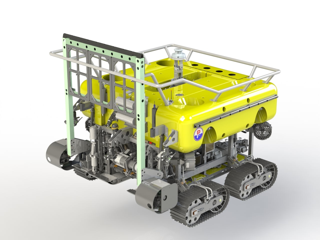
Forum Energy Technologies, Inc. (FET) today announced that it has been awarded a contract to provide a life extension (Lext) upgrade on one of its Perry ST200 Trenchers. The next upgrade will be completed for a Western Hemisphere telecommunications equipment company The enhanced asset will support the installation and maintenance of subsea cables that are a vital component of an international communications network.
This project marks FET’s second life extension upgrade for an ST200 trencher and follows on from the successful sea trial of the first upgrade last year.
FET’s Lext service provides remotely operated vehicle (ROV) operators with a cost-effective solution to ageing subsea vehicles and technology obsolescence by increasing the asset’s life in some case more than a decade.
As part of the work scope, FET will completely remove all obsolete components and associated parts within the control system and replace them with the latest evolution in control system hardware and software. The upgrade benefits from over 60 years of ROV development at FET, and will provide increased reliability and improved support, while also minimizing downtime.
FET has produced more than 800 Perry and Sub-Atlantic ROV systems over the past six decades. All vehicle manufacturing is certified and compliant to ISO 9001 and 18001 to provide safety and reliability assurance.
The latest Lext upgrade is based on the newest developments in work-class ROV and trencher technology. These vehicles feature significantly enhanced performance across the full range of demanding intervention, survey and trenching tasks without compromising the outstanding reliability which the original Triton vehicles are known for.
Kevin Taylor, FET’s Vice President - Subsea Vehicles, said:
“We recognised the opportunity to provide a more cost-efficient solution to ageing vehicles while still delivering the high quality, robust assets that FET is renowned for. This award underlines our ongoing commitment to delivering new and innovative technological solutions to the subsea industry across the blue economy.
“This is the second life extension upgrade for this client in the last 12 months and it’s fantastic to see customers continue to recognise the reliable performance our trenchers deliver and the operational sustainability the Lext service provides.”
The upgrade will be carried out at FET’s facility in Bryan, Texas, using components manufactured at FET’s UK facility in Kirkbymoorside, Yorkshire. It is expected to be delivered in the third quarter of this year.
Greensea Enters into Contract with Ocean Power Technologies
The next generation of OPT’s Maritime Domain Awareness System (M-DAS) will use the OPENSEA platform
Greensea Systems, creator of OPENSEA®, the universal open architecture software platform for the marine industry, recently contracted with Ocean Power Technologies (OPT) to provide development and engineering services. During the three-year contract, Greensea will support OPT to develop and launch the next generation of their PowerBuoy®-based Maritime Domain Awareness Solution (MDAS) on the OPENSEA platform and will work closely with OPT’s other software partner, Fathom5.
“This is an exciting project to be involved in and it speaks to the versatility of open architecture and OPENSEA,” says Ben Kinnaman, Greensea CEO. “It also takes into consideration what working with Greensea is all about, an open business relationship where we work collaboratively with all partners to develop their differentiating technologies based on the proven and stable technologies of OPENSEA. This is the only way to eliminate the barriers that often prevent rapid technology advancement.”
James Truman, VP of Engineering for Greensea, says;
“We’ll be standing up an engineering payload unit at our Plymouth, Massachusetts facility which will provide a continuous ‘live’ test and eval system for us and Fathom5. Greensea’s over-the-horizon command and control suite, SafeC2™, will be playing an important role in the OPT project.”
“There is growing international focus on Maritime Domain Awareness to prevent and prosecute activities from some of the most remote areas of the seas,” says Philipp Stratmann, OPT President and CEO. “Greensea brings decades of experience in developing agile and adaptable software solutions that can help our products withstand the harshest ocean environments. Along with Fathom5, Greensea will allow us to seamlessly integrate video and radar from a PowerBuoy®-based Maritime Domain Awareness Solution with available satellite, weather, bathymetric, and other data feeds to form a customizable and detailed surface and subsea picture of a monitored area as we develop a best-in-class autonomous threat detection solution.”
Fathom5 CEO Zac Staples remarks, “We are excited to be a part of the team put together by OPT and we are looking forward to working with Greensea to deliver this important advance in maritime domain awareness.”
The Nippon Foundation-GEBCO Seabed 2030 Project and Kongsberg Maritime enter partnership as the race for a complete map of the world's seabed accelerates
The Nippon Foundation-GEBCO Seabed 2030 Project and Kongsberg Maritime have entered a Memorandum of Understanding in support of the global initiative to produce the complete map of the ocean floor. Under the terms of the MOU, the two parties will work together to advance understanding of ocean bathymetry. The effort complements the goals of the United Nations Decade of Ocean Science for Sustainable Development.
Seabed 2030 is a collaborative project between The Nippon Foundation and GEBCO to inspire the complete mapping of the world's ocean by 2030, and to compile all bathymetric data into the freely available GEBCO Ocean Map. GEBCO is a joint project of the International Hydrographic Organization (IHO) and the Intergovernmental Oceanographic Commission (IOC), and is the only organisation with a mandate to map the entire ocean floor.
Kongsberg Maritime provides solutions for safe, efficient and sustainable maritime operations. The solutions are suitable for offshore energies, seaborne transportation, hydrography, science, navy, coastal marine, aquaculture, training services and more. Kongsberg Maritime is the largest business area within Kongsberg Gruppen ASA. The Group has an integrated portfolio of solutions for businesses, partners and nations operating from the depths of the sea, to outer space and to the digital frontier.
“Seabed 2030 greatly welcomes the support of Kongsberg Maritime,” commented Jamie McMichael-Phillips, Director of the Seabed 2030 Project. “Kongsberg’s prominent capabilities in providing sustainable maritime operations closely align with our ethos and aim here at Seabed 2030.”
Bjørn Jalving, Senior Vice President Technology Kongsberg Maritime said: “As an organisation committed to offering the best marine technology, we are delighted to support Seabed 2030 in its mission of producing the definitive map of the seafloor.
“We envisage our systems for surveying, positioning and navigation to contribute rewardingly to this imperative global effort. We will specifically develop freely available functions to Kongsberg Maritime multibeam echo sounders, single beam echo sounders and AUVs that ease the process of contributing bathymetric data to the Seabed 2030 data centers. The development will be collaboratively with the University of New Hampshire and Stockholm University.
A complete map of the seafloor is a critical first step in understanding our planet through ocean exploration. We’re proud to support the Seabed 2030 Project.”
All data collected and shared with the Seabed 2030 Project is included in the GEBCO global grid, which is free and publicly available.
A project monitoring the water quality during the renovation of the old warehouse city of Hamburg - a heritage resting on aged oak poles - is managed by MacArtney Germany.
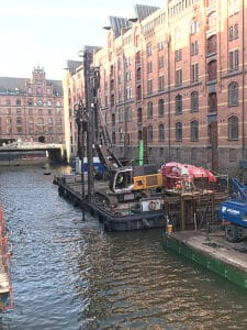 As of 2015, the world's largest complex of warehouses, Speicherstadt Hamburg (warehouse city, Hamburg), is a UNESCO World Heritage Site. Speicherstadt's beautiful neo-gothic red-brick architecture and winding network of streets, fleets and bridges erected into the Elbe river is an 'extraordinary example of representing the value of trade in Hamburg during its foundation.
The Speicherstadt, built between 1885 and 1927, rests on thousands of oak poles that have deteriorated over time due to a slow advancing bacterial decomposition and indentation of the fleet bed as a result of an expanded tide difference.
Renovation work is necessary to prevent the poles from sinking towards the fleets, including bed reconstruction arrangements raising the fleet bed by 0.5 to 1.5m and supply of bearing sand. Furthermore, the bed is stabilised with cement.
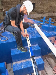
Incorporating these measures - a process ranging from Fall 2020 to Summer 2021 - necessitates an accompanying water quality monitoring, especially controlling and remedying any impacts on the water quality caused by the cement placement.
For this purpose, nine EXO1 Multiparameter Sondes from US manufacturer YSI are placed in different locations close to the ground on the existing fleet poles. The EXO 1 Sonde measures temperature, conductivity, pH value, dissolved oxygen content and turbidity every 5 minutes over several days and time sequences. The sondes feature internal data storage and power supply for autonomous operating.
MacArtney Germany was commissioned to take on the supply of the multiparameter sondes, including a measurement and service concept for the project and all planning plus execution of the water quality measuring. This involves regular calibration and maintenance of the sondes in the in-house workshop, data provision and installation and de-installation of the sondes on-site.
Working in the fleets requires flexibility and swiftness. The environment is tide dependent, generating relatively short time windows following the water level. The water quality measurements were conducted throughout the renovation work, with brief interruptions for calibration, processing and data evaluation.
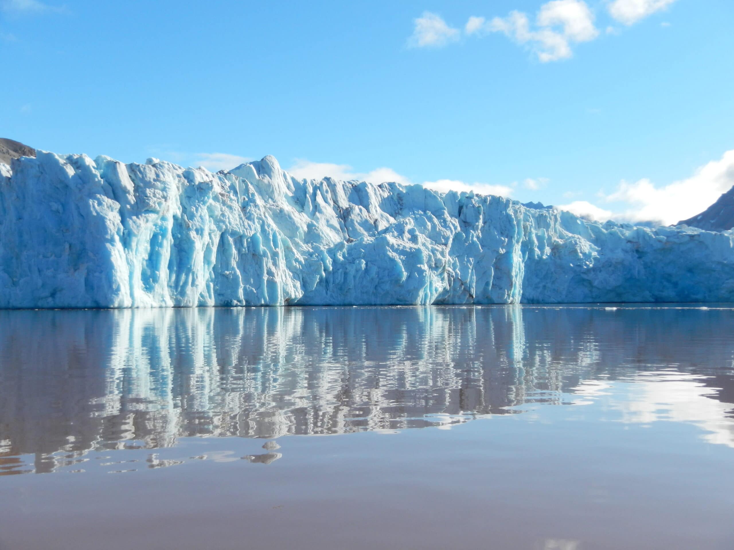
Marine robotics to help uncover hidden link in glacier melting
On Friday 13th August 2021, Marine scientists deployed robotic vehicles on a dangerous mission to the face of a glacier in Svalbard as they attempt to expose the hidden link in how rapidly melting Arctic ice is changing our ocean.
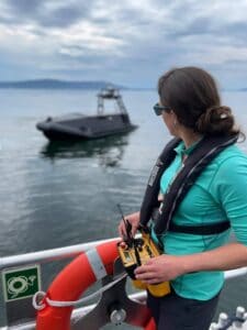 The mission to Ny Ålesund, the world’s most northerly settlement, is a collaboration between the Scottish Association for Marine Science (SAMS), UiT The Arctic University of Norway, the Norwegian Polar Institute and University Centre on Svalbard. The team will examine the Kronebreen glacier in Kongsfjorden, measuring the freshwater run-off as it melts, and assessing how it interacts with the saltier sea water coming into the fjord from the North Atlantic.
Humans are unable to sample at the glacier face because of the risk of huge chunks of ice collapsing into the sea below, a process known as glacier calving.
Instead, the team will use an autonomous surface vehicle (ASV) built by Norwegian company Maritime Robotics, to record various oceanographic measurements at the face of the glacier, while an autonomous underwater vehicle, known as an ecoSUB, will take temperature, salinity and oxygen readings below the surface. Meanwhile, aerial drones will survey the so-called freshwater ‘plumes’ that run off from the glacier.
Lead scientist Prof Finlo Cottier of SAMS said:
“Fjords are the connection between the changing ocean and our rapidly melting northern glaciers. The transfer of heat and water at these points, often just a few kilometres wide, are therefore extremely important in understanding how climate change is impacting our ocean.
However, as these areas are too dangerous to survey fully and too small to be picked up on global ocean models, the interactions between fjords and glaciers have not been sufficiently represented in ocean and climate predictions. We need to know much more about the fresh water coming into the ocean: How much is there? Where does it end up? How does it move?It would simply be too dangerous to go into such a hostile and remote environment with a boat. Not only is there a risk of falling ice, but large-scale calving causes huge waves, so it is a dangerous place. That is where the robotic systems come into their own, working at the front line of Arctic science.”
While rising global temperatures increase glacial melt, glaciers are also breaking up below the surface of the water. In a process known as sub-glacial discharge, melt water flows down through the glacier and out into the ocean. This water is fresher than the surrounding sea water, so starts to rise in the water column, creating a plume that pulls in warmer Atlantic water which increases the melt rate at the face of the glacier. This process undermines the wall of ice, causing huge chunks to collapse into the sea.
The marine robotics deployed by the team will collect crucial data to improve our understanding of this process.
The mission is scheduled to last seven days and the team, which includes SAMS Prof Mark Inall and University of the Highlands and Islands PhD student James Coogan, will be based in Ny Ålesund, making daily visits to the glacier.
SAMS has close links with project partner UiT The Arctic University of Norway: Prof Cottier has an adjunct professorship at the Norwegian institute, while UiT’s chief technician for the ASV Dr Emily Venables was previously part of the SAMS robotics team.
Oceaneering and DDK Positioning Sign Service Agreement Enhancing C-Nav® Positioning Solutions’ Offerings
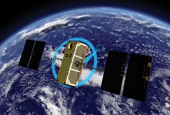
Oceaneering International, Inc., and DDK Positioning Limited announced the companies have entered into an agreement for the provision of GNSS (Global Navigation Satellite System) augmentation service and all associated software and hardware supporting Oceaneering’s C-Nav® Positioning Solutions group offerings.
DDK Positioning’s services are delivered exclusively through the Iridium® satellite communications network coupled with hardware developed by partner Topcon. This pairing of cutting-edge hardware and advanced communication infrastructure will enhance the ability of Oceaneering’s customers to precisely position their assets globally. This unified solution offers several benefits to Oceaneering’s positioning customers including, two-way communication enabling machine control and feedback, and redundancy to cover potential signal losses.
From launch, DDK Positioning will provide its MAX service to Oceaneering clients, which can achieve accuracy to less than 10 cm (2 Sigma). The MAX service uses both GPS, Galileo, and GLONASS constellations with further systems to be added within a year.
Eric Smith, Director of Survey Services at Oceaneering, said:
“There have been significant advances made in communications infrastructure and satellite positioning technology over the last several years. With this agreement, Oceaneering will be able to offer enhanced positioning technology allowing us to build on our strong industry track record while continuing to serve the positioning needs of our clients now and into the future.”
Kevin Gaffney, CEO at DDK Positioning said: “We are absolutely delighted to have signed an agreement with Oceaneering to provide our precise and reliable GNSS positioning solution to Oceaneering’s customers in the maritime energy industry.
“This agreement demonstrates the need for an alternative GNSS augmentation service that increases the reach of services from Pole to Pole, with the added benefit of Iridium’s resilience and reliability. We are looking forward to working with Oceaneering to enhance their service and product portfolio while delivering market leading services for many years to come.”
Learn more: oceaneering.com/positioning-solutions

Metocean studies underway for first floating wind farms in Welsh waters
A metocean study supporting the design of the first floating offshore wind (FLOW) projects in Welsh waters is underway.
Blue Gem Wind (BGW), a joint venture between Simply Blue Energy and TotalEnergies, is the developer behind two Celtic Sea floating offshore wind projects, Erebus and Valorous.
BGW has appointed ABPmer to deliver the certifiable metocean design bases to inform front end engineering design (FEED) and Detailed Design for both projects. This includes the production of fully calibrated spectral wave and hydrodynamic hindcasts.
Heidi Roberts, Head of Modelling and Physical Processes at ABPmer, said;
“Alongside our physical process work to support the consenting of Erebus, we are thrilled to continue working with BGW on these exciting projects.“
“We will refine our existing models using ABPmer’s SEASTATES hindcast database, enabling us to fully represent the regional oceanographic conditions and nearshore processes, providing a bespoke 40-year hindcast of both hydrodynamics and waves. Detailed metocean analysis will then be completed on the calibrated hindcast and metocean design bases produced.”
The study will provide extreme and operational metocean criteria for the array and export cable corridors for both projects, with delivery in late summer 2021.
ABPmer’s metocean consultants use the global SEASTATES hindcast models and extensive suite of metocean analysis software to support projects worldwide.
More information www.metocean.com

Kraken Completes Acquisition of PanGeo
Kraken Robotics Inc. (“Kraken” or the “Company”), Canada’s Ocean Company, is pleased to announce that it has completed the acquisition of PGH Capital Inc. (the “Acquisition”) on terms previously disclosed in the Company’s press release dated July 20, 2021. PGH Capital operates its business through its subsidiaries, PanGeo Subsea Inc. and PanGeo Subsea Scotland Limited (collectively with PGH Capital, “PanGeo”). PanGeo is a services company specializing in high-resolution 3D acoustic imaging solutions for the sub-seabed with offices in St. John’s, Newfoundland and Aberdeen, United Kingdom. Upon closing, PanGeo is now a wholly owned subsidiary of Kraken Robotic Systems Inc. Under Kraken’s ownership, PanGeo will continue to operate as a trusted name in sub-seabed imaging and will complement Kraken’s turnkey offering of high-resolution subsea imaging services.
Karl Kenny, Kraken President and CEO said, “We are pleased to have completed this acquisition and to welcome the PanGeo employees to the Kraken team. Together we offer a holistic solution of world-leading technologies and services in subsea acoustic and optical imaging, autonomous robotics, and subsea batteries for customers in the defense and commercial markets. We are also excited for the increased exposure to the offshore renewable energy market and believe we can bring technologies to bear that will drive down customer costs, improve safety, and reduce their emissions footprint.”
The Acquisition constituted an “Expedited Acquisition” in accordance with TSX Venture Exchange Policy 5.3 – Acquisitions and Dispositions of Non-Cash Assets. All common shares issued in connection with the transaction are subject to a restriction from trading for four months and a day from the date of issuance.
In connection with the acquisition, Kraken’s Board of Directors has approved the issuance of 1,000,000 options to an officer of PanGeo. These options have a five-year term and an exercise price of $0.50 per common share.
UPDATE ON BOUGHT DEAL OFFERING
In connection with the Company’s previously announced “bought deal” short form prospectus offering of units (the “Offering”), the Company paid the syndicate of underwriters led by Canaccord Genuity Corp., and including Raymond James Ltd., Desjardin Securities Inc., Beacon Securities Limited, and Research Capital Corp., an aggregate commission of $600,000, equal to 6.0% of the gross proceeds from the Offering.
LINKS
www.krakenrobotics.com


Pete Craigmile Joins Teledyne Marine Americas Sales Team

Teledyne Marine is pleased to announce that Pete Craigmile has joined the organization in the key role of Technical Sales Manager for OEM accounts in the Americas. Pete will serve as the primary sales contact and technical liaison for customers in the US and Canada that integrate Teledyne Marine’s technology into their own products. Teledyne Marine’s vast portfolio of industry leading products and technology have led to an increasing number of OEM customers, driving the need for this new role to ensure complete customer satisfaction.
Pete is a graduate of James Madison University, and has spent the majority of his career at Hilti Inc., where he served in a number of advancing roles spanning product management, sales, business development and strategic planning. Pete’s extensive hands on sales experience, combined with his technical background, and experience in key and strategic account management, make him an idea candidate to tackle this critical role.
Matt Burdyny, Vice President Strategy & Business Development, adds: “Teledyne Marine’s products have long been the technology of choice for integration into vehicles and other marine platforms. With our expanding portfolio and increasing customer base, it’s essential we provide our customers with a dedicated Teledyne resource to partner on delivering a Teledyne Marine solution, while ensuring their continued satisfaction. Pete’s expertise in key and strategic account management positions him well to serve our customers in an ever more challenging environment. I look forward to seeing Pete grow and succeed alongside our customers.”
Pete Craigmile shares:
“I am looking forward to working with Teledyne Marine as the industry leader in marine instrumentation. This team is built up of true professionals, and I’m excited to be working along-side them to provide our OEM customers with the best possible experience.”
About Teledyne Marine
Teledyne Marine is a group of leading-edge subsea technology companies that are part of Teledyne Technologies Incorporated. Through acquisitions and collaboration, Teledyne Marine has evolved into an industry powerhouse, bringing Imaging, Instruments, Interconnect, Seismic, and Vehicle technology together to provide total solutions to our customers.