

IFHS Introduces HPAS, the first Accreditation Scheme with an International Footprint
The International Federation of Hydrographic Societies (IFHS) have developed the Hydrographic Professional Accreditation Scheme (HPAS) to provide international recognition to hydrographic professionals in demonstrating their competency, educational background and career development.
The HPAS initiative has reached an important milestone by completing its Pilot Phase which was initiated in March. This phase, run by a panel of international experts, aimed to benchmark the HPAS procedures and processes. Over forty hydrographic professionals volunteered to be the first professionals assessed under the HPAS framework. Of these, eighteen were selected for the Pilot Phase from across the countries and regions represented by the IFHS Member Societies: Belgium, France and the francophone countries, Germany, The Netherlands, South Africa and the United Kingdom. The HPAS Panel of Experts awarded HPAS accreditation to fifteen of these candidates.
The IFHS would like to publicly acknowledge the following, without whom HPAS would not have been made possible and whose continued support is invaluable:
The HPAS Working Group who devised and developed the scheme and wrote the documentation and processes.
The HPAS Assessment Panel; a college of international recognised professionals drawn from all IFHS member societies, who assess the applications of the HPAS candidates. These volunteers have given up their time to review all the applications submitted and, where necessary, interview candidates to ensure they meet the assessment criteria.
The HPAS Steering Committee; representatives from all the IFHS member societies. The HPAS Steering Committee is responsible for the oversight and stewardship of HPAS under the aegis of the IFHS Executive Committee.
The first formal round of HPAS applications opens on 6th September 2021 until 17th October 2021. For further information about HPAS framework and application process, visit the HPAS webpage on https://hydrography.earth/hpas/ or email us at [email protected].
END
About IFHS
The International Federation of Hydrographic Societies (IFHS) is a unique partnership of learned national and regional hydrographic societies that, through its worldwide membership, is able to address every specialism within the hydrographic profession and related disciplines, at all levels of experience and expertise.
The Federation is recognised throughout the world for promoting the development of hydrography and hydrographic expertise such providing opportunities for the exchange of ideas and practices within the World Hydrographic Community and, to an extent, a wider audience.

OceanTools to develop new line of Robotic products
OceanTools, based in Aberdeen, UK, global leaders in subsea engineering, announce the expansion of their product portfolio with the introduction of newly developed subsea robotic products following a significant period of growth.
Predominantly recognised for their trusted advanced Leak & Dye Detection Systems, Subsea Pressure Housings and Subsea cameras, OceanTools are now applying their engineering expertise to expand their offerings to include Hydraulics & Robotics. The investment in their new product line was driven by high levels of demand from their clients for reliable robotic technology and follows a substantial period of growth for the subsea manufacturer.
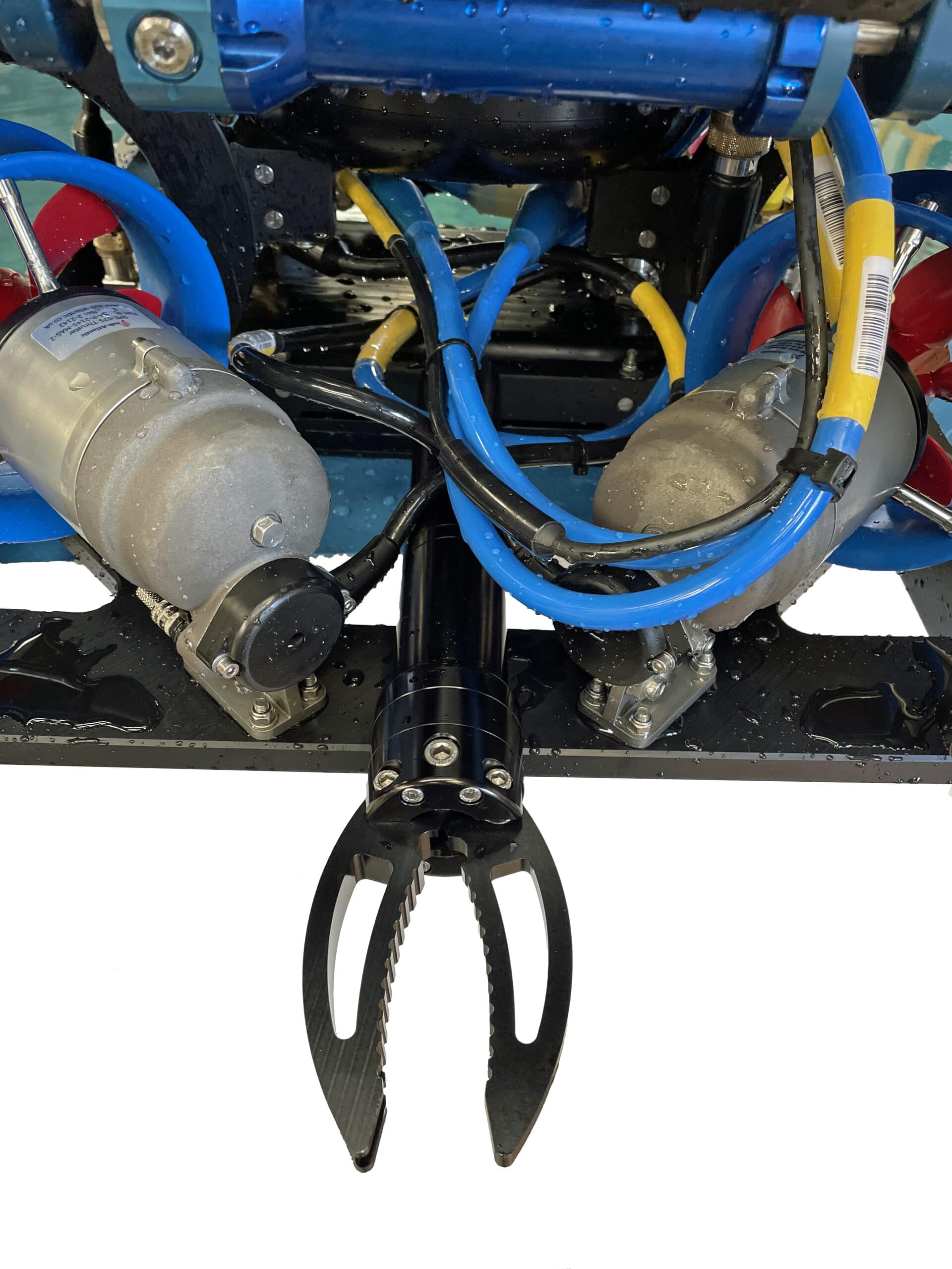
OceanTools launch the first product in their line of Robotic developments, introducing the new OM-1 single function electric manipulator arm to the subsea market. The OM-1 is a compact and cost-effective single function manipulator designed for use on smaller ROVs. The grabber may be used for a range of applications including recovering ordnance from the seafloor or for stabilising the ROV by holding onto an object. The jaw head is detachable, allowing for other attachments to be fitted by the operator including rope cutters, sampling bottles and a magnetic clamp.
Kevin Parker, Managing Director, OceanTools, said “We have plans to develop a wide range of subsea robotic products to serve our clients worldwide. Our launch customer is a leading manufacturer of smaller electric vehicles who approached us to design a variant of the OM-1 for their vehicles, and we were delighted to utilise the extensive experience of our engineering team to support them on this project. Longer term our intention is to offer multi-function electric arms as well as hydraulic arms for larger ROVs.
We would also like to thank our long-term partners Seatronics, for showcasing our new OM-1 manipulator fitted on to their VALOR observation ROV for our product launch”.
For further information on OceanTools extensive underwater product range, visit www.oceantools.co.uk or email [email protected].
- END -
For more information contact:
Kevin Parker
Managing Director
E: [email protected]
T: +44 1224 709606
About OceanTools
OceanTools is a world leading subsea engineering company specialising in the design and manufacture of equipment for the professional offshore and underwater markets. Established in 1997 and headquartered in Aberdeen, OceanTools have designed and developed an extensive product portfolio. Deployed in harsh environments, applications include offshore survey, subsea drilling and ROV operations. To find out more, visit www.oceantools.co.uk
New Teledyne Geospatial combines world-leading expertise of CARIS & Optech to deliver comprehensive solutions for land and sea
Vaughan, Ontario, CANADA – September 14, 2021 – Teledyne announces the launch of a geospatial group with the unification of its Optech and CARIS businesses. The new Teledyne Geospatial group will offer holistic solutions to seamlessly map land and sea through the integration of industry-leading lidar sensors combined with world-renowned software workflows.
Teledyne Optech has been a world leader in the design, development and manufacture of advanced lidar instruments for more than 45 years. And for over four decades, Teledyne CARIS has developed market-dominating software for the marine GIS community.
This collaboration provides customers with a competitive edge in mapping and delivering data products inside of one complete workflow. Ease of collection and processing, through to final product, is enhanced with efficiency-driving AI algorithms and real time quality control. Ongoing collaborations with other Teledyne businesses extends the geospatial capabilities even further.
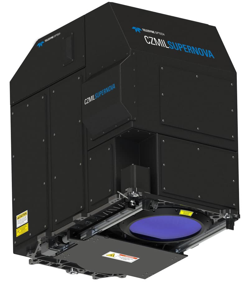
The CZMIL SuperNova, the first product from Teledyne Geospatial, integrates Optech’s bathymetric lidar with CARIS’ comprehensive processing software providing the highest performing bathymetric lidar system in the world.
Photo caption: CZMIL SuperNova first solution from the newly formed Geospatial group
Andy Hoggarth, Vice President, Sales and Marketing at Teledyne Geospatial explains: “Businesses today are increasingly expected to offer a more comprehensive suite of services. Bringing Optech and CARIS together allows us to leverage the world-leading expertise of both companies, ensuring customers can fully realize the competitive advantages provided by our ability to deliver holistic solutions for land and sea.”
Join us at Intergeo, September 21-23 in Hannover, Germany, at Hall 020 booth C16.
Teledyne Geospatial unifies the hardware and software expertise of two unique companies in the geospatial arena. The new group provides customers with innovative integrated solutions. Offerings will include turnkey systems, lidar and sonar integrated workflows and a range of systems and solutions that support holistic, precision data collection.
Notes to Editors:
For media enquiries, please contact:
Jennifer Parham
[email protected]
Making oceanographic data of extraordinary quality accessible to a wider audience
Alseamar, a producer of glider UUVs, has been able to produce highly accurate data plots of current profiles from large swathes of the water column. A combination of tailor-made algorithms, underwater gliders and a high-performing ADCP from Nortek has helped break new ground for the oceanographic community, making high-quality data more accessible for a multitude of stakeholders.
Acoustic Doppler current profilers (ADCPs) have revolutionized our ability to record ocean current movements. But they can only measure what they can “see”, and that is largely determined by what they are attached to, which may be a surface buoy or a frame on the seabed.
That’s perfect for many uses, but if you are seeking to find out about the movements of currents across a large swathe of ocean, then moving ADCPs on frames from location to location is a time-consuming business and doesn’t provide a complete picture of the currents in the whole area. Mounting an ADCP on a moving surface vessel is a good option for many, but some users are put off by the work and cost involved with hiring and crewing a vessel.
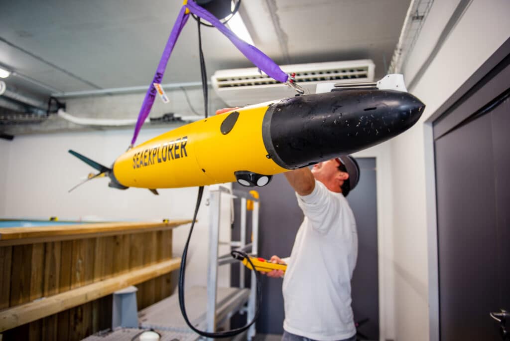
The Nortek ADCP’s small form and low profile enabled Alseamar to fit it to the SeaExplorer with little impact on the glider’s hydrodynamic properties. Photo: Alseamar.
An efficient and cost-effective way to profile a large volume of water
However, rapid advances in underwater glider technology have provided an exciting new alternative. Slimline battery-powered gliders are capable of cruising through the oceans for months at a time, carrying a multitude of instruments measuring many facets of the underwater world close up.
Typically, gliders move in a sawtooth, or wave-like, movement between the top of the water column and depths of around 1000 m. So, if you can get accurate measurements from an ADCP fixed to a glider, you have an efficient and cost-effective way to profile a huge volume of water in a relatively short period of time.
That possibility prompted researchers at French marine tech company Alseamar to investigate how an ADCP could be made to work with their SeaExplorer glider. The company produces high-tech marine and submarine equipment, such as gliders (or UUVs – underwater unmanned vehicles) with very long mission endurance.
The results of Alseamar’s innovative development are of benefit for the greater ocean science community. The detailed analysis of current movements made possible by the Nortek ADCP, combined with data from the glider’s other instruments, gives users access to highly accurate data on how our oceans work.
“Glider missions contribute to the international efforts of the Global Ocean Observing System (GOOS),” says Orens de Fommervault, oceanographer at Alseamar.
The UNESCO-led GOOS program coordinates observations in the ocean globally, focusing on three critical themes: climate, operational services and marine ecosystem health.
Making water velocity measurements with glider-mounted ADCPs more accessible
Nortek’s 1 MHz current profiler was an attractive option for Alseamar due to a multitude of reasons.
“The Nortek ADCP design is really ideal for a profiling platform like ours. You could almost say it was dedicated to our application,” says Orens de Fommervault, who is the oceanographer at Alseamar leading the ADCP glider integration project.
This project truly breaks new ground in the oceanographic research industry. Some select academic institutions are also able to estimate water currents from a glider, but the real step forward is that this is now available as a service from a private company. Alseamar is currently the only known private company able to estimate water currents from a glider and to provide this service to other companies, organizations and researchers.
“Glider-mounted ADCPs offer the ability to collect high-resolution, dense-data water velocity measurements at an unprecedented spatio-temporal scale resolution without the constant use and expense of support vessels,” de Fommervault points out.
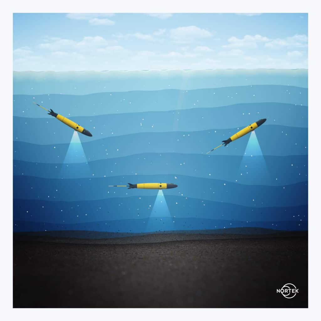
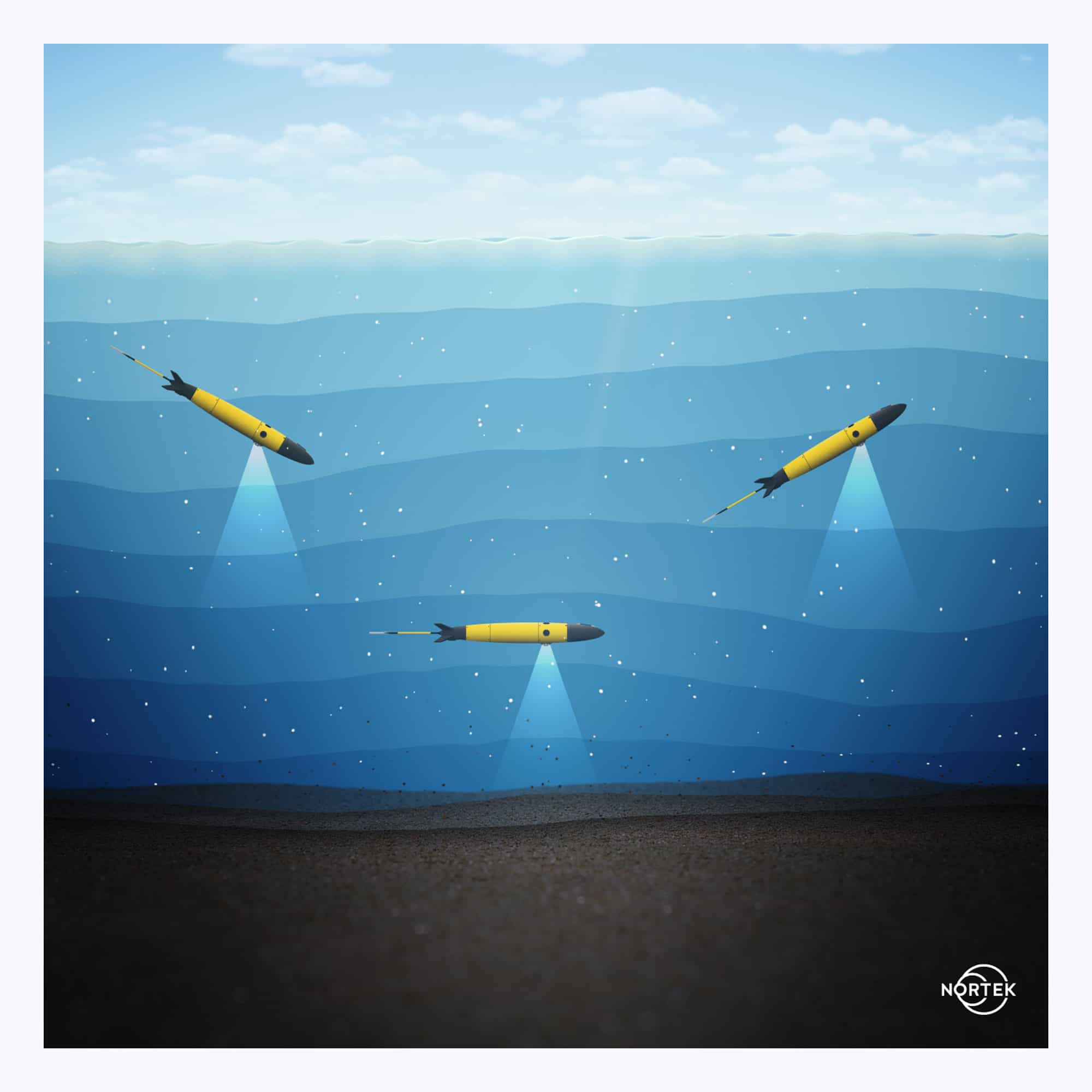
Accurate analysis of currents across tens of kilometers of ocean is now possible due to Alseamar’s successful integration of the Nortek ADCP into its SeaExplorer glider. This provides unprecedented opportunities for measuring full ocean current profiles, whether the vehicle is ascending or descending.
The relatively small size and low power consumption of Nortek’s ADCP are also plus points when you are seeking to pack as much instrumentation on to a glider as possible and get the most out of its on-board battery.
The ADCP-equipped glider has proved its accuracy in a number of different environments.
Current profiles obtained by the ADCP on the SeaExplorer glider across 60 km in the Mediterranean Sea off southern France correlate with temperature, salinity and chlorophyll measurements taken by the glider at the same time. The ADCP was also able to measure tidal currents in considerable detail through the depth profile in the Atlantic off northwest France.
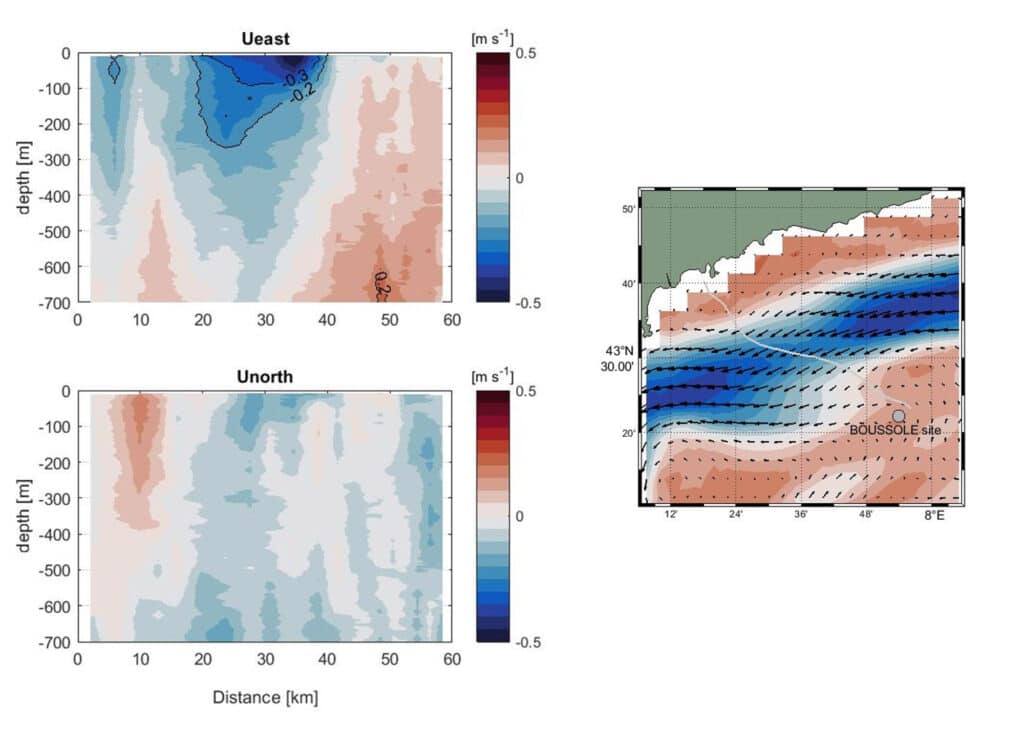
Current profiles acquired by a SeaExplorer glider equipped with a Nortek ADCP in the northwest Mediterranean, crossing a well-known geostrophic current. The left figures represent depth-resolved water currents acquired along the glider transect (the gray line on the right figure). The color indicates the velocity of the currents.
Improving access to ADCP glider data in real time
But configuring the ADCP-equipped underwater glider to gather vast amounts of usable oceanographic data is not the end of the story.
“One big remaining challenge is to get access to as much of that data as possible in real time – something that is vital for our customers in the oil and gas industry, for example,” Orens de Fommervault says.
Alseamar has made considerable progress with this already, and is currently working to improve real-time data interpretation still further, de Fommervault says.
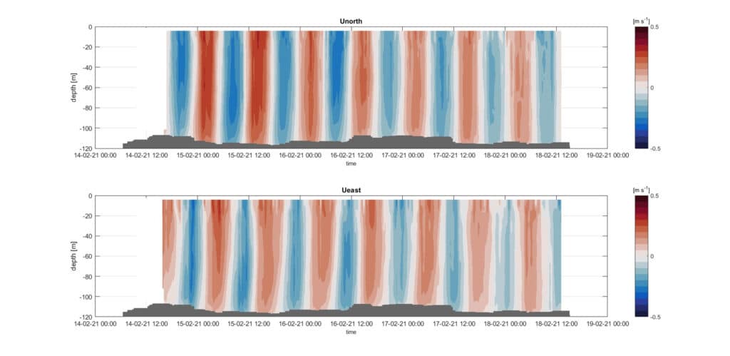
Tidal current in the Atlantic off Brittany, northwest France, over a 12-hour period, measured by the Alseamar SeaExplorer glider equipped with the Nortek ADCP glider current profiler. Source: This data was acquired in the framework of the MELANGE project (ASTRID MATURATION) in collaboration with the SHOM and the CNRS (Perpignan University).
Contact for further information and interviews:
Torbjørn Goa, Communication Manager, Nortek AS
[email protected]
+47 412 02 381
SEA-KIT wins funding to demonstrate zero emission hydrogen fuel cell technology for USVs
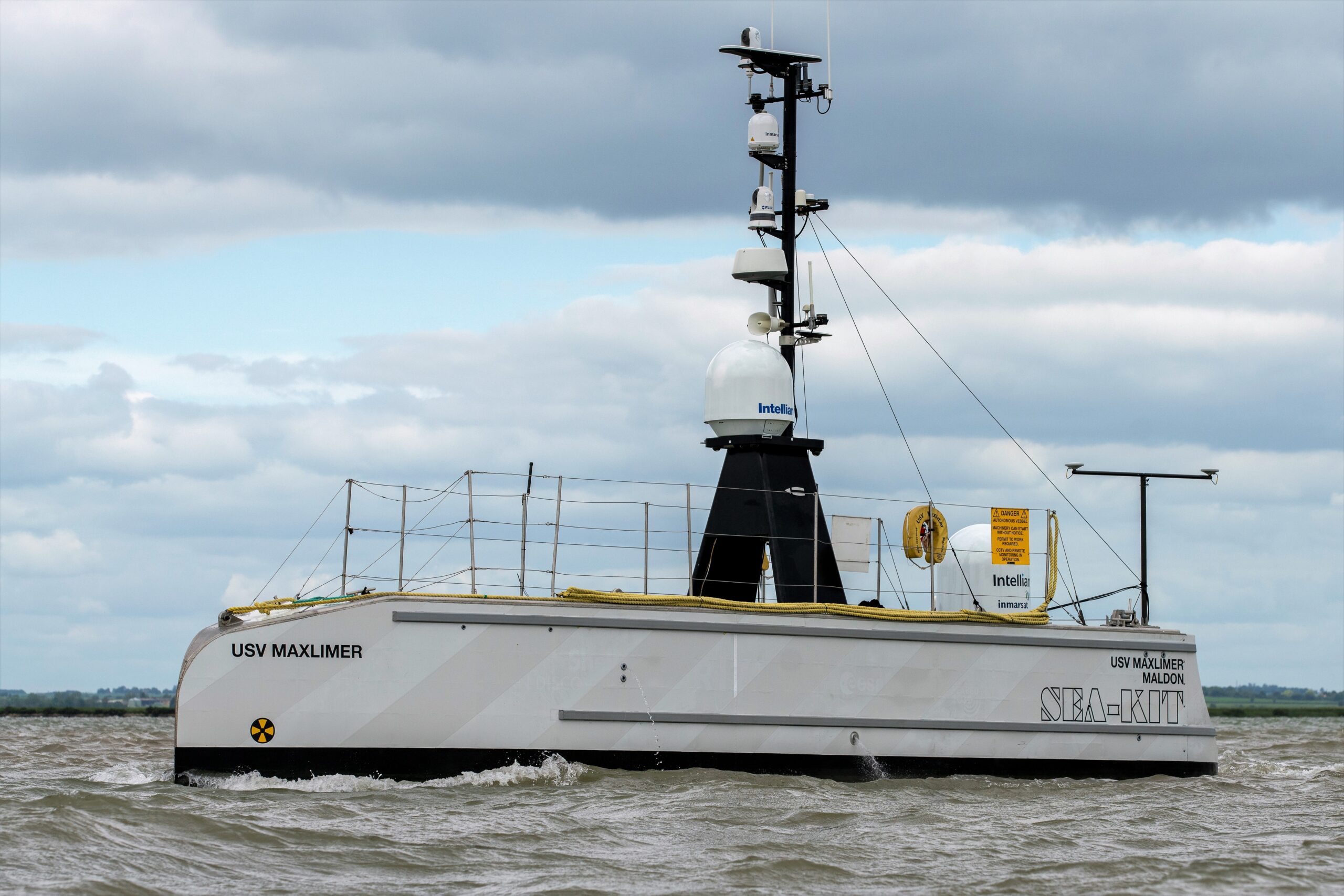
Essex, United Kingdom, 15 September 2021: SEA-KIT International, leading designer and builder of Uncrewed Surface Vessels (USVs), has won funding to install an innovative PCB-based hydrogen fuel cell, engineered by project partner Bramble Energy, on its 12m USV ‘Maxlimer’ and demonstrate zero emission maritime operations.
SEA-KIT secured the grant through the recent Clean Maritime Demonstration Competition (CMDC) – Strand 2. The project, funded by the Department for Transport (DfT) working with InnovateUK, will showcase a successful diesel to hydrogen conversion of SEA-KIT’s proven USV design and demonstrate a route to fulfilling the UK’s Clean Maritime Plan Strategy commitment of reducing greenhouse gas emissions from shipping by at least 50% by 2050.
“SEA-KIT USVs have a dual diesel-electric hybrid drive, with propulsion coming from an electric motor powered by battery banks that are charged by in-situ diesel generators,” said Ben Simpson, SEA-KIT CEO. “This project will replace one of the diesel generators with new hydrogen fuel cell technology from Bramble Energy and demonstrate an offshore operation with zero carbon emissions.”
West Sussex-based Bramble Energy, a disruptor in the clean tech space, will design and manufacture a marinized, customised version of its printed circuit board fuel cell (PCBFC). The use of PCBs, as opposed to metallic or graphite end plates, makes the technology more suited to rugged, marine environments. Bramble Energy’s PCBFC system will sit inside an enclosure within the USV to prevent sea water ingress and corrosion.
Dr Vidal Bharath, COO of Bramble Energy said: “Bramble Energy is committed to powering a net zero economy. This project provides the perfect opportunity to demonstrate our decarbonising technology in a real world, challenging environment across a new industry with an exciting commercial partner.”
SEA-KIT will retrofit its demonstration vessel, USV ‘Maxlimer’, with the hydrogen fuel system. Data gathered from bench testing and sea trials will be utilised for the design and build of similar USVs, as well as for larger uncrewed vessel builds in the near future.
USVs are already being deployed for a range of commercial tasks, including geophysical survey, offshore inspections, surveillance and coastal asset monitoring. This collaboration between SEA-KIT and Bramble Energy aims to enable the emergence of hydrogen fuel systems as another viable option for the fast-growing USV market.
Innovate UK, the UK’s innovation agency, drives productivity and economic growth by supporting businesses to develop and realise the potential of new ideas. The CMDC projects represent the first major investment from DfT specifically aimed to drive innovation within the maritime industry.
Simon Edmonds, Deputy Executive Chair and Chief Business Officer for Innovate UK, said: “As the UK prepares to host COP26 in the maritime city of Glasgow, it is great that we can announce funding for these fantastic projects in the maritime sector that will help the UK meet its net zero goals. From this competition we saw a very high level of demand, we have seen the very best of British ideas from all over the country. It is clear that not only does the UK have a great maritime history, but also a bright and greener future too.”
The application of a hydrogen fuel source to a USV will be a world first, putting the UK firmly in the lead on zero emissions uncrewed technology for sustainable maritime growth.
***ENDS***
Notes to editors:
About SEA-KIT International – www.sea-kit.com
SEA-KIT International is a British SME providing hi-tech, Uncrewed Surface Vessel (USV) solutions to the maritime and research industries for deployment in harsh offshore environments. SEA-KIT aims to be the UK’s leading USV designer and developer, focused on over-the-horizon deployment of systems and sensors for a range of applications, including maritime logistics, environmental management, security and surveillance, offshore asset monitoring, marine inspection and efficient survey of the ocean floor. Through ongoing collaboration with industry partners, SEA-KIT is sharply focused on driving down the cost of geo-data collection and reducing the sector’s carbon emissions.
Follow SEA-KIT International: LinkedIn | Twitter
Media contact: Amanda Çetin | Tel +44 (0)7518 049251 | Email [email protected]
About Bramble Energy - www.brambleenergy.com
Bramble Energy is powering a Net Zero world - today - and is proving to be a real game changer in solving key challenges in the production of hydrogen fuel cells including: lead times, up-front investment, manufacturing cost and scalability.
Founded in 2016 by Dr. Tom Mason, in the research labs at Imperial College of London and University College of London, Bramble Energy through revolutionary fuel cell design and manufacturing techniques, has developed the unique printed circuit board (PCB) fuel cell – the PCBFC™. A patent protected fuel cell that can be manufactured in almost all printed circuit board (PCB) factories worldwide.
Bramble Energy is fast becoming the leading hydrogen fuel cell provider for a cleaner and more sustainable world.
Home for Bramble Energy is a state-of-the-art facility in Gatwick, UK, where they have launched their portable power product range and are developing their high-power density, liquid-cooled fuel cell systems under the same scalable low-cost technology platform.
Media contact: Amanda Bunn | Tel +44 (0)7595 768277 | Email [email protected]
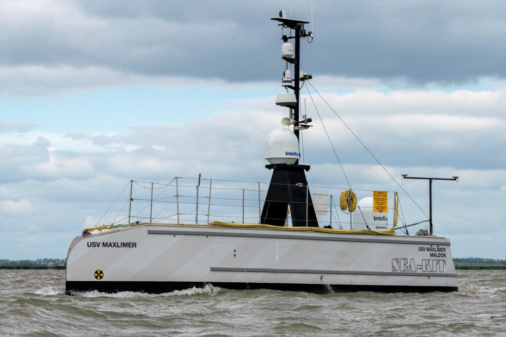
SEA-KIT’s USV ‘Maxlimer’ on a recent capability demonstration – credit SEA-KIT International
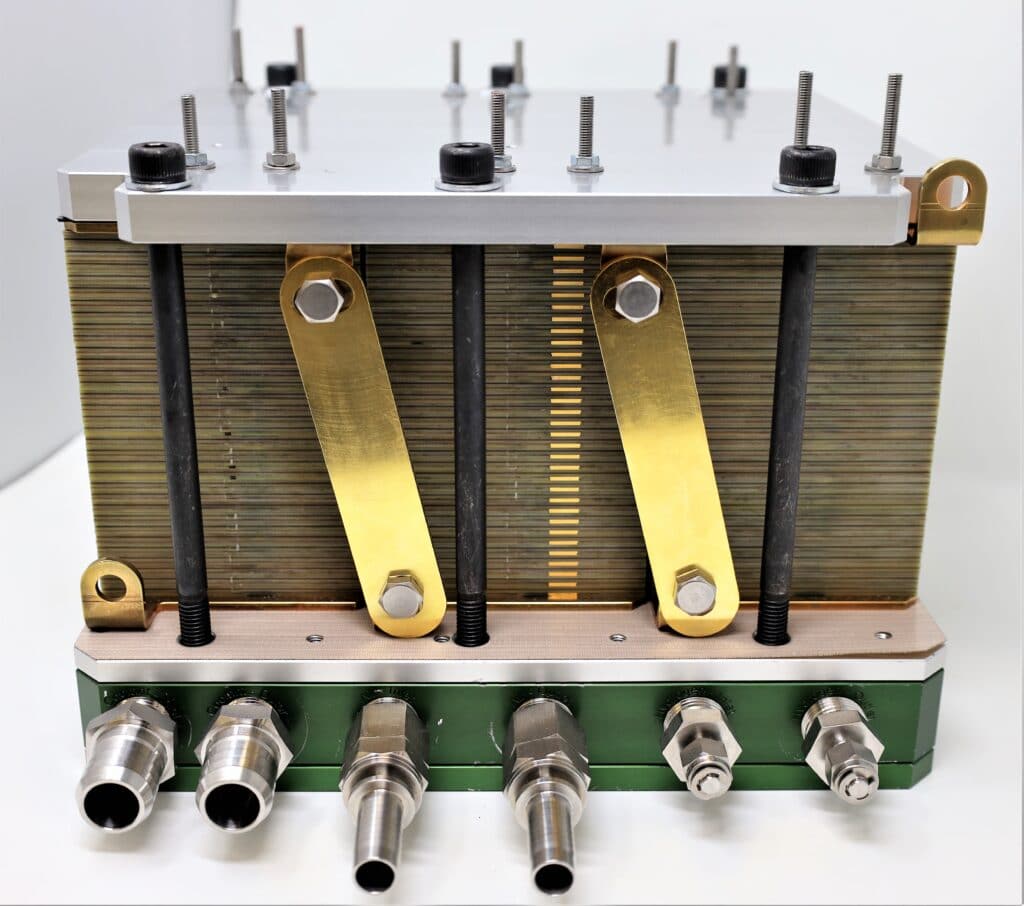
Bramble Energy Liquid Cooled Fuel Cell Stack – credit Bramble Energy
The next generation is coming
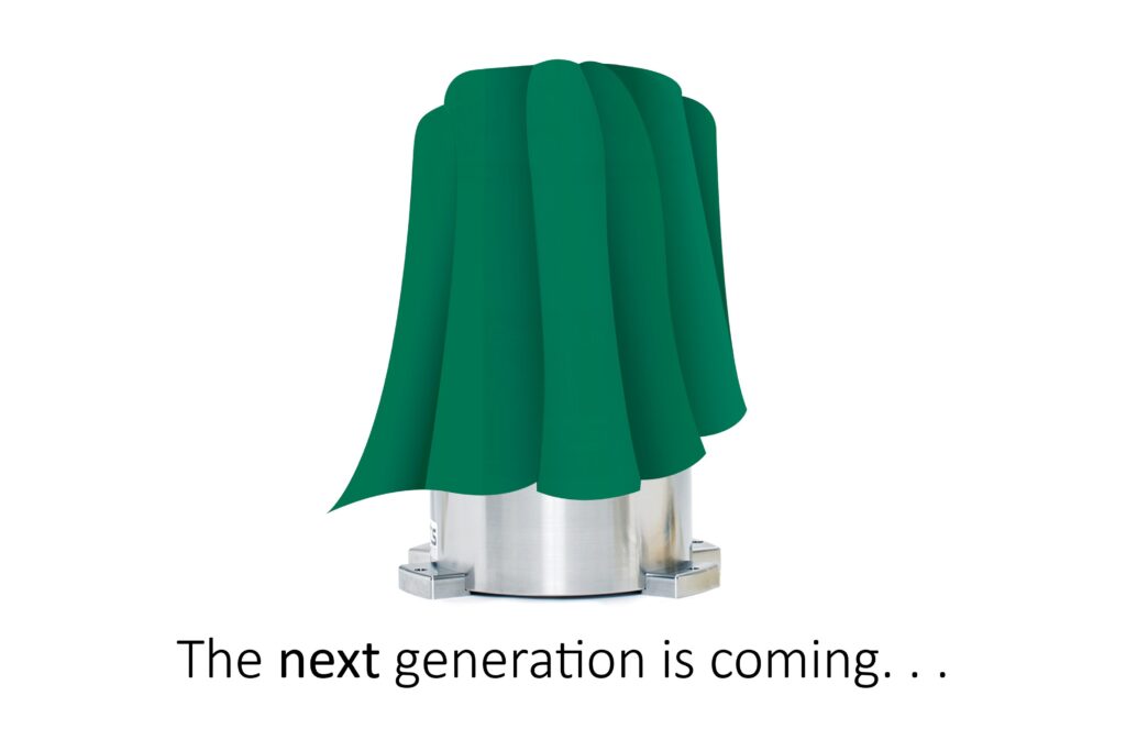
With 15 years experience with the RTS Gen 5 MUX, and previous generations of sensor interface products, RTS is now developing the next generation survey multiplexer. The RTS Gen 6 MUX is a redesign of the Gen 5 MUX from the ground up. This will improve reliability, performance and service friendliness of the unit. The unit is easily operated from the topside front panel or remotely via the integrated web interface.
Ivar Ersland, Development Manager: “With the gen6 we aim to set a new standard for survey multiplexers and their use in modern applications”
Tore, Managing Director: “Based on the success of the RTS Gen 5 that has become an industry standard in the subsea business with close to 200 units in operation worldwide, we expect the RTS GEN 6 MUX to be well received in the market.
Together with our partner Seatronics, a selection of end users have been involved in reviewing the new specifications on the gen 6, allowing for further improvements”
Read more about the RTS Gen 6 MUX: https://rts.as/rts-gen-6-mux/
OceanWise awarded the UK National Tide Gauge Contract
The prestigious 'National Tide Gauge Network' (NTGN) contract from the Environment Agency (EA), who own and operate 42 'Class A' tide gauges on behalf of the UK Coastal Flood Forecasting (UKCFF), has been awarded to Hampshire based OceanWise Ltd who alongside RS Divers, will deliver this multi-year contract.
As Dr Mike Osborne, OceanWise's Managing Director explains, "We are delighted to have been given the responsibility of maintaining the NTGN on behalf of the nation. We already support and maintain numerous tide gauges, as well as weather stations, around the UK for our port customers, so this contract is a natural extension of our work. We are particularly looking forward to working with the EA and NOC to upgrade the network, using our expertise and experience in sensor, and data acquisition and management technologies, whilst at the same maintaining and enhancing the legacy 'bubbler' based systems to improve the reliability and quality of the data overall".
The purpose of the (NTGN) is to observe sea level throughout the UK in near real-time, as input to monitoring and forecasting coastal surge, and to provide a long-term and strategic record for climatological and coastal engineering studies. The network currently consists of 21 sites in England, 10 in Scotland, 7 in Wales, 2 in Northern Ireland, 1 in Jersey and 1 in the Isle of Man.
The data provided by the network of guages is also used by academics and researchers for a variety of other scientific purposes. Several of the gauges are part of the Global Sea Level Observing System (GLOSS) and are of international and historical significance, with some datasets dating back to the 18th century.
For more details on the NTGN programme and other OceanWise projects please visit their website at www.oceanwise.eu.
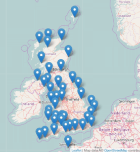
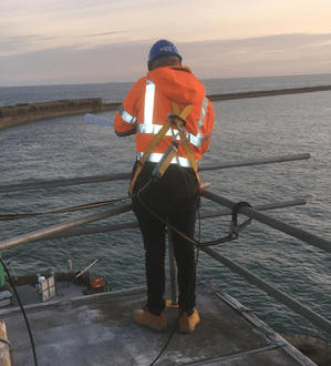
Image: An OceanWise site engineer servicing a tide gauge at a UK Port
Image: Map showing the NTGN sites around the UK
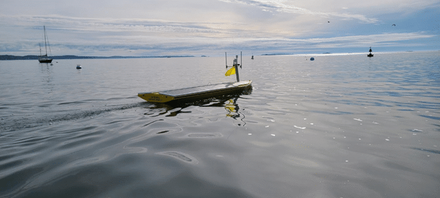
The University of Southern Mississippi Oceanographers Select SeaTrac SP-48 for Ocean Mapping, Port Resiliency and Maritime Domain Awareness
Marblehead, Massachusetts – August, 2021 - SeaTrac Systems, Inc. (SeaTrac) is pleased to announce the sale and delivery of one of its SP-48 persistent Uncrewed Surface Vehicles (USVs) to a team at The University of Southern Mississippi’s (USM) School of Ocean Science and Engineering (SOSE). The SOSE team has collaborated with SeaTrac, developing an innovative solution for rapid sensing of in situ optical properties using a SeaTrac Sp-48 autonomous platform.
SeaTrac SP-48 will be deployed for rapid sensing of optical properties in maritime environments
“There is a critical need for rapidly mapping localized hydrodynamic and turbidity conditions in nearshore-ocean and coastal marine environments for natural resource management, environmental protection and national security,” says Dr. Xiaodong Zhang, Endowed Chair and Professor with SOSE’s Division of Marine Science at USM. “The SP-48 has the persistence and the payload power we were looking for to host a SeaBird ACS to measure hyperspectral absorption and a Sequoia LISST-VSF to track angular scattering,” Zhang explains.
“Once the capability for rapid sensing of optical properties is demonstrated in turbid or “brown” water coastal environments, several Federal agencies would like to incorporate the capability in ongoing R&D programs in maritime environments,” explains Dr. Jason McKenna, Director of Research, Development, Testing, & Evaluation (RDT&E) at USM’s Roger F. Wicker Center for Ocean Enterprise located at the Port of Gulfport in Gulfport, MS. “Ocean Enterprise will continue to support Testing and Evaluation of the SP-48 platform with SeaTrac, SOSE and federal agencies to satisfy emerging requirements in port resiliency and maritime domain awareness” says Dr. McKenna.
“Increasingly customers’ missions have grown in complexity requiring a range of sensors, and they’re looking for less costly, less resource-intensive and more flexible solutions to carry out a variety of tasks simultaneously in challenging marine environments,” says Jigger Herman, Co--Founder, SeaTrac Systems. “We are pleased to help the USM team push the envelope in rapid mapping of the optical field.”
The SP-48 is designed for users who require a flexible data gathering and communications platform that adapts to a wide variety of operational scenarios and payloads. The solar-powered, 4.8m SP-48 is a low-logistic, sensor-agnostic persistent USV with Automatic Identification System (AIS) collision avoidance, speed of 5kts, 500W payload power, and 70Kg payload capacity that can host a variety of sensors perfect for the collection and communication of real-time ocean data over long durations. Built to operate in all marine environments—from inland, near shore to open ocean—the SP-48 has a self-righting hull and efficient electric motor that frees it from reliance on wind or waves for propulsion. It is easily deployed from a boat ramp, pier or ship. Communications is achieved by line-of-sight Radio Frequency (RF), cellular, high-bandwidth satellite or custom networks.
About SeaTrac Systems, Inc.
SeaTrac Systems, Inc. manufactures, sells, and rents cost-effective, multi-purpose long endurance solar-powered Uncrewed Surface Vehicles for commercial, scientific and military applications. The SeaTrac USV can carry a wide variety of sensors and custom payload modules that make it perfect for research, monitoring or surveillance tasks where autonomy, cost and ease of deployment matter. For more information, visit www.seatrac.com
Media Contact:
Alessandra Bianchi
SeaTrac Systems, Inc.
+1 781-258-1440
[email protected]
IFHS Introduces HPAS, the first Accreditation Scheme with an International Footprint
The International Federation of Hydrographic Societies (IFHS) have developed the Hydrographic Professional Accreditation Scheme (HPAS) to provide international recognition to hydrographic professionals in demonstrating their competency, educational background and career development.
 The HPAS initiative has reached an important milestone by completing its Pilot Phase which was initiated in March. This phase, run by a panel of international experts, aimed to benchmark the HPAS procedures and processes. Over forty hydrographic professionals volunteered to be the first professionals assessed under the HPAS framework. Of these, eighteen were selected for the Pilot Phase from across the countries and regions represented by the IFHS Member Societies: Belgium, France and the francophone countries, Germany, The Netherlands, South Africa and the United Kingdom. The HPAS Panel of Experts awarded HPAS accreditation to fifteen of these candidates.
The IFHS would like to publicly acknowledge the following, without whom HPAS would not have been made possible and whose continued support is invaluable:
- The HPAS Working Group who devised and developed the scheme and wrote the documentation and processes.
- The HPAS Assessment Panel; a college of international recognised professionals drawn from all IFHS member societies, who assess the applications of the HPAS candidates. These volunteers have given up their time to review all the applications submitted and, where necessary, interview candidates to ensure they meet the assessment criteria.
- The HPAS Steering Committee; representatives from all the IFHS member societies. The HPAS Steering Committee is responsible for the oversight and stewardship of HPAS under the aegis of the IFHS Executive Committee.
The first formal round of HPAS applications opens on 6th September 2021 until 17th October 2021. For further information about HPAS framework and application process, visit the HPAS webpage on https://hydrography.earth/hpas/ or email us at [email protected].

3D at Depth Welcomes Euan Tait as Vice President for North and Central America
Amid rapid growth and expansion, 3D at Depth hires an energy executive as Vice President of North and Central America.
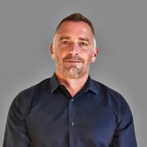
3D at Depth Inc., the world's expert in commercial Subsea LiDAR (SL) laser technology and leading provider of fully integrated underwater survey services, is pleased to announce that Euan Tait joins the company as Vice President of North & Central America.
In his role, Tait is responsible for leading the North American team and positioning 3D at Depth as the offshore integrity and inspection provider, accelerating 3D at Depth's revenue through expanding 3D at Depth's geographic presence in new regions, development of new services, as well as contributing to the company's business growth strategies.
"We're excited to have Euan on board, especially now as we have witnessed an increase of interest in 3D at Depth's spread across multiple energy sectors. We see that our patented Subsea LiDAR (SL) technology coupled with our recently acquired, fully integrated Saab Sabertooth hybrid supervised autonomous vehicle and AUV packaged into one vehicle is the solution our clients need for their assets in the Energy and Renewables (Offshore Wind Farm) sector," said Neil Manning, 3D at Depth's Chief Operating Officer.
Tait brings over 20 years of leadership experience in the energy market. Initially, he began his career in Energy Merger & Acquisition investment banking & corporate finance roles. This was followed by several senior management & executive board-level roles with corporate development and growth in the Energy sector. Before joining 3D at Depth, Tait held an integral role within the management team at ROVOP who developed and grew ROVOP over the last six (6) years.
Tait was a key driver in global geographic expansion, firmly establishing a presence in the United States (US), Middle East, Asia Pacific, and mainland Europe. During his time at ROVOP, the company significantly increased global revenues, with the America's region becoming an established core to the business with several global client contracts being sourced, secured, and managed from the US.
"I am both delighted and excited to be joining 3D at Depth at a pivotal point in the company's growth," said Euan Tait. "3D's market-leading technology and resultant highly cost-efficient service offering to the energy sector, make it incredibly well-positioned, to support and deliver for clients across several different energy sectors. I am looking forward to being part of the team as we look to further accelerate our growth."
About 3D at Depth
3D at Depth, Inc. provides advanced subsea LiDAR (SL) laser systems, survey support services, and 3D point cloud collection, visualization, and analysis solutions to help clients optimize marine, underwater and offshore survey campaigns. Precise, repeatable, millimetric 3D point clouds acquired through patented SL laser technology allow clients to "measure in 3D and manage in 4D" to increase operational efficiencies and reduce downtime. The Company's locations in Australia, Europe, and the United States support customer survey operations around the world. For more information and a broader listing of services, visit us at www.3datdepth.com and LinkedIn, or follow us on Twitter @3DatDepth.