Acquisition of Acteon Group
Acteon Group, the international offshore energy infrastructure services business, has been acquired by private equity investors Buckthorn Partners and One Equity Partners (OEP).
Buckthorn and OEP are making a substantial investment in the business to improve Acteon’s standing with suppliers and customers and enable it to compete even more strongly in its core markets.
The investors’ focus will be on developing Acteon’s capabilities across survey, foundations, moorings, decommissioning and consulting engineering services that support and differentiate the business in the offshore renewable, and offshore oil and gas market sectors.
Brice Bouffard has been appointed as Chief Executive Officer of Acteon. Brice brings a wealth of business experience highly relevant to Acteon and its key segments.
Rob Willings, Partner at Buckthorn, says, “Acteon’s products and services are key to the energy transition in constructing, maintaining and supporting offshore energy infrastructure. We are very pleased to acquire Acteon and its market-leading capability in managing offshore renewable, and offshore oil and gas infrastructure. Our ownership will bring stability to the business, and investment and expertise to grow and develop the company.”
Acteon provides specialist engineering, services and technology to companies who develop and own offshore energy infrastructure across all phases of the lifecycle. The business was established in 1989 and employs 2,300 staff operating from 58 locations across 14 countries worldwide.

SEA-KIT leads the march on Unmanned Marine Systems certification
In 2021, leading Uncrewed Surface Vessel (USV) designer and builder, SEA-KIT International, was awarded the first ever Unmanned Marine Systems (UMS) certificate by Lloyd’s Register (LR), representing a key milestone for the maritime industry.
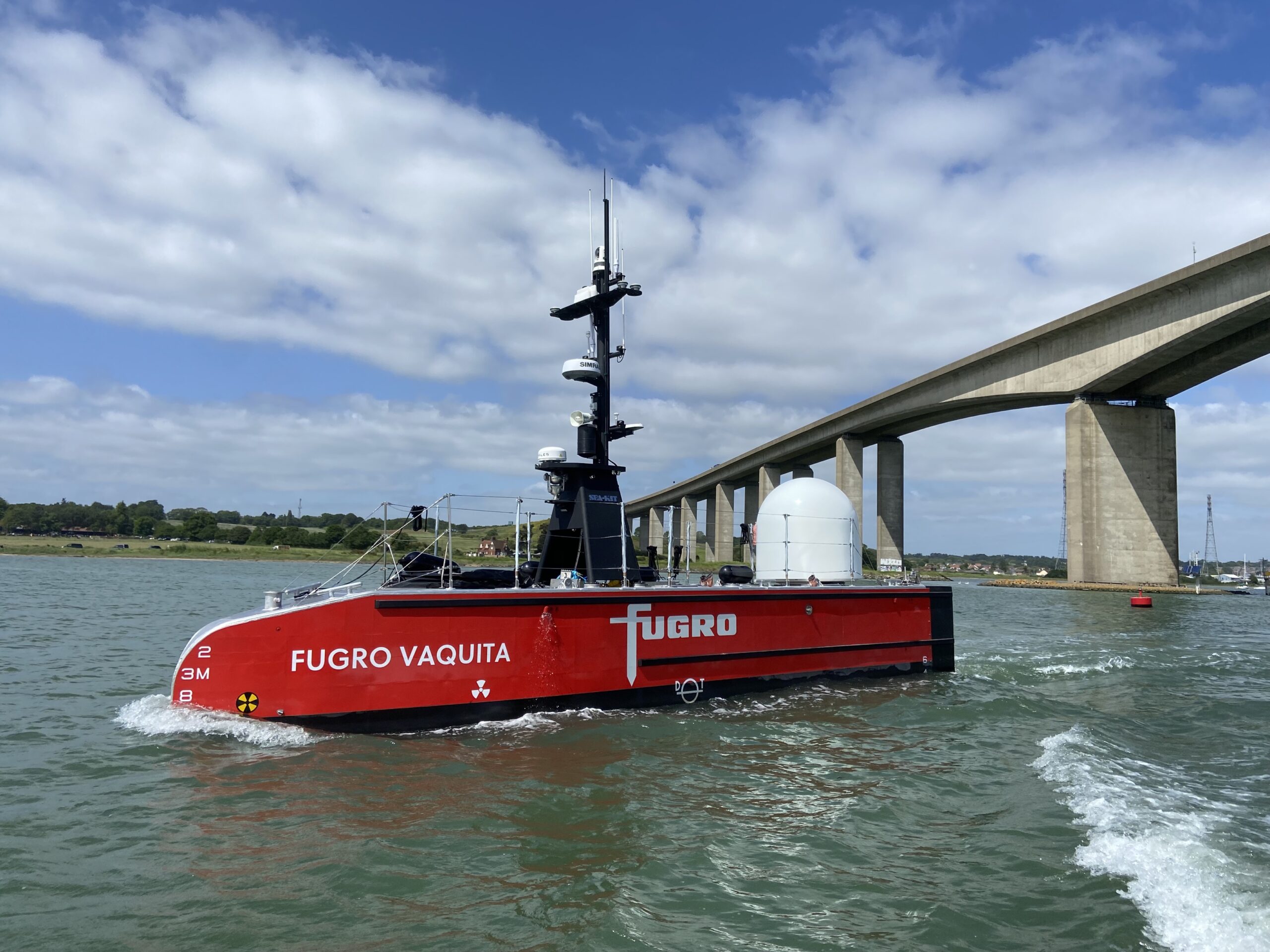
Since then, SEA-KIT has continued to work closely with LR to achieve the highest standards for the USV sector. The company’s latest 12 metre SEA-KIT X-Class USV, Fugro Blue Essence®, was recently also awarded LR UMS certification, marking the company’s 5th certificate and the first LR UMS certificate for a Category 0 certified vessel.
Mathew Palmer, LR Global Naval Business Lead – Submarines and Uncrewed Systems commented: “Lloyd’s Register is delighted to award UMS certification to this SEA-KIT X-Class Fugro Blue Essence®. The USV’s state-of-the-art design and capabilities demonstrate the future of marine technology, and this certification underscores the vessel's readiness for remote operation in challenging maritime environments.”
Category 0 approval, the highest level of approval for workboats, was awarded to the vessel by the UK Maritime and Coastguard Agency in January 2024. It is now the largest Cat 0 certified USV to operate fully remotely and with unrestricted service to support marine projects further offshore while enhancing safety and environmental performance.
Doug Graham, SEA-KIT MD, said: “We continue to push boundaries with the design and construction of our USVs. Certification is essential for the industry to provide a safety assurance framework and it is testament to the team’s hard work that SEA-KIT now holds the most UMS certificates awarded to any company. We will strive to maintain this leadership stance and our long-standing relationship with Lloyd’s Register, so that we can continue to support the sector in achieving ambitious net zero targets.”
SEA-KIT USVs are at work on commercial projects around the world. The company has several vessels in build and on order, including the next-generation, 18 metre, SEA-KIT XL-Class USV, which will also be certified against LR’s UMS Code. The vessel is currently preparing to start sea trials in Ipswich, Essex.
Argeo signs “Certificate of Delivery and Acceptance” with CSI for second Kongsberg Discovery HUGIN Superior AUV
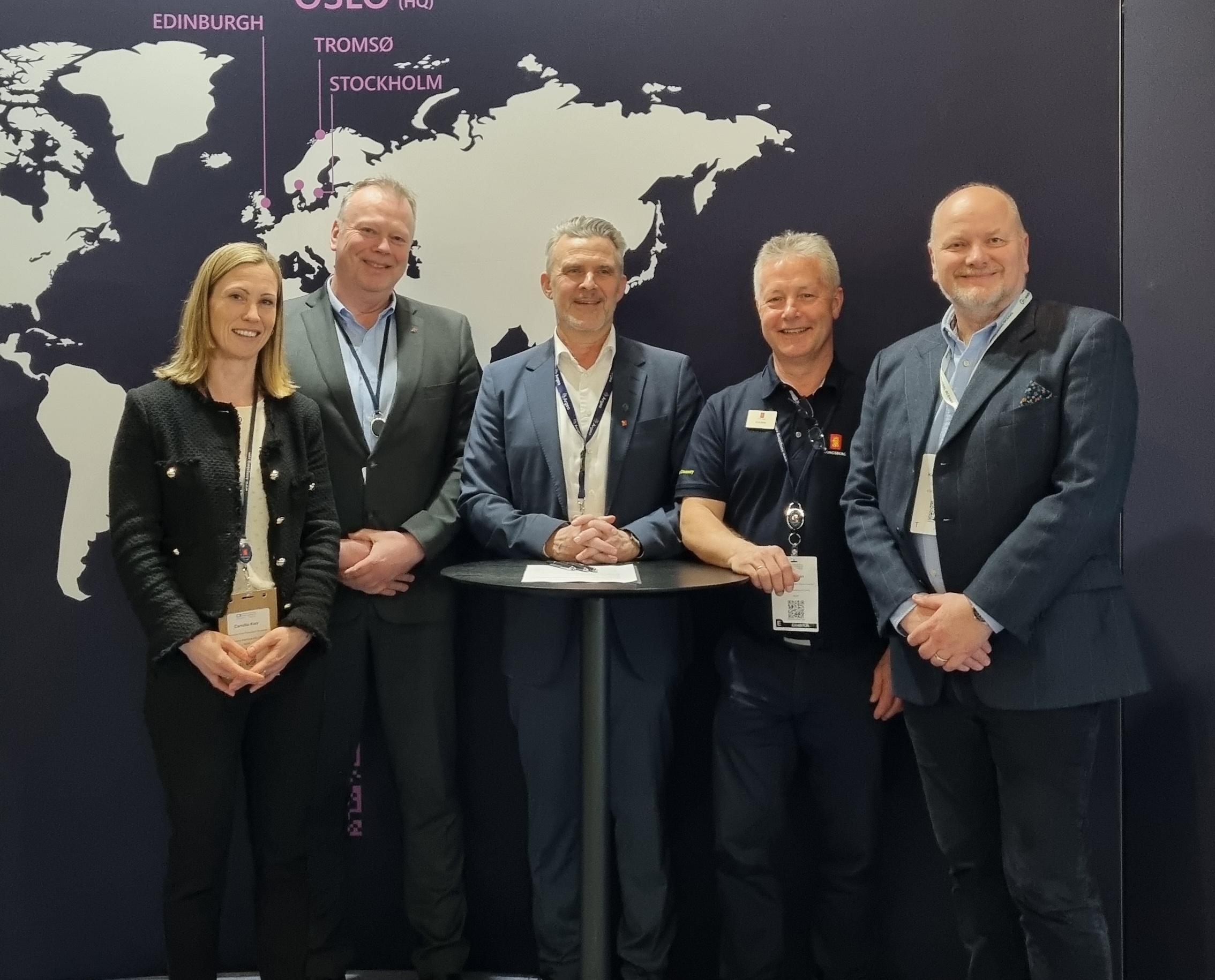
Ocean surveying and inspection specialist Argeo Subsea, CSI Nordics and Kongsberg Discovery have signed a three-party Certificate of Delivery and Acceptance for a new HUGIN Superior AUV. The agreement, confirmed at Oceanology International in London, supports Argeo’s ambitious fleet expansion plans, as the firm looks to build the world’s most advanced AUV fleet, with seven high specification units. Argeo already has one HUGIN Superior in service.
CSI Nordics, a subsidiary of CSI Leasing, one of the largest independent equipment leasing companies in the world, will purchase the unit from Kongsberg Discovery, entering into a long-term leasing agreement with Argeo.
Integrated excellence
Argeo CEO Trond Crantz says the deal will amplify the company’s operational capacity, putting it in “a unique position within both the marine minerals, oil and gas and the renewables segment, increasing efficiency and productivity substantially.”
He comments: “Our expansion plans will establish us as the premier authority in AUV technology worldwide. The strategic combination of Kongsberg's highly advanced AUVs with Argeo’s proprietary cutting-edge electromagnetic sensor system, Argeo LISTEN, propels us ahead of competitors.
“Argeo LISTEN allows for efficient inspection of cables and pipelines, both buried and on the seafloor, as well as rapid estimation of cathodic protection status and remaining lifetime. By integrating this state-of-the-art system into the Hugin Superior, our clients can expect expedited project completion and access to comprehensive data derived from multiple sensors concurrently, ensuring unparalleled quality and efficiency.”
Partnering for success
Speaking on behalf of CSI, Kenneth Mitsem, General Manager at CSI Nordics, adds: “We specialize in crafting leasing solutions that are both flexible and sustainable, designed to meet the rapidly changing needs of the modern market. Our strategic approach focuses on making advanced technology readily accessible, enabling businesses to quickly respond to new challenges and maintain a competitive edge.
“We're proud to collaborate with Kongsberg and Argeo to develop smart leasing options, facilitating easier access to innovations like the HUGIN Superior from Kongsberg Discovery. This partnership underscores our shared commitment to enhancing the acquisition of technology critical for thriving."
Raising the bar
The Superior sits at the top of Kongsberg Discovery’s HUGIN AUV family of products, which, after 30 years of developmental milestones, is the world’s most commercially successful range of AUVs.
The unit’s standard specifications are second to none. It includes a HISAS 1032 dual receiver, EM2040 Mk2 Multibeam Echosounder, a UHD still image camera, laser profiler, sub-bottom profiler, magnetometer, in addition to sensors for methane, carbon dioxide, oxygen, and more. Combined with the latest in navigation technology, including MicroNavigation systems for enhanced accuracy, the Superior raises the bar for AUV capability.
Competitive advantage
Stene Førsund, EVP, Kongsberg Discovery, says: “We’re delighted to be consolidating our relationship with Argeo and CSI, with the leasing of this advanced, high specification technology.
“With their second HUGIN Superior onboard they’ll be able to offer clients excellence in high-resolution seabed mapping and imaging, with the functionality needed for a broad range of applications, and the precision and reliability to go further, deeper and into more detail on missions, delivering powerful competitive advantage. Argeo can look forward to achieving some Superior results in the very near future.”
In addition to the Superior, the HUGIN family of AUVs includes a variety of models customised to meet diverse markets, budgets and operational flexibility. This includes the HUGIN Endurance, capable of conducting missions over a range of 1,200 nautical miles, and the soon-to-launch HUGIN Edge, weighing only 300kg and less than 4m in length.
Kongsberg Discovery is a standalone business within the KONGSBERG Group, focusing exclusively on cutting-edge underwater robotics and sensor technology innovations.
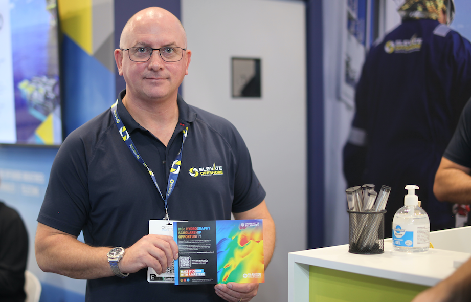
Elevate Offshore announces scholarship opportunity for MSc in hydrography at the University Of Plymouth
Elevate Offshore, a prominent provider of survey, ROV, geotechnical, and inspection personnel serving the offshore oil and gas, renewable energy, telecoms, and power sectors, is pleased to introduce a notable scholarship initiative in collaboration with the University of Plymouth. The scholarship aims to afford aspiring hydrographers a significant opportunity by fully covering the tuition fees for the MSc in Hydrography program, beginning in September 2024.
In addition to covering the degree fees, Elevate Offshore will offer mentorship from their experienced staff surveyors. This mentorship program aims to provide the recipient with invaluable guidance and insight into the industry, facilitating a trajectory towards a successful career in hydrography. Furthermore, the recipient will be able to participate in networking events hosted by Elevate Offshore, enabling them to cultivate meaningful connections within the industry. While the scholarship recipient stands to gain financial support and access to Elevate Offshore’s mentorship program, it will be tailored to provide guidance throughout their academic journey. Additionally, they will be expected to present their findings at industry events and accompany Elevate Offshore to networking opportunities, further enhancing their professional development.
Andrew Blears, Managing Director of Elevate Offshore, conveyed his enthusiasm for the scholarship, remarking,
“Elevate Offshore recognises the burgeoning demand for adept personnel in hydrographic surveying and remains steadfast in its commitment to nurturing talent within the field. Through this scholarship collaboration with the University of Plymouth, we endeavour to attract individuals who may not have previously contemplated a career in hydrography, thereby propelling the advancement of this discipline within the offshore industry.”
Dr Tim Scott, Associate Professor in Ocean Exploration and Programme Lead for MSc Hydrography, commented, “This wonderful scholarship opportunity, offered by Elevate Offshore, removes one of the greatest barriers to study for those interested in a career in Hydrography. Our team at the University of Plymouth offers master’s-level scientific and technical education in Hydrography, facilitating specialist training to graduates to accelerate their careers in the marine sector, at a time when there is a national and international shortage of highly skilled personnel.”
Applications for the scholarship must be submitted by 31st July 2024 through the University of Plymouth website. Eligible applicants must be UK-domiciled and have received an offer for a full-time place in the MSc Hydrography program at the University of Plymouth starting in September 2024.
Elevate Offshore intends to grant one scholarship annually to The University of Plymouth’s MSc in Hydrography program. The university will select successful applicants based on their funding application.
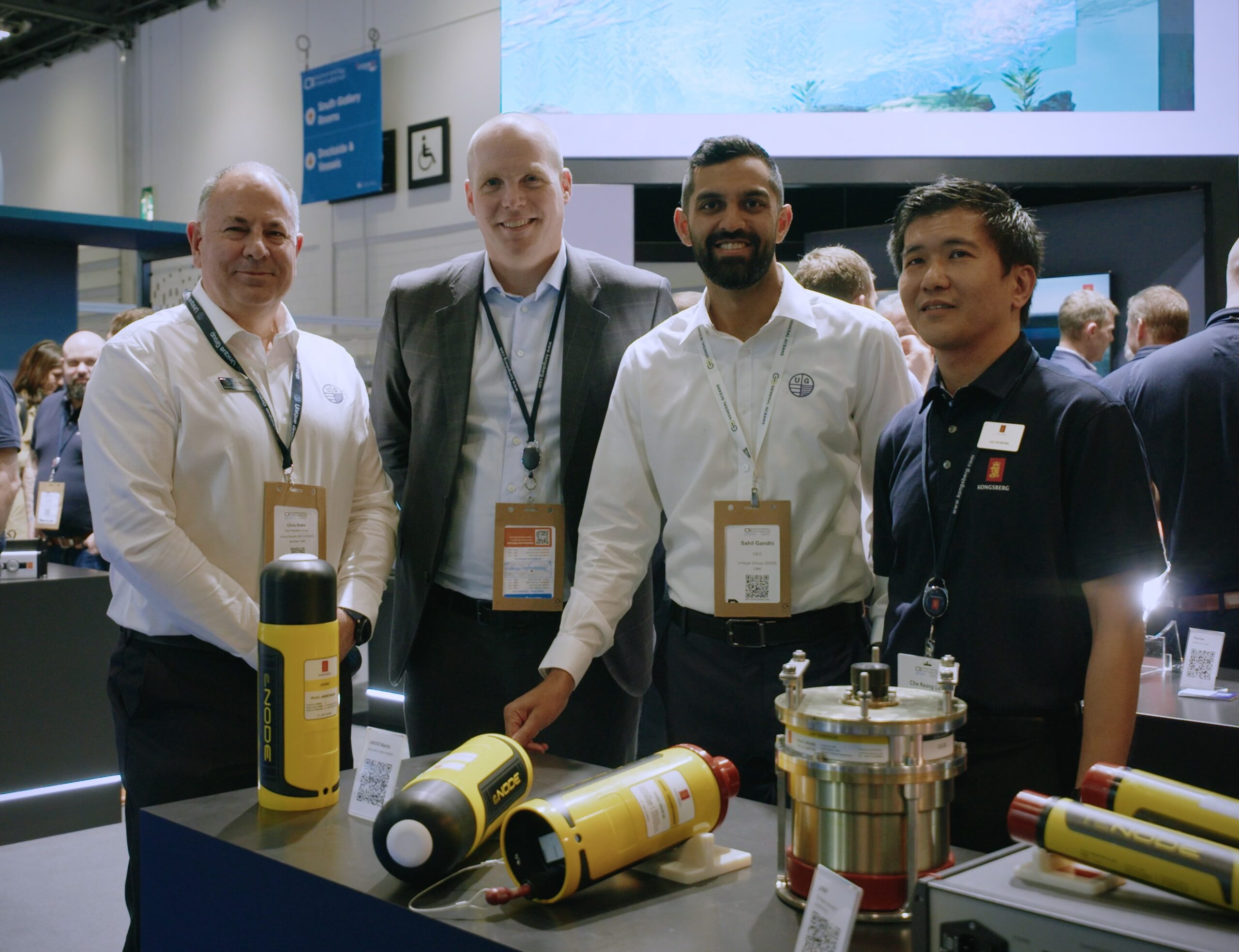
Unique Group invests in Kongsberg Discovery to manage surge in customer demand
Unique Group, global innovators in subsea technologies and engineering, have signed a contract with Kongsberg Discovery for USD 1.7million of advanced seabed mapping and compact acoustic positioning technology for the APAC region.
The agreement, for the delivery of cNODE Transponders, µPAP SSBL systems and the recently launched EM2042 multibeam echo sounder (MBES), allows Unique to boost its state-of-the-art subsea equipment rental pool, satisfying increasing market demand for innovations capable of unlocking the secrets of the seafloor.
Empowering success
Unique Group, an industry leader in subsea technology rental, sales and services, has an established relationship with Kongsberg Discovery, stocking a broad range of the Norwegian-headquartered company’s proven oceanographic equipment.
The latest order, confirmed at Oceanology International in London, will swell the capacity of Unique’s Singapore base, giving customers in South East Asia fresh access to the calibration free µPAP SSBL systems and the lightweight, robust and user-friendly EM2042, launched in September 2023.
As Sahil Gandhi, CEO, Unique Group, explains, the breakthrough MBES, created to deliver optimal seabed data gathering in remote, challenging environments, is exactly the kind of technology Unique’s ambitious customers require.
Quality counts
He comments: “The EM2042 multibeam systems will support the demand for both standalone rental and for installation on Unique’s Uni-Max USV for seabed mapping and hydrographic surveys. The EM2042 offers a quad-swathe high ping rate and predictive pitch for beam steering, allowing for increased productivity as higher survey speeds can be achieved without reducing data quality.
“This combination of the Kongsberg EM2042 and Uni-Max USV provides the absolutely highest quality data, with great operational functionality and efficiency for our growing customer base.”
Ocean intelligence
Spencer Collins, VP Sales, Kongsberg Discovery, adds: “The demand for high-specification underwater positioning and mapping technology reflects a burgeoning market, with a range of segments eager to enable the sustainable management, monitoring and development of the ocean space.
“With Unique’s track record of domain success, they’re often the first call for customers eager to utilise cutting edge technology, helping them achieve the highest quality data and powerful operational efficiencies. We’re delighted to support them in this mission with the latest acoustic positioning and mapping systems.”
Proven results
Kongsberg Digital’s cNODE family of transponders are market proven medium frequency units for highly accurate underwater acoustic positioning and data links, while µPAP is a small and compact acoustic positioning system for tracking ROV's, tow fish, divers and any other subsea target at ranges up to several thousand metres.
The EM2042 has made a significant market impact since launch, winning praise for its lightweight construction (60% lighter than the EM 2040), easy handling, efficiency, durability, and excellent ‘clean’ data acquisition.
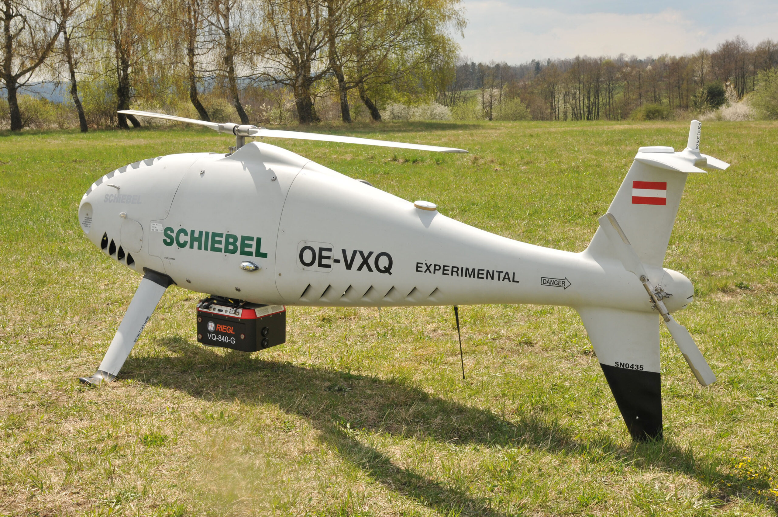
Successful Integration of the RIEGL VQ-840-G Topo-Bathymetric Laser Scanner into the Schiebel CAMCOPTER® S-100 UAS
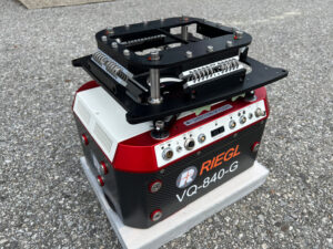
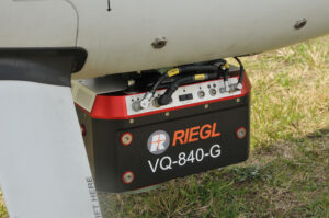
RIEGL Laser Measurement Systems GmbH and SCHIEBEL have successfully completed the integration of a high-end laser scanning system, the RIEGL VQ-840-G topo-bathymetric LiDAR sensor, on the Schiebel CAMCOPTER® S-100 Unmanned Air System (UAS).
Operating a high-end laser scanning system remotely on an Unmanned Air Vehicle (UAV) requires a tailored solution going beyond what is currently available off-the-shelf. In order to maintain the broad operating range of the UAS, it is imperative to keep the weight of the sensor payload low. In addition, the effective execution of the survey mission requires full remote control of the payload instruments and real-time feedback to the operator via a data link.
The compact topo-bathymetric laser scanner was designed for use in a variety of maritime and hydrographic environments. The LiDAR sensor payload system is controlled remotely via a data link, which is a crucial for the integration into the S 100 system.
The scanner is controlled by using the onboard software “RiACQUIRE-Embedded” via the available data link; data acquisition and laser safety are also monitored. Once the survey is completed, the raw data seamlessly integrates into the RIEGL data processing workflow.
The RIEGL VQ-840-G, combined with the outstanding technical specifications and performance of the CAMCOPTER® S-100 UAS, enables an efficient and secure way for surveying shallow waters, where monitoring from boats becomes a challenge. The applications of Airborne LiDAR Bathymetry (ALB) include the mapping of coastlines and river banks as well as the monitoring of natural habitats, water reservoirs and hydraulic engineering applications (e.g., canals, dams, bridges). In a single data acquisition mission, data below and above the water surface are covered.
Additionally, the topographic laser scanners RIEGL VUX-1UAV/-LR and VUX-12023 can be integrated in the front payload bay of the CAMCOPTER® S-100.

Falcon underwater robot helps protect Maldives coral reefs
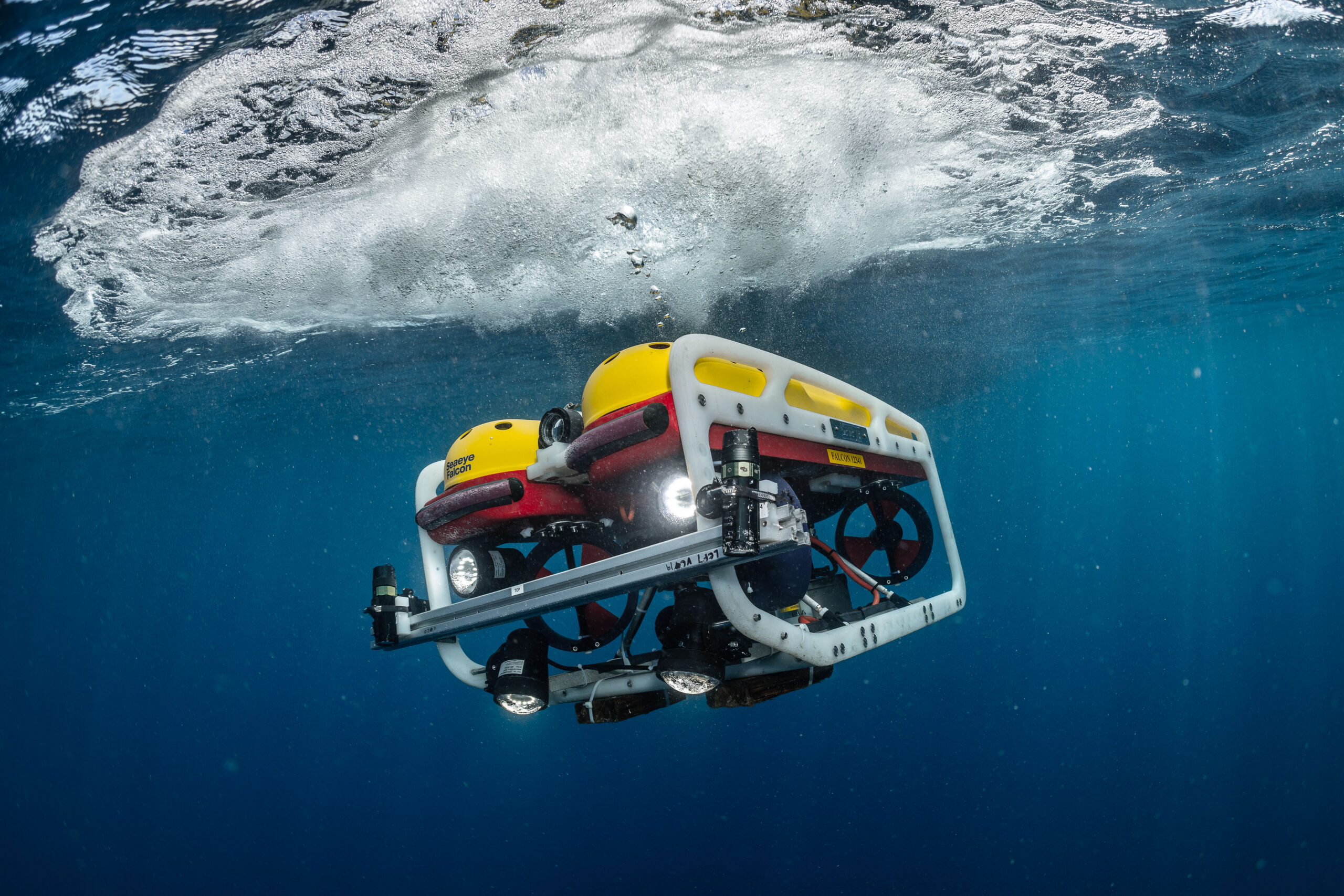
A Saab Seaeye Falcon underwater robot has helped complete the first-ever systematic scientific survey of the waters of the Maldives - the lowest-lying nation on earth.
The Maldives is just 1.5 metres above sea level on islands of coral reef atolls. Globally, coral reefs account for 32% of known biodiversity. They are seen as the ‘rainforests of the ocean’, yet at least 97% could be lost with a 1.5-degree temperature rise.
The Nekton Foundation in partnership with the Maldives Marine Research Institute undertook the mission to understand the Maldives’ ecosystem to help create extensive new protected marine areas and strengthen the resilience of coral reefs to protect the islands from increasingly intense storms and erosion caused by climate destabilisation.
As an official partner to the mission, Saab Seaeye donated use of the Falcon to work alongside human-occupied submersibles, autonomous systems and research technologies.
The Falcon and other submersibles and divers collectively documented the extensive biodiversity of the ecosystem from shallow waters to 1000 metres.
Analysis of video transects from the Falcon has revealed 107 fish species and 130 organisms that live on the seabed, such as coral, sponges and algae. Analysis is ongoing with more species expected to be identified.
The Falcon also recorded charismatic megafauna such as turtles and sharks. These specific observations will be used to support projects engaged in long-term population assessments.
The research recorded extensive coral bleaching at many locations. In other locations, however, exceptionally healthy coral reefs were found. This offers hope that healthy coral reefs can thrive, particularly in areas where cold water upwellings prevent bleaching. These areas may be critical to support coral propagation projects.
Marine life in high definition
To enable scientists to document the biodiversity of the ocean around the Maldives, Nekton scientists devised, tested, improved and deployed a novel methodology for using the Falcon for video transects in shallow waters on the complex topography of coral reefs and operating in areas of strong currents.
Two sets of cameras were positioned on the vehicle, one set forward facing and the other set downward facing. They were spaced 80cm apart and at inward angle of 8 degrees ready to be calibrated for stereoscopic video recording.
The same system was used by snorkelers and other submersibles to complete video transects in an identical manner and at different depths.
Challenge of shallow waters
“Surging currents in the shallows and sheer subsea cliffs made this one of the most challenging operations on the mission,” says Mission Director, Oliver Steeds.
“Only the Falcon could handle the swell surges and powerful currents, including up-currents and down-currents,” he explains.
Renowned for its ability to hold steady in strong currents while filming and manoeuvring, the Falcon is the world’s top robot in its class with a reliability record covering over a million hours underwater.
Nekton is a not-for-profit UK-based research foundation working with the University of Oxford and a wide range of partners engaged in the scientific exploration and protection of the ocean.
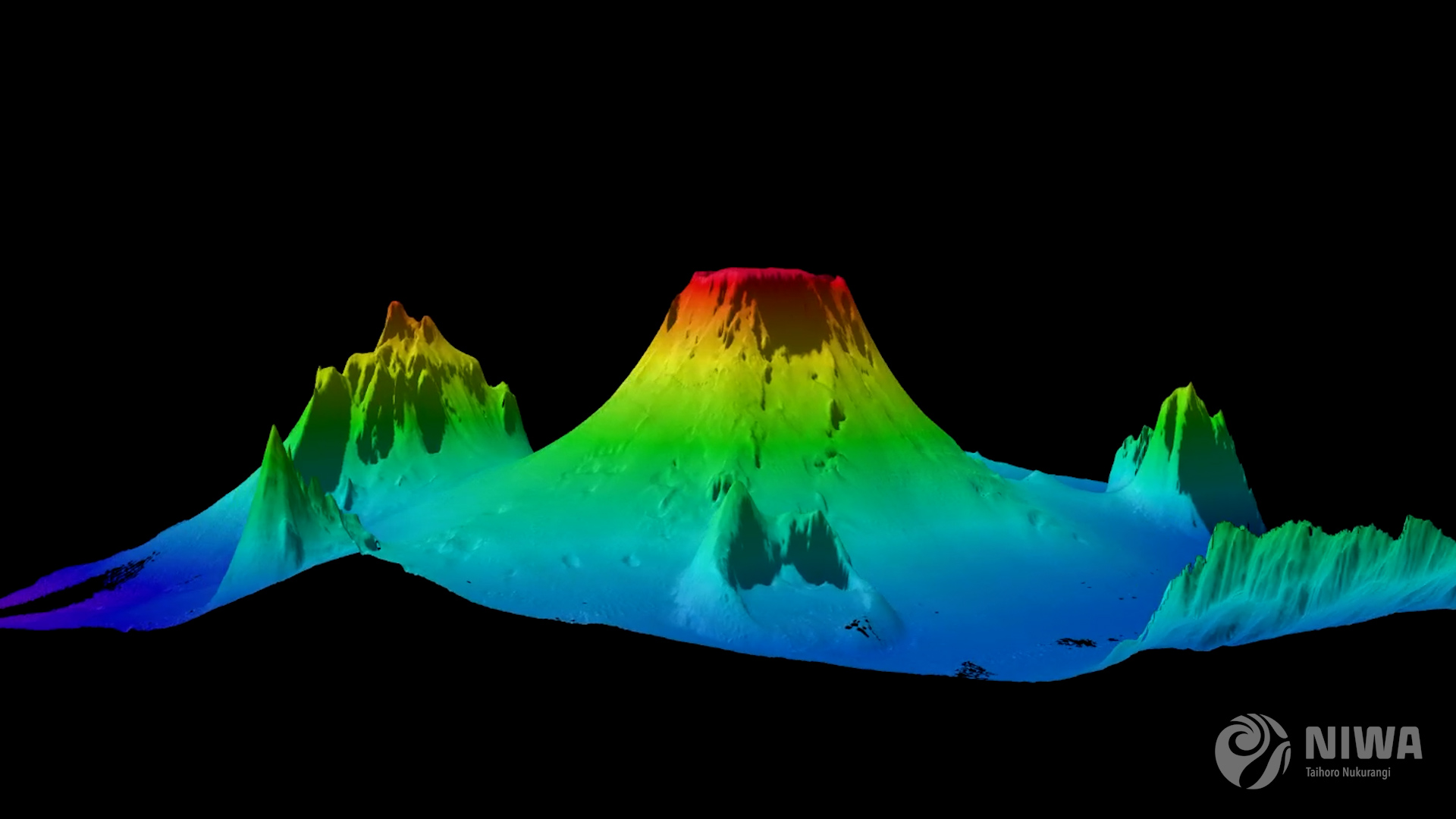
Tonga eruption confirmed as the largest ever recorded
A New Zealand-led team has completed the fullest investigation to date into January’s eruption of the underwater Tongan volcano.
Hunga-Tonga Hunga-Ha'apai (HT-HH) emitted the biggest atmospheric explosion recorded on Earth in more than 100 years.
New Zealand's National Institute for Water and Atmospheric Research (NIWA) has discovered that almost 10km3 of seafloor was displaced – the equivalent to 2.6 million Olympic-sized swimming pools and a third more than initial estimates – with two-thirds coming from the summit and the rest from the surrounding flanks.
Three-quarters of this material was deposited within 20km of the volcano. This leaves almost 3.2km3 unaccounted for.
The project leader, NIWA marine geologist Kevin Mackay, said this missing debris could be partly explained by aerial loss.
“This is why we didn’t notice the loss until we had mapped everything. The eruption reached record heights, being the first we’ve ever seen to break through into the mesosphere. It was like a shotgun blast directly into the sky. The volume of this ‘shotgun’ plume is estimated to be 1.9km3 of material, which has been circulating in our atmosphere for months, causing the stunning sunsets we saw following the eruption. This goes some way to explaining why we’re not seeing it all on the seafloor,” said Mackay.
Despite the huge displacement of material, the volcano’s flank remains surprisingly intact. However, the caldera, or crater, is now 700m deeper than before the eruption.
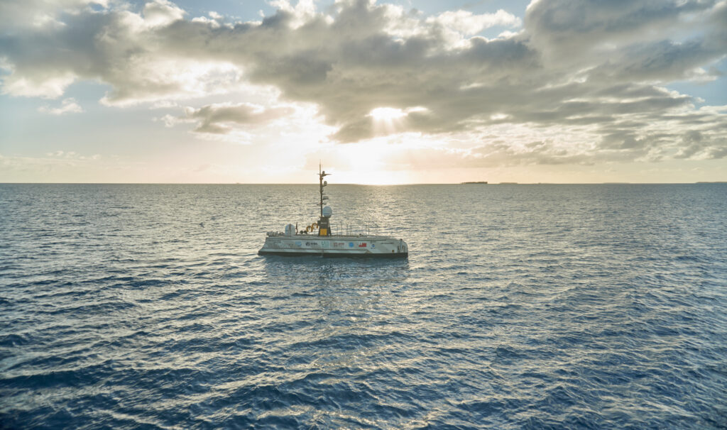
Further evidence from the caldera shows signs that HT-HH is still erupting. A robot boat remotely operated from the UK by SEA-KIT International detected active venting from newly formed cones, explaining why glass fragments formed from cooled molten lava were picked up during NIWA’s earlier survey.
NIWA scientists have also unravelled one of the biggest unknowns of the eruption – the pyroclastic flows.
Pyroclastic flows are currents made up of dense lava, volcanic ash, and gases which can reach temperatures of 1,000°C and speeds of 700km/hr.
NIWA collected 150 sediment cores which were sent to New Zealand’s University of Otago and the National Oceanographic Centre in the UK for analysis. These samples showed pyroclastic deposits some 80km away from the volcano. But Dr Emily Lane, NIWA Principal Scientist - Natural Hazards, believes they could have travelled even further.
“Eighty kilometres was the end of our survey range, but the pyroclastic flows appear to extend beyond that distance, perhaps as far as 100km away. They are also what caused both the domestic and international communications cables to break, with the domestic cable now being buried under 30m of eruptive material.
“The sheer force of the flows is astonishing - we saw deposits in valleys beyond the volcano, which is where the international cable lies, meaning they had enough power to flow uphill over huge ridges and then back down again,” said Dr Lane.
On land, the heat from pyroclastic flows creates a frictionless boundary layer which allows them to move so rapidly, like how a puck glides on an air hockey table.
However, Mackay says this is the first time that scientists have observed underwater pyroclastic flows of this magnitude.
“It’s the interaction with water that made this event so unprecedented. It’s still speculation but the latest science shows that this phenomenon may be more exaggerated under water. This could be why the pyroclastic flow travelled so far and with such force,” he said.
When heated, water can expand to around 1,000 times its volume. When you get several km3 of hot magma instantly hitting the cold saltwater, this reaction is supercharged, and all that energy must go somewhere – and the only options are to explode up or sideways out of the volcano.
“While this eruption was large – one of the biggest since Krakatoa in 1883 – there have been others of similar magnitude since then that didn’t behave in the same way. The difference here is that it’s an underwater volcano and it’s also part of the reason we got such big tsunami waves,” said Mackay.
Dr Lane said that because these volcanos are not just found in the Pacific, but the world over, we must know what happened and why it was so violent.
“The pressure anomaly generated by this eruption supercharged the tsunami so that it was able to travel right across the Pacific and world-wide. This mechanism meant that it could travel further and faster than our warning systems expected. The Krakatoa eruption was that last time a volcanic tsunami on this scale occurred,” she said.
The significant reshaping of the seafloor also had dramatic effects on ecosystems in the region.
There was little sign of any animal life on the flanks of the volcano, in deeper water channels, and most of the surrounding seafloor. However, there were patches of abundant life that had survived the eruption on several seamounts, giving hope for recovery.
This video, shot on board NIWA’s Research Vessel Tangaroa, shows the scale of the HT-HH explosion and the findings of the resulting undersea investigations.
This work was done by the NIWA-Nippon Foundation Tonga Eruption Seabed Mapping Project (TESMaP). Supported by The Nippon Foundation, NIWA and SEA-KIT surveyed over 22,000km2 surrounding the volcano, including mapping 14,000km2 of previously unmapped seafloor as part of The Nippon Foundation GEBCO Seabed 2030 project, which aims to map the world’s oceans by the end of the decade.
Mitsuyuki Unno, Executive Director of The Nippon Foundation said that this work is vital to understand the science behind these types of events.
“The research has made clear that underwater volcanic eruptions have serious implications for coastal communities around the world. A huge proportion of the Earth’s population live on the coast, which are already vulnerable to the impacts of climate change, sea level rise, and big storms.
We need to further our understanding of the risks from underwater volcanos so we can better prepare and protect future generations and their ecological environments.”
Jamie McMichael-Phillips, Project Director of The Nippon Foundation GEBCO Seabed 2030 project said that this project highlights the benefits of working in collaboration to collect fundamental knowledge of the ocean seabed.
“TESMaP is a fantastic testament to what can be achieved if we all come together in pursuit of scientific research. A complete map of the ocean floor is a necessity to protect our planet in line with the UN SDGs and our Seabed 2030 partners play an invaluable role in helping us realise our goal - as demonstrated by the truly collaborative nature of TESMaP."
Ben Simpson, CEO of SEA-KIT said that their technology allowed scientists to undertake a dangerous and vital mission.
“We have been able to add new equipment to our proven X-Class Uncrewed Surface Vessel’s survey platform, such as winch and sensor cage towing capability, showing yet again the potential of uncrewed vessel technology to support and develop our understanding of the ocean. USV ‘Maxlimer’ provided a low risk, non-invasive survey solution for this challenging location, bringing down both risk and costs and reducing carbon emissions.”
Blue Ocean Seismic Services takes seismic leap towards commercialisation of its revolutionary marine swarm robotics technology
Blue Ocean Seismic Services, the marine seismic survey disruptor, has successfully completed a series of passive and active seismic trials proving the quality of seismic data collection, putting the Company on track to commence pre-commercial trials during the second half of 2023.
Backed by industry leaders bp Ventures, Woodside Energy and Blue Ocean Monitoring, the UK/Australian tech company Blue Ocean Seismic Services is developing the world’s first fleet of autonomous low-impact subsea nodes for capturing high-quality seismic data from the ocean floor for multiple applications such as offshore wind, oil and gas, and CCS. These underwater vehicles will transform the offshore seismic sector to become more affordable, faster, safer, more environmentally friendly and significantly less carbon intensive.
Since its last update, the Company has undertaken substantial further testing in Plymouth, the North Sea and Australia towards confirming the effectiveness of command and control systems, underwater flight performance, seismic coupling and active seismic data acquisition.
Focusing on the recent North Sea active seismic trial, the Company achieved its technology and data collection objectives, including:
• Acquiring additional cycles of active seismic data with its alpha vehicles (AP-OBSrV) alongside conventional ocean-bottom nodes (OBNs);
• Testing engineering solutions for optimisations identified in the previous (August 2021) trials.
• Confirming the ability of the AP-OBSrV to maintain a close seismic coupling with the seabed, especially where cross currents exist.
These objectives were all achieved in the active seismic survey, in particular confirming that the geophysical performance is on track. With this confirmation, the Company will continue its rapid progression towards the commencement of commercial operations in 2024, starting with the assembly of up to 250 OBSrV version 1 nodes (based on the AP-OBSrV design) in batches, with pre-commercial trials in H2 2023.
Before commencing pre-commercial trials in H2 2023, the Company is progressing discussions with industry partners regarding their strong interest in our services and pre-qualifying for future tender opportunities. In addition, following substantial interest from potential customers, the Company also plans to open a new office in Houston, Texas, in Q1 2023, in line with its strategy to establish a presence in key markets.
Blue Ocean Seismic Services is delighted to announce the appointment of Fabio Mancini, PhD, as Chief Geophysicist. Fabio joins Blue Ocean Seismic Services from Woodside Energy where he was Chief Geophysicist from 2018. Fabio has extensive industry experience; he spent five years at TotalEnergies in R&D and operations, working on projects covering both seismic processing and acquisition. He subsequently moved to Hess, where he worked in the Exploration and Production Technology team and was in charge of Hess’s seismic activities for the Eastern Hemisphere. Fabio then moved to Australia to join Woodside where he covered several roles over ten years.
Simon Illingworth, Managing Director & Chief Executive Officer, Blue Ocean Seismic Services said:
“The successful results of the various pre-commercialisation trials over recent months are the culmination of a huge amount of work by the Blue Ocean Seismic Services team and represent a massive leap forward on our path to full commercialisation. We are now in an excellent position to continue with the operational scale up of the business, engaging with government regulators in our key initial markets and begin commercial operations in 2024. Substantial investment is also being made in securing components for our initial inventory of pre-commercial vehicles.
“As a leading figure in the subsea exploration sector, it is a huge endorsement to have someone of Fabio’s calibre join the business, he will bring considerable expertise and experience to the team as we move to the next phase of our development.”
Dr. Fabio Mancini, Chief Geophysicist, Blue Ocean Seismic Services added:
“I am very excited to be joining the team at Blue Ocean Seismic Services. As one of the co-inventors I look forward to realising the vision of transforming seismic acquisition in the years ahead.”

SUT’S Gwyn Griffiths Underwater Robotics Award Winner announced: Nominations now open for 2022
Operator demand was what stimulated Aleksandra Tomaszek, the winner of the inaugural Society for Underwater Technology (SUT) Gwyn Griffiths Underwater Robotics Award 2021, to become interested in robotics.
The inaugural award received high-calibre international nominations, with Aleksandra Tomaszek, COO and Co-Founder of Aberdeen-based 1CSI selected as the 2021 winner
Gwyn Griffiths MBE, a Past President of the SUT explained the judges’ selection:
“Aleksandra's achievements, drive and business acumen make her a most worthy winner. What stands out is her strong background in offshore project engineering and management, coupled with a mind tuned to the sometimes elusive combination of technology and business innovation.
“Those personal attributes led her to the design, development and introduction of the revolutionary TIAMAT ROV-mounted ultrasonic testing tool to meet client needs, with a vision to change the face of subsea ultrasonic inspection: a truly inspirational winner!”

Aleksandra Tomaszek
Nominations for the 2022 Gwyn Griffiths Underwater Robotics Award are now sought with full details at www.sut.org/gwyn-griffiths-underwater-robotics-award-ggura/. The award recognises people in the early to mid-stages of their career (and under 40 years old) who have made outstanding contributions to their field in underwater robotics. The award may be for industry/commercial, research and/or creative activity in underwater robotics. The winner receives £500, a certificate and an engraved award.
About the 2021 winner and her interest in robotics
Aleksandra Tomaszek, who at 1CSI is responsible for leading the company’s business operations globally, executing its business strategy and ensuring operational excellence, explained how her interest in robotics was stimulated:
“Following time with Balmoral Offshore Engineering overseeing the design and manufacture of deep-water products; I then spent three years at Oceaneering where my role involved the worldwide deployment of leading-edge subsea inspection technology using remote vehicles, it was where I met my business partner Matthew Kennedy - who developed a subsea scanner in 2009. I found my time there to be fascinating and exciting – it drew me in and made me wish to develop more methodical and effective approaches to the assessment of underwater asses.
“We were just finishing a project when the operator in question approached us looking for an inspection solution for another of their assets. At the time there was nothing that could be done with the existing technology. That made me think: ‘What if we had a clean sheet of paper, time and the resources required? How amazing it would be to create something new!’
“The opportunity arrived when we left Oceaneering and set up 1CSI Ltd in early 2017. Driven by operator demand and the desire to create applicational solutions we sought and received government grant funding to design and develop the TIAMAT™