
iXblue announces strategic partnership with RDML Tim Gallaudet to strengthen its growing presence in the U.S.
iXblue, Inc. and iXblue Defense Systems announced today that they have formed a strategic partnership with Rear Admiral (RDML) Timothy Gallaudet through his marine technology consulting agency, Ocean STL Consulting. With this partnership, iXblue and RDML Tim Gallaudet will be advancing iXblue’s growing market presence in the U.S. in the fields of maritime autonomy, navigation and positioning for both defense and the private sectors.
“Tim is a great addition to our teams. He brings a nationally recognized reputation and record of success at the highest levels of government, academia, and the private sector.” States Marine Slingue VP at iXblue, Inc. “His comprehensive technical knowledge of oceanography and navigation, as well as extensive experience in the field in the US Navy and with NOAA will be of great value to iXblue.”
RDML Tim Gallaudet recently retired from the National Oceanic and Atmospheric Administration (NOAA), where he served as the Assistant Secretary of Commerce for Oceans and Atmosphere and Deputy Administrator, advancing the American Blue Economy activities that pushed forward marine transportation, sustainable seafood, ocean exploration and mapping, marine tourism and recreation, as well as coastal resilience.
Before joining NOAA, he served for 32 years in the U.S. Navy, completing his service in 2017 as the Oceanographer of the Navy. His lifelong commitment to education, science, service, and stewardship has brought him a wealth and knowledge and a stellar reputation. RDML Gallaudet holds a Bachelor’s Degree from the U.S. Naval Academy and a Master’s and Doctorate Degree from Scripps Institution of Oceanography, all in oceanography.
“RDML Tim Gallaudet has been at the forefront leading the efforts to advance science and technology strategies for Artificial Intelligence and Unmanned Systems.” States Ted Curley, President and General Manager at iXblue Defense Systems. “His knowledge of the maritime industry and his familiarity with iXblue makes him a perfect partner in our goal to strengthen and grow our presence in the U.S. defense market.
“Marine mapping is critical to advancing our understanding, the health, and the sustainable use of our oceans, and iXblue brings a capability to do this like none I have ever seen,” said RDML Gallaudet. “As a lifelong champion of ocean science and technology, I could not be more thrilled to partner with iXblue.”
More info www.ixblue.com

Duo of Distribution Agreements
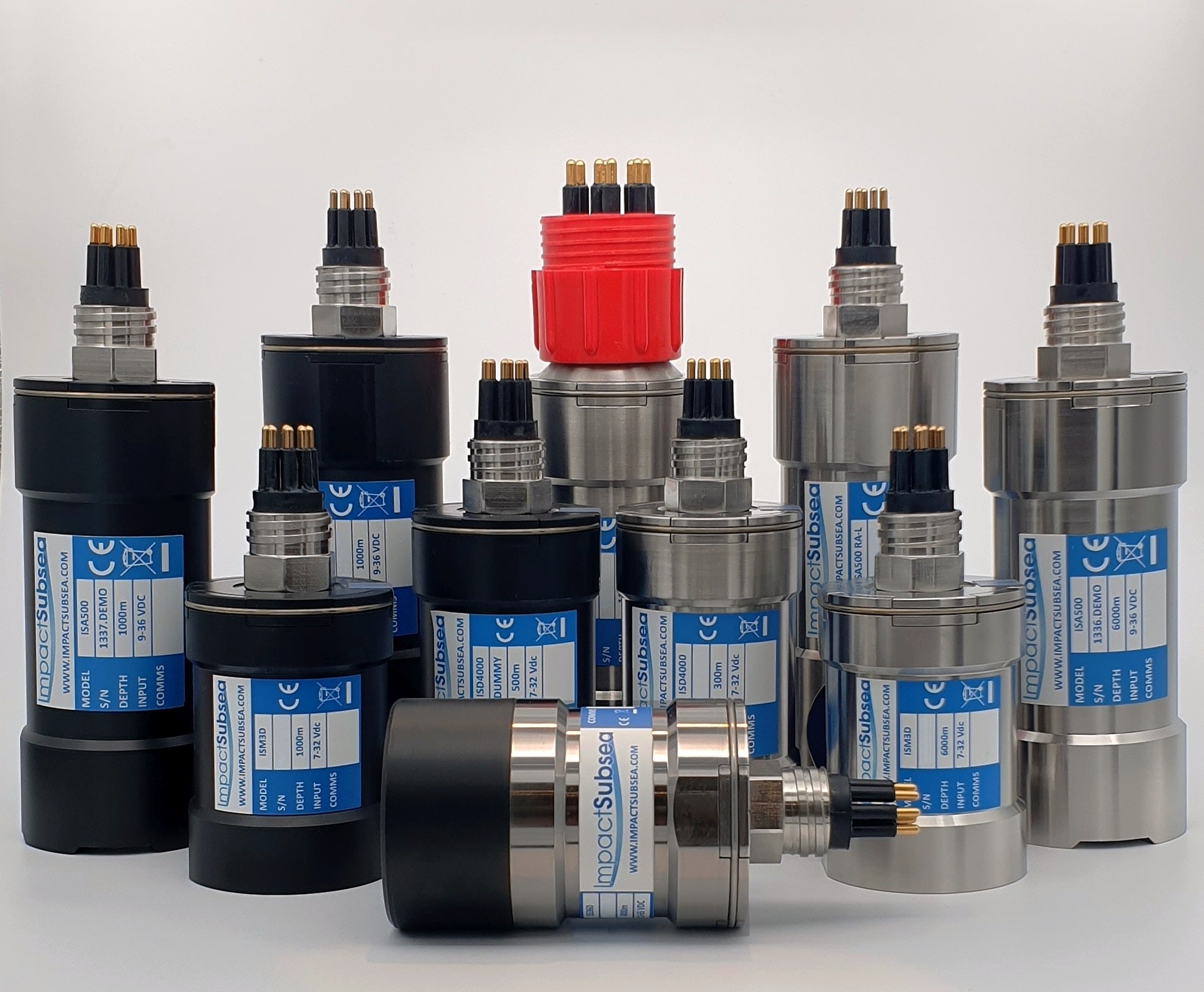
Impact Subsea is delighted to announce the appointment of two new companies as distributors of Impact Subsea sensor solutions.
Norwegian Offshore Rental has been appointed as a distributor within Norway and Seismic Asia Pacific within Australia.
Headquartered in Haugesund, Norwegian Offshore Rental are leading providers of rental equipment within the offshore, subsea and renewable energy industries. NOR’s vision encompasses providing quality product and services with a strong customer focus. Their vision and skills will provide excellent support to Impact Subsea’s Norwegian Client base.
Jostein Jansen, Sales Manager, NOR commented:
“NOR is pleased to add Impact Subsea sensor solutions to our large equipment selection. Their range of quality ROV and AUV sensors align with our mission to provide dependable and effective equipment to our customers in Norway and around the world.”
Established in 1959, longstanding equipment providers; Seismic Asia Pacific provides both hardware and software equipment and solutions for Hydrographic, Oceanographic, Geophysical and Navigation Systems within Australia. With additional offices throughout South East Asia and the Pacific Rim, the team at Seismic Asia Pacific will play a key role in the sales and support of Impact Subsea’s expanding customer base.
Paul Duncan, Executive Director, Seismic Asia Pacific comments:
“With the increasing move towards remote and autonomous systems to carry out various marine survey works and applications. Impact Subsea and their range of high quality ideally sized sensors and product lines adds beneficial solutions for our industry and complement our product offerings.”
Ben Grant, Managing Director, Impact Subsea further commented:
“To provide excellent regional support for our range of ROV and AUV sensors Impact Subsea continues to expand our distributor network. We are delighted to welcome Norwegian Offshore Rental and Seismic Asia Pacific at a time of strong growth in their respective markets. The technical support provided by these two well respected companies will be of significant benefit to Impact Subsea sensor users”.
---
Impact Subsea design and manufacture innovative underwater Sonar, Altimeter, Depth, Range, Heading, Motion and Temperature sensing solutions. The company also provides a range of underwater housings and a state of the art Flooded Member Detection system. Impact Subsea's solutions are used on underwater Remotely Operated Vehicles (ROV), Autonomous Underwater Vehicles (AUV) and in numerous standalone underwater applications. All sensors are extremely robust, small form factor, high reliability and lead the market in technical capability. To learn more please visit www.impactsubsea.co.uk
Fugro helps NOAA update nautical charts in Alaska for improved maritime safety and commerce
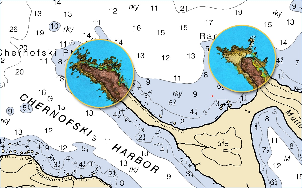
Fugro has completed fieldwork on a hydrographic survey project for the US National Oceanic and Atmospheric Administration (NOAA) to update nautical charts off the northern coast of Unimak Island, Alaska. Located in the Bering Sea, the island supports multiple fisheries, a major transit route, and at sea cargo transfers. Existing charts in the region do not meet current navigational needs, with data in some cases predating the 1940s. Fugro is helping NOAA address these data deficiencies with new, high resolution bathymetry over five sites totalling approximately 1700 km2. These Geo-data will be used to produce new nautical charts, making marine navigation safer and more efficient.
The new bathymetry was acquired from two multibeam-echosounder-equipped survey vessels, one focused on nearshore waters, the other on deeper waters located farther offshore. To plan the more challenging nearshore surveys, Fugro employed its SatRecon® service, which combines satellite imagery and proprietary processing techniques for the identification of potential unmapped hazards such as shipwrecks and rock outcrops. In addition to improving the safety of crew, equipment and the environment, identifying these hazards also increased Geo-data acquisition efficiency, allowing crews to survey the nearshore waters at a faster rate than would have otherwise been possible.
“It was great to work for NOAA in Alaska this summer, and we are really happy with the way our SatRecon service helped progress the nearshore survey operations,” said Mark MacDonald, Hydrography Director for Fugro in the Americas. “Since the mid-1970s, Fugro has been successfully mapping the seafloor in the state, including many years of nautical charting updates for NOAA, starting in 1998. We understand the operational challenges associated with working in remote parts of Alaska, and were pleased to apply innovative solutions on this project, unlocking insights from Geo data for a safer and more sustainable ocean economy.”
More information www.fugro.com
Greensea Launches EOD Workspace Simulator
Simulator replicates subsea environments for training
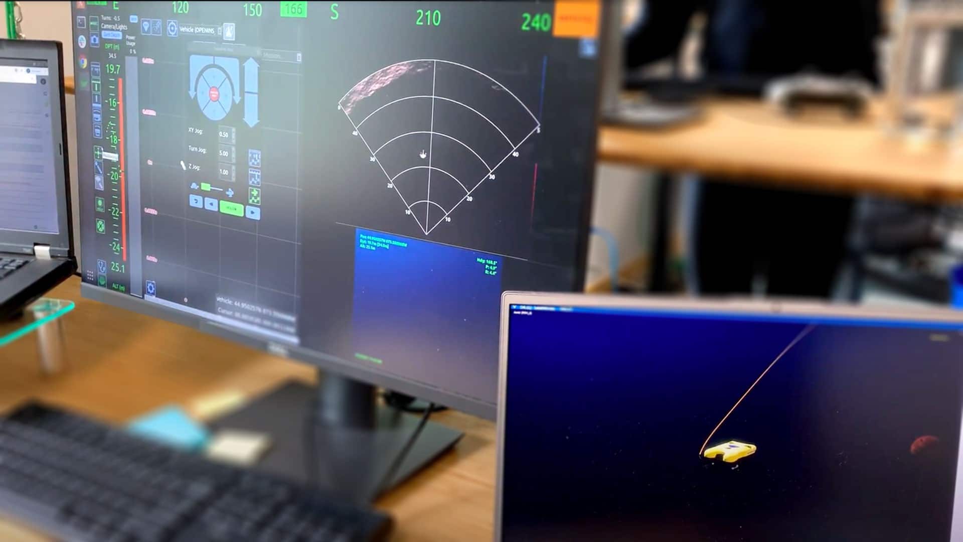
Greensea Systems, creator of EOD Workspace, the software and control solution for military EOD operations, has launched EOD Workspace Simulator. The new simulator, created in partnership with GRi Simulations, incorporates a physics engine based on actual subsea vehicle models which provides the realism needed to prepare operators, technicians, and other subject matter experts to be successful in critical real-world subsea environments when using EOD Workspace in the field. EOD Workspace Simulator will be offered for sale to military groups actively using EOD Workspace.
“Operators using the simulator are flying EOD Workspace and the system is working exactly like it would if they were flying a real ROV. It’s an amazing real life environment that allows more operators to train, in more locations and, since it can be done independently of vehicle availability, training can be done more often. It all leads to better preparedness,” says Ben Kinnaman, Greensea CEO. “One of the hardest things about training on an ROV is the fact that the operator has zero situational awareness and has to learn how to understand and control the vehicle using only sonar and video visuals. With the simulator, new operators and trainers get an inwater view of what’s happening as the operator responds to sonar and video visuals. Operators get to practice in a low stress classroom environment, ensuring that these skills are solidified.”
Simulator environments can replicate actual CONOPS allowing users to practice and train on missions with EOD Workspace. Supervisors can specify starting coordinates as well as environmental conditions such as time of day, surface conditions, current, and turbidity. Shipping with 10 (ten) mine targets that are placed throughout the simulated scene, operators will develop proficiency reading sonar and detecting objects. Additional target types and scenes will be available on a subscription basis. Additional information can be found at: https://greensea.com/eod-workspace-simulator/
ABOUT GREENSEA SYSTEMS, INC.
Greensea is the creator of OPENSEA, an open architecture software platform, and is a world leader in navigation and autonomy technology for marine robotics. Greensea develops software and hardware that revolutionizes the working relationship between people and machines. They are known for innovative and powerful technology designed for in-the-field success by a team of industry-experienced engineers driven to help customers get their job done. Since opening in Richmond, Vermont in 2006, the company has successfully delivered more than 1500 OPENSEA-based systems to the manned and unmanned maritime industry. Greensea directly supports several military programs with products, training, and technology development, including Explosive Ordnance Disposal using miniature marine robotics, Special Operations Forces combat diving, and ship hull robotics. Greensea also provides OPENSEA software products and services to Original Equipment Manufacturers and leading developers and integrators throughout the marine industry. To learn more, visit www.greensea.com, email [email protected], connect on Linkedin, or call us at +1.802.434.6080.
Hydroacoustic technology specialist appoints first marine surveyor to team
Subsea Europe Services GmbH’s expansion continues with new data acquisition and processing support for technology rental clients
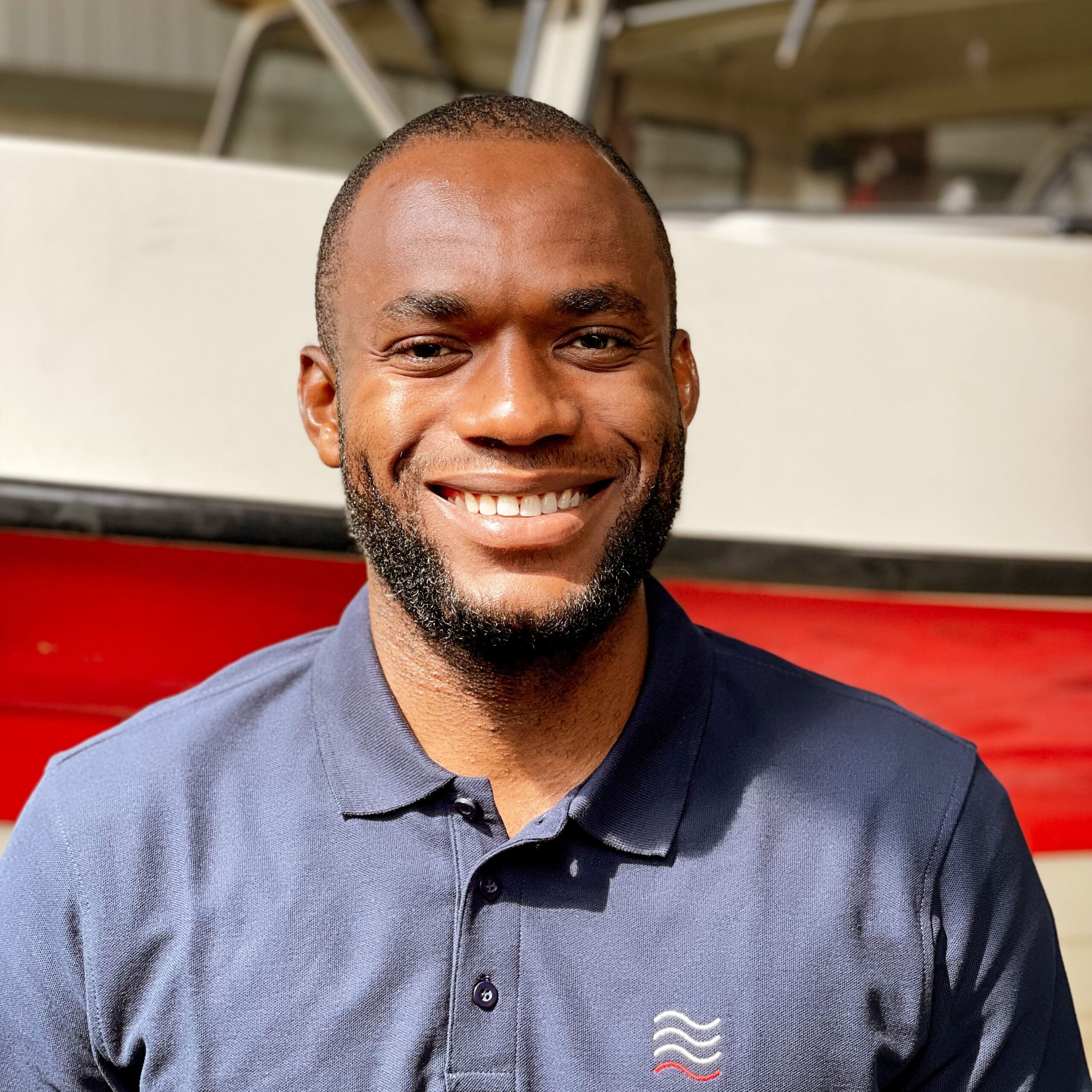
Hamburg, Germany – Ezekiel David (30) has joined Subsea Europe Services GmbH as a marine surveyor. The appointment is in line with the Hamburg-based hydroacoustic technology specialist’s growth plan, which saw the recent addition of a new Field Operations Manager and a partnership with Aberdeen-headquartered Seatronics that resulted in hundreds of hydroacoustic, and auxiliary systems added to the company’s Europe-wide rental portfolio.
Ezekiel, who holds an M Sc. with Distinction in Surveying and Geoinformatics with Specialisation in Hydrography and Geodesy from the University of Lagos in Nigeria, will complete his second Masters at Hamburg Hafencity University, in tandem with his position at Subsea Europe Services. Created to provide direct support to rental pool clients, the new position is intrinsically linked to Subsea Europe Services’ ambition to simplify hydrographic surveying so that organisations without in-house expertise can easily acquire their own marine data.
“Our integrated Hydrographic Survey System – iHSS – already streamlines the marine survey workflow by removing the need for expertise during procurement and installation, but the nature of this technology still demands a trained professional to get the best out of it,” said Sören Themann, CEO, Subsea Europe Services GmbH. “Ezekiel, an experienced marine surveyor, is well positioned to help our clients do just that, both during the survey campaign at sea as well as the post-processing phase back home. We’re pleased to have him in the team and confident he will do a fantastic job.”
“I’m delighted to join Subsea Europe Services, especially as it’s a new breed of company with the potential to expand and transform the marine survey sector for a more sustainable future,” said Ezekiel. “Having already used the iHSS recently installed on the university’s DVocean survey boat, I’m really looking forward to getting out on the water with Subsea Europe Service clients to help them collect precise marine data using it, as well as the countless other subsea technologies we offer in our rental, subscription and sales portfolio.”
Ends
Ezekiel David, Marine Surveyor, Subsea Europe Services
Media contacts:
Sören Themann
CEO, Subsea Europe Services GmbH
+49 170 7676666
[email protected]
Saul Trewern
Account Director, Oceanspace Communications
+44 (0)7312 105 130
[email protected]

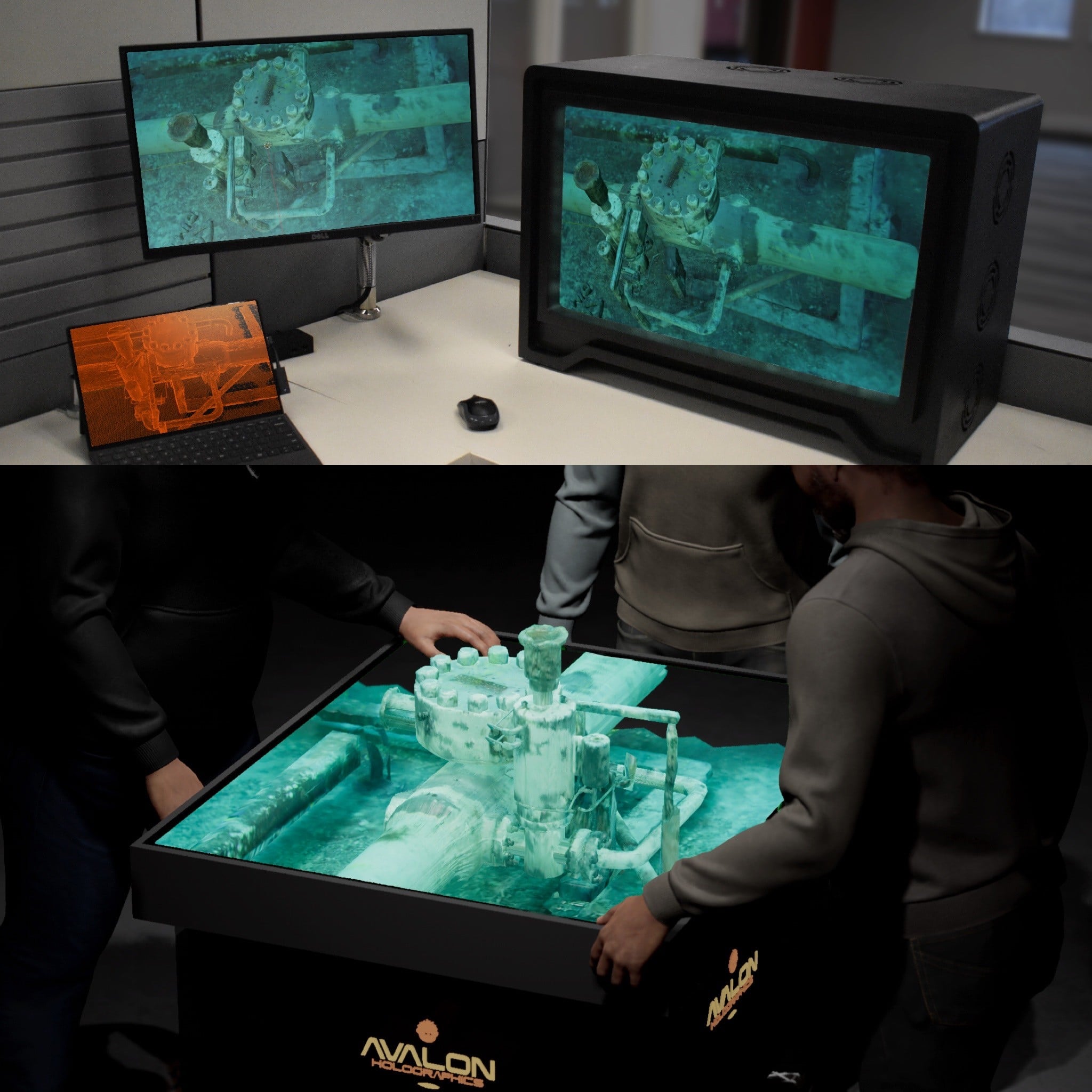
DimEye Corp. and Avalon Holographics bring the subsea world to your table
DimEye Corp. announced successful tests with Avalon Holographics Inc. in generating 3D Holograms of DimEye 3D As-Built CAD Models of subsea equipment. Over the last years, DimEye has developed a unique technology for high-accuracy subsea surveys and 3D CAD Modeling. Avalon Holographics leads the next wave of display technology with professional holographic displays that revolutionize the way people produce, view, and understand visual content. By replicating the experience of looking at real objects, Avalon’s displays produce realistic and natural 3D experiences.
For further information please visit www.dimeye.com or email Arnauld Dumont at [email protected]
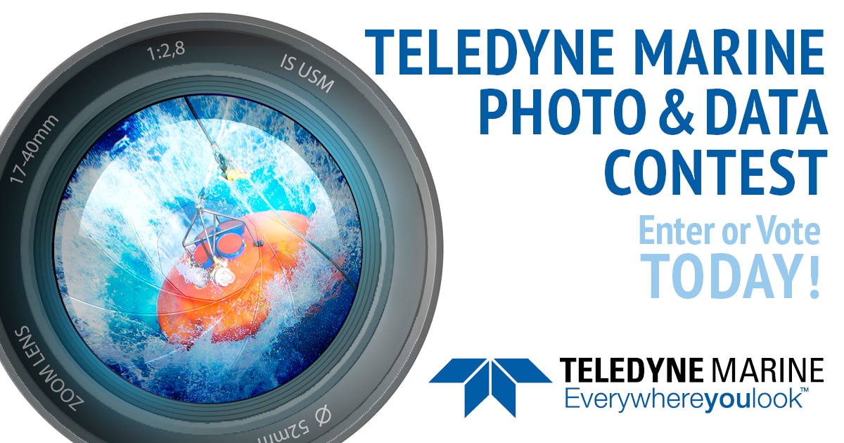
Teledyne Marine Annual Photo Contest Now Open
Teledyne Marine has announced the return of its annual photo contest. All Teledyne Marine customers and users are encouraged to submit their favorite photos showing any of Teledyne Marine’s products in action, data collected using a Teledyne Marine product, or photos taken using a Teledyne Bowtech camera.
This year’s contest, which closes on September 3, 2021, includes eight entry categories. The grand prize winner will choose from a GoPro HeroPro 9 Camera or Apple Watch SE; and the remaining seven winners will select from three prizes to match their interests.
All are encouraged to visit the contest page to submit an image and/or vote for their favorites. Full contest details, online submission, and voting can be found at: www.teledynemarine.com/contest
About Teledyne Marine
Teledyne Marine is a group of leading subsea technology companies that are part of Teledyne Technologies Incorporated. Through acquisitions and collaboration, Teledyne Marine has evolved into an industry cornerstone, bringing Imaging, Instruments, Interconnect, Seismic, and Vehicle technology together to provide total solutions to our customers. www.teledynemarine.com
MEDIA CONTACT
Teledyne Marine
49 Edgerton Drive
N. Falmouth, MA 02556
Attn: Margo Newcombe
[email protected]
Tel. +1-858-335-6727
Sonardyne BlueComm to stream ocean exploration missions live
The world’s deepest diving acrylic hulled manned submersible is to be equipped with Sonardyne’s BlueComm optical communications link to allow live streaming of deep ocean expeditions anywhere in the world.
The Triton 7500/3 series submersible will operate from REV Ocean, one of the world’s most advanced research vessels, currently under construction for the Norwegian non-profit organisation of the same name.
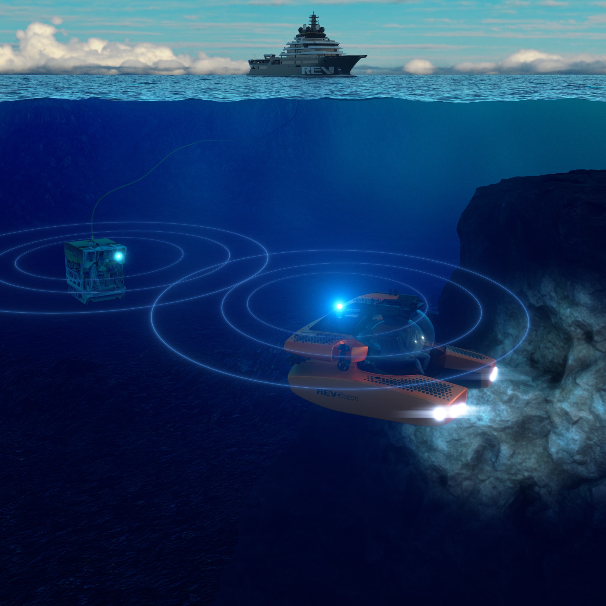
BlueComm will allow the occupants of the Triton submersible to live stream high-definition video and audio to the surface, including to those on board the vessel’s 35-person auditorium or even website and television audiences worldwide, to share first-hand in their experience.
The Triton 7500/3 is the only acrylic hulled submersible able to carry up to three people down to 2,286 m water depth. BlueComm will support its missions by transmitting data using high power light emitting diodes (LEDs) that are rapidly modulated.
Most underwater data transmission is done using acoustic signals, because of the ability of sound to travel long distances, measuring many kilometres, through water. But the bandwidth available using acoustics is not wide enough for high-definition video. By using light, BlueComm is able to stream up to 10 Mbps over up to 150 m.
During its missions, REV Ocean’s Triton submersible will work alongside a 6,000 m rated Kystdesign remotely operated vehicle (ROV), which will also be fitted with BlueComm. The Triton submersible will stream its video to the ROV, which will in turn feed the data up to the REV Ocean research vessel via a cable.
REV Ocean’s Triton 7500/3 is being built by Triton Submarines, builders of the first fully accredited (DNV/GL) submersible capable of diving to full ocean depth. The Triton’s unique pressure hull is being made of acrylic, which is over 300 mm (1 foot) thick and offers passengers a 360 degree and unobstructed view of the ocean during dives of up to 12 hours in duration. The design uses certified, aircraft-grade materials, Lithium-ion battery technology as well as pressure-balanced and oil-filled sub-systems to achieve its remarkable depth capabilities.
This is the latest application of BlueComm onboard a Triton submersible. In 2019, the Nekton Foundation used BlueComm to conduct the world’s first live streaming to global audiences from a submersible during their First Descent expedition in the Indian Ocean. This was quickly followed by the world’s first presidential address from a manned submersible, on the same mission. Both milestones were undertaken using a Triton 1000/2.
“Triton is delighted to be working with the talented and resourceful team at Sonardyne again,” says Patrick Lahey, Triton Submarines’ President. “The Sonardyne BlueComm system is an example of a transformative technology, which dramatically enhances the effectiveness and utility of our entire range of human occupied vehicles. Project REV is a very ambitious ocean exploration project aimed at furthering our knowledge and understanding of the ocean and the Sonardyne BlueComm system is a critical part of capturing the essence of what it is like to be on a dive in human occupied vehicle with remarkable accuracy and quality. The content made possible by the BlueComm system will dramatically enhance the viewing experience for the audience by making it both more powerful and compelling.”
“Through-water communication using BlueComm not only provides a reliable alternative to using cables underwater, which can be expensive to install and vulnerable to damage, for projects like this, it also provides the freedom for scientific vehicles and their occupants to explore the deepest seas and oceans yet still be connected with the surface,” says Geraint West, Global Business Manager, Oceanographic, at Sonardyne. “Nekton’s First Descent Mission in 2019 illustrated BlueComm’s unique ability to bring ocean conservation directly into peoples’ homes, furthering education and understanding. We’re delighted that BlueComm will now play an integral part in supporting the REV Ocean team during their future science cruises.”
Alex Rogers, the Science Director of REV Ocean said “BlueComm is a revolutionary technology enabling live transmission of submersible dives to audiences around the world. It can truly convey the excitement of ocean exploration as demonstrated last year in the Indian ocean by the Nekton Foundation. For REV Ocean it is a great asset for ocean literacy, educating civil society and policy makers about the beauty and value of the deep ocean but also about threats such as plastic pollution, ghost nets and disruption from the changing climate. It also enables scientists on our mothership or even back on land to remotely participate in dives even though they are not physically present.”
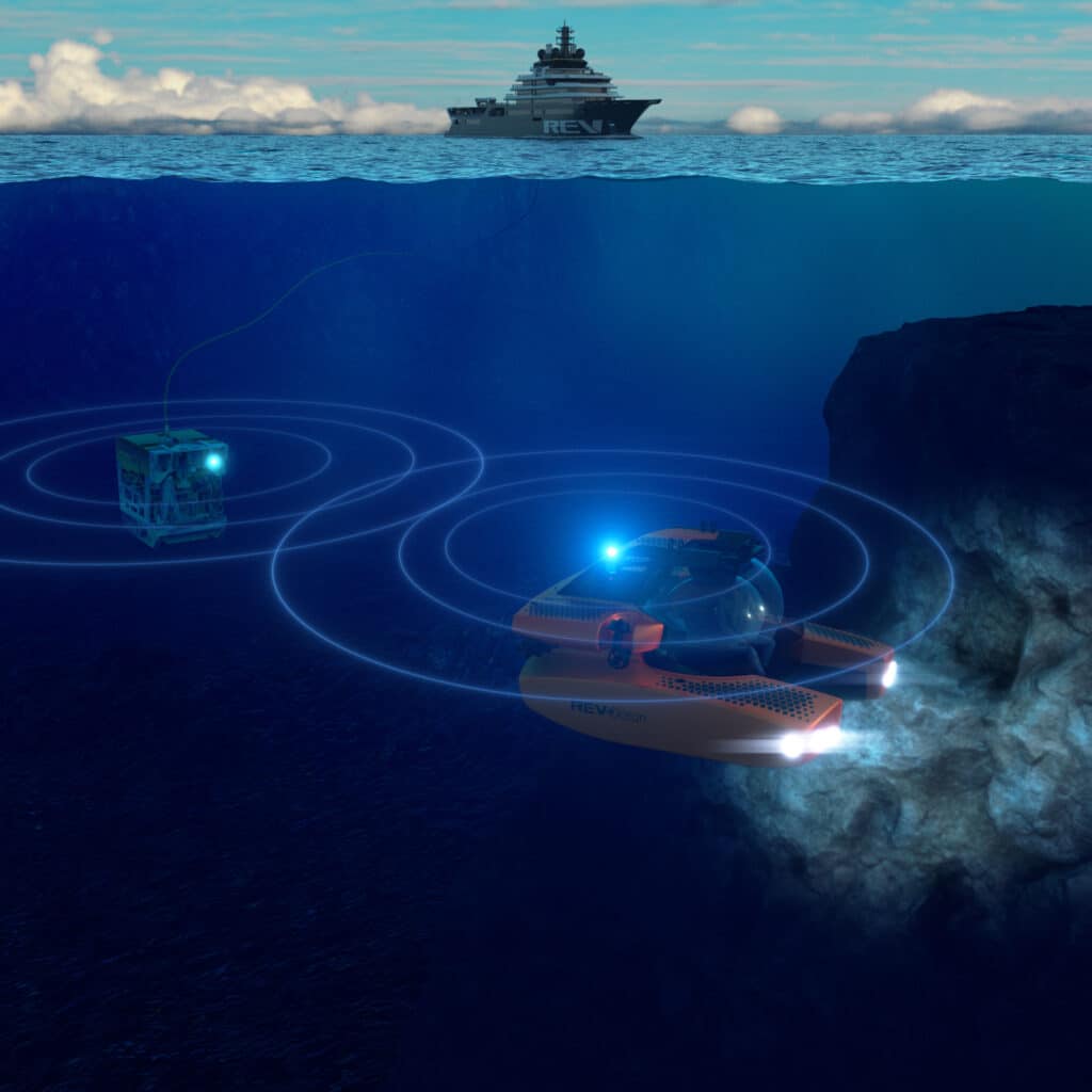
Image Caption: Underwater research re-imagined. Sonardyne’s BlueComm will unlock opportunities to share ocean science from onboard the REV Ocean. Image from Sonardyne.
Press Enquiries
David Brown
Head of Marketing
Sonardyne International Ltd
Tel: +44 (0)1252 872288
Email: [email protected]
World’s Most Compact 6,000m Rated Sonar Launched
Impact Subsea has announced the launch of the world's most compact 6,000 meters / 19,685 feet depth rated imaging sonar.
The new addition to the ISS360 range of sonars provides a full 360° field of vision, 80 meters range capability and high resolution imagery using powerful CHIRP based signalling. Heading and Attitude readings can also be provided by the sonar.
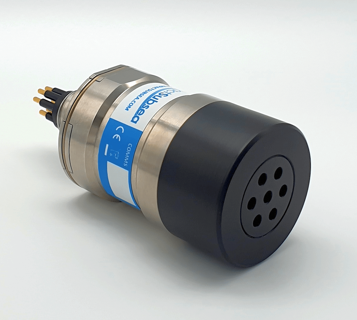
Developed to meet the demands of deep rated Autonomous Underwater and Remotely Operated Vehicles for commercial and scientific applications. At just 72mm / 2.83 inches long and weighing 0.37kg / 0.81lbs the deep rated ISS360 Imaging sonar is understood to be the most compact available today.
With Ethernet communications facilitating exceptional scanning speeds and serial communications for integration to vehicles without Ethernet capability; the ISS360 has been designed to provide an ideal obstacle avoidance and target identification sonar for underwater vehicles.
The ISS360 makes use of an inductive coupling between the electronics and scanning transducer which ensures there are no slip rings to wear and require periodic replacement. Housed in Titanium, it ensures many years of operation without the long term corrosion issues associated with anodised aluminium or alternative housing materials.
As part of this development a miniature composite broadband transducer was designed to withstand the increased pressure. Other components in the ISS360 oil filled boot end have also been redesigned to accommodate the higher pressure rating.
Ben Grant, Managing Director, Impact Subsea, commented “We are excited to bring this highly compact sonar to those with operations down to six thousand meters depth. As industry endeavours to reduce the size of underwater vehicles while maintaining capability, the size of the sensors available is critical. The ISS360 has been designed to provide a step change capability for the latest generation of vehicles while providing an excellent upgrade for existing operational vehicles”.
Further details of the ISS360 Sonar range can be found here.
---
Impact Subsea design and manufacture innovative underwater Sonar, Altimeter, Depth, Range, Heading, Motion and Temperature sensing solutions. The company also provides a range of underwater housings and a state of the art Flooded Member Detection system. Impact Subsea's solutions are used on underwater Remotely Operated Vehicles (ROV), Autonomous Underwater Vehicles (AUV) and in numerous standalone underwater applications. All sensors are extremely robust, small form factor, high reliability and lead the market in technical capability. To learn more please visit https://www.impactsubsea.co.uk/
---
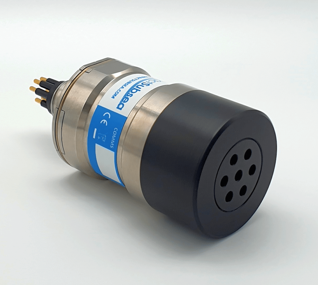
The 6,000 meter rated ISS360 Imaging Sonar.
Any additional enquires should be directed to Ben Grant – [email protected] / 01224 460 850

The Nippon Foundation-GEBCO Seabed 2030 Project and Ocean Exploration Trust announce partnership in pursuit of a complete map of the world's ocean floor
Seabed 2030 and Ocean Exploration Trust (OET) have established a Memorandum of Understanding in recognition that both organisations will continue working together to advance our understanding of the global ocean through collaborative contributions towards the completion of a definitive map of the seafloor. The effort complements the goals of the United Nations Decade of Ocean Science for Sustainable Development.
Seabed 2030 is a collaborative project between The Nippon Foundation and GEBCO to inspire the complete mapping of the world's ocean by 2030, and to compile all bathymetric data into the freely available GEBCO Ocean Map. GEBCO is a joint project of the International Hydrographic Organization (IHO) and the Intergovernmental Oceanographic Commission (IOC), and is the only organisation with a mandate to map the entire ocean floor.
Ocean Exploration Trust (OET) and the Nautilus Exploration Program explore the ocean, utilizing advanced seafloor mapping and robotic technologies, while connecting that exploration to the world in real-time via a high-bandwidth satellite. Established in the United States in 2007, OET partners primarily with United States National Oceanic and Atmospheric Administration (NOAA) Ocean Exploration through the NOAA Ocean Exploration Cooperative Institute, and also with NOAA Office of National Marine Sanctuaries, and other government agencies, academic institutions, and the private sector to advance the field of deep-sea exploration and to engage the public and next generation. NOAA Ocean Exploration’s domestic efforts are in support of the US’ National Oceanic Mapping, Exploration, and Characterization strategy and all NOAA-supported data is stored via National Centers for Environmental Information.
Expeditions are launched aboard Exploration Vessel (E/V) Nautilus —a 68-meter research vessel equipped with remotely-operated vehicles (ROVs) and with collaborative technology partners. During the expeditions, OET offers global scientists, educators, students, and the public a remote exploration experience via live video, audio, and data feeds from the field, as well as ship-to-shore interactions direct to classrooms and public venues around the world.
“We are delighted to welcome the support of a renowned institution such as the Ocean Exploration Trust,” commented Jamie McMichael-Phillips, Director of the Seabed 2030 Project. “OET’s expeditions, which focus on the scientific exploration of the seafloor, will make for a valuable addition to Seabed 2030 and our mission of a complete bathymetric data set of the world’s oceans.”
Dr Nicole Raineault, Chief Scientist of OET said: “A complete map of the seafloor is a critical first step in understanding our planet through ocean exploration. We’re proud to support the Seabed 2030 Project by collecting bathymetric data and producing high-resolution maps of the world’s ocean during each of our expeditions.”
All data collected and shared with the Seabed 2030 Project is included in the GEBCO global grid, which is free and publicly available.
ENDS
Notes to Editors
For more detailed information on The Nippon Foundation-GEBCO Seabed 2030 Project, please visit our website, seabed2030.org, like our Facebook page, follow us on Twitter @Seabed2030, or contact [email protected].
For media inquiries, contact:
Pegah Souri
[email protected]
+44 (0)7951 581707
Samantha Wishnak
[email protected]