
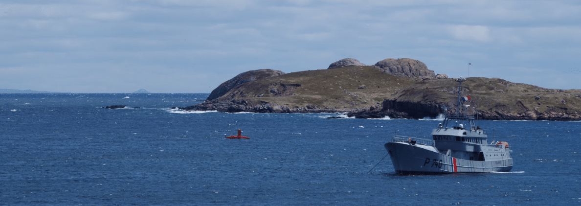
Operation Ravenel: The search for the wreck has begun in Saint-Pierre-et-Miquelon
A research campaign aiming to find the wreck of the Ravenel fishing trawler, which disappeared back in January 1962 off the coast of Saint-Pierre-et-Miquelon (France), has begun on May 23, 2021. Despite several attempts over the past decades, the wreck remains unfound. Thanks to the use of DriX Unmanned Surface Vessel (USV), designed, developed and operated by iXblue, this new research campaign relies on unprecedented technological means to solve this mystery, that remains one of the most important shipwrecks in the history of French fishing.
The 15 sailors aboard the Ravenel left for sea in January 1962 and dramatically disappeared after 8 days of sailing. The wreck of the vessel has never been found since then. In April 2021, Annick GIRARDIN, France Minister for the Sea, announced the launch of a major research campaign, which aroused great interest from the local population. A search area of 439 km ² has been defined thanks to information and documentation collected by the two associations of descendants of the missing, "Ravenel" and "Ravenel Research", as well as by teams of Meteo France (France national meteorological service) and the Department of Underwater Archaeological Research (DRASSM).
Since May 23, iXblue DriX autonomous surface vessel has been mapping the seabed of this newly defined area, looking for clues about the location of the wreck of the Ravenel or components of its structure. Developed by iXblue, this drone is equipped with powerful means of localization and detection of obstacles, allowing it to perform these missions autonomously. It is in constant contact with the ground and an accompanying vessel. The DriX operates 24 hours a day and is supervised by three iXblue surveyors. To accompany the DriX, four government vessels take turns on the surface: the French Navy Fulmar patrol boat, the P'tit Saint-Pierre from the “Armement des Phares et Balises”, the Charente, a vessel from the “Service des affaires maritimes et portuaires (SAMP)” of the Préfecture de Saint-Pierre et Miquelon, and the SAO vessel from France Gendarmerie Nationale. The Canadian authorities issued their authorization for the prospecting in their international waters and offered their assistance in this research, that will last a total of one month.
For more information, please visit: www.ixblue.com

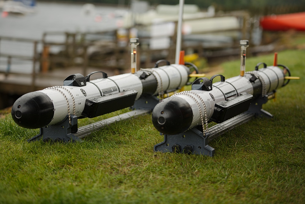
Sonardyne and SeeByte advance UMS navigation and autonomy in challenging environments
Maritime defence technology company Sonardyne and uncrewed maritime systems (UMS) software experts SeeByte have been awarded UK Defence Science and Technology Laboratory (Dstl) funding to enhance and extend the future operational capability of autonomous and remotely operated systems in challenging battlespace domains.
The collaboration is the second phase of the UK’s Defence and Security Accelerator (DASA)’s Autonomy in Challenging Environments competition and builds on the work both organisations undertook in Phase 1.
Sonardyne advanced underwater positioning system will be teamed with SeeByte’s adaptive, communication-aware, robotic behaviour developed for their autonomy system Neptune to allow the UMS to operate in highly complex, variable and communications-limited environments. Automatic target recognition imagery snippets will be transferred acoustically using SeeByte’s novel semantic compression software.
As part of the project, Sonardyne and SeeByte will be using surface and underwater assets from Project Wilton, a recently formed maritime autonomous systems (MAS) team based out of HM Naval Base Clyde. The collaboration will culminate in a series of in-water demonstrations at Project Wilton facilities in the UK.
Sonardyne will install a Mini-Ranger 2 underwater positioning system onboard Project Wilton’s ARCIMS uncrewed surface vessel (USV) and AvTrak 6 Nano telemetry and tracking transceivers to the team’s Iver 3 autonomous underwater vehicles (AUVs), which will be managed by SeeByte’s autonomous networked acoustic communications system.
In addition, Sonardyne’s SPRINT-Nav instrument will also be integrated with the ARCIMS USV to provide an independent navigation reference in GNSS-denied environments.
Teamed with SeeByte’s adaptive, communication-aware, robotic behaviour developed for their autonomy system Neptune, the UMS will be able to operate in highly complex, variable and communications-limited environments. Automatic target recognition imagery snippets will be transferred acoustically using SeeByte’s novel semantic compression software.
This project will enable optimal uncrewed underwater vehicle (UUV) distribution for improved subsea communications and navigation in a range of challenging environments.
Ioseba Tena, Head of Defence at Sonardyne said, “Collaborative autonomy is part of the maritime defence road map. We need to enable more robots and have fewer operators in the underwater battlespace. Working alongside leaders in autonomy development like SeeByte, to make that vision a reality, as part of the Autonomy in Challenging Environments competition, is a significant step towards that goal.”
Andrea Munafo, Technical Program Manager at SeeByte said, “UMS operate in challenging environments and they need to be robust against faltering communications and navigation. Partnering with Sonardyne makes it possible for our autonomous systems to consider both during real-time execution and hence to improve the effectiveness of future underwater missions.”
DASA’s Autonomy in Challenging Environments competition is funded through the UK Ministry of Defence’s Chief Scientific Adviser’s Research Programme’s Autonomy Incubator project. Awards are made by DASA on behalf of Dstl.
The Autonomy Incubator project aims to: Identify and develop underpinning research and technologies to support the development and fielding of unmanned systems across defence. This work can be matured through the wider Dstl Autonomy Programme and other research and development programmes.
Dstl delivers high-impact science and technology for the UK’s defence, security and prosperity. Dstl is an Executive Agency of the MOD with around 4,000 staff working across four sites; Porton Down, near Salisbury, Portsdown West, near Portsmouth, Fort Halstead, near Sevenoaks, and Alverstoke, near Gosport.
For more information, please visit: www.sonardyne.com
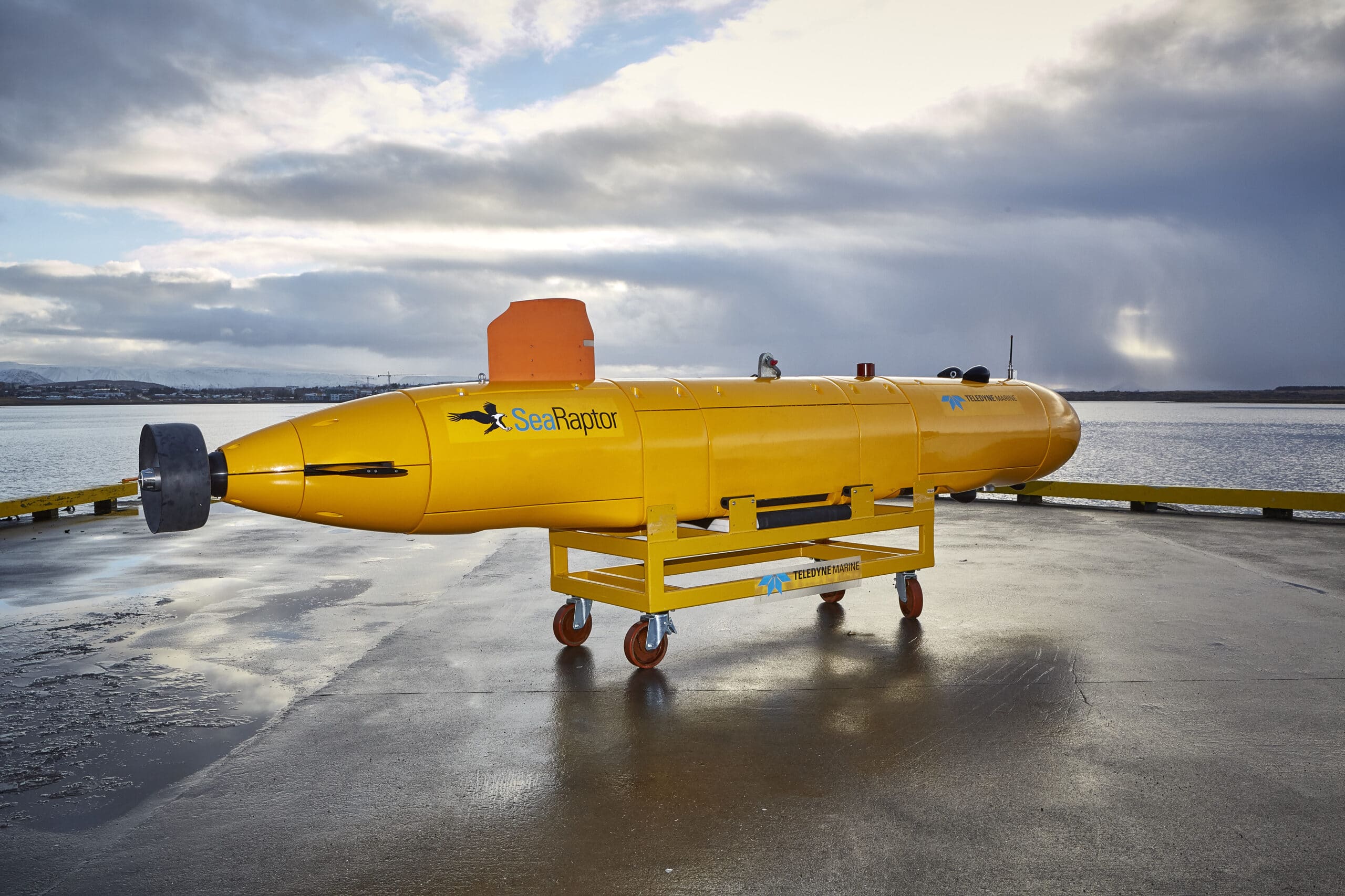
Teledyne Marine Announces Sale of Two SeaRaptor 6,000m AUVs to Argeo
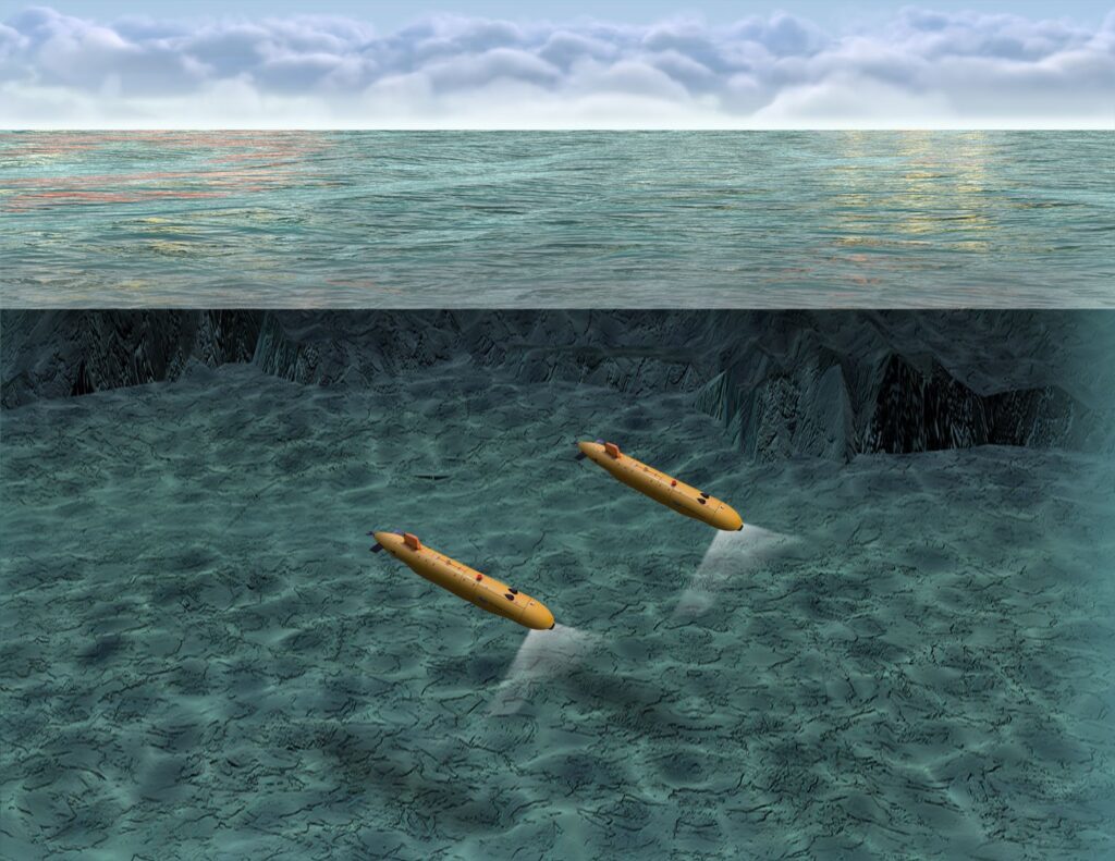
A global leader in the manufacture of Unmanned Maritime Systems, Teledyne Marine Vehicles, a business of Teledyne Technologies Incorporated (NYSE:TDY), today announced that Argeo of Norway, a newly listed company and growing subsea offshore service company, has procured two Teledyne Gavia SeaRaptor 6,000 meter rated Autonomous Underwater Vehicles (AUVs). The two SeaRaptor AUVs will contribute to Argeo’s growing fleet of AUVs and will enable deep-sea surveys to the benefit of marine industries including offshore wind, aquaculture, deepsea minerals, and offshore oil & gas.
The SeaRaptor 6000 AUVs will be equipped with the latest Kraken MinSAS 120 Synthetic Aperture Sonar (Kraken Robotics, Canada) providing large swath area coverage and high-resolution imagery and bathymetry data collection. The vehicles will also be fitted with Teledyne RESON T50-S Multi-Beam dual frequency 200/400 kHz Echo Sounders, Teledyne Benthos Chirp III Sub Bottom Profilers, iXblue PHINS 6000 INSs coupled to Teledyne RDI Tasman DVLs, and CathX Hunter Camera Systems. All data collected will be processed onboard using Teledyne CARIS OnBoard postprocessing and mosaicking software to allow quick turnaround during missions. The AUVs are also fitted with a large variety of scientific sensors from RBR which will take Conductivity, Temperature, Pressure, Turbidity, pH, Dissolved Oxygen, Redox, CH4 and Magnetic measurements to provide valuable water column data which will contribute to better ocean basin characterizations.
“Teledyne is very pleased to supply these unique deep water AUVs to Argeo. We see the strategic partnership forming between our companies as being beneficial, far into the future.” said Mike Read, President, Teledyne Marine.
Both vehicles will be supplied in 40 foot containers hosting their Launch and Recovery Systems, deck support and handling equipment and a spares set to offer the highest redundancy and availability of the systems. The vehicles are designed to be air transportable, including their Li-Ion batteries which offer over 40 hours of autonomy for long endurance missions.
Teledyne is excited to offer these systems to assist in bringing back new information as to the nature and composition of the deepest parts of the planet.
For more information, please visit: www.teledynemarine.com

Xeos Technologies Chosen by the NFSI to Supply Recovery Beacons for Major Refit
Xeos Technologies is excited to announce that it has been chosen by Canada’s National Facility for Seismic Imaging (NFSI), headquartered at Dalhousie University in Halifax, Nova Scotia, to help rebuild Canada’s ocean seismic capability. Xeos will be supplying 120 Apollo Mono GPS, Iridium and LED beacons along with 120 XMB RF recovery beacons to monitor, track and recover a network of Ocean Bottom Seismometers (OBS) deployed across the world’s oceans and inland seas. The system of beacons will provide precise location information to the deployment and recovery teams in real-time, while also providing a safeguard against any unplanned surfacing events.
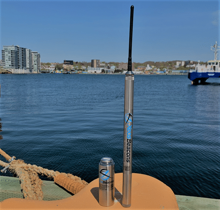
set chosen to monitor and track the NFSI BOBS fleet.
The beacons will be integrated with the Broadband Ocean Bottom Seismometers (BOBS) manufactured by Güralp Systems Ltd in the UK. Guralp’s BOBS systems use acoustic telemetry to deliver near real-time seismic data from the ocean floor to the surface without cables. The state-of-the-art BOBS network created for this project, designed to replace the previous system decommissioned in 2015, will support fundamental science discoveries. The goal is to generate a vast repository of core data that NFSI scientists can utilize to probe critically important questions related to earth structures, undersea earthquakes and tsunamis. The NFSI is a partnership of ten major universities from across Canada including Dalhousie University, University of Victoria, University of British Columbia, Simon Fraser University, University of Manitoba, University of Toronto, University of Ottawa, Université du Québec à Montréal, McGill University and Memorial University.
Xeos will work in close cooperation with Güralp and the NFSI project team to provide user training to ensure successful deployment and recovery missions. Geoff MacIntyre, Vice President at Xeos Technologies commented, “An enormous amount of time, energy and resources will be put into this project over the next couple of years and we are honoured to have been chosen to provide the technology responsible for safeguarding and recovering it all. The data that this system will produce over the next several years will be used to expand our understanding of the ocean bottom environment and support important scientific discoveries. We are looking forward to working with the project team and helping it all come together”.
Professor Mladen Nedimovic, NFSI Director, Department of Earth and Environmental Sciences, Dalhousie University said: “The NFSI is thrilled to have Xeos Technologies as a partner and supplier of 120 sets of recovery devices for our BOBS. We look forward to working together toward safe deployments and recoveries of our large fleet of BOBS with the goal to record data that will transform our understanding about critically important earth structures, particularly those offshore Canada that generate large earthquakes and tsunamis.”
For more information, please visit: xeostech.com
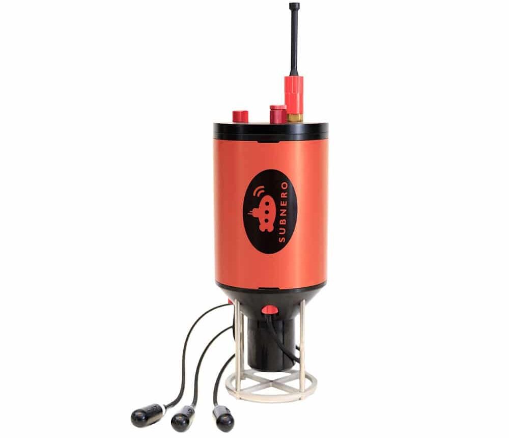
Introducing Subnero Multi-Channel Modems
Subnero modems running UnetStack software framework, are at the forefront of the underwater wireless communication technology. In addition to providing unparalleled communication and networking performance, they also provide the user with the ability to transmit and record arbitrary waveforms. Being software-defined, these devices provide the flexibility to you, the user, to develop or extend the capabilities using your own techniques. We, at Subnero, are constantly working to bring you new features to help you realize your vision of underwater communications and networking.
Now, imagine being able to use our modems to do things that were not possible previously, with a conventional acoustic modem. For example, let’s say you have a communication link, that stops working beyond a certain range. You upgrade your modem and you can extend your communication range beyond what was previously possible.
Or, say you want to monitor and record the underwater soundscape, but also send events of interest back to a control station in real-time, or allow control of the recording device from the surface. It would be nice to have a single device that can allow recording using multiple synchronized receiving channels, but also be able to communicate with that device directly, without the need to attach an external modem.
What if you have a single device that can do all of these functions in real-time? Today we are very excited to launch a new class of underwater acoustic modems, called the Subnero multi-channel modems. The multi-channel modems combine our silver edition M25M series modems, with a multi-channel acoustic recorder, thereby providing an acoustic modem with multiple synchronous receiving channels, without a significant change of the form factor. Configurable with up to 4 additional synchronous receiving channels, each channel can have a sampling rate of 128 or 256 kilo samples per second.
Out-of-the-box, you can use the multi-channel modems as a normal modem or a standalone acoustic recorder or both at the same time. The data collected from the additional receiving channels can be saved to the modem’s internal storage to be downloaded later. The recordings can be scheduled before deployment or triggered remotely using specific signals thereby making the multi-channel modems, ideal candidates for applications such as rapid environment assessment.
These devices use spatial diversity combining techniques to decode transmissions from remote modems, in real-time. This increases the effective communication range by acting as a spatial diversity receiver.
In addition to the extra receiving channels, the multi-channel modems are also equipped with sensors such as GPS, compass and a depth sensor, for underwater positioning and tracking applications. By combining techniques such as time or phase difference of arrival with the data from these sensors, three dimensional positioning and tracking is also available with the multi-channel modems.
Some of these features will be available as a software upgrade in the form of UnetStack premium agents.
For power users, the full potential of the device can be harnessed through the customizability of UnetStack. You can get direct access to raw data from all the channels in real-time, through UnetStack APIs. The out-of-the-box length of the hydrophone cables is 10 m from the housing, which allow you to decide the placement of these channels depending on your application. With such flexibility, users can develop their own array processing or spatial diversity combining techniques or positioning applications with the help of various developer tools provided by UnetStack. With native support for scientific computing languages such as Julia, or UnetStack gateway support with Python, these devices reduce the time to deployment of your algorithms, dramatically. In short, the kinds of applications you can develop using our multi-channel modem platform is only limited by your imagination.
We hope you find our multi-channel modems exciting.
We love to hear from you. Let us know your thoughts and comments through [email protected]
Hybrid AUV secures Statnett Survey Contract for Modus
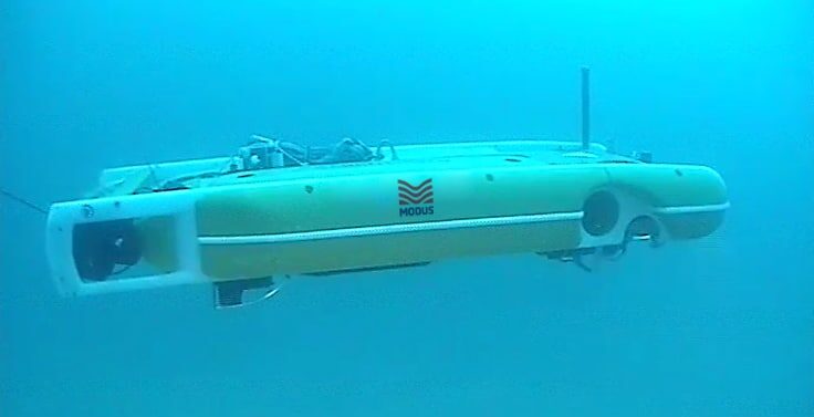
Global subsea services company, Modus Subsea Services Ltd has been awarded a contract to perform survey services in connection with a new cable corridor requirement in Ofotfjorden, northern Norway. The campaign will use the Modus Hybrid AUV (HAUV) system which represents the very latest in merged ROV and AUV technology.
As part of the scope, Modus shall perform a desk top study, to identify further site information and support the preparation of the project. In Q2 2021, Modus shall mobilise HAUV-2 to collect geophysical seabed survey data, perform target inspection and an environmental survey across a 6km x 1km area. The HAUV will be operated as a high-speed ROV in tethered mode to provide real time data feedback and decision making. The scope will be performed from the M/V Elektron vessel in a water depth range of less than 10 metres to 500 metres.
To perform the scope of work the HAUV will house Multibeam Echosounder, Sidescan Sonar and Sub-Bottom Profiler. The speed in which the HAUV can collect data in high current and shallow water environments without compromising data quality, is expected to yield significant project efficiencies for Statnett.
"This is the first survey contract we have entered into with Modus and we are looking forward to the cooperation", says Karin Ryssdalsnes Project Manager at Statnett.
Guy Lainchbury, Commercial Manager for Modus said “Working for Statnett, the system operator of the Norwegian grid, is a great opportunity for Modus to demonstrate this class leading Hybrid AUV technology. The difficult environmental conditions that we will experience, along with the ability to collect multiple streams of data from varying sensor technology and at high speed, will be the defining factors of this project. Modus HAUV systems are now used globally, and we have achieved success in reducing overall project timelines and providing best in class reporting. Modus look forward to working with Statnett across their subsea network into the future with this disruptive technology.”
For more information, please visit: www.modus-ltd.com
OSIL Modular Vibrocorers Make Global Impact
Leading environmental monitoring systems manufacturers Ocean Scientific International Ltd (OSIL) is pleased to report that its range of robust and easy to use vibrocorer systems are increasingly in use worldwide.
A multitude of users in Europe, Asia and Africa currently boast a modular OSIL vibrocoring system amongst their geotechnical assets, and have put the systems to work on a variety of marine reclamation projects, offshore drilling works and pipeline route surveys in addition to academic studies.
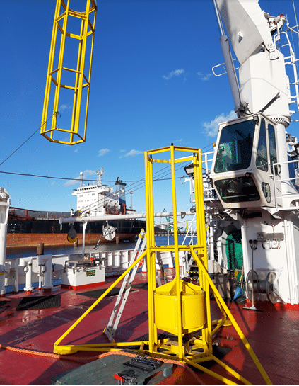
The OSIL Vibrocorers have been designed as tough but versatile modular systems for the sampling of densely compacted sediments in up to 250m water depth, which are easy to transport and which minimise dockside assembly for quicker mobilisation. The Vibrocorers benefit from a simple deployment and recovery procedure, which suits opportunistic use of available vessels.
The systems can either be assembled dockside or on the vessel itself into a 3m or 6m system before deploying over the stern. The corers have been designed for straightforward horizontal or vertical recovery on the vessel and effortless removal of the core barrel and sample once back on deck.
OSIL’s global reputation for the production of simple, cost effective sediment coring systems has steadily increased year-on-year as a direct result of word-of-mouth recommendations from existing clients.
For further information, please visit: www.osil.com
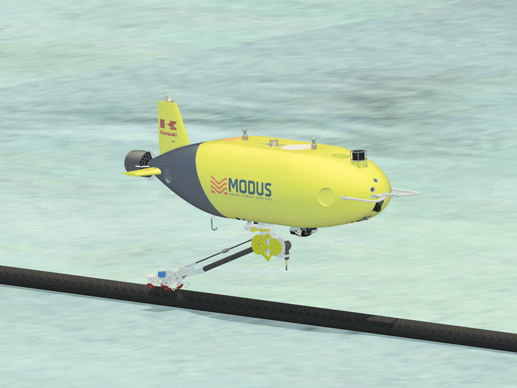
Modus acquires two (2) complete, integrated, SPICE AUV systems from Kawasaki Heavy Industries, Ltd.
Modus Subsea Services Ltd. (Modus), a leading independent expert in the provision of seabed intervention, IMR, survey and specialist AUV services, announces the acquisition of two (2) complete, integrated, SPICE AUV systems from Kawasaki Heavy Industries, Ltd. (KHI). SPICE AUVs represent highly capable systems, delivered by one of the World’s leading OEMs, capable of providing a wide range of autonomous services and data acquisition with high efficiency and quality, down to 3,000m water depth.
“This multi-million-pound investment represents a significant expansion of Modus’ capability and fleet. SPICE represents a world first AUV with integrated manipulator (robot arm), designed for cable and pipeline inspections as well as more conventional, high quality, high efficiency surveys. Our strategic relationship with KHI positions us well for growth and cements our leading position in the market” said Nicholas Tompkins, Group CEO.
Building on Modus’ existing fleet of Saab Sabretooth HAUVs, currently the world’s largest such fleet, SPICE is equipped with a fully comprehensive survey suite, capable of enhancement to suit specific Client needs and rapid global mobilisation. The acquisition of the SPICE systems enables Modus to strengthen its position as a technology innovator and provider of high quality, low cost, integrated services.
For further information, please visit: www.modus-ltd.com

The Nippon Foundation-GEBCO Seabed 2030 Project enters new agreement with Esri
London, 17 May 2021 – Seabed 2030 and Esri have entered a new formal agreement, which will see the two organisations work collaboratively towards the shared objective of assembling a global compilation of high-resolution bathymetric data, to assist us in the sustainable use of our planet.
Seabed 2030 is a collaborative project between The Nippon Foundation and GEBCO to inspire the complete mapping of the world's ocean by 2030, and to compile all bathymetric data into the freely available GEBCO Ocean Map. GEBCO is a joint project of the International Hydrographic Organization (IHO) and the Intergovernmental Oceanographic Commission (IOC), and is the only organisation with a mandate to map the entire ocean floor.
Committed to solving our planet’s most pressing challenges with geographic expertise and rational resolve, Esri’s mission is to inspire and enable people to positively impact their future through a deeper understanding of the changing world around them. This understanding involves a commitment to ocean science and maritime industry.
Esri places high importance on increased engagement with the ocean science community, as complex ocean science questions and data are increasingly used to inform the responsible use and governance of the oceans, as well as conservation.
“As we enter our last decade, Seabed 2030 warmly welcomes the support of a renowned organisation such as Esri. With experts in geographic science, software development, and data analytics, the work of Esri will no doubt greatly support our mission of compiling all bathymetric data of the entire global ocean floor by 2030,” commented Jamie McMichael-Phillips, Director of the Seabed 2030 Project.
Dr Dawn Wright, Chief Scientist of Esri said: “We are dedicated to a sustainable planet and Esri is therefore committed to supporting initiatives such as Seabed 2030, which play a fundamental role in allowing us to better understand and protect our planet.
“Since our beginning in 1969, Esri has cultivated collaborative relationships with partners who share our commitment to solving Earth’s most pressing challenges with geographic expertise. To this end, we are proud to count Seabed 2030 as a partner.”
All data collected and shared with the Seabed 2030 Project is included in the GEBCO global grid – the most complete bathymetric dataset of the world’s ocean floor, which is free and publicly available.
For more information, please visit: seabed2030.org
Tritex NDT leading the way in Drone Thickness Measurements
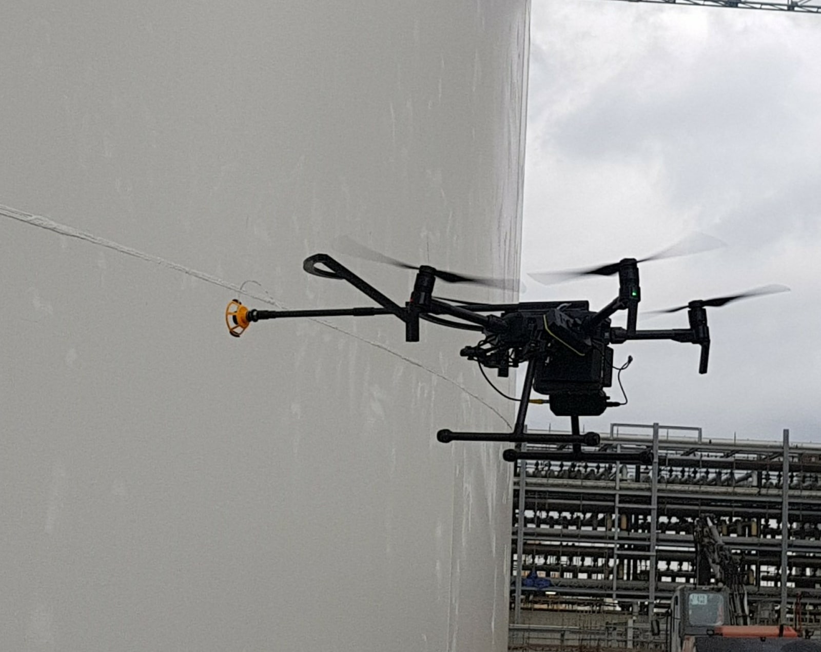
Tritex NDT have for many years been manufacturing ultrasonic thickness gauges and are now established as one of the leading companies offering multiple echo gauges. Multiple echo technology means that thickness measurements can be taken through 6mm thick coatings, only the metal substrate is measured. It doesn’t matter whether the coating is paint, epoxy or bitumen, it is completely ignored. This has huge advantages over having to remove coatings, both in time and money. It also has a big advantage when developing a gauge to mount onto a drone.
Taking thickness measurements at height has always been a requirement, and up until recently this has been done using scaffolding or rope access techniques. However, with the Tritex Multigauge 6000 dedicated Drone Thickness Gauge, first developed over three years ago, this is now a lot safer and cost effective than before.
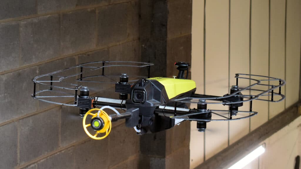
Tritex NDT are leading the way in this application and are the only company worldwide with a dedicated thickness gauge to mount onto drones. In excess of 100 systems have so far been sold, with repeat orders coming from major petrochemical companies and class societies. The gauge and technology have been improved over three years of development in response to customer’s feedback and requirements.
The Multigauge 6000 consists of three parts, which includes the gauge, a gel dispenser and a probe holder for the correct alignment of the probe. The single crystal probe ensures accurate measurements on curved surfaces, such as storage tanks and pipelines. Thickness readings are transmitted wirelessly up to 500 metres, using its integrated RF transmitter, to a dedicated software that allows the operator to record measurements, set up templates and to remotely control the gel dispenser before touching the probe onto the surface.
The gauge can mount onto any ‘work class’ type drone, with the most popular being the DJI Matrice 210 or 300. Tritex NDT have also developed their own custom drone, the Multigauge 6500, specifically designed to provide a complete solution. The Multigauge 6500 ‘Flying Thickness Gauge’ has eight rotors to provide redundancy, as well as propellor guards so that it can be easily used inside tanks.
Tritex NDT is a leading manufacturer of thickness gauges and are at the forefront of using drones for high level inspections. All gauges are designed and manufactured in the United Kingdom and supplied as complete kits, ready to use, with a 3-year warranty and free annual calibration for the life of the gauge.
For further information, please go to www.tritexndt.com