University of Plymouth to integrate GeoAcoustics GeoPulse Compact sub-bottom profiler into its hydrography programmes and research projects
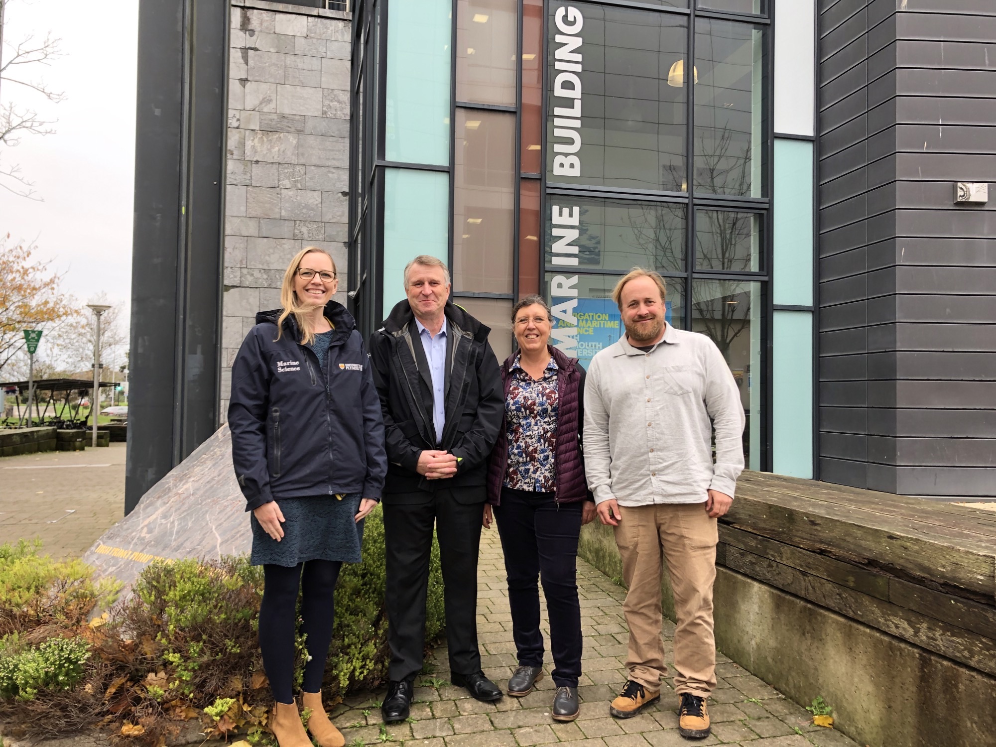
Hydroacoustic technology specialist GeoAcoustics Ltd and the University of Plymouth have signed a new technology partnership agreement based on the use of a GeoPulse Compact sub-bottom profiler for education and research purposes.
The University will take delivery of the system, which includes an Over-the-Side (OTS) transducer mount for deployment flexibility, this December. The partnership also includes the potential to switch to a next generation GeoPulse system in 2023 as well as a 1-day guest lecture and processing workshop for the University’s MSc Hydrography and BSc Ocean Exploration and Surveying students.
The GeoPulse Compact enables the University to expand and enhance their teaching of the fundamentals, workflows and best practice of Sub-Bottom Profiling with the opportunity to apply the theory in a live setting using an industry-standard shallow water acoustic system.
The system will be integrated into undergraduate and postgraduate research projects as well as broader academic research. Upcoming research projects within the Coastal Processes Research Group will use GeoPulse Compact for dependable, accurate sub-bottom data acquisition.
“The exciting new partnership will facilitate new academic research investigating coastal sand supply to our coasts in the UK; a key factor in how our coasts respond to rising sea levels,” said Dr Tim Scott, Associate Professor of Ocean Exploration at the University of Plymouth.
“We are excited to integrate this system into the third year of our BSc Ocean Exploration and Surveying programme, giving students the opportunity to get hands-on with collecting, processing, and analysing sub-bottom data. This is becoming increasingly important in hydrography, reflected in current commercial, research and industry needs, and using this technology alongside our fleet of autonomous vessels will significantly improve our sub-seafloor mapping capabilities,” said Dr Jenny Gales, Senior Lecturer in Ocean Exploration at the University of Plymouth.
“With demand for marine data growing rapidly due to increased activity in offshore renewable energy, education and research partnerships are more essential now than ever. We are confident that our partnership with the University will contribute to producing new highly trained and technology aware marine surveyors and are also keen to support the research teams in their efforts to gather solid data for important marine research projects,” said Dr Richard Dowdeswell, General Manager, GeoAcoustics Ltd.

Kraken Robotics receives $14 million order for subsea power systems
Kraken Robotics Inc. announces that it has received an initial order for subsea batteries valued at $14 million, which includes a significant advance payment. Deliveries will occur in 2023.
Kraken’s SeaPower® 6000-meter rated pressure tolerant batteries are based on Kraken’s unique pressure tolerant gel encapsulation technology for lithium polymer batteries. This provides an attractively priced, environmentally friendly, and superior energy density alternative to the traditional oil compensated batteries commonly used for deep subsea battery applications. Kraken’s hot swappable batteries are modular and include an integrated battery management system within each battery module which provides a very high level of redundancy and safety.
Job Advert: EGS International Ltd hiring Head of Geosciences
Location: Bordon, Hampshire
Position: Full time, Permanent
Salary: Competitive salary, contributory pension, life assurance, private medical insurance, 25 days holiday plus bank holidays.
EGS are looking for a dynamic motivated individual to manage the day to day running of the Geosciences Department. You will head up a dedicated team working on complex projects across a broad spectrum of market sectors.
The Role:
• Provide support on Geoscience Department related components for tendering and survey planning.
• Support Project Managers with all ‘geo’ aspects of a project, from data acquisition, processing & interpretation, through to reporting.
• Manage your department’s support of site activities, focusing on successful delivery of the site works and as such, this position, while primarily office-based, will require some on-site working.
• Manage your department’s personnel planning for both on-site and office-based teams.
• Manage the processing, interpretation, and reporting of the geophysical datasets.
• Provide timely feedback to Project Managers / Reporting Manager and on the status of Geo data acquisition and then the processing / production of relevant deliverables.
• Contribute to Client meetings and updates.
• Liaise with other departments to develop technical solutions and new processes.
Our Requirements:
• University degree in Geosciences/Geophysics/Geology
• Relevant management experience.
• Marine survey experience, with a thorough understanding of geophysical techniques and demonstrable experience in acquiring, processing, and interpreting geophysical survey data.
• In depth knowledge of, and experience in using some (but preferably all) of the following software packages: IHS Kingdom, CODA GeoSurvey, EdgeTech Discover, CTI SonarWiz, Geosoft Oasis Montaj, RadEx Pro (or equivalent) and GIS packages (Arc GIS, QGIS, Global Mapper).
• Experience of working in both shallow inshore and deeper offshore environment preferable.
• Site work periods may be as short as a few days but could extend up to 6 weeks.
Send your CV to [email protected]
SeaTrac’s SP-48 completes 800 nautical mile offshore Loop Current monitoring mission in the Gulf of Mexico
SeaTrac Systems, Inc. (SeaTrac), in collaboration with the Woods Hole Group (WHG), successfully completed a 21 day over the horizon, deployment of SeaTrac’s SP-48 solar powered Uncrewed Surface Vehicle (USV) in the Gulf of Mexico. The 15 ft USV travelled over 800 nautical miles in 3 weeks, operated 24/7, and navigated strong ocean currents (> 2 knots) as it conducted a mission to map and monitor the Loop Current using an acoustic Doppler current profiler (ADCP).
The goal of the mission was to evaluate the ability of the SP-48 to conduct survey work that has traditionally relied on large (>170’) conventional vessels that are expensive, carbon intensive, and keep crews at sea for up to 60 days at a time. The data these vessels collect are vital for Oil and Gas stakeholders in the Gulf of Mexico, and thus, the ability to perform this type of data collection with a solar powered USV (or fleet of USVs) would lower the cost and environmental impact of this critical monitoring activity.
"SeaTrac's system successfully made several passes into currents greater than 1.5 knots, demonstrating a key milestone for USVs to detect strong currents at the edge of the Loop Current without losing their maneuverability. The real time data quality compared favorably to data collected from traditional vessel mounted surveys for the sea state conditions encountered during the mission,” says Jill Storie, EddyWatch and SurveyWatch Program Manager at Woods Hole Group.
SeaTrac’s USV provides offshore Enhanced Situational Awareness with High Definition 360° Still Shots and AIS alerts within 10 nautical miles
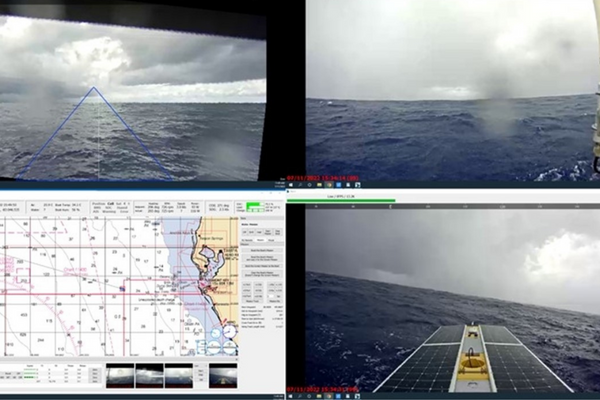
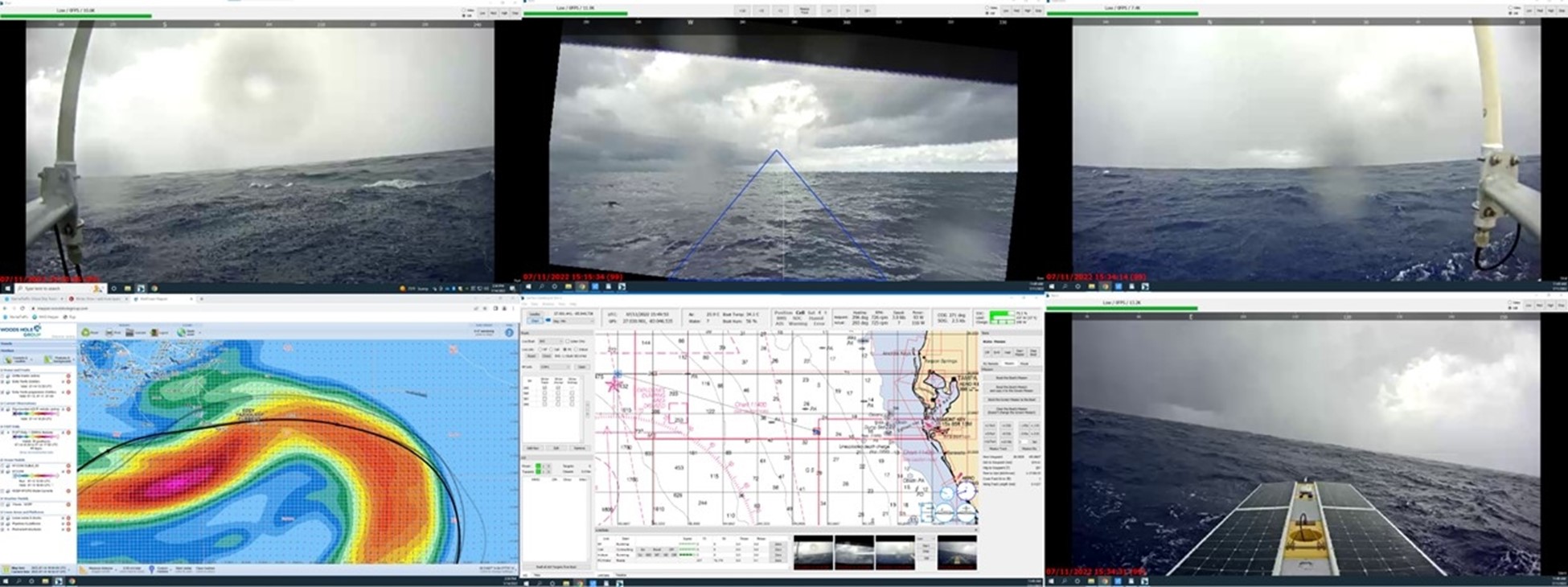
The mission was run from the SeaTrac remote operations center in Marblehead, MA where the piloting team leveraged SeaTrac’s custom control software and the onboard systems for enhanced situational awareness. Four onboard cameras provided 360 degree viewing around the USV, while an AIS transceiver enabled the USV to broadcast its position and detect other vessels in the area. Real time USV health and status information were available to the operators, and alerts were set up to notify them of key considerations including the range and closest point of approach for vessels in the area, battery levels, charging rate, weather conditions, and communications status.
The data from the 300 kHz Teledyne Workhorse Monitor ADCP was packaged by the onboard payload computer and sent back over satellite to the WHG oceanographers and SeaTrac team every 10 minutes. The current data from SeaTrac’s USV was being monitored for quality control and directly compared to the WHG network of proprietary drifting buoys. The ADCP data also informed the dynamic mission planning for the USV by providing regular updates to the piloting team about the observed current profiles.
Surface current data from the ADCP on SeaTrac’s USV overlaid with Woods Hole Group’s drifting buoy data (numbered and colored steamlines) and Loop Current front (gray line) for several days during the survey in July 2022.
“SeaTrac is excited to have demonstrated our ability to operate over the horizon for extended periods of time in a challenging environment like the Loop Current, where sustainable, regenerative, and storable power for propulsion is required to navigate the ocean currents reliably. The team is planning to get back out into the Gulf in the coming months to test and better understand the operational limitations of the system (sea state),” notes SeaTrac Operations Director Hobie Boeschenstein.
“Looking forward, we envision multiple boats intelligently working together to create networks of data collection platforms at a cost below that of a single ship. The unique nature of the SP-48 platform presents a new paradigm of data collection that will provide ocean stakeholders more data, with less risk, cost, and environmental impact”. Boeschenstein says.
Saab Seaeye Falcon used in Angolan ‘Rig to Reef’ project
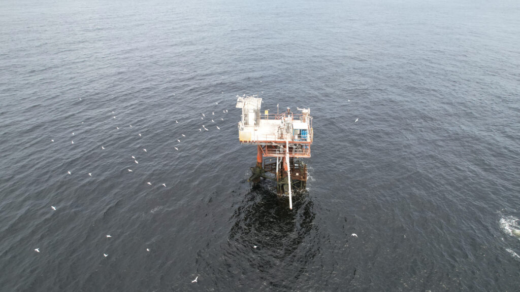
The transformation of an oil platform into an artificial reef is underway in Angola.
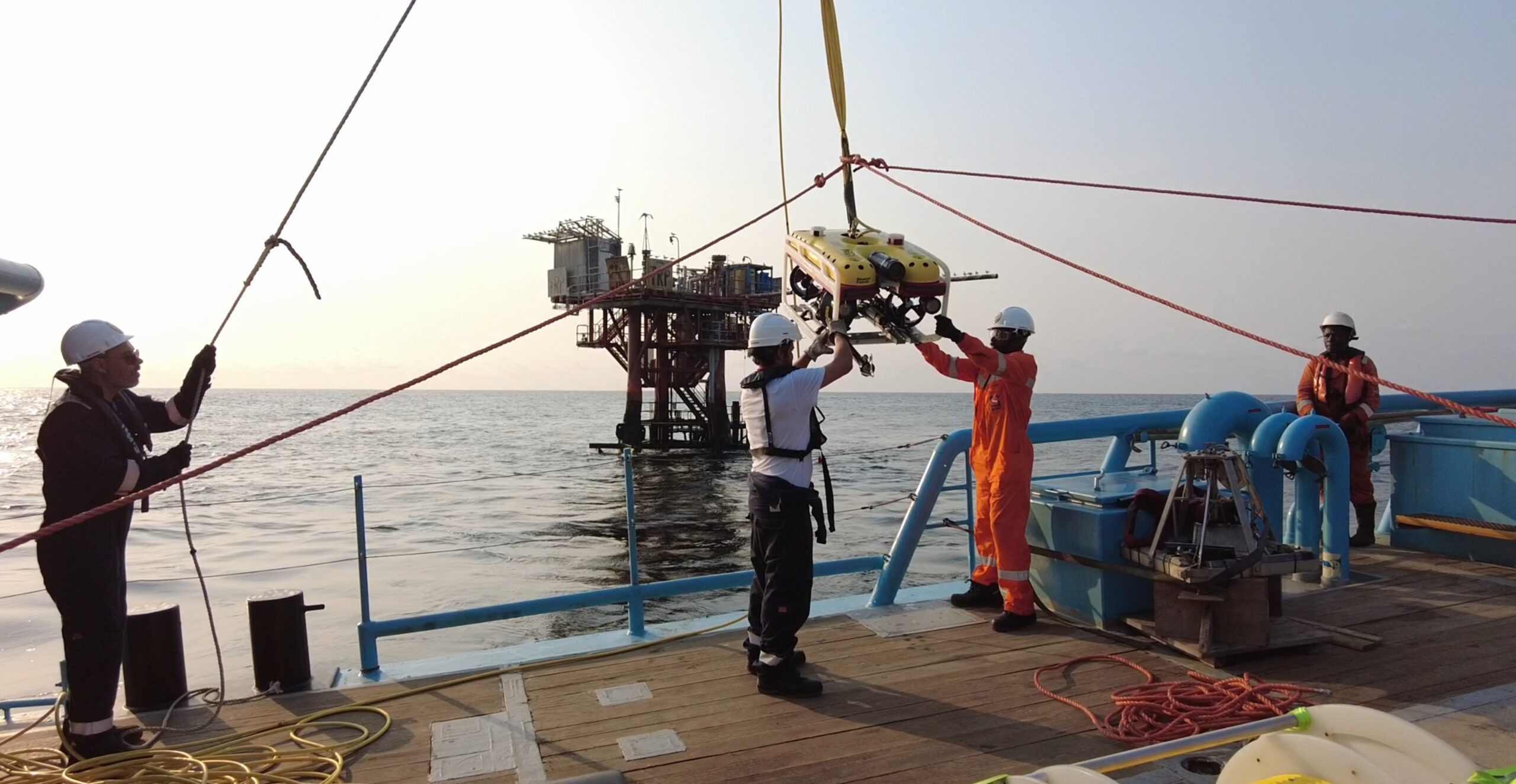
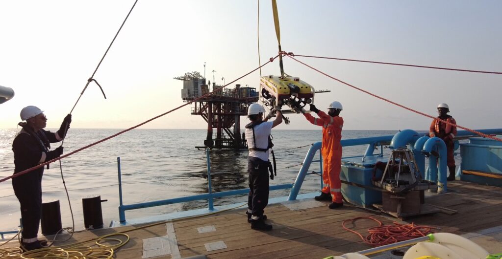
It is the first platform in Africa to be decommissioned in a project led by environmental quality services company, EQS, with a Saab Seaeye Falcon underwater robot deployed for the task.
Chief Technical Officer at EQS, Carlos Rodrigues says, “By operating the Seaeye Falcon and all its related capabilities, EQS is supporting its aim to fulfil specific works in a safe and cost-effective manner delivering accurate and relevant information.”
The Falcon is assisting in the survey and mapping of all underwater components, including checking the wellhead, pipelines and the surrounding maritime environment.
Baseline environmental conditions are determined by taking water and sediment samples at several stations and at different depths, focussing on biological matter, namely zooplankton, phytoplankton, and benthos.
Significant marine growth already exists throughout the structure with abundant marine life already in the area for populating the rig when toppled on its side to become an artificial reef.
Once decommissioning is complete, a series of surveys will be scheduled to monitor the evolution of marine growth on the newly created reef.
EQS selected the Seaeye Falcon for its ability to handle an array of cameras, sensors, tooling and complex data gathering systems that include a digital multi-frequency profiling sonar.
Having reached the end of its service life the rig’s transformation into a reef is being undertaken under the auspices of The Ministry of Mineral Resources, Oil and Gas of Angola.
EQS helps offshore energy clients navigate the complex environmental regulatory landscape including compliance, HSE subjects, and business liabilities.
The mission involves a multi-disciplinary team from different companies and sectors of activity, including marine biology, hydrographic surveys, quality inspectors and personnel specialised in survey equipment such as the Falcon.
Future work involves clearing an area of fish nets, restoring platform signalling and marking, positioning of signal buoys and confirmation of pipeline locations along with the surveys to monitor marine growth.
Rovco and Horizon Ocean Management enter strategic partnership for Japanese offshore wind market
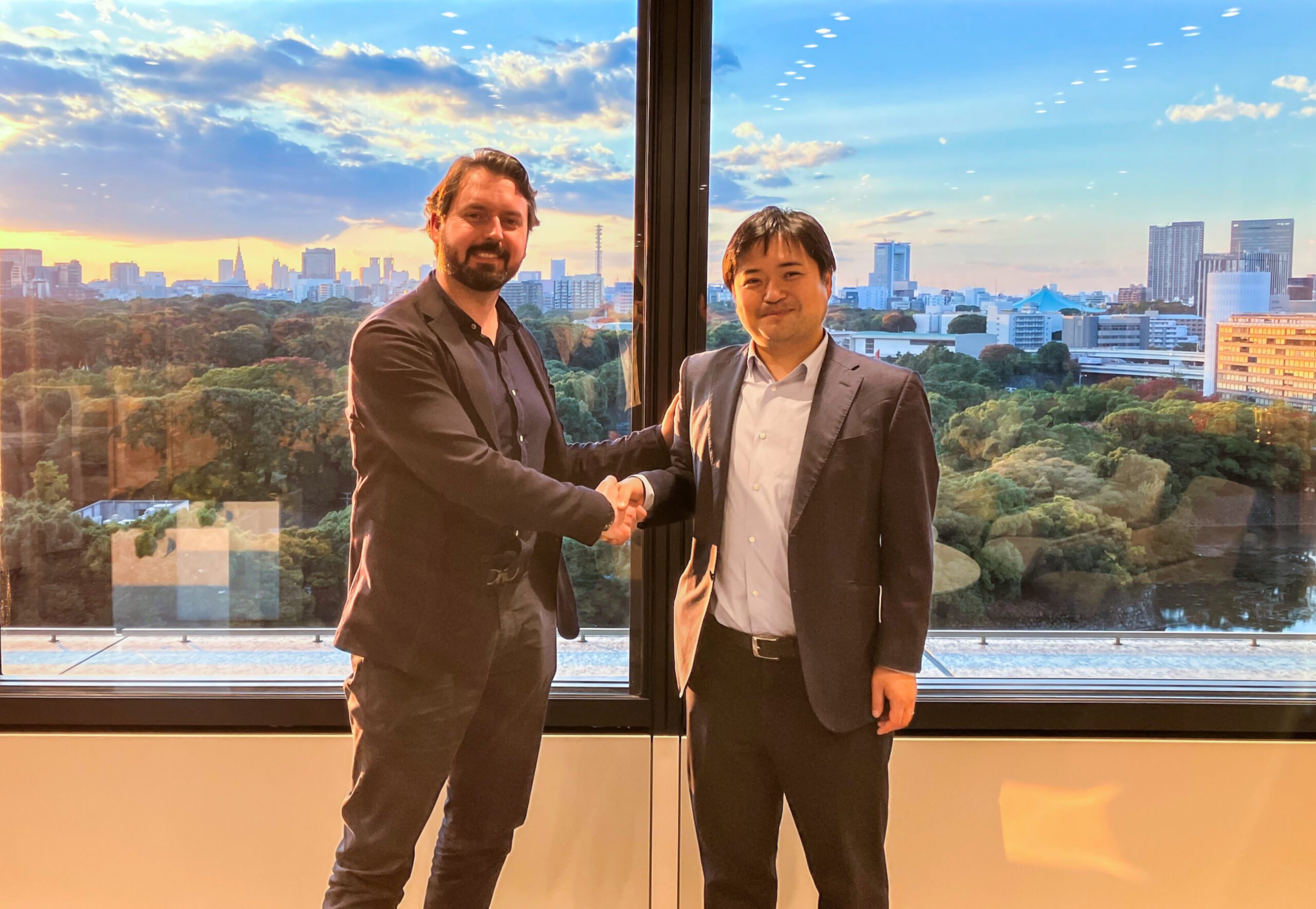
Horizon Ocean Management (HOM) – a subsidiary joint venture between Mitsui and Hokutaku (the leading turbine maintenance company in Japan) – and Rovco, a global provider of subsea robotic and hydrographic survey solutions to the offshore wind industry, have signed a Memorandum of Understanding for through-life subsea asset integrity and balance of plant survey solutions for the Japanese offshore wind market.
The agreement will see both parties work together to analyse the Japanese offshore wind market and develop a better understanding of in-country demand, as well as developing asset integrity programmes of work to support the maintenance of critical infrastructure.
HOM was formed in 2021 by Japanese conglomerate Mitsui and Hokutaku, the country’s leading wind turbine maintenance company. It has already established a unique position within the supply chain of the offshore wind industry in Japan.
Rovco and HOM will enter into a joint business development agreement, with a view to strengthening commercial ties and jointly promoting new projects. They aim to build a world-class service model for subsea integrity and survey scopes across offshore wind developments in Japan.
Drawing on Rovco's reputation as a leading provider of technology-focused survey solutions to the global offshore wind sector, the collaboration provides a powerful proposition, offering through-life subsea asset integrity, 3D difference modelling assessments and critical subsea component data analysis for predictive and preventative maintenance to offshore wind projects across Japan, in the operational phase. The partnership also assists in the creation of early operation and maintenance planning regimes for clients, building upon substantial industry know-how.
Leveraging Rovco’s extensive experience gained across the UK and European sectors, the agreement will enable Japan to adopt and benefit from the lessons learned by more developed markets at an early stage. Combined with HOM’s profound understanding of the local market and regulatory requirements, the collaboration will pave the way for expansion across Japan’s coastlines.
The companies have launched a joint proposal to clients for a number of future operations and maintenance projects. The Japanese government last year unveiled ambitious plans for offshore wind expansion, including targets of 10 GW of offshore wind by 2030 and installations of a combined 30 GW to 45 GW by 2040, along with a cost reduction target by industry of 8 to 9 yen/kWh between 2030 and 2035.
Simon Miller, Chief Revenue Officer at Rovco, said: “This partnership marks a significant milestone for Rovco. The Japanese offshore wind sector is rapidly upscaling, and this is an exciting opportunity for us to work alongside Horizon Ocean Management, sharing vital insight into subsea asset integrity best practices, whilst introducing both established and emerging technologies that help capture, interpret and present key infrastructure performance against design criteria and ensuring operational uptime with overall economic benefit to our customers.”
Nobuyuki Takagi, Managing Director of HOM, commented: “The European offshore wind supply chain has a wealth of marine and subsea experience via its long history in sectors such as Oil & Gas, in order to realise our national offshore wind deployment vision, HOM believe that learning from and working with the leading companies in these more advanced markets will develop and improve Japanese competence earlier, ultimately helping to establish middle to long-term local capability. We identified Rovco as one of the most innovative subsea inspection companies and are delighted to be collaborating with them here in Japan.”
Earlier this year, Rovco and its sister company Vaarst completed a successful series B raise to fund global expansion plans, co-led by Legal & General Capital alongside Equinor Ventures. This saw an initial £15.2m raise complete in April, with subsequent further investor contributions taking the total raise to £20.5m.
applied acoustics achieves milestone defence contract
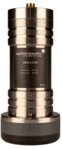
applied acoustics, an aae technologies group company, has signed a major contract for the supply of multiple units of its next generation military USBL subsea tracking system. The MIPS 2 system is the latest addition to the range of acoustic sub-systems.
Designed for defence applications, with many of those systems finding use in mine countermeasure (MCM) operations. While details of the contract are undisclosed, the order marks a significant milestone for the UK headquartered company as it represents its 300th USBL system assigned to military service.
The second generation of Mobile Integrated Positioning System (MIPS 2) adds to the family of advanced Ultra Short Baseline (USBL) underwater tracking systems designed and manufactured by applied acoustics, and has been designed for integration onboard both autonomous and crewed surface vessels. The highly accurate transceivers are available in two formats, offering hemispherical and directional acoustic footprints for advanced subsea positioning requirements across a variety of naval platforms and environments.
Speaking from the company’s UK HQ, Business Development Manager Gavin Willoughby commented, “Although we have a long and successful history in providing advanced equipment to the maritime defence industry, the importance of this contract cannot be underestimated as it highlights the continued confidence shown in applied acoustics both as a qualified defence contractor and an innovator in the field of underwater acoustics. We’re extremely proud to be recognised as a significant stakeholder in this arena”.
Kraken Subsidiary, PanGeo Subsea, Concludes Over $5 Million of Sub-Bottom Imager Projects
Using PanGeo’s proprietary bottom-penetrating Synthetic Aperture Sonar, the Sub-Bottom Imager™ (SBI) has completed over 1,500km of cable depth of burial survey in 2022, adding to the already more than 10,000 km of Sub-Bottom Imager survey since its launch in 2012.
Kraken Robotics Inc (TSX-V: PNG, OTCQB: KRKNF) announces that its PanGeo Subsea subsidiary has completed over $5 million in Sub-Bottom Imager (SBI) projects year-to-date. This includes over 1,500 km of depth of burial (DOB) surveys that have a cumulative 2022 contract value of over $3 million. These surveys have supported the development of offshore wind farms in the US, Irish Sea, North Sea, Baltic Sea, and off the coast of Taiwan.
The SBI is the industry preferred technology for pre and post cable lay surveys. SBI campaigns in 2022 have included ROV-based surveys using ROVs of opportunity, as well as high-speed surveys using the SeaKite SBI intelligent towed platform along several HVDC interconnector transmission cables. The SBI has also demonstrated success imaging buried fiber optic cables as small as 30mm, further expanding the market opportunities for this cutting-edge technology.
In June, the SBI was recognized by the industry and added to the IMCA ‘Guidelines for the Measurements of Depth of Burial’ report, which is a comprehensive industry guide on how to conduct DOB surveys and what survey sensors to consider for verification.
“The Sub-Bottom Imager has a strong history of delivering high-speed, high-resolution results in buried object detection and depth of burial measurements, without the need for taking assets offline or injecting a tone in the cable” says Moya Cahill, CEO of PanGeo and EVP Services at Kraken. “Our combined technology and service teams have formed a powerhouse of innovative technology and reliable, repeatable service delivery. Our teams are enabling rapid deployment of new features and enhancements across our technology portfolio from the SBI through to the KATFISH delivering service excellence in seabed and sub-seabed imaging.”.

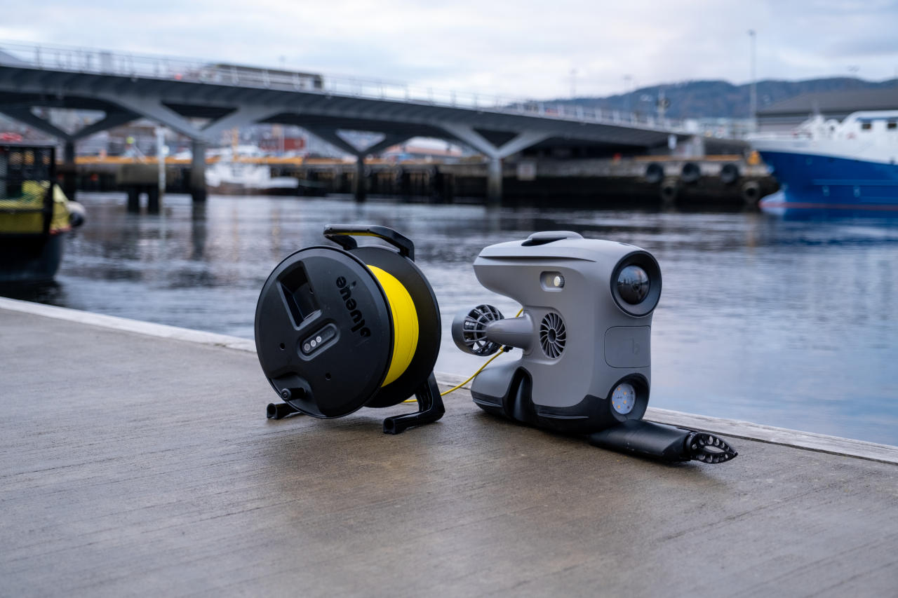
SCS Ltd. signs distributor agreement with Blueye Robotics AS.
Subsea Commercial Services Ltd. (SCS) is proud to announce the securing of the exclusive Scottish distribution rights for Norwegian ROV manufacturer Blueye Robotics AS.
Founded in 2015, Blueye has its roots in the highly renowned Centre for Autonomous Marine Operations and Systems (AMOS) at The Norwegian University of Science and Technology. With over one thousand ROVs delivered to more than 50 countries worldwide, Blueye’s product offering is proven, very capable and technologically extremely evolved.
Callum Magee, SCS’s Managing Director, leans on his years of small ROV experience when stating: “Blueye has nailed it! If you wrote down a list of the limitations and frustrations involved in Mini-ROV operations, the Blueye X3 ROV removes everything on that list. For me, the integration of hardware and software sets the X3 apart. The lack of traditional ROV topside, enabled by networked devices and downloadable piloting, viewing and reporting software, coupled with the vehicle’s power and payload capabilities, make it’s the complete package”.
Deployed in underwater remote visual inspection and survey applications, the battery powered X3 is equipped with work enabling sensors, manipulators, sonars and positioning systems from a range of leading manufacturers. The X3 has no topside case or cables, with the ROV benefiting from an integrated Wi-Fi and Bluetooth hub which enables viewing and recording on personal devices. The vehicle is piloted via a wireless handheld controller, reducing risk and increasing flexibility on work sites, remote locations and vessels.
Christian Gabrielsen, CEO of Blueye is enthusiastic about the relationship: “We see Scotland as a key geographical region and are delighted to have teamed up with SCS. They have a great deal of experience and an extensive network in our primary market sectors and we’re looking forward to supporting their efforts in developing the Scottish market”.
SCS is organising a client roadshow across Scotland during the second half of November 2022 with live demonstrations of the X3 available upon request. Please contact SCS to book your time slot. SCS will also be exhibiting the X3 and other subsea solutions at Subsea Expo, February 2023, Aberdeen, Scotland.
IMAGE Project with Voyis, Cellula Robotics Ltd., Shift Environmental Technologies Ltd. and Fisheries and Ocean Canada
Voyis is excited to announce the development of the IMAGE project - Image Mapping & Analysis for Governance and Education, funded through Fisheries and Oceans Canada’s Ocean Management Contribution Program (OMCP).
This project will bring together many strong industry partners: Voyis, Cellula Robotics Ltd., and Shift Environmental Technologies Ltd. Together, these organizations will conduct Autonomous Underwater Vehicle (AUV)-based image mapping and interpretation of Canadian Marine Protected Areas (MPAs) to efficiently monitor, manage, and educate in ocean management.
The OMCP provides funding opportunities to eligible applicants to support marine conservation initiatives with an emphasis on outreach, monitoring and stewardship, as well as capacity building initiatives.
The Project
Marine researchers increasingly rely on remote video and images from underwater vehicles to monitor marine habitats like coral reefs, boulder fields, kelp forests, and other underwater habitats. With new high-resolution 3D data, high-speed imaging, and machine learning approaches, there is an opportunity to automate MPA surveys and use this data automatically by classifying and counting the abundance of various species over time.
Yearly datasets can be consistently collected and compared to infer environmental and population changes, possibly caused by climate change, pollution, or other external factors.
This project seeks to demonstrate that the Canadian Ocean Management can apply this autonomous monitoring approach on a wider scale. This objective can be accomplished by developing a robust commercial solution with Cellula’s Solus-LR AUV fitted with Voyis optical sensors, in addition to demonstrating surveys with local indigenous stakeholders who could become the future stewards of an MPA monitoring strategy.
The project has four main goals to be successfully completed:
- Goal 1 - Monitoring Solution Development: Design and integration of Voyis optical sensors into the Solus-LR to build an MPA monitoring and interpretation solution
- Goal 2 - Indigenous Training & Mission Planning: Engage and build the Indigenous community's technical ability to participate in marine environmental monitoring and ocean conservation planning
- Goal 3 - Survey & Analysis: Execution of survey operations and data analysis following developed mission plans
- Goal 4 - Governance & Education: Dissemination of collected data to improve education and inform new methodology and site establishment
Project Partners
Voyis will supply a laser scanning and imaging package for integration into Cellula's Solus-LR AUV to complete the first goal. Using Voyis' stills camera and LED panel, the project will improve the researcher's ability to monitor large areas of seafloor with high-resolution images and laser data with new automated image interpretation software. This high-resolution technology, combined with the new image interpretation software, will improve the localization of seabed features for future data comparisons using optical navigational aiding algorithms.
Solus-LR is a hydrogen fuel cell powered AUV with a submerged range of over 2,000 km. Solus-LR was developed by Cellula for Defence Research Development Canada under the Arctic all domain situational awareness program. Cellula will integrate the Voyis camera system and plan and execute the MPA survey missions.
To achieve the second project goal, Shift Environmental Technologies Ltd. will leverage its existing First Nations relationships to facilitate training of the indigenous community on AUV survey operations and gain input on selecting survey locations.
With the first two goals completed, Vpyis will be able to achieve the third one and complete the survey and data analysis, which will rely on all project partners working together.
And for the fourth outlined goal, an educational organization will join the consortium to build on its world-leading contributions to monitor remote MPAs. Along with Fisheries and Oceans Canada, they will use the high-resolution wide-area datasets collected in the project to drive improvements in ocean education programs, governance, and monitoring methodologies.
Contact Voyis to learn more about this project and all our environmental monitoring capabilities.