SEA-KIT International secures first USV export deal
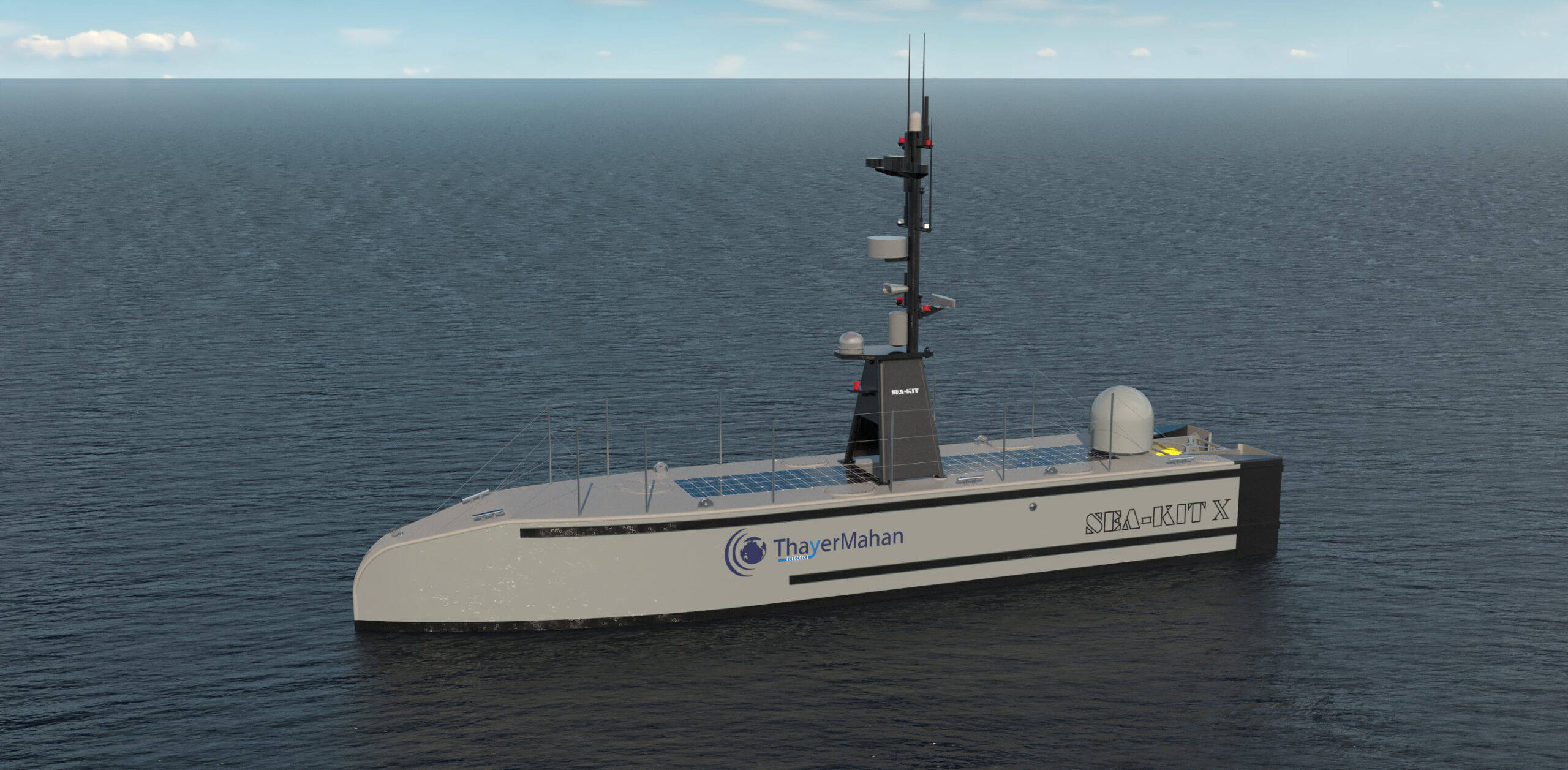
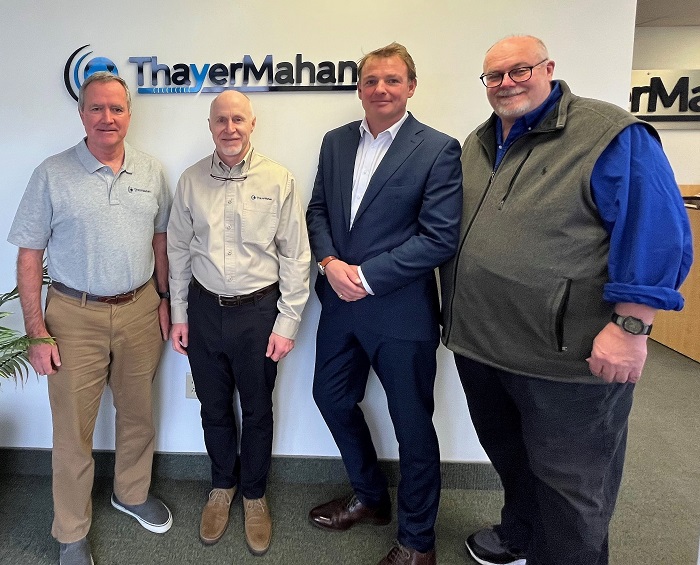
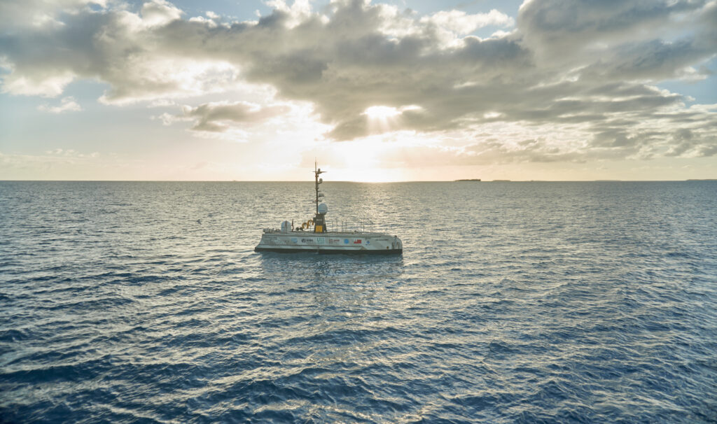
SEA-KIT International has announced its first Uncrewed Surface Vessel (USV) export sale to ThayerMahan, a world leader in autonomous maritime solutions based in Connecticut, USA.
The X-Class USV’s award-winning combination of extended range, high sea state endurance and payload capacity attracted ThayerMahan initially to the UK-based USV technology leader. The fact that SEA-KIT’s vessels are already commercially proven across the globe also factored heavily in their decision-making process.
Mike Connor, President and CEO at ThayerMahan, said: “We are always striving to improve the efficiency of maritime domain awareness and to keep people safe. SEA-KIT’s flexible payload design enables us to host multiple, sophisticated maritime sensing systems onboard, which in turn will support ThayerMahan to continue leading the field of remote and autonomous mobile acoustic sensing and sense making.
“We envisage that the introduction of this hi-tech USV to our portfolio will enhance the protection of ports and vessels at sea as well as have a positive impact on illicit trafficking across international borders.”
ThayerMahan is a world-leading provider of state-of-the-art remote and autonomous maritime sensing systems for government, industry and academia. The company plans to use the SEA-KIT USV to support introduction of the technology into government service, as well as for its own commercial activities in US and international waters.
Ben Simpson, SEA-KIT CEO, said: “This US export deal marks a significant milestone in the company’s journey so far. The UK is forging a leadership stance in Maritime Autonomous Systems innovation, and we are proud to be part of that. We look forward to a fruitful, ongoing partnership with ThayerMahan and to supporting their current and future maritime domain awareness goals.”
ThayerMahan is set to take delivery of the latest 12m SEA-KIT X-Class design in spring 2023, with plans for it to enter operation over the summer.
Tom Chant, Chief Executive of the UK’s Society of Maritime Industries (SMI), recognised its member’s achievement: “SEA-KIT has been with SMI right from its inception and it is tremendously satisfying to witness the growth of the company and to follow its numerous overseas projects, like the recent subsea volcano survey in Tonga. Winning new export business with new technology takes vision and a great deal of investment in product development, allied with the development of service and support teams. Congratulations to everyone at SEA-KIT for this impressive export win.”

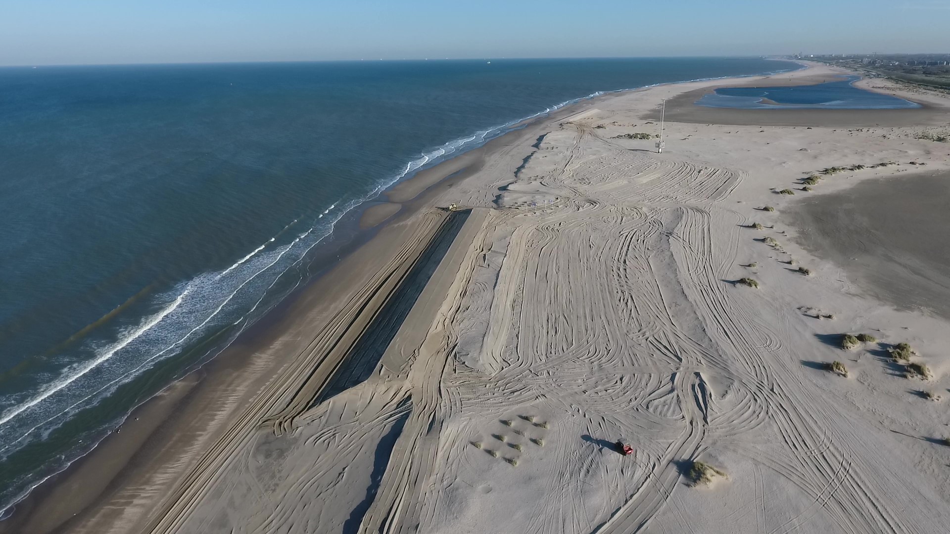
Understanding erosion of protective coastal dune systems
The Dutch have embraced numerous techniques to keep water at bay, but their dune systems are the primary defense against the sea. Understanding how resilient these systems are to coastal erosion is essential. The Dutch government “uses dune erosion models as the basis of their management,“ Dr Jantien Rutten, a post-doctoral researcher at Delft University of Technology (TU Delft), explains.
However, these models need to be validated using instruments such as Nortek’s Signature1000 acoustic Doppler current profilers (ADCPs) and Vector velocimeters, which are capable of measuring complex processes in situ. For example, Rutten and her colleagues at the RealDune/REFLEX project are particularly interested in understanding how infragravity waves play a role in eroding these protective dunes.
How waves erode the coast
Most waves are generated by the wind blowing across the sea surface. When wind-generated waves reach the coast, they tend to break on the shore, dissipating their energy quickly.
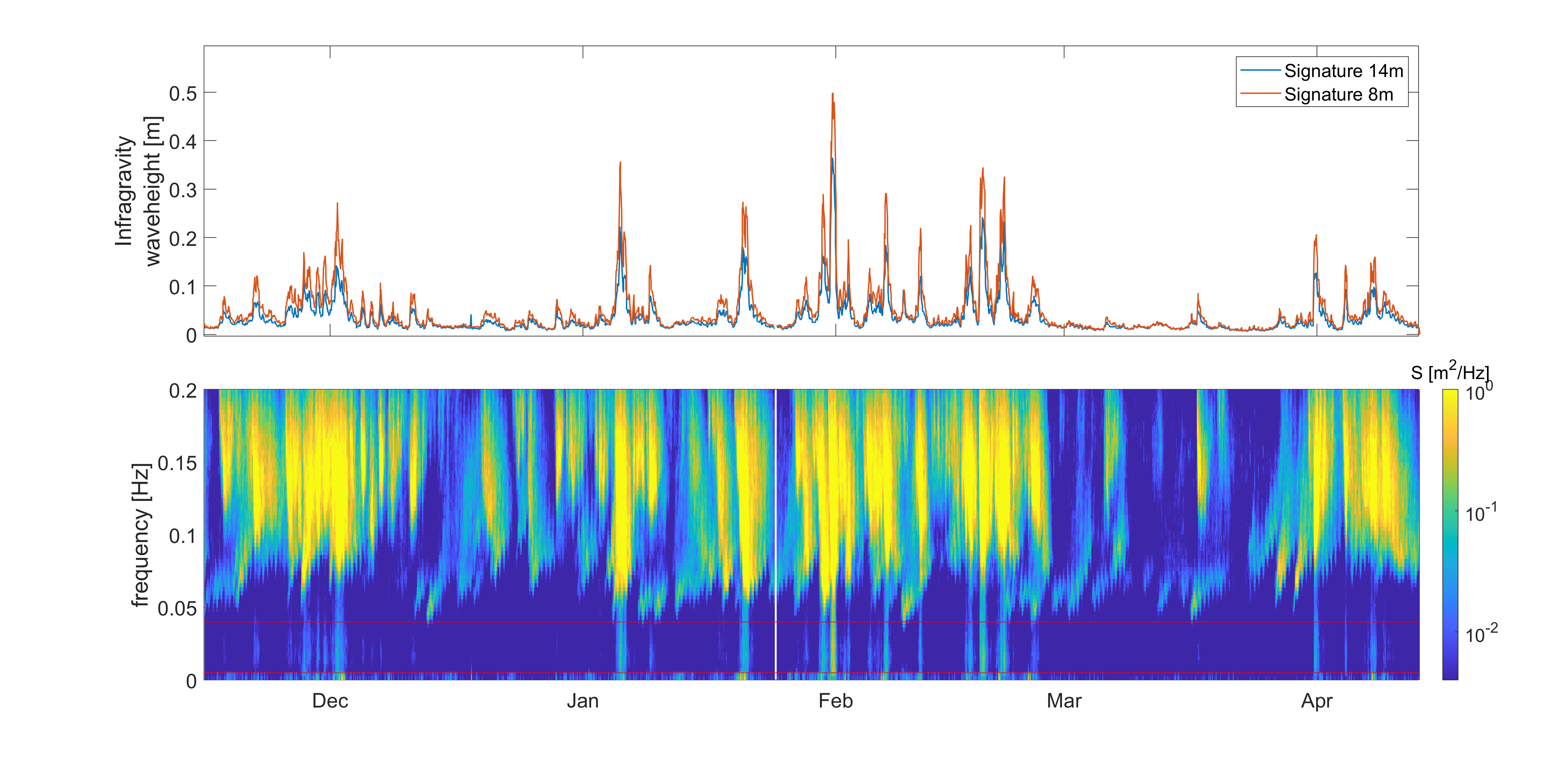
Infragravity waves arise as ocean swell interacts with the wind-generated waves. They tend to start very small but grow in size as they move toward the shore.
“The energy is transferred from the wind-generated waves into long waves,” explains Dr Marion Tissier, Assistant Professor of Ocean Waves at TU Delft.
“When these longer waves reach the beach, they don’t lose as much energy as short [wind-generated] waves, so they travel much further up the beach,” says Rutten.
Sometimes, infragravity waves travel so far up the beach they reach the dunes. The backwash then takes sand from the dune with it, causing erosion.
Measuring the impact of infragravity waves
To quantify the erosional impact of infragravity waves, the RealDune/REFLEX researchers needed to capture data from land and water across an entire storm season. The team constructed two artificial dunes at De Zandmotor beach. They placed a series of ADCPs in deeper waters a few kilometers offshore from the dunes, along with velocimeters in the shallower waters.
ADCPs measure wave conditions well in deeper waters, but “as waves move towards the coast, they become steeper and eventually start breaking. That kind of process is best measured with a Vector,” Nortek’s Rikke van der Grinten explains.
Wave direction matters
The instrumentation can also help the researchers understand how much of the infragravity wave energy originates from the Dutch coast and how much is reflected from more distant coastlines, such as those in the UK.
“This is important because we typically neglect the remotely generated infragravity waves when assessing coastal safety,” says Tissier, noting that this omission could mean models are underpredicting dune erosion.
The team has begun the processing of their data. “We are starting to look at separating the different types of infragravity waves and quantifying their direction and energy,” Tissier says.
The results of the RealDune/REFLEX projects interest researchers in the Netherlands and beyond as infragravity waves become increasingly important for understanding coastal erosion.
ION Science Holdings acquires Analox to further accelerate growth
ION Science, the world’s leading developer and manufacturer of PID gas sensors and instruments, has announced the acquisition of Analox Group, a gas sensing and analysis manufacturer based in Stokesley, North Yorkshire. “This is a major step on our strategic growth journey,” explains ION Science Group Managing Director, Duncan Johns. “With strong brands in global markets, ION and Analox will continue to operate separately. However, both companies invest heavily in research and development, so by working together, we are really excited by the opportunities this acquisition presents for accelerating future growth.
“Importantly, both companies share a common focus on customers’ needs, and especially product quality and reliability. We also both supply OEM sensors and engineered solutions, so customers can expect a broader range of solutions in the future. From an ION Science perspective, this move will expand the range of measurement technologies that we will be able to offer, which means that in addition to VOCs, we will also offer detection and measurement solutions for a wide range of other gases.”
Analox Managing Director, Emma Harbottle says: “Over the last 40 years we have designed and developed innovative gas sensing solutions that truly solve our customers' challenges. We are extremely proud of the reputation we have built, especially in the defence, beverage & hospitality and laboratory sectors. By working closely with ION we can continue to build on the success of both companies and I am excited to see what the future holds.”
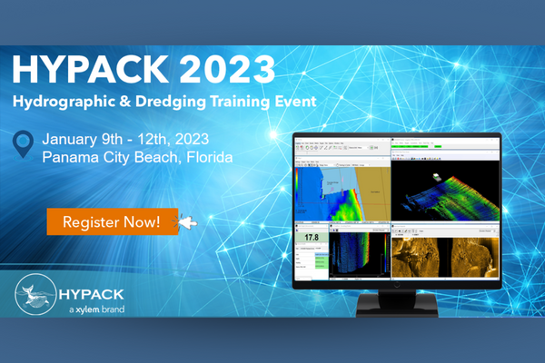
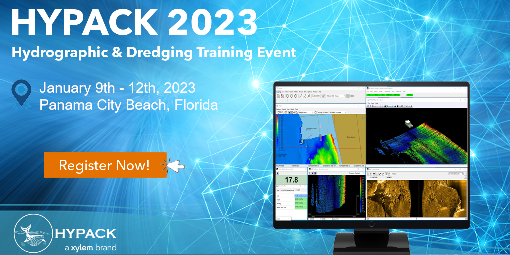
HYPACK 2023 Hydrographic and Dredging Training Event on 9-12 January
9 -12 January 2023
Panama City Beach, Florida
Website: https://support.hypack.com/hypack/2023/
The annual HYPACK Training Event will be held on 9-12 January 2023 in Panama City Beach, Florida! HYPACK are very excited to celebrate 30 years of their training event.
The event will offer instruction on the newest features of HYPACK® 2023 and training in HYPACK®, HYSWEEP® and DREDGEPACK® software. By attending you will have exclusive access to all of HYPACK's live training sessions and the ability to network with attendees and exhibitors. Attendees will also be able to see HYPACK® in action from livestreamed demos at the hotel.
Terradepth announces commercial launch of Absolute Ocean marine data management platform
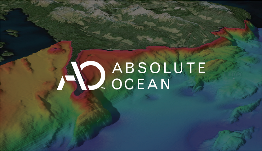
Terradepth has announced the official launch of Absolute Ocean (AO), a secure easy-to-use cloud-based geospatial solution providing high-level visualization, analysis, collaboration, and management of all marine data. In addition to offering Absolute Ocean as a software-as-a-service solution, Terradepth leverages the platform to deliver its own marine survey products – including Autonomous Underwater Vehicle (AUV) data – as well as those of third-party ocean data vendors.
Terradepth, a provider of seafloor hydrographic and geophysical survey solutions, developed Absolute Ocean to deliver greater operational efficiencies in marine data delivery and collaboration. Absolute Ocean has been available in beta since early 2022 with several early adopters exercising its functionality. Currently, the solution is being used for projects ranging from environmental monitoring and construction engineering to offshore energy production and telecommunications infrastructure inspection.
“Absolute Ocean breaks open the data silos that have traditionally impeded access to, and collaboration on, vital ocean information,” said Joe Wolfel, CEO of Terradepth. “This fully integrated platform allows marine organizations to manage and archive all of their data sets in one place for enterprise-wide access and global collaboration.”
Absolute Ocean is intuitive, enabling multiple stakeholders, most of whom did not previously have easy access to this data, the ability to easily manage, view, analyze and deliver ocean geospatial information. Absolute Ocean addresses the need for a unified 3D geospatial data platform for secure enterprise-wide data sharing and visualization, as well as regulatory compliance.
“Terradepth’s Absolute Ocean revolutionizes ocean data management,” said Damon Wolfe, President of ECHO81, a premier supplier of underwater survey technology and Terradepth reseller based in Hartwell, Ga. “This easy-to-use interactive interface offers a long-needed solution to managing complex maritime data sets.”
Users can easily and securely upload geospatial data in any format into the secure cloud database directly from Absolute Ocean’s web browser interface. They can then query and visualize the data and perform geospatial analysis. Users can also generate and send hyperlinks that allow other stakeholders to see the exact view and projection on screen for easy collaboration.
A powerful geospatial engine enables users to view marine data and the base map data sets in 2D and 3D, from a variety of perspectives, scales, and viewing angles. Linear distances, profile measurements, and areas of subsurface features can be measured. Data sets can be viewed by themselves, overlaid on each other or with third party base maps, such as NOAA’s Electronic Nautical Charts (ENCs), for analysis.
For hydrographic surveying companies, the platform offers a way to differentiate themselves from competitors through more effective data delivery to their customers.
“The ability to quickly and easily analyze geospatial information helps our surveyors, data processors and project managers make more well-informed data-driven decisions, saving time and resources,” said William Jenkins, S.T. Hudson Engineers’ Vice President.
As one early adopter learned, it can also give customers near real-time access to valuable data.
“We are thrilled with how AO helps us achieve our customer’s goal of mapping the Great Lakes more quickly and efficiently and provide visualized data close to real-time,” says Derek Niles, President and Founder of Orange Force.
Terradepth has populated Absolute Ocean with thousands of publicly available data sets, including side-scan sonar, synthetic aperture sonar, magnetometer grids, multibeam bathymetry, LiDAR, and satellite imagery. Access to pre-loaded data and advanced functionality will be available through a graduated subscription pricing structure.
In addition, the platform serves as a storefront where customers can purchase commercial products from third parties, such as satellite-derived bathymetry from TCarta of Denver.
“The marine industry has been waiting for a solution like this,” said Kyle Goodrich, TCarta President & Founder. "AO gives us a secure and efficient way to instantly deliver updates, visualized files, and raw data to our clients, allowing them to view data and collaborate much more quickly than traditional practices.”
To request a demonstration of Absolute Ocean or learn more about Terradepth, go to terradepth.com.
Valeport appoints new Innovation and Product Manager
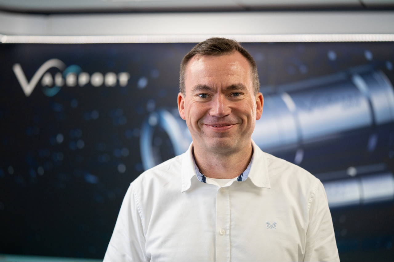
Leading manufacturer of oceanographic and hydrographic instrumentation, Valeport, has appointed Iain Slade as Innovation and Product Manager. Iain comes from a position as a Surveyor and Hydrographic Training Programme Manager at Fugro and Fugro Academy.
In the newly created role at Totnes-based Valeport, Iain will be responsible for formulating ideas for new products and solutions, as well as managing the New Product Introduction (NPI) process from prototype to finished project. This includes reviewing existing products to ensure they remain relevant and meet customers’ current and future needs.
With over 18 years’ experience as an accredited hydrographic professional working within a range of sectors including: civil hydrography, marine renewables, coastal monitoring and offshore oil and gas, Iain has an established international reputation within the hydrographic community.
Iain has a strong commercial background and joins Valeport following 12 years across various roles at Fugro and Fugro Academy, where he was involved in operations offshore as a surveyor, and designing and delivering the internationally recognised FIG/IHO/ICA (IBSC) Category B Applied Hydrographic Survey Training Programme for Fugro Academy.
As a Director of The Hydrographic Society UK, Iain also helped manage the development, external accreditation and implementation of a Hydrographic Professional Accreditation Scheme (HPAS), and now sits on the International Federation of Hydrographic Societies (IFHS) HPAS steering committee as one of the UK representatives. Iain holds an MSc in Hydrography (IBSC Cat ‘A’ recognised Programme), and a BSc in Ocean Science from the University of Plymouth.
Commenting on his new role, Iain Slade said: “Having worked on the other side of the fence in the operational side of the industry, it’s a real pleasure to have the opportunity to understand more about Valeport’s quality oceanographic and hydrographic instruments – equipment which I’ve been using throughout my entire career."
“Valeport is a small but incredibly fast-paced business with a global footprint and great reputation. I’m delighted to have joined the company at such an exciting time in the firm’s growth plan and to be working with a team of highly talented professionals, all with a clear, shared ambition and common goal to continue innovating and be the leading environmental sensor manufacturer.”
Kevin Edwards, Chief Commercial Operations, added: “As a hydrographic surveyor, Iain is exceptionally well-versed in hydrographic operations. His extensive industry knowledge, practical experience of working with Valeport products, and strong commercial background make him a brilliant asset to both our team and our clients. We’re truly excited to have him on board.”
Subnero Wireless Integrated Suite (SWIS) - ADCP edition
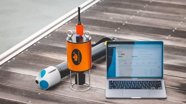
Subnero, a Singapore-headquartered company is launching its latest development: Subnero Wireless Integrated Suite (SWIS) - ADCP edition.
Acoustic Doppler Current Profilers or ADCPs are used to measure high-quality underwater current data which is essential for many subsea operations such as coral reef health studies, metocean studies, discharge pattern surveys, ship navigation, subsea construction, inspection, intervention, and decommissioning.
When deploying ADCPs, users are generally presented with two choices to retrieve the data. Either retrieve the device after deployment and download the data or connect the bottom-mounted device to a buoy or a platform using a cable to download the data in real-time. Both these choices are expensive, logistically challenging, prone to data loss or equipment failure and may need additional permits which can increase the overall cost and complexity of the operation.
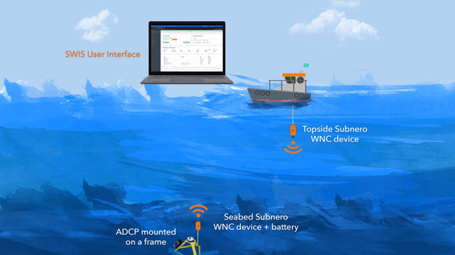
SWIS - ADCP edition provides seamless wireless connectivity to a seabed-mounted ADCP integrated with the Subnero Wireless Network Communication (WNC) series of products.
Users can interact with the remote ADCP through another WNC device deployed from the topside, such as from a boat, buoy, or platform, which can be dynamically configured to provide the best communication performance in the prevailing environment. The topside device can be accessed using a laptop or a tablet.
When connected, you are presented with a modern, intuitive web-based dashboard with all relevant information in one place. In addition to the list of measurement files that you can download, the user interface provides critical information such as the roll and pitch of the sensor, its temperature, battery voltage, etc., to ensure an error-free deployment. A single click allows you to download any file of interest just like you download something from the Internet. You get real-time feedback on the download progress, and you can even modify some of the remote device parameters during a deployment.
But what if the ADCP is configured to generate large amounts of data that an acoustic link cannot support? That is where SWIS makes a real difference.
SWIS features a Content-Aware Data Summarisation or CADS engine that leverages machine learning techniques to generate smart previews of the ADCP data files for a user-selectable date range and compression ratio. Smart previews are of the same format as a regular file generated by the ADCP which you can open using the same ADCP vendor-provided software to seamlessly integrate into your existing workflow.
In addition, SWIS provides smart scheduling capabilities for optimising battery usage, as well as fault tolerance by duplicating the data in both the ADCP as well as the WNC device to ensure data retrieval in the event of an equipment failure. SWIS also supports downloading data from multiple ADCPs deployed in the same area using a single topside unit.
All of these not only make your experience of deploying and managing multiple ADCPs easier but also drive down the costs dramatically by avoiding costly cables or frequent device retrievals, it also makes SWIS an ideal solution for subsea applications that need near-real-time access to current measurements.
After attending a local demonstration, Bob Coutts, Survey Business Development at Bintang Subsea noted “SWIS opens up new possibilities for the efficient and reliable acquisition of subsea sensor data.”
Subnero is constantly working to bring you new features to help you realise your vision of underwater communication and networking.
Falcon underwater robot helps protect Maldives coral reefs
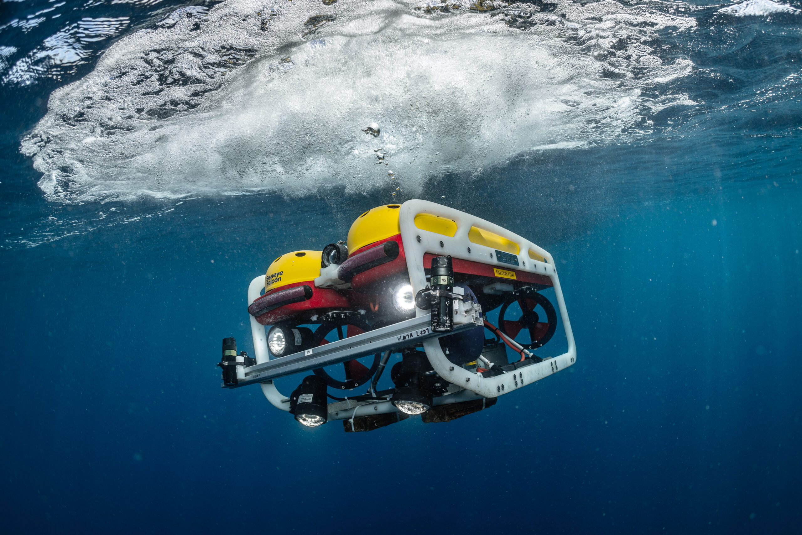
A Saab Seaeye Falcon underwater robot has helped complete the first-ever systematic scientific survey of the waters of the Maldives - the lowest-lying nation on earth.
The Maldives is just 1.5 metres above sea level on islands of coral reef atolls. Globally, coral reefs account for 32% of known biodiversity. They are seen as the ‘rainforests of the ocean’, yet at least 97% could be lost with a 1.5-degree temperature rise.
The Nekton Foundation in partnership with the Maldives Marine Research Institute undertook the mission to understand the Maldives’ ecosystem to help create extensive new protected marine areas and strengthen the resilience of coral reefs to protect the islands from increasingly intense storms and erosion caused by climate destabilisation.
As an official partner to the mission, Saab Seaeye donated use of the Falcon to work alongside human-occupied submersibles, autonomous systems and research technologies.
The Falcon and other submersibles and divers collectively documented the extensive biodiversity of the ecosystem from shallow waters to 1000 metres.
Analysis of video transects from the Falcon has revealed 107 fish species and 130 organisms that live on the seabed, such as coral, sponges and algae. Analysis is ongoing with more species expected to be identified.
The Falcon also recorded charismatic megafauna such as turtles and sharks. These specific observations will be used to support projects engaged in long-term population assessments.
The research recorded extensive coral bleaching at many locations. In other locations, however, exceptionally healthy coral reefs were found. This offers hope that healthy coral reefs can thrive, particularly in areas where cold water upwellings prevent bleaching. These areas may be critical to support coral propagation projects.
Marine life in high definition
To enable scientists to document the biodiversity of the ocean around the Maldives, Nekton scientists devised, tested, improved and deployed a novel methodology for using the Falcon for video transects in shallow waters on the complex topography of coral reefs and operating in areas of strong currents.
Two sets of cameras were positioned on the vehicle, one set forward facing and the other set downward facing. They were spaced 80cm apart and at inward angle of 8 degrees ready to be calibrated for stereoscopic video recording.
The same system was used by snorkelers and other submersibles to complete video transects in an identical manner and at different depths.
Challenge of shallow waters
“Surging currents in the shallows and sheer subsea cliffs made this one of the most challenging operations on the mission,” says Mission Director, Oliver Steeds.
“Only the Falcon could handle the swell surges and powerful currents, including up-currents and down-currents,” he explains.
Renowned for its ability to hold steady in strong currents while filming and manoeuvring, the Falcon is the world’s top robot in its class with a reliability record covering over a million hours underwater.
Nekton is a not-for-profit UK-based research foundation working with the University of Oxford and a wide range of partners engaged in the scientific exploration and protection of the ocean.
Tonga eruption confirmed as the largest ever recorded
A New Zealand-led team has completed the fullest investigation to date into January’s eruption of the underwater Tongan volcano.
Hunga-Tonga Hunga-Ha'apai (HT-HH) emitted the biggest atmospheric explosion recorded on Earth in more than 100 years.
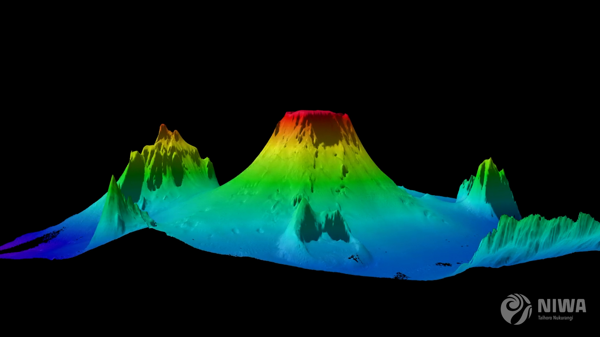
New Zealand's National Institute for Water and Atmospheric Research (NIWA) has discovered that almost 10km3 of seafloor was displaced – the equivalent to 2.6 million Olympic-sized swimming pools and a third more than initial estimates – with two-thirds coming from the summit and the rest from the surrounding flanks.
Three-quarters of this material was deposited within 20km of the volcano. This leaves almost 3.2km3 unaccounted for.
The project leader, NIWA marine geologist Kevin Mackay, said this missing debris could be partly explained by aerial loss.
“This is why we didn’t notice the loss until we had mapped everything. The eruption reached record heights, being the first we’ve ever seen to break through into the mesosphere. It was like a shotgun blast directly into the sky. The volume of this ‘shotgun’ plume is estimated to be 1.9km3 of material, which has been circulating in our atmosphere for months, causing the stunning sunsets we saw following the eruption. This goes some way to explaining why we’re not seeing it all on the seafloor,” said Mackay.
Despite the huge displacement of material, the volcano’s flank remains surprisingly intact. However, the caldera, or crater, is now 700m deeper than before the eruption.
Further evidence from the caldera shows signs that HT-HH is still erupting. A robot boat remotely operated from the UK by SEA-KIT International detected active venting from newly formed cones, explaining why glass fragments formed from cooled molten lava were picked up during NIWA’s earlier survey.
NIWA scientists have also unravelled one of the biggest unknowns of the eruption – the pyroclastic flows.
Pyroclastic flows are currents made up of dense lava, volcanic ash, and gases which can reach temperatures of 1,000°C and speeds of 700km/hr.
NIWA collected 150 sediment cores which were sent to New Zealand’s University of Otago and the National Oceanographic Centre in the UK for analysis. These samples showed pyroclastic deposits some 80km away from the volcano. But Dr Emily Lane, NIWA Principal Scientist - Natural Hazards, believes they could have travelled even further.
“Eighty kilometres was the end of our survey range, but the pyroclastic flows appear to extend beyond that distance, perhaps as far as 100km away. They are also what caused both the domestic and international communications cables to break, with the domestic cable now being buried under 30m of eruptive material.
“The sheer force of the flows is astonishing - we saw deposits in valleys beyond the volcano, which is where the international cable lies, meaning they had enough power to flow uphill over huge ridges and then back down again,” said Dr Lane.
On land, the heat from pyroclastic flows creates a frictionless boundary layer which allows them to move so rapidly, like how a puck glides on an air hockey table.
However, Mackay says this is the first time that scientists have observed underwater pyroclastic flows of this magnitude.
“It’s the interaction with water that made this event so unprecedented. It’s still speculation but the latest science shows that this phenomenon may be more exaggerated under water. This could be why the pyroclastic flow travelled so far and with such force,” he said.
When heated, water can expand to around 1,000 times its volume. When you get several km3 of hot magma instantly hitting the cold saltwater, this reaction is supercharged, and all that energy must go somewhere – and the only options are to explode up or sideways out of the volcano.
“While this eruption was large – one of the biggest since Krakatoa in 1883 – there have been others of similar magnitude since then that didn’t behave in the same way. The difference here is that it’s an underwater volcano and it’s also part of the reason we got such big tsunami waves,” said Mackay.
Dr Lane said that because these volcanos are not just found in the Pacific, but the world over, we must know what happened and why it was so violent.
“The pressure anomaly generated by this eruption supercharged the tsunami so that it was able to travel right across the Pacific and world-wide. This mechanism meant that it could travel further and faster than our warning systems expected. The Krakatoa eruption was that last time a volcanic tsunami on this scale occurred,” she said.
The significant reshaping of the seafloor also had dramatic effects on ecosystems in the region.
There was little sign of any animal life on the flanks of the volcano, in deeper water channels, and most of the surrounding seafloor. However, there were patches of abundant life that had survived the eruption on several seamounts, giving hope for recovery.
This video, shot on board NIWA’s Research Vessel Tangaroa, shows the scale of the HT-HH explosion and the findings of the resulting undersea investigations.
This work was done by the NIWA-Nippon Foundation Tonga Eruption Seabed Mapping Project (TESMaP). Supported by The Nippon Foundation, NIWA and SEA-KIT surveyed over 22,000km2 surrounding the volcano, including mapping 14,000km2 of previously unmapped seafloor as part of The Nippon Foundation GEBCO Seabed 2030 project, which aims to map the world’s oceans by the end of the decade.
Mitsuyuki Unno, Executive Director of The Nippon Foundation said that this work is vital to understand the science behind these types of events.
“The research has made clear that underwater volcanic eruptions have serious implications for coastal communities around the world. A huge proportion of the Earth’s population live on the coast, which are already vulnerable to the impacts of climate change, sea level rise, and big storms.
We need to further our understanding of the risks from underwater volcanos so we can better prepare and protect future generations and their ecological environments.”
Jamie McMichael-Phillips, Project Director of The Nippon Foundation GEBCO Seabed 2030 project said that this project highlights the benefits of working in collaboration to collect fundamental knowledge of the ocean seabed.
“TESMaP is a fantastic testament to what can be achieved if we all come together in pursuit of scientific research. A complete map of the ocean floor is a necessity to protect our planet in line with the UN SDGs and our Seabed 2030 partners play an invaluable role in helping us realise our goal - as demonstrated by the truly collaborative nature of TESMaP."
Ben Simpson, CEO of SEA-KIT said that their technology allowed scientists to undertake a dangerous and vital mission.
“We have been able to add new equipment to our proven X-Class Uncrewed Surface Vessel’s survey platform, such as winch and sensor cage towing capability, showing yet again the potential of uncrewed vessel technology to support and develop our understanding of the ocean. USV ‘Maxlimer’ provided a low risk, non-invasive survey solution for this challenging location, bringing down both risk and costs and reducing carbon emissions.”
Blue Ocean Seismic Services takes seismic leap towards commercialisation of its revolutionary marine swarm robotics technology
Blue Ocean Seismic Services, the marine seismic survey disruptor, has successfully completed a series of passive and active seismic trials proving the quality of seismic data collection, putting the Company on track to commence pre-commercial trials during the second half of 2023.
Backed by industry leaders bp Ventures, Woodside Energy and Blue Ocean Monitoring, the UK/Australian tech company Blue Ocean Seismic Services is developing the world’s first fleet of autonomous low-impact subsea nodes for capturing high-quality seismic data from the ocean floor for multiple applications such as offshore wind, oil and gas, and CCS. These underwater vehicles will transform the offshore seismic sector to become more affordable, faster, safer, more environmentally friendly and significantly less carbon intensive.
Since its last update, the Company has undertaken substantial further testing in Plymouth, the North Sea and Australia towards confirming the effectiveness of command and control systems, underwater flight performance, seismic coupling and active seismic data acquisition.
Focusing on the recent North Sea active seismic trial, the Company achieved its technology and data collection objectives, including:
• Acquiring additional cycles of active seismic data with its alpha vehicles (AP-OBSrV) alongside conventional ocean-bottom nodes (OBNs);
• Testing engineering solutions for optimisations identified in the previous (August 2021) trials.
• Confirming the ability of the AP-OBSrV to maintain a close seismic coupling with the seabed, especially where cross currents exist.
These objectives were all achieved in the active seismic survey, in particular confirming that the geophysical performance is on track. With this confirmation, the Company will continue its rapid progression towards the commencement of commercial operations in 2024, starting with the assembly of up to 250 OBSrV version 1 nodes (based on the AP-OBSrV design) in batches, with pre-commercial trials in H2 2023.
Before commencing pre-commercial trials in H2 2023, the Company is progressing discussions with industry partners regarding their strong interest in our services and pre-qualifying for future tender opportunities. In addition, following substantial interest from potential customers, the Company also plans to open a new office in Houston, Texas, in Q1 2023, in line with its strategy to establish a presence in key markets.
Blue Ocean Seismic Services is delighted to announce the appointment of Fabio Mancini, PhD, as Chief Geophysicist. Fabio joins Blue Ocean Seismic Services from Woodside Energy where he was Chief Geophysicist from 2018. Fabio has extensive industry experience; he spent five years at TotalEnergies in R&D and operations, working on projects covering both seismic processing and acquisition. He subsequently moved to Hess, where he worked in the Exploration and Production Technology team and was in charge of Hess’s seismic activities for the Eastern Hemisphere. Fabio then moved to Australia to join Woodside where he covered several roles over ten years.
Simon Illingworth, Managing Director & Chief Executive Officer, Blue Ocean Seismic Services said:
“The successful results of the various pre-commercialisation trials over recent months are the culmination of a huge amount of work by the Blue Ocean Seismic Services team and represent a massive leap forward on our path to full commercialisation. We are now in an excellent position to continue with the operational scale up of the business, engaging with government regulators in our key initial markets and begin commercial operations in 2024. Substantial investment is also being made in securing components for our initial inventory of pre-commercial vehicles.
“As a leading figure in the subsea exploration sector, it is a huge endorsement to have someone of Fabio’s calibre join the business, he will bring considerable expertise and experience to the team as we move to the next phase of our development.”
Dr. Fabio Mancini, Chief Geophysicist, Blue Ocean Seismic Services added:
“I am very excited to be joining the team at Blue Ocean Seismic Services. As one of the co-inventors I look forward to realising the vision of transforming seismic acquisition in the years ahead.”