
Job advert: Deep BV hiring for Senior Geophysicist / Hydrographer
Are you ready to take charge as a senior Geophysicist or Hydrographer, overseeing the processing, reporting, and charting of geophysical or hydrographical project data?
Do you thrive in troubleshooting and resolving data issues, conducting QA/QC, and guiding the professional development of junior staff members? Join Deep!
Deep is at the forefront of hydrography, marine geophysics, and precise marine positioning, committed to contributing to a blue economy and marine climate adaptation. Deep's approach combines high-quality data with innovative technologies and a diverse, skilled team.
Deep is not just a company; it’s a melting pot of over 90 talents from 15 nationalities, unified by a passion for sustainability and technological innovation. Deep's main markets are Renewables, Infrastructure, Governmental, Salvage & Decommissioning and Energy. The main area of survey operations is Northwest Europe with its own specialised nearshore vessels, providing survey support for future-proof projects around the world.
What is Deep looking for?
• Expertise in magnetometry, sub-bottom profiling, multibeam, backscatter or side scan sonar.
• Bachelor’s/master’s degree in Geophysics, Physics, Geology, Hydrography, or a related Earth Science.
• 5+ years of experience working with marine geophysical data.
• Fluency in English, both written and verbal.
• Flexible in working hours and prepared to occasionally work 10-hour days or weekends.
Deep offers
• Working in a team of like-minded professionals.
• Emphasis on training and development.
• Attractive secondary benefits that fit your experience and education.
• Office with scenic roof terrace for lunch and drinks, located in Amsterdam Noord.
• Only a ferry ride away from the center, and easily reachable from outside of Amsterdam.
• Remote work from the UK or relocation to Amsterdam.
If you are interested, have a look at our vacancies or contact HR: [email protected].

Autonomous marine survey and underwater inspection development boosted as Subsea Europe Services receives milestone investment
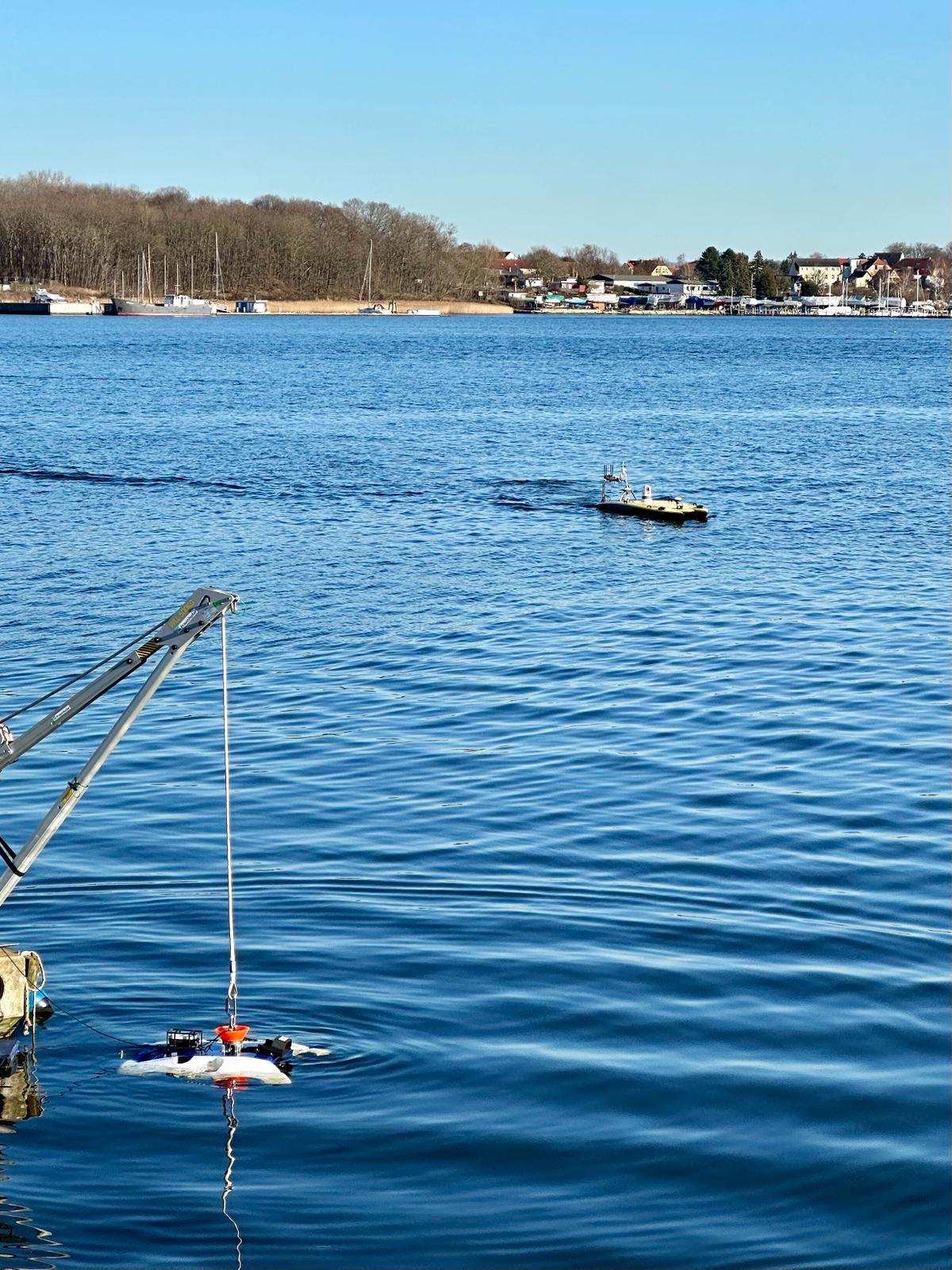
Leading innovator in autonomous marine survey and underwater inspection solutions and services Subsea Europe Services has completed a strategic multi-million Euro funding round. This significant investment marks a pivotal moment in the company's journey towards ‘True Autonomy’, an innovative approach to optimising marine data workflows through the seamless integration of new-generation sensors and platforms.
Comprised of 50% private equity and business angels, the investment is complemented by a mirrored contribution from the ‘Mittelständische Beteiligungsgesellschaft Mecklenburg-Vorpommern mbH’ through the innovative ‘innoGROWTH’ Programme, which is renowned for supporting start-ups and medium-sized companies, particularly those focusing on ecological, digital, or social innovations.
The funding will propel Subsea Europe Services into a new era of growth and development, with a focus on attracting more skilled talent and expanding software and hardware development. Key workstreams will be accelerated with the company’s ongoing development of a state-of-the-art ‘Autonomy Engine’ and expansion of its existing autonomous surface and underwater vessel fleet leading the way. The addition of cutting-edge vehicles will be a significant leap forward in providing more capacity for autonomous survey and inspection services to the offshore wind industry and other marine sectors.
In alignment with this growth trajectory, Subsea Europe Services has strategically decided to relocate its headquarters to Rostock in the ‘Mecklenburg–Western Pomerania region’, where the company already has an extensive R&D centre. This relocation is poised to leverage the exceptional resources of the Ocean Technology Campus in Rostock, including the Digital Ocean Lab (DOL), the state-of-the-art testing facilities along the Warnow river waterfront, and proximity to key research institutions like the IOW, Rostock University, and the Fraunhofer Institute.
Søren Themann, CEO, at Subsea Europe Services, commented on this milestone development in the company’s short history, since it was founded at the beginning 2020: "The investment represents faith in our vision and mission to simplify the acquisition and analyses of marine data, making it more accessible to more organisations, and at a much lower cost. It enables us to deepen our research and development in autonomous marine technologies, bringing us closer to the reality of ‘True Autonomy’. Further, relocating our HQ to Rostock, a hub of marine innovation, positions us perfectly to harness the expert talent and professional facilities it offers.”
Mario Mietsch, Team Lead Investments at the Mittelständische Beteiligungsgesellschaft Mecklenburg-Vorpommern mbH, says: “Our investment is a testament to Subsea Europe Services’ innovative spirit and commitment to leading the charge in the marine technology sector. We’re looking forward to them becoming even more integral to the sector expertise we have in Rostock with the forthcoming HQ move, as well as supporting their journey to shape the future of marine survey and inspection using cutting-edge autonomous technology for operational, economic, and environmental benefits.”
Mario Mietsch, Team Lead Investments at the Mittelständische Beteiligungsgesellschaft Mecklenburg-Vorpommern mbH, says: “Our investment is a testament to Subsea Europe Services’ innovative spirit and commitment to leading the charge in the marine technology sector. We’re looking forward to them becoming even more integral to the sector expertise we have in Rostock with the forthcoming HQ move, as well as supporting their journey to shape the future of marine survey and inspection using cutting-edge autonomous technology for operational, economic, and environmental benefits.”
Tetra Tech purchases Teledyne’s CZMIL SuperNova to successfully complete NOAA's Great Lakes Coastal Mapping project
Teledyne Geospatial is pleased to announce that Tetra Tech, Inc., a leading provider of high-end consulting and engineering services, has purchased a Teledyne Optech CZMIL SuperNova Topobathymetric lidar system and have successfully completed a project for the National Oceanic and Atmospheric Administration (NOAA).
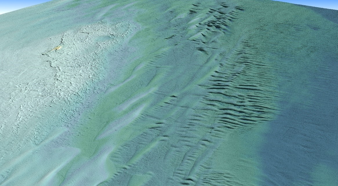
NOAA has an ongoing effort to update all its bathymetric maps in the Great Lakes region, which includes refined maps of the marine ecology. This necessitates obtaining accurate digital elevation models and reflectance products. The updated information will aid in enhancing the understanding of the Great Lakes hydrography and ecosystem.
Tetra Tech operated Teledyne’s Optech CZMIL SuperNova system for its best-in-class depth penetration and high-density mapping capability. The CZMIL SuperNova enabled mapping of the lakebed to a maximum depth of 31 meters. The intensity raster product, crafted with input from NOAA, served as a valuable tool for benthic habitat modeling and the full waveform data will contribute to further research questions. At the end of the project, Tetra Tech delivered classified point clouds and gridded products.
“The CZMIL SuperNova enabled Tetra Tech to exceed the project's density requirements, achieving approximately five points per square meter for bathymetric bottom density and an impressive 89 percent bathymetric bottom coverage across the Area of Interest,” said Renee Walmsley, Vice President for Tetra Tech Geomatics and Remote Sensing. “Tetra Tech is dedicated to continuous improvement and innovation in bathymetric lidar technology and is enthusiastic about exploring diverse environments worldwide, leveraging the CZMIL SuperNova system's capabilities.”
“We are particularly pleased to see the CZMIL SuperNova excel on this NOAA project and are driven by advancing 3D topo-bathymetric lidar solutions that help map and manage such aquatic environments. It is also our pleasure to support Tetra Tech on high impact projects like this one,” commented Malek Singer, Airborne Product Manager, Teledyne Geospatial.
Tetra Tech is the leader in water, environment and sustainable infrastructure, providing high-end consulting and engineering services for projects worldwide. With 28,000 employees working together, Tetra Tech provides clear solutions to complex problems by Leading with Science® to address the entire water cycle, protect and restore the environment, design sustainable and resilient infrastructure, and support the clean energy transition.
Teledyne Geospatial unifies the hardware and software expertise of Teledyne CARIS and Teledyne Optech. The group provides customers with innovative integrated solutions. Offerings include turnkey systems, lidar and sonar integrated workflows and a range of systems and solutions that support holistic, precision data collection.
Feritech Global spearheads subsea operations innovation for Oceaneering
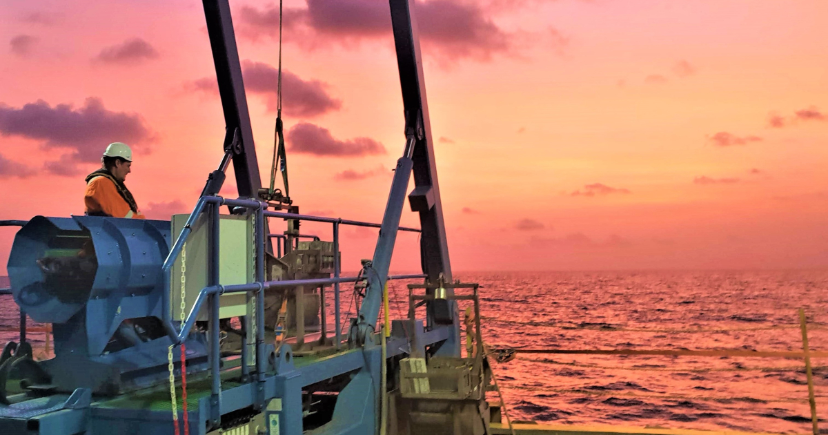
Feritech Global has completed a major design and build project for Oceaneering, the world’s largest provider of subsea robotics to the offshore energy industry. The company has designed a next generation auto-drop piston corer which is expected to dramatically reduce the amount of time needed for subsea geotechnical surveying, increasing safety and efficiency, whilst reducing costs.
A piston corer is a long, heavy tube plunged into the seafloor to extract samples of soft sediment. Analysis of these samples provides vital information for developers who want to build installations out at sea, such as wind turbines, oil and gas pipelines, or undersea cables.
Rob Ferris, Managing Director of Falmouth-based Feritech Global, said: “The new auto-drop piston corer technology represents a step change in precision and efficiency. We estimate that this new product will enable seabed samples to be collected up to ten times faster than with traditional piston corers.”
The new bespoke system has been developed for Oceaneering with their project team involved in its development, providing feedback at each stage.
The new system includes a range of innovative features. Using sophisticated software, the auto-drop piston corer can be programmed, lowered to pre-set sea depth and then automatically released. This provides much greater precision and faster speeds than traditional piston corers, which are launched manually by a trigger mechanism. As well as improving efficiency, this system also enhances operator safety.
In addition, the Launch and Recovery System (LARS) and the winch can be operated remotely, through a control panel which is integrated into a lightweight wearable pack. This allows the operator to carry the control panel on the front of his body, making it portable and flexible. As a result, piston corer operations can be carried out safely by only one person, whereas previously at least two staff would have been needed to operate all the equipment required.
The upgraded LARS system also includes a new, strengthened barrier rail, which can withstand pressures of up to 2 tons.
Brandon Wacasey, Project Management Lead for Survey and Geotechnical Operations at Oceaneering says: “We are delighted with the outcome of this pioneering development project. This innovative new system will help increase the safety and efficiency of our subsea survey operations and help us continue to build our Geoscience market position.”
Oceaneering intends to deploy the new auto-drop piston corer in the international market.
Rob Ferris adds: “At its best, innovation is driven by really listening to users and using smart user insights to invent new solutions to challenges. This flagship project is a great example of that. We are very excited to see the new system deployed in 2024 and look forward to continuing to work closely with Oceaneering, as we continue to push at the frontiers of subsea geotechnical survey technology.”
FET enters into memorandum of understanding with SAFEEN Survey & Subsea Services
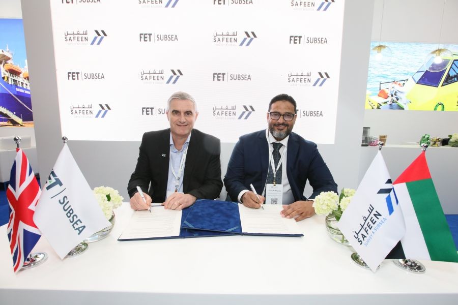
Forum Energy Technologies’ (FET) today announced that its Subsea Technologies product line executed a memorandum of understanding (“MOU”) with an underwater inspections provider, SAFEEN Survey & Subsea Services (SAFEEN), to collaborate on the development of cutting-edge electric thrusters for remotely operated vehicles (ROVs).
A signing ceremony took place at the Oceanology International trade event in London, UK as FET launched its updated 300Vdc and 600Vdc range of direct current thrusters.
Under the Sub-Atlantic brand, FET has been a pioneer in the thruster market for over 20 years. The recently launched 600Vdc ROV thruster option for all observation and light work class thrusters is equivalent to the well proven SA-300 hydraulic thruster.
As part of the SAFEEN MOU agreement, the thrusters will be subject to extensive cycle testing to fully validate functionality, durability and integration capabilities with existing ROV systems. Testing will also ensure smooth deployment and operation.
The collaboration will enhance the performance, efficiency, and reliability of the United Arab Emirates headquartered company’s underwater services capabilities. The thrusters will be tailored specifically to the requirements of SAFEEN’s submersibles, delivering an optimal solution to the challenging marine operations in which it operates.
The development of the thrusters will be overseen by experts from both FET and SAFEEN, driving collaboration through effective communication and coordination of project activities.
Kevin Taylor, FET Vice President – KMS and Subsea Robotics, said: “We are pleased to collaborate with Safeen on this groundbreaking industry initiative. Our shared commitment to excellence is complementary to our ongoing innovation goals and will drive the advancement of electric thrusters, redefining industry standards to ensure safety and efficiency during offshore operations.
“At FET we are at the forefront of innovation and sustainable development for our subsea technology. With our latest thrusters being launched alongside the signing of this MOU, we look forward to furthering our offering to the offshore and energy industries.”
Tareq Al Marzooqi, SAFEEN CEO, said: “This MOU represents a significant step forward in advancing underwater technology. By combining our expertise in marine exploration with FET’s cutting-edge engineering capabilities, we aim to revolutionise ROV propulsion systems.”
Greensea IQ strengthens its global presence signing major contract with BUVI Scandinavia at Oceanology International
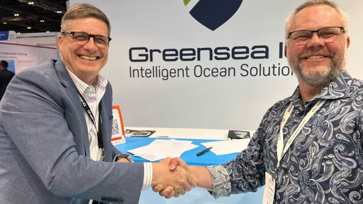
In a strategic move to strengthen its global market presence, Greensea IQ, a leading provider of marine robotics software and integrated solutions, proudly announces the signing of BUVI Scandinavia (BUVI) to join its international sales team. The signing took place at Oceanology International on the Greensea IQ stand and follows another recent signing of the Spanish sales representative Uniformidad Y Suminstros De Proteccion (USP).
The introduction of these two new additions represents a significant milestone in Greensea IQ’s continuous global expansion efforts, and commitment to providing exceptional service and support to clients worldwide. With this expansion, Greensea IQ’s footprint will now encompass Finland, Norway, Sweden, and Spain.
The new business relationships will see BUVI and USP represent Greensea IQ and its complete range of Bayonet autonomous underwater ground vehicles (AUGVs). Offering a wealth of experience and specialised expertise, each representative will ultimately facilitate the increased accessibility of the Bayonet AUGVs within their respective markets. Their regional expertise will be instrumental in tailoring Greensea IQ’s offerings, fostering strong relationships with local customers and partners.
BUVI was established in 2011 and has extensive experience in ROVs, underwater technology and other underwater assignments. BUVI Scandinavia is a trusted partner for its clients in the region offering consultation, training, and support to deliver subsea solutions and technology that is capable, efficient, and user-friendly for their customers. Serving as Greensea IQ’s international representative, BUVI will support sales for Greensea IQ’s Bayonet AUGVs to its clientele across all of Scandinavia. providing an established and trusted partner to drive Greensea IQ’s growth and impact in the region.
“BUVI Scandinavia has been following the development of Greensea IQ and its software in ROVs for some time,” said Marie Fleetwood, CEO & Marketing BUVI Scandinavia. “Now that BUVI Scandinavia’s focus on underwater solutions has taken bigger steps towards Search, Security, Police, Military, Defense, and Surveillance, the Bayonet AUGV range has become an obvious and perfect addition to our portfolio of products and solutions.”
“With Greensea IQ’s strength in developing intelligent ocean solutions and BUVI Scandinavia’s network of contacts in Scandinavia and Europe, we look forward to being a Greensea IQ representative and a strong team together.”
USP, backed by 40 years of expertise, stands as a distinguished authority in advising and equipping various sectors, including law enforcement, armed forces, private security, and the civil sector. It specialises in providing superior solutions for police and military needs, including ballistic solutions and specific products tailored to diverse requirements. The addition of the Bayonet line up to its portfolio will undoubtedly increase Greensea IQ’s standing among the Spanish defense and commercial clientele of USP, capitalising on USP’s trusted reputation.
Rob Howard, Greensea IQ’s CGO, expressed enthusiasm for the expansion, “We are excited to welcome BUVI Scandinavia and USP to our Growth Team. Their representation in these key regions strengthens our efforts to provide Greensea IQ products and services on a global scale."
The recruitment of sales representatives for Scandinavia and Spain is part of Greensea IQ’s comprehensive strategy to expand its international presence and global footprint. By investing in local professionals, the company aims to facilitate greater market penetration, improve customer satisfaction, and drive sustainable growth.
Kongsberg Discovery empowers remote operations with launch of breakthrough HiPOS – HiPAP positioning software
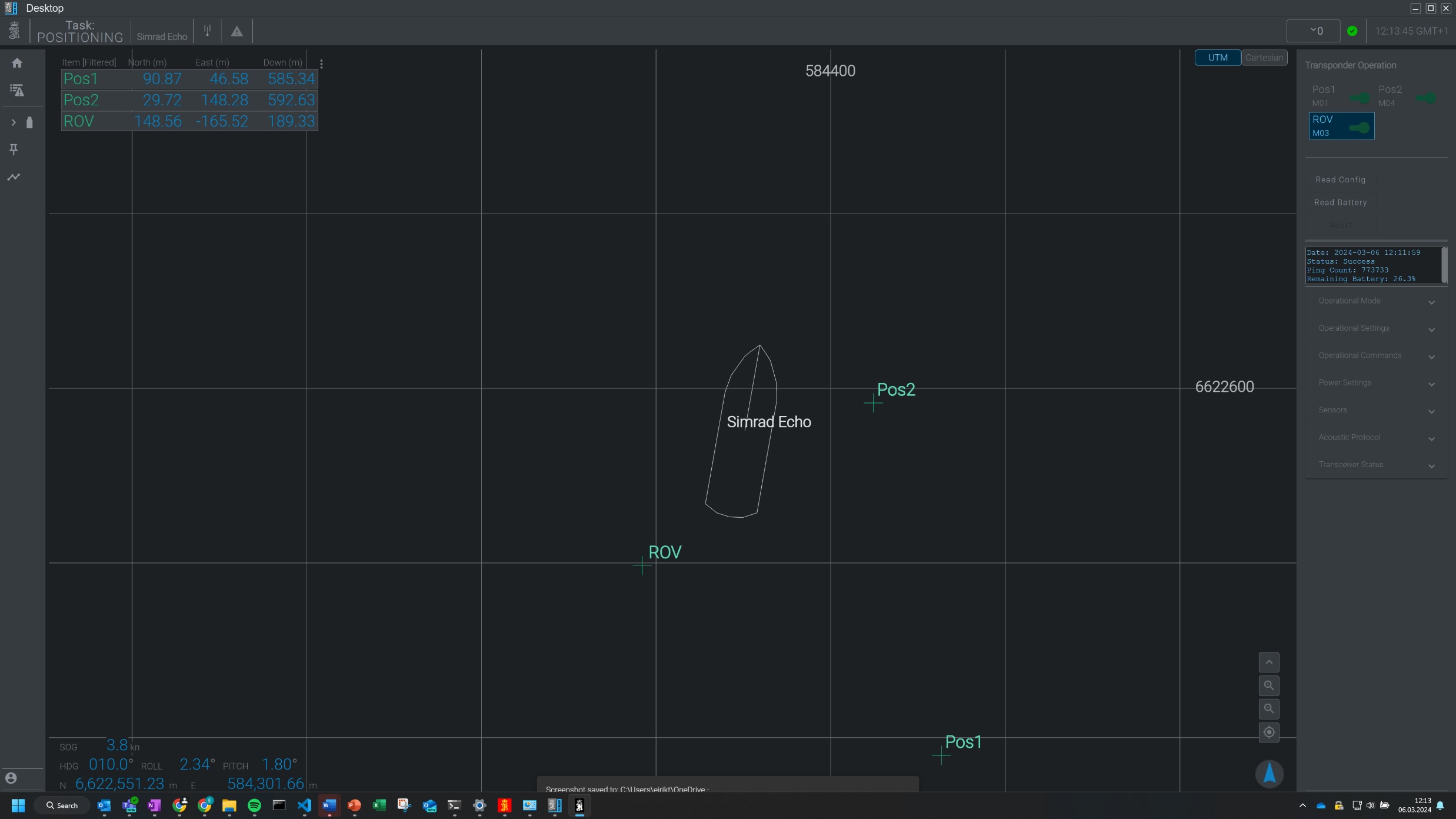
Kongsberg Discovery has responded to market demand with an innovative new software solution to enable remote operations of HiPAP and µPAP SSBL acoustic positioning systems, for both crewed and uncrewed survey vessels.
Launched at Oceanology International in London, HiPOS – HiPAP Positioning Software for Remote Operations bridges the gap between onshore teams and vessels, allowing shore-based surveyors in remote operations control centres to operate the SSBL system with the same functionality as being offshore. Remote operations reduce HSE risk, with fewer personnel offshore, while also enabling lower operational carbon footprints with smaller uncrewed vessels.
Remote control
The software essentially splits the workload of Kongsberg Discovery’s HiPAP systems, with the positioning and processing managed onboard the vessel processor, while a client user interface is run remotely over a lower bandwidth VPN connection. The remote connection can be via satellite, 4G, 5G or Maritime broadband radio.
The user interface can also be operated directly on the vessel, as in a traditional setup, whilst at the same time having the option for shore-based operators to log in and take over for a shift, or provide expert support.
Evolving demand
Spencer Collins, Vice President for Sales, Kongsberg Discovery, comments: “Our proven HiPAP systems ensure accurate positioning of Remotely Operated Vehicles (ROVs), Autonomous Underwater Vehicles (AUVs), towed bodies, or structures, as well as data recovery from cNODE sensor logging transponders and cNODE modems. We’ve seen global demand grow and now evolve, with a clear call for a solution that allows greater remote, onshore control.
“Meeting that challenge, and addressing this customer ‘pain point’, has been the prime motivation for this new development. We believe this user-friendly software can be a key piece of the puzzle in delivering safe, secure, and more sustainable operations in the most demanding environments.”
Simplifying benefits
HiPOS can be used across the latest generation of Kongsberg Discovery HiPAP systems, including the 602, 502, 352 and µPAP solutions.
In addition to the software innovation, the Norwegian-headquartered business has also added two models of portable SSBL acoustic systems to its market-leading portfolio, the µPAP 201-C and HiPAP 352P-C. With computers built into the transceiver/transducer housing this offering allows for easy installation on smaller uncrewed vessels by negating the need for a separate onboard computer.
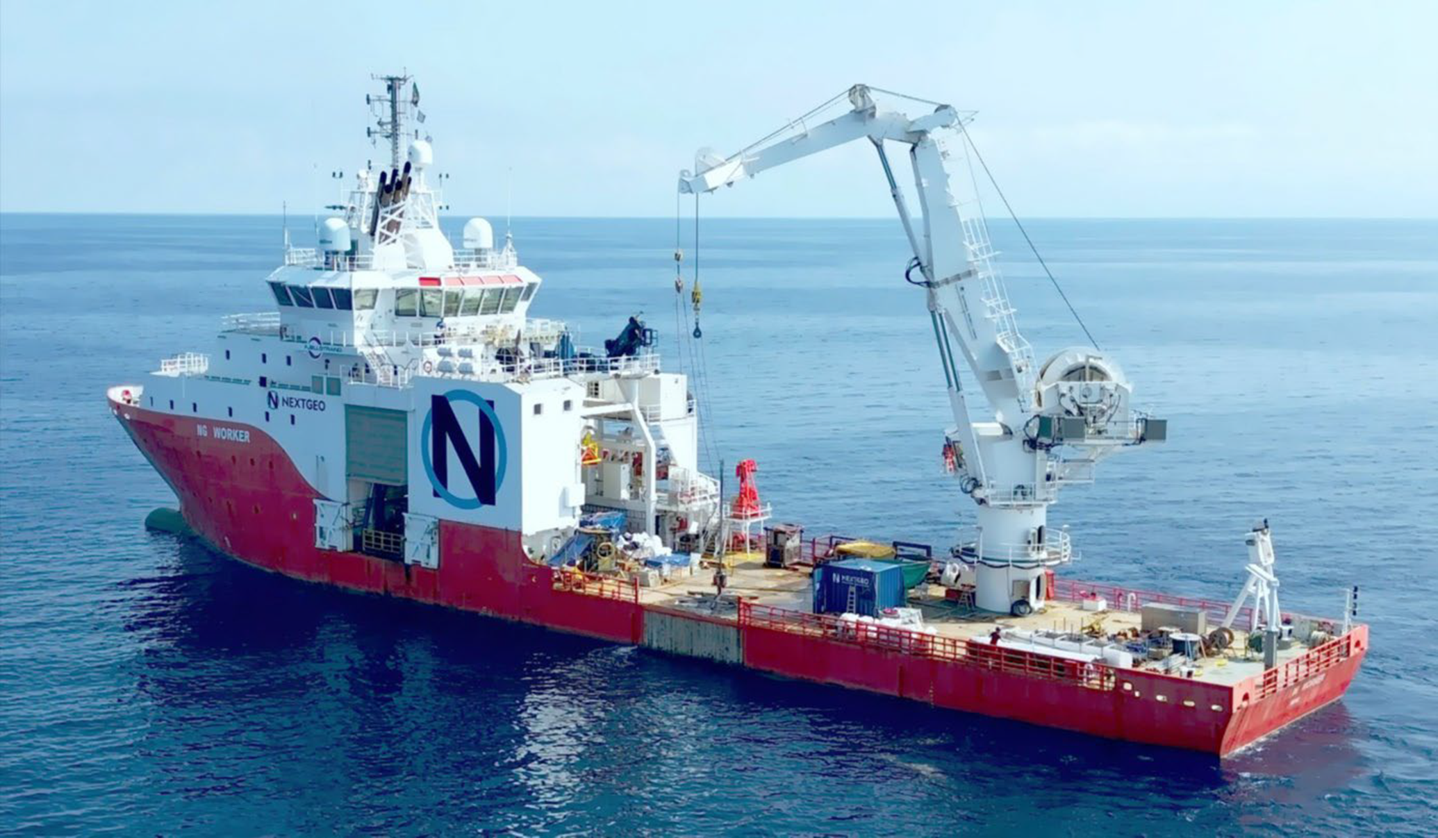
NextGeo wraps up the Tyrrhenian Link East survey works for Prysmian
The Naples-headquartered international survey contractor Next Geosolutions (NextGeo) has successfully completed all the pre-installation survey tasks for the Tyrrhenian Link East branch on behalf of Prysmian.
The works entailed extensive marine detailed geophysical, geotechnical, UXO, archaeological and environmental survey activities along the Terna’s submarine power line connecting the landing points in Sicily and in Campania with two HVDC cables, approximately 485 kilometres long each.
Additional survey tasks have been executed in the nearshore sections of the corridor, including boreholes, HDD survey, topography and geoelectrical investigations.
Over 400 days of work and numerous ships were used to carry out the project, including the group-owned offshore vessels MPSV “NG Worker” and MPSV “Ievoli Ivory”, as well as the MV “Eco-One” and other smaller nearshore vessels.
The Tyrrhenian Link is one of the most important energy infrastructures in the entire Mediterranean. With this project, Terna, the Italian TSO, will connect Sicily with Sardinia and the Italian peninsula through a double submarine HVDC cable link with a power capacity of 1,000 MW and a total length of about 970 km.
The connection will improve the electricity exchange capacity, promote the development of renewable sources and the reliability of the grid.
Giorgio Ruta, NextGeo Project Manager for the Tyrrhenian Link project, added: “This mission presented quite a few operational challenges, however it was successfully, efficiently and sustainably accomplished, thanks to the consistent NextGeo resilience, resources and capabilities, as well as to a close collaboration with all the teams involved in the project. We are extremely proud to actively contribute to the realisation of such a fundamental energy infrastructure”.
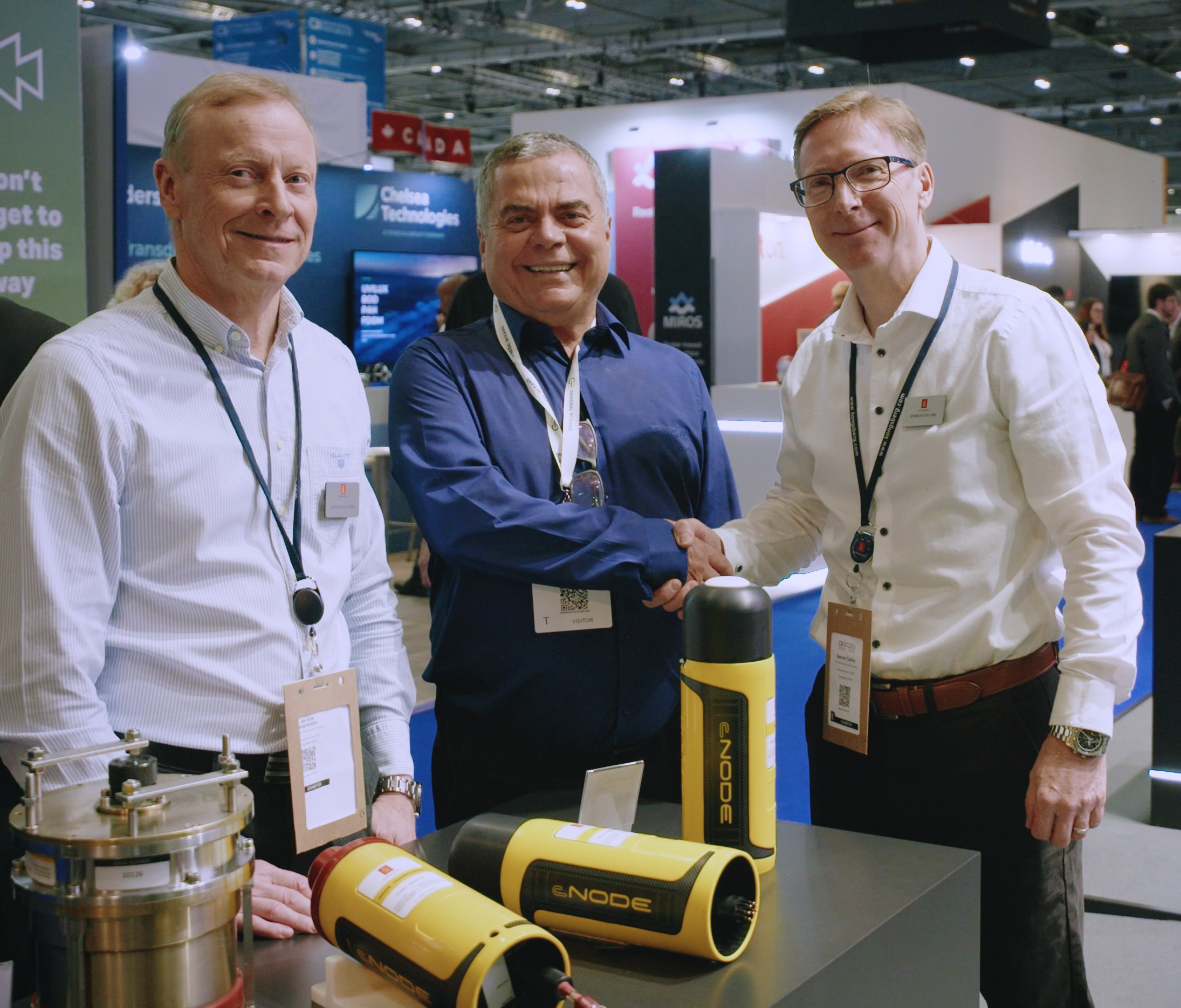
Corcovado Geosub Ltda looks to Kongsberg Discovery to supply cNODE Transponders for environmental monitoring
Corcovado Geosub Ltda today signed a multimillion-dollar contract with Kongsberg Discovery for advanced seabed monitoring equipment.
The agreement, for the delivery of cNODE Sensor Logging Transponders, will allow Corcovado to conduct long-term environmental monitoring for seabed horizontal and vertical displacement during both carbon capture & storage and oil & gas recovery, within the Brazilian market.
Empowering decision making
Corcovado Geosub, a specialist Brazilian supplier of Survey, ROV and AUV services, has an established relationship with Kongsberg Discovery, having conducted high resolution mapping of significant areas of the seafloor with the HUGIN AUV.
The latest order, confirmed at Oceanology International in London, will put Corcovado at the forefront of serving the Brazilian market to monitor seabed displacement. Monitoring for changes to elevation of the seabed during carbon capture, for example, is essential to mitigate against the risk of the stored gas escaping due to over-pressurisation.
As Donizeti Carneiro, Commercial Director, Corcovado, explains, the ground-breaking precision offered by Kongsberg Sensor Logging Transponders in the deep-water offshore environment is exactly what is required to deliver vital information to clients to ensure optimal decisions during production and carbon capture.
Precise performance
He comments: “The cNODE Sensors will be deployed for up to 10 years at a time providing high quality data that will be recovered every three to six months by acoustic telemetry.
“The sensors chosen within the cNODE Sensor Logging Transponders range include high accuracy digiquartz crystals and internal barometers for continuous calibration, providing the highest quality and precision in the data.”
Ocean intelligence
Spencer Collins, VP Sales, Kongsberg Discovery, adds: “The demand for high-specification underwater positioning transponders for seabed monitoring reflects the market demand in ensuring environmental safety during offshore operations.
“Kongsberg Discovery’s key mission is protechting people and planet and in providing the technology to Corcovado we enable the sustainable management, monitoring and development of the ocean space.”
Kongsberg Discovery’s cNODE family of transponders are market proven medium frequency units for highly accurate underwater acoustic positioning and data links, while µPAP is a small and compact acoustic positioning system for tracking ROV's, tow fish, divers and any other subsea target at ranges up to several thousand metres.
Fugro enhances ocean habitat mapping technology by joining forces with PlanBlue
Fugro and PlanBlue are teaming up in a strategic partnership to advance habitat mapping technology, a significant move for both companies as they integrate new mapping technology and digital solutions within Fugro's existing systems.
The aim is to enhance and broaden Fugro's hydrographic solutions by incorporating cutting-edge technology such as advanced imaging and AI-based processing and deploying it across different platforms like remote and autonomous underwater vehicles. This collaboration targets the improvement of habitat mapping solutions, systematically studying and documenting the characteristics and distribution of critical marine ecosystems such as seagrass and corals. Habitat mapping helps in understanding their ecological importance, assessing their condition, monitoring changes over time, and informing conservation and management efforts.
Roughly 75% of the ocean floor remains unexplored. Even the parts we have explored lack detailed information, especially regarding the ocean's impact on climate and food security. The development of this new capability aims to improve the speed, accuracy, and scope of underwater mapping, leading to better decisions for ocean conservation and use.
PlanBlue's expertise in advanced imaging and AI-based data processing is set to gather crucial information about the ocean floor and its ecosystem. This partnership, leveraging Fugro's industry knowledge, aims to develop solutions that meet industry needs while championing environmental conservation.
"We are excited about the opportunities this partnership brings," said Dr Marco Filippone, Fugro’s Solution Director for Ocean Science and Hydrography. "By integrating PlanBlue's advanced technology and analytics, we aim to lead the industry in providing innovative solutions that positively impact the environment and various sectors."
“This partnership is a great opportunity to scale our business operations and data products and have a growing impact on coastal resilience,” commented Dr Hannah Brocke, Co-founder and CSO at PlanBlue. “Accelerating the collection of insights about marine habitats is essential for meaningful policy decisions in the blue economy. Through this partnership we strengthen our contributions to the UN Sustainable Development Goals, and global initiatives like the UN Decade of Ocean Science and Seabed 2030.”
The partnership between Fugro and PlanBlue signifies a shared commitment to driving positive change through technological innovation. This collaboration is particularly vital considering initiatives like the recently awarded Italian government’s Marine Ecosystem Restoration (MER) Project, which aims to restore the marine habitats, fortify the national system for observing marine and coastal ecosystems, and comprehensively map coastal and marine habitats across Italian waters (specifically seagrass meadows). As the collaboration progresses, both companies look forward to exploring new frontiers, pushing boundaries, and creating solutions that make a lasting difference for a safe and liveable world.