
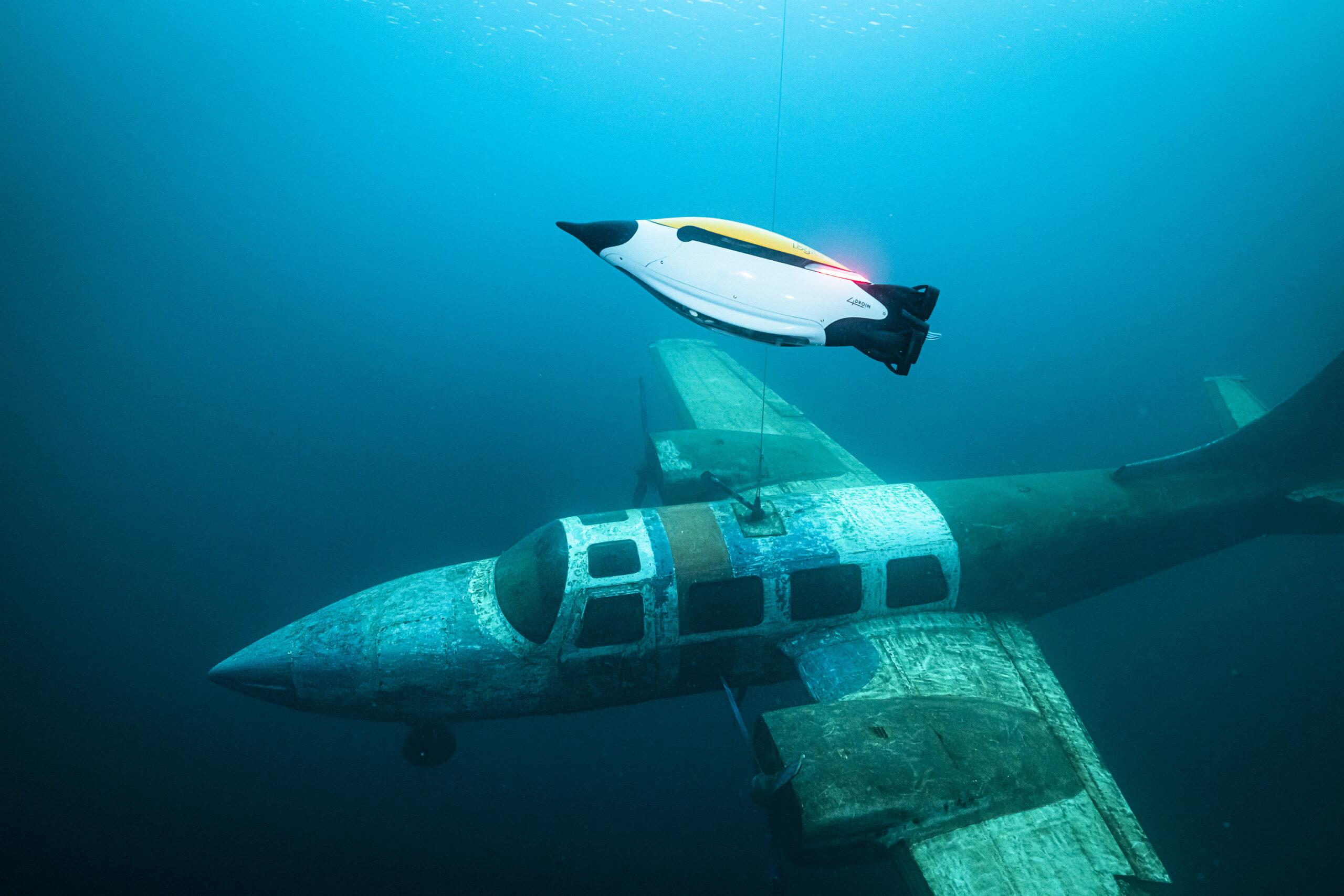
EvoLogics presents the next-generation Quadroin AUV
EvoLogics, a Berlin-based provider of high-tech underwater robotics, data networks, positioning, and sensor technologies, proudly announces the launch of the next iteration of the Quadroin AUV.
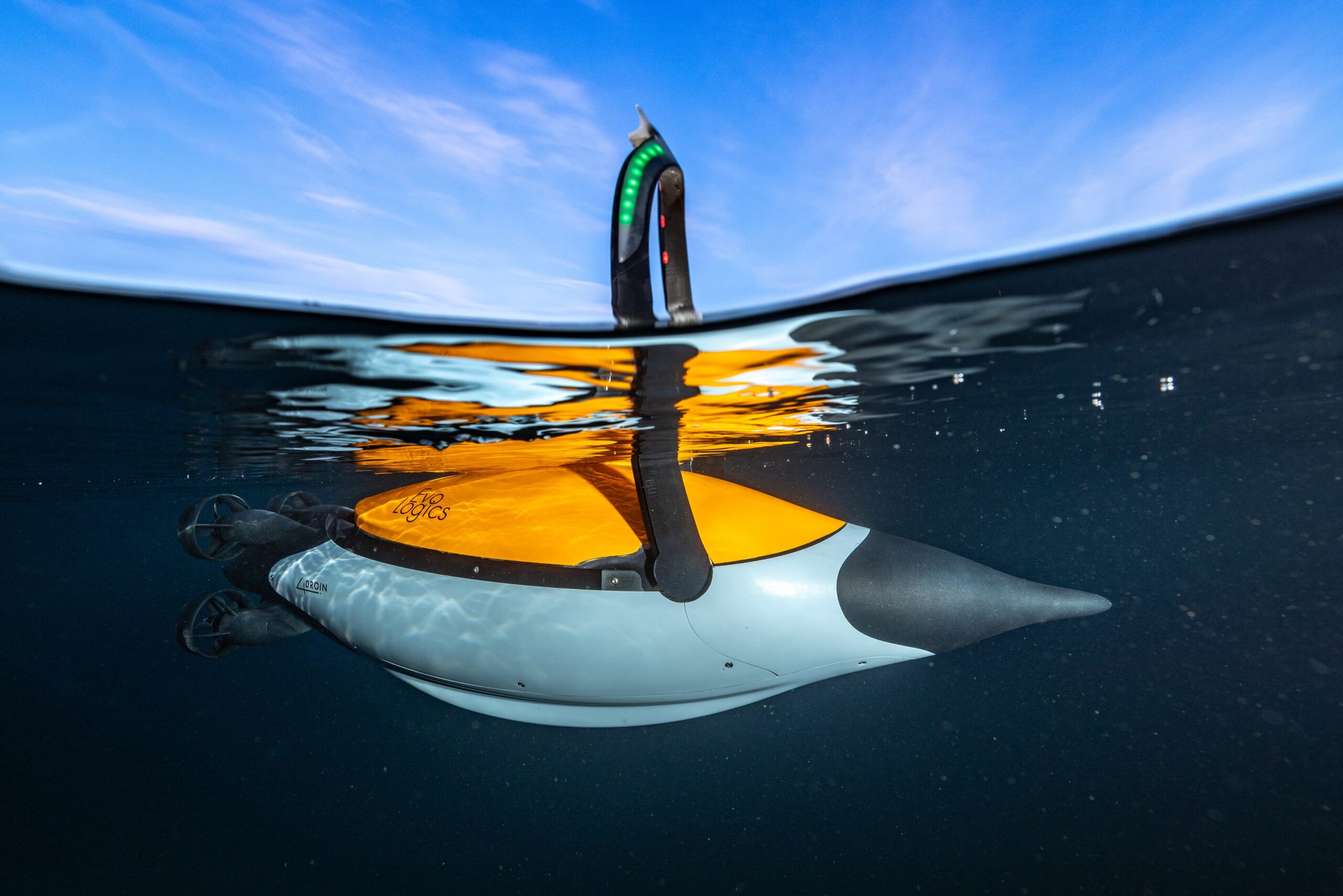
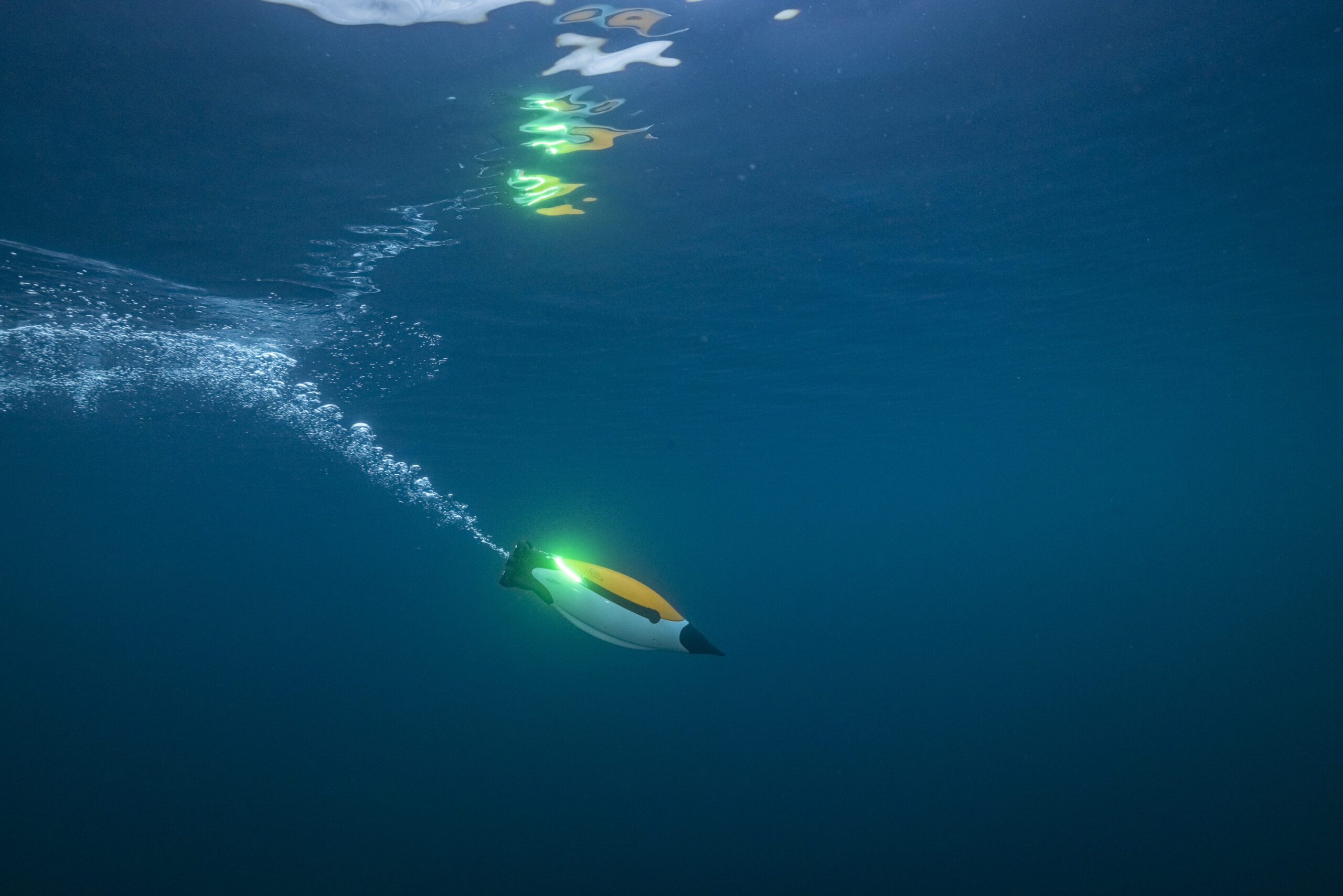
Originally introduced in May 2021, the Quadroin vehicle garnered attention for its distinctive, penguin-like design. Engineered for monitoring and surveying, the fast and maneuverable Quadroin leverages EvoLogics' expertise in low-drag bionic design. Dr. Rudolf Bannasch, EvoLogics founder, delved into years of research on penguin locomotion, resulting in the AUV's remarkable hydrodynamic properties. With its low-drag shape, the Quadroin achieves speeds of up to 10 knots, minimising energy consumption and enabling versatile deployments.
The initial series of Quadroin prototypes, developed in collaboration with Hereon for the Helmholtz Association's MOSES initiative, focuses on monitoring ocean eddies. These vehicles are equipped with sensors for collecting geo-referenced data on various physical water parameters, including temperature, pressure, oxygen, conductivity, and fluorescence, at different depth levels.
Building upon this foundation, EvoLogics has undertaken significant enhancements to the Quadroin platform, with a primary focus on expanding its instrument payload capacity and underwater A.I. computations. This evolution led to a comprehensive redesign of the vehicle's internal layout, integration of updated components, and optimisation of sensor systems to accommodate a broader range of instruments while maintaining operational efficiency.
The new generation Quadroin now carries an expanded instrument payload. The side-scan sonar enables acoustic seafloor imaging. Additionally, two full-HD underwater cameras—one forward-facing at a 45-degree angle and one downward-facing—equipped with dimmable LED lights, provide a visual identification of the vehicle’s surroundings.
The newly integrated EvoLogics AI-powered object recognition module allows detecting objects in the side-scan sonar and video feeds live during the mission with processing carried out onboard the vehicle. It is also to enable automatic collision avoidance through a front-looking sonar system.
The hardware and propulsion systems were redesigned with next-generation components for optimal performance. The Quadroin now features a Nortek Nucleus1000 integrated subsea navigation package that couples Nortek’s DVL technology with additional position-aiding sensors for reliable vehicle control.
Today, team EvoLogics is happy to reveal a new video of the Quadroin vehicles in action, shot in late 2023 at the Kreidesee Lake in Hemmoor, DE.
EvoLogics will be presenting the upgraded Quadroin at Oceanology International 2024 through live on-site demonstrations.
Click here to watch Quadroin in action.

Teledyne Marine unveils revolutionary Vertical Detection Mode for SeaBat T-Series sonars
Teledyne Marine, a leader in subsea technology, announces a breakthrough innovation in sonar technology with the release of Vertical Detection Mode (VDM), a game-changing enhancement now available as a free upgrade for all SeaBat T-Series sonar systems. This new feature is set to revolutionise how vertical structures are detected underwater, providing precision like never before.
Traditional multibeam sonar systems have historically struggled with accurately detecting vertical structures, often facing issues such as multipath interference, which can degrade data quality. The typical bottom detection algorithms are not designed to handle the complexity of these environments effectively. However, with the introduction of VDM, Teledyne Marine has redefined the standard for vertical-structure surveys, delivering exceptional accuracy and improving data quality, particularly in environments challenged by multipath interference from structures like sheet pilings.
VDM is engineered to conquer these challenges with a 'purist' approach. Each detection is processed to stand on its own merit, independent of adjacent beams or historical data. This ensures that true features are captured without compromise, maintaining the integrity and detail of the vertical structures.
The release of VDM comes with the SW/FW upgrade Release 3.0, which is compatible with all Teledyne RESON SeaBat T-series systems. This versatile mode is designed to work flawlessly across any frequency, pulse, or beam mode and is suitable for single or dual-head configurations. Users can now access these powerful capabilities without the need for additional licenses, changes to data output, or new configurations, ensuring a seamless integration into existing operations.
Beyond VDM, the latest software and firmware upgrade introduces a suite of enhancements and new features, including Ping Sequencing, further improvements to Tracker, and overall FW stability, all designed to augment the performance of Teledyne Marine's sonar systems.
Teledyne Marine is committed to continuous innovation and providing customers with the most advanced and reliable underwater technology solutions. The Vertical Detection Mode is a testament to this commitment, offering unparalleled detection accuracy and quality for surveyors and marine professionals worldwide.
Kraken Robotics minehunting systems operational with the Royal Danish Navy
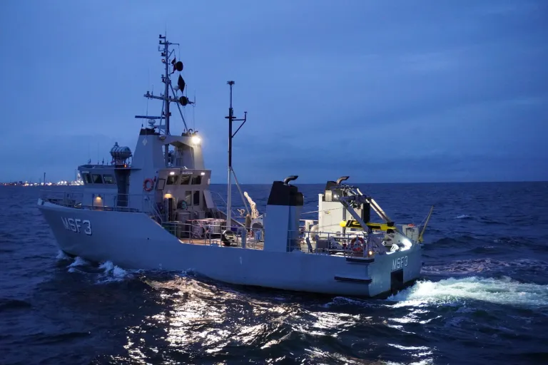
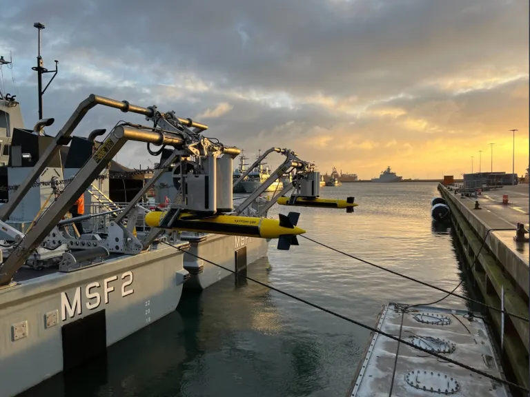
Kraken Robotics is pleased to announce the completion of all deliveries and the successful sea acceptance of all systems for its mine-hunting sonar equipment under the Royal Danish Navy Minehunting sonar upgrade program. This contract was signed in September 2020, following a competitive bidding process. Under the contract with the Danish Ministry of Defence Acquisition and Logistics Organization (DALO), Kraken has delivered four complete turnkey mine-hunting systems, with each system consisting of a KATFISH™ towed Synthetic Aperture Sonar, Tentacle® Winch and Autonomous Launch and Recovery System (ALARS), topside command and control equipment, and remote operation and monitoring capability for standoff mine-hunting operations.
Starting in 2022, the KATFISH mine-hunting systems were integrated onboard the Royal Danish Navy’s optionally uncrewed surface vessels (USVs), the MSF-class. Kraken worked closely with MCM Denmark operators and workshop technicians as well as skilled local Danish shipyard, JOBI, to install Kraken’s DNV design approved Autonomous Launch and Recovery System (ALARS) onto the MSF-class in parallel with the MSF-class planned mid-life refit. Kraken also integrated the KATFISH system with Saab’s Command and Control (C2) software, providing operators with a seamless experience for mission planning and mission monitoring. The inclusion of Kongsberg’s Maritime Broadband Radio (MBR) enables the complete system to operate remotely, streaming full resolution sonar imagery in real-time at ranges exceeding line of sight.
In 2023, Kraken also entered in a 7-year sustainment contract with DALO, with options for two further 7-year extensions, for a total possible 21 years of sustainment. The sustainment program includes regularly scheduled maintenance, repair, and overhaul as well as provision of training and spare parts, and the delivery of regular capability enhancements through software updates. Throughout 2024, Kraken will also be delivering additional spares, including spare towcables and two spare KATFISH towbodies.
Kraken has developed and delivered extensive training programs with the MCM Denmark team, including Onboard Operator, Onboard Maintainer, and Depot Maintainer training certification programs. As of 2024, the Royal Danish Navy will have completed their first full year of KATFISH operations, with an undisclosed large number of operational hours. Commander (Navy) K.P. Hansen, Commanding Officer of MCM Denmark said: “Our operators have been extremely pleased with the performance of the KATFISH system, including the ability for safe automated remote launch and recovery. The addition of this valuable high-resolution, high-speed seabed survey tool to our MCM toolbox has provided our operators with an invaluable capability in seabed warfare. Our mission to provide safety and security in Danish waters has been bolstered by this capability, and we look forward to many years of successful operations with the Kraken systems.”
The Head of the Maritime Division within DALO, Captain (RDN) Jakob Damgaard Rousøe noted in February 2024: “The proces of integrating the Kraken KATFISH sonar into the Danish MCM forces is coming to an end and it is anticipated that the MCM capacity will reach Full Operational Capability (FOC) within the first half of 2024. An extremely extensive and close coordinated work has been put into the system integration from all stakeholders. This have resulted in many days and hours onboard the small MCM drones at the Naval base in Frederikshavn. I have followed the work closely and I am very pleased with the overall result. A very impressive sensor providing very detailed images that will increase the detection and classification probability of mine like echoes significantly. Well done to all”

Fugro maps seagrass around Italy in groundbreaking ecosystem restoration project
Fugro has been selected to map the coastal habitats of the entire Italian coast as part of the Italian government’s Marine Ecosystem Restoration (MER) Project, a groundbreaking initiative under the National Recovery and Resilience Plan. The Italian Institute for Environmental Protection and Research (ISPRA) has selected Fugro, in partnership with Compagnia Generale Ripreseaeree (CGR), to leverage their cutting-edge technology and extensive experience in coastal resilience solutions to deliver the crucial mapping component of the MER Project, which is set to revolutionise marine conservation and environmental restoration efforts in Italy.
The MER Project aims to restore the marine habitats, fortify the national system for observing marine and coastal ecosystems, and comprehensively map coastal and marine habitats across Italian waters (specifically Posidonia oceanica and Cymodocea nodosa seagrass meadows). Fugro and its partners will play a pivotal role in the success of the MER project executing the MER Project’s mapping phase via a mix of mapping methodologies.
The project, which is due to start in March 2024 and be completed by June 2026, includes acquisition of hydrographic data utilising state-of-the-art sensors, including airborne lidar and imagery, airborne gravimetry and satellite sensors covering 10 200 km²; vessel-based multibeam technology spanning 4000 km2; and deployment of an autonomous underwater vehicle, one of Fugro’s state-of-the-art underwater drones, to cover 4000 km of coastline for direct observation and ground-truthing of other datasets. The collected data will be managed through VirGeo®, Fugro’s cloud-based Geo-data engagement platform, to provide seabed and habitat mapping insights, enhancing the local Government’s decision-making process for the protection of coastal marine habitats.
Giordano Giorgi and Sante Francesco Rende, respectively Project Director and Technical Director at ISPRA said: “We are delighted to announce the award of this project to a consortium led by Fugro and its partner, CGR. This contract signifies a significant milestone in our environmental efforts within the PNRR Marine Ecosystem Restoration project and specifically aligns with Mission 2: Green Revolution and Ecological Transition and the objectives to protect the territory and water resources and restore and protect the seabed and marine environments. The project is administered by the Ministry of Environment and Energy Security, with funding from the European Union's Next Generation EU programme”.
Mark Heine, Fugro’s CEO, said: “The MER Project represents a milestone in marine ecosystem restoration. We’re delighted with this opportunity from ISPRA to demonstrate our commitment to environmental stewardship and climate resilience. Our Geo-data for this transformative project will support the conservation and restoration of Italy's coastal and marine ecosystems for generations to come spearheading the drive towards a sustainable future for Italy's marine heritage, for a safer and more liveable world.”
ACUA Ocean and Robosys Automation make waves announcing global partnership to integrate Voyager AI systems with ACUA’s hydrogen-powered USV
The ocean monitoring and protection innovator and unmanned craft specialist, ACUA Ocean, has signed a commercial contract to integrate Robosys Automation’s groundbreaking Voyager AI vessel control systems with its unique ACUA hydrogen-powered H-USV.
The contract marks ACUA Ocean’s ongoing commitment to further develop its range of innovative long endurance hydrogen-fuelled uncrewed surface vessels for open ocean monitoring and data collection, across the security, offshore energy, and marine conservation sectors.
Partnering with Robosys, ACUA plans to undertake a phased approach of integrating the Voyager AI vessel control software with its hybrid electric and hydrogen propulsion systems.
Robosys’ Voyager AI is regarded as the world-leading maritime artificial intelligence (AI) software, which delivers autonomous navigation and remote control for unmanned surface vessels’ (USV) control systems at various levels of autonomy.
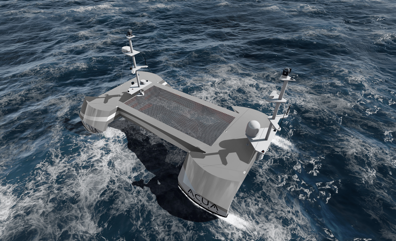
ACUA’s highly seaworthy offshore H-USV will deliver up to 40 days of endurance, meaning increased operational time on site and data collection through its novel modular sensor payload system. The integration of Robosys’ solutions will provide navigational, platform controls, and supported decision aids, to deliver precise USV monitoring and protection to oceanic operations.
ACUA Ocean has deployed its first mobile Remote Operations Centre situated at its Plymouth (UK) headquarters, with vessel Harbour and Sea Acceptance Testing commencing in H2 2024. This will rigorously evaluate its Small Waterplane Area Twin Hull (SWATH) design for seakeeping and manoeuvrability, as well as its unique hydrogen-electric hybrid powertrain and command, control, and communications systems. ACUA Ocean’s H-USVs are powered by RAD Propulsion’s drive-by-wire 40kW electric twin drives allowing clean and efficient control by third party systems such as Robosys. RAD’s drives provide exceptional control and manoeuvrability.
Nigel Lee, CSO of Robosys Automation, which is headquartered at the National Oceanography Centre in Southampton (UK) comments, “Combining the unique features of ACUA’s H-USV with Robosys’ Voyager AI solutions will result in ACUA Ocean’s pioneering H-USV continuing to be the most innovative unmanned surface vessel available in the market, both now and in the foreseeable future.”
Commenting on the agreement, Oli Mulcahy, ACUA’s Head of Product said, “ACUA is excited to be working with Robosys, and to accelerate the adoption of zero-emission technology across the marine sector. After a lengthy evaluation process, it was evident that Robosys’ system offers both flexible and dynamic solutions, and a roadmap to future certifications for unmanned systems controls which will be key to scaling the use of autonomous technologies.”
Through the partnership with Robosys, the H-USVs will operate to Workboat Code Edition 3, Annex 2, ROUV. Additionally, as part of the agreement, the companies will further collaborate in workshops with the Maritime Coastguard Agency and Lloyd’s Register, aiming to obtain UK Flag and vessel class society certification of the ACUA H-USV with Robosys Voyager AI software.
New Midi Vibrocorer joins OSIL range of sediment sampling equipment
Ocean Scientific International Limited (OSIL) have announced the launch of a new hybrid vibrocoring system, fitting between the traditional Vibrocorer, and the popular Mini Vibrocorer which was added to OSIL's equipment list in the last 12 months.
The Midi Vibrocorer is a lightweight coring system that is supported by a traditional deployment frame, making deployments easier in unstable conditions. The Vibrocorer is designed for sampling dense or compacted sediments, and the lightweight nature of the new system enables deployment in off-grid areas or from vessels of opportunity with restricted handling capabilities.
The Vibrocorer is a fully self-contained system available in 2 or 3m configurations, with sufficient battery capacity to power the system for 4 hours of continuous use, and has been designed for ease of deployment from small vessels with a winch or davit system. The corer can also be operated from 24VDC 12A vessel supply if available.
The Vibrocorer features a rotational barrel joint, anti-return valves and a high-power motor for excellent seabed penetration.
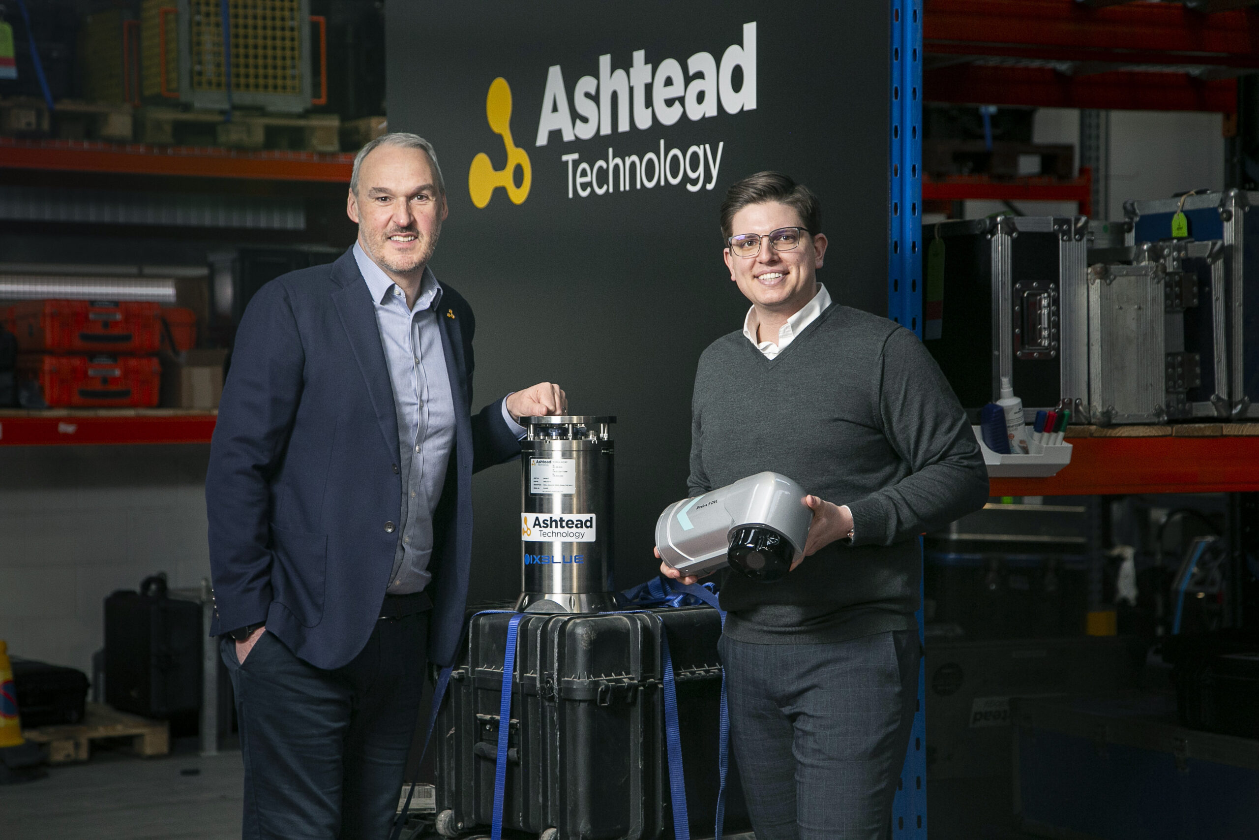
Ashtead Technology expands rental fleet portfolio with acquisition of Exail’s Rovins 9-DVL
Exail, a leading provider of cutting-edge navigation technology, has secured a major contract with Ashtead Technology for the initial sale of six units of its brand-new all-in-one INS/DVL system, the Rovins 9-DVL. With this new acquisition, Ashtead Technology becomes the first rental company in the market to adopt Exail’s new INS/DVL technology.
Exail’s Rovins 9-DVL is a high-performance navigation system that seamlessly integrates INS (Inertial Navigation System) and DVL (Doppler Velocity Log) functionalities, delivering highly accurate and reliable subsea positioning and velocity measurements. By incorporating this innovative technology into its rental fleet, Ashtead Technology solidifies its position as a frontrunner in the industry.
“Ashtead Technology remains committed to delivering unparalleled service and industry-leading technology to its customers worldwide,” stated Phil Middleton, Head of Survey and Robotics at Ashtead Technology. “The Rovins 9-DVL, with its advanced capabilities as an integrated INS/DVL system, along with its compact horizontal design and plug-and-play feature, will facilitate effortless integration into various subsea vehicles, streamlining operations for subsea operators in the field.”
"We extend our deepest gratitude to Ashtead Technology for their confidence in our technology and are immensely proud to have them as a trusted partner," expressed Maverick Piccininni, Regional Sales Manager at Exail. "The success of our collaboration in 2023 has been outstanding, and we eagerly anticipate further growth and innovation in partnership with Ashtead Technology throughout 2024."
The acquisition of the Rovins 9-DVL marks the latest addition to a series of strategic moves undertaken by Ashtead Technology over the past year, further enhancing its underwater technology portfolio through partnering with Exail.
Expanded vision: Introducing Voyis' discovery stereo camera for shallow depths
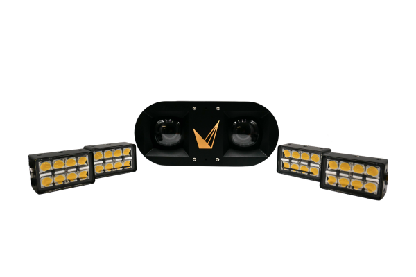
Last year, Voyis revolutionised underwater operations with the launch of the Discovery Stereo camera, boasting an impressive 4000-meter depth rating with high accuracy dome viewports. This innovative product delivered true depth perception and real-time 3D modeling to ROV (Remotely Operated Vehicle) platforms across the ocean sector. Taking an innovative approach, the Discovery is a more than a stereo camera, it is a Vision System that simultaneously records low-latency piloting video, high-resolution stills images, and 3D models. With a wide 75°x75° field of view and onboard edge computing, the system instantaneously delivers 3D depth maps to enable true autonomy, from fine manipulator automation, accurate vehicle docking and visual tracking, or station keeping without seabed bottom-lock.
Today, Voyis releases a 300-meter depth rated version of the Discovery Stereo, delivering the same performance and accuracy but in a package that is lower cost and neutrally buoyant.
Key Benefits of the Discovery Stereo 300m Rated
A remarkable feature of the 300m rated Discovery Stereo camera is its neutrally buoyant design that is achieved without compromising on the proven system accuracy. This advancement drastically simplifies integration into small ROVs for shallow water applications, ensuring ROV piloting dynamics are not affected.
The most intricate details of the underwater world can now be captured on smaller platforms that are both lower cost and easier to deploy. With the neutrally buoyant Discovery Stereo camera, you will experience enhanced stability and ease, allowing you to capture stunning images, video, and 3D data with simple integration.
The paired Nova Mini lights are smaller and employ corrected optics that expand the illumination coverage. This ensures the entire camera’s field of view is perfectly illuminated, maximising target coverage rates, and improving the robustness of tracking algorithms.
In addition to that, the 300-meter rated Discovery Stereo camera generates the highest quality datasets in this depth class. With other shallow rated stereo products compromising on performance to achieve their reduced cost and weight requirements, 300m Discovery maintains all product functionality and accuracy, simply in an optimised form factor. This new product version was created to assist operations in shallower water, without compromising data quality and precision.
By prioritising both performance and adaptability, the Discovery Stereo camera empowers users to navigate shallower waters without compromising on the unparalleled quality of the collected data. Its advanced features not only elevate the standards for underwater inspections but also make it an indispensable tool for various ocean sciences and civil infrastructure applications where precision and data integrity are paramount.
Sequoia Scientific Inc. provides 13 LISST-200X particle sizing instruments for the Ocean Observatories Initiative
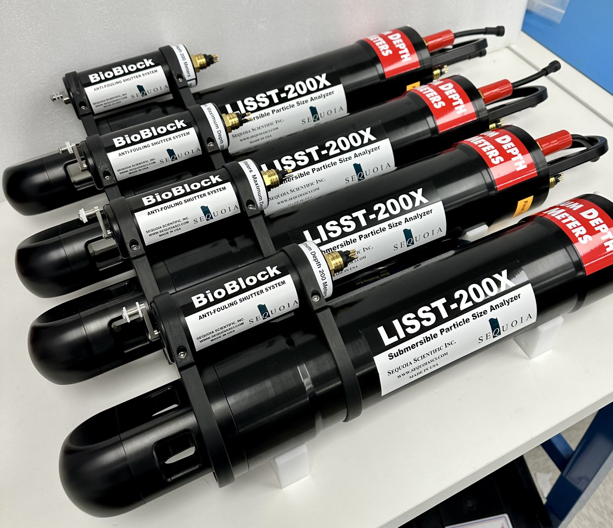
Sequoia Scientific Inc., a leading provider of cutting-edge oceanographic instrumentation, proudly announces an agreement for purchase to The Woods Hole Oceanographic Institution (WHOI), the operator of NSF’s Ocean Observatories Initiative (OOI). WHOI is an independent non-profit dedicated to ocean research, exploration, and education. WHOI's scientists and engineers push the boundaries of knowledge about the ocean to reveal its impact on our planet and our lives. 13 LISST 200X instruments with BioBlock accessories were delivered to their facilities in Woods Hole, MA.
The LISST-200X is a self-contained submersible laser diffraction particle size analyzer, designed for measuring suspended particle size and concentration in the aquatic environment – oceans, rivers, lakes, streams. The LISST-200X also takes a variety of measurements such as temperature, depth, and optical transmission. Sequoia’s Bioblock accessory, when attached to the LISST 200X, utilizes a copper shutter to prevent biofouling, enhancing the instruments’ performance during extended deployments such as those being done for the OOI.
The Ocean Observatories Initiative is a National Science Foundation sponsored research facility with a network of platforms across both the Atlantic and Pacific Oceans that collect continuous data real-time about the state of our oceans. One of these data collection sites was the Coastal Pioneer Array located about 75 nautical miles south of Martha’s Vineyard, Massachusetts. Plans are underway to relocate the Pioneer Array to the Mid-Atlantic Bight (MAB) off the coast of Cape Hatteras, NC in spring 2024.
Among the science questions of interest for the Pioneer MAB Array are the nature of suspended particles and how they are distributed in the water column over time. A competitive procurement process, based on solicitation of information from multiple vendors and evaluation of the responses relative to pre-defined criteria, resulted in selection of the Sequoia product. The first planned deployment of the Sequoia instrumentation is in the spring of 2024. Data are to be available after instrument recovery in the fall of 2024.
This association between Sequoia Scientific, Inc. and WHOI emphasizes a shared commitment to advancing oceanographic research. It also shows that Sequoia products are the standard for such projects.
Robotic seagrass solution targets commercial adoption
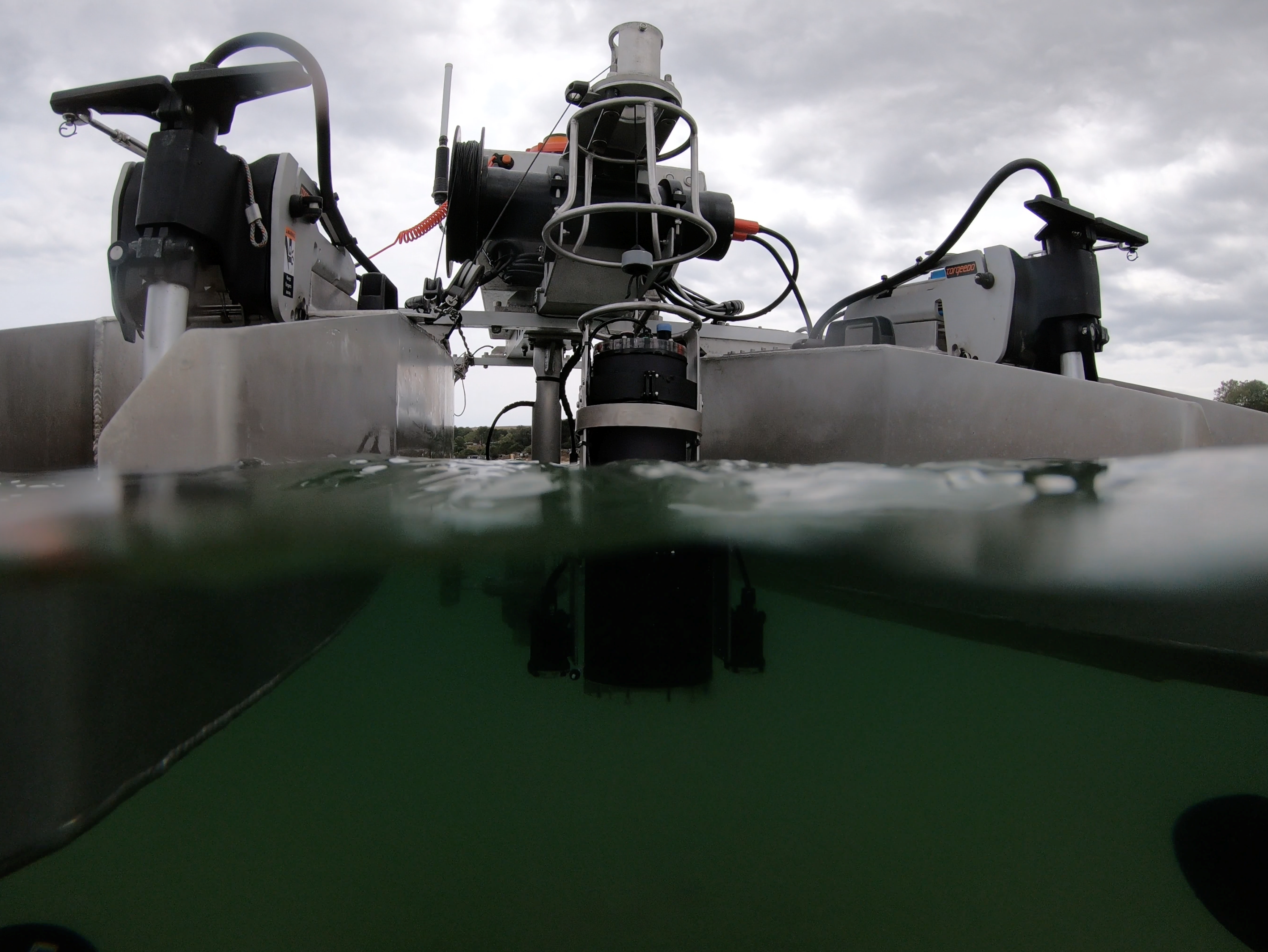
HydroSurv, a leading provider of electric and hybrid uncrewed surface vessels (USVs), has secured Innovate UK funding to commercialise an end-to-end seagrass monitoring solution with support from the Department for Environment, Food and Rural Affairs (DEFRA).
The project aims to provide a rapidly scalable, low-impact and comprehensive answer to the numerous challenges of monitoring seagrass meadows by combining HydroSurv USV platforms with an automated data processing toolchain. The robotic solution will be demonstrated over spring and summer 2024 at three designated worksites on the south west coast of England, conducting baseline and seasonal re-survey work and ultimately delivering some 40 days of on-water testing and data, showing seasonal variation over the project’s 9-month duration.
Dubbed SONARS (Seagrass Observation using Novel Acoustic Remote Sensing), the project will see HydroSurv work with Coastal Marine Applied Research (CMAR) from the University of Plymouth, the Ocean Conservation Trust, Falmouth Harbour and the South Devon Area of Outstanding Natural Beauty.
The technology package has already significantly advanced seagrass mapping capabilities. HydroSurv started to develop the non-invasive solution, with Innovate UK support, in early 2022 in collaboration with the University of Plymouth and Valeport. This previous work focused on refining acoustic ground discrimination techniques from the robotic vessel platforms and was successfully demonstrated in live trials over the past two years. The partners envisage that this next stage of technology development will propel the concept towards scale deployment and commercial viability.
“Working with partners and end-users, our focus has shifted from technology development towards the scale pilot of a whole-system solution. The ability to demonstrate to service operator customers and channel partners that the solution has been extensively tested with engagement from survey commissioners, not only on small field trials, but also on multiple sites and seasonal resurveys, will build confidence in the solution.” commented David Hull, CEO of HydroSurv.
“We’ve received a lot of interest from survey contractors who are interested in delivering these services, amongst others in environmental monitoring. Working together with them, I expect we could take this solution to market within the next 12 months across the UK and further afield in Europe.”
HydroSurv's cloud-based data hosting and visualisation application, EasySurv, facilitates real-time decision making without the need for specialist GIS packages or interrogation skills. EasySurv hosts content-managed data deliverables, processed using machine learning algorithms, alongside the raw data collected from the company’s USVs.
Timothy Scott, Associate Professor in Ocean Exploration at University of Plymouth, said: “It is great to see how our early-stage academic collaboration with HydroSurv is developing into a ready for market solution. HydroSurv has leveraged our expertise in hydrographic survey and data analytics to facilitate a streamlined end-to-end solution for seagrass monitoring. We look forward to supporting HydroSurv in this next phase of development.”
HydroSurv is delivering the project from its facilities in Exeter, in close proximity to the pilot test sites in the South West of England. The company will expand its data processing team as a result of the project.