
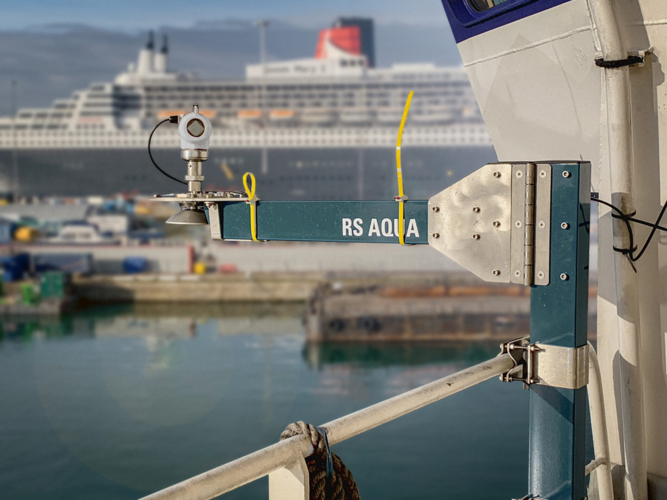
NOC equips RRS Discovery & RRS James Cook with WaveRadar REX2 systems from RS Aqua
In early 2021, the National Oceanography Centre enhanced their existing research ships with two RS Aqua WaveRadar REX2 system, for the RRS Discovery and the RRS James Cook. The RRS Discovery is now equipped with a full REX2 system, while the RRS James Cook REX2 system will be installed later in the year during routine maintenance.
The NOC’s research vessels are multidisciplinary ships, specifically designed for the challenges of 21st century oceanography. Both ships are fitted with state-of-the-art, high-performing instruments and equipment. Combined they are the UK’s primary vessels for oceanographic observation.
Application
The capabilities of the REX2 sensor system were chosen by the NOC to provide accurate sea state intelligence during the ships’ operations such as offboard equipment handling (ROV operations and large profiling payloads etc.) and to provide absolute wave height data and so greater accuracy of real time sea state whilst underway.
Both research vessels have X-band radar systems installed to provide surface wave, current and sea state measurement to the NOC’s research community and also enhance safety at sea and to provide navigational intelligence. Whilst X-band systems provide sea state intelligence from radar imagery over a relatively large spatial scale (several kms from the ship), the wave and sea state data close to the ship is often of lower quality than required for ship operations.
WaveRadar REX2 is a downward facing microwave radar system that delivers exceptionally high-quality wave parameters in the immediate vicinity of the ship. REX2 has been installed on both vessels to enable the scientific engineering team to ground-truth or validate specifically wave height data for the X-band system whenever the ship is sailing. Furthermore, the wave and sea state intelligence from REX2 will be used whenever the research vessels are carrying out research operations, for instance the deployment of tethered ROV systems or other large and valuable offboard systems. When the vessel deploys these offboard systems, often the ship will be holding position dynamically and is vulnerable to the prevailing wave climate and other features such as rogue waves. REX2 provides direct measurement of ocean waves in the immediate vicinity of the ships in real time, providing reliable wave intelligence to the bridge, to the scientific engineering teams and to any stakeholder with secure internet access to the ship.
REX2 Technology
The full REX2 system, inclusive of real-time motion-compensated wave processing suite - WaveView Connect – and a bespoke mounting frame, is built for the harsh environment of the open ocean and is ideal for the RRS Discovery and the RRS James Cook’s scientific expeditions. With end users from almost every continent operating in every Ocean, internationally recognised hazardous zone certifications and high-level commissioning support from RS Aqua, WaveRadar REX2 can be used in almost any location around the world. Coupled with WaveView Connect, REX2 is able to deliver motion compensated wave measurements in real time. The GR-2 mounting frame is specifically designed for the WaveRadar REX2. It is designed to provide an extremely stable, rigid platform that complements the high performance of the REX2.
Conclusion
These two use cases of the REX2 data – ground-truthing X-band data and real time wave climate observation during ship operations – enable the ship operators and the scientific engineering team to have greater confidence in their understanding of the wave climate in open ocean conditions, whilst also optimising their operations. The end result is an expansion and improvement of the essential ocean variables provided to the oceanographic science community and more efficient and safer work environment at sea.


EdgeTech Announces the Availability of the 6205s2 Swath Bathymetry & Side Scan Sonar System
EdgeTech, the leader in high resolution sonar imaging systems and underwater technology, has recently introduced the 6205s2 Combined Swath Bathymetry & Side Scan Sonar System. Building on the success of the popular 6205 and 6205s systems, EdgeTech has redesigned the 6205s2 and achieved a more compact and lighter package with additional features and benefits including the options for an integrated INS, the higher resolution frequency pair of 850/1600 kHz, and EdgeTech’s gap-fill side scan output.
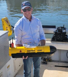
The EdgeTech 6205s2 produces real time, high resolution, three dimensional maps of the seafloor while providing an enhanced and fully integrated swath bathymetry and dual frequency side scan sonar system.
The new 6205s2 is unrivalled in its swath coverage in shallow water when compared to other single head bathymetry-only systems. The system offers co-registered dual frequency side scan and bathymetry with swath coverages up to 200° with a selection of equidistant and equiangle output options. Additionally, the 6205s2 is the only bathymetry system to now offer EdgeTech’s motion tolerant side scan sonar feature for operation in more adverse weather conditions. The new 6205s2 is ideally suited to compact USV (unmanned surface vehicles) projects, especially those looking to achieve bathymetry, side scan and sub bottom profiler datasets with a single data-pass.
The 6205s2 incorporates EdgeTech’s Full Spectrum® technology to exceed IHO SP-44, NOAA and USACE specifications for feature detection and bathymetric point data uncertainty. The data outputs of the 6205s2 are accepted by most third-party acquisition and post processing software packages.
For more information please visit: www.edgetech.com

Events Executive, IMarEST
Responsible to: Events Manager
Responsible for: None
Salary: £25-27k, based on experience, with generous employee benefits package
Base: London (with support for flexible / hybrid working)
Term: Permanent
The Role
Do you have experience working in delivering virtual and in-person events? Do you possess great organisational skills? This is a fantastic opportunity for a talented and ambitious events professional to join the Institute of Marine Engineering, Science and Technology (IMarEST) to support the development and delivery of the Institute’s events programme across existing and emerging maritime and marine areas – all in support of our vision of a world where marine resources and activities are sustained, managed and developed for the benefit of humanity.
The IMarEST events programme includes, but is not limited to: digital, physical & hybrid international technical conferences, lectures, panel discussions, roundtables, workshops, training events, the IMarEST Annual Dinner, the IMarEST Annual Conference, the biennial European International Submarine Races, a Fellows event programme and the IMarEST Prestige Lecture Series. Much of these are broadcast or recorded for IMarEST TV, the Institute’s video content platform.
The IMarEST events programme is a key way in which we support the Institute’s charitable purposes, engage the IMarEST membership and wider audiences, and raise the profile of the Institute around the world.
During the pandemic we have actually increased the reach, impact and revenue from our events. This role, as a key part of the Events function, will help in continuing this trend, with responsibility for the direct planning and delivery of IMarEST events, be they digital, hybrid or physical; as well as working closely the Institute’s partners, volunteers and internal teams, and other stakeholders, including supporting organisations and sponsors.
Main Responsibilities:
1 Event Planning & Logistics
- Implementation of event project plans ensuring activities are delivered on time and on budget to a high quality.
- Coordination of digital platforms for events (physical/virtual/hybrid), including registration, setting up livestreams of sessions, making arrangements for international speakers to present remotely, setting up and managing virtual participation and networking.
- Support conference committees through planning meetings, and speakers from the time that they commit to speaking through to briefings and evaluating their participation.
- Support day-to-day finance processes and ensure timely payment of event suppliers.
- Liaise with IMarEST content team to ensure the timely submission, review and high-quality publication of any conference proceedings, presentations and recordings and appropriate copyright policies and procedures are in place.
- Liaise, project manage and build relationships with the venues contacts and event contractors, including exhibition builders, caterers, operations & logistics teams and AV teams in the build-up to events.
- Co-ordinate group accommodation and travel bookings.
- Attend events to ensure their smooth running, manage contractors and help with onsite queries.
- Organise the planning and delivery of event feedback surveys and thank-you letters.
2 Event Marketing and Sales
- Support the delivery of the marketing plan for each event ensuring effective development of marketing materials and event collateral, include speaker bios, ensuring it is produced in collaboration with partners or committees and also in line with brand and communications sign off procedures.
- Produce and deliver engaging targeted marketing communications with full compliance with GDPR regulations and following internal sign-off procedures.
- Liaison with marketing team to develop event web listings and digital channels including event apps as appropriate and ensure event web listings and digital channels are updated with relevant event information.
- Work with in-house designer to develop event collateral as appropriate, this may include; flyers, brochures, banners, onsite branding, exhibition manuals, event brochures/programme and delegate packs.
- Implement impactful contra deals with key media, industry and event supporting organisations, ensure sponsor agreements are in place and sponsors and supporting organisations’ needs are met.
3 External Events
- Represent IMarEST at national and international industry events if required.
- Support the IMarEST’s annual exhibiting plan in liaison with the marketing and communications and B2B teams.
Other Responsibilities:
1 Awards and Funding
- This role will also provide wider administrative support to the IMarEST awards portfolio including processing of applications, supporting committees in assessing submissions, working closely with Marking & Communications team to promote the achievements of recipients, including participation in events.
2 The post holder may be required to:
- undertake additional or other duties as necessary to meet the needs of the Institute
- work remotely from home as maybe necessary
- work hours which sit outside of a standard working day
- travel within the UK and internationally as part of the role
The post holder must be legally entitled to work in the UK.
As a term of your employment you may from time to time be required to undertake additional or other duties as necessary to meet the needs of the Institute.
This Job Description is subject to your Contract of Employment which, in the event of conflict, shall take precedence. Your job description may be reviewed and amended in the light of any changes to the Institute as appropriate.
Person Specification
The required skills, qualifications, experience or other attributes needed to carry out the role are identified below. Please be aware that your application will be measured against these criteria.
The selection panel will be looking for clear evidence and examples in your cover letter and/or CV, which support any assertions you make in relation to each of the criteria below.
Qualifications
Hold a relevant degree or professional experience
Knowledge & Experience
- Good knowledge and understanding of organising and supporting a range of events, hospitality and visits, including facilitating digital/virtual and hybrid events.
- Awareness of event tools and techniques; particularly the use of registration systems (e.g. Eventbrite), electronic marketing, website/online, social media and creative/printing, Zoom or other online meeting platforms.
Skills
- Excellent project management, organisational and IT skills
- Time management and ability to prioritise own work in a fast moving environment
- Ability to work within a budget
- Ability to use initiative and creativity
- Good networking and relationship building skills to work with internal and external clients
Personal Attributes
- Ability to form successful client relationships
- Detail orientated with strong administration skills
- Ability to influence staff and volunteers, who may have different priorities, to achieve common goals
- Ability to work flexibly and under own initiative to achieve objectives
How to apply
If you are interested in this role then please review the full job description and send a CV & covering letter to [email protected] by Sunday 30 January. Applications must include both a CV and covering letter in order to be considered. Interviews expected to take place week of 31 January & 7 February.

Remote Hydrography Conference & Exhibition taking place 22 – 24 February 2022
With just over four weeks to go The Hydrographic Society UK & Ireland (THS:UKI) are looking forward to welcoming you all to the Remote Hydrography Conference & Exhibition taking place 22 – 24 February 2022 at The Printworks, Dublin Castle, Ireland.
This conference gives you the opportunity to hear about the latest developments in autonomous and unmanned surface, underwater and aerial survey platforms (operating either alone or in cooperative swarms; in sight or over the horizon) with associated remote survey command and support services, as well as how techniques such as Satellite-Derived Bathymetry (SDB), Crowdsourced Bathymetry (CSB), Artificial Intelligence (AI), Machine Learning (ML) and Forward-Looking Sonar (FLS) are revolutionising hydrographic data collection, processing, analysis and presentation.
This in-person event provides you with a fantastic opportunity to meet and network with other attendees and visit with our exhibitors. The Remote Hydrography Conference & Exhibition is hosting several leading industry companies in the exhibition area, stop by their stands to connect and learn more about their products and services!
In addition to the conference programme, we have planned networking events including the Conference Dinner at the Guinness Storehouse, St. James’s Gate, Dublin; all networking events are included in the delegate ticket price.
THS:UKI would like to thank all of the Remote Hydrography Conference & Exhibition sponsors, for their ongoing support of this event.
All of the early-bird tickets are now sold so to avoid missing out book your delegate ticket straight away via the conference web page: Remote Hydrography Conference & Exhibition - The Hydrographic Society.
COVID-19: The conference, exhibition and all networking events will take place subject to the Government of Ireland COVID-19 legislation and guidelines in force at the time to help ensure a safe event. If the event does not take place, for any reason, all ticket holders will receive a full refund.

EIVA releases entry-level hydrographic survey software variant
EIVA’s new software variant NaviSuite Kuda Core provides advanced hydrographic survey software capabilities at an entry-level price. Tailored to support hydrographic surveys with a single USV or small survey vessel using multi-beam echosounder (including backscatter), LiDAR and/or camera, this software solution is…
- simple to configure and run
- affordable for entry-level survey professionals – priced at € 1.998 annually
- ... and provides advanced hydrographic survey features from NaviSuite Kuda software, for example enabling autonomous operations, as it is one of several variants of this software bundle
Software features for automated, efficient hydrographic surveys
Thanks to EIVA’s decades of experience developing and delivering hydrographic survey solutions, not only does the NaviSuite Kuda software yield high quality and deliverable 3D model results quickly, but users can improve the efficiency of their surveys with software tools for…
- Remote operations, including autopilot route planning and onboard processing
- Real-time optimisation of survey area coverage
- Automatic data cleaning
- Automatic data processing workflows
- Patch test for multi-beam calibration
- Easy registration and classification of observations
NaviSuite lets users scale up their software with their survey spread
In addition to the new entry-level variant, the list of bundle variants includes NaviSuite Kuda Pro, which supports more complex survey spreads at a reduced price, and + Processing variants, which provide advanced data processing tools. Since these variants are all part of one big NaviSuite family, users can upgrade between different variants if they scale up operations. Meaning it’s possible to go from a single vessel setup to a large network installation – without changing software.

iXblue delivers the synthetic aperture sonar dedicated to Ifremer's new 6000m-rated AUV
Ifremer, the French Research Institute for Ocean Science, has received its new synthetic aperture sonar (SAS) from iXblue. It will equip the institute’s new 6000m-rated Autonomous Underwater Vehicle (AUV) dedicated to deep sea exploration.
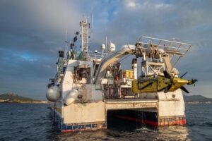
This synthetic aperture sonar, the Sams-150, offers a unique seabed mapping solution perfectly suited to deep-sea autonomous vehicles. Benefiting from more than 20 years of development within iXblue, this technology is already being operated by world-class navies and scientific institutes. This interferometric SAS sonar allows for simultaneous real-time imaging and high-resolution bathymetric mapping of the seabed.
"With a swath width of 500m for a constant resolution of 6cm, our new Sams-150 sonar optimizes the compromise between the resolution and range of imaging solutions. Thanks to its interferometric processing, a high-resolution bathymetric model can be generated simultaneously with the production of the imaging data, thus ensuring a coverage equivalent to more than 10 times the height of water under the sensor,"
explains Bertrand Chemisky, head of civil activities at iXblue Sonar division.
"Our SAS technology, coupled with an inertial navigation system and an acoustic positioning system, will ensure precise geo-referencing of each pixel, thus enabling the creation of homogeneous maps over large areas.”
The Sams (Synthetic Aperture Mapping Sonar) solution as designed by iXblue responds to the operational objective of significantly reducing the duration of operations at sea and therefore the cost of data acquisition. Following these same considerations, iXblue Sams sonar aims at optimizing the autonomy of underwater vehicles by seeking the best compromise between mapping coverage and energy consumption.
"The UlyX AUV is capable of diving down to 6,000 m and navigating on mapping profiles or in quasi-stationary flight near the bottom," explains Jan Opderbecke, project manager for the development of the UlyX system at Ifremer. “It is equipped with a suite of state-of-the-art sensors to produce a set of data on the explored area: high-resolution imagery-bathymetry data with the Sams-150, multi-beam bathymetry, and optical images aided by a laser profiler for photogrammetry. The AUV also implements a set of modular scientific sensors adapted to the scientific mission: physical parameters, chemical analysis, magnetometry, etc. Sams-150 has been selected based on its specifications for integration and use on the UlyX AUV: size, survey parameters such as altitude, resolution and swath. The unprecedented performance of the sonar and the data processing software chain are real assets. By combining imagery and bathymetry, the data from the Sams-150 sea trials show a significant potential that will bring scientific exploration to a whole new level.”
"We are very proud to contribute to this technological breakthrough in deep-sea exploration alongside Ifremer and to be able to participate, at our level, to France's leadership in deep-sea exploration,"
adds Bertrand Chemisky.
Sonardyne hybrid positioning chosen for vessels across energy and science
Acoustic and inertial position reference systems from marine technology company Sonardyne have been chosen to underpin the critical station keeping activities of multiple deepwater vessels operating in the energy and ocean research sectors.
Through a combination of upgrades to existing installations and the purchase of new systems, four deepwater drillships, a marine construction vessel and a floating production system working in North and South America will be using Sonardyne’s 6G (sixth generation) Marksman DP-INS technology. In addition, an ultra-deepwater scientific drilling vessel has now also upgraded its Marksman DP-INS system to the latest (sixth generation) equipment configuration.

Image Caption: Helix Energy Solution’s Helix Producer-1 floating production system is supported by Sonardyne’s 6G DP-INS system. Image from Helix Energy Solutions, by Robert Almeida.
Marksman DP-INS improves vessel positioning performance by exploiting the long-term accuracy of Sonardyne’s Wideband acoustic signal technology with high integrity, high update rate inertial measurements. The resulting navigation output is capable of riding-through short-term acoustic disruptions associated with deep water drilling and is completely independent from GNSS so can be considered as a third, independent reference for DP Class 3 vessels.
The system uses a combination of single or dual redundant surface transceivers, Sonardyne’s own vessel-based INS sensor and Long Baseline (LBL) seafloor transponders. However, unlike conventional LBL operations, Marksman DP-INS does not need a full seabed array of transponders to be installed and calibrated before subsea operations can commence. For most subsea tasks, positioning specifications can be met with only one or two transponders deployed on the seabed. Additionally, as the system needs only occasional aiding from the acoustics, transponder battery life is substantially increased so the need to task an ROV to deploy and recover transponders for servicing is reduced.
Noble Drilling has ordered a 6G upgrade to the Marksman system onboard its Noble Globetrotter II, adding two HPT 7000s to the vessel, as well as Compatt 6+ transponders for its vessel seabed array inventory and for wireless underwater marine riser flex joint monitoring.
The DP-INS system onboard Helix Energy Solution’s Helix Producer-1 floating production system has also been upgraded to 6G. The vessel is operating on the Phoenix and Tornado field in the US Gulf of Mexico for Talos Energy.
Two Brazilian drilling company’s deepwater drillships. Both rigs were fitted with Marksman DP-INS when they were launched in 2011. Also in Brazil, another rig operator has ordered a 6G upgrade for the Marksman system onboard its 6th generation, deepwater semi-submersible rig.
An Asia-based scientific drilling ship recently completed a Marksman DP-INS 6G upgrade. Sonardyne’s Marksman LUSBL technology was first installed on the vessel in 2005. This was upgraded to DP-INS with Sonardyne’s 5G hardware in 2012.
A US-based marine contractor has also ordered a Marksman 6G upgrade kit system to DP-INS to improve their vessel DP capability, especially when GNSS positioning is unstable or masked by nearby platforms.
Andre Moura, sales & Application Manager, at Sonardyne in Brazil, says:
“Vessel utilisation rates have been rising steadily over the past 12 months, providing vessel owners and operators with the confidence to invest now in technologies that will deliver long-term operational efficiency gains. Marksman DP-INS is one of those technologies; it’s mature a field proven technology which can be installed in the field and addresses industry’s need for a third, independent DP reference.”

SEA-KIT and Fugro ink contract for next generation 18m USV
World leading Geo-data specialist, Fugro, has ordered a SEA-KIT XL Class Uncrewed Surface Vessel (USV) for future North Sea operations. The 18m USV, the first of its kind, will be built at SEA-KIT’s expanding UK production facility on the Essex coast.
“Following the successful delivery and award-winning operations of the 12m vessels built so far for Fugro, we are delighted to announce this order for the first, larger SEA-KIT XL Class
USV. The XL design is a result of industry collaboration aimed at overcoming the complex challenges of effective uncrewed operations at long range in heavy seas. Our 18m USV will push the boundaries of robustness and versatility, meeting the increased challenges of endurance, communications and station keeping head on.”said SEA-KIT CEO Ben Simpson.
The SEA-KIT XL USV has a 7-tonne payload capacity and powerful bollard pull, making it suitable for towing spreads and larger sensors. The vessel can launch and recover a wide variety of remotely operated vehicles and payloads, has fully redundant station holding capability, Cat 0 operations for unrestricted use and a large lithium UPS supply for ship systems.
This build will feature the latest developments in uncrewed systems technology, including the next generation of SEA-KIT’s proven proprietary remote helm USV control and surveillance platform, G-SAVI.
Ivar de Josselin de Jong, Director Remote Inspection at Fugro, said:
“This order is an exciting next step in the roll out of Fugro’s remote and autonomous strategy and the development of our global USV fleet. The Blue Eclipse is the first 18m USV in an anticipated global series of long endurance and more capable USVs that will be deployed in the offshore energy sector with comparable ROV inspection performance to regular DP2 vessels. Equipped with the Fugro Blue Amp electric eROV and being operated from one of our nine global remote operations centres (ROC), we will be able to support our clients in achieving safer and more efficient data collection operations, whilst contributing to our mutual carbon footprint reduction ambitions.”
Fugro and SEA-KIT formed their ongoing partnership in March 2020, with a joint remit to improve safety and efficiency and to reduce the environmental impact of offshore operations. Work will start on the hull of the 18m USV in March with delivery scheduled for early 2023.
SEA-KIT recently sponsored the virtual Maritime Autonomous Systems Regulatory Conference, with Robert Courts MP, Parliamentary Under Secretary of State at the Department for Transport, as keynote speaker. Themed ‘The Reality of MASS’, this year’s event focused on developments made in the commercial and defence maritime sectors and sparked in-depth discussion on how autonomous vessels are now providing realistic opportunities to achieve net zero emissions in shipping.

Ashtead Technology bolsters rental fleet with investment in Innova multiplexers
International subsea equipment rental and solutions specialist Ashtead Technology has further strengthened its rental fleet with a significant investment in twelve new Matrix MK II+ multiplexers from Innova.
The Matrix is an established and proven stand-alone fibre optic multiplexer and control solution. It provides a simple plug and play interface for a large array of sensors and equipment to any remotely operated system offering reliable power management and strong diagnostic capabilities to help simplify and enhance the efficiency of survey operations.

The additional systems are available to rent throughout the company’s nine international technology and service hubs in Q1 2022.
Ross MacLeod, Ashtead Technology’s Technical Director, said:
“With over 17,000 assets in our subsea equipment rental fleet we offer the largest pool of Innova subsea multiplexer systems for rent worldwide. The Matrix MK II+ multiplexers from Innova are extremely popular and we have invested in additional systems to meet growing demand.
“This latest investment also demonstrates our continued commitment to the global subsea rental market by ensuring we can offer the broadest range of best-in-class subsea equipment from leading manufacturers to support our customers’ projects worldwide.”
Eivind Brimsøe, Sales Director at Innova AS, said:
“We have enjoyed a strong relationship with Ashtead Technology for many years and are delighted to support their continued investment in the latest survey technologies. We believe that our systems offer unrivalled performance and flexibility while maintaining the openness and ease of use that are vitally important to Ashtead Technology and its customers.”
North Sea research initiative INSITE announces Professor Dickon Howell as Programme Director
North Sea focused research initiative, INSITE, has announced the appointment of Professor Dickon Howell as its new Programme Director.

Prof Howell, an experienced marine scientist who is a respected leader in the field, takes over from Dr Richard Heard who will continue as an adviser to the organisation.
The new director will bring his considerable expertise and global experience of leading the blue economy, marine policy, governance, stakeholder relations and regulation to INSITE, leading its funding programmes, outreach and research development.
Speaking about his appointment, Prof Howell said:
“INSITE will continue with this vital work and we have further plans to release collective research, outcomes and drive the debate further within the decision making process.”
Dickon Howell is Professor of Practice at Newcastle University School of Natural and Environmental Science as well as director and founder of Howell Marine Consulting. He is an expert in policy development with a track record of bringing together regulators, scientists and politicians to find solutions on sustainability within the marine environment and has advised governments on biodiversity conservation and many other issues affecting offshore activity.
The INSITE Programme (INfluence of Structures in the Ecosystem) is a joint industry study on the impact of man-made structures in the North Sea. INSITE aims to facilitate and inspire research into the role of these structures in the marine ecosystem by providing funding and building the interface between scientists and industry.
INSITE draws funding from various sources - including its principal partner UK Research and Innovation (UKRI) - to provide grants to academics across the UK and Europe to carry out specific research. The resulting findings become part of an ongoing resource, which is available via scientific literature to industry, academia, government and other relevant policy bodies to inform current and future decisions about activity in the North Sea and around the globe.