
The earliest round-the-world marine research voyages give new insights on climate change
For the first time, scientists have used ocean measurements taken on research voyages almost 150 years ago to learn more about how human activity has impacted climate change.
Scientists from the National Oceanography Centre (NOC) and the Scottish Association for Marine Science (SAMS) have made the first combined study of water density measurements from the British HMS Challenger and Prussian SMS Gazelle round-the-world research expeditions in the 1870s to draw parallels with modern-day measurements. The two ships, which circled the world independently provided new insights into the ecologies and ethnologies of remote and rarely-visited communities and of the biology, geology, physics and chemistry of the oceans.
Their two contributions have been brought together to give an insight into the impact of the industrial age on Earth’s climate. The study is the first global-scale analysis of salinity from these two expeditions and the first observational evidence of changes in the global water cycle since the late 19th century.
With no baseline measurement for salinity pre-1950s, Dr John Gould from NOC and Professor Stuart Cunningham of SAMS have converted these density measurements into salinity and were able to show that the planet’s water cycle has increased in intensity, just as the global temperature has risen.
The findings, published in the journal Nature Communications in Earth and Environment, confirm that there has been an increase in evaporation from saltier parts of ocean, such as the Atlantic, and more rainfall in fresher areas. In effect, changes in the salinity pattern of the oceans have been used as a global-scale rain gauge.
Now this trend has now be found to extend back to the 1870s, early in the industrial age, and to have been 50% less intense before the 1950s than since that decade.
The water cycle is extremely sensitive to environmental changes. A rise in global temperature of just one degree Celsius will result in a 7 – 8% increase in water vapour in the atmosphere.
Earth’s average temperature has warmed by over 1°C since the 1950s, and this accelerates the water-cycle. Patterns and intensity of rainfall over land are changing: deserts are expanding; the UK is suffering more intense rainfall and flooding.
NOC Emeritus Scientist, Dr John Gould, said, ”When we started this study we did not know whether these measurements, taken with simple instruments, would be good enough to be of scientific value. In fact they have given us an insight almost into the pre-industrial age. In the 1870s atmospheric CO2 levels were 285 ppm (parts per million), hardly changed from 1000 years before. They are now approaching 420ppm. Our results provide an early baseline against which future changes in the water cycle can be compared”.
SAMS oceanographer Prof Stuart Cunningham said: "Our blue planet is fundamental to Earth’s water cycle, which is the processes of evaporation, precipitation and river run off, transferring water between the oceans, the land and vegetation. Studying how the ocean’s surface salinity pattern is changing tells us about changes in Earth’s water cycle and is vitally important to humans and our survival.
"The ocean, and the way it moves, is the main influence on our global climate. If we are to predict what our weather and climate will look like in decades to come, we must better understand our blue planet."
For more information, please visit: www.noc.ac.uk

XOCEAN Expand Global Fleet USV Operations with €1.7M EU Grant Funding
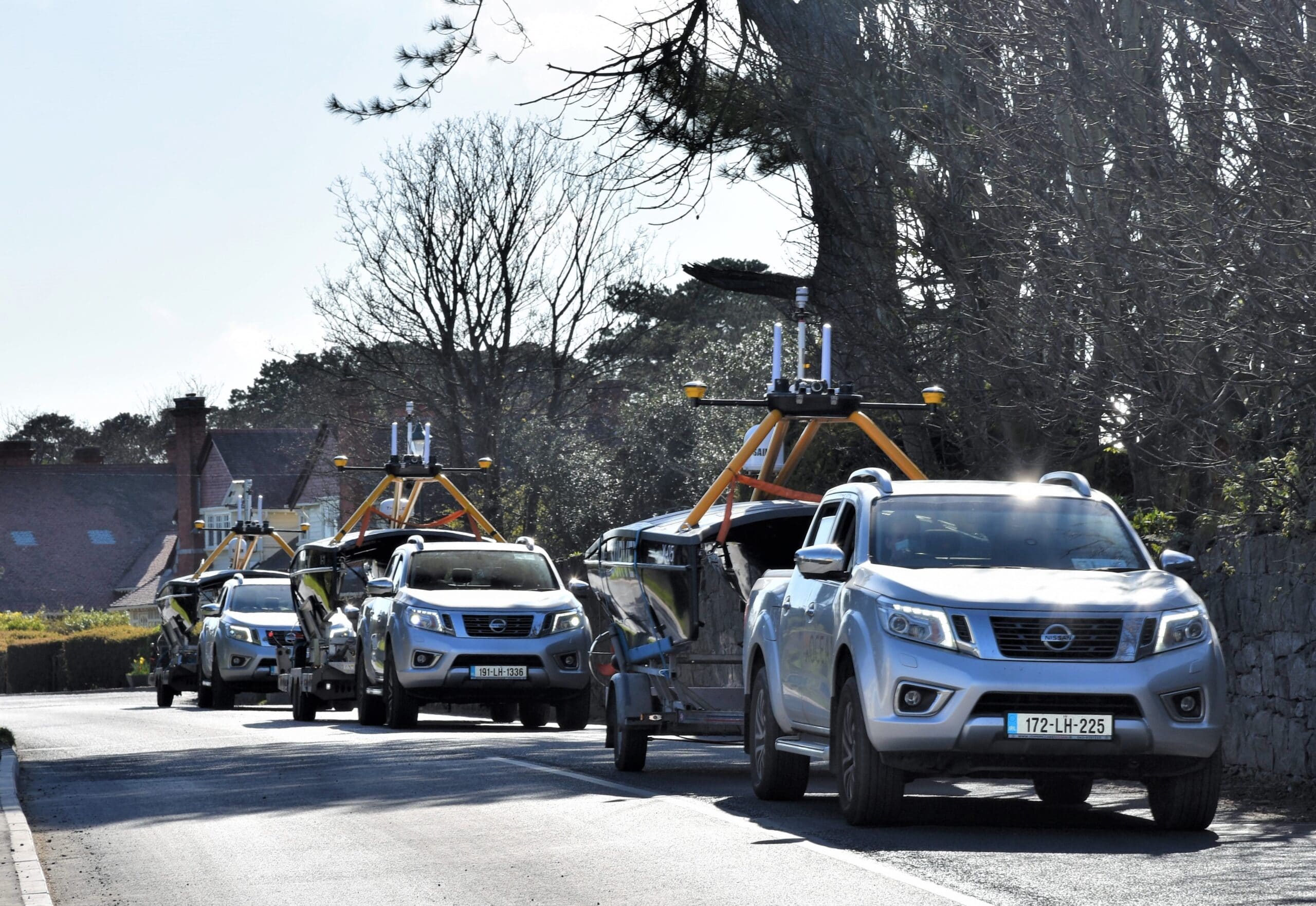
XOCEAN has secured a grant of €1.7m from the European Maritime and Fisheries Fund (EMFF) and CINEA through the Blue Economy Window program to bring to market XOCEAN’s innovative, high-performing, low-carbon Uncrewed Surface Vessels (USV) aimed at the commercial ocean data collection sector.
The funding will support the product market launch in Europe, North America and Asia resulting in over a thousand direct and indirect jobs in 3 years.
XOCEAN’s pioneering USV platform offers significant benefits including safety with operators remaining onshore, efficiency with 24/7 operations and environmental with ultra-low emissions (emitting 1,000 times less carbon than traditional survey vessels) which together leads to significant economic savings.
To date, XOCEAN has operated in 14 countries, delivering over 100 projects including seabed surveys on 16 offshore wind farms for clients such as SSE Renewables and Ørsted. In the last 12 months, XOCEAN has doubled the size of its team to 82.
Commenting on the funding, James Ives, CEO, XOCEAN said “We are delighted to be partnering with the European Maritime and Fisheries Fund of the European Union on this project. Our USV platform has demonstrated itself to be a safe, reliable and low carbon solution for the collection of ocean data. This project will support our technology development and ready our business for large scale market growth.”
For more information, please visit: www.xocean.com

EGS are recruiting a Deputy Head of Hydrography
An exciting opportunity exists at EGS to join our Survey Department as Deputy Head of Hydrography. You must be an experienced and dedicated professional prepared to be involved in both office and site work, you will have knowledge of data acquisition, processing and reporting. Applicants must have a relevant first or second degree/diploma in Hydrography / Surveying and at least three years’ relevant practical experience. Working knowledge of QINSy, SIS, POSMv for acquisition and POSPac, Caris and Global Mapper is highly desirable.
You will be based at our office in Bordon, Hampshire and will work full-time on projects in the UK and worldwide. You will be involved in survey planning, mobilisation/demobilisation, acquisition, processing and reporting. Possessing good interpersonal and communication skills along with experience of motivating and managing a team of surveyors. You should possess good analytical skills and the ability to identify and solve problems.
EGS offers a competitive remuneration package based upon experience together with a professional, friendly and COVID compliant working environment.
You will be part of a hard-working and dedicated team involved in complex marine survey projects in the Renewables, Oil and Gas, Utilities and Cable Route sectors.
You must live within or be willing to relocate to a commutable distance of the EGS office in Bordon, Hampshire.
To apply for this position please send your CV to [email protected]

Introducing the Solent MEZ - Connect. Collaborate. Deliver.
The Solent Maritime Enterprise Zone (Solent MEZ), established December 2019, is an umbrella organisation comprising a consortium of the Royal Navy, industry (including small and medium sized enterprises), government and academia working collaboratively in creating a centre of excellence for maritime research, innovation, education, skills and training. The Solent MEZ consortium connects networks regionally and nationally, collaborates on key maritime initiatives to support the maritime sector in its broadest sense. Through an enterprise approach it partners with other regions, maritime clusters and cross-sectors to benefit maritime businesses and institutions. With the mantra ‘Connect. Collaborate. Deliver.’, the Solent MEZ optimises the enterprise approach to tackle key maritime issues. The Solent MEZ’s ‘Connected and Autonomous Maritime’ initiative is capitalising on this and has enabled cross-sector, cross-region collaboration supported by the Catapult network. This initiative will benefit from the Solent’s strengths in marine autonomy, robotics, innovative engineering solutions, advanced manufacturing and smart port initiatives.
The Solent MEZ team is growing and currently includes Captain Allan Youp Royal Navy (Head of the Solent MEZ and responsible for the strategic engagement and operations), Jordan Thomas (Business Manager and business development lead for the innovation, technology & research space) and Andy Stewart (secondee from BAE Systems and is the skills, careers & apprenticeship lead). The team will drive forward an enterprise approach to the prosperity and growth agenda across the region and beyond.
Jordan, who recently joined from L3Harris, says “The Solent has an ecosystem of ground-breaking maritime technological companies due to the world leading scientists, engineers, manufacturing, innovators and regulators conveniently located here. Opportunities to connect with different organisations and industries, collaborate on exciting and innovative projects whilst delivering socio-economic benefits, presents an exciting challenge. Working with highly skilled marine professionals, positive disruptive technology and cutting-edge capabilities, there are a plethora of opportunities available that the Solent MEZ consortium can pursue and tackle as part of the Maritime 2050 strategy and more.”
If you would like to learn more, please feel free to contact the team regarding your area of interest. Contact e-mails are provided below:
Topic |
Contact |
|
| Head of the Solent MEZ - Strategic Engagement and Operations | Captain Allan Youp RN | [email protected] |
| Solent MEZ Business Manager and Innovation, Technology & Research lead | Jordan Thomas | [email protected] |
| Skills, Careers & Apprenticeships lead | Andrew Stewart | [email protected] |

Ocean Infinity acquires Abyssal
Ocean Infinity, the marine robotics company is excited to announce that it has acquired software engineering specialists, Abyssal.
Abyssal develops and implements proprietary software solutions for the offshore industry geared towards improving the safety and efficiency of subsea operations. As part of Ocean Infinity, the team will play a key role in shaping the enlarged group’s software development capability as it continues to grow and provide ever expanding robotics and data acquisition services to its marine customer base.
Abyssal’s technology ranges from a managed cloud data platform, synthetic environments, advanced 3D visualisation and operation management system tools. With artificial intelligence enabled digital twinning core to its services, Abyssal enables some of the world’s largest offshore operators to safely deliver complex projects.
Integrating Abyssal’s software expertise with Ocean Infinity’s robotic fleet will further underpin the company’s safe and secure data acquisition operations through the development of operational simulation, fleet management and cloud data tools.
Abyssal’s 38 highly experienced employees will transition to the Ocean Infinity Group, and will operate from Porto, Portugal, under the Ocean Infinity brand.
Oliver Plunkett, Ocean Infinity’s CEO, said: “Over the past nine years, Abyssal has built a great business with a talented team, focused on designing incredibly creative tools to improve the safety and data quality of its customers operations. Bringing this team of highly skilled solution developers into Ocean Infinity strengthens our in-house capability to provide the highest quality data, securely and quickly. Growing our team in such a way unquestionably moves us forward in becoming the leading ocean and seabed data analytics business. On behalf of everyone at Ocean Infinity I extend a warm welcome to our new colleagues.”
Manuel Parente, Founder and CTO of Abyssal, said: “With Ocean Infinity we share a vision to keep pushing the boundaries of technology development, in order to enable ever safer and ever more sustainable offshore work. We are pleased to now be part of this ambitious, “can do”, group. I look forward to the opportunities ahead, both for the team but also for our existing and future customers.”
For more information, please visit: www.oceaninfinity.com or www.abyssal.eu
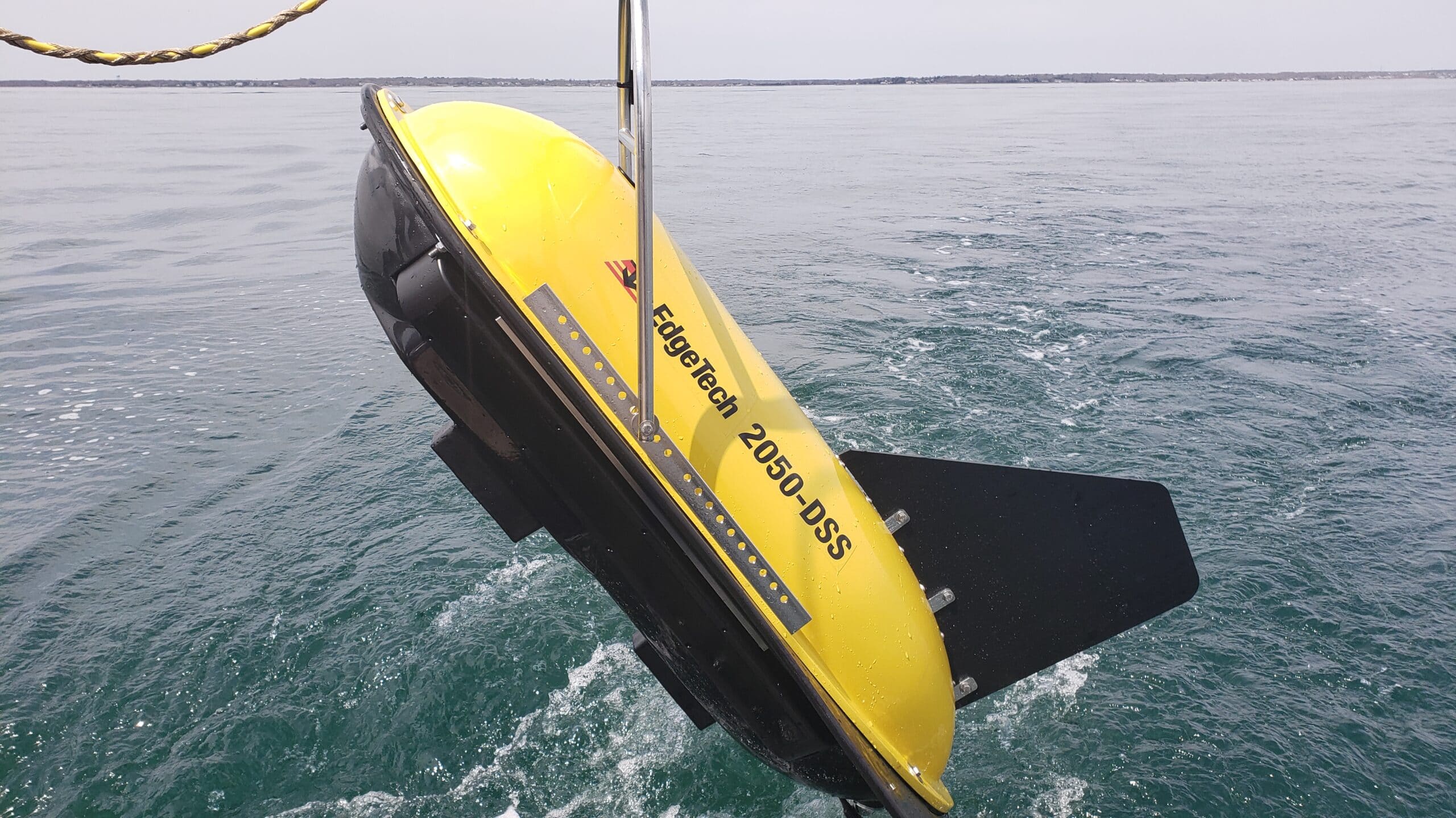
EdgeTech Introduces New 2050-DSS Combined Side Scan Sonar & Sub-Bottom Profiling System
EdgeTech, the leader in high resolution sonar imaging systems and underwater technology, has recently introduced a new combined tri-frequency side scan sonar and high resolution sub-bottom profiling sonar system.
The 2050-DSS is a tri-frequency side scan sonar system, where any two, operator selectable, frequencies can be operated simultaneously. The system can be provided with either a 120, 410 & 850 kHz towfish, or a 230, 540 & 850 kHz towfish. Both towfish options are equipped with a 2-16 kHz sub-bottom profiler, that utilizes a PVDF panel receive hydrophone. Use of an area based receive hydrophone panel provides improved beam patterns and therefore improved signal to noise ratio’s, which in turn means cleaner data for the operators.
The 2050-DSS comes complete with a combined towfish, digital telemetry that runs over a single coaxial cable, a 19-inch rack mount topside interface, and EdgeTech’s DISCOVER acquisition software. The 2050-DSS can be integrated with several auxiliary sensors such as magnetometer and USBL responder. Additionally, an interface is fitted to the electronics so that the electronics and sensors can be mounted onto an ROV. The 2050-DSS is ideal for applications such as cable and pipeline surveys, marine construction surveys, pre and post dredging surveys and more.
For more information please visit: www.edgetech.com
TCarta Delivers Satellite-Derived Bathymetry to NOAA for U.S. Coastal Mapping Pilot
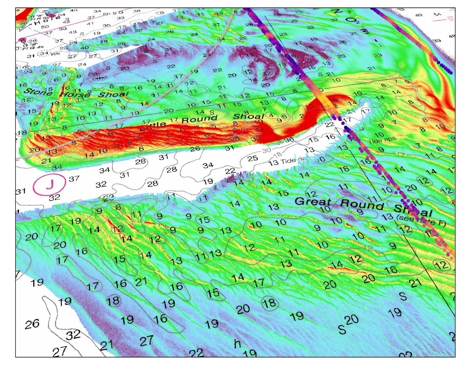
TCarta Marine, a global provider of marine geospatial products, has supplied the National Oceanic and Atmospheric Administration (NOAA) with satellite-derived bathymetry (SDB) validated by green laser altimeter data from the NASA ICESat-2 satellite for two U.S. shallow-water coastal areas.
TCarta was the subcontractor on the prime contract awarded to Woolpert, an international geospatial firm headquartered in Dayton, Ohio.
The NOAA pilot focused on two shallow-water regions that were 3,000 square kilometers in total area - one in the Green Bay area of western Lake Michigan and the other around Cape Cod and Nantucket Sound. Both areas experience natural forces that alter the underwater terrain faster than traditional bathymetric surveys can be completed.
SDB is being considered as a fast and inexpensive alternative for such coastal zones. A primary advantage of SDB is that orbiting satellites can be tasked to collect up-to-date imagery, with bathymetric measurements derived to create end products in a matter of days.
TCarta created products in the two project pilot areas to enable NOAA to test the use of SDB in shallow coastal zones. This provided updated bathymetry and infilled data gaps from traditional bathymetric measurement technologies, such as airborne lidar or marine sonar. The pilot was conducted jointly by NOAA’s Office of Coast Survey and National Geodetic Survey’s Remote Sensing Division. The SDB data sets measured the seafloor to a depth of 20-25 meters, with validation using ICESat-2.
"The integration of ICESat2 bathymetry with satellite imagery derived bathymetry is a powerful combination to increase accuracy," said RDML Shepard Smith, the recently retired Director of NOAA's Office of Coast Survey. "It holds the potential to dramatically improve our ability to monitor change in dynamic coastal waters and allow us to map remote areas for the first time."
“The enhanced SDB product validated with ICESat-2 data created for this pilot results directly from our research under the National Science Foundation SBIR program,” said TCarta President Kyle Goodrich.
In late 2019, TCarta received Phase 2 Small Business Innovation Research (SBIR) grant to commercialize next-generation SDB measurement technologies. ICESat-2 (Ice, Cloud & land Elevation Satellite) space-based laser data was included in the research following the satellite’s launch in 2018.
For more information, please visit: www.tcarta.com
Go-ahead for Marine Technology Cooperation
Federal ministry of economics and energy funds research project for fully autonomous deep-sea applications to protect people and the environment.
The German Federal Ministry for Economic Affairs and Energy is providing 12 million euros as part of the Maritime Research Program for the development of a novel autonomous submersible robotics system that will enable autonomous monitoring of underwater installations in the deep sea with a significantly reduced carbon footprint.
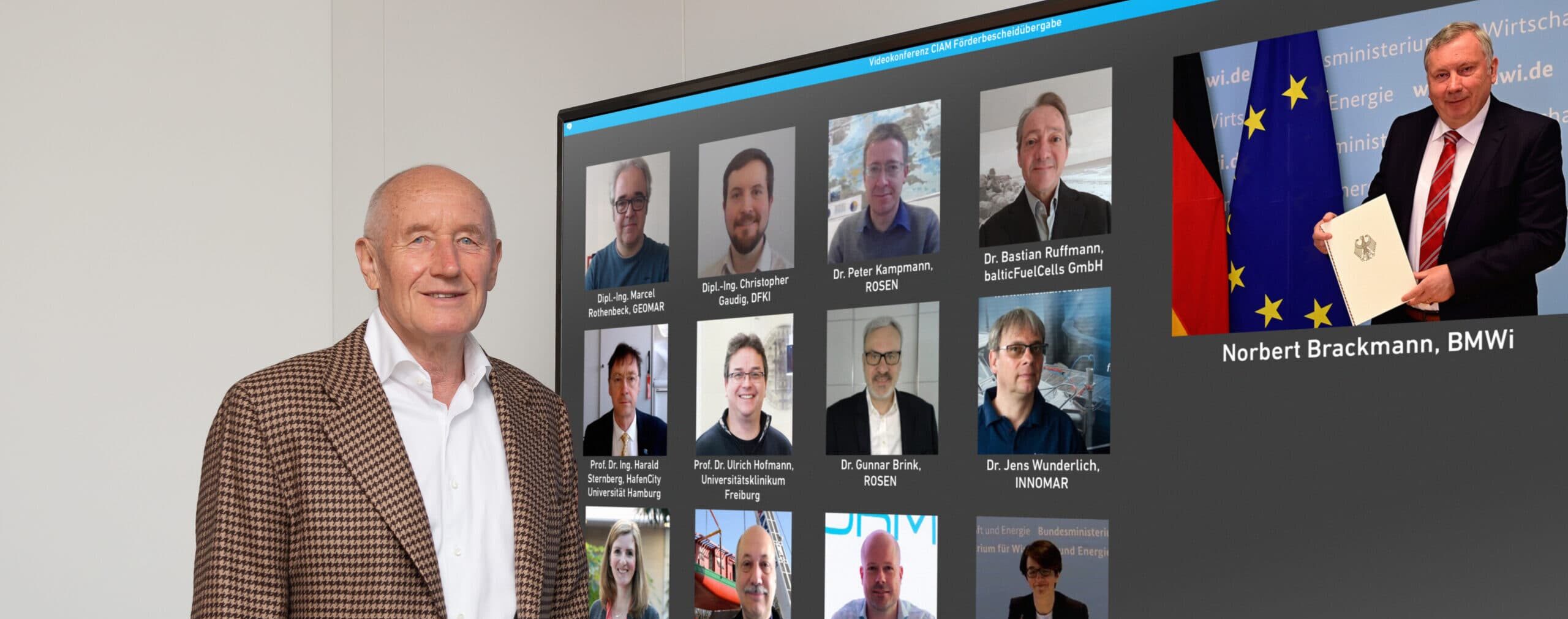
Norbert Brackmann, member of the German Bundestag and the German government's coordinator for the maritime industry, presented the funding decision to the nine participants in the CIAM ("Cooperative Development of a Comprehensive Integrated Autonomous Underwater Monitoring Solution") project during an online event on April 30.
Brackmann commented:
“I am pleased to be able to give the go-ahead today for a new marine technology project that is not only an example of the maritime industry's high innovative strength, but is also characterized by good cooperation between small and large companies, renowned universities and research institutions. As a future and growth industry, the maritime sector is actively shaping the maritime energy transition and investing in research and development. The future CIAM vehicles, which are expected to achieve particularly long mission durations, be deep-sea capable and yet relatively light, will be a step forward for German marine technology. With such innovative technologies for pipeline and submarine cable inspection, we are also strengthening our position on the world market.”
As part of the project unmanned submersible robotic systems with unprecedented autonomy will be developed and build, without the need for costly support vessels. These will monitor underwater assets and infrastructure such as oil and gas pipelines, hydrogen lines, renewable energy power cables, and telecommunications cables, and help prevent damage to these assets.
Governments and businesses worldwide see the oceans as a driver of future economic development with great potential for innovation and economic growth. In this regard, autonomous underwater vehicles (AUVs) are an important component of expected future market developments for a variety of underwater applications.
The CIAM project aims to solve a key problem of unmanned submersible vehicles: namely, that AUVs have so far required large, costly support vessels, in addition to high risks associated with flooding the AUVs and retrieving them from the sea again. To date, in addition to the availability of skilled personnel, the availability of suitable vessels and AUVs has been a challenge, especially in urgent operational and emergency situations. Maritime applications also typically require a global presence. Therefore, flexible systems that can be deployed quickly and flexibly in any weather and sea state are needed, possibly with air cargo capability.
The CIAM approach aims to solve these challenges in a new class of unmanned submersible robotic systems controlled by artificial intelligence. These should be able to achieve particularly long mission durations and ranges, enable fully autonomous coast-to-coast operations, be capable of deep-sea operations and still be relatively light.
Hermann Rosen, President of the ROSEN Group, added:
“The permanently high investments we have made so far in in-line inspection of onshore and offshore pipelines, broad manufacturing capability, system competence and, for some years now, also in our own AUV development, demonstrate our commitment and ambition to become a national champion and world market leader for autonomous underwater applications in this business field as well. In this context, we are very pleased to receive government support, which together with our partners should help us to achieve comparable international competitive conditions.”
In addition to ROSEN, the consortium includes three other renowned universities, two research organizations and three technical experts from Rostock, Schwerin and Karlsruhe as project partners. Dr. Gunnar Brink, Head of Global Market Strategy for Subsea Asset Integrity at the ROSEN Group, coordinates the project consortium and is proud to be part of the team: “Especially in the last weeks and months of project preparation, it was a pleasure for me to see how much the partners in this project have grown together. We know each other. The partners have been carefully selected. Each project partner has the will to contribute to the success of the project with their individual contribution, in order to ultimately establish themselves at the top of the global competition in this business field.”
The Maritime Research Program is part of the maritime research strategy, which provides incentives for research and development to support the German maritime industry in tapping growth potential and strengthening its international competitiveness. In addition, the program serves to support the industry in developing sustainable technologies, in securing and expanding competitiveness, and in identifying climate and environmentally compatible solutions. The special interest lies in the creation and safeguarding of high-quality maritime jobs as well as in the improvement of maritime value creation in Germany.
The ROSEN Group is a leading global service provider for in-line inspections of pipelines. It initiated the CIAM project and will manage it responsibly. ROSEN defines itself as “empowered by technology”, as a company that provides sophisticated services worldwide with application of the latest technologies in harsh environments to protect people and the environment.
This project will advance the inspection of subsea assets, push the boundaries of deep learning applications and certainly reduce the carbon footprint.
For more information, please visit: www.rosen-group.com
WASSP and SBG Systems to partner for WASSP’s new version of its world’s most cost-effective multibeam sonar
New WASSP S3r Multibeam Sonar
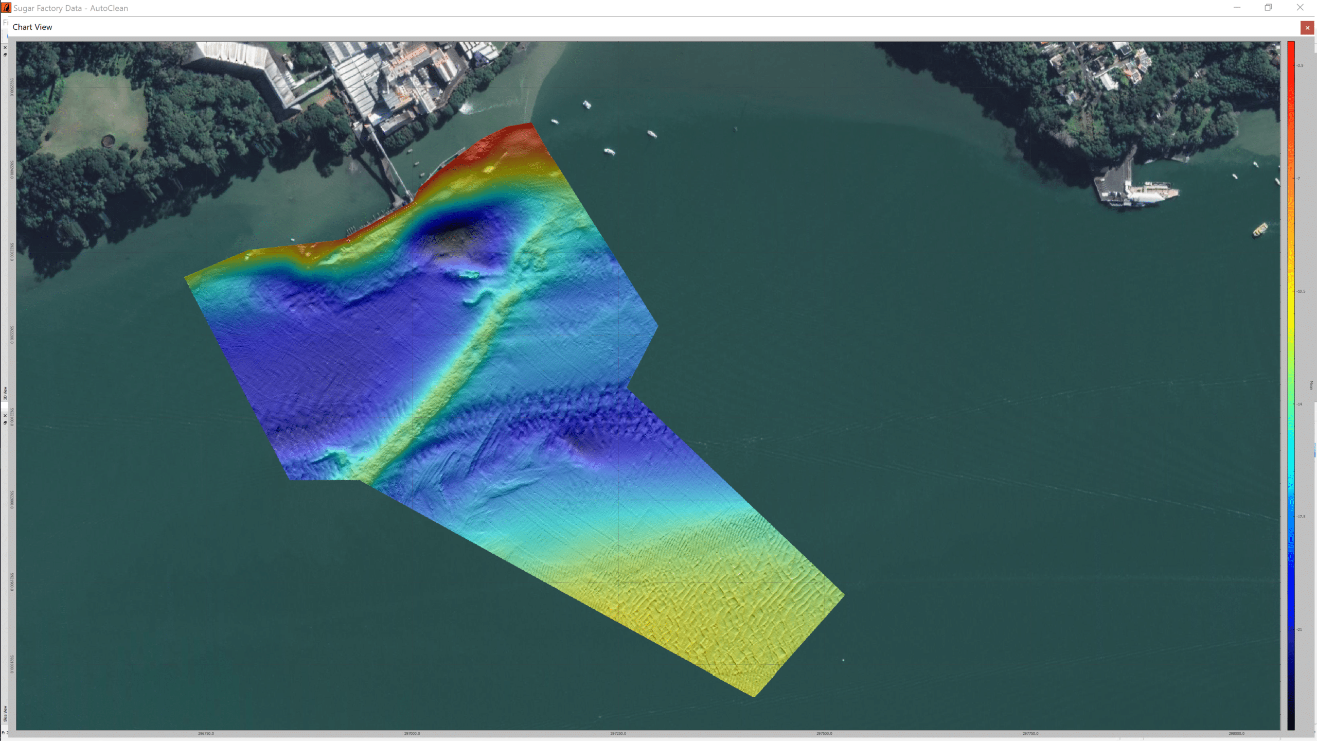
The new WASSP S3r is one of the world’s most cost-effective, professional survey and mapping multibeam sounder solutions. It combines data from a multibeam sounder transducer with 224 beams covering 120° degrees swath port-to-starboard along with position, heading, and motion to create an accurate bathymetric map of underwater features for various survey situations and environmental conditions. WASSP S3r is able to survey area up to 10 times faster than a single-beam sounder.
With the very high requirements hydrographic surveying has for accuracy, WASSP needed a solution for RTK + INS that could allow the sounder to create accurately positioned 3D bathymetric representations of the seafloor, down to centimeter accuracy with minimal passes. This demand combined with the complexities of tide, and boat movement mean that in order to get usable position and motion data, a dual antenna system was required. The company made multiple test scenarios from which the SBG Ellipse-D inertial navigation system came out as the best choice based on accuracy of consecutive test mapping.
“We required a cost-effective and high-precision position and motion solution. It needed to be able to combine with our WASSP multibeam technology so we could meet the high level of accuracy our customers expect” explains Bart Slingerland, Product Owner at WASSP.
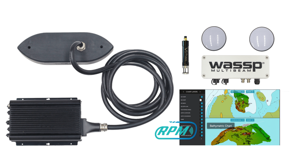
WASSP has also incorporated the Ellipse-D into its S3Pr portable survey package where size, weight, and cost were also key factors in the final solution. The SBG Ellipse-D was able to fit into a covered housing that allows quick setup on small vessels and interface with the WASSP DRX processing unit and CDX software.
Ellipse-D, The Smallest RTK INS on the Market
The new Ellipse-D has been launched in June 2020. This miniature Inertial Navigation System (INS) provides RTK position, 0.05° attitude, and dual antenna heading. It also outputs a 5cm heave, that adjusts automatically to the wave period. This sensor is designed to be easily integrated into marine projects thanks to compatibility with numerous industry standards (TSS1, PASHR, INDYN protocols). Ellipse is the smallest heave sensor at this level of performance, and the OEM version allows the tightest integrations. “We are very proud to be part of WASSP S3r and S3Pr. WASSP innovative solutions makes multibeam sonar technology available to the largest professionals” to conclude Thibault Bonnevie, CEO of SBG Systems.
For more information, please visit: www.sbg-systems.com