

The Nippon Foundation-GEBCO Seabed 2030 Project enters new agreement with Esri
London, 17 May 2021 – Seabed 2030 and Esri have entered a new formal agreement, which will see the two organisations work collaboratively towards the shared objective of assembling a global compilation of high-resolution bathymetric data, to assist us in the sustainable use of our planet.
Seabed 2030 is a collaborative project between The Nippon Foundation and GEBCO to inspire the complete mapping of the world's ocean by 2030, and to compile all bathymetric data into the freely available GEBCO Ocean Map. GEBCO is a joint project of the International Hydrographic Organization (IHO) and the Intergovernmental Oceanographic Commission (IOC), and is the only organisation with a mandate to map the entire ocean floor.
Committed to solving our planet’s most pressing challenges with geographic expertise and rational resolve, Esri’s mission is to inspire and enable people to positively impact their future through a deeper understanding of the changing world around them. This understanding involves a commitment to ocean science and maritime industry.
Esri places high importance on increased engagement with the ocean science community, as complex ocean science questions and data are increasingly used to inform the responsible use and governance of the oceans, as well as conservation.
“As we enter our last decade, Seabed 2030 warmly welcomes the support of a renowned organisation such as Esri. With experts in geographic science, software development, and data analytics, the work of Esri will no doubt greatly support our mission of compiling all bathymetric data of the entire global ocean floor by 2030,” commented Jamie McMichael-Phillips, Director of the Seabed 2030 Project.
Dr Dawn Wright, Chief Scientist of Esri said: “We are dedicated to a sustainable planet and Esri is therefore committed to supporting initiatives such as Seabed 2030, which play a fundamental role in allowing us to better understand and protect our planet.
“Since our beginning in 1969, Esri has cultivated collaborative relationships with partners who share our commitment to solving Earth’s most pressing challenges with geographic expertise. To this end, we are proud to count Seabed 2030 as a partner.”
All data collected and shared with the Seabed 2030 Project is included in the GEBCO global grid – the most complete bathymetric dataset of the world’s ocean floor, which is free and publicly available.
For more information, please visit: seabed2030.org

Tritex NDT leading the way in Drone Thickness Measurements
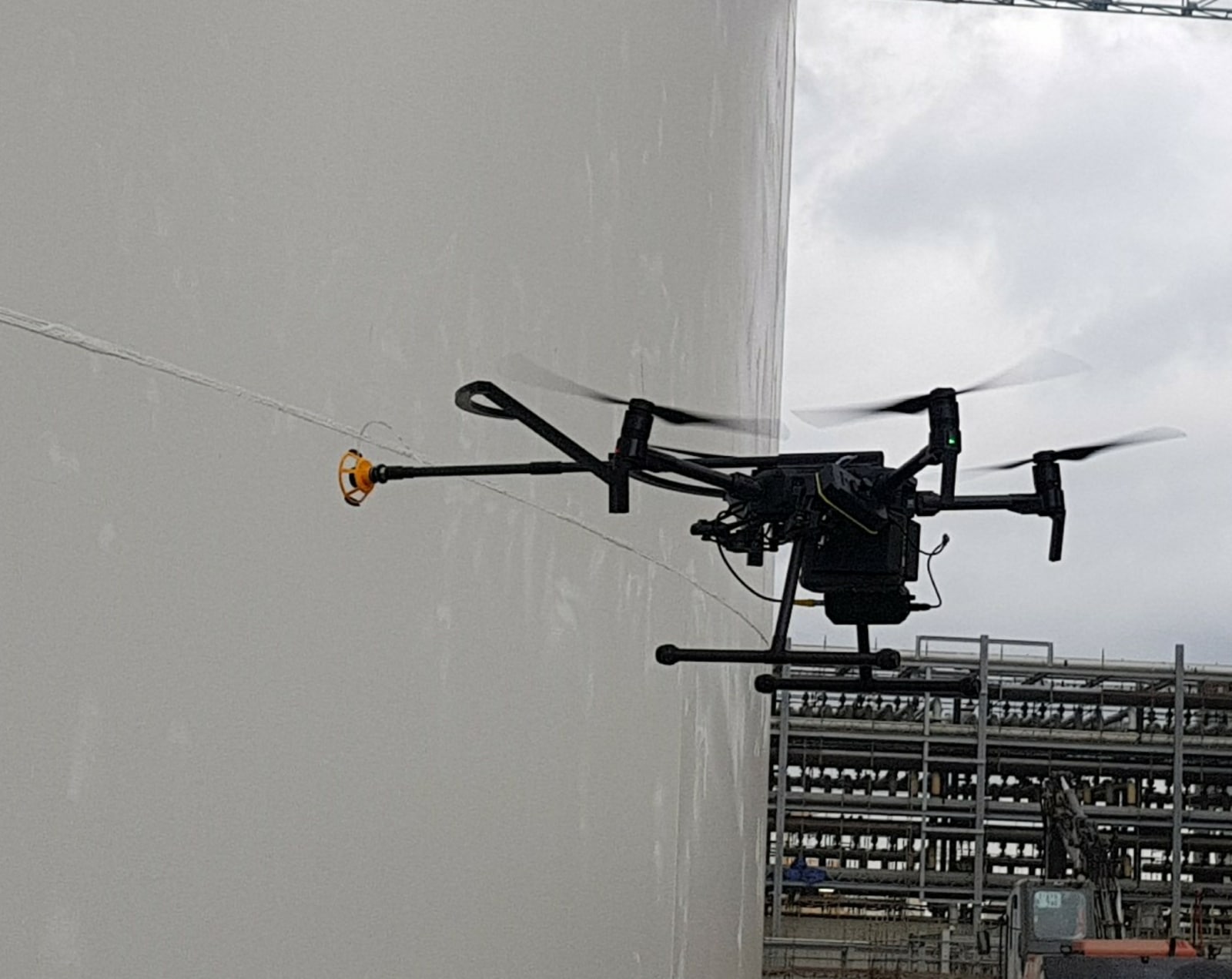
Tritex NDT have for many years been manufacturing ultrasonic thickness gauges and are now established as one of the leading companies offering multiple echo gauges. Multiple echo technology means that thickness measurements can be taken through 6mm thick coatings, only the metal substrate is measured. It doesn’t matter whether the coating is paint, epoxy or bitumen, it is completely ignored. This has huge advantages over having to remove coatings, both in time and money. It also has a big advantage when developing a gauge to mount onto a drone.
Taking thickness measurements at height has always been a requirement, and up until recently this has been done using scaffolding or rope access techniques. However, with the Tritex Multigauge 6000 dedicated Drone Thickness Gauge, first developed over three years ago, this is now a lot safer and cost effective than before.
Tritex NDT are leading the way in this application and are the only company worldwide with a dedicated thickness gauge to mount onto drones. In excess of 100 systems have so far been sold, with repeat orders coming from major petrochemical companies and class societies. The gauge and technology have been improved over three years of development in response to customer’s feedback and requirements.
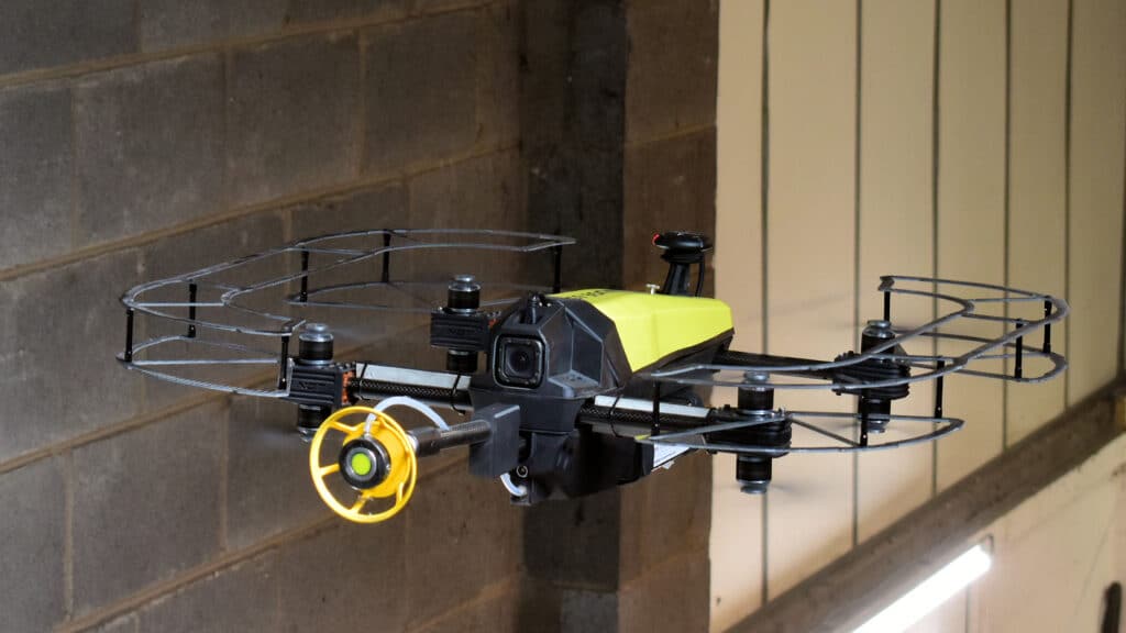
The Multigauge 6000 consists of three parts, which includes the gauge, a gel dispenser and a probe holder for the correct alignment of the probe. The single crystal probe ensures accurate measurements on curved surfaces, such as storage tanks and pipelines. Thickness readings are transmitted wirelessly up to 500 metres, using its integrated RF transmitter, to a dedicated software that allows the operator to record measurements, set up templates and to remotely control the gel dispenser before touching the probe onto the surface.
The gauge can mount onto any ‘work class’ type drone, with the most popular being the DJI Matrice 210 or 300. Tritex NDT have also developed their own custom drone, the Multigauge 6500, specifically designed to provide a complete solution. The Multigauge 6500 ‘Flying Thickness Gauge’ has eight rotors to provide redundancy, as well as propellor guards so that it can be easily used inside tanks.
Tritex NDT is a leading manufacturer of thickness gauges and are at the forefront of using drones for high level inspections. All gauges are designed and manufactured in the United Kingdom and supplied as complete kits, ready to use, with a 3-year warranty and free annual calibration for the life of the gauge.
For further information, please go to www.tritexndt.com
Innovacorp launches Global Blue Innovation Challenge
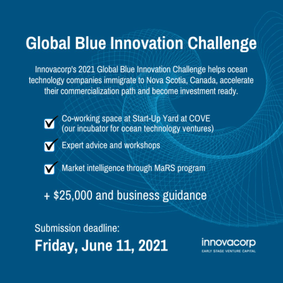
Ocean technology start-ups outside Canada, build your company in Nova Scotia! Innovacorp can help you get a start-up visa and grow your business. Apply for the Global Blue Innovation Challenge by Friday, June 11: bit.ly/2M0vHb0
MacArtney strengthens its board of directors with a new profile from the offshore wind industry
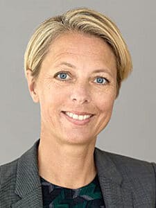
The MacArtney Group will be welcoming a new face to its board of directors: Trine Borum Bojsen, Chief Operating Officer, Copenhagen Offshore Partners.
Trine Borum Bojsen brings a wealth of global experience from the offshore wind industry. Trine Borum Bojsen has an M.Sc in Engineering and more than 25 years of experience within marine infrastructure with special emphasis on offshore wind farms. Throughout her impressive career, she has built up strong management and strategic skills.
Trine looks forward to joining the board at MacArtney and says:
“MacArtney has an impressive history and a clear ambition to stay relevant in the market. I look forward to contributing to the continued success of MacArtney.”
Prior to joining Copenhagen Offshore Partners, a position she has held since 2019, Trine Borum Bojsen held senior management posts at Ørsted and also served on a number of boards and key committees within the company, including its working environment committee and sustainability committee.
MacArtney’s board of directors is now composed of Niels Erik Hedeager (Chairman), Glenn MacArtney, Henrik Uhd Christensen, Marco MacArtney and Trine Borum Bojsen.
For more information, please visit: www.macartney.com
Ashtead Technology awarded funding through Canada’s Ocean Supercluster for Unmanned Digital Twinning Project
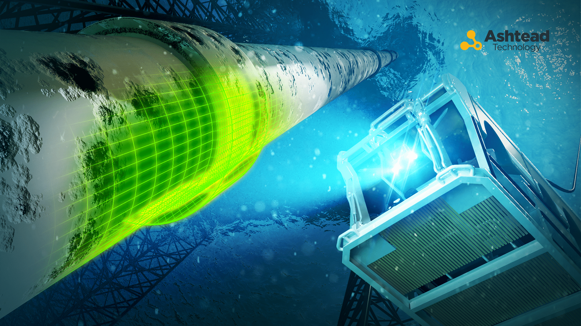
Welaptega, an Ashtead Technology company, has launched a $500,000 (USD) initiative to develop a product to enable digital twinning of underwater infrastructure without the need for offshore personnel.
Funding for the Unmanned Digital Twinning Project has been awarded by Canada’s Ocean Supercluster, an industry-led, national ocean cluster that’s growing the ocean economy in a digital, sustainable, and inclusive way.
In collaboration with Whitecap Scientific, SubC Imaging, and Nova Scotia Community College SEATAC division, the new digital twinning technology will develop an intuitive bridge between Welaptega’s and Whitecap Scientific’s technology systems. Upon successful launch of the project, conventional offshore ROV and vessel crew will be able to confidently collect high quality image data for post-processing digital twins, guided by real-time 3D reconstruction, to give feedback on image quality and coverage.
Tyler de Gier, General Manager of Welaptega, said: “We’re excited to be at the forefront of transitioning high-quality digital twinning services from the domain of specialists to conventional ROV and vessel crew. Furthermore, we’re able to achieve this through collaboration between Atlantic Canadian companies, providing ongoing employment opportunities and strengthening Atlantic Canada’s export industry.”
Sam Bromley, CEO of Whitecap Scientific, said: “This project is a shining example of how the Ocean Supercluster can bring together two complementary, world-leading companies in underwater 3D inspection to accelerate technological and product advances for the industry. We are proud to work with Welaptega, SubC Imaging, and SEATAC, to extend the ease of use, flexibility, and computational intelligence of Whitecap Scientific’s live ROV3D scanning system to Welaptega’s high-precision photogrammetry workflows.”
Digital twins digitise replicas of physical assets, used for integrity management, simulations, and the general visualisation of remote infrastructure to maintain the economic viability of assets, increase safety and reduce risk.
De Gier, added: “The flexible product created through this project will allow our clients to cost-effectively digitise their high value, safety critical assets without the need for offshore photogrammetry specialists, facilitating a transition to unmanned operations without jeopardising service quality.”
Together with members and partners, the Ocean Supercluster is accelerating the development and commercialisation of globally-relevant ocean solutions, and advancing Canada’s position as a global leader in ocean.
Commenting on the latest project award, Kendra MacDonald, CEO of Canada’s Ocean Supercluster, said: “It’s when we work together to solve shared challenges in the ocean, that we achieve the greatest outcomes. We are thrilled to see companies come together from across the region, in collaboration with academia to help bring a new digital twinning solution to ocean industries for the management of infrastructure at sea with a solution built in Atlantic Canada.”
For more information, please visit: www.ashtead-technology.com

New GAJT-410MS protects against RF interference and jamming in marine environments
GAJT-410MS delivers safe marine navigation as part of your assured PNT solution
With the increase of interference and jamming in marine environments worldwide, Hexagon | NovAtel is proud to release GAJT-410MS, the latest addition to their proven GPS Anti-Jam Technology (GAJT), into the commercial and defense marine markets. This low size, weight and power (SWaP) variant protects civil and military operations from interference and jamming, with jammer direction-finding capabilities for enhanced situation awareness in the marine environment.
Interference, both benign and malicious, is a challenge facing civilian and military operations. Commercial marine applications like shipping, tankers and bulk carriers are under threat from interference targeting their navigation and cybersecurity. Without assured positioning, these vessels can drift off-course and place the vessel, crew and cargo at risk. Nearshore marine applications like survey, construction and piloting require reliable positioning for uninterrupted operations in crowded waterways and RF environments. Interference mitigation and jammer direction-finding for advanced situation awareness ensure users acquire assured positioning, navigating and timing (PNT) while identifying and limiting risk from interference sources.
The GAJT-410MS provides dynamic protection on both GPS L1 and L2 bands, as well as Galileo E1, QZSS L1 and L2 and SBAS L1 to combat intentional and unintentional interference. If a vessel experiences jamming, the device’s direction-finding capabilities provide improved situation awareness of their RF environment to identify and locate the source of the jamming signals. This commercial off-the-shelf, non-ITAR solution is easy to install or retrofit onto existing fleets, enabling assured PNT for continuous operations, cybersecurity and safe navigation at sea.
“Assured navigation and cybersecurity defenses are growing priorities for marine users as global threats from interference and jamming increase,” said Dr. David Russell, marine segment portfolio manager for Hexagon’s Autonomy & Positioning division. “The GAJT-410MS is an anti-jam solution protecting vessels from interference and jamming disruptions to ensure continuous operations wherever your application takes you. With GAJT, your position, navigation and timing are protected and assured.”
The GAJT-410MS is the latest iteration of proven, high-performance anti-jam products from NovAtel. It includes flexible mounting options, jammer presence and direction-finding capabilities for advanced situation awareness.
For more information on the GAJT-410MS and the GPS anti-jam technology product line, visit novatel.com.
Hydromea unveils the world’s first wireless compact underwater drone providing live HD video feedback
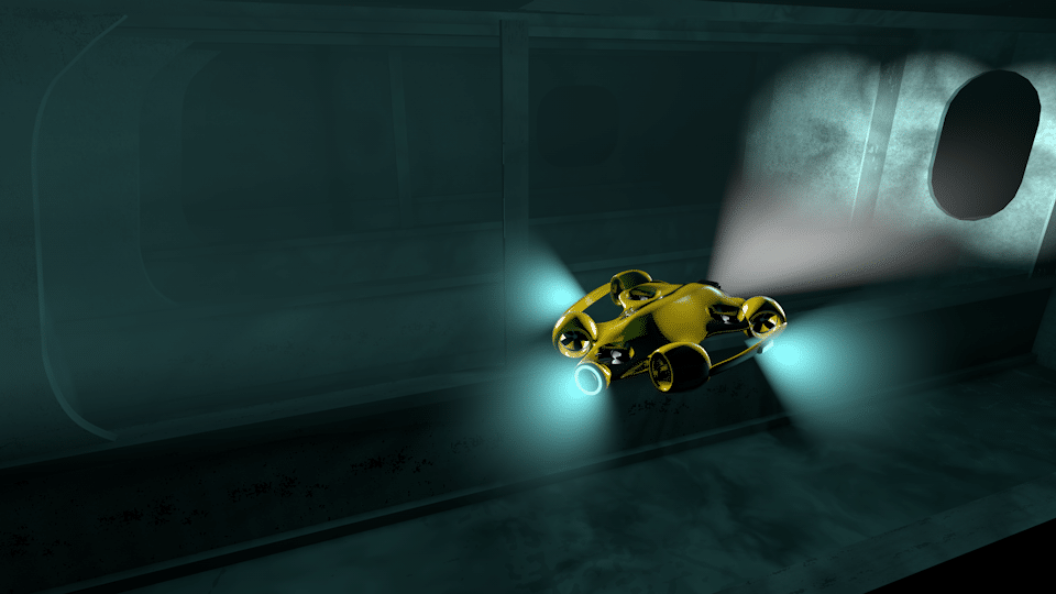
Hydromea unveiled the prototype of world’s first wireless underwater drone in a pool demo today. The drone can fit into a backpack, can be remotely controlled, and sends HD video back in real time without any physical connection to the pilot. The drone will deliver significant benefits in a number of inspection scenarios in confined flooded spaces, such as hydropower dams, closed waterways and ballast tanks on ships, reducing the cost and time-to-results, eliminating safety risks of dangerous inspections performed by humans today.
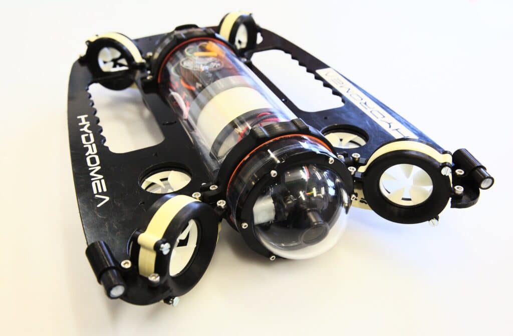
Igor Martin, co-founder and CEO of Hydromea, said: “Up to now, portable underwater vehicles always relied on a cable for communication. Our underwater drone works without a cable and sends full HD video stream back in real time. This eliminates any risks of getting stuck in complex flooded spaces, usually associated with cabled vehicles.”
Felix Schill, co-founder and CTO of Hydromea, added: “Since radio signals do not travel under water, Hydromea had to develop a new technology to control the drone: a wireless optical system which uses light to transmit high-bandwidth data. With our unique technology that is robust and miniaturized, we can finally cut the cord and unleash the freedom of portable robotics underwater.”
Founded in 2014, Hydromea is a Swiss-based autonomous underwater robotics company delivering solutions that allow customers to have unparalleled access to subsea data and underwater assets. Ultra-fast and high-volume, real-time data transfer and harvesting bring a paradigm shift in our quest to explore the ocean and understand its impact on the subsea economy.
For more information, please visit: www.hydromea.com
SeeByte’s ATR supports Royal Danish Navy and Polish Navy onboard Kraken Robotics’ KATFISH™
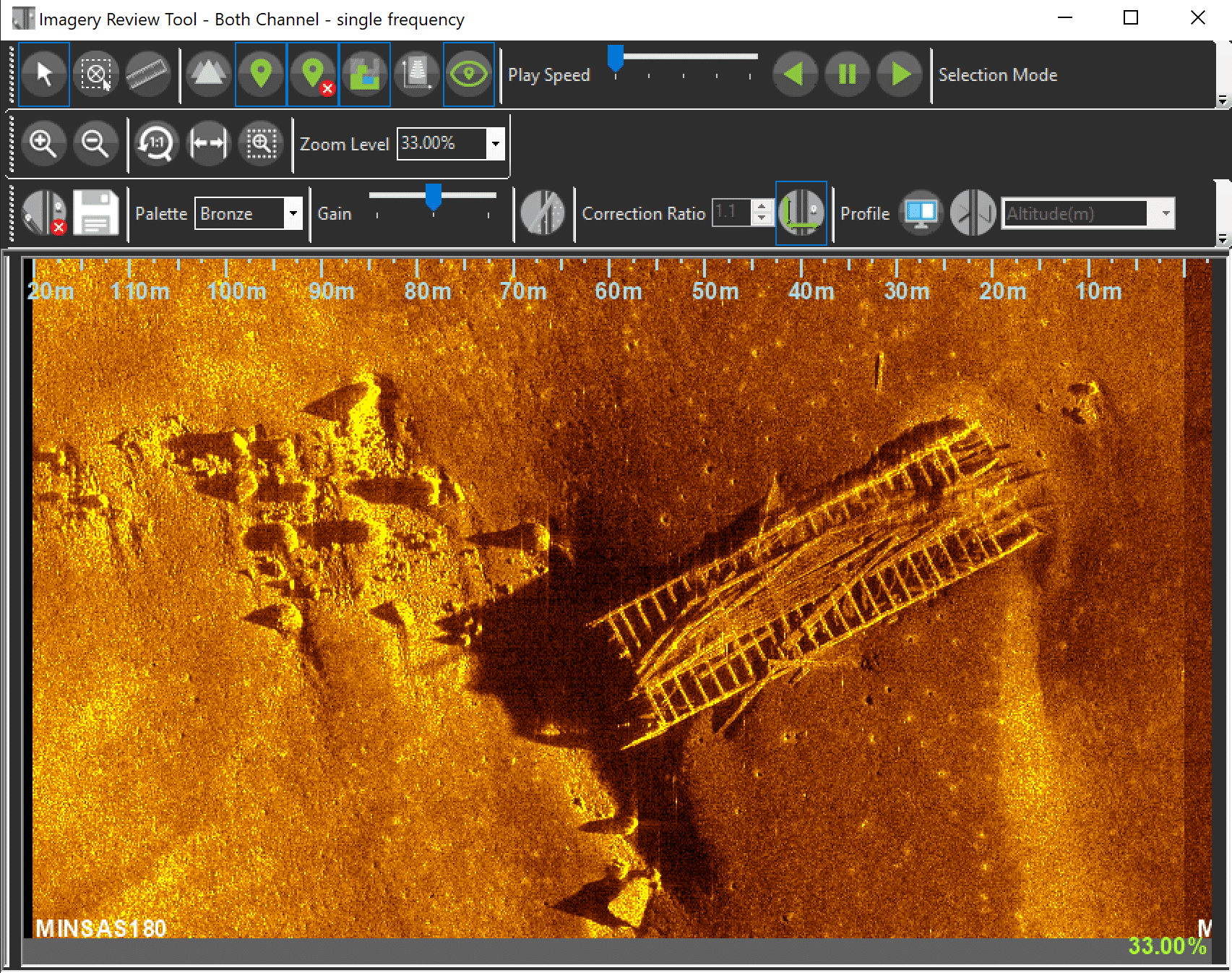
SeeByte, the global leader in developing smart software solutions for unmanned maritime systems, is pleased to announce they have partnered with Kraken Robotic Systems Inc (“Kraken”), a world leader in Synthetic Aperture Sonar or SAS, a revolutionary underwater imaging technology. to integrate their Automatic Target Recognition (ATR) System onto the Kraken KATFISH™ Towed Synthetic Aperture Sonar (SAS).
The KATFISH™ towed SAS, complete with SeeByte’s embedded ATR capability will be delivered to the Royal Danish Navy and Polish Navy to support their mine countermeasure activities.
KATFISH is a high speed, actively stabilized towed Synthetic Aperture Sonar vehicle designed to be deployed from manned or unmanned surface vehicles. KATFISH provides ultra high resolution, high accuracy sonar imagery, real time and in mission, covering larger survey areas in less time compared to legacy systems. Integrating the KATFISH with SeeByte’s robust ATR solution allows for improved real-time target detection and classification, reducing post mission analysis requirements and enabling operators to review greater quantities of high-definition data in less time.
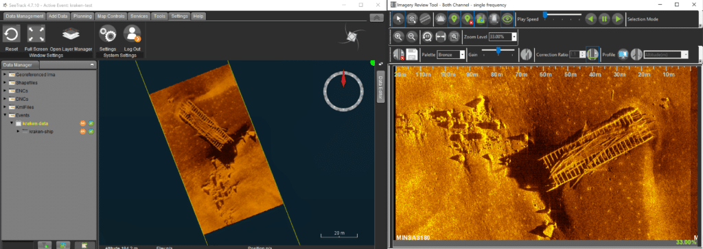
SeeByte’s Chief Technology Officer, Scott Reed said, “We are delighted to be partnering with Kraken Robotics to integrate our proven SeeTrack ATR System with Kraken’s KATFISH minehunting solution, for delivery to end customers in the Royal Danish Navy and Polish Navy. Our ATR System is designed with flexibility in mind, offering a range of options from embedded ATR to a complete set of tools that fit into the Post Mission Analysis workflow. This integration with the KATFISH™ will allow Kraken’s naval customers to intuitively work with the output produced by the ATR to support their MCM efforts.”
With offices in Edinburgh, Scotland and San Diego, US, SeeByte provides clients in the global maritime industry with the most advanced software solutions to enhance the capabilities of their unmanned systems. SeeByte’s open architecture technology provides enhanced capability, autonomy, and value to maritime systems and their users.
Kraken Robotics Inc. is a marine technology company dedicated to the production and sale of software-centric sensors, subsea batteries and thrusters, and underwater robotic systems. The company is headquartered in Mount Pearl, Newfoundland with offices in Dartmouth, Nova Scotia; Toronto, Ontario; Bremen & Rostock, Germany; Boston, Massachusetts; and a newly formed office in Copenhagen, Denmark. Kraken is ranked as a Top 100 marine technology company by Marine Technology Reporter.
For more information, please visit: www.seebyte.com

CM Sourcing are recruiting a Client Manager
Location:
Taunton, UK
Reports To:
Operations Director
Job Overview:
Working within the Operations Team, the Client Manager is responsible for liaising with a small group of clients and understanding their freelance staffing requirements. They will then be responsible for sourcing the appropriate contractor for the role and overseeing negotiations and all aspects of the resulting contracts.
Responsibilities and Duties:
Liaising with clients, working closely with them to source the best possible freelance personnel to fulfil their requirements.
Building relationships with individuals in the freelance community, understanding their needs and placing them on appropriate projects.
Negotiating rates and terms to ensure both the client and the contractor are fully satisfied with the final contract.
Work closely with the operations assistants to ensure contractors arrive on site promptly and in accordance with the client’s needs.
Assist with travel arrangements and other ad hoc bookings (Such as training courses) to ensure the smooth running of the project.
Be on call over weekends where needed i.e. crew changes/emergency travel.
Attending industry events to network with new and existing clients and contractors.
Qualifications / Experience:
Ideally has 5-10 years of experience within the offshore survey industry. All backgrounds will be considered (onshore/offshore, technical/crewing/commercial).
To apply, please visit: https://www.cmsourcing.global/jobs/
Gardline are recruiting for multiple positions
Gardline Limited is a wholly owned subsidiary of Royal Boskalis Westminster N.V. We are a multidisciplinary marine survey company, providing a comprehensive range of marine services including geophysical, geotechnical and environmental surveys.
We currently have a variety of offshore roles available:
• Geophysical Engineers
• Surveyors
• Seismic Processor
• Geophysicists
• Geotechnical Engineers
For details on all of our roles and the skills, qualifications and experience required, please visit our website www.gardline.com/careers.
All candidates must be positive, confident and keen to develop a reputation as a team player in a seagoing role. We look forward to hearing from you and hopefully welcoming you aboard.