
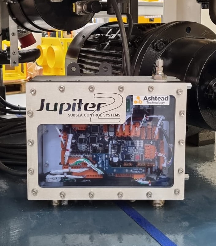
Ashtead Technology signs collaboration agreement with Zetechtics
Integrated subsea technology and services provider Ashtead Technology has signed a deal with Zetechtics to offer customers a range of new ROV tooling technologies.
The agreement will see an array of torque tools, control systems and associated peripherals from the subsea control systems specialist made available to customers through Ashtead Technology’s nine customer service hubs.
David Mair, Ashtead Technology’s Business Development Director said: “We are continually developing and expanding our capability to meet the diverse needs of our customers around the world, who operate in all areas of the global energy industry. These new technologies offer improved performance, reliability and efficiency, as well as a greater level of user-friendliness.
“Zetechtics has 27 years of experience for us to draw on and this collaboration is set to add undeniable value to our customers operations.”
The deal gives both organisations the scope to add further specialist equipment based on demand.
Alan Duncan, Commercial Director of Zetechtics, said: “Customers prefer to use modern, easily-supported equipment, with the type of technical features they would have access to if buying new.
“We are excited to collaborate with Ashtead Technology and by introducing a wide range of new equipment to the market in this way will enable their customers to unlock the potential of our market-leading solutions.”
For more information visit: www.ashtead-technology.com


Kraken Enters into Letter of Intent to Acquire Subsea Services Company
Kraken Robotics Inc. (TSX-V: PNG, OTCQB: KRKNF), Canada’s Ocean Company, is pleased to announce that it has entered into a non-binding letter of intent (the “LOI”) dated April 8, 2021 in connection with the proposed acquisition of PanGeo Subsea Inc. (“PanGeo”) from Cahill Innovation Inc, a member of the Cahill Group of Companies, and Argentum Asset Management AS. Moya Cahill, a director of Kraken, is a shareholder of Cahill Innovation Inc, and she resigned as a director of Kraken prior to the approval and execution of the LOI in order to ensure proper governance and review of the transaction by a fully arm’s length board.
PanGeo is a private Canadian services company specializing in high resolution 3D acoustic imaging solutions for the sub-seabed. This proposed acquisition would accelerate Kraken’s transformation to a Robotics/Data as a Service model by increasing recurring service revenue and providing increased exposure to the non-defense market, including the offshore renewable energy market. Following completion of the proposed acquisition, Kraken would offer a holistic solution of world-leading technologies and services in subsea acoustic and optical imaging: Kraken’s suite of ultra-high resolution seabed 3D acoustic imaging sensors, autonomous robotics, and optical laser scanning paired with PanGeo’s suite of leading-edge sub-seabed high resolution 3D acoustic imaging systems.
Acquisition Rationale
The proposed acquisition would create a Canadian-headquartered global leader in ocean technology in the areas of subsea and sub-seabed imaging. If completed, Kraken would benefit from a number of synergies and advantages including:
- PanGeo would provide a broader foundation for Kraken to build a significant recurring revenue stream from a provision of reduced carbon emissions survey services.
- The acquisition will result in a more balanced blend of revenue (both defense and commercial) and product mix (product sales and services).
- PanGeo has an attractive diversified customer base consisting of leading companies in offshore renewables and offshore energy. Most of PanGeo’s offshore survey revenue is generated in Europe, with new opportunities emerging in the U.S. and Asia.
- PanGeo’s geotechnical and geophysical expertise, operational excellence and service delivery capabilities for the marine survey market are complementary to Kraken’s newly emerging service business. Kraken’s service capabilities consist of ultra-high-definition subsea imaging technologies that have been proven and well received in the defense market but are just as applicable to the commercial subsea survey and inspection markets, albeit delivered as a service (rather than a product sale).
- PanGeo’s technology augments Kraken’s to provide a more complete range of subsea surveying services. PanGeo’s Synthetic Aperture Sonar 3D seabed penetrating technology, which allows customers to understand the characteristics of the sub-seabed, will pair well with Kraken’s high ultra-high-definition seabed imaging technologies. This is essential to understanding the sub-seabed characteristics for infrastructure builds as well as maintenance and repair (buried pipelines, buried cables, buried UXOs, offshore wind turbine and offshore oil platform construction).
- Kraken will be able to take advantage of synergies to advance the development of technology on both platforms more quickly and more efficiently. The combined platforms will have a strong R&D feedback loop as new technologies are deployed, tested, and iterated in Kraken’s services business.
- Kraken does not expect significant integration risk as PanGeo’s management team is also headquartered, and has significant operations, in Newfoundland and Nova Scotia.
Kraken CEO Comments
Karl Kenny, Kraken President and CEO said:Commenting on the LOI, “Since plans for our OceanVision project started in 2018, we have been preparing our industry leading Synthetic Aperture Sonar and 3D underwater laser scanning technologies to be used in a Robotics/Data as a Service (RDaaS) business model as opposed to a product only strategy. While customers in the defense industry generally purchase this technology, in the commercial market customers are more focused on the provision of services by capable third-party companies. We believe that this potential acquisition would complement Kraken’s existing products and services with a stronger base of recurring revenues. As in the past, we expect PanGeo and Kraken will continue to work with many offshore service companies that prime these jobs and integrate specific scopes of work from various sub-contractors.”
PanGeo CEO Comments
Moya Cahill, PanGeo’s co-founder and CEO noted:“Notwithstanding that there is due diligence and negotiation for Kraken to complete this acquisition, this opportunity is very exciting for PanGeo as Kraken and PanGeo are world leaders in seabed and sub-seabed technology applications, respectively. Assuming closing of this transaction, I am confident that ocean industry customers will benefit from a broader suite of offerings from sensors, platforms, and service delivery solutions. PanGeo has a more than 10-year commercial track record of providing 3D acoustic imaging solutions to offshore renewable energy, offshore energy, and defense customers.”
Proposed Transaction Details
Although the LOI remains non-binding, it is anticipated that the purchase price will be between $18-$24 million, based on PanGeo’s performance over the 2-year period following the acquisition, to be paid by way of cash and stock over that period. Based on initial information provided by the target, the unaudited consolidated assets at December 31, 2020, of the business that Kraken is proposing to acquire were $11.7 million and net debt was $0.4 million. Unaudited trailing 12-month revenues for the period ended December 31, 2020, were $9.0 million and the corresponding EBITDA was a loss of $0.5 million. This was down from comparable 2019 revenues of $10.8 million and EBITDA of $2.3 million. The year-over-year decline was largely due to the impact of COVID on customer activity.
Completion of the acquisition is subject to, among other matters, the completion of due diligence, the negotiation of a definitive agreement providing for the transaction, and satisfaction of certain other conditions to be negotiated therein. Given the materiality to Kraken, it is not anticipated that any Kraken shareholder approval would be required to complete the proposed acquisition. Pursuant to the LOI, the parties have agreed to a 60-day exclusivity period during which they will complete their due diligence and negotiate exclusively with each other with a view to settling the terms of the transaction and the form of definitive agreement. Further details will be provided upon successful completion of the due diligence period and the signing of a definitive agreement. The LOI may be terminated by either party if a definitive agreement is not entered into by May 31, 2021. In addition to other conditions, the proposed acquisition remains subject to the approval of the TSX Venture Exchange.
For more information, please visit: www.krakenrobotics.com

RBR Ltd. releases the new RBRquartz³ Q|plus pressure logger
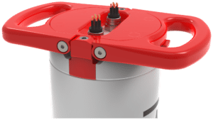
RBR Ltd. is pleased to announce the commercial release of the new RBRquartz³ Q|plus pressure logger to meet the demands for high-accuracy, long-term measurements of sea level, tidal, and wave dynamics by coastal oceanographers worldwide. At the heart of the RBRquartz³ Q|plus is an integrated Paroscientific Digiquartz® pressure sensor for best-in-class initial accuracy, resolution, and low-drift performance.
Learn more: https://bit.ly/3t0JO3Z
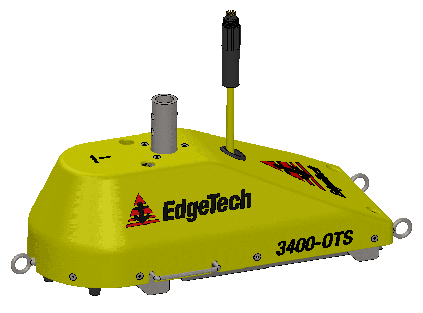
EdgeTech Introduces Two New 3400-OTS Lightweight Pole Mount Sub-Bottom Profiling Systems
EdgeTech, the leader in high resolution sonar imaging systems and underwater technology, has recently introduced two new Pole Mount Sub-Bottom Profilers to the family of 3400 Sub-Bottom Profiling Systems.
Building on the long running success of the EdgeTech sub-bottom profiler product line, the new Ultra-Lightweight Shallow Water and Lightweight Shallow Water over-the-side pole mount 3400-OTS systems provide users many unique enhancements to current sub-bottom profiler systems. The 3400-OTS transmits wide band Frequency Modulated (FM) pulses utilizing EdgeTech’s proprietary Full Spectrum CHIRP technology. The systems use flat multi-channel hydrophone arrays to generate high resolution images of the sub-bottom stratigraphy in oceans, lakes, and rivers and provides excellent penetration in various bottom types. The 3400-OTS receiver array is segmented for standard sub-bottom profiling operations or “pipeline” mode for optimal location and imaging of buried pipelines or cables. The system offers real-time reflection coefficient measurements. This unique function of the EdgeTech sub-bottom profiler system allows users the ability to collect complex ‘analytic’ data using linear system architecture to measure sediment reflection and analyze sediment type determination. Additionally, the system has discrete transmit and receive channels allowing for continuous data collection resulting in a high ping rate particularly important for construction and pipeline surveys.
The lightweight 3400-OTS systems are ideal for shallow water surveys using small boats of
opportunity. The sub-bottom profiling systems come as a complete package including EdgeTech’s DISCOVER sub-bottom acquisition & processing software. The 3400-OTS can also be interfaced to 3rd party software.
For more information please visit: www.edgetech.com.

Second annual Captain Don Walsh Award for Ocean Exploration is now open for entries
The Society for Underwater Technology (SUT) and The Marine Technology Society (MTS) announce the second annual Captain Don Walsh Award for Ocean Exploration is now open. Nominations must be received by 31 May 2021.
 Awarded jointly by both societies, the Captain Don Walsh Award for Ocean Exploration is presented annually to an individual who has made an outstanding, sustained, international contribution to the development, application, or propagation of marine/ underwater technology toward the advancement of ocean exploration. The award is named in honour of Captain (Ret) Don Walsh, an accomplished American oceanographer, explorer, retired naval officer, and marine policy specialist. He and Jacques Piccard were aboard the bathyscaphe Trieste on January 23, 1960 when it made a record descent into the Mariana Trench, which is the deepest point of the world's oceans. Dr. Edie Widder, an MTS member, won the inaugural award in 2020.
The judging panel, comprised of the presidents and three members from each society, will reflect diversity in demographics, sector and discipline. In addition, Dr. Edie Widder, MacArthur Fellow, a deep-sea explorer, and conservationist known for her expertise in oceanographic research and technological innovation and her commitment to reversing the worldwide trend of marine ecosystem degradation, will join the judging panel.
“A pioneer, outstanding Naval officer, mentor and influencer is how I describe Don Walsh. MTS is proud to join SUT in this award that recognizes an individual who is pushing the limits of ocean exploration,” said Zdenka Willis, President of MTS
“Don Walsh has been an inspirational role model for six decades, we are looking for a winner whose achievements will similarly inspire early career marine technologist, scientists and engineers,” said Judith Patten MBE, President of the SUT.
Nomination details for the award are online at https://bit.ly/3fyiXIs, www.sut.org, or www.mtsociety.org.The closing date for nominations is 31 May 2021.


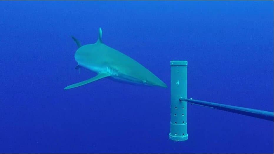
Extensive underwater camera network to monitor and protect ocean wildlife and blue economies
The ocean wildlife and diverse ecosystems of the UK Overseas Territories (UKOTs) will soon be more visible than ever thanks to pioneering work to establish a major network of underwater camera deployments.
Funded as part of the UK Government Blue Belt programme, scientists from Cefas, the University of Western Australia and partners in the UKOTs are working with Blue Abacus, in a world first to supply and analyse the data collected from 66 non-intrusive stereo-Baited Remote Underwater Video Systems (BRUVS), which will be deployed in open ocean and coastal habitats.
Together these BRUVS will form the Global Ocean Wildlife Analysis Network, which will provide information on ocean biodiversity and ecosystems found in the vast maritime and coastal areas of the UKOTs in the Atlantic, Indian, Pacific and Southern Ocean.
The UKOTs involved in the project are: Anguilla, Ascension Island, British Antarctic Territory, British Indian Ocean Territory, British Virgin Islands, Cayman Islands, Montserrat, Pitcairn, St Helena and Tristan da Cunha.
BRUVS will enable researchers to see below the surface and provide a benchmark of scientific understanding of the marine species within their maritime area, allowing the UKOTs to take more informed decisions about protecting and managing these diverse ecosystems.
The data the cameras collect will provide a standard measure of the status of both open ocean and reef species, letting scientists and the UKOTs set benchmarks for diversity and abundances. This will form valuable information on the many migratory species of open ocean and coastal reef fish species, assist in the management of data-poor fisheries and also improve our understanding of the functioning of pelagic and benthic ecosystems.
Co-founder of Blue Abacus and Professor at the University of Western Australia, Jessica Meeuwig said:
“The world’s tunas, sharks and large reef fish continue to decline in numbers and this trend must be reversed. This programme will give decision makers the evidence they need to act decisively in support of their blue economies.
“We are delighted that the UK Government and Overseas Territories support the drive for increased knowledge as we rebuild our oceans. Our refinements to conventional underwater cameras are what makes possible the rollout of this programme over four ocean basins, the largest single such government-supported initiative globally.
“We look forward to working with the communities in the Overseas Territories, building on their local knowledge and experience.”
The Global Ocean Wildlife Analysis Network of underwater stereo-baited cameras supports ongoing work amongst the UKOTs, many of which are part of the UK Government Blue Belt Programme, which now covers more than 4 million square kilometres of ocean.
Cefas project lead, Dr Paul Whomersley said:
“The UKOTs are taking a global lead on protecting their oceans and the wildlife and livelihoods that it supports.
“Global Ocean Wildlife Analysis Network will provide UKOTs with a world-first network of stereo-baited remote underwater video systems which will enable us all to better understand the biodiversity, functioning and connectivity of these ocean areas, while providing valuable and necessary data to inform and develop UKOTs marine management and protection strategies.”
The project has received support from UK ministers and UKOT representatives.
Timothy Austin, Deputy Director, Research and Assessment, Cayman Islands Department of Environment said:
“The Cayman Islands Department of Environment is very excited at the opportunity to participate in the Global Ocean Wildlife Analysis Network that will bring the BRUV network into the Caribbean region for the first time.
“Nearshore benthic BRUVs have been an important research tool for informing marine species and protected area management in the Cayman Islands. The opportunity to take this technology further offshore will greatly enhance the Cayman Islands’ ability to implement meaningful and effective conservation regimes for this data limited, poorly understood, but crucially important ecosystem.”
Diane Baum, Director of Conservation and Fisheries, Ascension Island Government said:
“Ascension is committed to safeguarding its vast 445,000km2 Marine Protected Area, but we recognise how challenging this will be. The support of the Blue Belt Programme and the opportunity to join Global Ocean Wildlife Analysis Network will help us to meet that challenge.
“Our previous use of BRUVs has given us an insight into the amazing diversity of our open ocean ecosystems and enabled us to identify hotspots of biodiversity that need special protection. Being part of this initiative will provide Ascension with the information we need to take good local management decisions.
“It will also strengthen the network of UK Overseas Territories that is driving improvements in marine conservation at a global scale. Ascension aspires to be the best MPA in the world by basing its management on sound evidence, adopting new technologies and seeking inspirational international partners; this project achieves all three.”
Dr Simon Morley, British Antarctic Survey, representing British Antarctic Territory said:
“Science is constantly striving to find innovative solutions to monitor the marine environment and these baited cameras offer a solution to help us better understand mid-water communities close to shore along the Antarctic Peninsula. This global network, gives us an excellent opportunity to compare different oceans and understanding the impact of our changing climate."
Over the next few months, complete sets of carbon-fibre stereo-BRUVS and associated equipment will be delivered to the UK Overseas Territories.
This initiative builds on progress to date through the Blue Belt programme to improve our understanding of the marine environment of the UKOTs, and to ensure these diverse ecosystems are protected and managed for future generations. Through the programme, the UKOTs have put in place large-scale marine protection and management measures which cover an area of over 4 million square kilometres.
For more information visit www.cefas.co.uk.
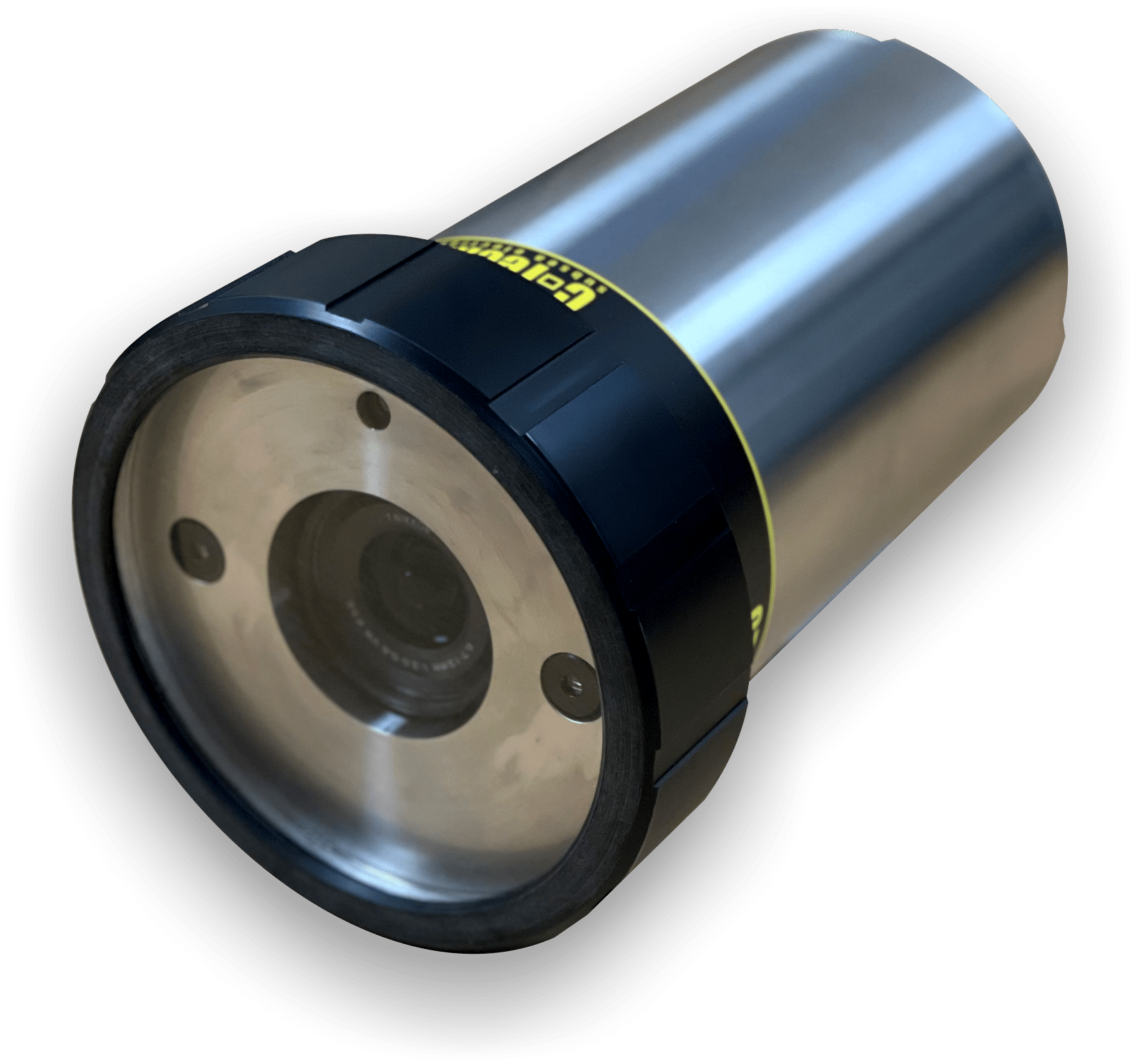
New camera technology brings huge savings and hugely improved performance
A new combined Stills-Laser-Video camera is taking the marine science market by storm.
C-tecnics have used new technology to bring huge savings for customers looking for a camera offering multi-functions required in aquatic and benthic studies. The system offers real time video and stills photography with built in lasers for scaling marine creatures.
The SLV Mk 2 camera minimises use of wiring and separate components to reduce costs in production and assembly and is significantly less than any competing system. The design results in an exceptionally robust product with up to date video processing technology.
Once the deployment has finished, all video recording and still images can be easily downloaded via a USB connector. Controls are through RS232/RS485 connection via software.
A major Scientific institute has recently exchanged older systems for the new product and are delighted with the increased performance and high quality images.
Transmark Subsea new representative for Boxfish Remotely Operated Vehicles in Europe
Transmark Subsea becomes the European distributor of ROV systems from Boxfish Research, New Zealand, expanding their offering of high-tech subsea solutions to help their customers operations stay relevant and effective.
Boxfish Research designs and manufactures industry leading, actively stabilised, ultra-high definition underwater ROVs and 360 cameras for submerged asset inspection, defence & security, marine science, energy, aquaculture, police and search & rescue, VR/ AR and cinematography. A tetherless, autonomous option is pending – stay tuned!
Distribution of Boxfish Research ROV systems complements Transmark Subsea’s diverse range of underwater solutions which include WiSub pinless connectors, DeepSea Power& Light cameras and lighting, as well as the company’s in-house range of subsea cabling and termination solutions.
“Boxfish Research is excited to be able to better serve our clients in Europe and expand our regional capabilities in partnership with Transmark Subsea,” said Craig Anderson, Co-Founder of Boxfish Research.
“Transmark Subsea is proud to become the European representative for this reputable product line”, said Transmark Subsea’s Managing Director Leif Hugo Arntsen. “Boxfish’s superior product range aligns very well with our development of Subsea resident solutions and swappable tools.”
For more information, please visit: www.transmark-subsea.com
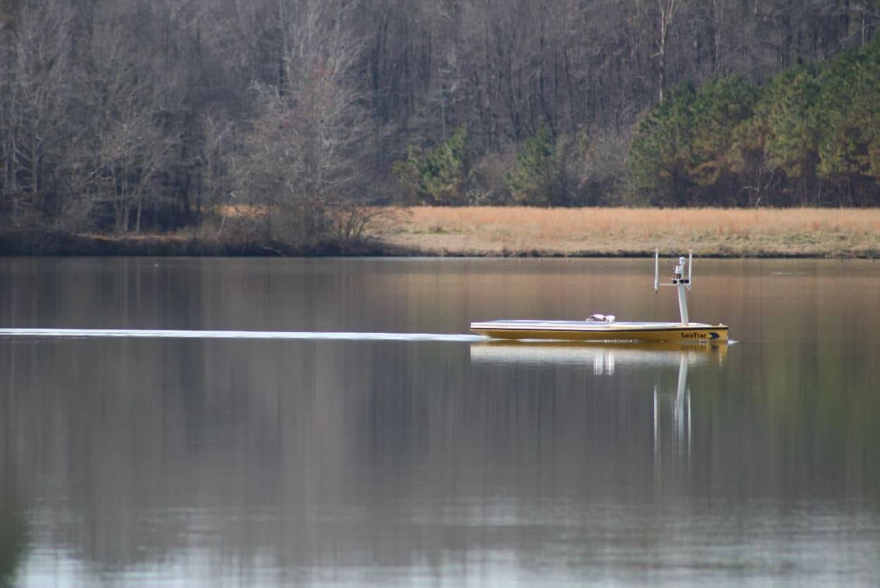
Top Mississippi State University Oceanographers Select SeaTrac SP-48 for Environmental Monitoring and Threat Assessment
SeaTrac Systems, Inc. (SeaTrac) is pleased to announce the sale and delivery of one of its SP-48 persistent Uncrewed Surface Vehicles (USVs) to a team at Mississippi State University’s (MSU) Geosystems Research Institute (GRI), in Starkville, MS. GRI selected the SP-48 to support a research study funded by the Army Corps of Engineers to study real time water quality monitoring and threat assessment of navigable waterways of the Gulf of Mexico region. GRI develops, operates, and maintains an increasingly integrated research and transition program, the results of which raise awareness and understanding of the Gulf region.
The MSU team was attracted to the SeaTrac platform for its ease of use and versatility to navigate in a variety of waterways, as well as its ample available power to support a rich payload over long durations. The custom payload includes the following: Pro Oceanus CO2-Pro CV sensor, Seabird SBE 63 dissolved oxygen sensor, 3 Seabird ECO Triplets, AML CT Sensor and AML pH Sensor.
“The team at SeaTrac is first rate; they can integrate anything and have been a pleasure to work with, pushing the envelope to fit into their boat all of our complex demands,” notes Dr. Robert Moorhead III, Director of GRI. “Because of its versatility, we plan on deploying the SP-48 in a number of our waterways, ranging from very shallow waterbodies to the open ocean in the Gulf.”
“Increasingly customers’ missions have grown in complexity requiring a range of sensors, and they’re looking for less costly, less resource-intensive and more flexible solutions to carry out a variety of tasks simultaneously in challenging marine environments,” said Buddy Duncan, Co-Founder, SeaTrac Systems. “We are pleased to help the MSU team achieve its real-time monitoring and data-collecting goals.”
The SP-48 is designed for users who require a flexible data gathering and communications platform that adapts to a wide variety of operational scenarios and payloads. The solar-powered, 4.8m SP-48 is a low-logistic, sensor-agnostic persistent USV with Automatic Identification System (AIS) collision avoidance, speed of 5kts, 500W payload power, and 70Kg payload capacity that can host a variety of sensors perfect for the collection and communication of real-time ocean data over long durations. Built to operate in all marine environments—from inland, near shore to open ocean—the SP-48 has a self-righting hull and efficient electric motor that frees it from reliance on wind or waves for propulsion. It is easily deployed from a boat ramp, pier or ship. Communications is achieved by line-of-sight Radio Frequency (RF), cellular, high-bandwidth satellite or custom networks.
For more information, please visit: www.seatrac.com.