

Industry Leader Q&A with Prof Edward Hill CBE
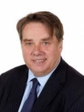 Professor Ed Hill is Chief Executive of the National Oceanography Centre (NOC) having been appointed as Executive Director in 2010, previously holding the position of Director at NOC since 2005 and the Proudman Oceanographic Laboratory (NERC) in Liverpool 1999-2005. Professor Hill has served and continues to serve on numerous national and international advisory bodies, including: the International Steering Group of the Global Climate Observing System (GCOS), the European Marine Board (EMB), the cross UK Government UK Marine Science Coordination Committee (MSCC), the Governing Board of the National Partnership for Ocean Prediction (NPOP).
Professor Hill’s research background is in physical oceanography, specialising in the circulation of continental shelf seas and participated in over 20 research ship expeditions, half of these as Principal Scientist. Professor Hill received his MSc and PhD degrees in oceanography from Bangor University and his BSc in applied mathematics from the University of Sheffield, and subsequently recognised by both universities with the award of an Honorary Fellowship (Bangor) and an Honorary Doctorate of Science (Sheffield). He was appointed a Commander of the Most Excellent Order of the British Empire (CBE) for services to environmental sciences.
-
How is your business adapting to the challenges of these uncertain times?
Like many organisations we had to adapt quickly to home working which we found worked well. A lot of science could be done remote which reduced the amount of staff working onsite. We found that engagement in large meetings was easier to manage when run as a remote event.
However, the biggest challenge was operating the research vessels which required scaling back. We made the most of this opportunity by having a period of maintenance with ship refits over the summer and were able to resume the expedition programme from September 2020, with reduced scientific parties involved.
We put in various layers of protection including the use of quarantining and made use of testing as and when it became available.
We continued to develop technology for ocean observations but the ability to test and trial is something we are looking forward to resuming as things get back to normal. Ultimately, science is a creative and social business that benefits largely from interaction with each other.
-
Please tell us more about how you are supporting your teams and/or local communities?
- Wellbeing programme – webinars, EAP, newsletters, virtual Pilates
- Staff trained in wellbeing to be point of contact for those who need it
- Open staff meeting – regular communication
- Regular check ins from line managers to staff
- Flexible working – allowances for home schooling
- Encouraging staff to look after mental health – encouraging daily walks, being flexible in work, not to stress about achieving as much as they would in normal circumstances
- We provided PPE to local hospitals during the first wave, which were printed at our facility by our staff
-
How do you think the industry will change? Are there potential opportunities?
Our primary focus is research and development. We are likely to see more flexible working in the future and we had already been looking to limit extensive travel, especially internationally, to reduce our carbon footprint. The restrictions on travel has given us an opportunity to participate in large international conferences remotely without the need to travel. We do expect to see more remote communications, although for early career researchers, networking face to face is extremely beneficial.
The pandemic also seems to have made the public more aware of the role of science. Science has clearly been important for providing solutions to the pandemic, and I think there is a great respect for science being used to deliver solutions.
-
What do you think are the main challenges ahead?
The scientific advice given to Government during the pandemic has underpinned some unpopular choices e.g. lockdown, which had an enormous impact on lives and businesses. Consequently, public and media has had a closer scrutiny on what scientists are saying, questioning the data and conclusions drawn from epidemical models. This is not necessarily a bad thing. Science based advice into government may expect greater public scrutiny especially when leading to major impacts on peoples like such as NET ZERO/green energy transition.
The main challenge, in a nutshell, is to continue great science with increased public interest and scrutiny at the same time recognising science is less about facts and more about uncertainty and therefore navigating the uncertainty of decision making based in science advice which is based on incomplete information.
-
What’s the most rewarding aspect of your job?
Seeing great science being done by very bright people across the institute and watching early career researchers develop and grow - making a real impact.
-
And the most challenging?
Recognising the scale and importance of what needs to be done to measure, observe and understand the ocean. Whilst the recognition that sea blindness (out of sight, out of mind) means that securing the resources to be able to do this is a continual challenge.
-
Who or what inspires you to be even better?
When I’m feeling frustrated, one of the best things is to take a walk around the building. I always learn something new from someone who perhaps has just discovered something or got an interesting idea about something. I’m inspired by their enthusiasm. I go back to my desk thinking, “Yes, this is totally worth it”.
-
Tell us a fun fact about yourself that most people don’t know.
I’ve climbed the Old Man of Hoy, a 449-foot (137-metre) sea stack. 8 hours up 2 hours down – not a world record!
-
What’s the best advice you’ve ever been given?
By my former boss once said: “I expect my Directors to direct. If you screw up, come and tell me. I won’t blame you, I just need to know. If you screw up repeatedly, I might begin to question your judgement.”
-
What advice would you give to someone starting out in the industry?
Anything is possible. Don’t limit yourself or your own ambitions. If you put your mind to it, it’s possible.
-
Why is innovation so vital to the ocean technology sector?
The ocean is an economic, environmental, geopolitical and technological frontier and we need new technologies to both measure and operate in the ocean, in ways that enable us to operate at scale and to have a continuous presence in the ocean. The technology that enables us to do this, are the technologies of the future, e.g. robotics, communications, autonomy, AI and big data analysis. These are the only things that are absolutely essential.
-
How important is Ocean Business to the ocean technology sector? Why would you recommend a visit?
As the CEO of the National Oceanography Centre, I would say it was very important and a unique opportunity to bring people together from across the industry; to be actually able to undertake hands-on demos of equipment in the water, with conferences and networking opportunities and with the opportunity to informally socialise and engage in the city of Southampton. All taking place in one of the top research institutions.
With a really great atmosphere, I definitely recommend a visit! If you come once, you will be back.

High Speed Transfers future proofs fleet with triple order from BAR Technologies and Chartwell Marine
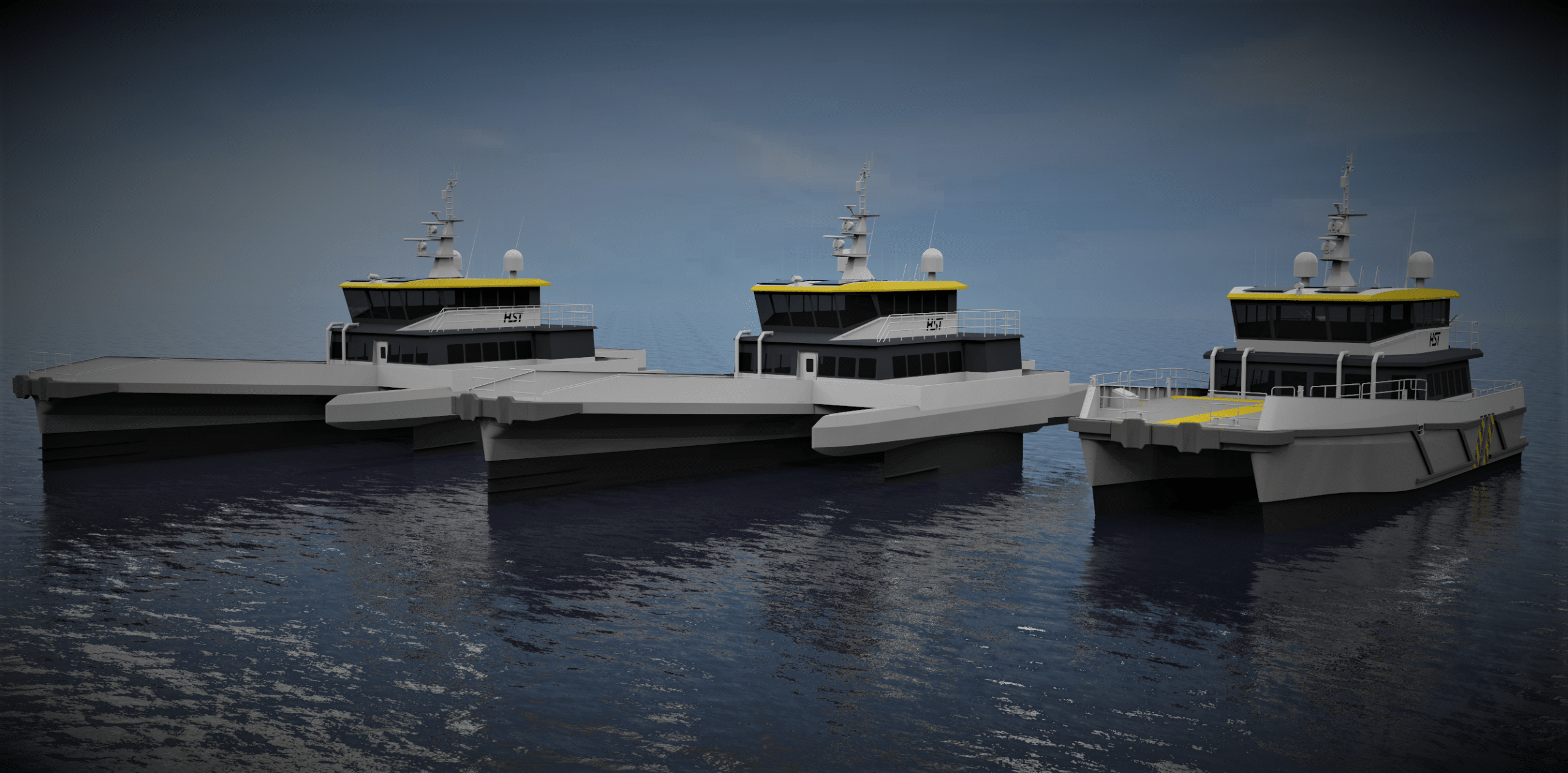
HST places order for two BARTech 30 CTVs and an additional Chartwell 24 in high-tech boost for offshore wind
High Speed Transfers (HST), an innovative crew transfer vessel (CTV) operator that supports the offshore wind energy and oil and gas industries worldwide, has confirmed its order of two BARTech 30 CTVs from innovative simulation-driven marine engineering consultancy, BAR Technologies, and an additional hybrid Chartwell 24, with BAR Technologies’ Foil Optimised Stability System (FOSS), from Chartwell Marine, a pioneer in next-generation vessel design. The vessels will be built at Diverse Marine, on the Isle of Wight, UK.
As offshore wind technology continues to evolve, and projects are developed further out to sea, the operational profiles that wind farm operators require have become diversified. Versatile fleets have become increasingly prized in the race to scale the sector in new markets. Equally, as decarbonising the vessel supply chain becomes a key imperative for wind farm owners and operators, BAR Technologies’ CTV is set to provide HST with fuel – and therefore emissions – savings of up to 30%.
Additionally, to ensure that new projects can be safely and efficiently maintained, vessel designers have risen to the challenge to deliver the next wave of innovation in offshore wind’s maritime supply chain – without sacrificing the proven characteristics that have underpinned the sector’s success to date. The two BARTech 30 vessels will offer HST the flexibility to operate year-round, benefiting from a significant reduction in vertical acceleration to ensure optimal performance.
HST’s order will ensure that the business is able to continue to provide the highest standards of comfort for passengers during voyages to wind farms even in regions that typically see higher sea states such as the US. The proven Chartwell 24 vessel formula will be further enhanced with BAR Technologies’ FOSS, offering improvements in seakeeping and boosting efficiency.
Crucially, the vessels will all have the same layout of the console, seating and bridge, adhering to HST’s strict safety specifications and ensuring operational familiarity for crew and passengers. All three vessels will be equipped with Reygar’s BareFLEET technology to give HST a granular view of fuel use and operational efficiency, delivering savings to clients and using data to demonstrate the concrete benefits of the vessel platforms to wind farm operations.
Tom Nevin, CEO, High Speed Transfers, said: “Offshore wind owners and operators have shown a real appetite for efficient, low-carbon vessel platforms. It is exciting to work with vessel designers such as BAR Technologies and Chartwell Marine who understand what the industry needs and have the expertise to deliver next-generation designs without overcomplicating the vessels. BAR Technologies’ FOSS is fast becoming a ‘must have’ and we are keen to demonstrate the capabilities of our new vessels to the market.”
John Cooper, CEO, BAR Technologies, said: “Offshore wind is about to enter a golden era, but the sector needs to be ready for rapid growth – and this means building out a solid global fleet. We are proud to support forward looking vessel operators such as HST as they tackle the challenges of future offshore wind operations head-on by adopting the latest innovations in vessel design.”
Andy Page, Managing Director, Chartwell Marine, said: “We looked at a broad suite of propulsion options for the vessel before deciding on the configuration that suits HST’s needs best, as we understand how important it is to maintain the core HST identity while continuing to innovate. By opting for a full complement of BARTech 30 and Chartwell 24 CTVs, HST has continued to show leadership in offshore wind by taking the next step in performance.”
John concluded: “Decarbonisation is the next great challenge for the offshore wind sector as it continues to expand into new markets. A crucial element of net-zero in offshore wind is reducing emissions in its maritime supply chain, using hydrodynamic expertise to deliver vessel platforms designed to reduce energy waste, opening the door to battery-electric drivetrains and cutting the carbon footprint of existing fuels.”
For more information, please visit: www.hst-marine.com, www.bartechnologies.uk or www.chartwellmarine.com
Sonardyne’s forward looking sonar now supported in NAUDEQ’s ECDIS
Marine technology company Sonardyne has announced its Vigilant Forward Looking Sonar (FLS) is now available as an external sensor interface for NAUDEQ’s electronic chart display and information system (EDCIS) MASTER-DEQ.
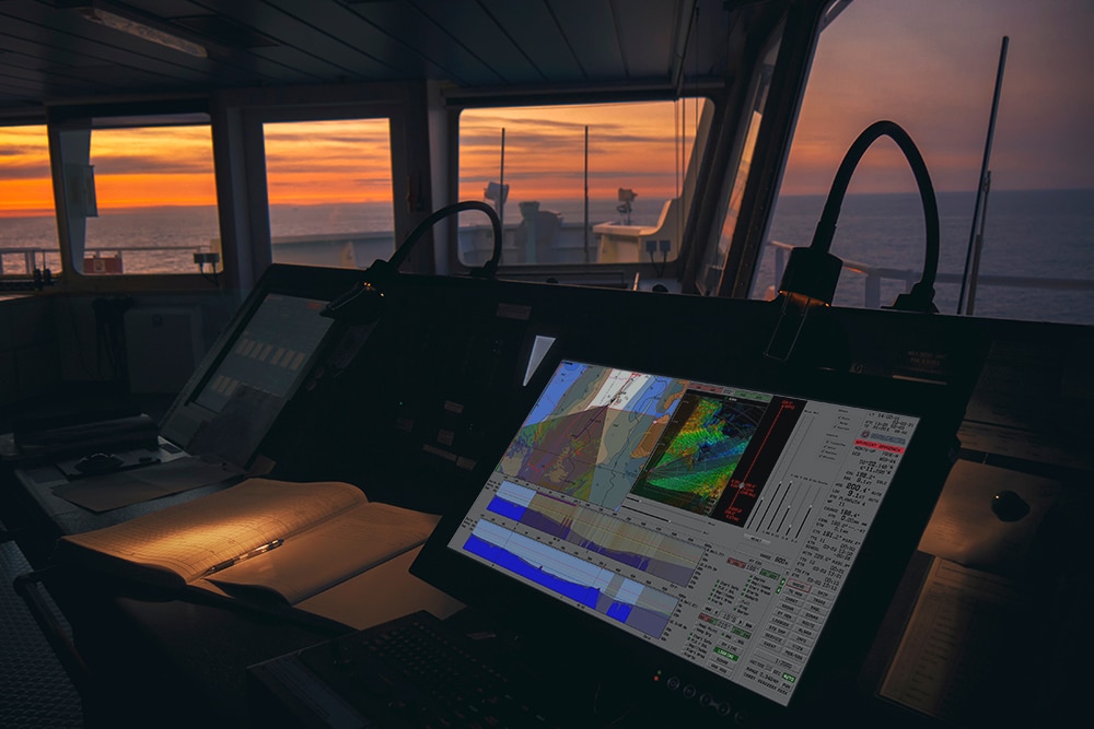
Sonardyne’s Vigilant FLS shows captains and crews where it is safe to navigate and alerts them to potential underwater dangers that could result in a collision or grounding. It can be used as standalone system or overlaid into third party ECDIS systems such as MASTER-DEQ. This means NAUDEQ’s naval, merchant and fishing vessel users can now take advantage of this valuable aid to navigation through Vigilant’s enhanced reality imaging overlaid on their MASTER-DEQ bridge display.
Using the sonar data from Vigilant, NAUDEQ’s MASTER-DEQ builds and displays cut profiles and 3D maps of the seabed, taking into consideration the tide level. Through MASTER-DEQ, mariners can also view cut profiles looking at their course over ground, obstacle avoidance coinciding with heading and a profile in a user-defined direction. By superimposing reliable Vigilant data on the seabed topography, built using NAUDEQ’s technology and using ENC S-57 data, a comparative analysis can also be run. Any discrepancies between the chart data and the real-world returns from Vigilant are then clear to see.
For more information visit: www.sonardyne.com

A-2-Sea are recruiting a Geophysicist
A-2-Sea are looking to expand their successful Survey Department, adding to their growing team of experienced professionals. This is an exciting opportunity for experienced Geophysicists, who wish to specialise in applying core geophysical skills in the coastal zone, to lead and develop A-2-Sea’s geophysical capability.
A-2-Sea place a great emphasis on the individual, when assessing suitability for a role. Surveying in the coastal zone is rewarding, but challenging, and in our experience suits people who are hardworking, dynamic, and driven in achieving the objectives of a given project.
Job description:
The position offers a variety of responsibilities that would require the successful candidate to lead A-2-Sea’s geophysical services. This role include working both offshore away from home in UK territorial waters and further afield, and onshore at A-2-Sea’s offices based in Romsey, to deliver all aspects of a project. The key roles of the position include:
- Planning and preparation of A-2-Sea survey projects.
- Mobilisation of survey equipment including Side Scan Sonar, Magnetometer, Gradiometer & Sub-Bottom Profiler.
- Working onboard survey vessels (12 and 24 hours operations), acquiring geophysical and hydrographic data with a variety of survey equipment.
- Data QC.
- Geophysical data processing, interpretation, and production of deliverables.
- Report writing and interpretation of results.
- Growing A-2-Sea’s geophysical capability
- Continuous investigation of new technologies to utilise in future projects.
- Development of A-2-Sea’s geophysical processes and procedures.
Essential experience:
- Experience of a variety of survey equipment including Edgetech and Klein Side Scan Sonars, Geometrics G882 Magnetometers / Gradiometers and Innomar Parametric Echosounders.
- A strong knowledge of using industry software including Chesapeake SonarWiz and Oasis Montaj.
- Minimum 4 years’ experience in marine geophysical survey.
- A higher education degree in geophysical or a technically related subject.
- Willing to work away from home for periods of generally 2 to 4 weeks although periods away from home can vary from a few days to a few weeks.
- A proactive approach to achieving tasks.
- Good interpersonal and written communication skills.
- A keen interest in working the coastal zone.
- Experience of working within a team but with the ability to work independently.
- Ability to understand how their actions impact their surrounding environment and the wider project.
- Possession of a full, valid UK driving licence.
Desirable experience:
- Experience of working on cable route and offshore renewable energy projects in shallow water environments.
- Ability to lead vessel mobilisations.
- Experience of operating a variety of sub-bottom profiler systems.
- Knowledge of GIS software.
- Holds valid offshore medical and sea survival certification.
This is an exciting opportunity for experienced Geophysicists to join and develop a growing and successful survey department.
To apply for this position please send your CV and covering letter to Nicola Tucker: [email protected]

A-2-Sea are recruiting Hydrographic Surveyors
Following a period of successful growth, A-2-Sea are looking to recruit Hydrographic Surveyors with varying levels of experience to join their continuously expanding Survey Department.
A-2-Sea place a great emphasis on the individual, when assessing suitability for a role. Surveying in the coastal zone is rewarding, but challenging, and in our experience suits people who are hardworking, dynamic, and driven in achieving the objectives of a given project.
Job description:
The position offers a variety of responsibilities that would require the successful candidate to work both offshore away from home and onshore at A-2-Sea’s offices based in Romsey, to deliver all aspects of a project, with opportunities for international travel. The key roles of the position include:
- Planning and preparation of A-2-Sea survey projects.
- Continuous investigation of new technologies, such as UAVs and ASVs to utilise in future projects.
- Mobilisation and calibration of survey equipment to A-2-Sea’s survey vessels as well as vessel of opportunity.
- Acquisition of hydrographic and geophysical data using a variety of survey equipment.
- Data QC.
- Data processing and production of deliverables.
- Report writing and interpretation of results.
- Development of A-2-Sea’s processes and procedures.
Essential experience:
- Experience of a variety of survey equipment including Kongsberg, R2Sonic, Norbit and Reson multibeam systems, positioning systems and USBL systems.
- A higher education degree in hydrographic surveying (ideally IHO Cat-A accredited) or related science-based subject.
- Willing to work away from home for periods of generally 2 to 4 weeks although periods away from home can vary from a few days to a few weeks.
- A proactive approach to achieving tasks.
- Good interpersonal and written communication skills.
- A keen interest in working the coastal zone.
- Experience of working within a team but with the ability to work independently.
- Ability to understand how their actions impact their surrounding environment and the wider project.
- Possession of a full, valid UK driving licence.
Desirable experience:
- Experience of working on nautical charting, cable route and offshore renewable energy projects in shallow water environments.
- Ability to lead vessel mobilisations.
- User of software including Caris HIPS & SIPS, QPS QINSy, QPS Qimera, BeamWorx AutoClean, QPS Fledermaus and Kongsberg SIS.
- Experience of operating Side Scan Sonar systems with data acquisition and QC.
- Knowledge of GIS software.
- Holds valid offshore medical and sea survival certification.
This is an exciting opportunity for experienced Hydrographic Surveyors to join and develop a growing and successful Survey Department.
To apply for this position please send your CV and covering letter to Nicola Tucker: [email protected]

Amphibious vehicle auto-pilot for British Army
The team at Dynautics recently worked closely with Ultrabeam Hydrographic on a MoD Defence and Security Accelerator (DASA) funded project, ‘Map the Gap’, run on behalf of the Defence Science and Technology Laboratory (Dstl). Ultrabeam, in conjunction with Foundry Cube Ltd (a subsidiary of Ultrabeam Limited), was awarded one of five contracts to develop a remotely-operated reconnaissance aid to help British Army troops safely and stealthily advance across water obstacles in enemy territory.

Crossing challenge
Currently, the only way of identifying suitable water crossing points is to send Royal Engineer reconnaissance troops to survey both banks of the river – exposing them to danger which also risks compromising the operation by signalling interest in that location to the enemy. The aim therefore is to ultimately remove personnel from these dangerous tasks with a remote system that allows more crossing locations to be surveyed, increasing the choices available to commanders and giving an opportunity to surprise the enemy.
Tailored solution
Ultrabeam’s goal was to demonstrate the capabilities of their autonomous and amphibious hydrographic survey vehicle – the Argocat – in meeting the challenges of this crucial work.
As a strategic partner, Dynautics is sharply focused on the ultimate goals of its customers and the team immediately started work on honing autopilot specifications to support the Ultrabeam team in achieving their mission. Dynautics’ key task was to develop its MicroSPECTRE autopilot hardware to drive the Argocat. This included the consideration of: joystick-based remote operation; the ability to follow a straight-line heading or pre-planned mission tracks; steering, heading control and track keeping both for land and waterborne operations and collision avoidance measures.
“We thrive on new integration challenges to existing systems. The team had never attempted to control a vehicle both on land and in the water before, but we were able to adapt our SPECTRE Autopilot quickly and effectively. It goes to show really how robust and capable our solutions are.”
Henry Robinson, Dynautics CEO

Successful field trials
Dynautics’ autopilot products enable tight heading and speed controls, track following (including event management at waypoints), vehicle following, collision avoidance, attitude and depth control as well as hovering and dynamic positioning. Traditionally used for marine vessels, such as uncrewed surface vessels (USVs), adapting MicroSPECTRE for an amphibious vehicle was a new challenge that the team rose to, with successful field trials being completed in December 2020.
Moving forward
The second phase of the Map the Gap project has now been launched and Dynautics continues to work closely and collaboratively with Ultrabeam Hydrographic. More news coming soon!
Watch the video for more info on the Argocat and phase 1 trials:
For more information visit: www.dynautics.com/2021/02/26/amphibious-vehicle-auto-pilot-for-british-army
The Hydrographic Society UK Announces Hydro 21 Conference and Exhibition
The Hydrographic Society UK (THS UK) are pleased to announce that they will be hosting the Hydro 21 conference from 16th to 18th November 2021 at Cork City Hall, Cork City, Ireland. Hydro 21, is the latest in the International Federation of Hydrographic Societies' world-renowned series of hydrographic symposia which date back to 1976.
Hydro 21 will incorporate the THS UK postponed Remote Hydrography conference but will be further expanded in terms of papers, exhibition and aligned events, and will retain the theme of ‘remote hydrography’. The speakers that were originally selected have been invited to refresh or revise their papers, it is likely that a further call for papers will be issued in May 2021.
THS UK Chief Executive, David Parker said: “Whilst we were very disappointed to have postponed our Remote Hydrography Conference twice in 2020, we are now looking forward to delivering an even better event in 2021. Hydro 21 will be a fantastic event that provides the hydrographic community with the opportunity for education and networking. To further connect with our Irish Region of THS UK we have also decided to host the event in Cork, Ireland. We would like to thank all of our Members, Speakers, Sponsors and Exhibitors for their patience and continued support.”
Seán Cullen, Chair and Regional Director of THS UK commented: “The Hydro 21 Conference and Exhibition will run immediately after the annual INFOMAR Seminar at the same venue – allowing for a greater networking opportunity for hydrographers in Ireland to meet up with the wider industry”.
Sponsorship and exhibiting opportunities will be released in the coming months.
For further information please contact us: [email protected]
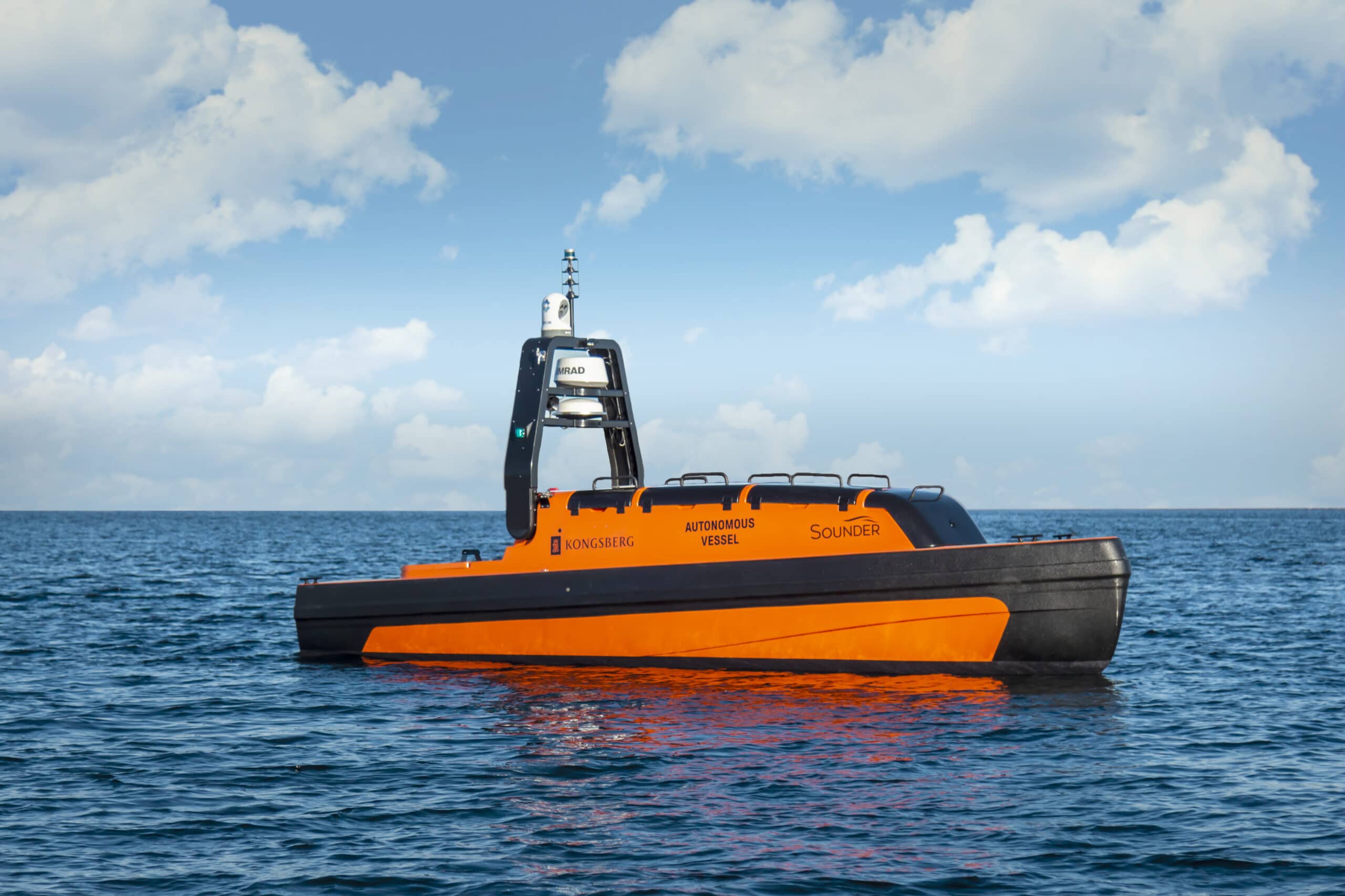
KONGSBERG secures contract to deliver full solution for ecosystem monitoring using autonomous vessels
Kongsberg Maritime is pleased to report that it has reached an agreement to supply Norway’s Institute of Marine Research (IMR) with four autonomous vessels. The scope of supply includes two Kongsberg Maritime Sounder USVs (Unmanned Surface Vehicles) and two KONGSBERG AUVs (Autonomous Underwater Vehicles), which will form the practical basis of the institute’s long-term strategy to develop the monitoring and management of marine environments and resources.
The four autonomous vessels will be equipped with KONGSBERG’s new Blue Insight, a cloud-based ecosystem designed to facilitate remote instrument operation, data visualisation and smart management of oceanographic and meteorological data. Infrastructure for automated classification of fish through machine learning is a key feature of the delivery, consolidating the long-running partnership between KONGSBERG and the IMR towards the goal of implementing seagoing drones for ecosystem management.
The KONGSBERG AUVs are scheduled for delivery this year, with the USVs following in the late summer/early autumn of 2022. The AUVs are depth-rated to 1,500m and are equipped with a powerful payload for environmental monitoring and seabed mapping. The IMR USVs will be equipped with a full EK80 wideband system accommodating ADCP functionality, similar to the setup on their existing research vessels. Importantly, control and navigation of both AUVs and the Sounder USVs can be handled just by a single interface. The comprehensive overview provided by this fleet management capability enables interoperability between all assets and reduces in-mission complexity.
This integrated autonomous survey solution is the first to merge AUV and USV operations, and the investment testifies both to the IMR’s future- and sustainability-focused ambitions and to its faith in KONGSBERG’s ability to supply the most advanced autonomous craft.
As one of the largest marine research institutes in Europe, the IMR is committed to promoting sustainable practices at sea, and digitalisation is a cornerstone of this policy. Stimulus programmes introduced last year to facilitate remote working during and after the pandemic have accelerated the institute’s wholesale adoption of high-tech digital solutions, supported by a substantial digital investment by Norway’s Ministry of Trade, Industry and Fisheries, in addition to external research grants.
“As we embark on the next stage in this project, we are happy to do so alongside our trusted and long-term partner Kongsberg Maritime,” says the IMR’s CEO, Sissel Rogne. “We are seeing a wide range of changes in our coastal and ocean ecosystems – and these changes happen fast. In response to this, we must streamline and increase our management efforts. To obtain this we need innovative and reliable partners, and the cooperation with Kongsberg Maritime is therefore vital to us. Their USVs and AUVs will initially work alongside our traditional research vessels in an ‘armada strategy,’ but will subsequently operate more independently as we expand our plans.”
“We’re very pleased to have secured this contract with the IMR,” adds Tonny Algrøy, Sales Director, Ocean Science, Kongsberg Maritime. “This delivery builds upon decades of collaborative work with the IMR to create innovative solutions for ocean ecosystem monitoring, and the addition of smart platforms plus a new E-infrastructure solution is a logical next step in this shared history.”
For more information visit: www.kongsberg.com/maritime
Greensea Announces Free Webinar Series
A Unique Webinar Series of Conversation & Discovery for the Marine Industry
Greensea, creator of OPENSEA®, the universal open architecture software platform for the marine industry, announces an entertaining and educational webinar for anyone interested in robotics, entrepreneurship, and the marine industry. The webinar series, entitled The Mixtape Sessions, will be led by a variety of different speakers (both Greensea employees and other partners) and will take on different formats based on the discussion topic with all sessions allowing for an open conversation between speakers and participants.
“Like everyone else, Greensea has been unable to meet face-to-face with our customers, partners, or employees,” says Greensea CEO, Ben Kinnaman. “After a long winter in Vermont, we wanted to do something virtual, but also something that gets away from ‘the standard corporate webinar’ format. We want to have open and honest conversations with people about the issues and concerns that face all of us working in the marine industry. Hopefully, people will leave a Mixtape Session feeling like they learned something they might not have known and that they have had a good time. ”
Kinnaman goes on to say, “All of the presenters are passionate about their chosen topics. Most of us aren’t professional public speakers, so Greensea’s Mixtape Sessions may lack that corporate polish, but they should be fun. I’m hoping to present from Greensea’s neighborhood pub, if they’ll have me, to ensure that the atmosphere for my topic is even more relaxed.”
The first Mixtape session will be held March 24th on the topic “An Open Architecture Framework for the Next Generation of ROVs” and will be conducted in an interview format with Ben Kinnaman being interviewed by Marybeth Gilliam, Greensea CMO.
The Mixtape Session series will run through 2021, with an event happening most months. For more information, and to register, visit: Greensea.com/events.
We want to hear from you as well, if you would like to collaborate on your own Mixtape session, email [email protected]. Mixtape Sessions will be recorded and available for download by registered users after each event.
OBIC are recruiting an Instrumentation Software Engineer
The Ocean-Bottom Instrumentation Consortium (http://www.obs.ac.uk), operated by Southampton and Durham Universities, designs, builds, and operates instruments on the seabed in the deep oceans. Our autonomous instruments are deployed for up to a year to record variation in water pressure, ground vibration, and electric or magnetic fields.
OBIC are looking for an enthusiastic and versatile software engineer to be based at the University of Southampton’s Waterfront Campus to help develop its next generation of seabed scientific equipment that will be deployed all over the world. Joining a small but highly skilled team of engineers, you will prototype, develop and test embedded firmware, as well as maintaining and improving a suite of data processing and visualisation code. This role would suit a programmer with a strong track record of development in C, who is enthusiastic about seeing their code go to production collecting unique datasets globally at the bottom of the Earth’s oceans. This post offers global travel and working at sea, providing the key data sets required by scientists working at the forefront to better understand planet Earth.
Informal enquiries can be made to Profs Tim Henstock ([email protected]) or Christine Peirce ([email protected])
For more information and to apply visit https://jobs.soton.ac.uk/Vacancy.aspx?ref=1325421HN-R