
New collaboration brings together high speed ROV capability and reduced costs
Created in response to Covid-19 operational requirements
Two Scottish companies, Aberdeen-based Underwater Contracting (UCO) and Gulfxstream from the Isle of Lewis, have entered into a working collaboration that will reduce costs of underwater inspection and survey.
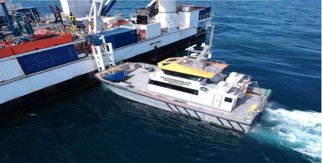
The agreement sees the permanent installation of one of UCO’s observation and inspection ROVs aboard Gulfxstream’s MV Viking. This means the spread can be mobilised at short notice and, with MV Viking’s cruising speed of 20 knots and able to operate 60 miles from shore, rapidly transit to location, significantly cutting mobilisation costs.
Stationed at Peterhead in North-east Scotland, and servicing the O&G, renewables, decommissioning, and marine sectors, the vessel and ROV will be equipped to carry out a full range of specialist support services.
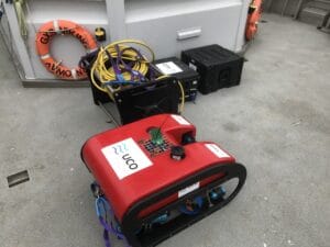
Depth rated to 300m, the ROV is fitted with sonar and underwater cameras. Additional sensors such as 3D cameras, laser metrology and survey tools can also be fitted to the ROV. MV Viking is certified to carry 12 people and, with ample deck space, means client personnel and equipment can be onboarded for a range of mission specific tasks.
Projects are envisaged to include underwater inspection of marine and renewable structures, hydrographic surveying, environmental monitoring and ocean research, search and rescue, hull inspections at sea or in port, emergency response for cable and pipeline damage identification, aquaculture survey and support, media and film production and even unique leisure experiences.
In addition, it can provide UWILDs, EOD and MMO support, seabed surveys, wave buoy deployment, salvage support and guard duties, equipment, personnel transfer and also for fuel transfer, thanks to its high fuel capacity.
The collaboration came in response to the impact Covid-19 is having on some offshore operations, creating a need for a fast, quickly mobilised service capable of carrying out a variety of tasks across a range of disciplines.
Calum Buchanan, MD of Gulfxstream, said: “This exciting collaboration with UCO comes at a time when there has been a marked increase in enquiries for our vessels for activities such as the servicing of offshore renewables sites, inspection of vessels stationed at sea, personnel transfer and similar tasks due to the effect Covid-19 is having on operations.
“The combination of the ROV and vessel in a cost effective package gives clients access to a single source solution for services, pre-mobilised and ready to work at very short notice. We believe this new way of working will bring efficiencies to marine operations for the future beyond COVID-19.”
Mick Bower, General Manager of UCO, said: “We are proud to work with Gulfxstream in bringing a solution to market that offers clients access to innovative technology and services from a highly adaptable platform. Giving them access to such a comprehensive range of services in one package will allow them to make optimum use of the time on hire to carry out other tasks.”
A rollout of the service to west Scotland and other ports around the UK is now being planned, a move which is expected to create additional jobs and further investment in the two companies. Two additional Gulfxstream vessels are ready for deployment for the next phase of growth, the GXS Valtos which has can operate 150miles offshore and the GXS Venturer, a high speed commercial RIB.
For more information please visit: www.underwatercontracting.com


RBR Welcomes John Kumhyr as Vice President of Sales and Marketing
RBR is pleased to welcome John Kumhyr as the new Vice President of Sales and Marketing. John comes to RBR with more than 25 years of experience in technology, sales, and business development. He will lead the RBR sales and marketing team into the Decade of Ocean Science. "A strong background, sales talent, and a highly personable leader - John will excel in this role and help take RBR to the proverbial 'next level'," said Greg Johnson, President of RBR.
Learn more here: http://bit.ly/3eAQNfJ

Revision of the Guidelines for GNSS Positioning in the Oil and Gas industry published by IOPG and IMCA
The updated ‘Guidelines for GNSS Positioning in the Oil and Gas Industry’ has been released by the International Association of Oil & Gas Producers (IOGP) as IOGP Report 373-19 and the International Marine Contractors Association (IMCA) as IMCA S 015. The report is a joint publication of the IOGP Geomatics Committee and IMCA’s Offshore Survey Division Management Committee and has wider use than purely by the oil and gas industry.
The document provides guidelines for the use of global navigation satellite systems (GNSS) to position vessels, vehicles, and other fixed and mobile installations. Although primarily aimed at oil exploration and production (E&P) related surveying and positioning activities, the principles and recommendations of the Guidelines are equally valid for any similar activities where precise position is critical, for example: offshore renewable energy plant, cable laying operations, harbour construction and management.
The report was originally produced in 1994 by UKOOA, the predecessor of Oil and Gas UK (OGUK), as a response to the development of commercially viable satellite-based positioning. A thorough revision of these guidelines was published in 2011 by a workgroup formed from representatives of IOGP’s Geomatics Committee (the custodians of the document), IMCA, and the marine seismic survey technical community. In fact, IMCA’s Offshore Survey Committee and IOGP’s Geomatics Committee work together regularly holding joint workgroups to ensure accuracy and relevance of such guidelines.
As Nick Hough, Technical Adviser – Offshore Survey at IMCA explained:
“The newly published updated second revision of the Guidelines takes account of the many developments in technology, procedure and practice that have occurred since the first revision some ten years ago.
“The document has been written as far as possible in plain and general terms to provide guidance to those wishing to use GNSS techniques and requiring a suitable authoritative source to support them. It assumes a basic knowledge of GNSS and includes references to textbooks and other sources to encourage readers to refer to these for in-depth descriptions of the principles.”

IOGP Report 373-19 / IMCA S 015 is available to members of both organisations to download free of charge at IOGP bookstore and www.imca-int.com/store/digital-publications/survey/ for members of IMCA.
MacArtney strengthens its sales focus in the UK and Ireland
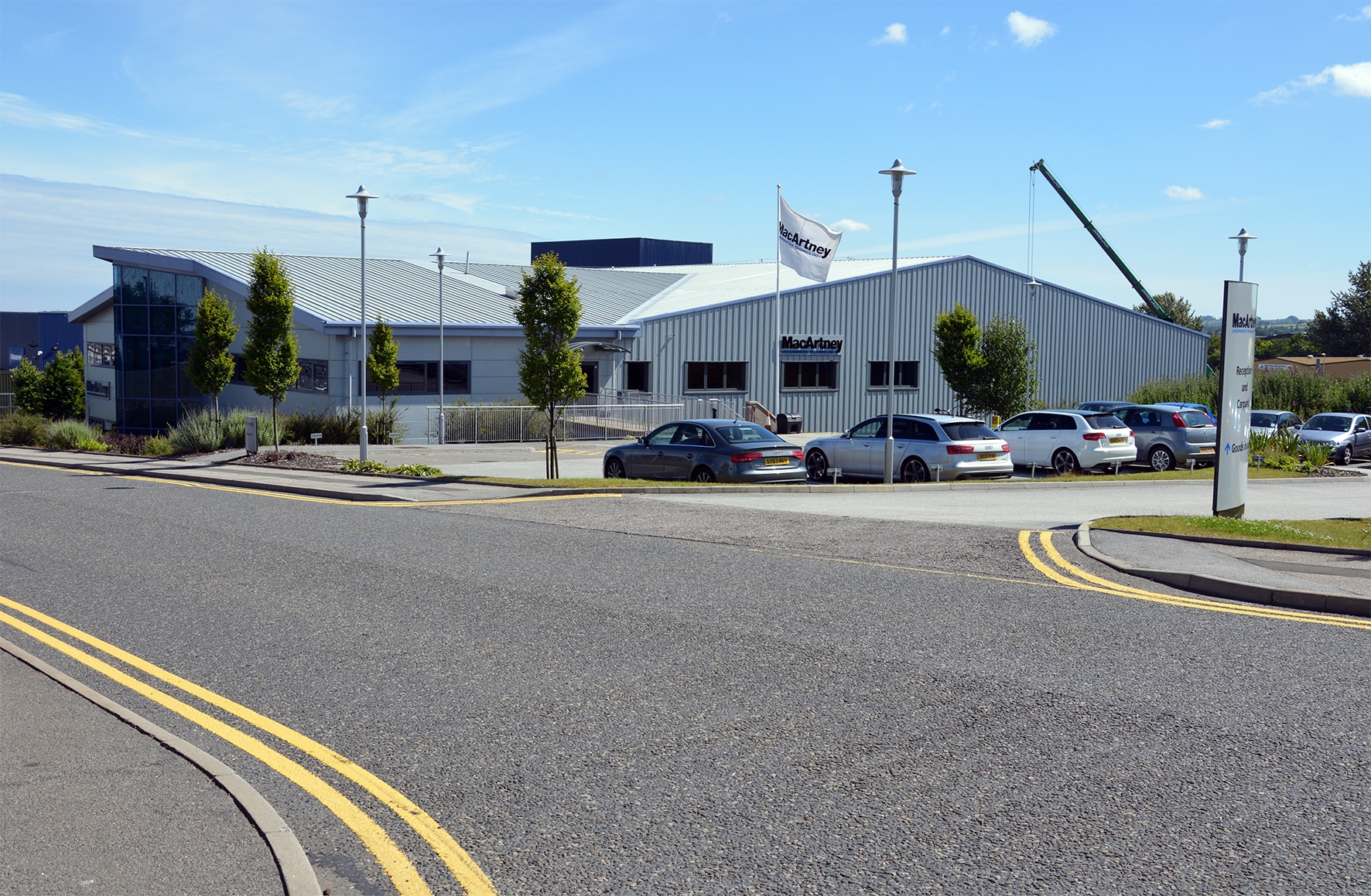
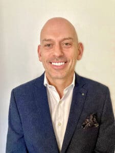
MacArtney UK appoints Kevin Murray as the new Head of Sales.
Kevin brings large-scale expertise from positions worldwide and will contribute towards ambitious growth plans alongside Managing Director Phil Middleton.
He will be joining the Group in its Aberdeen office on 8 March.
For more information visit: www.macartney.com
Marine Autonomy Challenge (MAChallenge) Relaunching in 2021!
After the disappointment of having to cancel MAChallenge 2020 due to Covid-19, the Society of Maritime Industries (SMI) is excited to announce that we will be launching our Marine Autonomy Challenge on Friday! A key mission of the Maritime Autonomous Systems Group (MASG) Council is to encourage young technologists and help develop careers that contribute to the future of the UK’s MAS industry.
This exciting challenge is open to teams of students studying at UK universities. The first phase involves a video submission and the finals take place in November this year. Each qualifying team will be provided with an industry simulator to enable them to build the autonomous behaviours required to achieve a series of challenges. These will be carried out using a 2m catamaran that has been specially designed, built and equipped for MAChallenge – a cash prize of £2000 awaits the winning team. Our aim is to bring on the next generation of marine technologists and to encourage development and take-up of marine autonomous systems technologies in the UK.
If you haven’t done so already and want to join our list of generous sponsors, then please get in touch with Emma Johnson at SMI.
Visit www.maritimeindustries.org/Maritime-Autonomy-Challenge for more information and an announcement on Friday!

Seiche Ltd and Deep Vision Inc. Announce Collaboration to Develop Real-time Camera System for Automated Detection, Geo-location and Quantification of Marine Mammals
Seiche Ltd and Deep Vision Inc. have signed a Memorandum of Understanding (MoU) to establish a collaborative relationship in support of their respective business interests.
Seiche has expertise in the field of maritime environmental monitoring; in particular, Seiche has developed a unique camera system, as implemented in their Mini Dual Camera, that has been specifically designed to aid the observation and monitoring of marine mammals (and other surface, and near surface objects).
Deep Vision has expertise in the field of computer vision and unsupervised machine learning; in particular, Deep Vision has developed a highly advanced, unique, passive EO/IR technology that provides robust, real-time detection and tracking of marine mammals, vessels and other maritime assets on, or near, the surface of the water.
Under this MoU, the two companies will advance collaborative efforts to develop a real-time camera-based system that can automatically detect, geo-locate, and quantify the presence of marine mammals and other maritime assets. The system will be resilient under all weather conditions and operable at both surface level and above, e.g. mast mounted for ships. By leveraging state-of-the-art unsupervised machine learning techniques, the system will be truly autonomous.
Both Seiche and Deep Vision have strongly aligned environmentally focused business goals and feel that this partnership will be mutually beneficial both for their respective organisations and for their key stakeholders.
Mark Burnett, CEO of Seiche Ltd, comments: “We are excited to be working with Deep Vision and their cutting-edge technologies, particularly their software capabilities that can rapidly assess changes in the environment and automatically tune detection algorithms to optimise performance. Our Seiche camera systems are currently providing environmental monitoring to clients around the world and this is an important next step in the provision of this technology to further protect marine life.”
Alan Parslow, CEO, Deep Vision, adds: “We are thrilled to be working with Seiche, one of the most respected and forward-looking environmental monitoring companies on the planet. We are confident that the proposed system, once realised, will become a significant tool in protecting marine life. We are certain that such a tool is crucial for the ultimate survival of the North Atlantic right whale.”
For more information on Seiche Ltd, visit www.seiche.com
For more information on Deep Vision Inc, visit www.deepvision.ca

RIEGL Webinar Recording - LiDAR Bathymetry: New Tools and Workflows for RIEGL's Next Generation Bathy Sensors
The recorded webinar „LiDAR Bathymetry: New Tools and Workflows for RIEGL's Next Generation Bathy Sensors” by Joshua France is now available at the RIEGL Video Lab: https://www.youtube.com/watch?v=KcTN3Vm2ti4
Why accurate subsea navigation was vital for an ROV assisting with deep ocean research
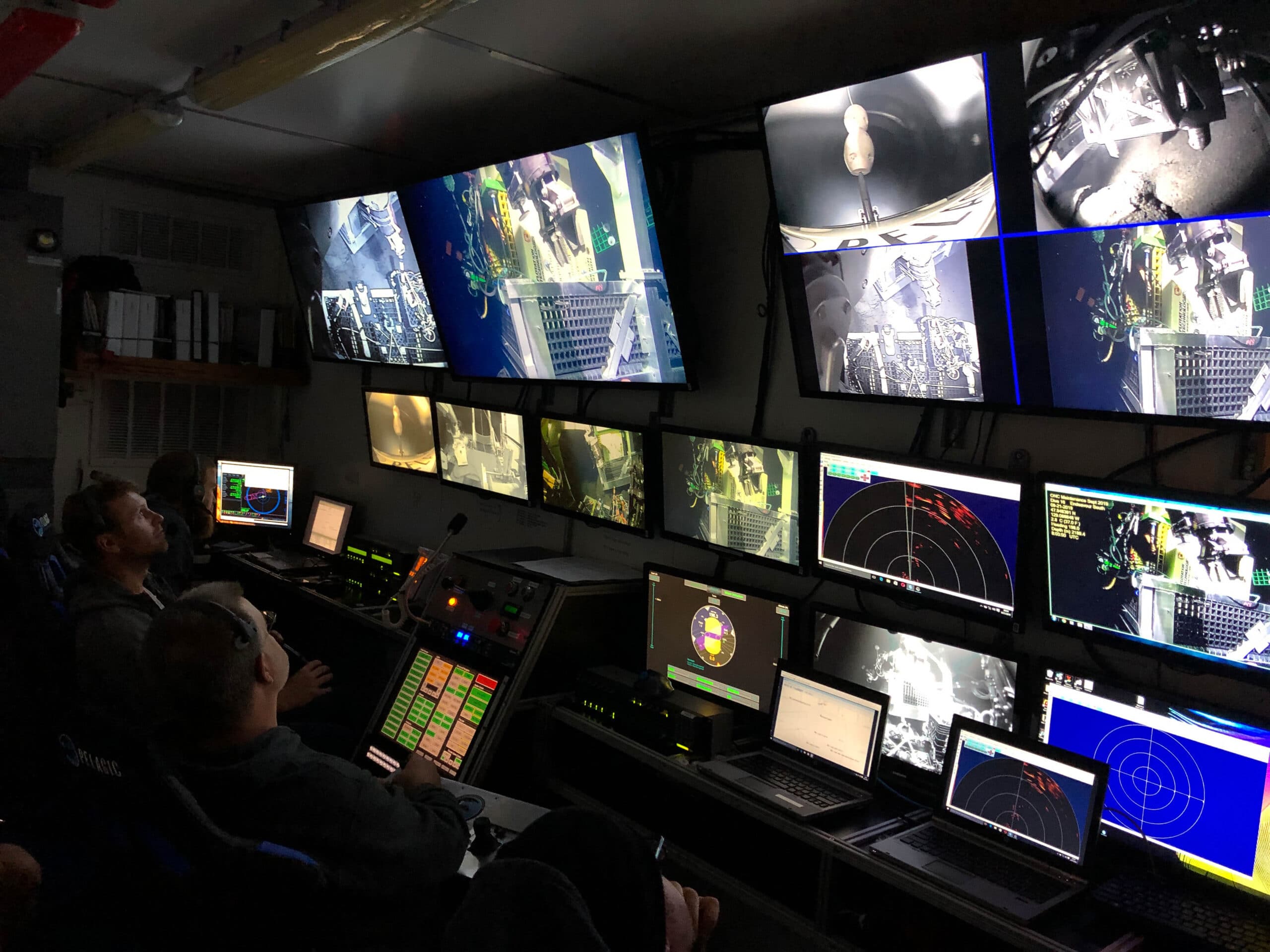
Pelagic Research Services was looking to improve the accuracy of the subsea navigation systems on its ROV. Find out how an accurate and high-performing DVL paired with an inertial navigation system enabled smooth operation in tricky conditions by hydrothermal vents in the deep ocean.
Pelagic Research Services, based in Cape Cod, has been carving out a niche in the remotely operated vehicle (ROV) market with its versatile Odysseus vehicle, which can carry out a wide variety of duties despite its small footprint.
The ROV is capable of providing real-time HD imagery, lifting loads of up to 4000 lb (1814 kg – in-air weight) and using seven-function manipulators to carry out precise work in water depths down to 6000 m.
The ROV has proved to be a flexible tool for University of Victoria’s Ocean Networks Canada (ONC), which installs infrastructure in the waters around Canada’s coasts to deliver data in real time for scientific research to help government and industry decision-making on future projects.
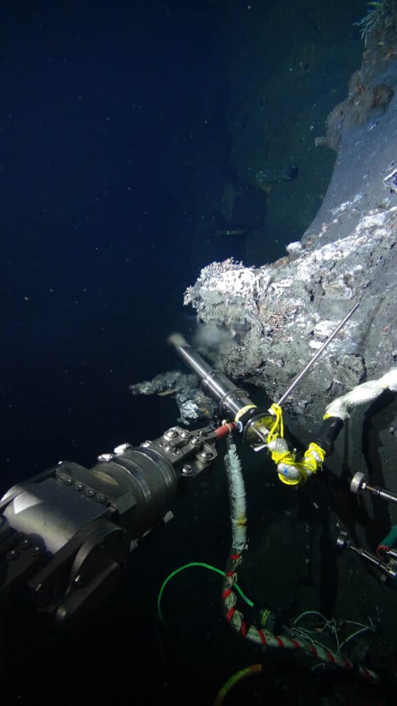
As part of ONC’s “Wiring the Abyss” program, Odysseus has carried out several assignments. Operating in one of the most hostile underwater environments on the planet, the ROV has enabled ONS to monitor and install infrastructure in an area of hydrothermal vents some 200–300 km offshore Vancouver Island at depths of greater than 2200 m.
(Photo ©: Ocean Networks Canada and Pelagic Research Services.)
Accurate navigation is vital in a complex subsea environment
The vents provide a unique habitat, so they have long been the target of serious investigation. But this is not an environment that is easy to work in or get around.
“It can take one or one-and-a-half hours to get to the sea floor at 2200 m, and you might be limited by a weather window, so once you get down there, you need to be able to work quickly and effectively. To do that, accurate navigation is vital,” says Ed Cassano, Pelagic’s Chief Executive.
(Photo ©: Ocean Networks Canada and Pelagic Research Services.)
A high-accuracy DVL and inertial navigation system to pinpoint subsea location
An inertial navigation system (INS) on board means the Odysseus can navigate with considerable precision across the tricky contours around the hydrothermal vents. But an INS only functions correctly if it knows its exact starting location, and that is not straightforward in this environment.
An ROV’s INS routinely uses ultra-short baseline (USBL) acoustic positioning, which sends pings from the ROV to a transceiver on the surface vessel that can then be interpreted to provide positional data. But that becomes less accurate the deeper the ROV goes and the greater the number of water layers of differing density the sound must pass through, as changing density alters the acoustic properties of water.
Even the highly accurate USBL system Pelagic was using routinely resulted in positioning errors of around 25 m down on the seabed. That might be fine for navigation in some deployment scenarios, but not for the precision work required around the hydrothermal vents.
So, Pelagic needed input independent of surface-based technology to accurately establish the ROV’s position. This is where Nortek’s Doppler Velocity Log came in.
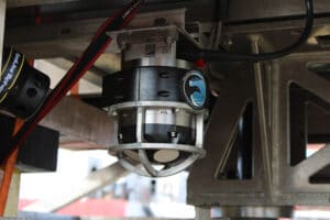
A DVL fires acoustic pulses from its transducers on board the ROV into the water at various distances from the vehicle and then records the time it takes for each of those pulses to be reflected back to the transducer from particles in the water. By applying equations based on the Doppler effect to this data, as well as using proprietary algorithms, this DVL can calculate the ROV’s speed very accurately.
Because it requires no direct input from the surface to do this, a DVL makes an ideal aid for inertial navigation systems. Once the position of the ROV’s INS has been fixed at a point where surface-based positioning technology can function correctly, accurate velocity readings from the DVL on board the ROV will then help maintain the accuracy of the INS, even when Odysseus is moving around areas where USBL positioning is not viable.
Pelagic integrated the Nortek DVL1000, a Doppler Velocity Log combining accuracy with a small footprint, to their ROV. The 1 MHz DVL, which has a maximum operating depth of 4000 m, is widely used by subsea operators, not just because of its light weight and compact form, but also due to its high accuracy, state-of-the-art technology, and ability to operate close to the seabed.
“The DVL1000 integrated seamlessly with the INS system right off the bat. After the first time we took it into the field, the client basically said: ‘You’ve solved navigation for us,’” Cassano recalls.
Improved efficiency in subsea navigation means cost savings
“We were able to move around the subsea spires and vents with confidence and with great efficiency. It really allowed the world to come into focus for us down there. And that meant we had more time to do the work and get the job done faster, which can save thousands of dollars for the client just by speeding it up,” says Cassano.
Given some of the equipment being deployed around the vents can cost hundreds of thousands of dollars, mislaying it is not really an option with which anyone involved wants to be presented. The accuracy and reliability of the Nortek DVL1000 has helped ease stress levels among the crew too.
For more information visit: www.nortekgroup.com
The Economist Group and The Nippon Foundation launch a new initiative to promote ocean health
Back to Blue, a new initiative from The Economist Group and The Nippon Foundation, launches today at the 8th annual World Ocean Summit. With an initial focus on ocean pollution, the three-year collaboration is a response to the escalating challenges posed by plastic pollution and, less visibly, pollution from nutrients and chemical contaminants that are damaging ocean life and ecosystems, and in turn human health. The programme, now under development, has been supported by findings from a Back to Blue global survey* which place plastic pollution (59.6% of respondents) and chemical pollution (39.1%) as the top two concerns, followed by climate change (31.1%).
The opportunity to embark on original research, stimulate fresh dialogue and explore new solutions to the vexing problems posed by pollution in the ocean is motivating both organizations. The Economist Group, through its World Ocean Initiative and World Ocean Summit, has been fostering a global conversation on the greatest challenges facing the seas. The Nippon Foundation - with its diverse programmes building and nurturing ocean networks, research and professionals - has a global reputation for championing ocean science and health. The Back to Blue initiative brings together two organizations that share a common understanding of the need for evidence-based approaches and solutions to the pressing issues faced by the ocean, offering a powerful platform from which to accelerate momentum for improving ocean health.
During remarks at the signing of a memorandum of understanding between the two organisations, Yohei Sasakawa, chairman of The Nippon Foundation, warned that “we are much aware of the land-based problems that occur around us[...]; however, when it comes to understanding the multifaceted problems of the ocean that covers 70% of the earth surface, I believe that our understanding is still very poor. This is already a threat to human security for every individual on this planet.”
Echoing these sentiments, Lord Deighton, chairman of The Economist Group, said: “We [at The Economist Group] have also developed our own passion for the ocean. We held our first World Ocean Summit in 2012, after we had argued in the newspaper that the seas were in trouble, and that human activities were having a profound impact on ocean health. A decade or so later we are more committed than ever to our vision of an ocean in robust health and with a vital economy. The ocean is too big to fail.”
Speaking on the Back to Blue initiative at the launch event, Charles Goddard, editorial director at The Economist Group, noted that “defining and heading towards a pollution-free ocean is an enormous challenge, as we are already seeing in the many extraordinary efforts to address plastic pollution. We hope Back to Blue can contribute vital new knowledge and perspectives on contaminants in the ocean, and to the global architecture of engagement needed to address them. The urgency is very real.”
*In January 2021, The Economist Group, in cooperation with The Nippon Foundation, undertook two related surveys - one of industry and public-sector executives, the other of the general public (global citizens) - to better understand their views and priorities around key ocean issues. The survey was conducted to provide a reference point for the Back to Blue initiative among the global audience we expect to be engaging, as well as to seek feedback on the direction and relevance of the initiative, and to help us gauge progress towards our goals.
Survey details:
Survey 1. Industry and Public Sector
Sample size: 1000
Geography: 20% each from North America, Europe and Asia-Pacific, 40% Rest of the World
Employment status: Full or part-time employees
Type of organisation respondents work for:
70% for profit organisations (a range including minimum 50 each from finance, food (including fisheries) and beverage, travel (including shipping) and tourism, energy
30% public sector, non-profit organisations or academia
Survey 2. General Public/World Citizens
Sample size: 3000
Geography: 20% each from North America, Europe and Asia-Pacific, 40% Rest of the World
Age: 50% Millennials (1981-96) and Generation Z (1997-) / 50% Generation X (1965-80) and Baby Boomers (1946-64)
Gender: At least 40% male/female
For more information visit: www.backtoblueinitiative.com
First Marine Solutions names Hexagon | VERIPOS as key supplier of offshore positioning solutions
With VERIPOS, FMS achieves reliable and robust positioning for offshore hydrographic survey operations
First Marine Solutions (FMS) has made a significant investment to strengthen their new survey department through a key supplier partnership with Hexagon | VERIPOS to achieve a complete and robust offshore positioning solution. With the purchase of high-precision LD8 GNSS receivers, Quantum software and a subscription to VERIPOS’ PPP correction services, FMS can begin offering decimetre-level accuracy for offshore hydrographic survey, positioning and construction operations.
FMS’ selection of VERIPOS as their key supplier of GNSS positioning and correction services recognizes VERIPOS’ complete positioning offerings. VERIPOS delivers positioning through their GNSS receivers, antennas and GNSS+INS technology, with complete redundancy in corrections from VERIPOS’ own 80+ station reference network. VERIPOS technology and services provide a complete positioning solution supporting offshore construction, mooring, hydrographic survey and other offshore energy applications.
“Our investment with VERIPOS positioning products and services bolsters First Marine Solutions’ in-house offerings,” said FMS Survey & Positioning Manager Carl Lafferty. “Choosing VERIPOS as our key supplier of GNSS positioning receivers and correction services firmly establishes FMS as a leading turnkey supplier in the offshore energy market.”
With their investment in precise positioning, FMS extends their positioning solutions into their work in offshore survey as well as temporary and permanent mooring solutions for floating offshore units to support the emerging renewables market.
Learn more about VERIPOS GNSS positioning hardware, software and correction services at veripos.com.