
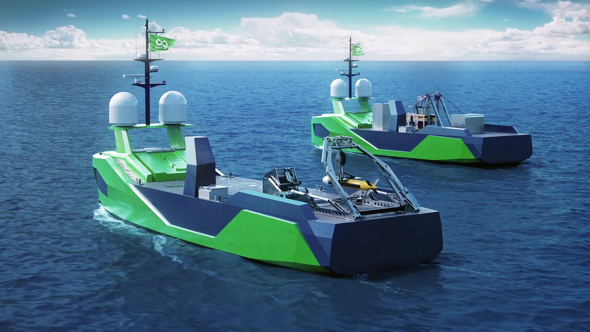
Ocean Infinity acquires MMT
Combining world-class innovation with unrivalled experience
Ocean Infinity and MMT are excited to announce an acquisition that brings together MMT’s deep expertise and established track record as a distinguished marine survey and data analytics provider and Ocean Infinity’s best-in-class robotic technology and operational expertise.
The combined force will maximise the potential of Ocean Infinity’s fleet of Autonomous Underwater Vehicles (AUVs), and the soon to be launched Armada fleet of uncrewed, low-emission, robotic ships. The company will be uniquely placed to support its international clients’ data acquisition requirements, working across multiple sectors including, energy, subsea cables, government and defence.
Following the acquisition by Ocean Infinity, MMT will continue to operate under the MMT brand. The enlarged group will have a headcount of over 300 people and will operate from an expanded geographical footprint with offices in the US, Sweden, UK, Singapore and Norway.
Per-Olof Sverlinger, CEO of MMT said:
“These are two world-leading companies with highly complementary competencies that are joining to strengthen our unique positions and our continued international expansion and development. This is a highly positive development for all MMT stakeholders. Our clients will continue to receive our trademark, personalised levels of support, but will now also be able to access an expanded range of services. For our team it opens many exciting opportunities and the chance to be on the cusp of the wave at a time of real change in our industry.”
Ola Oskarsson, founder of MMT said:
“We are a company with unique knowledge and unique employees, with a passion for what we do. As part of Ocean Infinity we can create new opportunities for our clients and our team and enjoy continued growth. Ocean Infinity has the ambition to be at the absolute forefront of technology when it comes to future analysis of the sea and seabed, which is a perfect combination for our skillset. I am proud of our past and extremely excited about our future.”
Oliver Plunkett, Ocean Infinity’s CEO said:
“When we started Ocean Infinity we revolutionised the industry with the deployment of AUVs on an unprecedented scale and we are set to push the boundaries again with our fleet of uncrewed low-emission robotic vessels. To achieve our ambition of transforming operations at sea through innovation and technology we need the very best people who share our passion for creating safer and more sustainable ways of working. I’m thrilled that we are being joined by a highly impressive group of new colleagues from MMT who collectively bring with them decades of knowledge, experience and a track record of excellence. With the team from MMT alongside us I have no doubt we will exceed all expectations and create the leading ocean and seabed data analytics business in the world.”
For more information visit: www.oceaninfinity.com or www.mmt.se


Scientists create first of its kind guidelines for identifying species through images
Scientists have created a set of unique guidelines for image-based species identification to improve biodiversity data collection. Led by Dr Tammy Horton at the National Oceanography Centre (NOC), the new guide provides rules for the use of open nomenclature signs in image-based biodiversity studies. The guidelines have been developed as a way of indicating the level of certainty in the identification of species. The guide is the first of its kind to bring together the fields of scientific nomenclature and image-based analyses to improve biodiversity data collection.
As scientists move away from monitoring the biodiversity of oceans using traditional sample-based methods to increasingly using remotely operated technology, vast numbers of images and videos require analyses and identification. This is managed by naming the taxa seen in those images and often providing them with ‘temporary’ names using open nomenclature. The new guide allows for identifications to be more easily understood and shared through a standardised process, making them more useful to other researchers, environmental managers and policy makers.
Drawing on expertise and experience from NOC, University of Southampton, the Charles Darwin Research Station (Ecuador), National Geographic Society (USA), Flanders Marine Institute (Belgium) and the Intergovernmental Oceanographic Commission (Belgium), the guide offers a simple flow chart to help determine the term to use at each level of identification. It also gives examples of recommended use for these terms for input to online databases and in the preparation of catalogues of the fauna of an area.
Lead author, Dr Tammy Horton, said: “Image-based biodiversity work is increasingly common but will always have limitations to the level of certainty in species identification. This is particularly critical in deep-sea studies where most of the animals are poorly known and we often encounter new species that have not been described before. Developing these clear rules for the use of open nomenclature will improve the clarity, precision and comparability of biodiversity data.”
The full article is available at:
Recommendations for the standardisation of open taxonomic nomenclature for image-based identifications.
Tammy Horton, Leigh Marsh, Brian James Bett, Andrew Russell Gates, Daniel O B Jones, Noëlie M.A. Benoist, Simone Pfeifer, Erik Simon-Lledó, Jennifer Durden, Leen Vandepitte, Ward Appeltans.
Frontiers in Marine Science, Deep-Sea Environments and Ecology. 08 February 2021
https://doi.org/10.3389/fmars.2021.620702
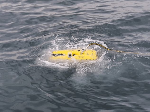
Turkey gets Falcon for emergency response
The rapid detection of hazardous substances in Turkey’s offshore water is made possible with a Saab Seaeye Falcon operated by MOST Maritime and Environmental Services.
MOST Maritime’s emergency response team chose the remotely operated vehicle for its speedy deployment complete with cameras and multi-sensor detectors, ready to locate the incident, observe, and secure the danger.
The company provides global emergency response services for petroleum and other harmful substance spills in the sea and inland waterways worldwide.
Easy to deploy, the Falcon’s rapid response capability makes it a vital resource for hydrocarbon leak detection where speed is essential to avoid the serious consequences of economic loss and environmental pollution.
Depth rated to 300m and 1000m, the Falcon is the world’s top-selling underwater vehicle in its class noted for its ability to handle a wide range of cameras, sensors and tools, and a reliability record covering thousands of hours of undersea operations.
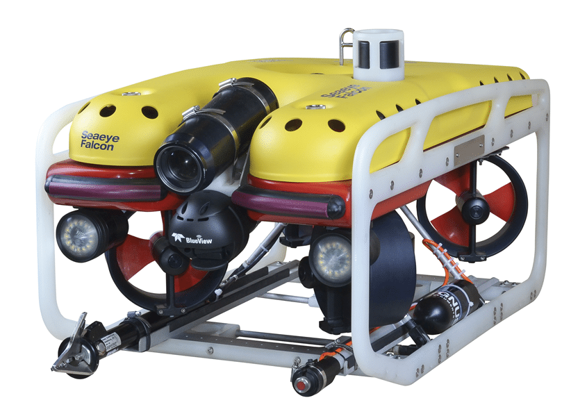 The Seaeye Falcon’s success comes from its reputation as a versatile resource, with five powerful thrusters packed into a compact and easy-to-handle metre-sized vehicle enhanced by Saab Seaeye’s iCON™ intelligent control architecture. The resultant design is a highly manoeuvrable, multi-tasking vehicle that is easy to use and able to handle strong currents.
For more information visit: www.saabseaeye.com

SUT launches Virtual Subsea Awareness Course
The Society for Underwater Technology (SUT) has launched a foundation level virtual Subsea Awareness Course (SAC) based on its highly successful face-to-face five-day course which has seen over a thousand delegates during more than 20 years.
As Cheryl Burgess, Chief Executive of SUT explained:
“Like the face-to-face course the 5-session virtual SAC is aimed at new entrants who are already technically qualified but just entering the offshore energy industry and/or the subsea sector; technically qualified experienced personnel undergoing a technology transfer and conversion process into the subsea sector; and non-technical personnel from legal or finance sectors who regularly deal with the subsea sector and are eager to find out more.”
Week 1 of the first virtual SAC will run on the mornings of Tuesday 6th, Wednesday 7th and Thursday 8th April; and will be followed by two sessions on 13th and 14th April. The syllabus for the five 3-hour sessions embraces subsea production equipment and systems; flow assurance; pipelines and risers; construction and installation; metocean; renewables and future technology trends; and operation, maintenance, and decommissioning. Future virtual 5-session SACs will be held at regular intervals.
Looking back at responses to the face-to-face course Cheryl Burgess explained:
“The face-to-face SAC has been attended by delegates from across the UK and from further afield including Angola, Azerbaijan, Egypt and Norway from oil and gas operating companies, from major contractors and organisations from throughout the supply chain. The SAC has attracted accolades in plenty – the following being very typical:
- A great course from which to gain a thorough understanding of the existing technologies that can help solve current problems
- Extremely helpful and definitely recommended for people of all disciplines
- The presenters were excellent, and the course material was at a very professional level
- Great course and great instructors
- Well organised and the presenters made learning about subsea enjoyable
- This course increased subsea vision and understanding
- It helped me improve and consolidate my existing knowledge
“We are confident that the virtual course, available globally presented by industry leading figures, fills the void resulting from the COVID-19 pandemic.”
The virtual course will be presented by specialists from across the sector from operators, contractors, and technology system suppliers, many of whom are recognised Technical Authorities (TA). The course fee for SUT members is £715 and £845 for non-members (excluding VAT where chargeable). It is CPD approved. Registration for the virtual SAC is at https://www.sut.org/virtual-subsea-awareness-course/
Two other SUT virtual SACs are currently under development, one for the offshore wind industry and the second for the insurance industry. Both will be launched in the next few months.
SUT’s Houston and Perth (Australia) branches also run SAC face-to-face courses dates and details are available on the SUT’s website at www.sut.org

Teledyne Webb Research Welcomes Two New Team Members!
Teledyne Marine is delighted to welcome two exceptional new members to the Teledyne Webb Research Glider team.
Shea Quinn joins the team as the new Product Line Manager. In his new role, Shea is responsible for driving the product line development for the gliders and bringing voice of customer to the engineering and development process within the company. Shea will support the outside sales teams, agents, and customer base to assure that the products that are delivered meet customer expectations and specifications. Shea comes to Teledyne Webb Research from Lockheed Martin where he held several positions within the engineering group including most recently, Engineering Project Manager. Shea’s work experience at Lockheed includes a variety of unmanned and remotely operated vehicle projects. Shea earned his Bachelor of Science in Electrical Engineering at Villanova University and a Masters of Engineering in Systems Engineering and Project Management from Cornell University.
Cordielyn Goodrich joins the group as a Customer Support Applications Engineer and member of the Glider Support Team. In Cordie’s new role, she is providing customer support and training for users, creating and updating user documentation, piloting TWR gliders, and assisting in final test of new vehicles and beta testing of new Slocum hardware and software. Cordie joins us from the Bermuda Institute of Ocean Sciences (BIOS) where she was a Glider Research Specialist managing the Mid-Atlantic Glider Initiative and Collaboration (MAGIC) Lab. Cordie received her Bachelor of Mathematics from Washington College and a Master’s degree in Marine Studies from the University of Delaware, College of Earth, Ocean, and Environment.
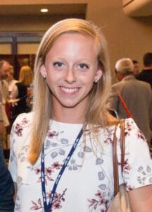
Connect with Cordie on LinkedIn
When questioned about the potential impact of the new team members, Arnar Steingrimsson, Senior Director of Business Development – Vehicles, Teledyne Marine said, “We are excited to have Shea and Cordielyn join the Slocum glider team at Teledyne Webb Research. Both have a strong background in unmanned vehicles combined with existing connections to the Slocum user community and a customer centric approach that will both improve the overall Slocum customer experience and ensure that the Slocum glider maintains its position at the forefront of glider technology for years to come.”
For more information visit: www.teledynemarine.com/webb-research
OTAQ: Non-Executive Director Appointment
OTAQ, the marine technology products and solutions group for the global aquaculture and offshore oil and gas industries, is pleased to announce that Malcolm Pye will join the Board of OTAQ as a Non-Executive Director with immediate effect.
Malcolm founded, and from 1999 to 2019 was Chief Executive of, Benchmark Holdings plc (“Benchmark”), the world’s leading aquaculture health, nutrition and genetics business.
Malcolm has over 35 years' experience in international agribusiness through his various roles at Hillsdown Holdings (then HMTF Group), and through building Benchmark from the initial start-up into a major international aquaculture technology business serving the global salmon, shrimp, tilapia and farmed fish industries. Malcolm focused Benchmark’s activities on animal health, breeding and genetics, advanced nutrition and knowledge/technology delivery and led the flotation of Benchmark in 2013, maintaining a lead role in investor engagement.
Prior to his founding role at Benchmark, Malcolm gained wide experience in the food sector from his various senior management positions within Hillsdown Holdings, operating in animal breeding, poultry production, feed milling and veterinary services. During this time, he developed extensive experience in breeding and genetics, food production/technology, sales (including account lead responsibilities within the UK / international retail sector with a range of bluechip companies including M&S, Tesco and McDonalds) and strategic M&A as well as holding a main board position within the Group.
Malcolm’s work with Hillsdown Holdings in the early to mid-1990’s influenced a career-long focus on sustainable food production which formed the basis and inspiration for the creation of Benchmark Holdings.
Alex Hambro, Non-Executive Chairman, commented: “We are really delighted to welcome Malcolm to the Board of OTAQ. Malcolm’s experience in, and knowledge of, the global aquaculture industry is unparalleled, and will be of huge benefit to OTAQ as it develops and commercialises additional sustainable technologies and services for the aquaculture farming and producing communities. Our core SealFence acoustic deterrence system has significant opportunities for growth in geographies where Malcolm has built strong long-term relationships. Furthermore, his knowledge of additional farmed species other than salmon will be extremely helpful as we expand our range of products.”
For more information visit: www.otaq.com

New Marine Environmental Science SIG formed by SUT
The Society for Underwater Technology (SUT) has formed a new special interest group (SIG) – the Marine Environmental Science Special Interest Group (MES SIG). Its creation brings the number of SIGs run by the SUT to a dozen
Mick Cook, Director - MCL Consultancy and SUT Council Member & Treasurer who initiated the formation of the new SIG explained:
“The purpose of the new SIG is to bring together organisations and individuals with a common interest in underwater technology, ocean science and offshore engineering with a specific interest in the marine environment.
“A primary activity of the SIG is to educate users of the marine environment through the provision of seminars, workshops, training courses and conferences that may be of interest to specialists and non-specialists.”

The MES SIG held its inaugural meeting virtually on 11 February 2021 and will meet monthly for the foreseeable future. Meetings will comprise discussions on topics of interest, presentations by members and non-members and preparation for future seminars, workshops, training and conferences. Further, where appropriate, the MES SIG will prepare guidelines on appropriate subjects and provide advice to governmental and non-governmental organisations on environmental matters.
Officers elected at the first meeting of the MES SIG are:
- Chair: Katie Cross – Marine Environmental Consultant, MarineSpace Limited
- Secretary: Lucy Shuff - Deputy Commercial Development Manager, Environmental – Gardline Limited
- Events Secretary: Nathan Formosa - Operations Manager, Green Tech
The Marine Environmental Science SIG is open to all SUT individual and corporate members that work and/or are qualified in marine environmental science, including ecologists, oceanographers and physical processes specialists. Those interested in joining the SIG should contact Lucy Shuff copying Katie Cross – [email protected] and [email protected]
Details on membership of the SUT are at www.sut.org/sut-membership/application-for-membership/
Seabed 2030 enters new agreement with the Global Multi-Resolution Topography Synthesis Project
The Nippon Foundation-GEBCO Seabed 2030 Project and the Global Multi-Resolution Topography (GMRT) Synthesis Project, operated at Columbia University’s Lamont-Doherty Earth Observatory, have paved the way for a future of collaborative working by entering into a Letter of Intent. The formal agreement establishes a partnership between the two projects, with the shared objective of assembling a global compilation of high-resolution bathymetric data.
Seabed 2030 is a collaborative project between The Nippon Foundation and GEBCO to inspire the complete mapping of the world's ocean by 2030, and to compile all bathymetric data into the freely available GEBCO Ocean Map. GEBCO is a joint project of the International Hydrographic Organization (IHO) and the Intergovernmental Oceanographic Commission (IOC), and is the only organisation with a mandate to map the entire ocean floor.
The mission of the GMRT Synthesis Project is to provide free and open access to multi-resolution bathymetry data throughout the global oceans to the widest possible user community through a scalable infrastructure for data synthesis, and tools for data access and visualization.
The synthesis began in 1992 as the Ridge Multibeam Synthesis (RMBS), and was expanded to include multibeam bathymetry data from the Southern Ocean. Today, it includes bathymetry from throughout the global and coastal oceans. To achieve its aim of providing access to bathymetric data, the GMRT Synthesis Project processes and integrates publicly available multibeam bathymetry data into a global synthesis, and operates a scalable infrastructure that can be used to offer the highest-resolution data for any particular location in the ocean.
“GMRT and its commitment to obtaining high-resolution bathymetric data will inevitably play a central role in supporting Seabed 2030’s mission of mapping the entire ocean floor,” commented Jamie McMichael-Phillips, Director of Seabed 2030.
“The Letter of Intent lays the groundwork for Seabed 2030 and GMRT to work together in acquiring new data from uncharted waters, and appropriately processing those already available.”
Dr Suzanne Carbotte, GMRT Principal Investigator, said: “GMRT is committed to ensuring data access to the widest possible user community, which is why we’re pleased to contribute to Seabed 2030 and the GEBCO grid, which is made available to all.”
Data collected and shared with the Seabed 2030 Project is included in the GEBCO global grid – the most complete bathymetric dataset of the world’s ocean floor.
For more information visit: www.seabed2030.org
Fear of the light may help tiny ocean creatures survive a brighter future
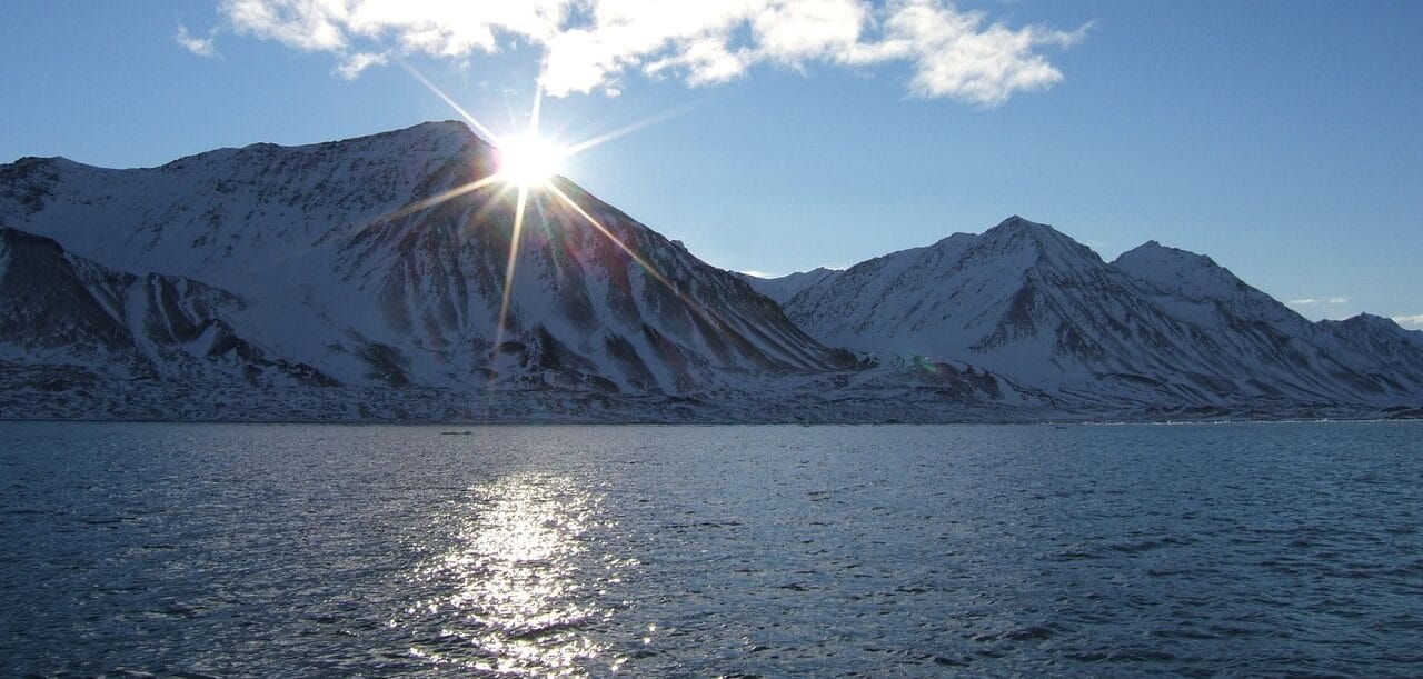
An aversion to light has long been a survival tactic used by the smallest creatures in our ocean, but scientists have discovered this photophobia may already be protecting them against impacts of environmental changes in the Arctic.
Known as zooplankton, these microscopic creatures swim hundreds of metres every day, up and down the water column in response to the changing light. By staying deep below the surface during the daytime, they can avoid predators. Only during the relative safety of night can they come nearer the surface to feed on tiny marine plants known as phytoplankton.
The underwater light in the Arctic is changing in various ways. As sea ice in the Arctic melts at an increasing rate because of climate change, more light penetrates the water. Added to an increase in light from infrastructure and shipping, these changes are potentially making zooplankton – a crucial part of the ocean food web – more vulnerable to predators.
But an international group of Arctic scientists led by the Scottish Association for Marine Science (SAMS) in Oban and the University of Strathclyde has discovered that zooplankton have an established threshold of light tolerance, regardless of the time of day, season or year, suggesting they are capable of adapting to dramatic changes in light. As the depth at which this light level is found moves up and down the water column between day and night, and across seasons, zooplankton are seen to remain below it, avoiding the shallow depths where it is light.
The findings were published on the 24th February in Biology Letters.

Research partners on the publication include University of Bergen, Norwegian Institute for Nature Research, UiT The Arctic University of Norway ,The University Centre in Svalbard (UNIS), The University of Delaware, and the Norwegian University of Science and Technology.
Lead author of the report Dr Laura Hobbs said: “As the Arctic lightscape changes, and more light enters the ocean, it would be reasonable to think that fish and other predators would become more proficient at feeding on zooplankton.
“However, we’ve seen that zooplankton might already be adapted to these changes by swimming deeper to avoid high light levels. More light also means larger blooms of phytoplankton, so there’s potentially more food available to them. Whether they are able to reach that food, given the higher levels of light at shallower depths, is another question.”
Zooplankton sit in the centre of the Arctic marine food web. They are responsible for transferring energy from phytoplankton to larger species like fish, seabirds, and whales. Their vertical migrations in the water are also important: as they eat at the surface but excrete at depth, they play a vital part in removing carbon from the surface layers and taking it to deeper waters.
This research contributes to a suite of UK and Norwegian led projects, including those funded by the UK Natural Environment Research Council through the Changing Arctic Ocean programme and the Research Council of Norway. The data used in this research were collected by a long term collaboration between researchers at SAMS, UiT The Arctic University of Norway in Tromsø, and the University Centre in Svalbard.
For more information visit: www.sams.ac.uk
3D at Depth Launches Worldwide Offshore Geophysical Survey Services Business
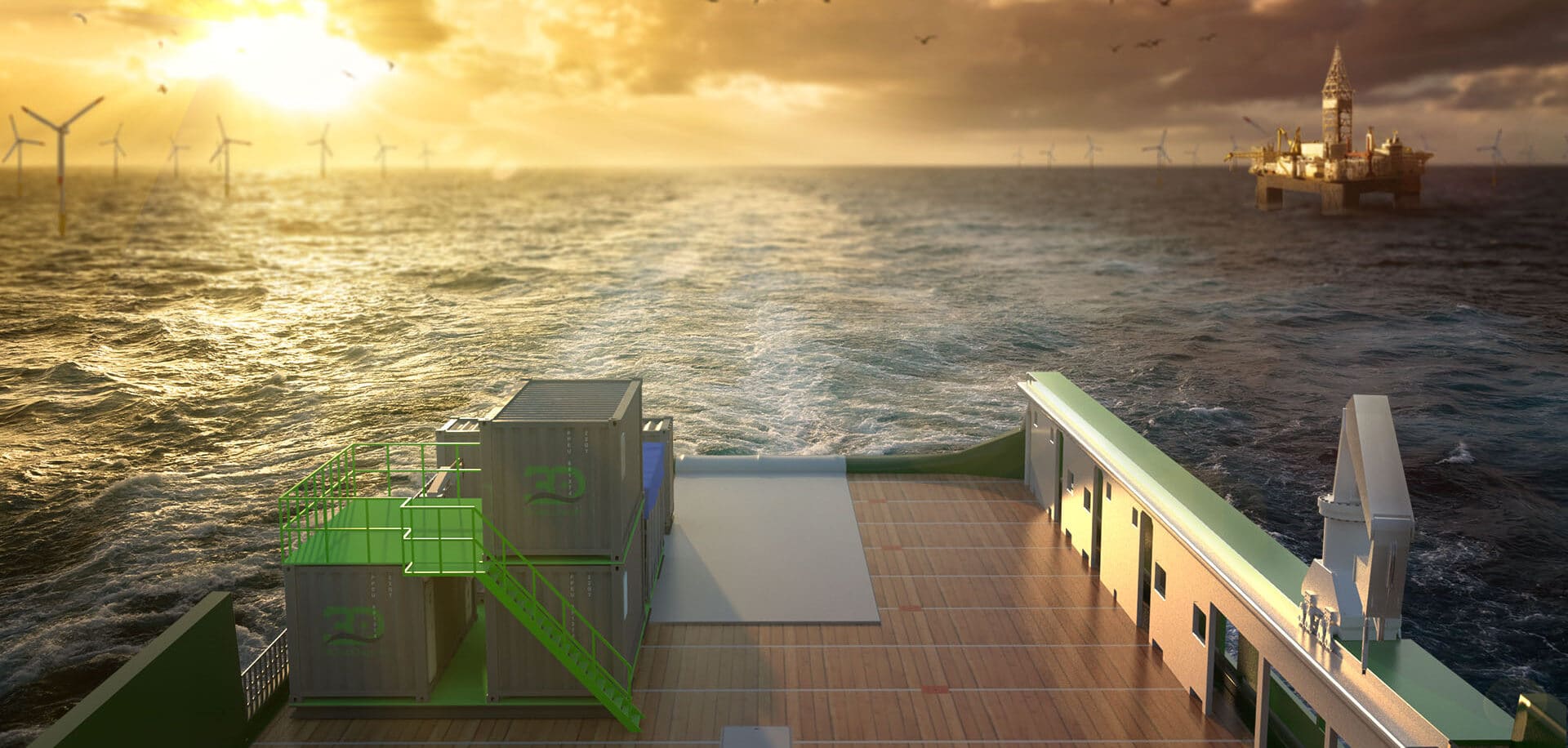
3D at Depth Inc., the world’s expert in commercial Subsea LiDAR (SL) laser technology, and leading provider of underwater survey services and 3D data solutions, today announces the launch of its offshore Geophysical Survey Services division. The new division will provide optimized surveys to support both nearshore, inshore, and offshore deepwater development activities focused in the areas of offshore wind farms, pipeline routes, environmental site surveys, offshore hydrocarbon projects, and civil engineering surveys. 3D at Depth first commercialized Subsea LiDAR (SL) technology for the offshore industry in 2014. The Company focus has always been on 3D data excellence through innovative technology solutions that enable cost savings across any survey initiative without sacrificing data quality. The Geophysical Survey Service division is supported by a team of experienced LiDAR experts, 3D data specialists, geophysical, and hydrographic professionals providing a multi-disciplined approach to guide, identify and analyze data acquisition initiatives across survey campaigns. The team complements the Company’s patented Subsea LiDAR (SL) laser technology and state-of-the-art innovations including 3D at Depth’s comprehensive inspection and survey solution – recently announced in the January edition of the Wind Energy Network Magazine.
The Geophysical Survey Services division will leverage 3D at Depth’s in-house electronics, system integration, and design capabilities as key differentiators. Subsea LiDAR 3D data sets will be merged with multibeam echosounder (MBES) multi-frequency, multi-spectral data acquisition and optical technologies which will enable more robust, higher quality output, maximizing results for the end client. Deepwater offshore, inshore, and nearshore projects will also have a clear advantage with 3D at Depth’s integrated autonomous or tethered underwater vehicle and vessel mounted survey solution. The fully integrated solution incorporates a hovering supervised autonomous AUV/ ROV package and takes full advantage of 3D at Depth’s Subsea LiDAR (SL) laser with remote sensing technology - inertial navigation coupled with a multibeam echosounder and pipeline and hydrocarbon leak detection sensors. One tool, one set-up, one mobilization for multiple survey deliverables designed for efficient and integrated operations.
The application of 3D at Depth’s disruptive technology approach will enable it to expand into Geophysical survey services and is built around solving customer challenges in three areas: reducing environmental and human risks, lowering the project's overall carbon footprint, and providing more robust data acquisition solutions. Specifically, the technology was developed from best practices in deep water survey campaigns to tackle the challenges of shallow water survey data collection and acquisition projects. Shallow water projects have exposure to lengthy weather events; crew and ship standby costs, sea-state challenges for collection, etc. All of which impact the time, budget, and quality of the data.
“Since the company formation, we’ve focused on developing flexible site and subsea asset characterization technologies designed to reduce crew time and dramatically lower CO2 emissions, while increasing the speed and quality of the results,“ stated Neil Manning, COO, 3D at Depth, Inc. “By deploying smaller, more efficient vessels that can be operated safely outside the 500m zone or offshore exclusion areas without sacrificing data quality is a differentiator. When we looked at the problem, we found a gap in the Geophysical market for this type of implementation that delivers cost-efficient surveys that still provide maximum data quality. Specifically, we pulled from our deep-water technology portfolio to fast-track a solution that meets the current requirements of the shallow water survey market. With over 600 offshore projects behind us and an increasing backlog, I am excited to push the flexible vehicle systems and in-house patented technology into the geophysical market. By moving the budget needle in the right direction for our customer’s survey projects, we assist the offshore energy market in obtaining quality data for a reasonable price”
3D at Depth’s geophysical survey services recently completed a major project for post-hurricane NTL surveys in the Gulf of Mexico for a large U.S. based pipeline company. The project continues with expanded requirements. 3D at Depth will partner and act as the prime contractor to ensure best practices, and unsurpassed technical expertise is always on hand. Geophysical and geotechnical capabilities for the projects will be available from vessel mounted or subsea vehicle-mounted methods to allow for both long and close-range inspections which enable a blend of efficient data collection and high data quality to meet and exceed the demands from the end-users.
The Range of Services includes:
Rig and platform site surveys
Geohazard surveys
Wind farm site surveys
Pre-engineering surveys
Clearance surveys including UXO
Ice gouge surveys
Multibeam echosounder surveys in shallow and deep water
Pre-and post-lay Pipeline route surveys
Deepwater site developments
LNG and FPSO offloading facilities
Marine archaeology and cultural heritage sites
For more information visit: www.3datdepth.com