
Aquatec marks three decades innovating for ocean sustainability with marine charity donation
Basingstoke-based subsea instrumentation designer and manufacturer Aquatec Group announces a donation to celebrate the beginning of its 31st year focusing on sustainable development activities. The donation, made to the Marine Conservation Society, is part of Aquatec’s commitment to supporting the ocean environment and looking after marine wildlife. This funding will allow the non-profit organisation to continue their work preserving the seas by creating well-managed marine protected areas, liaising with fishermen and industry to find more sustainable ways of fishing, and working together with retailers and consumers to buy and choose more sustainable food.
The contribution was part of a novel campaign the company launched to celebrate its 30th anniversary. Aquatec added a fixed amount to the donation fund for every view on its online corporate timeline. By promoting its three-decades of subsea innovations, the firm also encouraged the entire subsea community to think about the impact humans have on the oceans and contribute to the environment. Every view counted, and the timeline got thousands.
The firm is also taking other initiatives to achieve its sustainability objectives. These include an increased focus and plans to develop further its marine bioacoustics brand. Also, Aquatec is now actively participating in the NAUTILOS Project, funded under the Horizon 2020 Future of Seas and Oceans Flagship Initiative and coordinated by the National Research Council of Italy (CNR). The project brings together an influential group of 21 entities from 11 European countries with multidisciplinary expertise ranging from ocean instrumentation development and integration, ocean sensing and sampling instrumentation, data processing, operational oceanography and biology, water and climate change science, technological marine applications, and research infrastructures.
30TH ANNIVERSARY VIDEO
For more information visit: www.aquatecgroup.com

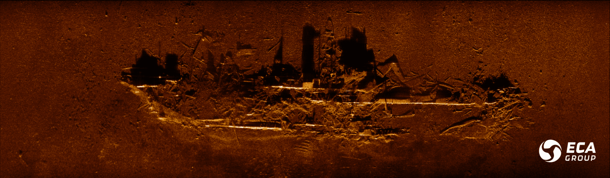
Successful sea trials for ECA GROUP’s UMISAS sonar
ECA GROUP’s UMISAS sonar completed a series of sea trials in the 2nd half of 2020 in preparation of their integration in AUVs and Towed Sonars for the Mine Countermeasures replacement programme for the Belgian and Royal Netherlands navies.
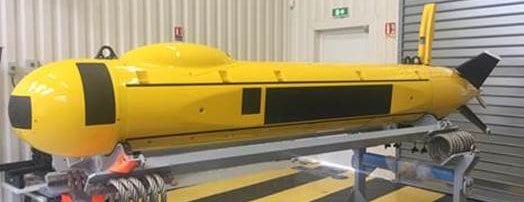
As part of the programme to replace the naval Mine Countermeasures capability of the Belgian and Royal Netherlands navies, which includes the supply of twelve minehunters equipped with unmanned systems (Toolbox), ECA GROUP announces the completion of sea trials of its UMISAS sonar for both the AUVs and Towed Sonars of the rMCM programme. The next step is the on-going production of the UMISAS sonars for their integration in the A18-M and T18-M adapted to the rMCM programme.
This integration will take place between October 2021 and March 2022.
ECA GROUP decided to develop its own range of Synthetic Aperture Sonars in 2014 and launched an internal programme. SAS sonars proposed by partners did not fulfil ECA GROUP’s internal requirements:
- Their weight, size or power consumption would have led to a too big and too heavy AUV whereas ECA GROUP’s MCM AUV was targeting the size of an A18-M medium-size AUV;
- Impossibility to precisely synchronize the SAS and the inertial navigation of the AUV in order to fully exploit the benefits of a new technique protected by an ECA GROUP patent for both SAS imagery and AUV navigation.
The A18-M AUV and T18-M Towed Sonar have the best performance when fitted with UMISAS sonars. Thus, these drones are exclusively commercialized with UMISAS sonars.
UMISAS: A NEW GENERATION OF SYNTHETIC APERTURE SONARS
ECA GROUP’s research and development in the field of sonars started back in 2014 together with its development of new generation Autonomous Underwater Vehicles in the A18 range. Driven by operational needs of Navies requesting high performance and more compact unmanned solutions for mine detection missions, ECA GROUP brings on the market their own sonar technology to be fitted on its naval drones and fully integrated into its unmanned systems.
The UMISAS sonars are interferometric synthetic aperture sonars (InSAS) used for mine detection missions as part of Mine Countermeasures operations at sea. The UMISAS sonars aim to obtain a spatial resolution of about 3 cm x 3 cm to optimally classify small and irregularly shaped objects on the seabed.
The positioning of the platform required to form the synthetic antennas is an integral part of the UMISAS processing chain. UMISAS directly uses the data from the A18-M or T18-M navigation grade inertial unit to perform SAS processing, thus eliminating the use of low cost navigation sensors used by some commercial SAS systems on the market which perform only the short term navigation required to produce focused SAS imagery, but do not allow for geo-referencing of the SAS images or improved positioning of the AUV by exploiting the SAS and, above all, are much less reliable.
UMISAS SONAR JOINS THE ECA GROUP DRONE FAMILY
The UMISTM Toolbox developed by ECA GROUP is a comprehensive solution for stand-off and autonomous mine clearance missions at sea to be operated from the ship or from the shore. It contains: a USV INSPECTOR125 surface drone , AUV A18-M underwater drones and T18-M towed sonars for mine detection, SEASCAN and K-STER C MIDS (Mine Identification and Disposal System) for mine identification and neutralization as well as UMISOFT, a comprehensive software suite for mission planning, drone control and data management.
UMISTM drones perform accurate navigation and positioning, obstacle detection and avoidance with a high level of performance, and one of the key elements, which will guarantee the expected high level of performance of the system, is the quality of imagery provided by these drones, which the ECA GROUP’s UMISAS Synthetic Aperture Sonar can offer.
UMISAS PROVIDES SUPERIOR COVERAGE RATE– DETECTING & CLASSIFYING STEALTHY MINES
UMISAS, an Interferometric Synthetic Aperture Sonar (InSAS), is an innovative underwater imaging technology that considerably improves seabed surveys by providing ultra-high resolution imagery at superior coverage rates, i.e. 4 times greater in terms of coverage and between 5 and 10 times greater in terms of resolution compared to conventional side scan sonars. Combining several dozens of acoustic pings to form an image with a much higher resolution, UMISAS processes raw data into 3 cm X 3 cm resolution images, constant with range, together with high area coverage rates (i.e. 1 square nm per hour for the UMISAS 240 fitted on the T18-M).
”This combination of resolution, area coverage and accurate positioning is what makes UMISAS unique. It allows for a high detection and classification probability, even of stealthy mines, which are a challenge for other sonars.”
Marc Pinto, Naval Robotics Scientific Advisor at ECA GROUP
DRONES + SONAR = DUAL EXPERTISE FOR BETTER MISSION PERFORMANCE
ECA GROUP is one of the few manufacturers capable of developing the drones as well as the InSAS sensor, optimising both in an integrated system approach ensuring a seamless integration and successful mine detection and classification operations. This integration expertise is a real asset to the global performance of the system:
- Close collaboration between trajectory control, navigation and positioning, sonar signal processing systems, allowing system tradeoffs to be made at the right place;
- Greatly facilitated electrical and mechanical integration of the InSAS sensor into the drone as both were designed together;
- Optimized Size-Weight-Power and Cost.
AI DRIVEN REAL-TIME PROCESSING INCREASES AUTONOMY
In addition, ECA GROUP engineers have focused on real-time InSAS processing on Graphical Processing Units leveraging significant progress in COTS computer hardware driven by AI applications:
- Thus, the real-time InSAS processor is very compact and has a low and optimized power consumption, inferior to 30W, which increases mission duration.
UMISAS’ systems operate on 2 frequency bands: High Frequency & Very High Frequency:
- Permitting a superior signal to noise ratio and thus a high contrast imagery at long range, even in harsh environments, including multi-pathing in shallow waters and high absorption in warm waters.
PROVIDING HI RES BATHYMETRY IMAGES
Finally, UMISAS has a pair of vertically superposed arrays for reception on each side of the platform for interferometric processing, allowing for high resolution of the bathymetry which is co-registered with the imagery for improved environmental assessment.
For more information visit: www.ecagroup.com

Aleron Limited announce the appointment of Gary McConnell as new Managing Director
Aleron Limited, specialists in complete ROV solutions, tooling and products, are delighted to announce the promotion of Gary McConnell to Managing Director. Formerly Commercial Manager, McConnell steered the business through a challenging year and will continue to lead Aleron through a significant period of growth, implementing new internationalisation strategies and developing the Aleron client offerings.

Aleron recently completed a high-level organisation restructure, consolidating the businesses of Aleron Subsea & ROVQUIP to the single entity of Aleron Limited. McConnell managed this transition to streamline the Aleron product and service offerings, bringing increased efficiencies to their global clients. The growth period for Aleron has also seen a 20% increase in their Aberdeen workforce, alongside the relocation to an enhanced new facility in November 2020.
Former Managing Director Mike Bisset, has returned to the role of Technical Director, focused on growing demand for Aleron Products, Services and Special Projects. Bisset said “We are delighted to see Gary take the Aleron reins. Since joining the business in 2015, Gary has proven his dedication to the company and has successfully built strong relationships with our clients. With his in-depth knowledge of the subsea industry and commercial drive, we look forward to seeing him grow the business to new strengths”.
Gary McConnell added “I am passionate about Aleron’s progression and success. Aleron has built a strong brand and customer base during a challenging period. We have diversified our product range, market segments and created new partnerships and alliances in overseas locations. Additionally, in the last year Aleron have added several senior industry specialists, widen
ing our knowledge, increasing experience and strengthening the team. Aleron has shown great resilience during the COVID downturn and begin 2021 in a strong financial position. I am delighted to have been given the opportunity to champion the growth plans at such an exciting time for the company.”
For further information on Aleron Limited’s products and services, visit www.aleron-group.com or email [email protected]
Southampton University opt for PicoTech Multibeam Sonar USV with BeamworX
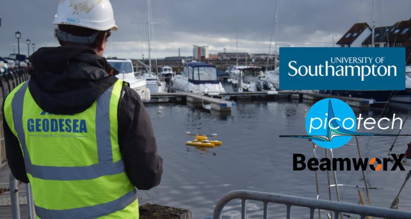
Geodesea Ltd is proud to announce the delivery of a Picotech Ltd PicoCAT USV with PicoPod Multibeam sonar payload (Pico MB-130, integrated Applanix POSMV SurfMaster, PC & AutoPilot) to the Environmental Sensing @ Southampton facility at the University of Southampton.
PicoPOD is a turnkey multibeam package to power-up your existing USV for autonomous multibeam surveys. PicoPOD has a simple mechanical interface and free open-source autopilot. Supported by industry standard acquisition and processing software, BeamworX®, EIVA NaviSuite®, Xylem HYPACK®, Teledyne PDS® and QPS QINSy®.
BeamworX software (NavAQ/AutoPatch/AutoClean) is bundled into a single suite; each program can work completely stand-alone due to the flexible imports and exports. But together they form a powerful toolkit for for acquiring, calibrating and (re)processing Multibeam Echosounder Data. The University of Southampton is the latest UK university to adopt BeamworX as part of its software portfolio for undertaking research and educating the next generation of multibeam users!
Dr Julian Leyland, Associate Professor in the School of Geography and Environmental Science, and director of ES@S (www.esas.soton.ac.uk) said “The PicoCAT and PicoPod setup offer us a unique capability for autonomous survey in riverine and coastal settings. Integration of one of our VLP-16 puck Lidar units on the vessel will further enhance our capabilities and allow coincident above and below water monitoring. The equipment will underpin our world-leading research and teaching which seeks to better understand environmental change in these complex systems. Geodesea and Picotech combined to offer us a bespoke unit and superb support, from ordering to delivery and testing.”
For more information visit: www.geodesea.com

Blue Ocean Marine Services receives additional Autonomous Underwater Vehicle (AUV)
Blue Ocean Marine Services (BOMS) have recently purchased an additional L3Harris Technologies Iver3 Autonomous Underwater Vehicle (AUV) to support their expanding survey operations in Australian and Asian markets.
Keith Wallace, General Manager of BOMS, stated: “Based on performance and recent project successes, we have procured and now received our second Iver3 AUV to compliment the expanding range of innovative technologies we operate and the services we can provide. The addition of a second system significantly lowers project risk providing full equipment redundancy whilst increasing our efficiency in the field. This innovative unmanned technology directly challenges traditional survey and inspection techniques, delivering highly accurate data with significant reductions in project cost, time and risk. The Iver3 AUV is robustly engineered, capable of operations to 200m depth, and is one of the smallest and lightest on the market allowing for deployments from smaller vessels or directly from the shore.”
BOMS Operations Manager, Andrew Mercer added ”Our systems are equipped with dual-frequency (600/1600kHz) side-scan sonar combined with an interferometric phase differencing bathymetry system (600kHz), integrated digital cameras, multi-parameter water quality sondes and extended payload sections permitting the addition of a wide range of additional sensors. The AUVs are particularly suited for pipeline and field infrastructure inspections, but have recently proven their capability for a number of applications including cable route surveys, produced formation water discharge studies, water quality monitoring and benthic habitat assessment. The size and practicality of the systems allows for rapid mobilisation and demobilisation which has opened opportunities in emergency response, and locally here in Western Australia in post-cyclonic infrastructure assessment.”
BOMS is a Joint Venture between Blue Ocean Monitoring and The Vertech Group. With a strong management team and a clear vision, the company is truly committed to drive positive change across the offshore industry by working in collaboration with clients and partners to increase efficiencies and lower costs. With a combination of unconventional thinking and decades of experience, they provide highly effective offshore survey solutions using leading-edge autonomous (unmanned) survey platforms and sensors.
For further information please get in touch here: [email protected] or visit www.blue-ocean.com.au
@BlueOceanMar1
Kongsberg Maritime launches new cNODE MiniS transponder with pressure sensor
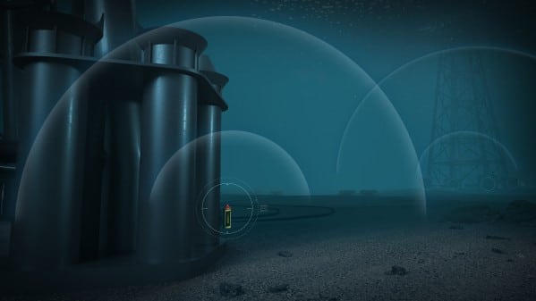
Kongsberg Maritime is pleased to announce that it has augmented its range of cNODE MiniS SSBL (Super Short Base Line) and LBL (Long Base Line) transponders with new models incorporating an internal, high-accuracy strain gauge pressure sensor.
The new transponder units are designed primarily for positioning ROVs, AUVs and towed bodies, and are also well adapted for operations where additional depth data or depth aiding is required, such as when locating subsea structures. This makes them particularly useful for windfarm installation support applications.
A range of models with different pressure sensors are available to maximise the accuracy of the reading. The 100m-rated unit would be best suited for windfarm installation, while the 1,000m- and 4,000m-rated units are ideal for use in contexts such as subsea construction, deep-water research, towfish tracking and AUV missions.
Pressure sensor data can be simultaneously reported on the back of the SSBL navigation reply pulse with no requirement for additional telemetry. The new transponder shares its specification with standard MiniS models and is fully compatible with HiPAP, µPAP and cPAP medium-frequency underwater positioning systems, using KONGSBERG’s Cymbal wideband acoustic protocol and FSK (Frequency-Shift Keyed) signalling. Configuration is carried out via an RS-232 connection or acoustic telemetry.
“Our cNODE MiniS transponders have attained a very solid reputation for the enhancements in accuracy and operational safety they have helped to establish in a broad variety of important functions,” says Erik Bjerke, cNode Product Line Manager, Kongsberg Maritime, “and the new units are destined to bring that same vital level of detail and reliability to an even wider range of applications.”
For more information visit: www.kongsberg.com
Sonardyne’s SPRINT-Nav reaches new heights of capability
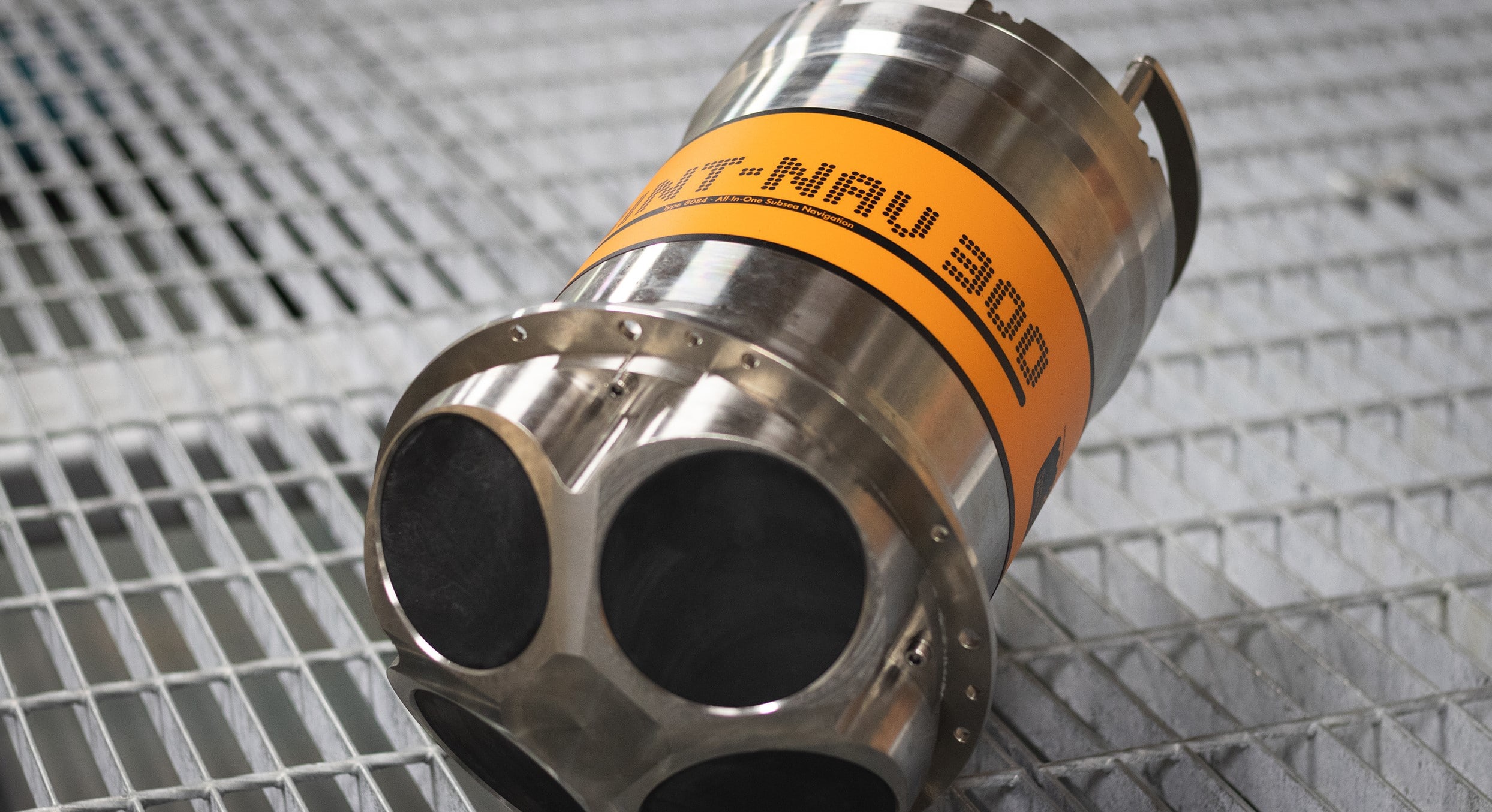
Marine technology specialist Sonardyne has released a new high altitude variant of its market leading hybrid navigator SPRINT-Nav to allow uncrewed surface vessels (USVs) and underwater vehicles to extend their operational envelope.
SPRINT-Nav tightly integrates a Sonardyne SPRINT INS, Syrinx DVL and a highly accurate pressure sensor into a single high-performance solution providing navigation and optional acoustic Doppler current profile (ADCP) functionality. Sonardyne’s new variant takes this capability to an even higher level; increasing the altitude at which vehicle platforms can work when they don’t have an external position reference, without compromising accuracy.
Operating at 400 kHz, the high altitude variant achieves reliable bottom lock at up to 230 m altitude above the seabed, providing USVs with a highly accurate and robust navigation source, which is critical for, as an example, station keeping applications in coastal surveys where GNSS could be denied or subject to interreference. Installation of the new SPRINT-Nav variant on autonomous underwater vehicles (AUVs) and remotely operated vehicles (ROVs) allows inspections and surveys to be performed at even higher altitudes than previously possible. In addition, the instrument’s optional ADCP functionality has been extended to 120 m, adding oceanographic data gathering and increased operational capability.
For more information visit: www.sonardyne.com

OSIL are recruiting a Oceanographer/ Marine Scientist
OSIL is a leading supplier of meteorological and oceanographic (metocean) equipment for offshore and coastal engineering applications. Operating on a global basis from an office base in the UK, we offer metocean solutions through cost-effective, high quality and technically advanced equipment.
Position
The Systems Division of OSIL specialises in the design, build, commissioning and service of real-time data acquisition and monitoring systems for offshore and coastal engineering projects globally.
Due to continued growth, and in order to better serve the increasing needs of the business, we are looking to recruit an additional Oceanographic Engineer to undertake the design, build and maintenance of offshore metocean monitoring systems worldwide.
This post will comprise a combination of both office/ laboratory based duties and overseas fieldwork. This challenging role, based in the UK office, will encompass varied responsibilities, the key aspects of which are:
- Design and build of Metocean monitoring systems
- Specifying and procuring equipment
- Testing and integrating equipment
- Configuration and testing of real-time data acquisition software
- Visits to overseas installations to conduct installation, commissioning and maintenance duties
- Preparation of technical documentation
- Establish technical procedures
- Take an active role in all QA & HSE relating to projects
- Liaise with Clients
- Providing remote support to on-site clients
- Frequent overseas travel will be required
- Clear career progression opportunities
Position Requirements
The candidate we have in mind is flexible, stress resistant, has an accurate work practice and a hands-on mentality. The following qualifications and experience is also required:
- Experience with scientific or commercial instrumentation
- Electrical/Electronic Engineering or Science qualifications
- Experience within the offshore industry
- Experience of working on vessels, rigs and platforms
- Strong computing and IT knowledge
- Excellent communication skills, both verbally and in written service reports
- Able to work in the offshore environment
- Be a team player with excellent communication skills
- Financial/commercial project experience is preferred
- May suit a newly qualified graduate with the right background
- Candidates must be fluent in written and spoken English and confident working at heights.
- What we offer
OSIL offers a dynamic team-based working environment in an exciting and developing market, as well as the long-term potential for you to develop your skills and career. Salary for this position is negotiable and dependent on experience. OSIL also offers 25 days annual leave, plus additional offshore allowances.
To apply:
Please email your CV and a covering letter to [email protected] telling us why you want to work for OSIL and how your skills and experience will benefit our team.
Reference ID: OSIL Oceanographer/ Marine Scientist - January 2021
For more information visit: www.osil.com/job-vacancies
Metocean Proposal Specialist - Fugro
Metocean Proposal Specialist needed for an exciting opportunity to support a newly merged and growing commercial team in the offshore energy transition sector based in either Portchester or Wallingford. Compiling winning quotes and tenders to secure metocean data analysis work together with business development. Corresponding with clients in Europe and Africa as well as colleagues in the regional Fugro offices in both Asia and the Americas. Fugro places an emphasis on working with clients on a consultative basis so a strong technical knowledge paired with commercial experience is pre-requisite to this role.
Responsibilities:
Preparing quotes and tenders as well as providing technical input to multi-entity proposals for metocean criteria studies.
Develop business opportunities in Europe and Africa for metocean studies.
Liaise with technical specialists in the metocean consultancy team.
Keep in regular contact with the metocean consultancy teams in APAC, the Americas and
Fugro geoconsulting teams in Europe and Africa
Typical day:
Analyse client requests and engage with clients.
Prepare quotes and tenders for metocean desktop studies.
Prepare costs, margin and schedules.
Ensure all relevant documents are communicated to the clients and all questionnaires are completed as well as reviewing Terms & Conditions.
Attend client meetings, both internal and external.
Keep up to date with industry, competitor and applicable scientific news and developments plus attend selected conferences.
Support marketing activities.
Requirements:
MSc level qualification in metocean or engineering and professional experience of metocean data analysis, criteria derivation and/or modelling in support of commercial applications.
Experience of tendering and/or commercial activities.
Organised, able to prioritise, strong attention to detail, conscientious and showing initiative
Competent IT skills to include Microsoft Word, Excel and PowerPoint.
Fluency in an additional language is desirable.
Job reference: R0011648
Kongsberg Maritime to launch next generation HUGIN Endurance AUV
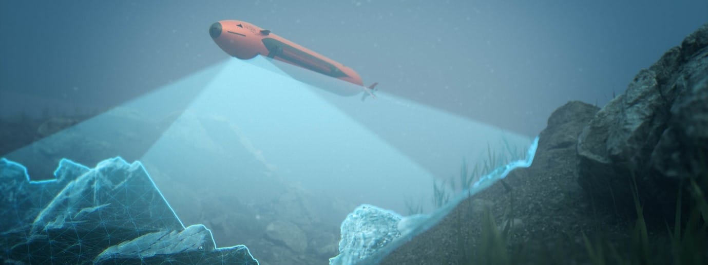
Kongsberg Maritime is proud to announce the next generation of its advanced HUGIN Autonomous Underwater Vehicle (AUV). Named HUGIN Endurance, the new AUV boosts operational duration to approximately 15 days, enabling extended survey and inspection missions far from shore.
This longevity allows HUGIN Endurance to undertake extensive missions without the support of a mothership. Shore-to-Shore operations offer the opportunity to reduce carbon footprint for commercial activities and yet retain unrivalled data resolution and accuracy. With this in mind, KONGSBERG has added its Maritime Broadband Radio (MBR) communications system to HUGIN Endurance’s payload, allowing it to surface and share large quantities of data swiftly with any suitably equipped installation, such as another vessel, shore station or a wind turbine fitted with an MBR antenna.
For defence applications, HUGIN Endurance makes persistence a reality. Whether it is long range military survey; wide area mine detection, classification and identification; or even patrolling a choke point listening for submarines, this new extended range capability offers new solutions to existing and future challenges.
HUGIN AUVs already set the standard for autonomous underwater operations thanks to their rugged reliability and accurate, cutting-edge sensor payloads. The HUGIN Endurance is no exception; it can be equipped with a wide array of sensors including the high-resolution KONGSBERG HiSAS synthetic aperture sonar, a wide swath multibeam echo sounder, sub-bottom profiler and magnetometer, together with other sensors to detect parameters such as methane, current and turbidity.
This proven portfolio of hydroacoustic sensors, communications and other technologies – teamed with unparalleled operational range – ensures that HUGIN Endurance is well equipped for advanced situational awareness scanning, and mapping/inspection activities for far-field applications such as offshore wind farms. It also delivers significant sustainability benefits, not only when contrasted with conducting operations from surface vessels but also compared with other AUV operations, as the reduction in the need for surface support further diminishes the environmental footprint.
“We are proud to launch HUGIN Endurance, which represents a step change in AUV operations,” says Richard Mills, Vice President of Marine Robotics Sales, Kongsberg Maritime. “Teaming long endurance with large area coverage capabilities allows a single AUV to map areas up to 1,100 square kilometres in a single mission – a target impossible until now. With its unprecedented long-range capability and advanced communications, HUGIN Endurance sets a new standard for autonomous subsea mapping and inspection, yielding unmatched operational flexibility, efficiency and sustainability.”
For more information visit: www.saltwater-stone.com